
Idaho Panhandle National Forests
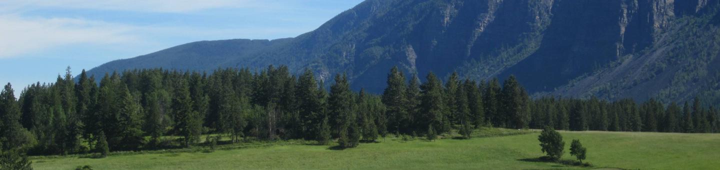
Endless Waters, Edges and Islands
From the shores of big lakes to the banks of winding rivers, the Idaho Panhandle National Forests create a tapestry of land and water in the handle of North Idaho.
Recreation opportunities on the IPNF can be viewed as occuring in 5 fairly broad geographic areas, each centered around one or more distinctive features. These areas are the:
- Priest Lake Area (Priest Lake Ranger District - flanking scenic Priest Lake and Upper Priest Lake)
- Lower Kootenai River Area (Bonners Ferry Ranger District - rugged mountains surrounding the Kootenai River as it flows through the northern panhandle)
- Pend Oreille Lake Area (Sandpoint Ranger District - centered around Pend Oreille Lake and its major tributaries - Clark Fork River, Lightning Creek, and Pack River)
- Coeur d'Alene River Area (Coeur d'Alene River Ranger District - comprised largely of the Coeur d'Alene river basin)
- St. Joe River Area (St. Joe Ranger District - comprised primarily of the St. Joe River basin)
On our web site you'll find our recreation sites organized by these areas. So, note the area on our forest you'd like to stay or explore and then discover our recreation opportunites. Or, choose an activity and see where on the forest it is offered. Either way, we're sure you'll find exceptional recreation opportunities on the Idaho Panhandle National Forests.
The map below shows these areas in relation to the entire Idaho panhandle. These areas are also coincident with our 5 Ranger Districts: Priest Lake, Bonners Ferry, Sandpoint, Coeur d'Alene River, and St. Joe. Read more...
Recreation Fee Program Accomplishments, 2017 (.pdf, 0.4 mb)
RecAreaDirections
Open with Google Map
Misc
| Stay Limit | |
| Reservable | false |
| Keywords | |
| Map Link | |
| Contact Phone | |
| Contact Email |
Permits info
Facilities
Idaho Panhandle National Forest Christmas Tree Permit Tree Permit
Beaver Creek A-Frame Cabin (ID) Campground
List of CampsitesOverview
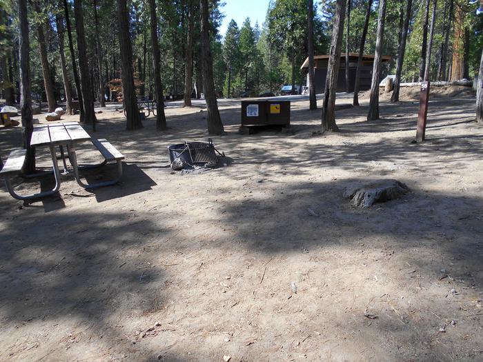
Beaver Creek A-Frame is located on the St. Joe Ranger District of the Idaho Panhandle National Forests in the heart of the Bitterroot Mountains. It is only a few miles from the St. Joe Wild and Scenic River and the historic Red Ives Ranger Station. The area is well known for its abundance of outdoor activities, such as site seeing, hiking, ATV/UTVing, fishing, and hunting. There is no cell service in the area.
Recreation
ATVing, UTVing, hiking, hunting, fishing, berry picking, site seeing.
Facilities
Beaver Creek A-Frame is a rustic cabin. The cabin is furnished with only a picnic table and woodstove. It is 1900 sq. ft with an upstairs, 2 decks, and covered outside cooking area. There is a small creek in close proximity as well as a vault toilet. The cabin can fit eight people.
Natural Features
Beaver Creek A-Frame is located on the Beaver Creek Drainage which is heavily forested, rugged, and remote.
Nearby Attractions
Historic Red Ives Ranger Station, St. Joe Wild and Scenic River, Mallard Larkins Pioneer Area, Snow Peak WMA. Closest towns with amenities are St. Regis, MT (approx 39 miles) and Avery, ID (approx 40 miles). There are also many miles of nonmotorized and motorized trails in the area.
Spyglass Ground House Campground
List of CampsitesOverview
Spyglass Lookout Ground House is located on Spyglass Peak, in the heart of the Coeur d'Alene River Ranger District, Idaho Panhandle National Forests. It's approximately 2.5 miles east and slightly south, as the crow flies, of the Magee Historic Site.
The Spyglass Lookout site is listed on the National Historic Lookout Register. It was first used as a patrol point in 1911 and by the 1920s supported a tower and housing for forest fire lookouts. It was an operational lookout until the mid- to late 60s and then abandoned in the 1970s. Current structures on the site include a 53-foot tower support structure (the hipped roof L-4 cab having been removed in 2014), a 1930s gable roofed ground house used as a residence for lookouts when the site was operational, and a 1930s Civilian Conservation Corps (CCC) constructed outhouse. Extensive restoration of the ground house for use as a recreation rental cabin began in 2012 and was completed in 2019.
Recreation
The cabin provides access to several non-motorized hiking trails and a popular fishing stream for day excursions in the surrounding area. The trailhead for Fearn Creek (Trail #407) is about 1 1/2 miles from the cabin and the upper trailhead for Halsey Creek (Trail #451) is about 2 miles from the site. Within 8-10 miles of the cabin are trailheads for Boundary Peak (Trail #325), the lower end of Halsey Creek Trail, and the lower end of Little Elk Creek (Trail #32). Also within this range is Tepee Creek, a favorite fly fishing stream with a westslope cutthroat trout fishery. Slightly further, but still within range of a day outing is Independence Creek National Recreation Trail (Trail #22). This trail offers opportunities for hiking, mountain biking, horseback riding, and motorcycle riding.
Facilities
The ground house measures 14 x 14 feet and offers a dry cabin camping experience for 4 guests; there is no water or electricity. There are two new single mattresses and one bedframe to provide sleeping accommodations for two, with one mattress on the floor. Additional guests may need to provide their own sleeping pads or cots. There are kitchen table and chairs, a Jotul woodstove, wood box, and storage cabinet with basic dishes and eating utensils. There is no refrigerator or cooking stove. Outside the cabin is a picnic table and fire pit. The outdoor pit toilet is located about 150 feet from the cabin and is supplied with biodegradable toilet paper. Visitors should bring plenty of water for drinking and washing up, sleeping bags, matches or lighter, newspaper, garbage bags, flashlight, an ice chest for food storage, battery or propane lanterns, a propane cook stove, dish soap, towels and wash cloth, toiletries, insect repellent, first aid kit, extra toilet paper (just in case), and warm clothes.
Natural Features
Spyglass Peak is situated at 5,190 feet in elevation and is surrounded by the Coeur d' Alene Mountains. From vantage points near the cabin, vistas of ridgetops, forested slopes, and drainages of the North Fork Coeur d'Alene River and tibutaries extend as far as the eye can see. Wildlife in the area include moose, elk, whitetail deer, mule deer, wolf, black bear, mountain lion, fisher, ground squirrels, grouse, and goshawks, as well as other birds and many small mammals.
Nearby Attractions
Fishing streams, non-motorized hiking trails, motorcycle trail, Magee Historic Site
Reynolds Creek Group Camp (ID) Campground
List of CampsitesOverview
Located near Priest Lake, this group site has a large covered gazeebo, three restroom facilities, fire rings, bear-resistant storage boxes. Reynolds Creek Group Site is located within walking distance of Priest Lake and the Kalispell Bay Boat Ramp and can host several RVs in an area removed from other campers. Site capacity is 70 people.
This group camp has a graveled, two-wheel drive access road, fire ring/grill, a Pavilion without utilities, vault toilet, designated parking, picnic tables and tent pads.
contact_info
This location is unstaffed. To speak with our main office for general information, please call: (208) 443-2512.Emerald Creek Garnet Area Tickets Ticket Facility
Tickets open up for reservation 90 days prior to the available date. If no availability is shown on the calendar they have either not been released yet or all available times are fully booked. If ticket holders cancel their reservation these available times will show up on the calendar. Tickets will begin to be released March 2nd, 2022 on a 90 day rolling basis.
Welcome to the Emerald Creek Garnet Area! If you are ready to get dirty, have fun and find some garnets to take home you’ve come the right place. Our staff will greet you with an orientation to the site and provide all the tools necessary to dig, sift and wet sluice to find garnets. This is a great activity for families and people of all ages.
Hidden in the hills of the Idaho Panhandle, Emerald Creek is one of only two places in the world where Star Garnets can be found in quantity and the only location where you’re able to collect them! When a Star Garnet is cut by a jeweler it displays a six-ray reflective star pattern in the purple stone and is commonly used for jewelry. It is also the Idaho State Gem! Please note that garnets cannot be collected outside the Emerald Creek Garnet Area recreation site or while the site is closed.
Emerald Creek Garnet Area is open Friday through Monday beginning the Friday of Memorial Day weekend and ending the Monday of Labor Day weekend. To provide for public safety and to protect the delicate natural resources, tickets are required to visit Emerald Creek Garnet Area. Thank you for your cooperation!
Tickets are available for morning or afternoon time slots. They are issued per person and are only valid for the date and time slot listed. To make your reservation, please visit www.recreation.gov for tickets. Please be sure to bring your printed ticket(s) with you to the recreation site and we’ll issue a mineral permit when you arrive. This permit authorizes the holder to dig, sift, sluice and collect garnets within the Emerald Creek Garnet Area recreation site.
LUBY BAY Campground
List of CampsitesOverview
Luby Bay Campground is located near both Lamb Creek and Priest Lake. The campground is densely wooded with nicely secluded sites, and is within easy access to many great views of the Selkirk Mountains.Recreation
Visitors enjoy kayaking, canoeing and power boating up the 3.5-mile thoroughfare that leads to the Upper Priest Lake Scenic Area. The upper lake cannot be accessed by car.Fishing, swimming, birding and wildlife viewing are popular activities as well.
The Beach Trail #48 can be accessed from the campground. The 8-mile scenic excursion loops around the southern part of Priest Lake.
Facilities
Luby Bay has an upper and lower section. Upper Luby Campground has paved roads and gravel parking spurs. Lower Luby has paved parking spurs and the option of waterfront sites. Campground amenities include water hydrants, flush toilets and a dual-bay RV dump station.
Lower Luby has a large day use area perfect for picnics and group functions. If you park to use day use area there is a parking fee of $8.00. If you walk from your campsite there is no fee to use the day use.
An amphiteather is located in the recreation area and regularly hosts interpretive programs.
Natural Features
The campground sits at an elevation of 2,500 feet on the western shores of Priest Lake. Campsites are shaded by hemlock and cedar.Priest Lake consists of the main lake where most water recreation takes place. To the north, the lake connects via a narrow channel with Upper Priest Lake.
Nearby Attractions
Off-road vehicle enthusiasts will find authorized trails like the Peewee Trail, Steep Creek Trail and John Wayne Trail. In winter, hundreds of miles of groomed trails beckon nordic skiers and snowmobile riders.REEDER BAY Campground
List of CampsitesOverview
Reeder Bay Campground is a picturesque hideaway for nature immersion and relaxing water sports on Priest Lake. Campsites are shaded by a dense forest of cedar, fir and hemlock. Campers visit Reeder for its incredible beach that slopes down into the refreshing, clear lake.Recreation
Wake boarding, jet skiing, bird watching and canoeing are among the many activities campers enjoy.Hike the 8-mile Lakeshore Trail which passes through alder, pine, young cedar and open hillsides of brush, providing memorable scenic views throughout the journey.
Anglers seek Dolly Varden and cutthroat trout, as well as kokanee salmon, on the lake and nearby Priest River.
Facilities
Reeder Bay boasts accessible facilities and paved roads and parking spurs. Amenities include a pressurized water system with hydrants, flush toilets and overflow gravel parking areas.
Natural Features
The campground is situated on the eastern shore of Priest Lake, nestled deep below the crest of the Selkirk Mountains. The lake spans 19 miles in length and reaches a depth of 300 feet. Priest Lake is noteworthy for its incredibly clear waters, fed by streams cascading from the high Selkirk peaks.A variety of wildlife inhabits the surrounding area, including deer, elk, moose, grizzly and black bears, wolves and mountain lions.
Nearby Attractions
Explore the extensive trail system around the lake. The Upper Priest Lake Trail takes hikers and mountain bikers to the Upper Priest Lake Scenic Area, which can also be accessed by boat.SAM OWEN Campground
List of CampsitesOverview
Sam Owen Campground is nestled on the banks of Lake Pend Oreille in a densely wooded forest of pine and cedar. Popular activities include hiking, canoeing, swimming and boating in summer, and skiing in winter.Recreation
A sandy beach draws crowds of sunbathers and swimmers. Visitors also like to hike the half-mile, accessible Sam Owen Trail #4. The trail reaches a beautiful vista of Owens Bay, where hikers can rest on benches and take in the astonishing view.Anglers take pleasure in catching kamloops, Dolly Varden, northern pike, trout and catfish. A boat ramp and dock are located on-site.
Facilities
Amenities include a picnic area, paved overflow parking areas and an amphitheater for educational programs. Campsites do not have electric hookups but a group picnic shelter has electricity and lights. Accessible flush toilets, drinking water and a dump station are provided.Natural Features
Sam Owen Campground is situated on a peninsula on the east side of Lake Pend Oreille in the Idaho Panhandle National Forest, at an elevation of 2,000 feet. The lake spans 82,088 acres and has 125 miles of shoreline.The well-loved campground shares a peninsula with the Sam Owen Game Preserve, which provides plenty of opportunities to see wildlife up close. Deer are very easy to spot, and watching for unique birds is a rewarding activity.
Nearby Attractions
The Pend Oreille Scenic Byway is well worth exploring.BEAVER CREEK (IDAHO) Campground
List of CampsitesOverview
Beaver Creek Campground sits in the Idaho Panhandle National Forest, offering phenomenal views of the Selkirk Mountains across the reflective waters of Priest Lake.Recreation
A local beach is easily accessible, where swimming and boating are available.Visitors enjoy kayaking, canoeing or power boating up a 2.5-mile channel called Thoroughfare that leads to the Upper Priest Lake Scenic Area, where birding is a popular activity.
Beaver Creek has two trailheads, one for the 9-mile Navigation Trail that heads north, and one for the 8-mile Lakeshore Trail that heads south. Both trails offer sweeping mountain views and are enjoyed by both hikers and horseback riders.
Anglers find an abundance of trout fishing in Beaver Creek and in Upper and Lower Priest Lake.
Facilities
Beaver Creek offers approximately 42 spacious, reservable campsites, including one large group site that can accommodate up to 35 guests. Amenities include drinking water, vault toilets and picnic tables. A boat ramp is just outside the campground entrance for boats 20 feet long or shorter.Natural Features
The campground is situated on the shores of Priest Lake at an elevation of 2,500 feet, shaded by hemlock and cedar.Priest Lake consists of the main lake, where most water recreation takes place, and the smaller Upper Priest Lake to the north. The two lakes are divided by a narrow channel.
Nearby Attractions
Cross country skiing and snow shoeing are excellent in the Kaniksu Forest Region of Priest Lake.DEVILS ELBOW Campground
List of CampsitesOverview
Devil's Elbow Campground is perched on the banks of the North Fork Coeur d'Alene River, providing a perfect escape for a warm summer weekend. Here, visitors can camp in tents or RVs and spend their days fishing or floating the river.Recreation
Rafting, swimming and kayaking are favorite activities on the river. Rafters will find class I-III rapids further down the river. Catch-and-release cutthroat trout fishing is also popular.Visitors also enjoy explore the river valley on foot to see nearby Downey Creek or Valitons Creek.
Facilities
Devil's Elbow Campground has 20 campsites including one host site and a group site. The group site can accommodate up to 50 people. Amenities include hand-pump drinking water and vault toilets.Campground roads are paved and parking spurs are short but wide enough for parking two vehicles alongside a trailer.
Natural Features
- The campground sits among lodgepole and other mixed pines along the river at an elevation of 2,600 feet. The area is located in the Coeur d'ALene Mountains, 69 miles from popular Coeur d'Alene Lake.
Wildlife watchers and photographers have the chance to see mule deer, moose, osprey and calliope hummingbirds.
KIT PRICE Campground
List of CampsitesOverview
Kit Price is a beautiful campground overlooking the North Fork Coeur d'Alene River. Campers enjoy the benefits of the river by fishing along the banks, swimming and floating. Hiking is also a great way to see mountain views.
“Past visitors may notice a change in the appearance and openness in the park due recent removal of dead and diseased trees. This was done to improve safety for visitors and to improve forest health. New tree plantings are currently being planned to replace some of those lost and to increase the natural appearance of the campground for years to come. Please visit our website for additional information.”
Recreation
Tubing, swimming and kayaking on the North Fork Coeur d'Alene River are popular summertime activities. Rafters like to head downstream for the class I-III rapids. Catch and release fishing for cutthroat trout is also popular.Facilities
Amenities include picnic tables, grills, paved parking spurs, accessible vault toilets and drinking water. Kit Price does not have electric hookups.Natural Features
The campground is situated along the North Fork Coeur d'Alene River at an elevation of 2,550 feet. Campsites are in a meadow like setting, in full to partial sun, in the river bottom of the Coeur d'Alene Mountains. Popular Coeur d'Alene Lake is about 65 miles west of Kit Price. Wildlife in the region includes mule deer, moose, osprey and calliope hummingbirds.
SNYDER GUARD STATION (ID) Campground
List of CampsitesOverview
Snyder Guard station, located on the banks of the scenic Moyie River, has been listed on the National Register for Historic places since 1982. The complex of seven buildings includes a residence, two log cabins, a cookhouse, warehouse, corrals, a machinery shed and a garage. The facility is spread across 10 lovely acres and is perfect for large groups of up to 70 people or small family getaways.The buildings on the property were constructed from 1906 to 1936, and most structures are available for rent. A group picnic and camping area provide additional campsites and amenities for six RVs, plenty of room for tent camping, pathways to the river, and more.
Snyder was originally constructed as a remote work station for early Forest Service employees. As roads were constructed and transportation improved, the site no longer required live-in crews, so visitors can now use these buildings as recreation rentals.
Recreation
Outdoor recreational opportunities abound on the Moyie River and nearby lakes. Fishing, whitewater rafting, canoeing and kayaking are all popular pastimes.Over 70 miles of trails are open to hikers, mountain bikers, horseback riders, and motorcyclists. The Copper Falls viewpoint trail is just a few miles from the Snyder Guard Station on copper Falls Road #2517. Hunting, huckleberry picking, cross country skiing and snowmobiling are enjoyed in season.
Facilities
Historic Site buildings include the main ranger house, two small log cabins, a cookhouse, a horse pole barn, and several administrative buildings. Camping Loop buildings include a 50' x 30' covered picnic shelter, a camping loop with six sites with picnic tables and fire rings, a vault toilet, and additional parking for 10 vehicles. Additionally, two horse corrals, vault toilets, drinking water faucets, campfire rings, picnic tables, and a mowed grassy playing field are available for use.The ranger house has three bedrooms, a bathroom with a flush toilet and hot shower (low capacity, only for groups under 25 people, outdoor screened shower areas are also available), a living room, dining room, and a fully stocked kitchen with enough utensils for 12 guests. The small cabins come with three to four beds and a table and chair. These cabins have no electricity. Most facilities and furnishings are 80-110 years old, please use them gently and treat them with respect. To protect the historic features, pets are not allowed at Snyder Guard Station.
The cookhouse is furnished with benches and tables to seat 30, plus cookware and place settings. Outdoor amenities include picnic tables and campfire rings at six sites and a large picnic shelter with a fireplace and grills.
Campers should bring basic camping gear like bedding or sleeping bags, flashlights, food, matches, garbage bags, towels and dish soap. (Click here for more cabin details.)
Natural Features
Snyder Guard Station is located within the Lower Kootenai River Area (Bonners Ferry District) of the Idaho Panhandle National Forests. The area is bordered by the Purcell and Cabinet Ranges and the Montana Line on the east, the rugged Selkirk Range on the west, and the Canadian border to the north. The Kootenai River meanders north and west through the District, and the Moyie River joins it from the north.The Guard Station sits at an elevation of 2,500 feet along the Moyie River, 8 miles south of the Canadian border. Terrain in the river valley is relatively flat, and is bordered by Queen Mountain to the West and Ruby Mountain to the east.
The mixed conifer forest include Douglas fir and spruce. Wildlife sightings include elk, deer, black bears, moose and bald eagles.
Nearby Attractions
A restaurant, gas station and convenience store are less than 10 miles down the road.BARTOO ISLAND BOAT-IN CAMPGROUND Campground
List of CampsitesOverview
Surrounded by clear waters of Priest Lake, the 25 sites on Bartoo Island provide the ideal getaway for people looking for a rugged, but highly rewarding, camping experience on the peaceful shores of Priest Lake. There are 24 single sites on the island as well as one group site known as Sunrise Group Site. This group site has been renumbered from site #001 to site #23 for groups of 10-30 individuals. All sites are only reachable by boat.
Recreation
Visitors enjoy all types of boating from kayaking to canoeing to power boating up the 3.5-mile thoroughfare, which leads to the Upper Priest Lake Scenic Area. The upper lake cannot be access by car, so water is an excellent navigation option.Fantastic birding and wildlife viewing is available, as well as Huckleberry picking from mid-july to early fall, when the sweet berries can be found in abundance throughout the forests of Northern Idaho.
Swimming is a popular summer pastime and with beach access not far from the campground, visitors won't have any problem cooling off during warmer months.
Anglers will be excited to know that the waters of Priest Lake are home to record-breaking Mackinaw trout as well as Dolly Varden, Cutthroat and Kokanee.
Facilities
Campers are required to bring their own portable toilets to this campground. They can check out toilet buckets at the Kalispell Boat Launch.Bartoo Island can only be access by boat. No drinking water is available and this is a pack it in, pack it out facility. Picnic tables and campfire rings are provided.
Natural Features
Priest Lake spans 25,000-acres of incredible beauty, fed primarily by the waters of the Priest River. Named after the historical presence of Jesuit priests who settled in the lake area in the mid 19th century, Priest Lake is today a major tourist attraction, drawing water sports enthusiasts, photographers and birders alike.The group campground is located on the east side of Bartoo Island at an elevation of 2,400 feet. Bartoo, spanning 219 acres, is one of nine islands on Priest Lake.
Summers at the lake are typically sunny and warm and wildlife in the area includes bears, deer and moose.
Nearby Attractions
Hike the Lakeshore or Beach Trails that traverse along the west shore of Priest Lake. The Beach trail extends between Outlet Bay Campground and the Kalispell Bay Boat Launch. The Lakeshore Trail runs for 8 miles along the northwest shores of Priest Lake.In winter, ice fishing, shoe shoeing and snowmobiling on nearby trails entertain visitors.
KALISPELL ISLAND BOAT-IN CAMPGROUND Campground
List of CampsitesOverview
Surrounded by clear waters of Priest Lake, the 52 sites on Kalispell Island provide the ideal getaway for people looking for a rugged, but highly rewarding, camping experience on the peaceful shores of Priest Lake. There are 51 single sites on the island as well as one group site known as Three Pines Group Site. This Group Site is located on the southeast side of the island and has been renumbered from Site #001 to site #29 for groups of 10-30 individuals. All sites are only reachable by boat.
A popular activity among visitors is to kayak, canoe, or power boat up a 3.5-mile thoroughfare, which leads to the Upper Priest Lake Scenic Area. The upper lake - just like Kalispell Island - cannot be access by car, so water is an excellent navigation option.
Recreation
Priest Lake is less than an hour from the Canadian Border, nestled deep below the crest of the Selkirk Mountains. Surrounded by the natural beauty of Northern Idaho and the mile-high mountains, this 25,000-acre lake offers clear, blue waters reaching depths of 300 feet.Fantastic wildlife viewing is available on the 2.5-mile loop trail that encircles Kalispell Island, offering phenomenal lake views and bird watching opportunities.
The waters of Priest Lake offer anglers access to record-breaking Mackinaw trout, Dolly Varden, Cutthroat and Kokanee.
Facilities
Most campsites require campers to bring their own portable toilets. They can check out toilet buckets at the Kalispell Boat Launch. Kalispell Island can only be accessed by boat. No drinking water is availabe and this is a pack it in, pack it out facility. Picnic tables and campfire rings are provided
Natural Features
Kalispell Island is one of seven islands scattered throughout Priest Lake. Kalispell is the largest of these islands, spanning 264 acres, and is shaped like a tooth.Priest Lake, at a 2,400 foot elevation, is one of the top three largest lakes in Idaho. To the north, the lake connects to the Upper Priest Lake, divided by a narrow channel, which can be passed through by boat.
Nearby Attractions
Hike the Lakeshore or Beach Trails that traverse along the west shore of Priest Lake. The Beach trail extends between Outlet Bay Campground and the Kalispell Bay Boat Launch. The Lakeshore Trail runs for 8 miles along the northwest shores of Priest Lake.In winter, ice fishing, shoe shoeing and snowmobiling on nearby trails entertain visitors.
BEAUTY CREEK CAMPGROUND Campground
List of CampsitesOverview
Beauty Creek Campground is located a half mile from Lake Coeur d'Alene along the peaceful Beauty Creek. Visitors enjoy breathtaking scenery and convenient access to miles of trails.Recreation
The trailhead for the Caribou Ridge National Recreation Trail starts at the campground. The 5-mile trail features a moderate climb with two outstanding overlooks of Lake Coeur d'Alene.Biking and hiking trails in the area include the 1.8-mile Beauty Creek Overlook and the 4.9-mile Mt. Coeur d'Alene Viewpoint.
Anglers enjoy an abundance of northern pike, chinook salmon and bass in the nearby stream.
Facilities
Beauty Creek offers about 20 spacious campsites for both tent and RV camping. Vault toilets and drinking water are provided. Parking aprons are paved.The nearest boat ramp is at Mineral Ridge, which is less than a mile from the campground. Here, visitors have easy access to boating and fishing.
Natural Features
The campground is nestled in a narrow valley along Beauty Creek in northern Idaho. At an elevation of 2,100 feet, it is a sparsely wooded valley surrounded by heavily wooded hillsides.Beauty Creek sits in the Idaho Panhandle National Forest, between the Cascade Mountains to the west and the Bitterroot Mountains to the east.
Nearby Attractions
Lake Coeur d'Alene offers excellent boating, fishing and canoeing. Towns around the lake offer opportunities for para-sailing, ferry rides, paddle boating and sea plane rides.MOKINS BAY CAMPGROUND Campground
List of CampsitesOverview
Mokins Bay Campground is located near the eastern shore of Hayden Lake in northwest Idaho. Its picturesque setting in the northwest portion of the Bitterroot Mountain range, known as the Coeur d'Alene mountains, creates solitude in a forested setting at this campground. The lake is a 10 minute walk from the campground.
Recreation
Fishing is popular in the surrounding lakes and streams, and cutthroat trout and large and small-mouth bass are the most common catches. Power boating and other water sports are also popular activities.Facilities
Drinking water, grills, paved parking spurs and vault toilets are among the amenities at Mokins. A horseshoe pit is also onsite. Access to campground is on a gravel road.Natural Features
The small campground is surrounded by a heavy canopy of pines. Wildflowers like trillium and buttercups thrive in the springtime, creating a stunning backdrop for campers.Hayden Lake boasts a 40-mile shoreline with a surface area of 3,800 acres. The lake was formed by the Missoula Floods that occurred nearly 15,000 years ago, at the end of the last ice age.
Nearby Attractions
The town of Coeur d'Alene, Idaho is 21 miles away, and offers several tourist attractions, as well as restaurants, gas and groceries.
AVERY CREEK CABIN Campground
List of CampsitesOverview
Avery Creek Cabin is located 20 miles northeast of Kingston, Idaho, along Forest Road 208. The fully furnished three-room cabin is adjacent to the North Fork Coeur d'Alene River on the Coeur d'Alene River Ranger District in the Idaho Panhandle National Forests.The cabin was built between 1926 and 1928 to house Forest Service employees needed for administrative supervision and fire protection. It was built from a standard Forest Service plan known as the firemen's cabin. In 1935, a picnic area was constructed by the Civilian Conservation Corps across the road from the cabin and adjacent to the North Fork of the Coeur d'Alene River. In 1940, a bathroom was added in a board and batten shed addition to the cabin's east side, and a rustic log garage was built behind the cabin. The cabin was used for crew housing until 1981.
Newly renovated, the cabin is now fully accessible. Avery Cabin's central location along the North Fork Coeur d'Alene River provides easy access to the site. Access to the cabin is along paved roadways, making it an easy destination to reach by car. The cabin is available from mid-May through September, and provides many of the comforts of home. Guests only need to bring a few of their own amenities for an enjoyable stay.
Recreation
Guests can enjoy fishing for cutthroat or rainbow trout in the river. Check Idaho Fish and Game regulations for restrictions. Tubing is also a popular river activity.Hikers can enjoy a short hike to Centennial Falls. Non-motorized trails in the area include Lost Creek Trail, Settler's Grove Botanical Area and Shoshone Ridge. Motorized trails include Graham and Coal Creek. These trail systems require some travel, but offer a variety of opportunities for outdoor enthusiasts.
Facilities
The cabin can accommodate six people and has a living room, kitchenette, bedroom, bathroom and a covered porch. The kitchenette is equipped with an electric range, refrigerator, basic cookware, dishes and utensils. The sink has hot and cold water. The water is drinkable and supplied by a well system that is not chemically treated. Water quality testing is performed regularly.A fold-out couch, dining table and four chairs are in the living room. The cabin has electric baseboard heat. The bathroom has a flush toilet, sink, shower stall and mirror. The bedroom is equipped with a double bed and a set of bunk beds.
A picnic table, barbecue grill and campfire ring are provided outside. Four resin chairs are supplied on the front porch.
Guests should bring sleeping bags, flashlights, matches and newspaper, a first aid kit and garbage bags. All trash and food must be packed out, and guests are expected to clean the cabin before leaving.
Natural Features
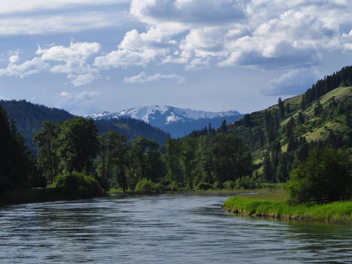
Located in the heart of the Coeur d'Alene Mountains along the North Fork of the Coeur d'Alene River, Avery Creek Cabin is situated in a small grassy area surrounded by an evergreen forest at an elevation of 3,000 feet.From lush evergreen mountains to the banks of winding rivers, the Idaho Panhandle National Forests create a tapestry of land and water in northern Idaho. Rich in wildlife, the forest is home to large game such as elk and deer, as well as species such as grizzly bears, wolves and caribou that add to the sense of wildness.
BUMBLEBEE CAMPGROUND Campground
List of CampsitesOverview
Bumblebee Campground is nestled in a dense forest near the Little North Fork Coeur D'Alene River, making it a perfect fishing and seasonal hunting base camp. Swimming and floating the river are popular activities as well.Recreation
Bumblebee's creekside location creates easy access for floating, swimming and wading. Trout fishing is available about a half-mile from the campground in the Little North Fork of Coeur d'Alene River. Rainbow and cutthroat trout are the most common catches.About 15 miles from the campground is the 803 Motorized Trail System, which provides dedicated off-road trails and open roads in the Steamboat Creek area.
Facilities
Bumblebee is comprised of two loops, each with vault toilets and hand-pumped drinking water. Roads are paved and campsite parking spurs are sealed gravel.Several single-family campsites are available. A group site can accommodate up to 100 people.
Natural Features
The campground sits next to Bumblebee Creek near the Little North Fork Coeur D'Alene River at an elevation of 2,200 feet.Coeur d'Alene National Forest spans 726,819 acres and is one of three forests comprising the Idaho Panhandle National Forests. The majority of Idaho's waters are located in this northern region.
Nearby Attractions
The town of Coeur d'Alene is a delightful place to explore. Visitors can go paddle boating or parasailing on Lake Coeur d'Alene, or even take a trip around the lake on a seaplane. A variety of shops and restaurants are available.Charges & Cancellations
A $10.00 service fee will apply if you change or cancel your reservation. Late cancellations are subject to additional fees. For full details see NRRS Reservation Policy.OSPREY Campground
List of CampsitesOverview
Campers come to Osprey for sunshine and boating at Priest Lake, and for breathtaking views of the rugged Selkirk Mountains. Fishing is also a big draw, with trout just waiting to be caught.While here, watch for moose, grizzly and black bears, wolves, mountain lions and deer. Osprey, as inferred by the campground name, also inhabit the area.
Recreation
Boating, canoeing, kayaking and wake boarding are summertime favorites. Boaters like to head north on the lake and traverse a narrow thoroughfare to reach Upper Priest Lake Scenic Area.Anglers often catch Dolly Varden and cutthroat trout and kokanee salmon.
Facilities
Campground roads and parking spurs are paved and facilities are accessible. Amenities include flush toilets, fire rings and picnic tables that are naturally shaded by towering trees.Natural Features
Osprey Campground is perched on the lower western shore of Priest Lake near Outlet Bay. The beautiful 25,000-acre lake is fed by springs trickling down from the Selkirks. The clear, blue lake reaches 300 feet in depth.Nearby Attractions
Hike the Chipmunk Rapids Trail that traverses along the Kaniksu Marsh, Priest River and Chipmunk Rapids.In winter, ice fishing, snowshoeing and snowmobiling are popular activities in the surrounding area.
BELL BAY CAMPGROUND Campground
List of CampsitesOverview
Bell Bay Campground is a prime place to set up camp on Coeur d'Alene Lake. The upper camp loop is on a hill overlooking the beautiful lake, while the lower loop sits on a short ridge along the shoreline.Recreation
Hikers enjoy the Bell Bay Trail, a foot path that runs for a mile around the lake shore.The lake beach offers plenty of opportunities for fishing, swimming, power boating and canoeing.
Anglers enjoy the abundance of trout, salmon and panfish in the vast lake.
Facilities
Bell Bay campground offers six reservable single family sites and several other sites that are available on a first-come, first-serve basis. There is also a large group campground on the upper loop that can accommodate up to 60 guests. Drinking water, vault toilets and campfire rings are provided.The lower loop has two docks where boats can be moored. The walk from the docks is fairly steep but short.
Natural Features
Located in the Panhandle of northern Idaho, the campground is surrounded by a forest of Ponderosa and other mixed pines. It lies on the southeast shores of Coeur d'Alene Lake just north of Harrison, Idaho.The lake spans 50 square miles, offering countless recreation opportunities and scenic views for visitors.
Nearby Attractions
The town of Coeur d'Alene, Idaho, on the northern side of the lake, is a popular destination. About an hour away, the area offers paddle boat rentals, ferry rides, sea plane rides and more.BIG HANK Campground
List of CampsitesOverview
Big Hank Campground is located along the North Fork of the Coeur d'Alene River in Idaho Panhandle National Forest. Shore fishing is a large draw, along with local hiking and biking trails. The campground also provides an excellent base camp for hunters during season.Wildlife like mule deer, moose, osprey and calliope hummingbirds are often spotted.
Recreation
Tubing on the river is a popular summertime activity, as is cutthroat fishing.Whitewater rafting enthusiasts enjoy the class I-III rapids down the river.
Hiking, biking and horseback riding trails are a short drive away. Highlights include trails to Centennial Falls, Shadow Falls and Settler's Grove of Ancient Cedars.
Facilities
Big Hank Campground offers about 30 spacious campsites for tent camping. Drinking water from hand pumps, vault toilets, picnic tables and established fire rings are among the conveniences offered. Roads and campsite parking spurs are paved.Natural Features
Big Hank is in a heavily wooded area on the banks of the Couer D' Alene River and Big Hank Creek. At 2,800 feet elevation, the campground sits on the Big Hank Meadow.SHORTY PEAK LOOKOUT Campground
List of CampsitesOverview
Shorty Peak Lookout, 45 miles northwest of Bonners Ferry, sits atop Shorty Peak with views of the Selkirk and Purcell mountain ranges of Northern Idaho, Montana, and British Columbia. The rustic dwelling was once used to patrol forest fires, and is now a unique way for overnight guests to escape the city and become enthralled with 360 degree views of area's magnificence.Access requires a moderate to steep 2.5 mile hike with a 1,300 foot elevation gain. The lookout was refurbished in 2005 and is in excellent condition.
Recreation
The 2.5 mile hike up to Shorty Peak is part of the fun of staying at the cabin. The trail is also open to horseback riding. While here, landscape photography and wildlife viewing are popular pastimes.Birding is particularly popular and guests may have the chance to look down on some birds of prey. Look for red-tailed hawks, golden eagles, and goshawks soaring over the valleys.
Clear nights offer prime stargazing opportunities.
Facilities
The 15' X 15' cabin sits atop a 5 foot foundation and can accommodate two overnight guests. The look of the interior is modern with hardwood floors. Two twin beds with pads, two chairs, two tables, a historic fire finder, and a district map are included inside the cabin. A pit toilet is within 100 yards of the lookout.No drinking water or electricity is available. Guests are asked to bring plenty of water, food, bedding, a first aid kit and all other basic camp gear.
Horses are allowed, but no corrals or hitching racks are available. Hobbles are recommended for horses.
Natural Features
Shorty Peak lookout is located in the Lower Kootenai River Area (Bonners Ferry District) of the Idaho Panhandle National Forest. The land is bordered by the Purcell and Cabinet Ranges and the Montana Line on the east, the rugged Selkirk Range on the west, and the Canadian border to the north.The 360-degree unobstructed vista from Shorty Peak Lookout is exceptional, with views of Kootenai Valley, U.S. and Canadian Selkirks, Smith Creek and Cow Creek drainage areas, Red Top Mountain, and the higher Lone Tree Peak a mile to the west.
Elk, deer and black bears are among the wildlife in the area. This is bear country, both grizzly and black. The Forest Service recommends that you be able to distinguish between them. Please be aware of and practice bear safety while camping in this area.
Nearby Attractions
The nearest location for a convenience store is the Canadian border. A more cost effective location for groceries and gear is in Bonners Ferry, about 50 miles from the lookout.SURVEYORS LOOKOUT Campground
List of CampsitesOverview
Located near the Mallard-Larkins Pioneer Area Attractions, Surveyors Lookout is perched atop a 30 foot tower, providing phenomenal views of Snow Peak and the surrounding mountains. The cabin is listed on the National Historic Register for Lookouts and offers visitors a unique camping experience in the Idaho Panhandle National Forest.The original pole structure lookout was built in 1931 as part of a network of lookouts used to spot fires in the Upper St. Joe Country. The original lookout was replaced with the current treated timber structure in 1964.
Access to the lookout is via a rugged single-lane road with pullouts, and is not recommended for low clearance vehicles. Road may be slick when wet.
Recreation
The Mallard-Larkins Pioneer Area straddles the divide between the Little North Fork Clearwater River basins and the North Fork Clearwater River. This beautiful area attracts hikers and some technical rock climbers. Hunting and trout fishing are offered in designated areas.From the lookout, there is access to Scribner Falls Trail #106 and nearby access to Surveyor's Ridge Trail #40, Horseshoe Loop Trail #141, and Northbound Creek Trail #111.
A scenic drive through the upper St. Joe country is an excellent way to take in the sights leading up to the lookout.
Facilities
Surveyors Lookout can accommodate up to four guests. Furnishings include a propane cook stove, heater and lights. A twin bed and two extra mattresses are provided, along with a chest with some drawers. A refrigerator is also available, but it is very small and unreliable. It is recommended that guests bring a cooler with ice as backup. Cooking pots and utensils are included.No drinking water is available; guests should bring plenty of their own. An alternate option is to collect water from a spring located 1.4 miles down the access road. This water is non-potable and must be boiled or treated before consuming.
Items to pack include food, bedding, a first aid kit, dish soap, towels, toiletries and binoculars. If planning to collect water from a stream, water containers are needed. Guests are advised to bring warm clothes and blankets for cold evenings. Although a heater is provided, the lookout is not insulated so it remains cold.
Natural Features
Surveyors Lookout is located atop Surveyors Ridge at an elevation of 6,000 feet. The 30 foot tower overlooks the spectacular Mallard-Larkins Pioneer Area, which straddles the divide between the Little North Fork Clearwater River basins and the North Fork Clearwater River. Snow Peak, Middle Sister and Mallard Peak Lookouts are still standing and can be seen from Surveyors.Nearby Attractions
Avery is the nearest town for conveniences.DEER RIDGE LOOKOUT Campground
List of CampsitesOverview
Deer Ridge Lookout, perched on a 40 foot timber frame, boasts excellent views of the Purcell mountain ranges of Northern Idaho, Canada and Montana. Located 24 miles northeast of Bonners Ferry, guests can enjoy magnificent scenery, hiking and wildlife watching.The lookout can be accessed by car and the gravel road to the lookout is well maintained.
Recreation
Hiking and viewing the scenery are two well-loved activities at the facility. Hiking trails from the lookout follow along the Deer Ridge and Ruby Ridge. Huckleberry picking is enjoyed from August to September.Fly fishing is available in the Moyie River, where anglers can cast for rainbow and brook trout. Make sure to check all regulations and secure all permits with the local Fish and Wildlife department before heading out.
Facilities
The 14' X 14' cabin has a wraparound catwalk, with a trap door that lifts for access to the tower's entrance staircase. The staircase is steep and is not recommended for small children. Furnishings include two twin beds, two chairs, a dresser and a table. A pit toilet is located 50 yards away.No water is available. Guests should bring plenty of water for drinking, cooking and washing. Cooking is not permitted in the lookout. All cooking should be done outside and at ground level. Guests should bring a tarp to block the rain. Other items to bring include bedding, a first aid kit, towels and flashlights.
Natural Features
The Lower Kootenai River Area (Bonners Ferry District) is bordered by the Purcell and Cabinet Ranges and the Montana Line on the east, the rugged Selkirk Range on the west, and the Canadian border to the north.The Kootenai River meanders north and west through the District, and the Moyie River joins it from the north. Peaks are moderate in elevation (6000 - 7000 ft.) but are rugged due to heavy glaciation. They are renowned for their mountaineering challenge.
The lookout is perched atop Deer Ridge at an elevation of 4,755 feet. The view from the facility includes the rugged Purcell mountain peaks and the beautiful Moyie River Valley and Moyie Springs.
Elk, deer and black bears are among the wildlife in the area. Please be aware of and practice bear safety.
Nearby Attractions
The nearest town for groceries is Bonners Ferry, about 24 miles from the lookout.LUNCH PEAK LOOKOUT Campground
List of CampsitesOverview
Lunch Peak lookout offers breathtaking views of Cabinet Mountain Wilderness, the Selkirk Mountains and Lake Pend Oreille. Located in the Cabinet Mountains, 35 miles northeast of Sandpoint, Idaho, the lookout sits at 6,414 ft. Guests can enjoy easy access to Pend Oreille Divide Trail #67. The lookout is remote and rustic with no heat, furnishings, water or cooking facilities. This basic structure lets visitors experience the feeling of "roughing it" while enjoying the cozy shelter and incredible views of the mountains and valleys below.Recreation
The Pend Oreille Divide Trail #67 starts just below the lookout and is suitable for hiking, horseback riding and mountain biking. It follows ridge lines for much of its length and offers great views in all directions. A nice day hike is out to Mt. Pend Oreille and back. 8 miles roundtrip.Facilities
The 15'x15' cabin was remodeled in 2002 and sits atop a 15' high cinder block foundation. No water or heat is provided. The lookout has limited furnishings which include a sleeping platform, table and cabinet. A modern vault toilet is located at the Pend Oreille Divide trailhead, 300 feet away. The last four miles of the access road is rough in spots and high clearance vehicles are necessary.Natural Features
The lookout is located northeast of Sandpoint, Idaho and Lake Pend Oreille at an elevation of 6,414 feet. Bear, deer, elk, and cougar are among the wildlife native to the area. Visitors are cautioned to be aware of and practice bear safety while staying at Lunch Peak Lookout.Nearby Attractions
The closest convenience store and fuel is located in Hope, Idaho, approximately 20 miles or a one hour drive.Charges & Cancellations
CLOSED 2021
LITTLE GUARD LOOKOUT Campground
List of CampsitesOverview
Little Guard Lookout, located about 9 miles north of Shoshone Camp, was one of the last remaining fire lookouts used in the Coeur d'Alene River area and has only just recently become inactive.The structure standing today on Little Guard Peak is the third in a series of lookout buildings that originated back to 1919. In October 1990, Little Guard Lookout was accepted for listing in the National Historic Lookout Register and the first for Idaho.
Recreation
Hiking is a great way to explore and take in the scenery of the grand mountains. The lookout provides access to the Shoshone Ridge Trail #81, a very nice day hike for visitors to the lookout. The trail provides many scenic viewpoints, but there is no source of water along the way, so hikers must bring plenty of their own.Facilities
The fully furnished two-story fire lookout has dimensions of 14 x 14 feet, an external cat walk, and a gabled roof. It sleeps four guests, with one single bed and three fold-up cots available. Quarters are tight and at least two cots will need to be set up downstairs in the kitchen area.The kitchen is on the ground floor and is equipped with a small propane refrigerator, propane cook stove, table, chairs and basic cooking utensils. Propane for the stove and refrigerator is also provided.
The outdoor pit toilet is within 200 feet of the lookout. It comes with biodegradable toilet paper. Other amenities include a propane heater upstairs and propane lanterns, but renters will need to bring their own propane for these.
No water or electricity is available. Visitors should bring plenty of water. A mountain spring is within a half-mile by footpath, and can be boiled and treated for consumption.
In addition to water, guests should bring food, propane for lanterns and heater, matches or lighters, warm clothing, garbage bags, insect repellent, towels and washcloths, toiletries, dish soap and a first aid kit. Air mattresses or sleeping pads are also recommended.
Natural Features
At an elevation of 6,031 feet, the lookout boasts spectacular views overlooking the North Fork of the Coeur d'Alene River and the Bitterroot Mountains, with views of nearby Downey Peak to the northwest.Wildlife in the area includes mule deer, moose, osprey and calliope hummingbirds.
contact_info
For facility specific information, please call (208) 664-2318.SHOSHONE PARK KITCHEN Campground
List of CampsitesOverview
Shoshone Park is a pristine forested park with a stream running through the area. It features two reservable kitchen shelters suitable for groups of all types. Perks of the family-friendly site include a large field and the Hale Fish Hatchery on the east end of the park. A point of particular interest is the Captain John Mullan historic cabin. Mullan was a 19th Century military commander who built a wagon road, which is used today as a hiking trail and snowmobiling route.Recreation
Groups enjoy playing baseball on the open field, pitching horseshoes and barbecuing. Bird watching is a rewarding pastime here, and a visit to the fish hatchery always fun.Facilities
The park includes 21 first-come first-served picnic tables in addition to the group kitchen facilities. Both kitchen shelters come with large grills and piped drinking water. The West Kitchen Shelter has electric hookups.Natural Features
At 3,600 feet, Shoshone Park sits in a valley at the base of Runt Mountain, a peak in the Bitterroot Mountains. The park is part of Idaho Panhandle National Forests, located near the border of Montana.Nearby Attractions
A few miles west is the historic mining town of Mullan, Idaho.MAGEE RANGERS CABIN Campground
List of CampsitesOverview
The Magee Ranger's Cabin is a fully furnished 2-story cabin in the center of the Coeur d'Alene River Ranger District. Guests can imagine themselves as forest rangers when sleeping in the old ranger's quarters, and enjoying the superb views and convenient access to prime recreation trails.The Magee Cabin was constructed in 1922 as living quarters for the Magee District Ranger. The cabin along with several buildings at the site are on the National Register of Historic Places. These buildings may occasionally be occupied as temporary housing for Forest Service employees working in the vicinity.
Recreation
Nearby trails include the Independence Creek Trail System, with 34 miles of trails suitable for hiking, motorcycle riding, horseback riding and mountain biking.Teepee Creek is a tributary of Idaho's South Fork Salmon River and is open to fly fishing with popular catches including cutthroat trout and brook trout.
Facilities
The log cabin has a front porch and is located near a public picnic area. It sleeps six guests, with a full-size bed downstairs and four single beds upstairs. Amenities include drinking water, propane stove, refrigerator and heater. Two portable propane lanterns are available, but guests should bring their own propane.
Items to bring include propane for lanterns, bedding, flashlights, food, a first aid kit, matches, insect repellent, towels, dish soap, dish towels and washcloths. Visitors should also bring a splitting maul, axe or bow saw for collecting firewood, plus charcoal and lighter fluid to start campfires.
There is an UNHEATED shower and toilet available in the warehouse that is approximately 200 ft. from the rental. A detailed walking map is available in the cabin.
Natural Features
Magee sits at an elevation of 3,000 feet along the Teepee Creek in the heart of the Coeur d'Alene Mountains.Nearby Attractions
The nearest telephone is about 25 miles away and the nearest grocery store is about 32 miles away in Prichard, ID.ARID PEAK LOOKOUT Campground
List of CampsitesOverview
Arid Peak Lookout was built in 1934 to help detect fires that may have been sparked by the Milwaukee Railroad Line. It was last staffed in 1969 and sat idle for over 25 years before being renovated by a team of over 30 volunteers, the Forest Fire Lookout Association and the U.S. Forest Service. Arid Peak Lookout was restored to its original splendor in 1997 and is available for rent to the public.The lookout is listed on the National Register of Historic Lookouts and provides epic 360 degree views of the Bitterroot Mountains. Access to the cabin requires a moderately-steep 3 mile hike and availability is dependent on weather conditions.
Recreation
The Hiawatha Bicycle Trail is considered the "crown jewel" of rail-to-trail mountain biking trails as it zips across seven trestles and through 10 tunnels in the magnificent Bitterroot Mountains. The trail can be accessed just over 10 miles from the lookout.The lookout offers access to the Arid Peak Trail #173, Mozier Peak Trail #174, and Kyle Creek Trail #175. All three trails are great for day-hiking, but can also be explored over longer backpacking treks or on horseback.
Facilities
The cabin fits up to four guests. Furnishings include two cots with mattresses, basic cooking gear, dishes, a propane lantern, propane camp stove, water containers, a table with two chairs and a wood stove. An
outhouse is located outside the tower.
No water is available so guests must bring their own or boil and treat stream water. Propane canisters are not included; a stock of 16.4 ounce canisters are required to use cooking and lighting equipment. Other items to pack include bedding, food, binoculars, a first aid kit, flashlights, towels, toilet paper, and dish soap.
Natural Features
The Arid Peak Lookout is located within the St. Joe River area of the Idaho Panhandle National Forests, an area that includes most of what was originally established as the St. Joe National Forest.The area is known for its blue-ribbon cutthroat trout streams, Wild and Scenic Rivers and extensive roadless and primitive areas. The St. Joe Rover area is also nationally recognized for its elk herds.
The 20 foot tower sits at an elevation of 5,306 feet and overlooks the beautiful Loop Creek area and the scenic Hiawatha Bicycle Trail. The mixed conifer forest around the facility includes Douglas fir and spruce. Wildlife sightings of elk, deer, black bears, moose and bald eagles are common.
This is bear country; Visitors are advised to be aware of and practice bear safety.
contact_info
For facility specific information, please call (208) 245-2531.Nearby Attractions
The town of Avery has the nearest conveniences.OUTLET AT PRIEST LAKE Campground
List of CampsitesOverview
Outlet campground is located on the southwest shore of Priest Lake at the headwaters of Priest River. Campers come to Outlet for sunshine, fishing, boating, kayaking, and the breathtaking views of the rugged Selkird Mountains of the Idaho Panhandle National Forests.Recreation
Visitors enjoy kayaking, canoeing, and power boating on Priest Lake and up the 3.5 mile thoroughfare that leads to the Upper Priest Lake Scenic Area. The upper lake cannot be accessed by car. Fishing, swimming, bird and wildlife viewing are popular activities, as well. Beach Trail #48 runs through Outlet campground and stretches northward along an 8-mile scenic part of Priest Lake. Off-highway vehicle enthusiasts will find authorized trails like the Peewee Trail, Steep Creek Trail, and John Wayne Trail. Hike the Chipmunk Rapids Trail that traverses along the Kaniksu Marsh, Priest River, and Chipmunk Rapids.Facilities
Outlet campground has three loops, two upper view sections and one lower lake-side section. Roadways and parking spurs are fully paved. There are RV and tent sites (two of which are walk-in tent sites). Campsites vary from very large, capable of parking an RV and a boat trailer, to small, camper size, with lake side and lake view sites. Some of the sites are heavily wooded, while some are found in opened areas.
Campground amenities include swimming beach, water hydrants and accessible flush toilets. Garbage service is available in bearproof cans. A public dump station is located 5-miles North of the campground, at Upper Luby Bay, on Highway 57.
Natural Features
Outlet campground is situated at an elevation of 2,500 feet on Priest Lake. The lake is one of three largest and most beautiful lakes in the Idaho Panhandle, and reaches 300 feet in depth and covers 25,000 acres. The world's largest Mackinaw trout was caught here in 1963.Upper Priest Lake is part of the Upper Priest Lake Scenic Area. The entire shoreline of Upper Priest Lake is either the State of Idaho or federal ownership, and is administered as a scenic area.
While visiting Priest Lake, watch for moose, black bear, wolves, deer, elk, and eagles, among others.
Nearby Attractions
Kalispell boat launch is the closest public boat launch, located about 7.5 miles north of the campground.
BERLIN FLATS Campground
List of CampsitesOverview
Berlin Flats Group Area is located along Shoshone Creek, near the North Fork Coeur d'Alene River. This area provides a perfect escape for a warm summer weekend. Here, visitors can tent camp or pull out their RVs and trailers. The nearby river provides ample fishing and river floating opportunities.Recreation
Catch-and-release cutthroat trout fishing is also popular on Shoshone Creek, and the North Fork Coeur d'Alene River. Rafting, swimming and kayaking are favorite activities on the water.Facilities
Berlin Flats Group Area was formed from 9 single family sites. The group area can accommodate up to 75 people. Amenities include drinking water and vault toilets within 10 miles.Natural Features
The campground sits among lodgepole and other mixed pines along the river at an elevation of 2,600 feet. The area is located among peaks of the Cascades, about 70 miles from the popular Coeur d'Alene Lake. Wildlife watchers and photographers have the chance to see mule deer, moose, osprey and calliope hummingbirds.Priest Lake Area Facility
Priest Lake was originally called Roothaan Lake by Father Desmet in 1846 in honor of his Jesuit Superior in Rome. One of the prominent peaks in the Selkirk Range still bears the name Roothaan. In 1865, Captain John Mullan designated this same lake as Kaniksu Lake on one of his maps. It is believed that "Kaniksu" was the Indian name of Black Robe, although this has never been authenticated. The name was gradually changed in the early 1900's from Kaniksu Lake to its present name of Priest Lake, which refers to the early-day Jesuit missionary priests who had established a base camp at Kalispell Bay in the 1840's. The lake is one of three largest and most beautiful lakes in the Idaho Panhandle, and a very popular recreation attraction. The world's largest Makinaw trout was caught here in 1963. Dolly Varden, Cutthroat, and Kokanee are also caught in the lake. It is now illegal to fish for Dolly Varden and they are to be returned to the lake when caught.
Upper Priest Lake is part of the Upper Priest Lake Scenic Area. There were five small parcels of private land totaling about 420 acres on Upper Priest Lake. The Forest Service purchased these tracts in 1967 with the assistance of Nature Conservancy. The entire shoreline of Upper Priest Lake is now in either the State of Idaho or Federal ownership, and is administered as a scenic area.
Upper Priest River, which flows into Upper Priest Lake, is one of the rivers to be studied for inclusion in the Wild and Scenic Rivers system along with the lower Priest River which was famous in the early days as a log-drive stream. The first recorded drive was in 1901 and the last in 1949. The greatest drive took place in 1931 when 50,000 cedar poles and 125,000,000 board feet or logs were herded down the river by the "river pigs".
Pend Oreille Lake Area Facility
The Kalispel, Kutenai and other native peoples were the first inhabitants of this area. They lived along the waterways and utilized the area's abundant natural resources for survival. The Pend Oreille Lake area is famous for having recreational activities for every season. Some of our Forest opportunities range from, camping, fishing, hunting, berry picking, trail hikes, nature walks, horseback riding, bike riding, ATV/OHV trails, skiing.
Lower Kootenai River Area Facility
The Lower Kootenai River Area (Bonners Ferry District) is bordered by the Purcell and Cabinet Ranges and the Montana Line on the east, the rugged Selkirk Range on the west, and the Canadian border to the north. The Kootenai River meanders north and west through the District, and the Moyie River joins it from the north.
Peaks are moderate in elevation (6000 - 7000 ft.) but are rugged due to heavy glaciation. They are renowned for their mountaineering challenge.
There are many spectacular lakes, both low elevation lakes with easy access and high elevation, subalpine lakes, accessed only by trail or 'bushwhacking'.
National Forest lands offer a full range of year-round recreational opportunities. Emphasis tends to be placed on backcountry, non-developed, semi-primitive recreation, yet urban activities such as auto touring, white water rafting, and car camping are common as well.
More than 360 miles of summer use trail are open and usable on the District. Approximately 60 miles of that are open to motorized use; the remainder is suitable for stock use, hiking, and camping. Miles of gated road offer additional routes for mountain bikers, berry pickers, and hunters.
Dispersed car camping is common throughout the District. Four campgrounds provide developed recreation opportunities in addition to several picnic and camping areas and interpretive sites.
The District provides two lookouts and one cabin for rental to the public. Cold water and ice fishing are popular as are white water rafting, canoeing, and swimming. Berry and mushroom picking and Christmas tree cutting are seasonally popular.
Winter provides thousands of acres for cross-country skiing and snowmobiling. Groomed routes vary from year to year.
Coeur d'Alene River Area Facility
Recreation opportunities in the Coeur d'Alene River area (Coeur d'Alene River Ranger District) of the Idaho Panhandle National Forests are as diverse as the landscape. From camping on beautiful Hayden and Coeur d'Alene Lakes to wandering by foot, horse, mountain bike, motorcycle, ATV, or snowmobile through backcountry areas on our hundreds of miles of trails, we offer something for everyone. Our rental cabins, Little Guard Lookout perched high on a mountain peak with unlimited vistas and historic Magee Ranger Station nestled beside a stream, allow you to experience rustic Forest Service living at its best.
St. Joe River Area Facility
The St. Joe River area of the Idaho Panhandle National Forests includes most of what was originally established as the St. Joe National Forest and is now our St. Joe Ranger District.
This is an area of blue-ribbon cutthroat trout streams, Wild and Scenic Rivers, and extensive roadless and primitive areas. We offer miles of trails for hikers, backcountry horse users, mountain bikers, and ATV riders. The St. Joe is nationally recognized for its' elk herds.
Many of our campgrounds are located adjacent to the beautiful Wild & Scenic St. Joe River. Our Route of the Hiawatha rails-to-trails mountain biking route winds across trestles and through tunnels. Visit Marble Creek and view artifacts of early 20th century logging. Spend some time at one of our backcountry cabins or lookouts, or simply spend a day driving the St. Joe River road taking in the beauty of our rivers, mountains, vegetation, and wildlife.
Red Ives Cabin Facility
Red Ives Cabin is one of our most popular rental facilities. It served as the Ranger Station for the Red Ives Ranger District of the St. Joe National Forest from the 1930s to 1984. Attractions include its location on the St. Joe Wild and Scenic River. It is located 86 miles southeast of St. Maries, Idaho on Forest Road 218.
The cabin features 2 bedrooms, kitchen, living room, bathroom, and covered front porch; propane stove/oven and refrigerator; hot water, flush toilet, and shower/ tub. Propane/battery lanterns are provided for lights and there is a gas log fireplace for heat. Absolutely no pets. For more information please contact the St. Maries Ranger Station at (208) 245-2531.
Reservations for the Red Ives Ranger Cabin can be made at Recreation.gov on a first come-first serve basis.
St. Joe Wild & Scenic River Facility
The "Shadowy" St. Joe River flows down the western slopes of the Bitterroot Mountain Range from it's headwaters at St. Joe Lake near the Idaho/ Montana state line.
The upper portion of the St. Joe River was Congressionally designated as a Wild and Scenic River in 1978; designating the portion of the St. Joe River from North Fork of the St. Joe River to Spruce Tree Campground (39.7 miles) as a Recreational River and the segment from Spruce Tree Campground to St. Joe Lake (26.6 miles) as a Wild River. The Recreational portion of the river provides multiple vehicle access opportunities and developed campgrounds. Above Spruce Tree Campground the Wild portion of the St. Joe River is accessible only by non-motorized travel, with Trail 48 following the river to Heller Creek Campground.
The St. Joe River offers a variety of recreational opportunites, such as fly fishing, floating, camping, hiking, horseback riding and backpacking.
Lookout Pass Ski and Recreation Area Facility
Lookout Pass Ski Area is located on the Idaho Panhandle and Lolo National Forests at the Idaho/Montana state line, roughly half-way between Spokane, WA and Missoula, MT. Access to the area is via Interstate 90, Exit 0. Lookout Pass features 540 acres of terrain, including 34 named runs and prime powder glades, and averages 400 inches of annual snowfall. The vertical drop from the summit elevation of 5,650 feet is 1,150 feet. Terrain is rated as follows: 20% Beginner, 50% Intermediate, 20% Advanced and 10% Expert. Three double chairs and one triple chair transport skiers and snowboarders up the mountain. Inside the base lodge, a cafeteria-style grill and deli, bar and gift shop serve visitors. PSIA & AASI certified instructors provide a full range of ski, snowboard and telemark lessons, and a full service ski and snowboard rental and repair shop operates next to the main lodge.
Directions: Lookout Ski Area is located on the Idaho – Montana state line adjacent to Interstate 90, and is accessed via Exit 0.
General Notes: Lookout Snow Buses provide transportation for a fee between several Idaho and Montana locations and the ski area on Saturdays during the peak season.
Parking: The ski area parking lot is located about 0.1 miles from the I-90 interchange.
Safety Information: Helmets are recommended while skiing and snowboarding.
Little North Fork of the Clearwater River Tr. #50 Facility
Description: This 18 mile single track mainline trail parallels the Little Fork of the Clearwater River from Adair Creek to Foehl Creek. It is used for fishing and hunting access by hikers and pack stock. One can also access the Mallard Larkins Pioneer area from Trail 50. The trail was originally built from 1924 to 1932 for pack trains to the Little North Fork country on what was then the Roundtop Ranger District.
Compared to other trails in the region, Trail 50 receives moderate use, especially within the first 4 miles of the trailhead. With nearly every catch being sizeable native trout, this trail is most popular with anglers looking to test their fly-fishing prowess. And those coming prepared to camp will be delighted by the options along the river. Clearings within towering ancient cedars groves, flat benches above the river, small depressions in stream-side meadows and the ever popular site beside the fishing hole where one can seemingly cast from beside their morning fire tantalize those who dream of backcountry fishing expeditions.
With seven trails accessing the river at different locations, visitors can choose their favorite way to descend to the best fishing in the forest. For those who prefer to go hookless into the forest, Trail 50 also ranks as one of the highest recommended in the region due to its remoteness, fantastic beauty, diversity, gentle grade, swimming holes and access to other trails.
Directions:
• Approximate travel time from Avery to the Trail 50 Little North Fork of the Clearwater Trailhead is 1 hour.
• From Avery drive downriver on the Old River Road 218 for 2.1 miles to Road 301 at the mouth of Fishhook Creek.
• Turn left on Road 301 and drive south for 14.0 miles to Road 1268.
• Turn left on Road 1268 and drive south for 6.5 miles to Road 1268C.
• Turn left on Road 1268C and drive east 1.2 mile to the Trail 50 Little North Fork of the Clearwater Trailhead.
Groomed Snow Routes in the St. Joe Area Facility
Several miles of roads are groomed on the St. Joe Ranger District in partnership with the Shoshone and Benewah County Groomer Boards. Many of these routes connect to adjacent areas such as the Silver Valley or Elk River. Conditions and grooming schedules vary depending on weather, road plowing and timing of snowmobile events. Roundtop snow hut is a great stop to warm up on your ride!
Additional information on grooming conditions can be found at: http://www.idahosnow.org/
Outfitters in St. Joe River Area Facility
There a several professional outfitters permitted in the St. Joe River area providing guided opportunities for hunting, fishing, whitewater rafting and trail riding.
Crooked Arrow Outfitting
Upland hunting guides
Bitteroot Mountain Outfitters
Upland hunting guides
Flat Iron Outfitting
Upland hunting guides
J&V Big Game Outfitters
Upland hunting guides
River Odesseys West (ROW)
St. Joe River rafting and guided fishing trips
Rocky Run Outfitters
St. Joe River guided fishing trips
Russel Pond Outfitters
Upland hunting guides
St. Joe Outfitters & Guides
Lodge located in the upper "Wild" segment of the St. Joe Wild & Scenic River, providing guided fishing trips
RED IVES CABIN Campground
List of CampsitesOverview
Red Ives Cabin is a popular location in the Idaho Panhandle National Forests. It served as the Ranger Station for the Red Ives Ranger District of the St. Joe National Forest from the 1930s to 1984. Attractions include its location on the St. Joe Wild and Scenic River. It is located 86 miles southeast of St. Maries, Idaho on Forest Road 218.
The Cabin requires an entry key code to get in. Contact St. Joe Ranger District for instructions if you have a reservation at 208 245 2531.
Recreation
Red Ives offers several recreation opportunities from hiking and OHV use to world-class fishing and wildlife spotting. The St. Joe River also offers opportunities in floating and kayaking.Facilities
The cabin features two bedrooms (one queen, two sets of bunkbeds and one queen size futon), kitchen, living room, bathroom and covered front porch; propane stove/oven and refrigerator; hot water, flush toilet and shower/tub. Battery lanterns are provided for lights, however visitors are recommended to bring additional battery operated lights. A gas log fireplace provides heat. Absolutely no pets.
