
Nez Perce-Clearwater National Forests

Activities & Corridors
Our recreation opportunities are organized two ways: by activity and by corridor. Click the corridor name to see it's opportunities. Learn more about qualities and get in-depth information on each corridor on the Travel Planner page.
Hells Canyon
Highway 14
Magruder Road
Salmon River/Highway 95
Selway River
Palouse
North Fork Clearwater
Lolo Trail
Lochsa/Highway 12
FY17 Nez Perce-Clearwater Recreation Fee Program Accomplishment Highlights Report
RecAreaDirections
Open with Google Map
Misc
| Stay Limit | |
| Reservable | false |
| Keywords | |
| Map Link | |
| Contact Phone | |
| Contact Email |
Permits info
Facilities
Nez Perce Clearwater National Forest Christmas Tree Permit Tree Permit
OHARA Campground
List of CampsitesOverview
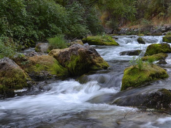
O'Hara Campground sits along the Selway River amid lush vegetation and old cedar trees. This is the largest campground on the Selway, with 32 sites, and makes a great base for exploring all the recreational activities and attractions in the area.Recreation
The Selway River is a destination fly fishing experience for cutthroat and rainbow trout and is also well-known for whitewater rafting. Several trailheads for hiking and biking can be accessed from Selway River Road and lead into the Selway-Bitterroot Wilderness area.
Facilities
The campground offers single-family sites, many of which are accessible. Each site is equipped with a picnic table, campfire ring and paved parking spur. Vault toilets, drinking water and bear-resistant dumpsters are provided.Natural Features
In the heart of north central Idaho, rugged peaks, deep canyons, dense forests and remote wilderness comprise the Nez Perce National Forest. Due in large part to dramatic elevational differences, the forest supports a wide variety of vegetation, from cedar groves to desert ecosystems.O'Hara is located in the Selway Wild and Scenic River Corridor, an area known for its rugged natural beauty and wildlife.
Nearby Attractions
An 11 mile sightseeing drive from Lowell to Selway Falls offers visitors opportunities to appreciate the pristine beauty of the Selway Wild and Scenic River and picturesque Selway Falls.O'Hara is near the Fenn Ranger Station, which is on the National Register of Historic Places.
WILDERNESS GATEWAY Campground
List of CampsitesOverview
Wilderness Gateway Campground provides direct access to the Wild and Scenic Lochsa River. Visitors enjoy a variety of recreational opportunities, including world famous whitewater rafting. Hiking and horseback riding trails abound in the nearby Selway-Bitterroot Wilderness area, which is the 3rd-largest in the lower 48 United States. This large and unique campground offers respite for a variety of campers, including those with horses, horse trailers and RVs.Recreation
The Lochsa River is world famous for its exciting whitewater rafting opportunities. Visitors do not need a permit to float the Lochsa, but technical expertise is a must. The river is also a destination fly fishing experience for cutthroat and rainbow trout, chinook salmon and steelhead. There are a number of river access points near the campground, along Highway 12. Highway 12, also known as the Lewis and Clark Highway, winds along the narrow river canyon through evergreen trees and large rock outcroppings. Visitors to the area enjoy the scenic drive and historic sites along the way. Elk, deer, moose, bear, cougar and mountain goats make the steep canyon country their home, as well as other wildlife. A variety of birds are also active in the area. Boulder Creek cascades down into the campground on its descent from the neighboring 1.5-million acre Selway-Bitterroot Wilderness area. Several trails head into the wilderness from the campground, including the 15-mile Lochsa Peak Trail and the 27-mile Boulder Creek Trail. A 1-mile birding trail loops around the campground and the half-mile Downriver Trail leads to a scenic river overlook. All trails are open to hiking and the wilderness trails are also open to horseback riding. The Lochsa Historical Ranger Station, a living history visitor center, is located one mile southwest of the campground.Facilities
The campground offers dozens of accessible, single-family campsites and a large-group site, available for tent and RV camping. Utility hookups are not available and parking surfaces are paved. The group campsite can accommodate up to 208 people and 52 vehicles. If the group campsite (Loop A) is reserved, a combination code will be provided in your confirmation email to gain access to the site. Loop D hosts equestrian sites, which provide access to hitching rails, a watering and feeding station and staging area. Please only reserve Loop D if you have stock you intend to bring with you. From April until June 1 of every year, individuals with boats or campers are allowed to camp in the site. After June 1 - no other campers are allowed.
All campsites are equipped with tables and campfire rings with grills. Accessible vault toilets, flush toilets and drinking water are provided throughout the campground. Firewood is not provided, nor is it always available at the campground. Some sites are available on a first-come, first-served basis.
An adjacent, accessible group shelter is also available and can accommodate up to 200 people. If reserved, a combination code will be provided in the confirmation email. the code is needed to access the utility room which has a converter plug for the use with your personal generator. Access to the utility room is required to run the lights and electrical outlets in the pavilion. The pavilion is equipped with a stone fireplace and multiple tables. The Accessible flush toilets and a parking area are adjacent to the pavilion.
Natural Features
The campground is located in heavily wooded forest in north-central Idaho at an elevation of 2,100 feet. It is adjacent to the Lochsa River. Lochsa is a Nez Perce word meaning "rough water." The 70-mile river and its tributaries have no dams and flow is unregulated from its headwaters near the Powell Ranger Station in the Bitterroots, to Lowell, where it joins the Selway River to form the Middle Fork of the Clearwater River. The Lochsa is one of the world's best for continuous whitewater.Nearby Attractions
*1 hour from access to the National Historic Lolo Trail Corridor *1 mile from the Lochsa Historical Ranger Station and Visitor CenterWALDE LOOKOUT CABIN Campground
List of CampsitesOverview
Walde Lookout Cabin was built in 1941 to house the employees who worked in the adjacent fire lookout, which was built in 1939. The fire lookout is still in use during the summer and fall, so the cabin is only available for rent from approximately mid-December through late March. This charming, rustic cabin has been restored to its original character.Guests must reach the cabin by snowmobile, skis or snowshoes. This is a trip of around 17 miles, and guests are responsible for their own travel arrangements and safety. The cabin provides a few conveniences, but guests will need to bring some supplies and gear to make a cozy and comfortable retreat for enjoying winter recreation.
Recreation
Several trails crisscross the vicinity, ideal for snowmobiling, snowshoeing or cross-country skiing. There are good places to sled nearby.Facilities
This 14x16-ft. log cabin accommodates four people with two mattresses located in a loft area and two cots. A wood stove heats the cabin, which is also equipped with a table and four chairs, a propane cook stove, propane lights, basic cooking and eating utensils, smoke alarm, mop and bucket, fire extinguisher and a snow shovel. Click here for additional cabin details.Firewood is available in a shed just outside. Toilet facilities consist of an outhouse with a pit toilet. Guests should be prepared to shovel a path to the cabin, shed and outhouse, as well as remove snow from the propane tank to turn it on.
There is no electricity or running water. Guests should bring their own drinking water. Natural sources can also provide water, although it should be boiled for culinary use. Garbage bags are also needed to pack out trash.
Bedding, flashlights or lanterns, extra batteries, matches, first aid supplies and toilet paper are not provided. Guests should remember to bring their rental permit with them to the cabin.
Natural Features
The cabin sits at an elevation of 5,220 feet on the watershed divide between the Lochsa and Clearwater Rivers. This vantage point shows off the western slopes of the vast Selway-Bitterroot Wilderness and the jagged peaks of the Selway Crags. The cabin is surrounded by a dense evergreen forest.The winter landscape is blanketed in deep, pristine snow. Wildlife sightings may include mule and white-tailed deer, elk, moose, gray wolf and cougar. A variety of birds also inhabit the area.
LOOKOUT BUTTE LOOKOUT Campground
List of CampsitesOverview
Lookout Butte has a history that spans nearly 80 years and has been home to three lookout towers. The first, built in 1923, was 45 feet tall with just a platform on which to stand. A cabin was put on the tower a couple years later. In 1935, a 50-foot tower was constructed. A new tower was built beside the old one in 1962, and this is currently available for rent.The current 60-foot wooden tower offers panoramic views and the perfect setting for enjoying the area's tranquility and natural beauty. Guests can enjoy the scenery from the exterior catwalk or from inside the single-room cabin.
Recreation
Several primitive roads in the area are open to mountain biking and off-road vehicles. Other activities in the area include hiking through second-growth forest and birding.Facilities
The lookout has room for up to four people and comes with two twin beds with foam mattresses and two cots. Other amenities include a propane stove and oven, a table and chairs, a broom, a bucket and a mop. A pit toilet sits downhill to the south of the lookout, and there's a campfire ring near the base. Guests should be prepared to haul supplies up five flights of stairs. Guests are required to bring their own drinking water. Other recommended supplies include food, sleeping bags or bedding, coolers, cookware and utensils, dishes, warm clothing and rain gear, flashlights, extra batteries, first aid kit, matches, toilet paper, garbage bags and the combination for the lookout and gate. Click here for more information about this lookout.Natural Features
The lookout sits at 5,869 feet in elevation with breathtaking views of the Selway Crags in the Selway-Bitterroot Wilderness area, the Seven Devils Mountain Range, Coolwater Ridge, Pilot Knob Lookout and the Lochsa and Selway River drainages.Nearby Attractions
Guests can take a sightseeing drive from Lowell to Selway Falls and back. This 42-mile drive offers opportunities to appreciate the pristine beauty of the Selway River, a Wild and Scenic River, as well as picturesque Selway Falls.ADAMS RANGER STATION Campground
List of CampsitesOverview
Adams Ranger Station Cabin is located in the heart of the Nez Perce National Forest at an elevation of 5,150 feet. Adams Camp served as a way station along the Milner Trail as early as 1862. The Forest Service established the area adjacent to Adams Camp as an administrative site in 1919. Adams Ranger Station was built in 1932 for the District Ranger and his family. It last served as District headquarters in 1958. Since then, it has served as a work center, hosting a variety of summer crews.The historic cabin is available for rent year-round, except during spring melt, which typically occurs from mid-March to late May. Winter access is approximately 30 miles from Fish Creek Snow Park along a groomed snowmobile route. The cabin must be reserved in advanced; there are no walk-ups.
Recreation
Many fun activities surround Adams Ranger Station, including numerous trails. Corral Creek, a nearby stock facility and trailhead, can accommodate horses and hikers. This trail system leads into the beautiful Gospel-Hump Wilderness.The Milner Trail, Road #641, is open to off-road vehicles in the summer and snowmobiles in the winter.
Facilities
The cabin can accommodate up to eight people and has one futon, one double bed, two single beds and two cots. Bedding and blankets are not provided. There is a vault toilet, a propane cook stove (the oven part of the stove is not hooked up to the propane and does not work), dishes, silverware, cookware, bakeware, a table and chairs. Other amenities include propane lanterns, a broom, bucket, mop, snow shovels, axes, mauls and firewood rounds. Firewood rounds provided are for heating the cabin, not for campfires in the fire ring outside. You must provide your own firewood for the outside fire ring.Water is not available on-site. Guests must bring their own or melt snow in the winter. It is recommended that visitors bring flashlights, extra batteries, matches, lighters, garbage bags, candles, lantern mantles, newspapers for lighting fires, warm clothes, rain gear, boots, white gas and small propane canisters, first aid kit, cabin shoes or slippers, maps of Nez Perce National Forest and the Gospel Hump Wilderness and lock combinations. Sleeping bags (0 to 20 degrees) may also be needed. Click here for more cabin details.
Natural Features
Adams Ranger Station is near the Gospel-Hump Wilderness and part of the Salmon River/Highway 95 Corridor. The landscape in this corridor varies from the emerald Salmon River pouring through steep canyon walls to sapphire Moore's Lake in the remote Gospel-Hump Wilderness.The Gospel-Hump Wilderness has elevations ranging from 1,970 feet at the Wind River pack bridge on the Salmon River to 8,940 feet at the summit of Buffalo Hump. The northern part of the Wilderness is wetter and heavily forested; the southern part is dry and sparsely vegetated. The two parts are separated by a rugged, glaciated divide which contains the peaks for which the wilderness is named.
Wildlife in the area includes mountain lions, moose, bighorn sheep, mountain goats and wolves.
Nearby Attractions
Guests may wish to visit the historic gold-mining town of Florence. It is now a ghost town with a cemetery and a few long abandoned buildings.KELLY FORKS CABIN Campground
List of CampsitesOverview
Kelly Forks cabin is located in a small clearing within an active forest service work center. It was originally built at the confluence of Moose and Kelly Creeks during the mid-1930’s to be used as a stopover between the upper North Fork and the Bungalow Ranger stations. It was then dismantled, floated down Kelly Creek, and reassembled at its current location during the mid-1900s. Fully remodeled around 2002 with modern comforts, the cabin maintains a high demand throughout the rental season. Although accessible by car, the gravel roads on the district can be quite rough and partially blocked with debris. Visitors are strongly advised to consult a map as well as the forest website prior to reserving or traveling to the cabin.
There is a maximum consecutive stay of 6 nights per user and a maximum total stay of 6 nights per year per user. Users may only hold two reservations for this cabin at any one time. Failure to abide by these rules may result in cancelled reservations without refund of reservation or cancellation fees.
Recreation
There are several fishing “holes” and hiking trails located within easy walking distance of the cabin with many more a short drive in any direction. The North Fork Ranger District prides itself on the diversity of world class recreational opportunities ranging from bird/wildlife watching, big game hunting, whitewater rafting, leisurely floats, secluded backpacking/equestrian trails into the high mountain backcountry, to motorized OHV trail systems providing unique experiences that draw visitors from around the world and all walks of life. Be sure to check the regulations and rules to educate yourself before you recreate by visiting https://idfg.idaho.gov/ and https://www.fs.usda.gov/news/nezperceclearwater/news-events for up to date information.
Facilities
The 3-room cabin can accommodate up to six people and is furnished with electricity, lights, running water, “on demand” propane hot water, and individual electric radiant heaters for each room. The bedroom contains 1 twin and 1 full size mattress and a dresser w/mirror. The spacious bathroom is equipped with a shower stall, flush toilet, sink and mirror. The kitchen is equipped with an electric range w/oven, microwave, refrigerator/ freezer, sink, drip coffee pot, toaster and an odd assortment of pots, pans, plates, bowls, utensils, cups, and glasses. The vaulted living area provides 2 full sized futons, and dining table with 4 chairs. The cabin also has a large covered porch with camp chairs and a picnic area that has a table and fire ring (guests provide their own firewood). The cabin can be reserved for a single night or up to 6 consecutive nights by the same individual or group. Guests are required to bring their own bedding, pick up after their pets, and clean the cabin before they check out with the provided cleaning supplies under the “leave it cleaner than when you arrived” policy.
Natural Features
The cabin is situated in a small semi secluded clearing surrounded by evergreens, cottonwood, and alder mixed with huckleberries at the confluence of Kelly Creek and the North Fork of the Clearwater River. The area is known worldwide as a blue-ribbon fishery for West Slope Cutthroat Trout, and the beautiful crystal-clear waters are just a stone's throw from the cabin. A wide variety of wildlife including elk, white-tailed and mule deer, black bear, wolf, cougar, bobcat, mountain goat, moose, eagle, otter, marten, fisher, osprey, raven, king fisher, dippers and many more call the steep, densely vegetated river valleys home. Seasonal changes can be particularly enjoyable from the swift moving whitewater in the spring to the extraordinary fall colors pursued by the crisp white snow line.
contact_info
For facility specific information, please call (208) 476-4541.LIZ CREEK CABIN Campground
List of CampsitesOverview
Liz Creek Cabin was built in 1929 in the remote backcountry as a Forest Service guard station and is eligible for the National Register of Historic Places. An extensive restoration that was completed in 2014 brought the cabin back to life as a rental available to the public. The small single room cabin has a loft and a covered porch. Although there are several entry points to the area, the site is only accessible by the single track multi use portion of Weitas Creek trail #20 that connects 12-mile saddle to the North Fork of the Clearwater River. Visitors are strongly advised to consult the forest website, as well as a map prior to reserving or traveling to the cabin and to call the district information desk for any questions.
Recreation
While remote, this site offers a great chance to explore both riparian habitat and mountain vistas. Along with trail 20 a multi-use motorized trail, that is also open to ATV/UTV 50" or less from 12 Mile Saddle to within approximately 1.5 miles of the cabin. There are several other trails in the vicinity that offer connection to a host of recreation opportunities to the avid outdoors adventurer with berry picking, hiking, biking, sightseeing, fishing and hunting being the most popular. Recreate responsibly, be sure to check the regulations and rules to educate yourself before you recreate by visiting https://idfg.idaho.gov/ and https://www.fs.usda.gov/news/nezperceclearwater/news-events for up to date information.
Facilities
The small primitive cabin has a loft and a covered porch and can accommodate a maximum of four people. There are sleeping cots, table with chairs, wood heating stove, storage cabinet, and a fire ring outside. The remote site offers no modern amenities, an outhouse with pit toilet is located a short distance from the cabin, and a stream provides water that needs to be treated before consuming. Guests must bring their own supplies and gear for a comfortable stay as there are no linens or toiletries provided. Guests are required to pick up after their pets/stock, take their trash and clean the cabin before they check-out with the provided cleaning supplies,under the “Leave it Cleaner than when you arrived” and the “Pack it in Pack it out” policies so everyone may enjoy their stay.
Natural Features
Situated at an elevation of 3,500 feet at the confluence of Liz and Weitas Creeks, the site offers a panoramic view of the diverse surroundings. The forest beyond the cabin’s meadow varies from old growth conifer trees mixed with huge cedar snags from the great 1910 fires, to steep mountain sides filled with an abundance of vegetation, including Huckleberry, Mountain Maple, Thimble berry and alder. Weitas, and to a lesser extent Liz Creek, have multiple beaver dams unique to the area providing a water abundant habitat full of native flora/fauna, so visitors are likely to have several opportunities to catch a glimpse of the many species in the area. The cabin is an ideal base camp for those looking to reconnect with nature, or as a stopover for a variety of outdoor enthusiasts as they explore the district.
Nearby Attractions
Depending on how you decide to travel into the cabin, there are many attractions along the way including the historic Lolo Motorway that stretches 100 miles through scenic mountain landscapes with spectacular views as it parallels a portion of the Lewis and Clark and the Nez Perce trails. Sites include but not limited to places such as; The Smoking Place, The Sinque Hole, and Spirit Revival Ridge. The North Fork ranger district prides itself on the diversity of world class recreational opportunities ranging from bird/wildlife watching, big game hunting, whitewater rafting, leisurely floats, secluded backpacking/equestrian trails into the high mountain backcountry, to motorized OHV/ ATV/UTV trail systems. These unique opportunities draw visitors from around the world and of all walks of life. Summer visitors also have the opportunity to observe meadows and hillsides blanketed in colorful wildflowers throughout much of the season. Travelers should be prepared for rough sometimes treacherous conditions. No services are located along this road so travelers should have plenty of gas, food, and water for the drive.
FISH CREEK PAVILION Campground
List of CampsitesOverview
Fish Creek Pavilion is a day-use picnic area adjacent to Fish Creek Campground. It's situated in a meadow surrounded by conifers and near a variety of recreational activities.Recreation
The Fish Creek Cross Country Trail begins within the adjacent campground. This 7-mile multi-use loop is open to hikers, mountain bikers, horseback riders and off-road vehicle enthusiasts. Hikers will find additional foot trails as well.Visitors who wish to camp can stay at Fish Creek Campground, which has first-come, first-served sites. Groups can reserve the Fish Creek Group Site about 2 miles down the road.
Facilities
The accessible pavilion can accommodate up to 75 people. Eight picnic tables, two barbecue grills, electricity and lights are provided. Drinking water is available from June 15 to September 15. A short paved path leads to additional picnic tables and campfire circle with benches.Natural Features
In the heart of north central Idaho, rugged peaks, deep canyons, dense forests and remote wilderness comprise the Nez Perce National Forest. Due in large part to dramatic elevational differences, the forest supports a wide variety of vegetation, from cedar groves to desert ecosystems.Fish Creek Pavilion is located in the Salmon River/Highway 95 Corridor. The landscape here varies from the emerald Salmon River pouring through steep canyon walls to sapphire Moore's Lake in the remote Gospel-Hump Wilderness.
Nearby Attractions
Grangeville is the nearest town. It offers camping supplies and a historical museum.POWELL CAMPGROUND Campground
List of CampsitesOverview
Powell Campground provides direct access to the Lochsa Wild and Scenic River, one of Idaho's most scenic waterways. The Selway-Bitterroot Wilderness lies on the opposite side of the river. The campground is within walking distance of a small general store, fuel, lodging and a restaurant. The Powell Ranger Station is nearby as well, but all visitor services have moved to Lolo Pass Visitor Center.Recreation
The Lochsa River provides visitors with opportunities for fishing and other water-related recreation. Cutthroat and rainbow trout, Chinook salmon and steelhead swim in the clear waters. The Lochsa is world-famous for its exciting whitewater rafting opportunities. A permit is not necessary to float the river, but technical expertise is a must.A variety of hiking and horseback riding trails are available in the wilderness area. The 1.5-mile Powell Complex Trail begins near the campground and leads west through cool, shady cedar and larch trees, making for a relaxing day trip. Hunting is also a popular activity in the rugged and primitive landscape.
Highway 12, also known as the Lewis and Clark Highway, winds along the narrow river canyon through evergreen trees and past large rock outcroppings. Visitors enjoy the scenic drive and historic sites along the way.
Facilities
The campground offers single-family sites for tent and RV camping. The sites in loop A offer electrical hookups (15 amp, 30 amp, and 50 amp.) Parking surfaces are paved throughout the campground. Additional sites are available on a first-come, first-served basis.
Each site is equipped with a table and campfire ring with grill. Accessible vault toilets and drinking water are provided throughout the campground. An accessible flush toilet is adjacent to the day use area. Firewood is not provided and it is often not available.
Natural Features
Lochsa is a Nez Perce word meaning "rough water." The 70-mile river and its tributaries have no dams and the flow is unregulated from its headwaters near the Powell Ranger Station in the Bitterroots, to Lowell, where it joins the Selway River to form the Middle Fork of the Clearwater River. The Lochsa is one of the world's best for continuous whitewater.The campground is situated in a dense forest in north-central Idaho at an elevation of 3,400 feet. It is across the river from the border of the 1.5-million acre Selway-Bitterroot Wilderness. Famed explorers Lewis and Clark passed through on their way to the Pacific Ocean in September of 1805.
Elk, deer, moose, bear, cougar and mountain goats make the steep canyon country their home.
Nearby Attractions
A variety of services are available in the rustic resort area near the campground including a general store, lodging, food and fuel. Fishing licenses are also available for purchase.The nearest free dump station is 40 miles west on Highway 12, at the Wilderness Gateway Campground.
CASTLE BUTTE LOOKOUT Campground
List of CampsitesOverview
Castle Butte Lookout is a unique cabin perched on a rocky point, 6,659 feet above sea level. It offers breathtaking, 360-degree views of the Selway-Bitterroot Wilderness, the Seven Devils Mountains, the Great Burn area and the deep canyons of the North Fork Clearwater River's upper drainages.A cabin was first constructed on this site in 1916 and was replaced in 1928 with a log cabin featuring a cupola. The current lookout was built in 1950.
Access to the lookout is via the Lolo Motorway, a primitive, single-lane road constructed by the Civilian Conservation Corps in the early 1930s. It is not recommended for large RVs, vehicles with low ground clearance or trailers. Guests should be prepared to walk about 100 feet up steep, rocky terrain to reach the lookout.
Castle Butte Lookout is equipped with a few creature comforts, but guests will need to bring some gear and supplies to help make their stay enjoyable. The panoramic view guarantees a memorable stay.
Recreation
Hikers can follow the paths of the Nez Perce and Lewis and Clark on the historic Lolo Trail. The Lolo Motorway is popular with off-road vehicle enthusiasts. Click here for an Idaho OHV safety message.Huckleberries are abundant in the summer, offering good berry picking opportunities.
Facilities
Castle Butte Lookout can accommodate four people and comes equipped with two twin beds with foam mattresses, two cots, a table with two chairs, mop & bucket, a propane cook stove, propane lights, propane heater and propane. A pit toilet is located in a separate building outside. Click here for additional cabin details. The cabin does not have electricity or water. Guests should bring their own water supply as there is no close water source. Guests must provide their own emergency lighting, garbage bags, bedding, matches, toilet paper, cookware and cooking utensils. The cabin should be cleaned before departure.Natural Features
The lookout is surrounded by a rocky landscape that quickly gives way to dense forests of lodgepole and ponderosa pines.This unique facility offers an ideal vantage point to watch sunrises and sunsets, and gaze at the stars. Wildlife enthusiasts may spot eagles, bears, moose, elk, deer and mountain goats.
Nearby Attractions
The Lolo Motorway stretches for 100 miles through scenic mountain landscapes. Summer visitors can see meadows and hillsides blanketed in colorful wildflowers. Travelers should be prepared for rough, sometimes treacherous conditions. No services are located along this road, so travelers should have plenty of gas, food and water for the drive.LIZ BUTTE CABIN Campground
List of CampsitesOverview
This facility is no longer reservable.
Recreation
Facilities
Natural Features
Nearby Attractions
JOHNSON BAR GROUP SITE Campground
List of CampsitesOverview
Johnson Bar Group Site is situated in a large, open field along the Selway River. The site is perfect for gatherings of up to 100 people, with room for tents and RVs. The site offers access to many recreational activities and sightseeing opportunities.Recreation
The Selway River is a destination fly fishing experience for cutthroat and rainbow trout and is also well-known for whitewater rafting. Several trailheads for hiking and biking are accessible from Selway River Road and lead into the Selway-Bitterroot Wilderness area. Johnson Bar offers beach and boating access.Facilities
The accessible group site can accommodate a maximum of 100 people. It is equipped with a campfire circle, two smaller campfire rings, picnic tables and drinking water. Vault toilets are adjacent to the site, and groups of 25 or more are required to rent 1-3 portable toilets.Individual campsites are located on either side of the group site on a first-come, first served basis.
Natural Features
In the heart of north central Idaho, rugged peaks, deep canyons, dense forests and remote wilderness comprise the Nez Perce National Forest. Due in large part to dramatic elevational differences, the forest supports a wide variety of vegetation, from cedar groves to desert ecosystems.Johnson Bar is located in the Selway Wild and Scenic River Corridor, an area known for its rugged natural beauty and wildlife.
Nearby Attractions
An 11-mile sightseeing drive from Lowell to Selway Falls offers visitors opportunities to appreciate the pristine beauty of the Selway Wild and Scenic River and picturesque Selway Falls.Johnson Bar is near the Fenn Ranger Station, which is on the National Register of Historic Places.
FISH CREEK GROUP USE Campground
List of CampsitesOverview
Fish Creek Group Camp is located a few miles from the developed Fish Creek Campground. The primitive group site is a horse-friendly camp that can accommodate up to 75 people. It is also known as "Eagle's Nest," "Girl Scout Camp" and "Fish Creek Dispersed Site."Recreation
The Fish Creek Cross Country Trail begins at nearby Fish Creek Campground. This 7-mile multi-use loop is open to hikers, mountain bikers, horseback riders and off-road vehicle enthusiasts, and offers scenic views of Gospel Mountain, Pilot Rock and Buffalo Hump.Facilities
The group site can accommodate up to 75 people and 20 vehicles. Tent pads and two vault toilets are provided.Natural Features
The group site is laid out in a large, flat area beneath tall pines within the Nez Perce National Forest in the heart of north central Idaho. The forest is comprised of rugged peaks, deep canyons, dense forests and remote wilderness. Due in large part to dramatic elevational differences, the forest supports a wide variety of vegetation, from cedar groves to desert ecosystems.Fish Creek Group Camp is located in the Salmon River/Highway 95 Corridor. The landscape here varies from the emerald-colored Salmon River pouring through steep canyon walls to sapphire-hued Moore's Lake in the remote Gospel-Hump Wilderness.
Nearby Attractions
Grangeville is the closest town. It offers camping supplies and a historical museum. The surrounding area offers a wealth of recreational activities, including whitewater rafting on the Salmon and Snake Rivers, golfing and fishing.MEADOW CREEK CABIN Campground
List of CampsitesOverview
Meadow Creek Cabin was originally built in the early 1920s and used as a guard station, which consists of five buildings. The main cabin contains the office, a sleeping area and the kitchen. The bunkhouse contains a main room and loft. There is also a tack shed, woodshed and outhouse. Since 1932, Meadow Creek has served as a workstation, with field crews occasionally utilizing the bunkhouse.The cabin is nestled among the pines on a steep-sided canyon along Meadow Creek. Plan on a 15-mile hike or horseback ride to this remote backcountry cabin, which is typically available from May 1 to September 15.
Recreation
Several trails are available in the area to explore by foot or horseback, including the Meadow Creek National Recreation Trail and the Butte Creek Trail. Anglers can enjoy fly fishing for trout in Meadow Creek after July 1st each year.Facilities
The rustic cabin has six beds with mattresses, a living room with wood heat, and kitchen facilities with a wood cook stove. A propane refrigerator, dishes, cookware, kitchen utensils, Coleman lantern (no fuel provided), mop, bucket, broom, fire extinguisher and lights are provided.Modern bathroom facilities and electricity are not available. An outhouse is located near the cabin. An indoor but untested water system is available; all water should be filtered or boiled for five minutes. The propane tank is located on the back porch.
A corral is provided for stock use and any grazing should take place beyond the grassy area in front of the cabins. Visitors must being weed-free feed for their stock.
Visitors should bring garbage bags for packing out trash. The cabin does not have matches, bedding, flashlights, first aid supplies or Coleman fuel. Click here for more information about this cabin.
Natural Features
Meadow Creek is a major tributary of the Selway River and is known for its clean, cold water and unspoiled beauty. Big game species found in the area include black bear, elk, moose, mule deer, whitetail deer and cougar. Visitors may also spot the Coeur d'Alene Salamander, which is only found in areas near the Selway River and Meadow Creek. Beaver, mink and otter may also be seen.Nearby Attractions
Indian Hill Lookout is near the cabin and just outside the Selway-Bitterroot Wilderness. The present tower was built in 1951 and the cabin is occupied by staff during the summer months.WALKER CABIN Campground
List of CampsitesOverview
Walker Cabin is nestled among trees just off Crooked River Road #233, which leads into the Gospel-Hump Wilderness Area, in the Nez Perce National Forest.
The cabin was originally built around 1930 as a summer home. Jerry and Helen Walker purchased the cabin in 1967, then donated it to the U.S. Forest Service in the 1980s. It is now available for public recreational use. The cabin must be reserved in advanced; there are no walk-ups.
Recreation
Crooked River is a popular area for many recreational opportunities, including hiking, trout fishing, hunting, snowmobiling and cross-country skiing. A nice hiking trail is located behind the cabin.Nearby trails lead to the Orogrande Summit, Buffalo Hump and Gospel Hump. Snowshoes may be required on the trails in winter. There are several lakes within a 3-mile radius that are easily accessible by foot or off-road vehicle.
Facilities
The rustic cabin has two bedrooms with two single beds each, a living room with a wood insert in the fireplace, several chairs, a table, a broom and a kitchen with a wood cook stove. A vault toilet is located in a separate building. Guests can find firewood in a shed behind the cabin.Running water and electricity are not available. Guests should bring their own water supply and garbage bags to pack out their trash. Cookware, kitchen utensils, bedding and blankets are not provided. A lantern or flashlight and extra batteries are recommended (click here for more details about this cabin).
Natural Features
Walker Cabin sits at an elevation of 4,500 feet near the northern part of Gospel-Hump Wilderness, an area that is moist and densely forested. Big game species like elk, mule and whitetail deer, black bear, cougar, moose, mountain goat and mountain sheep live within the Wilderness. Chukar, grouse, squirrels and songbirds make their home here as well.Nearby Attractions
The cabin is less than a mile from Orogrande, a historic mining site that is now a ghost town. The closest town, Elk City, Idaho, is a remote community with limited facilities that include a grocery store, restaurant, bar, laundromat, convenience store and gas stations.South Fork Group Site 5 - Nez Perce NF (ID) Campground
List of CampsitesOverview
South Fork Campground is nestled along the South Fork of Clearwater River. All standard sites are first-come, first-served, but a group site that can accommodate up to 25 people is available for reservations.South Fork Campground is well-suited to moderately-sized RVs. An abundance of recreational activities and scenic attractions are in the area.
Recreation
Anglers can fish for trout, steelhead and salmon in the Clearwater River. Berry picking is popular in season.Facilities
Each campsite has a picnic table, grill, tent pad and paved parking spur. Vault toilets are provided. Drinking water is available during the peak season only. A camp host may be on-site during the summer.Natural Features
In the heart of north central Idaho, rugged peaks, deep canyons, dense forests and remote wilderness comprise the Nez Perce National Forest. Due in large part to dramatic elevational differences, the forest supports a wide variety of vegetation, from cedar groves to desert ecosystems.South Fork Campground is located in the Highway 14 Corridor. This area features forested canyons with sections of rugged granite outcroppings, as well as gently sloping lodgepole pine-covered uplands and lush wildflower meadows.
Nearby Attractions
The campground's proximity to Highway 14 makes it easy to do a scenic drive. This picturesque route winds through changing landscapes and historic areas.Cold Springs Peak Cabin - Clearwater NF (ID) Campground
List of CampsitesOverview
As a qualifying inclusion to the National Register of Historic Places, the primitive 12'x14' log cabin was originally constructed to shelter firefighters and other work crews in 1931. Although Forest Service personnel and volunteers shored up the cabin’s foundation, re-shingled the roof and installed a wood heating stove, guests must bring their own supplies and gear for a comfortable stay as there are no linens, cleaning supplies, or toiletries provided. The popular cabin is perched on a ridge line just off Pot Mountain trail #169 overlooking the Elizabeth Creek drainage and Ice Lake. The trailhead to the cabin is not assessable with low clearance vehicles, and the 2 plus miles of trail from the trailhead to the cabin is a moderately difficult, multi-use trail with several steep grades. Although assessable by OHV's less than 50" in width, the roads and trails leading to the cabin can be partially or fully blocked by debris or snowpack in the early season. Off trail/road motorized travel is strictly prohibited. Visitors are strongly advised to consult the forest website, as well as a map prior to reserving or traveling to the cabin and to call the district information desk with any questions.
Recreation
Due to the unique location, the cabin is an ideal base camp for those looking to reconnect with nature, or as a stopover for a variety of outdoor enthusiasts as they explore the district. Multiple mountain lakes in the vicinity provides a welcome challenge for the avid adventurer looking to find the many secluded fishing holes. There are also several other trails in the vicinity that offer connection to a host of recreation opportunities including; berry picking, hiking, biking, sightseeing, and birding being the most popular. Recreate responsibly, be sure to check the regulations and rules to educate yourself before you recreate by visiting https://idfg.idaho.gov/ and https://www.fs.usda.gov/news/nezperceclearwater/news-events for up to date information.
Facilities
The cabin is a 1930’s primitive structure only providing a shelter from the elements. Two spring beds, a small table with a couple chairs, a modern wood stove, and a pit toilet outhouse are the only amenities provided. There is only one stream as a reasonable water source approximately 1 mile from the cabin on trail #169 that requires treatment before consumption. Guests are required to pick up after their pets/stock, pack out their trash, and clean the cabin before they check-out with the provided broom under the “Leave it Cleaner than when you arrived” and the “Pack it in Pack it out” policies so everyone may enjoy their stay.
Natural Features
The cabin is tucked into a narrow, rocky saddle, atop steep, nearly vertical cliffs directly adjacent to Cold Springs Peak. At almost 6,731 feet, guests enjoy open views of the Bitterroot Mountains to the east as well as a bird’s eye view of the Elizabeth Creek drainage, Ice Lake, and a small meadow directly below the cabin. The area boasts a wide diversity of wildlife and birds, so visitors never know what to expect while enjoying the scenery, but mule deer, mountain lion, black bear, elk, Mountain Bluebird, Mountain Jay, Raven, and Tanager are the most common. Seasonal changes can be particularly enjoyable as the storms blow through the saddle, or the extraordinary fall colors back dropped with mountains capped by advancing snow late in the season.
contact_info
For facility specific information, please call (208) 476-4541.Nearby Attractions
The North Fork ranger district prides itself on the diversity of world class recreational opportunities ranging from bird/wildlife watching, big game hunting, whitewater rafting, leisurely floats, secluded backpacking/equestrian trails into the high mountain backcountry, to motorized OHV trail systems providing unique experiences that draw visitors from around the world and all walks of life.
ELK CREEK CAMPGROUND (CLEARWATER NF) Campground
List of CampsitesOverview
Elk Creek Campground offers visitors a little bit of everything. From scenic views and vistas, to attractive waterfalls and ancient foliage, the campground provides a great place to stay in the mountains of north central Idaho. Recreational opportunities abound in the area and a variety of services are located nearby.Recreation
Elk Creek and nearby Elk River Reservoir provide visitors with opportunities for fishing and other water-related recreation. Cutthroat and rainbow trout, chinook salmon and steelhead swim in the clear waters. Fishing or hunting are popular activities in the rugged and primitive landscape.Hiking, mountain biking and horseback riding are available on the area's many trails and forest roads. The Elk Creek Falls Trail takes hikers 3.5 miles to the tallest waterfall in the state.
Facilities
The campground offers single-family sites for tent and RV camping, most of which are available on a first-come, first-served basis (no reservation needed). Electrical hookups are available at all sites including six campsites available for advanced reservations. Parking and driving surfaces are gravel throughout the campground.Each site is equipped with a table and campfire ring with grill. Accessible vault toilets and drinking water are provided. A more rustic overflow section offers additional campsites.
Natural Features
The campground is situated in a mature pine forest in the Clearwater National Forest, next to Elk Creek, at an elevation of about 3,000 feet. The surrounding area is home to the tallest waterfall in Idaho, as well as the largest cedar tree east of the Cascade Range.Elk, deer, moose, bear and cougar make the forested country their home.
Nearby Attractions
The town of Elk River is less than a mile from the campground and offers a variety of basic services, including gas, groceries, showers and fishing equipment.Bald Mountain Lookout (Nez Perce-Clearwater National Forests, ID) Campground
List of CampsitesOverview
Bald Mountain Lookout offers the opportunity to enjoy unforgettable views and participate in a variety of recreational opportunities. It was built in 1956 and was used as a fire lookout until 1984. Guests can drive to the lookout in vehicles with good ground clearance, but trailers are not recommended due to some rough spots on the road.The lookout is typically open from early July through early October. The accommodations are mostly primitive, but some conveniences are provided. Guests will need to bring some of their own supplies and gear for a comfortable experience.
Recreation
Access to Strychnine Ridge Trail 319 is just southwest of the lookout. This 4-mile trail intersects with Beason Meadows Trail 228 a half-mile below the lookout. The Beason Meadows Trail is 8.9 miles long and leads down to Giant White Pine Campground. These trails are open to hikers, mountain bikers, motorcyclists and equestrians. Click here for an Idaho OHV safety message.Facilities
This lookout sits 50 feet off the ground. A stairway leads to an exterior catwalk that surrounds the cabin, which can accommodate four people. A table and four chairs, a futon that folds into a twin bed with foam pad and two cots are provided. Propane appliances include a cooking stove and heater. Cookware, dishes and utensils are provided. A pit toilet is located just below the lookout.Water and electricity are not offered at the cabin. Guests need to bring their own drinking water and lighting/ Flashlights. Garbage bags are also needed to pack out trash.
Bedding and additional mattresses are not provided. The refrigerator has been removed, guests may want to consider bringing a cooler with extra ice for perishable items.
Natural Features
Bald Mountain is one of the highest peaks in the Hoodoo Mountain Range, and it's heavily forested with a mix of larch, red cedar, hemlock, western white pine, Douglas fir and Engelmann spruce. The lookout offers a bird's eye view of the surrounding mountains from its perch 5,334 feet above sea level.Guests who come to this rustic retreat can enjoy a panorama featuring the golden, rolling hills of the Palouse to the south and St. Maries to the north. The lookout offers an ideal vantage point to watch sunrises and sunsets or gaze at the stars.
Wildlife watchers may see eagles soaring through the sky. Bear, moose, elk and deer are frequently spotted in the area.
Nearby Attractions
Bald Mountain Lookout is located just off Highway 6, which is known as the White Pine Scenic Byway. This 80-mile scenic drive takes visitors through beautiful forests, historic towns and scenic farmland.GLADE CREEK CAMPGROUND Campground
List of CampsitesOverview
Glade Creek Campground is a group site, only available by reservation. The campground is located along US Highway 12 in the Clearwater National Forest about seven miles east of Lowell, Idaho. Located in the mountains of north central Idaho, the forested site offers campers river access and beautiful scenery. The site is suitable for groups up to 35 people and is perfect for families and groups who want easy access to the Lochsa River. Fees are $50 per night. A combination code is needed to gain entry to the site and will be provided in the confirmation email. Check out is 2:00 pm. Check in is 2:00pm
Recreation
Popular activities include fishing and swimming. For the whitewater thrill-seekers, the Wild and Scenic Lochsa River holds exciting floating and kayaking opportunities. There are three hiking/biking trails within two miles of the campground; #142, #111 and #107. These trails are also open to motorcycles from approximately June through September.Facilities
Glade Creek has four campsites and encompasses about one acre. Two of the sites are located adjacent to the river. There is a group fire ring with benches adjacent to the river. All four sites have accessible fire rings, ten foot picnic tables, level tent pads and graveled parking areas. Site 2 has an extra table and several tent sites. The spurs are short and not suitable for RVs greater than 24 feet. The campground has one unisex vault toilet, but does not offer water, sewer or power hookups. Please follow the "Pack it in, Pack it out" philosophy to keep this beautiful location clean, as garbage service is not provided at this location.
Natural Features
The campground is situated between US Highway 12 and the Lochsa River. The campground is on a large bend in the river, which makes the beach completely hidden from the highway. With shade from the surrounding stand of mixed-age conifers and low-growing shrubs, It is a cool reprieve during the summer.Flint Creek Trailhead Facility
Flint Creek trailhead (designated as "American River" campground on the Forest Map) offers camp pads, a stock loading ramp, fire rings, hitching rails, meat pole and toilet. Flint Creek flows by the campsite. It serves as the trailhead for Flint Creek Trail #510.
Mallard Creek Campground Campground
List of CampsitesMallard Creek Campground provides five campsites situated in the tall timber near Mallard Creek. Although there is a toilet, there are no tables or fire grates.
O'Hara Saddle Campground Campground
List of CampsitesO'Hara Saddle campground is at the edge of a meadow on an open ridge top. The campground is a nice location to park your OHV and camp for the night It provides fire rings and two camp pads. There is no toilet currently available. Heaviest use is by hunters during big game season.
Orogrande Campground #1 and #2 Campground
List of CampsitesLocally known as Orogrande #1 and 2, this campground occupies both sides of the road, one on the bank of Crooked River. It includes a toilet, fire rings and at least three camp pads. The non-river side is a good spot for one family or small group. The river side is an open, grassy campsite.
Orogrande Summit Campground Campground
List of CampsitesOrogrande Summit is a developed campground with camp pads, all dispersed throughout open timber. Expect to see alpine country with associated wildlife in this high-elevation campground on the route to Buffalo Hump. Wildhorse Lake is about two miles by road northwest of the site. This campground also serves as the trailhead for Columbia Ridge Trail #205.
Oxbow Campsite Campground
List of CampsitesLocated on the bank of Newsome Creek, this campsite provides 1 solitary campsite for fishermen wishing to try their luck in Newsome Creek. The area to the east is closed to motor vehicles year round but existing roads make for great mountain biking. The site is equipped with a camp pad and a toilet.
Rainy Day Campground Campground
List of CampsitesRainy Day Campground provides campsites located in open timber on ridge top. Some spots screened from road by timber. A toilet is available at the site, as are metal fire rings. Road access to the site is rough and narrow in places.
Table Meadows Campground Facility
Situated in a popular big game hunting area, Table Meadows Campground offers two toilets, two stock feeding bunks, a loading ramp, hitching rail and six camp pads. The West Fork of the American River flows through the campground.
Spring Bar Campground Campground
List of CampsitesA popular take-out point for floaters of the Salmon River, the Spring Bar Campground offers a boat launching ramp and 18 tent campsites. A table and fire ring are provided at all but two of the sites. Spring Bar is situated next to a relatively flat part of the Salmon River with the south end nestled in the shade of various fruit bearing trees. The surrounding area also provides for fishing, swimming, berry picking, and exploring. Wheelchair accessible picnic facilities are available at Allison Creek, to the west, and Riggins Hot Springs (not public lands) are across the river just west of the campground. No trailer hookups or RV dumps provided.
Fenn Pond Facility
Fenn Pond is located across from Fenn Ranger Station. It has an accessible trail and boardwalk. It is stocked with trout by the Idaho Department of Fish and Game.
Fish Your National Forests: This site can be accessed by Passenger Car; Fish available include: Trout; Types of fishing available include: Wade, Shore, Non-motorized boat, Float tube, Fly, Spin, Bait; ADA accessible fishing access with fishing pier
Crooked River Campground #4 Campground
List of CampsitesCamping pads are screened by trees. This site is good for large visitor parties. A small fishing and swimming pond located at campground, and there is easy access to Crooked River.
Dixie Meadow Campground Campground
List of CampsitesDispersed campsite with toilet.
Hells Canyon Wilderness Facility
Hells Canyon Wilderness is a part of the Hells Canyon National Recreation Area (HCNRA) that straddles the border of northeastern Oregon and western Idaho, split in half by the Wild and Scenic Snake River. The Idaho side boasts the Seven Devils mountain range, and is jointly managed by the Nez Perce-Clearwater National Forests, along with the Wallowa-Whitman National Forests. A small portion of the Wilderness in Oregon is managed by the Bureau of Land Management. Find out more about this and other wildernesses at Wilderness.net
Washington Creek Campground Campground
List of CampsitesCrossing the bridge over to Washington Creek Campground, visitors gain a splendid view overlooking the North Fork of the Clearwater River. This campground offers one host site and 23 campsites (including one group site). Each site contains a gravel parking pad, picnic table and fire ring, with access to 5 restrooms and 3 water spigots which are distributed around the loop for visitors’ convenience. Washington Ridge Trail departs from the campground, offering visitors quick access to higher elevation perspective. The trail is open to hikers, stock users, bicyclists and motorcycles. With river access along the full length of the campground, the area also offers ample opportunities for fishing, swimming or just dipping one’s toes in the crisp clear water.
Noe Creek Campground Campground
List of CampsitesThis six unit campground has an almost park-like aesthetic and is nestled in groves of fir and larch with views of the North Fork River. Whether coming for the day to fish or to stay for a couple nights with your family, Noe Creek Campground is a nice choice if you're looking for a quiet and peaceful spot to get away.
North Fork of the Clearwater Corridor Facility
Two main routes into the corridor make it possible to tour the area in a loop, with little backtracking. Road 247 from the small community of Headquarters is a paved, mostly winding road. Road 250 is paved for several miles from its junction with State Highway 11 just south of the town of Pierce.
Lochsa/Highway 12 Corridor Facility
The corridor winds along two wild and scenic rivers, the Middle Fork of the Clearwater River and the Lochsa River. Scenery is beautiful through the corridor, ranging from dense forests to shrubfields created by wildfires in the early 1900s. Canyon walls are steep, and rock outcroppings are impressive.
Hidden Creek Campground Campground
List of CampsitesTucked away in groves of old growth cedar trees and adjacent to the stunning North Fork of the Clearwater River in northwest Idaho, rests a hidden gem: Hidden Creek Campground. With 13 sites, one group tent camping pad, many fishing opportunities and nearby hiking trails, Hidden Creek Campground has proved to be a favorite for many visitors looking to camp out in a place that truely feels encased in nature and her many delights.
Fourth Of July Trailhead Facility
Home to yet another one of our glorious wooden suspension pack bridges, at the junction of FS Road 250 and the Fourth of July packbridge, the Fourth of July Trailhead offers a few dispersed campsites and many breathtaking views. Visitors traveling the Windy Ridge Trail will experience beautiful scenery and views into the 1910 Great Burn areas and the Lolo Motorway. The Idaho Centennial Trail also shares a portion of the trail between trails 531 and 634.
Musselshell Meadows Facility
Only 30 minutes southeast of the town of Pierce in north central Idaho, visitors will find Musselshell Meadows. Home to beautiful and rare wildlife, dense forests, eye catching scenery, and interpretation explaining the significance of the area. OHV trail riding, hiking, fishing, hunting, scenic driving, horse trail riding, wildlife viewing and for the winter sports enthusiasts, cross country skiing and snowmobiling, are only a few of the fun memory making adventures awaiting you at Musselshell Meadows--and with parking for several vehicles provided, you can bring the whole family!
Palouse Divide Nordic Ski Area Facility
Only 42 miles north of the college town of Moscow, in north central Idaho, skiiers, skate skiiers and snowshoers alike will find groomed as well as backcountry trails. Known for its beautiful landscape and spiraling evergreen trees reaching high into the sky, the 18 miles of winter trails range from easy to intermediate in skill level required, making the Palouse Divide Nordic Ski Area ideal for beginners as well as those with more experience.
Click here for a map of the trails.
Visit the Palouse Divide Nordic Ski Club's website for detailed information on trails, current conditions, events and more!
Kelly Forks Campground Campground
List of CampsitesTucked away in a heavily wooded, streamside location at the confluence of Kelly Creek and the North Fork of the Clearwater River in Northwest Idaho, is Kelly Forks Campground. With 14 campground sites, a group area, campground host and a hiking trail going directly up to Flat Mountain from the site, horseback riding trails in the vicinity, swimming and an abundant watchable wildlife, Kelly Forks has a little of everything. Also, for the all the anglers out there, Kelly Forks boasts a Blue Ribbon cutthroat trout stream (catch and release).
Kelly Creek Facility
The Kelly Creek area offers many opportunities for hiking, backpacking, camping, fly fishing, and a place to enjoy the quiet solitude beside a mountain stream. The area’s trailhead provides access to Little Moose Ridge Trail #760 which rolls from saddle to peak following a ridgeline 9 miles to connector trails, while Kelly Creek Trail #567 follows Kelly Creek and its tributaries for 22-1/2 miles. It’s an easy grade with scenic meadows with the last 3 miles climbing steeply toward the Bitterroot Divide. Kelly Creek, itself, is one of the best-kept fly fishing secrets in Idaho. Here, wild west-slope cutthroat trout leap to take a fly and then dive for the bottom. It is a remote location and truly a place where you will feel like you have the river all to yourself.
Visit our Road Condition Updates page for more information and select "North Fork Corridor."
Fish Lake Trailhead Facility
Accessed by FS Road 297, this wide, ATV friendly trail provides access to Fish Lake. The dispersed campsites are only reached via the trail on stock, on foot or ATV transport.
Aquarius Campground and Purple Beach Group Site Campground
List of CampsitesAquarius Campground boasts 9 developed sites and 2 group campsites (Purple Beach) on the bank of the scenic North Fork of the Clearwater River. Swimming, fly fishing, tubing and whitewater rafting (May and June) are just a few of the many water sports frequently enjoyed by visitors here. Hunters, anglers, and families looking for a quiet spot to take a dip and get away with the kids can all find respite here. Hiking trails near the campground take hikers and backpackers alike into the Mallard Larkins Pioneer Area and to the Black Mountain summit, one of the few remaining places in Idaho where Mountain Goats can still be seen!
Little Boulder Campground Campground
List of CampsitesLocated only 40 miles east of the town of Moscow, Idaho, Little Boulder Campground rests next to the Potlatch River in a heavily forested and richly vegetated and peaceful location. Great for RVs and tents, 17 developed sites, a campground host and all with ample parking and an overflow lot--It's easy to see why the Little Boulder Campground is a local favorite.
Laird Park Campground Campground
List of CampsitesLaird Park Campground, located in the northwest Idaho town of Potlatch and named in memory of A.W. Laird, a lumberman and early leader in the Potlatch Lumber Co., is a fantastic location to bring your family, friends or maybe even your boy or girl scout troupe for some outdoor fun and swimming. The recreation area has a sandy beach (a result of a swimming beach dam built by the Civilian Conservation Corps in 1933), 2 group picnic areas as well a half-mile interpretive trail. Fishing is a popular passtime here too, with abundant opportunities for rainbow and brown trout from the Palouse River.
Scurvy Mountain Lookout Facility
Sixty-one miles northeast of Pierce, Idaho, a basic platform tower was built atop this mountain peak in 1917 with the addition of living quarters in the 1920s, and was refurbished in 1952. The Forest Service continued to use the lookout on emergency basis into the 1970s. The Scurvy Lookout is equipped with a woodstove, kerosene lantern, and accomodations for two. It is currently being considered for future use as a rental. It is reached via a three-mile hike or ATV ride.
Junction Mountain Trailhead Facility
Come see the spectacular 150' long wooden suspension pack bridge crossing Kelly Fork Creek just upstream from its junction with the North Fork Clearwater River. The bridge provides crossing for hikers as well as pack trains, horseback riders, and motorcyclists. The trailhead boasts two trails; Junction Creek Trail #106 that provides good views, for hikers and stock, looking to the north toward Moose Buttes, and Junction Mountain Trail #191 and Lookout Trail #691 for views of Black Canyon of the North Fork of the Clearwater River.
Lolo Pass Visitor Center Facility
The Lolo Pass Visitor Center, constructed in 2003, echoes the log-built architecture of historic Forest Service ranger stations of the past. The visitor center serves as one of the many historical landmarks along Highway 12, the Lewis & Clark highway. The visitor center displays information on the Lewis and Clark journey across the Bitterroot Mountains and the 1877 flight of the Nez Perce Indians, and provides historical, natural, and general information about the area. Not only is it a recreational destination for winter sports enthusiasts, but the visitor center also doubles as a rest area at the Montana/Idaho border along Highway 12. The facility includes an interpretive center, small book store & gift shop, 24 hour restrooms, covered picnic area, picnic tables and short interpretive trails with benches. Stop on by for a complimentary cup of hot chocolate, tea or coffee and experience the Lolo Pass Visitor Center!
Click here to see the Montana Department of Transportation’s 24 hour web camera view of road conditions for Highway 12 at the Montana/Idaho state line (there’s a snow depth gauge in the image to the far right/center).
Weitas Guard Station Facility
Weitas Guard Station is a remote guard station staffed with volunteers for part of the year.
Isabella Landing Trailhead Facility
This trailhead, located at the junction of Isabella Landing and FS Road 700, offers access to trail 297, the North Fork Downriver Trail. The 7 mile mainline trail takes visitors into one of our Research Natural Areas, home of many rare plants, and through beautiful fern populations under old growth cedar trees. The trail ends at the lovely Salmon Creek. Motocyclists are allowed on this trail, but ATVs are not.
Palouse Corridor Facility
The corridor is made up of two main travel routes: State Highway 6 from Potlatch east and north to the St. Joe Divide, and State Highway 8 from Deary to Elk River. While forested, the area borders the rolling hills of the rich farmland known as the Palouse prairie. In the Palouse corridor itself are stands of old-growth cedar, grand fir and western white pine.
Blackerby Picnic Area Facility
Located approximately 20 minutes southeast of Grangeville, Idaho, the quarter acre Blackerby Picnic Area has a paved parking area, restroom, sidewalk, picnic tables and a grassy sitting area, making this a fantastic place to spend an afternoon with family or friends--and anglers will enjoy fishing for steelhead and cutthroat trout!
Isabella Point Trailhead Facility
The Isabella Point Trailhead serves as the beginning to trail 95 which connects to trail 399, taking hikers/stock on a journey into the spectacular Mallard Larkins Pioneer Area. Two campground units are located at the trailhead.
Clark Mountain/Orogrande Trailhead Facility
A primitive single lane road situated atop the ridgeline with spectacular panoramic views to the south of Orogrande drainage and to the north towards Chateau Rock. Some dispersed camping is available along the trail.
Here's a link to a map of the trails and more information about the area.
Partridge Creek Campground Campground
List of CampsitesNortheast of the Elk Creek Reservoir, located in Elk River, Idaho, the Partridge Creek Campground offers 13 developed campsites, the new 3.5 mile Patridge Creek ATV Trail, and an opportunity to drive our scenic Elk River Backcountry Byway!
Cedars Campground Campground
List of CampsitesCedars campground has five developed campsites situated alongside the North Fork of the Clearwater River and Long Creek. A loop of the Idaho Centennial Trail passes by the campground, and other hiking/horse riding trails are nearby. Anglers will also love this spot as trout are abundant.
Sheep Mountain Trailhead Facility
The Sheep Mountain-Camp 60 OHV loop trail system is a popular OHV trail located in northcentral Idaho. For more detailed information regarding what to access, terrain and how to get there visit StayOnTrails
Click here for a pdf map of the trail system.
Eagle Mountain Trailhead Facility
At mile marker 135.3 on US Hwy 12, Idaho’s Northwest Passage Scenic Byway, along the Wild and Scenic Lochsa River, a majestic wooden trail bridge forms part of the Eagle Mountain Trailhead, offering hikers, backpackers and those on horseback an opportunity to experience the Selway-Bitterroot Wilderness. Once across the bridge (don’t forget to take some pictures!), the trail follows the river and then a ridgeline as it winds into the wilderness. Hitch rails and some parking are provided at the trailhead.
Warm Springs Trailhead Facility
Warm Springs Trailhead serves as access to the Selway Bitterroot Wilderness and to the Jerry Johnson Hot Springs. It is located at at MP 152 on the famous Northwest Passage Scenic Byway and All American Road (US Highway 12) along the Lochsa Wild and Scenic River, approximately an hour and half from Kooskia, ID or an hour from Lolo, MT. This area is known for its panoramic views of the Selway Bitterroot Wilderness and spectacular wildflower displays, and is a perfect spot for horseback riding, hiking and hot spring enjoyment. Two parking spaces are provided: one is for stock use.
Elk Summit Campground Campground
List of CampsitesThis sweet destination of a campground rests a short distance from the 1.34 million acre Selway-Bitterroot Wilderness. Located just 24 miles south of Highway 12, you'll have available to you 15 campsites, stock facilities, stunning scenery, and access to some of the nation's wildest country including many remote alpine lakes and mountain peaks. Hoodoo Lake is just a short stroll from the campground.
Wendover Campground Campground
List of CampsitesWendover Campground is situated on stretch of land along the Wild and Scenic Lochsa River off the Northwest Passage Scenic Byway and All American Road (US Highway 12) at mile post 158.2. With 27 campsites all positioned within a mature, moss covered pine forest and centered around a small stream, this campground offers a serene spot for camping, picnicking, fishing, hiking, nature viewing and most importantly, relaxing. Hosts are provided when campground is open.
The Campground will accomodate RV's up to 40-ft.
Whitehouse Campground Campground
List of CampsitesApproximately an hour west of Lolo, MT at mile post 158.5 of the famous Northwest Passage Scenic Byway and All American Road (US Highway 12), directly across from the Lochsa Wild and Scenic River, rests the Whitehouse Campground. This riverside campground has 13 sites and due to its close proximity to the Lewis and Clark Trail, has much more to offer than just camping. It's an ideal location for fishing, hiking, back packing, nature viewing or as a place to stop and have a picnic while enjoying a scenic drive down highway 12.
The Campground will accomodate 30-ft. RV's.
Colt Creek Trailhead Facility
Although this trailhead requires some patience in order to get to it due to narrow and bumpy roads, the pay off is well worth it. Approximately 2 hours southwest of Lolo, MT or 2 hours and 45 minutes east of Kooskia, ID this moderately strenuous 12 mile hike along the stunnning Colt Killed Creek, adjacent to the Selway Bitterroot Wilderness, offers ups and downs, mountain views, river fishing and the sound of rushing water through steep canyons. Backpackers, day hikers and horseriders alike will be delighted with the bountiful views and serene environment. There is very little parking available at the trailhead so if you have a large group please consider carpooling.
Devoto Grove Picnic Area & Trailhead Facility
Only 12 miles from the Montana border in northeastern Idaho along the Northwest Passage Scenic Byway and All American Road (US Highway 12), visitors can enjoy a break from their travels by taking a stroll on down this accessible interpretive trail and memorial to Bernard DeVoto: a conservationist and historian of the American west. The Devoto Grove Picnic Area and Trailhead offers visitors 2 loops through stands of ancient western red cedar trees (some over 2000 years old!), views of the Lochsa River, picnicking and a chance to take a walk back in time--come and take a look for yourself and experience what it was that Mr. Devoto found so magical about this place.
The trail on the south side of the highway is a paved, wheelchair accessible path.
Mocus Point Trailhead Facility
Fourty-six miles northeast of Lowell, at milepost 143 along the Northwest Passage Scenic Byway and All American Road (US Highway 12), visitors can witness the magnificent Mocus Point suspension bridge leading into the Selway Bitterroot Wilderness across the Lochsa River. Spacious parking, hitchrails, stock ramps and a restroom provide for a comfortable unloading zone whether you are stopped for a break from your drive or preparing for a long pack trip into the wilderness.
Kooskooskia Meadows Trailhead Facility
Just 15 miles off of the Northwest Passage Scenic Byway and All American Road (US Highway 12), is one of the forest's more obscure trails, but also one of the more beautiful: trail #45, the Wind Lakes Trail. Accessed from the Kooskookia Meadows Trailhead on FS Road 358, this trail guides visitors into the Selway Bitterroot Wilderness.
Fog Mountain Trailhead Facility
Fog Mountain Trailhead, located at the end of Forest Service road 319 (Fog Mountain Road) and Big Fog Saddle, provides visitors with access to three trails which lead to the Selway Bitterroot Wilderness: Cove Lakes Trail #3, South Tree Links Lake Trail #693, and Fog Mountain Trail #343. A four-wheel drive vehicle is required to reach the trailhead (no trailers) or one must hike or ride in on horseback. The road is extremely steep and rocky, so visitors should proceed with caution. Once at the trailhead there is ample parking and a few dispersed campsites. From here, the Fog Mountain Trail treats hikers to backcountry trails passing along the banks of the designated Wild and Scenic Selway River and up and out of the river canyon, ascending the steep slopes of Fog Mountain.
Lolo Creek Campground Campground
List of CampsitesLolo Creek Campground consists of 9 camping units and is located 21 miles northeast of Kamiah, Idaho along the shores of Lolo and Eldorado Creek. This campground is a fantastic location for a rustic camping trip if you enjoy hiking, ohv trail riding, fishing, huckleberry picking or just watching the scenery while relaxing to the sounds of running water. With 9 camping units situated alongside both the Lolo and Eldorado Creeks, and only minutes from the Lewis & Clark Trail (#25) and the Musselshell OHV Trail System, the Lolo Creek Campground offers a wide variety of unique recreation opportunities for all!
Split Creek Trailhead and River Access Facility
Stop at the Split Creek Trailhead and take a break from your drive on the Northwest Passage Scenic Byway and enjoy a picnic while taking in views of the Lochsa River. The Split Creek Trailhead and river access area is located off US Highway 12 at milepost 112 on the Lochsa River—actually; one can hardly miss it due to the gorgeous wooden pack bridge spanning the Lochsa River which provides access to the 1.34 million acre Selway-Bitterroot Wilderness! The trailhead is equipped with a gravel parking area, hitch rails, and is a popular take-out for boaters.
Three Devils Picnic Area Facility
Take a break from your scenic drive on the lovely "long and winding road," Highway 12, and enjoy a picnic on the Middlefork of the Clearwatwer River at Three Devils Picnic Area. With 7 picnic table sites (2 with 16' long tables--great for groups!), a large sandy swimming beach and accessible paved parking area leading to two accessible restrooms, the Three Devils Picnic area makes for a great spot for a sunny day on the river.
Picnic area is located at milepost 95 along Highway 12, only 3 miles east of downtown Kooskia, ID.
Wild Goose Campground Campground
List of CampsitesSituated along the middle fork of the Clearwater River at milepost 98 on scenic Highway 12, Wild Goose Campground offers a superb location to feel the sand between your toes while deciding on which river adventure you want to enjoy. Tubing, swimming and whitewater kayaking are just a few of the water sports you and your family can choose from, and guided trips and equipment rental are available in the nearby towns of Syringa and Lowel, Idaho. With eight campsites, two toilets and gravel parking, this site could be the perfect spot for your next outdoor water sport adventure.
The Campground will accomodate 24-ft. RV's.
White Pine River Access Facility
White Pine River Access, also known as Indian Grave Creek, is a great place for kayakers and canoers to access the Lochsa River. Located at milepost 138 on highway 12, visitors will find a primitive gravel drive leading to the put-in/take-out area where there is room to unload one group at a time. Parking enough for 4 vehicles is provided above the river access area, along the highway.
Main Salmon River (Powerboat) Permit
Overview:
The Main Salmon Wild and Scenic River (Long Tom Bar to Corn Creek) offers powerboat users a fun, challenging and beautiful trip through a deep and rugged canyon. The Main Salmon River travels east to west for over 80 miles bisecting both the Frank Church River of No Return and Selway Bitterroot Wilderness areas. This undammed, free flowing river contains many class III and some class IV rapids, depending on water level, and its whitewater characteristics change greatly over the course of the year as flows fluctuate. The Main Salmon not only offers river users the opportunity to seek solitude, but also provides a unique glimpse into the past, from prehistoric pictographs to old homesteads.There are two primary seasons on the Main Salmon, control and non-control. The control season lasts from June 20 through September 7 each year, and during that period a limit has been set at six powerboats on the river per day, with no more than three powerboats traveling together as a group. The maximum stay is limited to six nights and seven days during this season with a maximum group size of 30. All power boaters are required to pay the fee of $4.00 per person per day and carry a valid permit. In addition, each powerboat must have a shovel, bucket, strainer, portable toilet and a fire pan at all times.
For those heading out during the non-control season between September 8 and June 19, the maximum stay is 10 days and nine nights. There is no limit on the number of power boats allowed on the river during this time, and all campsites are first-come-first-served. The group size and equipment requirements remain the same year round. It is prohibited to leave your camp or equipment unattended for over 24 hours without prior approval.
Apgar Campground Campground
List of CampsitesLocated along the Lochsa River and accessed by U.S. Highway 12, Apgar lies between the highway and on a river terrace filled with giant western red cedar and fir trees. Apgar is a quiet, rustic campground with aggregate surfaced roads, vault toilets, tables, and campfire rings.
The Campground will accomodate 24-ft. RV's.
ELK CREEK PAVILION (CLEARWATER NF) Campground
List of CampsitesOverview
Elk Creek Pavilion offers visitors a little bit of everything. From scenic views and vistas, to attractive waterfalls and foliage, the pavilion provides a great place to host group events in the mountains of north central Idaho. Recreational opportunities abound in the area and a variety of services are located nearby. For groups greater than 50 people please call the Palouse Ranger District at (208) 875-1131 to make additional parking arrangements.
Recreation
Elk Creek and nearby Elk River Reservoir provide visitors with opportunities for fishing and other water-related recreation. Cutthroat and rainbow trout, chinook salmon and steelhead swim in the clear waters. Fishing or hunting are popular activities in the rugged and primitive landscape.Hiking, mountain biking and horseback riding are available on the area's many trails and forest roads. The Elk Creek Falls Trail takes hikers 3.5 miles to the tallest waterfall in the state.
Facilities
The pavilion measures 42 feet wide by 80 feet wide and has a large stone fireplace situated towards the rear of the structure. The pavilion offers an ideal location to host group events such as weddings and reunions. Additional parking arrangements are required for groups greater than 50 people. Arrangements must be made by contacting the Palouse Ranger District office at (208) 875-1131.The campground offers single-family sites for tent and RV camping, most of which are available on a first-come, first-served basis. Electrical hookups are available at six reservation sites and 17 first-come, first-served sites.
Each site is equipped with a table and campfire ring with grill. Accessible vault toilets and drinking water are provided. A more rustic overflow section offers additional campsites.
Natural Features
The pavilion is situated alongside Elk Creek Campground in a mature pine forest in the Nez Perce-Clearwater National Forests, next to Elk Creek, at an elevation of about 3,000 feet. The surrounding area is home to the tallest waterfall in Idaho, as well as the largest cedar tree east of the Cascade Range.Elk, deer, moose, bear and cougar make the steep forested country their home.
