
Bitterroot National Forest
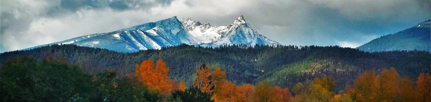
Two mountain ranges, separated by the Bitterroot River valley, in southwestern Montana and eastern Idaho comprise the Bitterroot National Forest. Breathtaking scenery is provided by 30 deep, rocky, glaciated canyons breaking the sharp face of the Bitterroot range at regular intervals to the west. Most of this rugged range is wilderness. To the east, the Sapphire range presents a gentler horizon. The forest has plentiful big game, high quality water, and backcountry recreation opportunities including wild rivers, more than 35 campgrounds and picnic areas, 8 rental cabins and lookouts, and many water sport and winter play areas.
The links on the left under Recreation will provide you with more information about the many recreational opportunities available on the forest.
RecAreaDirections
Open with Google Map
Misc
| Stay Limit | |
| Reservable | false |
| Keywords | |
| Map Link | |
| Contact Phone | |
| Contact Email |
Permits info
Facilities
Three Sisters Group Site (MT) Campground
List of CampsitesOverview
Three Sisters Group Site is located within the Lake Como Recreation Area on the Darby Ranger District of the Bitterroot National Forest. The group site, which is located across the road from the Rock Creek Horse Camp, is situated among the pine trees and is adjacent to the outlet of Lake Como.
Recreation
Boating, fishing, swimming and other water sports are popular on Lake Como. Anglers might see rainbow and cutthroat trout, as well as kokanee salmon, among other alpine species. A boat ramp and parking area are available at the south side of the lake. A large, sandy beach is available to visitors at the North side of the lake. To the West of the cabin, a short walk will take visitors to a trailhead that begins a 7-mile loop trail around Lake Como. The Lake Como National Recreation Loop Trail is suitable for hiking, mountain biking and accessing the lake for swimming or picnics. The first quarter-mile of the trail is wheelchair accessible and the trail also crosses Rock Creek at one point. Approximately 3 miles from the cabin, at the West end of the lake, is a magnificent waterfall that cascades over fern-covered rock cliffs. A trail continues from the waterfall, or heads west up Rock Creek, into the Selway-Bitterroot Wilderness area.
Facilities
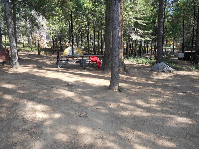
- Three Sisters Group Site has a 20’x30’ pavilion, equipped with 6 picnic tables, 1 BBQ grill, and 2 serving tables. The site also has benches around a fire ring, two outhouses, and accommodations for 25 vehicles. The maximum number of people allowed at the site is 75. Water, electricity, and firewood are not available at the site.
Natural Features
The group site is located near the East end of 913-acre Lake Como in the central Bitterroot Mountains of western Montana. It is situated at an elevation of 4,245 feet and is primarily used for meetings, reunions, weddings and family gatherings, as it can accommodate a larger group of people. A variety of wildlife and birds can be seen around the area and its surroundings. Osprey, bald eagles, deer, moose, elk and bears make their home in the area (learn about outdoor safety ).
Nearby Attractions
SPRING GULCH Campground
List of CampsitesOverview
Spring Gulch Campground is a well-maintained campground located about 50 feet from the highway, on the banks of the scenic Bitterroot River. Visitors enjoy a variety of recreational opportunities, including hiking, mountain biking, fishing and swimming. The campground provides accessible sites and amenities, making it a comfortable spot for anyone to relax in the mountains of southwestern Montana.Recreation
A number of hiking, biking and horseback riding trails can be accessed near the campground. The Continental Divide National Scenic Trail can be accessed not far from the campground, as well as trails that lead to the area's numerous mountain peaks.A variety of natural hot springs exist in the area, including Lost Trail Hot Springs, which is approximately seven miles south of the campground. The springs are popular places for swimming. A general store and lodging are located nearby.
Rafting, canoeing, kayaking and fishing on the Bitterroot River are also popular activities. A short paved path meanders along the river and an accessible fishing dock is located within the campground. Anglers can expect to find mainly cutthroat trout, but other freshwater species are available.
Facilities
The campground offers single and double-family campsites, some of which are accessible. Picnic tables and campfire rings with grills are provided, as are accessible vault toilets and drinking water. RV hookups are not available.Natural Features
Located on the banks of the Bitterroot River, the campground is nestled in a ponderosa pine forest. It is easily accessible from Highway 93 and sits at an elevation of about 4,300 feet in the Bitterroot National Forest. A variety of wildlife, including big game like mule and white-tailed deer, elk and moose, makes its home in the area.Nearby Attractions
The small town of Sula is less than five miles from the campground, offering gas and a post office.INDIAN TREES CAMPGROUND Campground
List of CampsitesOverview
Indian Trees Campground is a quiet place to stay 3/4 miles off of Highway 93 in the mountains of southwest Montana. It provides access to a number of enjoyable recreational activities, as well as the vast scenery of the rugged Bitterroot National Forest. The area boasts wild game, high quality water and wild and scenic rivers.Recreation
Visitors enjoy a variety of recreational opportunities, including hiking, mountain biking and horseback riding. A number of trails can be accessed near the campground, including the Nez Perce National Historic Trail and the Lewis and Clark National Historic Trail. The Nez Perce NHT is a 3.1-mile trail begins near the turnoff to the campground and follows a portion of the original Nez Perce route. Explorers in the early 1800s also used the route, and wagon ruts are still visible along parts of the trail. The Continental Divide National Scenic Trail is also nearby. Fishing is available in nearby Camp Creek. Anglers will find mostly cutthroat trout but other species are available. A variety of wildlife, including big game like mule and white-tailed deer, elk and moose, makes its home in the area.Facilities
The campground offers 15 single-family campsites, available for tent and RV camping. Most sites can accommodate up to 10 people and two vehicles, however, one site can accommodate up to 15 people. Site #6 is accessible, while Site #2 is designated for use by bicyclists. Each site is equipped with a table and campfire ring with grill. Accessible vault toilets and drinking water are provided. A campground host is on-site. Utility hookups are not available.Natural Features
The campground is conveniently located near Highway 93, at an elevation of about 5,100 feet. It is named for the numerous scarred ponderosa pine trees in the area. Native American populations that once lived in or frequented the area stripped the trees of bark to expose and extract the tree's sweet cambium layer for food. The trees remain historically significant and provide shade to the campground.Nearby Attractions
Popular Lost Trail Hot Springs is located less than a half-mile from the campground. Unlike the majority of natural hot springs, Lost Trail lacks sulfur, making it odorless and very comfortable for swimming.A general store and lodging is located in Sula Store, about 5 miles north.
EAST FORK CABIN Campground
List of CampsitesOverview
East Fork Cabin offers visitors a unique chance to camp in the Bitterroot National Forest of southwestern Montana. The cabin takes visitors back to a rustic, old-time setting and provides access to a variety of recreational opportunities on public lands. The site is available year-round and offers additional camping areas to accommodate large groups. An adjacent picnic area and pavillion provides a convenient location for everyone to gather. The cabin can be accessed by vehicle, however during winter months (October through April), alternative resources may be required to reach the cabin. The road is plowed up to three-quarters of a mile from the cabin. Guests are responsible for their own travel arrangements and safety, and must bring several of their own amenities.Recreation
Fishing is popular in the nearby river. A variety of trout, including brown, rainbow, cutthroat and brook, can be found in the area between Sula and Conner. Winter fishing for whitefish is popular and productive, as the river is closed to trout fishing during the colder months. The catch along the East Fork is fairly evenly divided between bait, spin and fly fishermen.The surrounding hills and valleys are popular for hiking, backpacking and horseback riding in the summer and fall. Cross country skiing, snowshoeing and snowmobiling can be enjoyed in the area during the winter (learn more about avalanche safety). Winter sports enthusiasts can enjoy more than 50 miles of groomed trails, along with a number of unmarked trails that are open for recreation.
Facilities
EAST FORK GUARD STATION CABIN is a rustic, historic cabin located on the East Fork of the Bitterroot River. It is a small one room cabin and can accommodate up to eight people. It is equipped with two bunk beds and mattress pads, a table and chairs/benches, a counter with cupboards, and a propane range with oven. Propane is provided. There are electric lights and one outlet inside the cabin. There is a wood stove for heat, firewood is provided but you may need to split your own logs. Please fill wood box inside before you leave. Pots, pans, plates, and utensils are provided. You will need to provide your own bedding and towels. Drinking water is available at the pump house. A vault toilet is located adjacent to the cabin and toilet paper is provided. A picnic table is available near the cabin for outdoor eating and activites. A group use fire pit with benches is located between the cabin and the East Fork River. Please supply your own firewood for outside fire pit use. Wood provided in the woodshed is for heating the cabin indoors. There is a corral/pasture area for stock use, but you should check the fence line prior to turn them loose. Hay must be certified weed free.
There is a large, log pavillion available for group use with many picnic tables, a fire place, and pedestal BBQ grills for cooking. Please only use charcoal in pedestal cooking grills. An electrical outlet is available on a power pole near the pavillion for your use. Even though there is a limit of eight people at the cabin, RV and tent camping is allowed in designated areas at the cabin. The site has a 35 person limit.
Guests will need to bring their own bedding, towels, soap and garbage bags. Guests are asked to replenish the supply of cut wood, as well as clean the cabin prior to their departure. Basic cleaning supplies are provided.
Natural Features
The rustic cabin was built before 1914 and was restored in 1987. It was originally a guard station, used by fire watchers in the forest. It is situated on the East Fork of Bitterroot River, at an elevation of about 5,200 feet. The river flows west from within the Anaconda-Pintler Wilderness, to just south of Conner, Montana, where it joins the West Fork of the Bitterroot River to form the Bitterroot River. During the spring the river becomes a dangerous combination of fast water and snags. The Anacondas are home to abundant wildlife, including mountain lions, elk, deer, moose and bears ( learn about outdoor safety ).Nearby Attractions
- East Fork Trailhead
- McCart Lookout
- Lost Trail Ski Area
- Cheif Joeseph cross-country ski area
- Anaconda-Pintler Wilderness
GIRD POINT Campground
List of CampsitesOverview
The Gird Point Lookout offers a unique chance to camp on top of a mountain peak in a rustic, old-time setting. It sits high above the valley and provides panoramic views of three surrounding mountain ranges.Comfortably equipped, the lookout tower provides almost everything anyone would need to enjoy a variety of recreational opportunities available in the mountains of western Montana.
Recreation
A variety of hiking and mountain biking trails are available in the area, as well as some off-road vehicle trails. The adjacent mountainsides have had several large fires in the last few decades and visitors will see a mosaic of recovering vegetation patterns. Hazardous snags still remain standing and hikers should use caution, especially during high winds.The lookout is known for its scenic views that can be enjoyed on just about any day of the year, regardless of current weather conditions. It provides a peaceful location to relax and enjoy nature. A variety of wildlife make its home in the area as well, providing ample sightseeing and wildlife viewing opportunities, from a vantage point at least 8 feet from the highest point in the region.
Facilities
The 14-by-14 lookout is equipped with two beds that can sleep up to four people. It has a table and chairs, a propane stove and lantern, basic eating and cooking utensils and pots and pans, as well as a wood stove for heat and cooking. Firewood should be available at the tower but supply cannot be guaranteed. An outdoor toilet is also provided. Guests will need to bring their own water for drinking, cooking and cleaning purposes, as well as propane fuel canisters. Bedding, including mattress pads, is not provided. Visitors should plan to bring bedding, towels, soap, matches, garbage bags, toilet paper and food, among other necessities. Guests are required to pack out all trash and clean the cabin prior to leaving. Basic cleaning equipment is provided. No smoking or open flames (candles) in the Lookout. No fireworks. The lookout can be accessed by vehicle and then a short hike over a moderate grade for the remainder of the route. Guests are responsible for their own travel arrangements and safety. The historic L-4 cabin sits on top of an 8' high tower, with narrow steps and catwalk. This may pose a hazard for children and pets. Guests are responsible for their own safety.Natural Features
The lookout is located 20 miles east of Hamilton, Montana, in the Bitterroot National Forest at an elevation of 7,702 feet. A 30-inch catwalk surrounding the glass-paneled room offers unobstructed views of the surrounding Sapphire, Bitterroot and Anaconda-Pintler mountain ranges. The 8-foot tower was originally built to watch for forest fires in the Hamilton/Skalkaho area, but it was later turned into a public recreation location. The lookout was restored beginning in 2001 and now has vintage 1940s furnishings.Nearby Attractions
Highway 38 is also called the Skalkaho Highway. It continues into the Sapphire Mountains along a primitive and once widely used Native American trail. The scenic drive, which is closed during winter, was built to provide access between mining areas and agricultural communities in the Bitterroot Valley.FALES FLAT CAMPGROUND Campground
List of CampsitesOverview
Fales Flat Campground is a group facility on Nez Perce Fork of the Bitterroot River. It is also well equipped for equestrian campers. The campground provides access to a variety of hiking and horseback riding trails in the area, as well as a variety of historic sites that denote the presence of the Nez Perce many years ago.Recreation
Fly fishing and wading in the Nez Perce Fork, which runs alongside the campground, are also popular activities.A variety of trails and unimproved roads are great for hiking and horseback riding. Three trails originate near the campground, including the Watchtower Trail and Sheephead Creek Trail which access the Selway-Bitterroot Wilderness and can be hiked as a loop. A steep, 2-mile trail leads to the historic Bare Cone Lookout.
Facilities
The campground offers one large group site for tent and RV camping. It can accommodate 15 to 100 people. Hookups are not available. Parking surfaces are gravel. The site is equipped with multiple tables and a large campfire circle. Vault toilets are provided. Drinking water and trash collection bins are not available. A few individual and equestrian sites are available at the campground on a first-come, first-served basis. Those sites have access to a horse staging area and hitching racks.Natural Features
The campground is located in a large meadow at the base of Nez Perce Pass along the Nez Perce Fork of the Bitterroot River. The area is believed to have been used by the Nez Perce Nimi'ipuu tribe during its travels to the buffalo country in eastern Montana.Nearby Attractions
The campground is about 23 miles from the town of Conner. A variety of services are offered there.WOODS CABIN Campground
List of CampsitesOverview
Woods Cabin offers a unique chance to camp in the forest, in a rustic, old-time setting, while enjoying all the summer and winter activities that are available from the shore of scenic Lake Como.The cabin provides a comfortable experience and spectacular views, with its large windows and decks overlooking the lake and nearby mountain peaks. It also provides access to the lake and a nearby beach and gives visitors access to a myriad of trails and open spaces.
IMPORTANT WINTER RENTAL INFORMATION:
Woods Cabin is available for rent in the winter and provides a great basecamp for numerous outdoor winter recreation activities. To ensure your stay is enjoyable, there are a few things to note when renting the cabin during the winter. The road to the cabin is NOT maintained during the winter months, so depending on weather conditions, you may or may not be able to drive to the Woods Cabin parking lot. The gate is closed on the access road to Woods Cabin for public safety so that visitors do not drive down to the cabin and get stuck or slide into the cabin. The county road, however, to the boat launch (located on the south side of Lake Como) is maintained. Visitors can park at the boat launch and walk, ski, or snowshoe across the dam and up to Woods Cabin, which is approximately ¾ mile. Be prepared to haul your gear into the cabin via sled or backpacks. There is no drinking water available this time of year, so please bring your own drinking water. Firewood is provided at the cabin but it may need to be split. A splitting maul is also provided. Please be aware of rapidly changing weather conditions and always use caution and be prepared when recreating in winter conditions.
Recreation
Boating, fishing, swimming and other water sports are popular on Lake Como. Anglers might see rainbow and cutthroat trout, as well as kokanee salmon, among other alpine species. A boat ramp and parking area are available at the south side of the lake. A large, sandy beach is available to visitors at the north side of the lake. To the west of the cabin, a short walk will take visitors to a trailhead that begins a 7-mile loop trail around Lake Como. The Lake Como National Recreation Loop Trail is suitable for hiking, mountain biking and accessing the lake for swimming or picnics. The first quarter-mile of the trail is wheelchair accessible and the trail also crosses Rock Creek at one point. Approximately 3 miles from the cabin, at the west end of the lake, is a magnificent waterfall that cascades over fern-covered rock cliffs. A trail continues from the waterfall, or heads west up Rock Creek, into the Selway-Bitterroot Wilderness area. Winter activities include cross-country skiing on un-groomed terrain, snow shoeing, and ice fishing.Facilities
The rustic cabin has three bedrooms, a living area and a kitchen. It has beds that can accommodate up to 12 people (double bunk beds with mattresses). The main living area offers a table and chairs and two wood stoves for heating. Woods Cabin is ony partially furnished. There is no electricity or hot water. We recommend bringing your own sleeping bags or bedding, ice chest, dish soap, matches, 1st Aid kit, flashlights, etc. Each renter is responsible for leaving the cabin cleaner than they found it. We'd appreciate your feedback on the condition of the cabin or any suggestions you may have. The cabin was built in 1928 and was renovated in 2011. Please be aware that this is a rustic cabin and despite our efforts to control the rodents, there may be rodent activity. Please keep the cabin clean and store food in containers or cupboards. Firewood is provided at the cabin but it will need to be split. A splitting maul is also provided. The driveway to the cabin is on a moderately steep hillside that flattens to a pull-through loop near the cabin entrance. Parking at the cabin is limited to 2 vehicles, but other vehicles can park in the upper parking lot. Day use passes are required at day use sites within the Lake Como Recreation Area from Memorial Day through Labor Day. Four day use passes are provided for Woods Cabin visitors and will be located inside the cabin. Upon vacating the cabin, please return the passes for the next renters to use. Additional vehicles need to have a day pass displayed. Day passes can be purchased on site within the Recreation Area.Natural Features
The cabin is located along the north shore of 913-acre Lake Como in the central Bitterroot Mountains of western Montana. It is situated at an elevation of 4,245 feet and is primarily used for meetings, workshops and retreats, as it can accommodate a larger group of people. The cabin is more than 90 years old and accommodations are rustic. A variety of wildlife and birds can be seen from the cabin and its surroundings. Osprey, bald eagles, deer, moose, elk and bears make their home in the area (learn about outdoor safety ).LARRY CREEK GROUP CAMP Campground
List of CampsitesOverview
Larry Creek Group Campground is located in western Montana's Bitterroot National Forest. It is a great location for an extended family or group getaway, providing access to many fishing, hiking, mountain biking and hunting opportunities.Recreation
A variety of non-motorized trails are nearby, including a half-mile nature trail that highlights some the area's best features. The 9-mile Bass Creek Trail is located just south of the campground and leads to a scenic overlook and many fishing holes. Bass Lake, Bass Creek and numerous additional mountain streams make the campground a very popular location for fishing. An interpretive trail, fitness trail and volleyball court are located within the campground.Facilities
The campground offers one large, accessible group campsite, available for tent and RV camping. It can accommodate up to 75 people and 10 vehicles. The adjacent parking area is small, limiting RVs to about 30 feet in length. The site is equipped with a picnic shelter, several tables, a large campfire circle and grills. Accessible vault toilets and drinking water are provided. A gravel road accesses the campground. Vehicles must stay on Forest Roads and in the designated parking area. Vehicles are not allowed off-road. Motorized access to the meadow is not allowed.Natural Features
The campground sits at a fairly low elevation in the Bass Creek Recreation Area between Missoula and Hamilton. It is situated west of the Lee Metcalf National Wildlife Refuge, in an area forested with pine, spruce and fir trees.A variety of wildlife, including mule and white-tailed deer, elk, moose and birds can often be seen in the area.
Nearby Attractions
The Lee Metcalf National Wildlife Refuge is located along the Bitterroot River about 20 miles from the campground. The refuge provides visitors with opportunities for wildlife observation, photography, hunting, fishing and environmental education. A wildlife viewing area offers 2.5 miles of nature trails, including an accessible 0.5-mile path. The trails meander through meadows and woodlands along the river.A variety of services are available in the neighboring city of Stevensville.
MCCART LOOKOUT Campground
List of CampsitesOverview
McCart Lookout is a historic tower located on McCart Peak, east of Sula. It has been restored to reflect a lookout of the 1940s, including the stove, furniture, dishes and other small touches. It offers a unique chance for visitors to camp on a mountain peak, on the border of the Anaconda-Pintler Wilderness, in a rustic, old-time setting. The tower provides spectacular views of the surrounding western Montana wilderness.Recreation
The trail to reach the tower continues south and joins the Continental Divide National Scenic Trail, which extends 3,100 miles across the United States, from the borders of Mexico to Canada. While it might take about six months to complete, a variety of day hikes and points of exploration are available within the area of the lookout tower. Trails can be enjoyed on foot or on horseback. Backpackers also enjoy the terrain. Aside from hiking and horseback riding, the area is replete with wildlife and offers scenic views. A lookout journal is kept inside, providing instructions of what to do in case of emergency or a storm. Danger from lightning is largely abated due to a lightning rod implanted at the structure.Facilities
McCart Lookout is a historic "L4" lookout located on Mccart Peak east of the Bitterroot Valley. The lookout is a one room cabin with a bed platform suitable for two people. Bedding is not provided. The lookout can accommodate up to four. Others are welcome to tent camp in the area. The lookout measures 14ft.X14ft. with a 30 inch catwalk around the outside. There is a wood stove for heat. You may have to saw your own wood from dead and down material found nearby. A bow saw and ax are provided. A two burner propane camp stove and lanterns are provided. Propane is not provided, you will need to bring your own propane canisters. Utensils for cooking and eating are provided. There is no water available near the lookout so please bring your own water. An outdoor toilet serves the lookout. You will need to provide your own toilet paper. There is a small corral for two or three head of stock.
The lookout is built on a 10 foot tall tower, with narrow steps and catwalk. This may pose a hazard for children and pets. Guests are responsible for their own safety.
Remember, guests will need to bring their own water for drinking, cooking and cleaning purposes, as well as propane fuel canisters for cooking and lighting. Guests are also responsible for their own bedding, towels, soap, toilet paper and garbage bags. The facility does not provide trash receptacles; all garbage must be carried out, and the tower must be cleaned by guests prior to leaving. Do not leave anything you bring, even if you think it will benefit other renters
The tower is accessed by a moderate, 1.5-mile hike from the parking area. Snowmobiles and other off-road vehicles are not allowed on the trail, however, horses and other livestock are welcome. Guests are responsible for their own travel arrangements and safety, and must bring several of their own amenities.
Natural Features
The tower is situated east of the Bitterroot Valley, at an elevation of 7,115 feet. It was named for William McCart, who settled the area but failed to complete his homestead entry to patent. It is poised on the edge of the Anaconda-Pintler Wilderness and offers beautiful views of the Pintler Mountains to the east and the Bitterroot Mountains to the west.The Bitterroot forest is home to many species of wildlife, from mule deer, whitetail deer, elk, bighorn sheep, mountain goats, black bear, mountain lions, and moose, to many varieties of smaller animals and birds.
Nearby Attractions
A variety of natural hot springs exist in the area, including the the Lost Trail Hot Springs, which is located about 13 miles northwest of the tower. It provides swimming and additional amenities, including a general store and lodging.TWOGOOD CABIN Campground
List of CampsitesOverview
Twogood Cabin offers guests a unique opportunity to camp in the forest of western Montana, in a rustic, old-time setting. It is available between the end of May through the middle of October, as well as throughout December, providing access to the surrounding mountains' best features and recreational attractions.
Hiking, backpacking and horseback riding is popular during the warmer months and visitors enjoy cross country skiing and snowshoeing on the snow-covered terrain.
Twogood Cabin is located 6 miles up a non-motorized trail.
Recreation
Fishing is popular in the adjacent stream and anglers might catch a variety of trout. At least two other mountain creeks are available in the area. The Warm Springs Creek is a larger stream and provides excellent fishing for cutthroat and other trout. Visitors also enjoy wading in the cool water.
A variety of hiking, mountain biking and horseback riding trails follow the creek. The large, rolling meadows are a winter elk range. When the snow melts, moose and deer may be spotted in the meadows.
The 6-mile hike includes several creek crossings.
Off-road vehicles are not allowed on the trail, however, horses and other livestock are welcome. In the winter, the trails are popular for cross country skiing and snowshoeing.
Facilities
The one-room cabin measures 15x19 feet with a concrete floor and covered porch. It accommodates up to four people and is equipped with two bunk beds, a table and chairs, counter space, a wood stove for heat and a two burner propane stove for cooking. A propane lantern is also available. Guests will need to bring your own propane fuel canisters.
There is a wood stove for heat. Firewood is usually available under the covered porch outside the cabin but you may need to split your own logs. Inside the cabin pots, pans, and basic cooking and eating utensils are available. An outdoor outhouse serves the cabin but you will need to provide your own toilet paper.
Porcupine Creek is the sole source of drinking water for you and your stock. It is recommended you use a water purifier, boil, or otherwise treat the water before consuming. You will need to provide your own bedding and towels. Guests are required to clean the cabin prior to their departure.
Three hitch rails for stock are located within site of the cabin and can accommodate up to 12 head of stock. An area behind the cabin is often used to high-line stock overnight. Grazing within one mile of the cabin is prohibited. Feed for stock must be certified weed-seed free.
Access to Twogood Cabin is by forest road and trail. Winter conditions can prevent access by vehicle to the trailhead. Snowshoeing, cross country skiing or snowmobiling may be the only access to the trailhead in the winter time. Guests are responsible for their own travel arrangements and safety, and must bring several of their own amenities.
Natural Features
The rustic cabin is situated on Porcupine Creek, in a road-less area of the southern Bitterroot Mountains, at an elevation of about 5,600 feet. It was built in 1952 by Harry Twogood and Clifford Wetzsteon and was used throughout the 1970s as a range camp until it was opened to the public for recreation purposes.
The Bitterroot forest is home to many species of wildlife, from mule deer, whitetail deer, elk, bighorn sheep, mountain goats, black bear, mountain lions, and moose to many varieties of smaller animals and birds.
Nearby Attractions
- Overwhich Falls
contact_info
For facility specific information, please call (406) 821-3913.MEDICINE POINT LOOKOUT Campground
List of CampsitesOverview
Medicine Point Lookout is a historic tower located on Medicine Point, west of Sula. It has been restored to reflect a lookout of the 1940s, including the stove, furniture, dishes and other small touches. It offers a unique chance for visitors to camp on a mountain peak, near the scenic Bitterroot River in a rustic, old-time setting, while having the enjoyment of recreating on public lands. The tower provides spectacular views of the surrounding western Montana wilderness.Recreation
An extensive trail system exists in the area, including several loop trails for hiking, backpacking and horseback riding. Hitching racks are available at the base of the tower for equestrian campers' needs. Road and trail conditions are unpredictable, as weather changes quickly in the area. For best results, consult the ranger district prior to travel.Aside from hiking and horseback riding, the area is replete with wildlife and offers scenic views. A lookout journal is kept inside, providing instructions of what to do in case of emergency or a storm. Danger from lightning is largely abated due to a lightning rod implanted at the structure.
Facilities
Medicine Point Lookout is a historic "L4" lookout located on Medicine Point, west of the Bitterrot Valley. The lookout is one room cabin with a bed platform suitable for two people. Bedding is not provided. The lookout can accomidate up to four people. Others are welcome to tent camp in the area. The lookout measures 14ft.X14ft. with a 30 inch catwalk around the outside. There is wood stove for heat. You may have to saw your own wood from dead and down material found nearby. A bow saw and ax are provided. A two burner propane campstove and lanterns are provided. Propane is not provided, you will need to bring your own propane canisters. Basic eating and cooking utensils are provided. There is no water available near the lookout so please bring your own water. An outdoor toilet serves the lookout. You will need to provide your own toilet paper.
The lookout is built on a 10 foot tall tower, with narrow steps and catwalk. This may pose a hazard for children and pets. Guests are responsible for their own safety.
Remember, guests will need to bring their own water for drinking, cooking and cleaning purposes, as well as propane fuel canisters for cooking and lighting. Guests are also responsible for their own bedding, towels, soap, toilet paper and garbage bags. The facility does not provide trash receptacles; all garbage must be carried out, and the tower must be cleaned by guests prior to leaving. Do not leave anything you bring, even if you think it will benefit other renters.
The tower is accessed by a somewhat difficult 3.5-mile hike from the parking area with a 2,000 foot elevation gain. Snowmobiles and other off-road vehicles are not allowed on the trail, however, horses and other livestock are welcome. Guests are responsible for their own travel arrangements and safety, and must bring several of their own amenities.
Natural Features
The tower is poised between the east and west forks of the Bitterroot River at an elevation of 8,409 feet. It offers beautiful views of the Bitterroot Mountains, as well as a vista of the southern Bitterroot Valley to the east. On clear nights the lights of Hamilton can be seen from the tower.The Bitterroot forest is home to many species of wildlife, from mule deer, whitetail deer, elk, bighorn sheep, mountain goats, black bear, mountain lions and moose to many varieties of smaller animals and birds.
MAGRUDER RANGERS HOUSE Campground
List of CampsitesOverview
Magruder Rangers House is one of seven buildings still used by Forest Service trail crews and wilderness rangers, but it is open to the public through parts of the year. It provides visitors with access to two designated wilderness areas, plenty of opportunities for sightseeing and exploration and a comfortably equipped place to stay.Recreation
Hunting and fishing are popular activities enjoyed by visitors to the area. The adjacent Selway River and a variety of nearby mountain streams are well known for trout fishing. Anglers might see bullhead, rainbow, steelhead and cutthroat trout, as well as mountain whitefish.
There are a variety of trails that traverse the area, including the 11-mile Swet Creek Trail. It follows a creek bed and connects to other trails in the area. It is open to hiking and horseback riding. Bicycles and motorized travel are not allowed within wilderness boundaries but is allowed on roads.
Facilities
The two-story, five-room log cabin has two bedrooms, a living area, a kitchen and an indoor bathroom. It has beds with mattresses, as well as futons, to sleep up to 10 people. A wood stove for heat is available in the basement of the cabin and firewood is provided.
The kitchen is equipped with a table and chairs, refrigerator, propane stove and propane lights. Cooking and eating utensils are available, as well as various cleaning equipment. During the summer and fall, hot and cold running water is available for the kitchen and bathroom, which has a flush toilet and a shower. The water system is turned off for fall and winter. Water is turned on from June through September 30. An outdoor vault toilet is provided.
Guests will need to bring their own bedding, towels, food, matches, garbage bags and toilet paper, among other necessities. It is required that guests replenish the cut kindling supply and clean the cabin prior to leaving.
The cabin is accessible by four-wheel drive and high-clearance vehicles. Guests are responsible for their own travel arrangements and safety. Livestock are not permitted at the Magruder Cabin compound.
Natural Features
The house is located on the Selway River, between the 1.2-million-acre Selway-Bitterroot Wilderness and the 2.3-million-acre Frank Church-River of No Return Wilderness areas, at an elevation of about 4,000 feet. It was once the residence of the district ranger and his family.
Most of the area is covered by coniferous forests, with open meadows near the river. Because of its size, the wilderness provides a secluded habitat for a wide variety of wildlife. Large populations of mountain lions and grey wolves live in the area, as well as coyote, fox, bighorn sheep, mountain goats, elk, moose, deer and black bears (learn about outdoor safety).
Nearby Attractions
The adjacent Magruder Road provides drivers with a unique experience in the back country of Idaho. The road was built by the Civilian Conservation Corps in the 1930s and remains much the same now as it did then. It continues to the Nez Perce Pass and is generally open in early June.
ALTA CAMPGROUND Campground
List of CampsitesOverview
Alta Campground is located in a scenic forest in the heart of Montana's Bitterroot National Forest. The West Fork of the Bitterroot River flows nearby, giving visitors access to some of the best fishing the area has to offer, as well as other water-related recreation.Recreation
Fly fishing and wading in the Bitterroot River, which runs alongside the campground, are popular activities. During high water season, canoeing and rafting are available as well. A variety of trails and unimproved roads are great for exploring by bike or off-road vehicle. Hiking trails to various mountain peaks, including to Lookout, Razorback and Thunder Mountains, as well as Beaver and Deer Creek Points, are nearby. The Alta Pine interpretive trail is nearby. Painted Rocks Lake is located about five miles north of the campground. Visitors enjoy swimming, boating and fishing. Anglers will find mountain whitefish and a variety of trout.Facilities
The campground offers 14 campsites, three of which are accessible, for tent and RV camping. Each site can accommodate up to 10 people and two vehicles. Utility hookups are not available. Parking spurs are gravel. Each site is equipped with a table and campfire ring with grill. Accessible vault toilets and drinking water are provided. A campground host is available on-site and trash collection bins are placed throughout the facility. Please properly store food in vehicles or hard sided campers to reduce attractants to wildlife, such as bears.Natural Features
The campground is located along the West Fork of the Bitterroot River, a popular fishing river in the area. Large, yellow-barked ponderosa pine trees tower above many of the campsites, which along with fir, aspen and lodgepole pine, provide pleasant shade. The campground is situated at an elevation of about 4,580 feet.A variety of wildlife can be seen in the area, including bald eagles, mule and white-tailed deer, moose, elk, bighorn sheep and numerous songbirds.
Nearby Attractions
The Alta Ranger Station, located on the West Fork of the Bitterroot River, was the first Forest Service Ranger Station in the United States, built in 1899. It remains a popular tourist location and is just minutes from the campground. Hughes Creek, once a vibrant placer gold mining site, is nearby. The historic area accounted for 88 percent of all the placer gold recovered in Ravalli County from 1904-1948. A variety of natural hot springs can be found about 18 miles from the campground. The nearest town is Conner, which provides some services and is about 27 miles away. Darby is about 30 miles away and offers full services.Charges & Cancellations
A $10.00 service fee will apply if you change or cancel your reservation. Late cancellations are subject to additional fees. For full details see NRRS Reservation Policy.ROMBO Campground
List of CampsitesOverview
Rombo Campground is located in a scenic area along the West Fork Bitterroot River in the mountains of southwestern Montana. The area is home to a variety of big game and wildlife, and provides access to a number of outdoor activities, including fishing, seasonal rafting and various trail opportunities.Recreation
Fly fishing and wading in the West Fork Bitterroot River are popular activities. During high water season, kayaking and rafting are available as well. Painted Rocks Lake is just five miles south of the campground. Visitors enjoy swimming, boating and fishing. Anglers will find mountain whitefish and a variety of trout. Many trails and unimproved roads in the area are great for exploring by bike or off-road vehicle. Hiking trails to various mountain peaks are nearby.Facilities
The campground offers 14 sites, four of which are accessible, for tent and RV camping. Individual sites can accommodate up to 10 people and two vehicles. A day use group picnic area is also available on a first come, first serve basis and can accommodate up to 30 people. Picnic tables, campfire rings and grills are provided, as are accessible pit toilets and drinking water. A campground host is on-site. Utility hookups are not available. Parking surfaces are gravel.Natural Features
The campground is located along the West Fork of the Bitterroot River. Large yellow-barked ponderosa pine trees tower above many of the campsites, which along with fir, aspen and lodgepole pine, provide pleasant shade. The campground is situated at an elevation of 4,600 feet.A variety of wildlife makes its home in the area, including bald eagles, mule and white-tailed deer, moose, elk, bighorn sheep and numerous songbirds.
Nearby Attractions
The Alta Ranger Station, located on the West Fork of the Bitterroot River, was the first Forest Service Ranger Station in the United States, built in 1899. It remains a popular tourist location and is a short distance from the campground.Horse Creek Hot Springs is about 29 miles from the campground via a gravel road.
Fuel, a post office and a general store can be found in Conner, 16 miles from the campground. Darby is 24 miles from the campground. It is a full-service community with laundry facilities, lodging and a grocery store, among other amenities.
Selway River (4 Rivers) Permit
Overview:
The Selway River flows through portions of north-central Idaho, within the Selway-Bitterroot Wilderness. The Selway is unique because it is the only river in the United States that received instant inclusion as a wild river, in both the National Wilderness Preservation System and the Wild and Scenic Rivers System. The natural beauty of the canyon, combined with the challenge of the rapids and the outstanding opportunities for solitude, make the Selway one of the highest quality whitewater rivers in the nation.The main fork of the Selway is about 100 miles in length, from the headwaters in the Bitterroot Range of the Rocky Mountains to the confluence with the Lochsa River near Lowell, Idaho. It is a tributary of the Middle Fork of the Clearwater River and drains 106,977 acres of Idaho County. It begins at above 9,000 feet in elevation and ends at more than 1,400 feet.
While the river was designated an official recreation river when the Wild and Scenic Rivers Act was passed by the U.S. Congress in 1968, the Idaho Legislature recommended the Selway and its five tributaries as Outstanding Resource Waters in 2002. The relatively new designation commemorates the river's powerful discharge.
The river flows for 47 miles through the heart of the wilderness. From the Paradise Launch Site to the Race Creek Take-out, the river drops an average of 28 feet per mile, creating a technical whitewater experience that challenges even expert boaters. Numerous exposed and barely submerged rocks, and stretches of unbroken whitewater with very few quiet recovery pools, require a high level of skill and expertise. Immediately below the confluence with Moose Creek, the increased gradient of 50-feet-per-mile combines with a major increased volume of flow, creating an extremely demanding technical section of the river.
Permits are not required outside the control season on the Selway River. Pre-season boaters must be off the river before May 15th. The limited permit season runs annually from May 15 to July 31, and is designed to protect the wilderness and river resources, while providing opportunities for solitude, adventure and a quality floating experience. Only one party of up to 16 people is allowed to launch each day during that time.
Permitted floaters who do not show up to the river on their reserved launch date will be penalized and may forfeit their permit. A permit-holder must be with the group at all times.
Darby RD Facility
The many miles of trails on the Darby Ranger District provide opportunities ranging from short day-trips to extended back-country trips.
Stevensville RD Facility
The many miles of trails on the Stevensville Ranger District provide opportunities ranging from short day-trips to extended back-country trips.
Sula RD Facility
The many miles of trails on the Sula Ranger District provide opportunities ranging from short day-trips to extended back-country trips.
West Fork RD Facility
The many miles of trails on the West Fork Ranger District provide opportunities ranging from short day-trips to extended back-country trips.
Warm Springs Trailhead Facility
Warm Springs Trailhead is located between Crazy Creek Horse Camp and Crazy Creek Campground. This site hosts a large parking area and bulletin board.
Skalkaho Snowpark Facility
Skalkaho Snowpark offers a parking lot allowing snowmobilers and cross country skiers access to Skalkaho Pass which is closed to traffic through the winter months.
Lake Como Campground Campground
List of CampsitesThe campground, a.k.a. Lower Como, is a single loop through a stand of mixed pine and fir trees and one of three campgrounds in the Lake Como Recreation Area. It is located below Lake Como. The understory is grass with good privacy between campsites. Lake Como Lower Campground is paved and features a host site and ten 125' pull through recreational vehicle (RV) sites (with electrical and water hookups) water, and garbage services. Three sites are handicap accessible, and there are 4 handicap accessible vault toilets located throughout the campground. This is bear country; practice safe food storage techniques. Lake Como is 913 acres. The beach is large and sandy. The boat ramp is located at the south side of dam.
Twin Lakes Trailhead Facility
Twin Lakes Trailhead has adequate parking for both cars and trailers. It offers access to the Moose Creek Trail # 421 over Lost Horse Pass and the Wahoo Creek Trail over Wahoo Pass. Trails leading out almost immediately enter the Selway-Bitterroot Wilderness. Facilites include a vault toilet. Close camping is readily available at Schumaker.
Three Frogs Campground Campground
List of CampsitesThree Frogs Campground is a newly reconstructed campground and features 16 small trailer campsites and 4 walk-in tent sites. The campground offers accessible vault toilets, picnic tables, fire rings, water and garbage service, and gravel surfaced roads. Some campsites are also equipped with tent pads. Can accommodate trailers to 30' lengths.
Bass Creek Trailhead Facility
Bass Creek Trailhead has adequate parking for both cars and trailers. It offers access to Bass Creek Trail #4 and the Selway-Bitterroot Wilderness. Facilities include hitching rails and a stock ramp.
Blodgett Campground Campground
List of CampsitesBlodgett Campground consists of 5 campsites, 1 walk-in site, plus 1 host site, complete with picnic tables, fire rings, and a vault toilet. There are two accessible campsites. The campground rests under the towering cliff faces of Blodgett Canyon which are very popular to rock climbers. Blodgett Canyon Picnic Area is across Blodgett Creek. Campground can accommodate RV's or trailers to 45 feet.
Charles Waters Campground Campground
List of CampsitesThe Charles Waters campground is paved asphalt with 26 campsites plus one double site, including 4 pull-through, one bicycle site, and one horse site; there is also one accessible site with electric hook-up. The campground also has water; accessible vault toilets; open meadow for activities and can accommodate RV's or trailers to 70 feet. Please note that the bicycle site and horse site are reserved for those users until 6 p.m. daily after which time if no one is occupying them then they are considered available on a first come first served basis. A campground host is available Memorial Day through Labor Day.
Also associated with the Charles Waters Campground is the Bass Creek Recreation Area. This recreation area includes four picnic sites; an interpretive nature trail; fire ecology trail and numerous trailheads to hiking, biking and stock routes with access to the Selway-Bitterroot Wilderness. The Larry Creek Group Site is located within the Bass Creek Recreation Area, this large overnight group site is available for reservation through Recreation.gov. The gate will close to the Larry Creek Group Site on Dec. 1.
For more information please contact the Stevensville Ranger District at (406) 777-5461.
Gold Creek Campground Campground
List of Campsites4 campsites with extensive hiking, biking, motorcycle and horseback riding opportunities.
Trails from the campground and from near the campground access the Skalkaho Wildlife Preserve, Gold Creek, and the Easthouse National Recreation Trail.
Fishing in area creeks or the North Fork Bitterroot; hunting for deer and elk in season.
Campground can accommodate RV's or trailers to 25 feet.
Mill Creek Trailhead Facility
Mill Creek Trailhead has adequate parking for both cars and trailers. It offers access to Mill Creek Trail #364 and the Selway-Bitterroot Wilderness. Facilities include a vault toilet, hitching rails and a stock ramp.
Sheafman Trailhead Facility
Sheafman Trailhead has adequate parking for both cars and trailers. It offers access to Sheafman Creek Trail #82, Sheafman, Knaack and Aichele Lakes and the Selway Bitterroot Wilderness. No facilities.
Crazy Creek Campground Campground
List of CampsitesCrazy Creek Campground hosts 7 sites with picnic tables, fire rings, vault toilet and a well with hand pump for water. There is no garbage service so Pack it in/Pack it out. Campground can accommodate trailers under 26 feet.
Mccart Trailhead Facility
McCart trailhead has adequate parking for 6-8 vehicles. Facilities include a stock ramp and hitching rail. It accesses the McCart lookout and the Anaconda-Pintler Wilderness.
Warm Springs Campground Campground
List of CampsitesWarm Springs Campground is nestled in a wooded area along Crazy Creek. It hosts 14 sites with picnic tables, fire rings, and vault toilets. There is no garbage service so Pack it in/Pack it out. Campground can accommodate trailers under 26 feet.
Swift Creek Trailhead Facility
Has Hitching rail
Boulder Point Lookout Facility
Not currently a rental
Paradise Campground Campground
List of CampsitesParadise Campground is located near the Paradise Boating Site which is one of the most popular launching sites on the Selway River. The campground consists of 11 sites complete with picnic tables, and fire rings. Other facilities include 3 vault toilets, hitching rails, and feed bunks. Campground can accommodate RV's or trailers to 25 feet.
Salmon Base Camp Trailhead Facility
Salmon Base Camp Trailhead has adequate parking for both cars and trailers. It offers access to trail #27, #19, the Selway-Bitterroot Wilderness and the Frank Church Wilderness. Facilities include a wooden outhouse, stock ramp, and hitching rails.
