
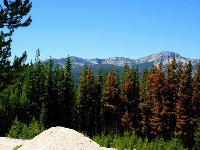
Payette National Forest
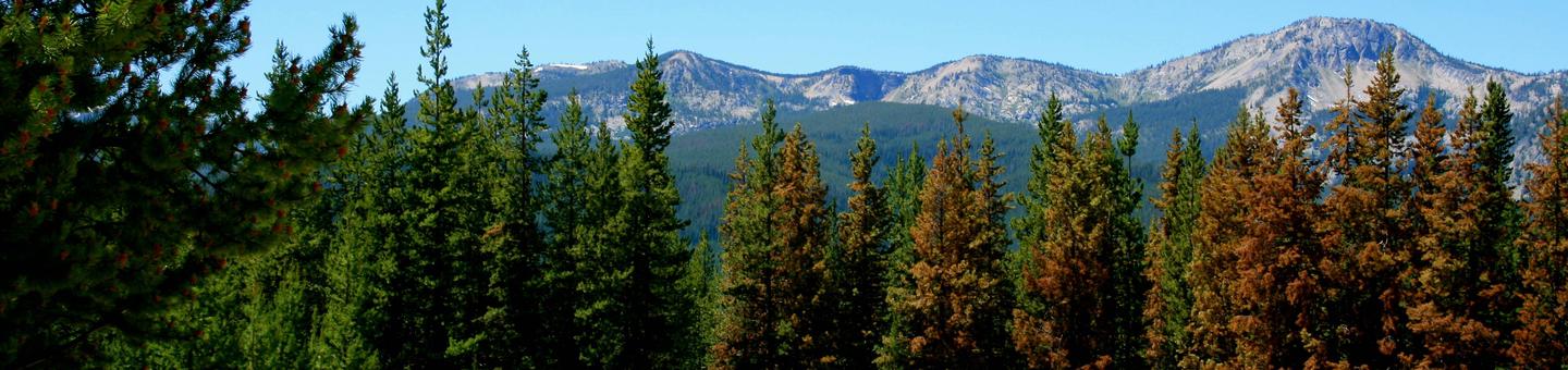
So Much To Do & See
Come visit the Payette National Forest spring, summer, fall, or winter for a wide range of recreational activities during any of the four seasons. Hiking, fishing, camping, hunting, skiing, and snowmobiling. You can find a spot on the Forest to indulge your recreational interest. Click here for an in-depth look at the Payette National Forest's niche.
Be Careful With Fire! Campfire Podcast (transcript)
Some tips to help you enjoy your recreation experience...
- FIREWORKS are not allowed on the National Forest.
- Winter brings snow to the high country. Be AVALANCHE AWARE!
- When camping or picnicking, please keep your site clean, free from trash and food. Otherwise animals and insects are attracted to your site.
- Bag your trash and take it home with you. Help us keep our forests clean and green by "Packing It Out!"
- Never leave your campfire unattended. When you leave, put it out, dead out! See Forest Orders for any current fire restrictions.
- Human waste is a big problem when thousands of people converge on the Forest. Please see Leave No Trace - Dispose of Waste Properly for detailed instructions on handling this "delicate" situation.
Sharing the trail with horses
When encountering a horse on a trail, remember it is us humans who have control over our actions and the ability to communicate with each other. The horse can spook and take an action that may not be desirable. The best way to approach a horse is to STOP, Communicate with the Rider, and Move to the Side of the Trail.
Driving motorized vehicles on the Forest
Keep motor vehicles on designated routes and areas. If you plan on camping, driving off-highway vehicles, hunting, or exploring the backcountry, get a free Motor Vehicle Use Map (MVUM) to know which roads are open to motor vehicle use. Know before you go.
With your help, we can protect our natural resources for future generations. Thank you!
RecAreaDirections
Open with Google Map
Misc
| Stay Limit | |
| Reservable | false |
| Keywords | |
| Map Link | |
| Contact Phone | |
| Contact Email |
Permits info
Facilities
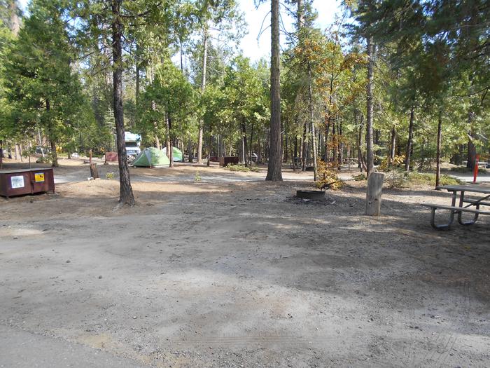
Big Creek Campground
List of CampsitesOverview
Located next to the Big Creek airstrip this four unit campground offers a good staging place to access the Frank Church Wilderness of No Return. It is popular with pilots camping overnight in Big Creek. The campground is near the Big Creek Work Station.
This location is available on a first-come, first-served basis only. Visitors are required to physically arrive at the campground to purchase and claim a site. Once on-site, you may be able to pay for your campsite(s) by scanning a QR code using the Recreation.gov mobile app, and the Scan and Pay feature.
If this option is available, you will need to first download the free Recreation.gov mobile app ht tps://www.recreation.gov/mobile-app prior to your arrival as some remote areas have limited or no cellular service.
Recreation
Trailhead access to the Frank Church-River of No Return Wilderness to the north on FR 371. Fishing in Big Creek.
Facilities
Facilities include an accessible toilet and drinking water. Pack in/pack out. No hook-ups.
Big Flat Campground
List of CampsitesOverview
Big Flat Campground has 12 campsites on the Little Weiser River.
This location is available on a first-come, first-served basis only. Visitors are required to physically arrive at the campground to purchase and claim a site. Once on-site, you may be able to pay for your campsite(s) by scanning a QR code using the Recreation.gov mobile app, a nd the Scan and Pay feature.
If this option is available, you will need to first download the free Recreation.gov mobile app https://www.recreation.gov/mobile-app prior to your arrival as some remote areas have limited or no cellular service.
Recreation
You may pass the day fishing for warmwater fish, like bass, in the river.
Facilities
No hook-ups are available. Please Pack-It-In/Pack-It-Out. Potable water is available for cooking and drinking. The campground has handicapped accessible toilets.
Brownlee Campground
List of CampsitesOverview
This 11-unit campground is located in Ponderosa pine trees offering shade on a hot summer day. Sites are located a few miles off the main Hwy 71, so it is peaceful and quiet.
This location is available on a first-come, first-served basis only. Visitors are required to physically arrive at the campground to purchase and claim a site. Once on-site, you may be able to pay for your campsite(s) by scanning a QR code using the Recreation.gov mobile app, and the Scan and Pay feature.
If this option is available, you will need to first download the free Recreation.gov mobile app https://www.recreation.gov/mobile-app prior to your arrival as some remote areas have limited or no cellular service.
Facilities
No hook-ups. Potable water for cooking and drinking is available on-site. Sixteen foot limit for RVs.
Buckhorn Bar Campground
List of CampsitesOverview
Located alongside the South Fork Salmon River, Buckhorn Bar Campground has 9 campsites, and an additional four walk-in, tent only sites.
This location is available on a first-come, first-served basis only. Visitors are required to physically arrive at the campground to purchase and claim a site. Once on-site, you may be able to pay for your campsite(s) by scanning a QR code using the Recreation.gov mobile app, and the Scan and Pay feature.
If this option is available, you will need to first download the free Recreation.gov mobile app https://www.recreation.gov/mobile-app prior to your arrival as some remote areas have limited or no cellular service.
Recreation
Fishing and rafting in the South Fork of the Salmon River.
Facilities
There are nine campground units, four walk-in sites with tables, fire rings, grills, handicapped accessible toilets and drinking water.
Burgdorf Campground
List of CampsitesOverview
Forested campground adjacent to open meadows at an elevation of 6,250'. Three sites are situated among the trees, each outfitted with a picnic table and fire ring.
This location is available on a first-come, first-served basis only. Visitors are required to physically arrive at the campground to purchase and claim a site. Once on-site, you may be able to pay for your campsite(s) by scanning a QR code using the Recreation.gov mobile app, and the Scan and Pay feature.
If this option is available, you will need to first download the free Recreation.gov mobile app https://www.recreation.gov/mobile-app prior to your arrival as some remote areas have limited or no cellular service.
Recreation
This area is a hub for recreation. Several trails depart from the Burgdorf Campground: Nethker Creek Trail #143, Jeanette Creek Trail #140, Burgdorf-1 Trail #175, Burgdorf-2 Trail #176. The campground is also located next to the Burgdorf Guard Station, a former Forest Service working station. Additionally, this area is within driving distance of several other areas of interest, including Burgdorf Hot Springs, the Warren Guard Station, and the historic towns of Secesh and Warren.
Facilities
Three sites are spaced among the trees, with picnic tables and fire rings at each. All sites are available on a first come, first serve basis. There is a vault toilet and potable water. There are no hookups and no trash receptacles; please pack out your trash. Volunteer Camp Hosts are present from June to September to assist visitors.
Natural Features
Forested campground adjacent to open meadows at an elevation of 6,250 feet. Summer days are typically warm and nights are cool.
Nearby Attractions
The nearby Burgdorf Hot Springs is privately owned, featuring three developed pools with sandy bottoms.
Cabin Creek Campground
List of CampsitesOverview
This campground contains 12 campsites in the West Mountains, where a waterfall graces the campground.
This location is available on a first-come, first-served basis only. Visitors are required to physically arrive at the campground to purchase and claim a site. Once on-site, you may be able to pay for your campsite(s) by scanning a QR code using the Recreation.gov mobile app, a nd the Scan and Pay feature.
If this option is available, you will need to first download the free Recreation.gov mobile app https://www.recreation.gov/mobile-app prior to your arrival as some remote areas have limited or no cellular service.
Recreation
Fishing in the West Fork of the Weiser River. ATV trail to the south, and a non-motorized vehicle trail to the north. Be careful not to trespass in this area, as the public lands are interspersed with private land.
Facilities
No hook-ups available. Potable water is available for drinking and cooking.
Camp Creek Campground
List of CampsitesOverview
This small campground (4 sites) on the South Fork Road is a hub for the nearby network of trails. Explore these ruggedly beautiful mountains in almost any direction, or try your luck fishing in the South Fork of the Salmon River.
This location is available on a first-come, first-served basis only. Visitors are required to physically arrive at the campground to purchase and claim a site. Once on-site, you may be able to pay for your campsite(s) by scanning a QR code using the Recreation.gov mobile app, and the Scan and Pay feature.
If this option is available, you will need to first download the free Recreation.gov mobile app https://www.recreation.gov/mobile-app prior to your arrival as some remote areas have limited or no cellular service.
Recreation
Camp Creek Trailhead is located at this site and is the starting point for the Pheobe Meadow Trail #291 which access Phoebe Meadows.
Facilities
The campground is equipped with a stock loading ramp and hitching rack. There are four campground units with tables, and fire rings. The campground has an outhouse and hiking trail access. No drinking water, no hook-ups. Please pack in/pack out.
Nearby Attractions
Camp Creek Campground is near the Reed Ranch airstrip or twelve miles south of the confluence of the East Fork of the South Fork of the Salmon and the South Fork Road.
Chinook Campground
List of CampsitesOverview
Forested campground situated along the Secesh River at an elevation of 5,650'.
This location is available on a first-come, first-served basis only. Visitors are required to physically arrive at the campground to purchase and claim a site. Once on-site, you may be able to pay for your campsite(s) by scanning a QR code using the Recreation.gov mobile app, and the Scan and Pay feature.
If this option is available, you will need to first download the free Recreation.gov mobile app ht tps://www.recreation.gov/mobile-app prior to your arrival as some remote areas have limited or no cellular service.
Recreation
Local activities include fly fishing, mountain biking, and hiking. The Secesh River Trail #080 and Loon Lake Trail #081 both comprise a portion of the popular Loon Lake Loop and depart directly from the campground. The historic town of Warren as well as Burgdorf Hot Springs are within easy driving distance.
Facilities
Each of nine sites includes a picnic table, fire ring, and several are equipped for stock use. There is typically potable water available June - September. There are no hookups or trash receptacles. Please pack out your trash.
Four Mile Campground
List of CampsitesOverview
Located along side the South Fork Salmon River, these 4 campsites offer access to an extensive trail system.
This location is available on a first-come, first-served basis only. Visitors are required to physically arrive at the campground to purchase and claim a site. Once on-site, you may be able to pay for your campsite(s) by scanning a QR code using the Recreation.gov mobile app, and the Scan and Pay feature.
If this option is available, you will need to first download the free Recreation.gov mobile app ht tps://www.recreation.gov/mobile-app prior to your arrival as some remote areas have limited or no cellular service.
Recreation
Trails provide access for both motorized and non-motorized recreation. Visitors enjoy fishing in the South Fork of the Salmon River.
Facilities
Four Mile Campground is a small campgroud with 4 campsites and a vault toilet. The campground is equipped with a stock ramp and hitching rack.
Nearby Attractions
The South Fork of the Salmon River is a highly popular area of the Forest and is one of the earlier areas to be snow-free in the spring. Several campgrounds and dispersed campsites can be found along the South Fork Road (FS Rd #674). The southern-most 7 miles of the South Fork Road are on the Boise National Forest.
Hazard Lake Campground
List of CampsitesOverview
Hazard Lake Campground is situated along the shore of Hazard Lake at an elevation of 7,050’, Hazard Lake Campground presents convenient lakeside access and abundant recreational opportunities.
This location is available on a first-come, first-served basis only. Visitors are required to physically arrive at the campground to purchase and claim a site. Once on-site, you may be able to pay for your campsite(s) by scanning a QR code using the Recreation.gov mobile app, and the Scan and Pay feature.
If this option is available, you will need to first download the free Recreation.gov mobile app https://www.recreation.gov/mobile-app prior to your arrival as some remote areas have limited or no cellular service.
Recreation
The Upper Hazard Lake Trail #169 departs directly from Hazard Lake. The surrounding area presents plenty of additional trail access for multiuse enjoyment. Motorized use on the lake is limited by a “no wake” restriction and there is no boat ramp available so lightweight, portable watercraft are recommended.
Facilities
Each of 12 sites includes a fire ring and picnic table. Potable water is typically available July – September.
Huckleberry Campground
List of CampsitesOverview
This is a popular 8 unit campground located along a small creek suitable for fishing. Large Ponderosa Pine and Douglas Fir shade the areas during the day.
This location is available on a first-come, first-served basis only. Visitors are required to physically arrive at the campground to purchase and claim a site. Once on-site, you may be able to pay for your campsite(s) by scanning a QR code using the Recreation.gov mobile app, and the Scan and Pay feature.
If this option is available, you will need to first download the free Recreation.gov mobile app https://www.recreation.gov/mobile-app prior to your arrival as some remote areas have limited or no cellular service.
Facilities
No hook-ups and no potable water are available. You will need to bring your own water. The typical operating season is mid-May through the end of November.
Jeanette Campground
List of CampsitesOverview
Six shady sites among the trees offer relief from the summer heat.
This location is available on a first-come, first-served basis only. Visitors are required to physically arrive at the campground to purchase and claim a site. Once on-site, you may be able to pay for your campsite(s) by scanning a QR code using the Recreation.gov mobile app, and the Scan and Pay feature.
If this option is available, you will need to first download the free Recreation.gov mobile app https://www.recreation.gov/mobile-app prior to your arrival as some remote areas have limited or no cellular service.
Recreation
Trail #222 leaves from the campground and there is trail access to the Idaho Centennial Trail via the Jeanette Creek Trail #140. This area is also within walking distance of Burgdorf Hot Springs, developed hot pools open to the public. The historic towns of Secesh and Warren, and the Warren Guard Station, are also within driving distance.
Facilities
Six sites are spaced among the trees, with picnic tables and fire rings at each. All sites are available on a first come, first serve basis. Large camp trailers and motorhomes are not recommended; pace is tight. There is an accessible vault toilet and there is no available drinking water. Water is available at nearby Burgdorf Campground. There are no hookups and no trash receptacles; please pack out your trash.
Natural Features
Forested campground at an approximate elevation of 6,144 feet. Summer days are typically warm and nights are cool.
Kennally Creek Campground
List of CampsitesOverview
Kennally Creek Campground is situated in a serene setting among mature forest along the banks of Kennally Creek.
This location is available on a first-come, first-served basis only. Visitors are required to physically arrive at the campground to purchase and claim a site. Once on-site, you may be able to pay for your campsite(s) by scanning a QR code using the Recreation.gov mobile app, and the Scan and Pay feature.
If this option is available, you will need to first download the free Recreation.gov mobile app ht tps://www.recreation.gov/mobile-app prior to your arrival as some remote areas have limited or no cellular service.
Recreation
The North Fork Kennally Creek Trail #102, East Fork Kennally Creek Trail #099, and the Needles Summit Trail #101 depart immediately from the campground with additional trail access just a few miles down the road.
Facilities
Each of 11 sites include a fire ring and picnic table. A stock loading ramp and hitching rails are available at the site. Potable water is typically available June - September.
Lafferty Campground
List of CampsitesOverview
Lafferty Campground has 8 campsites located along a small creek.
This location is available on a first-come, first-served basis only. Visitors are required to physically arrive at the campground to purchase and claim a site. Once on-site, you may be able to pay for your campsite(s) by scanning a QR code using the Recreation.gov mobile app, a nd the Scan and Pay feature.
If this option is available, you will need to first download the free Recreation.gov mobile app https://www.recreation.gov/mobile-app prior to your arrival as some remote areas have limited or no cellular service.
Facilities
It has a paved campground loop and is suitable for medium RVs. No hook-ups.
Lake Fork Campground
List of CampsitesOverview
This campground features nine sites along the North Fork of Lake Fork Creek. All sites are available on a first come, first serve basis.
This location is available on a first-come, first-served basis only. Visitors are required to physically arrive at the campground to purchase and claim a site. Once on-site, you may be able to pay for your campsite(s) by scanning a QR code using the Recreation.gov mobile app, and the Scan and Pay feature.
If this option is available, you will need to first download the free Recreation.gov mobile app https://www.recreation.gov/mobile-app prior to your arrival as some remote areas have limited or no cellular service.
Recreation
This is a beautiful campground and a great base camp for adventure. From the campground, trails head east, branching north and south into pristine mountain areas: East Fork Lake Fork Creek Trail #104, Lake Fork First Bridge Trail #339, and Paddy Flat/Lake Fork Creek Trail #103. There are many points of interest and trailheads if you continue along Lick Creek Road. Nearby is Slick Rock-Climbing area, a stunning exposed granite wall. Popular hiking areas include, Box Lake, Snowslide Lake, and Duck Lake. Drive to Lick Creek Summit (6,879 ft.) for 360-degree views of the Salmon River Mountains.
Facilities
This campground features nine sites along the North Fork of Lake Fork Creek. Each site has a fire ring, charcoal grill, and a picnic table. All sites are available on a first come, first serve basis. There are two vault toilets and drinking water is centrally located. There are no hookups and no trash receptacles; please pack out your trash.
Natural Features
Forested campground near a creek at approximately 5,329 feet elevation.
Last Chance Campground
List of CampsitesOverview
At Last Chance Campground, there are 20 single and three double sites situated along Goose Creek in a mature Ponderosa Pine and Douglas Fir forest.
This location is available on a first-come, first-served basis only. Visitors are required to physically arrive at the campground to purchase and claim a site. Once on-site, you may be able to pay for your campsite(s) by scanning a QR code using the Recreation.gov mobile app, and the Scan and Pay feature.
If this option is available, you will need to first download the free Recreation.gov mobile app https://www.recreation.gov/mobile-app prior to your arrival as some remote areas have limited or no cellular service.
Recreation
This campground boasts many opportunities for recreation. Goose Lake is a short distance away, which features a picnic area, restrooms, and fishing piers. There is excellent fishing in the reservoir, or try your luck in Goose Creek, next to the campground. Popular Goose Creek Trail #533 begins at the campground and leads to Goose Creek Falls and onto Brundage Reservoir. Hiking to Goose Creek Falls is a family-friendly hike that everyone is sure to enjoy. A special treat is to go huckleberry picking in late summer along the trail!
Facilities
This popular campground along Goose Creek features twenty single sites, three double sites, and one group area. Each site has a fire ring and a picnic table. All sites are available on a first come, first serve basis. There are vault toilets and drinking water through a hand pump and an artesian well. There are no hookups and no trash receptacles; please pack out your trash. A day use area has a horseshoe pit and picnic tables.
Natural Features
Last Chance Campground is situated among large ponderosa pine and Douglas fir trees, which offer a charming forested setting. The campground is situated along Goose Creek, at approximately 4,653 feet.
Ponderosa Campground
List of CampsitesOverview
This campground is located adjacent to the Secesh River and offers beautiful river views. There are eleven camp sites.
This location is available on a first-come, first-served basis only. Visitors are required to physically arrive at the campground to purchase and claim a site. Once on-site, you may be able to pay for your campsite(s) by scanning a QR code using the Recreation.gov mobile app, and the Scan and Pay feature.
If this option is available, you will need to first download the free Recreation.gov mobile app ht tps://www.recreation.gov/mobile-app prior to your arrival as some remote areas have limited or no cellular service.
Recreation
There is fishing and trail access.
Facilities
There are eleven camp sites, drinking water, fire-pits, tables, toilets, pack in/pack out. Please pack out your own trash. No hook-ups.
Nearby Attractions
The South Fork of the Salmon River is a highly popular area of the Forest and is one of the earlier areas to be snow-free in the spring. Several campgrounds and dispersed campsites can be found along the South Fork Road (FS Rd #674). The southern-most 7 miles of the South Fork Road are on the Boise National Forest.
Poverty Flat Campground
List of CampsitesOverview
Located along side the South Fork Salmon River, this paved campground offers 10 campsites, including 4 walk in tent sites.
This location is available on a first-come, first-served basis only. Visitors are required to physically arrive at the campground to purchase and claim a site. Once on-site, you may be able to pay for your campsite(s) by scanning a QR code using the Recreation.gov mobile app, and the Scan and Pay feature.
If this option is available, you will need to first download the free Recreation.gov mobile app https://www.recreation.gov/mobile-app prior to your arrival as some remote areas have limited or no cellular service.
Recreation
The campground serves as take-out for those floating the South Fork of the Salmon River from Goat Creek. Serves as the trailhead for an extensive trail system. Many loop hikes are possible from here, of varying lengths and difficulties. Open to those on foot, horses, mountain bikes, and trail bikes. Fishing in the river.
Facilities
Fire rings, hitching rails, toilet, drinking water, pack in/pack out. Please pack out all your trash. No hook-ups.
Nearby Attractions
The South Fork of the Salmon River is a highly popular area of the Forest and is one of the earlier areas to be snow-free in the spring. Several campgrounds and dispersed campsites can be found along the South Fork Road (FS Rd #674). The southern-most 7 miles of the South Fork Road are on the Boise National Forest.
Secesh Campground Campground
List of CampsitesOverview
This location is available on a first-come, first-served basis only. Visitors are required to physically arrive at the campground to purchase and claim a site. Once on-site, you may be able to pay for your campsite(s) by scanning a QR code using the Recreation.gov mobile app, and the Scan and Pay feature.
If this option is available, you will need to first download the free Recreation.gov mobile app https://www.recreation.gov/mobile-app prior to your arrival as some remote areas have limited or no cellular service.
Cold Springs Campground - Payette NF (ID) Campground
List of CampsitesOverview
Cold Springs Campground is located near Lost Valley Reservoir, just 10 miles from New Meadows, Idaho. Visitors enjoy boating, fishing and swimming.
Once on-site, you may be able to pay for your campsite(s) by scanning a QR code using the Recreation.gov mobile app, and the Scan and Pay feature. If this option is available, you will need to first download the free Recreation.gov mobile app https://www.recreation.gov/mobile-app prior to your arrival as some remote areas have limited or no cellular service.
Recreation
Lost Valley Reservoir is just 3/4-mile from the campground, offering boating, canoeing and fishing opportunities. On the north end of the reservoir is the Lost Creek Interpretive Site, an excellent location for bird watching.Facilities
The campground offers two group sites that can accommodate up to 75 and 50 guests each. Several additional single and double-family sites are available as well. Vault toilets and drinking water are provided. Roads and parking spurs are gravel. The campground has no hookups or trash receptacles. Please pack out your trash.
A boat ramp is located on the southeast shore of Lost Valley Reservoir, while Slaughter Gulch Day Use Site can be found on the west shore.
Natural Features
The campground is set in an open meadow lined with ponderosa pines and fir trees at an elevation of 5,000 feet. A few sites are shaded, but most are not. Summer wildflowers are abundant.Nearby Attractions
Lost Valley Reservoir is less then a mile from the campground.
SPRING CREEK CAMPGROUND Campground
List of CampsitesOverview
Spring Creek Campground is located along the peaceful Spring Creek in the Hitt Mountains of western Idaho. Visitors enjoy relaxing along the gentle creek, fishing and exploring local trails.
Once on-site, you may be able to pay for your campsite(s) by scanning a QR code using the Recreation.gov mobile app, and the Scan and Pay feature. If this option is available, you will need to first download the free Recreation.gov mobile app https://www.recreation.gov/mobile-app prior to your arrival as some remote areas have limited or no cellular service.
Recreation
Several miles of hiking, biking and off-road vehicle trails crisscross the area.The Sturgill Peak Trail climbs to a 7,289-foot summit and an active fire lookout built in 1934. Hikers are rewarded with views of the surrounding Hitt Range and the Wallowa Mountains to the west.
Facilities
The campground offers several single-family campsites and one large group picnic site than can accommodate up to 100 guests. Picnic tables and fire rings are provided, as are accessible vault toilets and drinking water.Natural Features
The campground is situated beneath tall ponderosa pine and fir trees at an elevation of 4,750 feet. Summer temperatures are hot during the day, but the surrounding trees provide ample shade.The Payette National Forest encompasses some of Idaho's most beautiful and diverse country. Located in west-central Idaho north of Boise, the 2.3 million-acre forest extends 100 miles west to east from Hells Canyon to the Middle Fork Salmon River, and 70 miles north to south from the Salmon River to the Weiser River.
Nearby Attractions
Mann Creek Reservoir is about 15 miles from the campground, offering boating and fishing opportunities.UPPER PAYETTE LAKE CAMPGROUND Campground
List of CampsitesOverview
Upper Payette Lake Campground is located 16 miles from McCall, Idaho, on the shores of beautiful Upper Payette Lake. Visitors enjoy fishing, canoeing and exploring local trails.
Once on-site, you may be able to pay for your campsite(s) by scanning a QR code using the Recreation.gov mobile app, and the Scan and Pay feature. If this option is available, you will need to first download the free Recreation.gov mobile app https://www.recreation.gov/mobile-app prior to your arrival as some remote areas have limited or no cellular service.
Recreation
Upper Payette Lake is a no-wake lake that offers great fishing, canoeing and kayaking opportunities. The paved, mile-long Shoreline Trail begins in the campground and several additional hiking and biking trails begin just across the road from the entrance.
Facilities
The campground offers two group sites that can accommodate up to 20 and 30 guests. Several additional single and double-family sites are available as well. All sites are accessible; some have lake views and some have lake access.Vault toilets and drinking water are provided. A boat ramp, day-use site and several paved pathways are located in the campground. Roads and parking spurs are gravel.
Natural Features
The lake is situated at the foot of the Salmon River Mountains at an approximate elevation of 5,900 feet. Engelmann spruce and lodgepole pine forest the site, providing partial shade. Summer wildflowers are abundant. Summer days are typically warm and nights are cool.
BUCK PARK CABIN Campground
List of CampsitesOverview
Buck Park Cabin is located on Cuddy Mountain, in the Payette National Forest of central Idaho. Guests enjoy the remote area for its hunting opportunities and abundance of hiking, biking, horseback riding and off-road vehicle trails. The cabin sits at an elevation of 7,280 feet within Buck Park, a scenic meadow surrounded by a dense conifer forest. Rush Lake, Hornet and Lower Hornet reservoirs are nearby.
This very rustic cabin can accommodate a maximum of three people. Metal cots are provided, but guests must bring their own sleeping bags. A wood stove is provided for heat and cooking. No plumbing or electricity is available. A vault toilet is located outside. Guests must bring water, food, bedding and firewood.
Recreation
The cabin sits near small Rush Lake, which offers fishing opportunities. Hornet and Lower Hornet lakes are a short distance away.Hikers, mountain bikers, horseback riders and off-road enthusiasts will find several motorized and non-motorized trails in the surrounding area. Click here for an Idaho OHV safety message.
Facilities
This very rustic cabin can accommodate a maximum of three people. Metal cots are provided, but guests must bring their own sleeping bags. A wood stove is provided for heat and cooking. No plumbing or electricity is available. A vault toilet is located outside. Guests must bring water, food, bedding and firewood.Horse corrals and hitching racks are available within the cabin complex.
Natural Features
The cabin sits at an elevation of 7,280 feet within Buck Park, a scenic meadow surrounded by a dense conifer forest. Rush Lake, Hornet and Lower Hornet reservoirs are nearby.The Payette National Forest encompasses some of Idaho's most beautiful and diverse country. Located in west-central Idaho, north of Boise, the 2.3-million-acre forest extends 100 miles west to east, from Hells Canyon to the Middle Fork Salmon River, and 70 miles north to south, from the Salmon River to the Weiser River.
GROUSE CAMPGROUND Campground
List of CampsitesOverview
Grouse Campground is located just 16 miles from McCall, Idaho, on the shores of Goose Lake. Visitors enjoy canoeing, fishing and horseback riding.
Once on-site, you may be able to pay for your campsite(s) by scanning a QR code using the Recreation.gov mobile app, and the Scan and Pay feature. If this option is available, you will need to first download the free Recreation.gov mobile app https://www.recreation.gov/mobile-app prior to your arrival as some remote areas have limited or no cellular service.
Recreation
Goose Lake is a no-wake lake offering rainbow and brook trout fishing, canoeing and kayaking. Numerous hiking, horseback riding and dirt bike trails are in the vicinity, including Granite Mountain Lookout and Goose Creek Falls.Facilities
The campground offers several single and double-family sites, all of which are accessible. Most sites have scenic lake views. Vault toilets and drinking water are provided, and a horse-unloading ramp and hitching rail is provided in the campground near the boat ramp. Roads and parking spurs are gravel.Natural Features
Goose Lake is situated in the beautiful Salmon River Mountain range at an elevation of 6,500 feet. A forest of Engelmann spruce and lodgepole pines provides partial shade in the campground, which is a short, three-minute walk from the shoreline. Summer wildflowers are abundant.
Nearby Attractions
Brundage Mountain Resort, located nearby, offers scenic chairlift rides and excellent lift-served mountain biking and hiking.EVERGREEN CAMPGROUND Campground
List of CampsitesOverview
Evergreen Campground is situated next to the Weiser River just off Highway 95 between the towns of Council and New Meadows, Idaho. Fishing and hiking are popular activities.
Once on-site, you may be able to pay for your campsite(s) by scanning a QR code using the Recreation.gov mobile app, and the Scan and Pay feature. If this option is available, you will need to first download the free Recreation.gov mobile app https://www.recreation.gov/mobile-app prior to your arrival as some remote areas have limited or no cellular service.
Recreation
The Weiser River flows between the campground and the highway, offering excellent rainbow trout fishing.The Weiser River Trail is popular for hiking, mountain biking and horseback riding, and can be accessed within the site.
Facilities
The campground offers several single and double-family sites, most of which are accessible. Vault toilets and drinking water are provided. The road system throughout the campground is gravel, but parking spurs are paved.Natural Features
Evergeen lives up to its name, as it's settled in a scenic, lush Douglas fir and spruce forest at an approximate elevation of 4,000 feet. Although the campground is right off the highway, the trees shelter campers from much of the traffic noise, creating a peaceful atmosphere.MANN CREEK CAMPGROUND Campground
List of CampsitesOverview
Mann Creek Campground is located near the Mann Creek Reservoir in the foothills of the West Central Mountains in western Idaho near the Payette National Forest. The reservoir is a popular boating and fishing destination.
Once on-site, you may be able to pay for your campsite(s) by scanning a QR code using the Recreation.gov mobile app, and the Scan and Pay feature. If this option is available, you will need to first download the free Recreation.gov mobile app https://www.recreation.gov/mobile-app prior to your arrival as some remote areas have limited or no cellular service.
Recreation
The reservoir offers 283 surface-acres of water and five miles of shoreline, although the water level fluctuates seasonally. Visitors enjoy boating, canoeing, swimming and trout fishing.
Facilities
The campground offers 13 sites, two of which are accessible and six sites are available for advanced reservations. Picnic tables, some of which are covered, and fire rings are provided, as are vault toilets and drinking water. Drinking water is often not available in late summer and fall; please call ahead to confirm availability. Roads and most parking spurs are gravel. The campground loop and two accessible sites are paved.Natural Features
Mann Creek Reservoir lies in the rolling and arid foothills of the Hitt Mountains. At an elevation of 3,300 feet, the area is hot and dry in the summer months. Large shade trees help block some of the intense sun, but shade is limited.contact_info
For facility specific information, please call (208) 549-4200.PADDY FLAT GUARD STATION Campground
List of CampsitesOverview
The Paddy Flat Guard Station is located in the Payette National Forest of central Idaho. Guests enjoy the remote area for its hunting opportunities and abundance of hiking, biking, horseback riding and off-highway vehicle roads and trails. Abundant streams and numerous alpine lakes within travel distance offer fantastic fishing opportunities.
The Paddy Flat Cabin East provides sleeping quarters four up to 4 persons. This cabin is also allowed up to two single-family tents outside.
The Paddy Flat Cabin West is undergoing renovation, and we hope to make it available for public use in late summer 2023 or early 2024.
Recreation
The Paddy Flat Guard Station serves as an excellent jumping-off point for adventures via horseback, motorcycle, ATV or hiking. Numerous trailheads within a few miles allow access to alpine lakes for fishing, meadows for watching birds and wildlife, as well as peaks ranging as high as 8,681 foot elevation for excellent views of the South Fork of the Salmon River drainage.Facilities
The Paddy Flat Guard Station currently offers one rental cabin (Paddy Flat Cabin East). The second rental cabin (Paddy Flat Cabin West) is anticipated to be avilable for public rental in late summer 2023 or early 2024.
Kitchen utensils such as a coffee pot, frying pans, and silverware are not provided, so please bring your own. Firewood gathering is available in the forest areas surrounding the Paddy Flat Guard Station, although none is available on site.
Paddy Flat Cabin East
- Paddy Flat Cabin East occupancy is 4 persons for sleeping quarters. This unit is also allowed up to two single-family tents on the cabin grounds.
- This Cabin is a large one room space with the kitchen on one side and the living/sleeping space on the other.
- The kitchen includes a refrigerator, stove/oven, sink and counter space.
- The living quarters include a futon bed, a twin bed, and a small table seating four.
- The attached restroom includes a flush toilet and shower stall.
- EAST UNIT ONLY: Up to four head of pack and saddle stock are permitted at this site. Parking is adequate for one four-horse stock trailer. Stock must remain contained within the provided corral. No pickets or high lines are permitted. All stock feed must be certified weed free and transported by tenants.
Natural Features
This Guard Station sits at an elevation of 5,250 feet and is situated within a scenic meadow surrounded by a dense conifer forest. The Payette National Forest contains some of Idaho's most beautiful and diverse country. Located in west-central Idaho, north of Boise, the 2.2 million-acre forest extends 100 miles west to east, from Hells Canyon to the Middle Fork of the Salmon River, and 70 miles north to south, from the Salmon River to the Weiser River.
