
Humboldt-Toiyabe National Forest Headquarters
Rising from the floor of the Great Basin— the vast expanse between the Rocky and the Sierra Nevada Mountains where creeks and rivers flow inward rather than to the ocean—the steep green mountains of the Humboldt-Toiyabe National Forest provides critical water, wildlife habitat, relief from heat, and “accessible isolation” for visitors and valley residents. Ghost towns and historic mining cabins dot these vast, remote, largely undiscovered sky islands that offer freedom, solitude, and a sense of discovery and adventure for self-reliant visitors. Although mostly remote, the forest also borders some of the busiest urban areas in the country—Las Vegas and Reno.
RecAreaDirections
Visit us on the web at: www.fs.usda.gov/htnf/
Open with Google MapMisc
| Stay Limit | |
| Reservable | false |
| Keywords | |
| Map Link | |
| Contact Phone | |
| Contact Email |
Permits info
Facilities
Humboldt-Toiyabe National Forest Christmas Tree Permit Tree Permit
Angel Creek (Humboldt-Toiyabe National Forest, NV) Campground
List of CampsitesOverview
Angel Creek Campground is located on the grassy foothills of the East Humboldt Mountain Range, just eight miles southwest of Wells, Nev. It sits at an elevation of 6,200 feet. Visitors enjoy making the short drive to Angel Lake for canoeing and fishing.Recreation
Beautiful Angel Lake is just four miles from the campground, offering great canoeing and fishing for rainbow and brook trout.Greys Lake Trail, a 4.75-mile round-trip path to a hidden alpine lake, begins at Angel Lake.
A variety of wildlife, including bighorn sheep, mountain goats, deer and birds of prey, make its home around the lake, creating good viewing opportunities for visitors to the area.
Facilities
The campground provides vault toilets and drinking water. Each campsite contains a picnic table and combination campfire ring with grill. Most sites have tent pads. Firewood is available for purchase from the host.
No trash collection is available. If you pack it in, please pack it out.
The tent only group camping area can accommodate up to 30 people and six tents. There is parking for six vehicles. The site contains picnic tables, a group fire ring and family grill. The site is handicap accessible. If not reserved, the site can be used on a first-come, first-served basis for group camping or day use picnics.
Natural Features
The campground is situated among mature aspens, which offer partial shade and beautiful fall color. Wildflowers dot the area during the summer months.Angel Lake (Humboldt-Toiyabe National Forest, NV) Campground
List of CampsitesOverview
Angel Lake Campground is located next to beautiful Angel Lake, high on the East Humboldt Mountain Range. It sits at an elevation of 8,400 feet, just 12 miles from the city of Wells, in northeast Nevada. Visitors enjoy canoeing, fishing, hiking and viewing wildlife.Recreation
Angel Lake offers great canoeing and fishing for rainbow and brook trout. Greys Lake Trail, a 4.75-mile roundtrip path to a hidden alpine lake, begins at the campground entrance.Facilities
The campground offers single and double campsites, some of which have lake views. Each site contains a picnic table, campfire ring and grill. Vault toilets and drinking water are also provided. Firewood is available for purchase from the campground host. A day-use picnic area is adjacent to the campground, along the lakeshore. No trash collection is available. If you pack it in, please pack it out.
Natural Features
The campground sits at the foot of rugged and scenic glacial cirques, that top out around 10,000 feet. Dwarf aspens cover the campground, providing privacy between campsites, but little to no shade.A variety of wildlife, including bighorn sheep, mountain goats, deer and birds of prey, make its home around the lake, creating good viewing opportunities.
GREEN CREEK GROUP Campground
List of CampsitesOverview
Green Creek Group Campground is located about 12 miles from Bridgeport, California, at an elevation of 7,500 feet. Visitors enjoy fishing on Green Creek and hiking the Green Creek Trail.Recreation
Green Creek offers rainbow trout fishing and can be easily accessed from within the campground.Green Creek Trail, for hiking and horseback riding, can be accessed just outside the campground entrance. It leads to Green Lake and further on to East Lake. Rugged peaks surround both large lakes, where hikers are rewarded with good backcountry fishing and spectacular scenery.
Facilities
This primitive campground contains two group sites that can accommodate 25 and 30 people, with large picnic tables, campfire circles, grills and food storage lockers. Vault toilets and trash collection are provided. Roads and parking spurs are dirt.Natural Features
The campground is tucked between Green Creek and a rocky outcropping, among a forest of towering Jeffrey pines, which offer partial shade. Aspens, juniper, sagebrush and summer wildflowers dot the landscape.HONEYMOON FLAT Campground
List of CampsitesOverview
Honeymoon Flat Campground is located just 8 miles from Bridgeport, California, next to Robinson Creek at an elevation of 7,000 feet. The Twin Lakes area is about 2 miles away, where visitors enjoy boating, fishing, hiking and horseback riding.Recreation
Robinson Creek offers good rainbow trout fishing and can be easily accessed from both loops. Numerous hiking trails are in the vicinity, including the popular Robinson Creek Trail.Facilities
The campground contains single and double-family sites equipped with picnic tables, food storage lockers and campfire rings with grills. Vault toilets, drinking water and trash collection are provided. Firewood is available for purchase from the host.Roads and parking spurs within the loop on the east side of the road are gravel. Most sites on the west loop have paved parking spurs.
Robinson Creek South Campground is nearby, where educational programs are held at its amphitheater on weekends from July 4 through Labor Day.
Natural Features
The campground is divided into two loops on either side of Twin Lakes Road. The west loop is partially shaded by Jeffrey and lodgepole pines.The east loop is much more open, with only a few Jeffrey pines towering over the area. Sagebrush, grasses and summer wildflowers dot the landscape on this loop.
Nearby Attractions
Upper and Lower Twin Lakes are nearby, offering beautiful mountain scenery, boating, canoeing and fishing for Kokanee salmon and rainbow and brown trout. The rugged and scenic Hoover Wilderness Area can be accessed from the Twin Lakes area and offers additional trails for hiking and horseback riding.PAHA Campground
List of CampsitesOverview
Paha Campground is located just 10 miles from Bridgeport, California, next to Robinson Creek at an elevation of 7,000 feet. The Twin Lakes area is close by, offering boating, fishing, hiking and horseback riding opportunities.
Reservations are non-transferable. Re-selling of reservations will render the reservation invalid. If you hold an invalid reservation, you will not be permitted to camp on the site.
Recreation
Robinson Creek offers good rainbow trout fishing and can be easily accessed from within the campground. Numerous hiking trails are in the vicinity, including the popular Robinson Creek Trail.Facilities
The campground contains several single-family sites, one of which is ADA accessible, and there are two double sites and one furnished yurt. All sites are equipped with picnic tables, food storage lockers and campfire rings with grills. Flush toilets, drinking water and trash collection are provided. Firewood is available for purchase.Robinson Creek South Campground is nearby, where educational programs are held at its amphitheater on weekends from July 4 through Labor Day.
Natural Features
The campground is situated alongside Robinson Creek, where a forest of massive Jeffrey pines towers over the site, offering partial shade. Lodgepole pines, sagebrush and summer wildflowers dot the landscape.Nearby Attractions
Upper and Lower Twin Lakes are nearby, offering beautiful mountain scenery, boating, canoeing and fishing for Kokanee salmon and rainbow and brown trout. The rugged and scenic Hoover Wilderness Area can be accessed from the Twin Lakes area and offers additional trails for hiking and horseback riding.ROBINSON CREEK NORTH Campground
List of CampsitesOverview
Robinson Creek North Campground is located just 9 miles from Bridgeport, California, next to Robinson Creek at an elevation of 7,000 feet. The Twin Lakes area is close by, offering boating, fishing, hiking and horseback riding opportunities.Recreation
Robinson Creek offers good rainbow trout fishing and can be easily accessed from within the campground. Numerous hiking trails are in the vicinity, including the popular Robinson Creek Trail.Facilities
The campground contains single sites with picnic tables, food storage lockers and campfire rings with grills. Vault toilets, drinking water and trash collection are provided. Firewood is available for purchase from the host.Educational programs are held next door at Robinson Creek South Campground's amphitheater on weekends from July 4 through Labor Day.
Natural Features
The campground is situated alongside its namesake creek, where a forest of massive Jeffrey pines towers over the site, offering partial shade. Lodgepole pines, sagebrush and summer wildflowers dot the landscape.Nearby Attractions
Upper and Lower Twin Lakes are nearby, offering beautiful mountain scenery, boating, canoeing and fishing for Kokanee salmon and rainbow and brown trout. The rugged and scenic Hoover Wilderness Area can be accessed from the Twin Lakes area and offers additional trails for hiking and horseback riding.SOUTH RUBY CAMPGROUND Campground
List of CampsitesOverview
South Ruby Campground is situated above Ruby Lake at the base of the beautiful Ruby Mountains at 6,000 feet in elevation, near the Ruby Lake National Wildlife Refuge in Ruby Valley, Nevada. Ruby Valley is a surprising wildlife oasis. An expansive marsh is laced with riparian corridors coursing with cool, spring-fed waters. Together with lush meadow and shrub-steppe uplands, these habitats support a diversity of wildlife seldom found in the high desert and is one of the most important waterfowl nesting areas in the region. The refuge is either home or a stopover location for over 220 species of birds. Of specific interest are canvasback ducks, trumpeter swans, greater sandhill cranes and sage grouse. Mule deer and pronghorn antelope can also be found in the area.Recreation
Ruby Lake is visible from the campground and offers excellent birding, fishing and hiking. The lake is stocked with largemouth bass and several species of trout. The Ruby Lake NWR headquarters is two miles north of the campground and offers visitor information.The campground is located on the Hastings Cutoff route, near the Pony Express Trail and historic ruins of Fort Ruby. An interpretive trail was recently constructed at Fort Ruby historic site and provides insight on local history as well as spectacular views of the southern Ruby Mountains, uninterrupted by development. The southern trailhead for the Ruby Crest National Recreation Trail at Green Mountain is located within reasonable driving distance from the campground. Many dirt and gravel roads begin at Harrison Pass (just north of the refuge) and Overland Pass (south of the area) and provide enjoyable routes for jeeps, off-road motorcycles, OHVs, and mountain bikes.
Facilities
A forest of pinyon pine and juniper covers the area offering partial shade. The campground contains 33 single sites, one double and one accessible site with picnic tables and campfire rings. Vault toilets and drinking water are provided during the main summer season, which usually runs from early May to late September. No garbage service is available - if you pack it in, please pack it out. The lower loop of the campground remains open all winter at a reduced fee with only campsites, picnic tables, and fire rings offered to campers at that time. Both RV and tent campsites are available for those who visit the campground. A fish cleaning station is located on site. Firewood and a trolling motor charging station are also available for a fee.
Natural Features
The campground is situated above Ruby Lake, at an elevation of 6,000 feet. A forest of pinion pine and juniper covers the area. The trees provide good privacy between campsites, but limited shade.TERRACES CAMPGROUND - PICNIC AREA Campground
List of CampsitesOverview
Terraces Overnight Group Area is a popular location for weddings, church activities, family reunions and company picnics. It is located in scenic Lamoille Canyon, 35 miles southeast of Elko, Nevada. Visitors enjoy fishing in Lamoille Creek and hiking on many local trails.Recreation
Lamoille Creek runs just outside the picnic area and is a popular stream among fly-fishermen. The creek contains brook and wild rainbow trout.Lamoille Canyon offers numerous hiking and horseback riding trails that lead to alpine lakes and vistas. The canyon road is popular for scenic driving and road biking. Many rock climbing routes can be found on the canyon walls.
Facilities
This site is a group overnight tent camping area that can accommodate up to 75 people throughout its nine individual family picnic sites or the facility can be reserved as a whole. If not reserved, the individual sites can be used on a first-come, first-serve basis for day use picnics.Sites are equipped with picnic tables and grills. Vault toilets, drinking water and trash collection are provided. A large paved parking area can accommodate up to 17 vehicles. Footpaths within the site are also paved.
Natural Features
The campground is situated at an elevation of 8,000 feet, high in Lamoille Canyon, within the beautiful Ruby Mountains. The area is a desert island brimming with wildlife, sparkling lakes and streams, wildflower-filled meadows and jagged peaks.A dense stand of aspens covers the picnic area, offering partial shade and pretty fall colors. Most sites afford breathtaking views of the surrounding peaks and canyon walls.
THOMAS CANYON Campground
List of CampsitesOverview
Thomas Canyon Campground is located in the scenic Lamoille Canyon, in northeast Nevada, 30 miles from Elko. Visitors enjoy fishing Lamoille Creek and exploring many local hiking trails.Recreation
Lamoille Creek is a popular stream among fly-fishermen. The creek contains brook and wild rainbow trout.Lamoille Canyon offers numerous hiking and horseback riding trails that lead to alpine lakes and vistas. Thomas Canyon Trail begins at the campground, leading past several waterfalls, through an alpine meadow into a glacial cirque.
The canyon road is popular for scenic driving and road biking. Many rock climbing routes can be found on the canyon walls.
Facilities
The campground offers single and double campsites, each equipped with a picnic table, campfire ring, and grill. Some sites also have tent pads. Vault toilets, drinking water, and trash collection are provided. A campground host is on-site during the peak season.
During the first-come, first-served season (typically late-September through late-October), there is no campground host on-site and water facilites (e.g., drinking water) are not available as they are turned off for the fall and winter seasons.
Natural Features
The campground sits at the mouth of Thomas Canyon, a part of larger Lamoille Canyon, at an elevation of 7,200 feet. Both canyons are within the beautiful Ruby Mountains, a desert island brimming with wildlife, sparkling lakes and streams, wildflower-filled meadows and jagged peaks.Groves of aspen and cottonwood trees provide partial shade in the campground and beautiful fall color. Lamoille Creek runs through the site. All campsites afford breathtaking views of the surrounding peaks and canyon walls.
TRUMBULL LAKE Campground
List of CampsitesOverview
Trumbull Lake Campground is located next to its scenic namesake at an elevation of 9,980 feet. The lake is one of ten alpine lakes in the area. Visitors enjoy fishing, canoeing and exploring local trails.Recreation
Trumbull Lake offers canoeing and fishing for rainbow, brown and brook trout in a beautiful natural setting.Facilities
This campground contains several single-family sites, a few double sites and one triple site, all with picnic tables, food storage lockers and campfire rings with grills. A few sites closer to the water have partial lake views. picnic tables, food storage lockers and campfire rings with grills. A few sites closer to the water have partial lake views.
Vault toilets, drinking water and trash collection are provided. Firewood is available for purchase from the host. Roads and parking spurs are dirt.
Natural Features
The campground is situated on the shores of quiet Trumbull Lake, a 100-acre lake surrounded by towering peaks and glacier-carved cirques. A dense forest of lodgepole pine covers the campground, providing ample shade in most campsites. Aspens and summer wildflowers dot the landscape.Nearby Attractions
The Virginia Lakes area is very close, offering additional canoeing and fishing. The Virginia Lake Trail, for hiking and horseback riding, provides access into the adjacent Hoover Wilderness Area and Yosemite National Park. Bodie State Park.
LOWER TWIN LAKES AT BRIDGEPORT Campground
List of CampsitesOverview
Lower Twin Lakes Campground is located just 10 miles from Bridgeport, California. The Twin Lakes area is close by, offering boating, fishing, hiking and horseback riding opportunities.Recreation
Robinson Creek offers good rainbow trout fishing and can be easily accessed from within the campground. Numerous hiking trails are in the vicinity, including the popular Robinson Creek Trail.Facilities
The campground contains several single-family sites with picnic tables, food storage lockers and fire rings with grills. Flush toilets, drinking water and trash collection are provided. Firewood is available for purchase from the host. Roads and parking spurs are paved.Robinson Creek South Campground is nearby, where educational programs are held at its amphitheater on weekends from July 4 through Labor Day.
Natural Features
The campground is situated next to Robinson Creek, just below Lower Twin Lake, at an elevation of 7,000 feet. Massive Jeffrey pines tower over the site, offering partial shade. Aspens, sagebrush and summer wildflowers dot the landscape.Nearby Attractions
Upper and Lower Twin Lakes are within walking distance, offering beautiful mountain scenery, boating, canoeing and fishing for Kokanee salmon and rainbow and brown trout. A public boat ramp and beach are half-mile from the campground.The rugged and scenic Hoover Wilderness Area can be accessed from the Twin Lakes area and offers additional trails for hiking and horseback riding.
CATHEDRAL ROCK PICNIC AREA Campground
List of CampsitesOverview
Cathedral Rock Group Picnic Area is located at the top of beautiful Kyle Canyon in the Spring Mountains National Recreation Area, just 30 miles from Las Vegas. Visitors enjoy hiking, horseback riding and scenic driving in this forested desert oasis.Recreation
No trails can be accessed through the Picnic Area at the present time. Trails may be found at the Forest Service Trailhead on the other end of Cathedral Rock Picnic Area. The new Spring Mountain Visitor Center is a 15 minute drive down the canyon, with guided hikes and educational programs.Facilities
The picnic area is for day-use only. Two group sites are available, both with large picnic tables, serving tables, grills and cement site pads. Parking areas are paved. Vault toilets, drinking water, trash collection are provided.Natural Features
The Spring Mountains National Recreation Area is a beautiful island in the desert, brimming with breathtaking scenery and diverse flora and fauna. The Bristlecone pine, the world's oldest organism, and the rare Mount Charleston blue butterfly are both found within the Spring Mountains.Over 100 springs create the namesake for the mountain range, creating the perfect place to escape the heat of the city.
The picnic area is set among a forest of ponderosa pine, white fir, aspen, mountain mahogany and Gambel oak, which provides partial shade. The area affords views of the surrounding Spring Mountains.
Nearby Attractions
More than 60 miles of hiking and horseback riding trails crisscross the area; two trails allow mountain biking. Rock climbing, picnicking and scenic driving are popular activities.FOXTAIL GRP PICNIC AREA Campground
List of CampsitesOverview
Foxtail Group Picnic Area is located in the Spring Mountains National Recreation Area, just 47 miles from downtown Las Vegas. Visitors enjoy hiking, mountain biking, scenic driving, and winter snowplay in this forested desert oasis.Recreation
Hiking and mountain biking are popular activities on the 1.3-mile Sawmill Trail and the 6.2-mile Bristlecone Trail. Both begin just a short drive from Foxtail. When there is at least 12 inches of snow on the ground, Foxtail becomes a winter playground for sledding and tubing.Facilities
This picnic area is a day-use site only. During the summer, seven group sites are available, each with picnic and serving tables, grills and campfire circles. The two largest have pavilions and fireplaces. Flush toilets and drinking water are provided. During the winter, fees are per vehicle for snowplay. There is a selfpay station. Firerings will be usable. Restrooms will be provided.Natural Features
The Spring Mountains National Recreation Area is a beautiful island in the desert, brimming with breathtaking scenery and diverse flora and fauna. The Bristlecone pine, the world's oldest organism, and the rare Mount Charleston blue butterfly are both found within the Spring Mountains.More than 100 springs create the namesake for the mountain range, making it the perfect place to escape the heat of the city.
The picnic area is set among a forest of towering ponderosa pine which provides limited shade. The area affords views of the surrounding Spring Mountains.
Nearby Attractions
More than 60 miles of hiking and horseback riding trails crisscross the area; two trails allow mountain biking. Rock climbing, picnicking and scenic driving are popular activities.KYLE CANYON PICNIC AREA DAY USE Campground
List of CampsitesOverview
Kyle Canyon Picnic Area is set in the beautiful Spring Mountains National Recreation Area, just 23 miles from Las Vegas. Visitors enjoy hiking, horseback riding and scenic driving in this forested desert oasis.Recreation
The 1.6-mile Fletcher Canyon Trail begins nearby. The 1.5 mile long Acastus Trail also passes through the site.
Facilities
This year-round picnic area contains several single and double sites, four of which are accessible. Sites are equipped with a picnic table, campfire ring and grill. Flush toilets and drinking water are provided. Roads and parking spurs are paved.Natural Features
The Spring Mountains National Recreation Area is a beautiful island in the desert, brimming with breathtaking scenery and diverse flora and fauna. The Bristlecone pine, the world's oldest organism, and the rare Mount Charleston blue butterfly are both found within the Spring Mountains.More than 100 springs create the namesake for the mountain range, making it an ideal place to escape the heat of the city.
The picnic area is set in an open forest of ponderosa pine, mountain mahogany and Gambel oak, which provides partial shade. Manzanita and wild roses dot the landscape. A seasonal stream and the highway parallels the area. Most sites have views of the surrounding towering canyon walls.
Nearby Attractions
More than 60 miles of hiking and horseback riding trails crisscross the area; two trails allow mountain biking. Rock climbing, picnicking and scenic driving are popular activities.MAHOGANY GROVE Campground
List of CampsitesOverview
Mahogany Grove Campground is set in the beautiful Spring Mountains National Recreation Area, just 40 miles from downtown Las Vegas. Visitors enjoy hiking, horseback riding and scenic driving in this forested desert oasis.Recreation
The North Loop-Mt. Charleston National Recreation Trail begins less than a mile away. Robber's Roost Trailhead is nearby as well. The Spring Mountains Visitor Center is a short drive from the campground, offering guided hikes and educational programs.Facilities
The campground was reconstructed and now contains six group sites, picnic and serving tables, grills, campfire circles, and tent pads. The sites are tent only, with lot-style parking. This means there are short distances to carry equipment to the campsites. Vault toilets are provided. Roads and parking areas are paved.Natural Features
The Spring Mountains National Recreation Area is a beautiful island in the desert, brimming with breathtaking scenery and diverse flora and fauna. The Bristlecone pine, the world's oldest organism, and the rare Mount Charleston blue butterfly are both found within the Spring Mountains.More than 100 springs create the namesake for the mountain range, making it an ideal place to escape the heat of the city.
The campground is situated so campers are awarded sweeping views of the Spring Mountains. Stands of juniper and mountain mahogany forest the site, providing privacy from the highway but only limited shade.
Nearby Attractions
More than 60 miles of hiking and horseback riding trails crisscross the area; two trails allow mountain biking. Rock climbing, picnicking and scenic driving are popular activities.MCWILLIAMS Campground
List of CampsitesOverview
McWilliams Campground is located in the Spring Mountains National Recreation Area, just 50 miles from downtown Las Vegas. Visitors enjoy hiking, mountain biking and scenic driving in this forested desert oasis.Recreation
Hiking and mountain biking are popular activities on the 6.2-mile Bristlecone Trail. Upper and lower trailheads are located just above and below the campground. The 1.3-mile Sawmill Trail begins about four miles below the campground just off State Route 156.
Facilities
This campground contains several single and double-family sites with picnic tables, grills and campfire rings. Flush toilets, drinking water, and trash collection are provided. Roads and parking spurs are paved.
Natural Features
The Spring Mountains National Recreation Area is a beautiful island in the desert, brimming with breathtaking scenery and diverse flora and fauna. The Bristlecone pine, the world's oldest organism, and the rare Mount Charleston blue butterfly are both found within the Spring Mountains.More than 100 springs create the namesake for the mountain range, making it an ideal place to escape the heat of the city.
The campground is situated in a scenic Ponderosa and white pine forest, which offers partial shade. The area affords breathtaking views of the surrounding Spring Mountains.
Nearby Attractions
More than 60 miles of hiking and horseback riding trails crisscross the area. Rock climbing, picnicking and scenic driving are popular activities.The Spring Mountains Visitor Center in Kyle Canyon offers guided hikes and educational and evening programs. Interpretive displays provide information on local plants, animals and history.
HOPE VALLEY Campground
List of CampsitesOverview
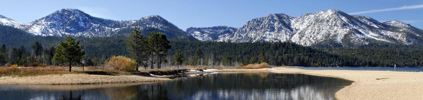
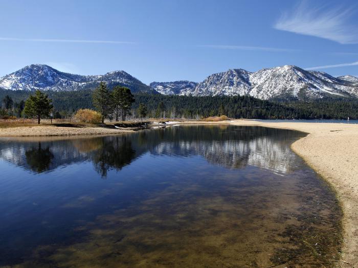
Hope Valley Campground is located in its beautiful namesake valley at an elevation of 7,300 feet, just 40 minutes south of Lake Tahoe. Visitors enjoy fishing the West Fork Carson River and exploring local trails.Recreation
The West Fork Carson River runs nearby, offering rainbow and cutthroat trout fishing. Numerous trails in the area provide excellent hiking and backpacking opportunities.Facilities
This tent and RV-friendly campground has been completely reconstructed and offers all new single and double-family campsites with picnic tables, campfire rings, grills, food storage lockers and tent pads.Vault toilets and drinking water are provided. Firewood is available for purchase from the host.
Natural Features
The campground is situated in a forest of Jeffrey and lodgepole pines on the edge of Hope Valley. The area affords views of the scenic valley and surrounding forested mountains.Nearby Attractions
Hope Valley is only 40 miles from the beautiful Lake Tahoe. Tahoe offers excellent boating, kayaking, fishing, hiking and scenic driving opportunities.MOUNT ROSE (NV) Campground
List of CampsitesOverview
Mount Rose Campground is conveniently located between Reno and Lake Tahoe just off scenic Mount Rose Highway. Visitors love the campground for its proximity to excellent hiking trails and recreational opportunities at Lake Tahoe.Recreation
Hiking is the most popular pastime at Mount Rose. Several trails, including the Tahoe Meadows, Tahoe Rim, Mount Rose Wilderness and Mount Rose Summit Trails, begin very close to the campground.Facilities
Mount Rose contains single and double-family sites, as well as one triple-family site. Six of the single sites are for tent camping only. Picnic and utility tables, campfire rings, grills and food storage lockers are provided, as are vault toilets and drinking water. Roads and parking spurs throughout the site are paved.Natural Features
The campground is situated high on the western slope of Mount Rose at an elevation of 9,300 feet. A scenic forest of lodgepole pine, Jeffrey pine, white pine and red fir covers the campground, offering pleasant shade in most sites.Nearby Attractions
Mount Rose is conveniently close to beautiful Lake Tahoe, less than 30 minutes away. Tahoe offers excellent boating, kayaking, fishing, hiking and scenic driving opportunities.Silver Creek Campground
List of CampsitesOverview
Silver Creek Campground is located near the town of Markleeville on scenic Highway 4. Visitors enjoy fishing various waterways in the area and exploring the nearby Pacific Crest Trail.Recreation
Anglers enjoy fishing the nearby East Fork Carson River, as well as other creeks in the vicinity. The Pacific Crest Trail can be accessed just 3 miles west of the site.Facilities
This campground straddles Highway 4, creating two separate loops containing several single-family sites with picnic tables, food storage lockers and campfire rings with grills. Vault toilets, No Water Available, Dry Camping only and trash collection are provided. Firewood is available for purchase from the host.
Natural Features
The campground is situated in a beautiful, shady fir and pine forest on the mountainside just above Noble Creek. The elevation is 7,100 feet.HILLTOP Campground
List of CampsitesOverview
Hilltop Campground is set in the beautiful Spring Mountains National Recreation Area, just 40 miles from downtown Las Vegas. Visitors enjoy hiking, horseback riding and scenic driving in this forested desert oasis.Recreation
The North Loop-Mt. Charleston National Recreation Trail begins only 1/4-mile away. Robber's Roost and the CCC Trailhead are located nearby as well. The Spring Mountains Visitor Center is a short drive from the campground, offering guided hikes and educational programs.
Facilities
The campground offers single and double campsites, all with picnic tables, campfire rings and grills. Some sites have stairs from the parking spur to the campsite.
Vault toilets and trash collection are provided. Roads and parking spurs are paved.
Natural Features
The Spring Mountains National Recreation Area is a beautiful island in the desert, brimming with breathtaking scenery and diverse flora and fauna. The Bristlecone pine, the world's oldest organism, and the rare Mount Charleston blue butterfly are both found within the Spring Mountains.More than 100 springs create the namesake for the mountain range, making it an ideal place to escape the heat of the city.
The campground is situated so campers are awarded sweeping views of the Mojave Desert below and Spring Mountains above. Stands of juniper, mountain mahogany and ponderosa pine forest the site and provide limited shade.
Nearby Attractions
More than 60 miles of hiking and horseback riding trails crisscross the area; two trails allow mountain biking. Rock climbing, picnicking and scenic driving are popular activities.CRAGS CAMPGROUND Campground
List of CampsitesOverview
Crags Campground is located just 10 miles from Bridgeport, California, at an elevation of 7,000 feet. The Twin Lakes area is close by, offering boating, fishing, hiking and horseback riding opportunities.Recreation
Robinson Creek offers good rainbow trout fishing and can be easily accessed from within the campground. Numerous hiking trails are in the vicinity, including the popular Robinson Creek Trail.Facilities
The campground contains one group site that can accommodate up to 45 people, with picnic and serving tables, grills, food storage lockers, a campfire circle and ample parking. Several single and double-family sites, some of which are accessible, are also available.Flush toilets, drinking water and trash collection are provided. Firewood is available for purchase from the host. Roads and parking spurs are paved.
Robinson Creek South Campground is nearby, where educational programs are held on weekends from July 4 through Labor Day.
Natural Features
The campground offers views of the rugged Sawtooth Ridge, with craggy peaks topping out at over 10,500 feet in elevation. A forest of Jeffrey pines towers over the campground, offering limited shade. Sagebrush and summer wildflowers dot the area.Nearby Attractions
Upper and Lower Twin Lakes are within walking distance, offering beautiful mountain scenery, boating, canoeing and fishing for Kokanee salmon and rainbow and brown trout. Twin Lakes Resort is just across the road.The rugged and scenic Hoover Wilderness Area can be accessed from the Twin Lakes area and offers additional trails for hiking and horseback riding.
ROBINSON CREEK SOUTH Campground
List of CampsitesOverview
Robinson Creek South Campground is located just 9 miles from Bridgeport, California, next to Robinson Creek at an elevation of 7,000 feet. The Twin Lakes area is close by, offering boating, fishing, hiking and horseback riding opportunities.Recreation
Robinson Creek offers good rainbow trout fishing and can be easily accessed from within the campground. Numerous hiking trails are in the vicinity, including the popular Robinson Creek Trail.Facilities
The campground contains single sites with picnic tables, food storage lockers and campfire rings with grills. Vault toilets, drinking water and trash collection are provided. Firewood is available for purchase from the host.Educational programs are held at the campground's amphitheater on weekends from July 4 through Labor Day. Robinson Creek North Campground is adjacent.
Natural Features
The campground is situated alongside its namesake creek, where a forest of massive Jeffrey pines towers over the site, offering partial shade. Lodgepole pines, sagebrush and summer wildflowers dot the landscape.Nearby Attractions
Upper and Lower Twin Lakes are nearby, offering beautiful mountain scenery, boating, canoeing and fishing for Kokanee salmon and rainbow and brown trout. The rugged and scenic Hoover Wilderness Area can be accessed from the Twin Lakes area and offers additional hiking and horseback riding trails.FLETCHER VIEW Campground
List of CampsitesOverview
Fletcher View Campground is set in the beautiful Spring Mountains National Recreation Area, just 24 miles from Las Vegas. Visitors enjoy hiking, horseback riding and scenic driving in this forested desert oasis.Recreation
There is paved nature trail.Facilities
This recently updated campground is open year-round and contains several single and double-family sites, all of which have electric hookups, tables, campfire rings and grills. Drinking water is provided. Roads and parking spurs are paved.Due to this campground being located in a flood plain, reservations are not available during the monsoon season (mid-July to mid-Sept.). During this time, overnight stays are available only as weather permits. High chances of rain in the forecast equal no overnight stays.
Natural Features
The Spring Mountains National Recreation Area is a beautiful island in the desert, brimming with breathtaking scenery and diverse flora and fauna. The Bristlecone pine, the world's oldest organism, and the rare Mount Charleston blue butterfly are both found within the Spring Mountains.More than 100 springs create the namesake for the mountain range. It's the perfect place to escape the heat of the city.
The campground is set in an open forest of ponderosa pine, mountain mahogany and Gambel oak, paralleling a seasonal stream and the highway. Most sites have views of the surrounding towering canyon walls.
Nearby Attractions
More than 60 miles of hiking and horseback riding trails crisscross the area; two trails allow mountain biking. Rock climbing, picnicking and scenic driving are popular activities.POWERHOUSE GROUP PICNIC AREA Campground
List of CampsitesOverview
Powerhouse Group Picnic Area is set in scenic Lamoille Canyon, next to Lamoille Creek, at an elevation of 6,500 feet. Elko, in northeastern Nevada, is just 25 miles away. Visitors enjoy fishing and exploring local trails.Recreation
Fishing for rainbow and brook trout is popular on the creek. Lamoille Canyon contains numerous hiking and horseback riding trails that lead to alpine lakes and scenic vistas. The canyon road itself is popular for scenic driving and road biking. Many rock-climbing routes can be found on the canyon walls.Facilities
This day-use picnic area was constructed in 2003 and is a fully accessible site. A large shelter covers several picnic and serving tables, two grills and a campfire circle with benches. Accessible vault toilets and trash collection are provided but drinking water is not available. A large parking area is adjacent to the site, accommodating 25 through 30 vehicles.Natural Features
The picnic area is situated at the mouth of Lamoille Canyon, a part of the beautiful Ruby Mountains. The area is a desert island brimming with wildlife, sparkling lakes and streams, wildflower-filled meadows and jagged peaks.The shelter is surrounded by a stand of shady aspens. Lamoille Creek runs through the site.
WARD MTN. CAMPGROUND (MURRAY SUMMIT) Campground
List of CampsitesOverview
Ward Mountain Recreation Area and Campground sits in the shadow of its namesake, just 10 miles southwest from the city of Ely, in eastern Nevada. It sits at an elevation of 7,400 feet. Many trails are available for hiking, mountain biking and horseback riding.Recreation
Ward Mountain and the surrounding area offers miles of trails for hiking, mountain biking and horseback riding. Many of the trails offer scenic views of the surrounding high desert terrain.Facilities
This campground offers single-family campsites and three large group sites that can accommodate up to 100 or more people. Multiple access points for trails are found throughout the campground with the main trailhead located at the eastern most side.
All campsites are equipped with picnic tables, campfire rings and grills. Vault toilets, drinking water and trash collection are provided, but there is no electricity. A campground host is on-site.
Natural Features
Ward Mountain is the highest point in the Egan Range, topping out near 10,800 feet. The campground is well below the summit, but sits high above the desert floor below. A forest of pinyon pine and juniper trees covers the area, offering partial shade and privacy between campsites.Nearby Attractions
Comins Lake is about 13 miles from the campground offering boating and fishing for trout and bass. Cave Lake State Park is less than 20 miles away, with opportunities for boating and fishing for rainbow and brown trout.
Ward Charcoal Ovens State Park is 26 miles away, with interesting historic stone ovens and an interpretive trail. The Northern Nevada Railway in Ely has a museum and offers train rides. Stop by the Chamber of Commerce for more information on local events and sites.
TIMBER CREEK CAMPGROUND Campground
List of CampsitesOverview
Timber Creek Campground is located in Duck Creek Basin, high on the Schell Creek Range, in eastern Nevada. It sits at an elevation of 8,500 feet, approximately 25 miles from the small city of Ely. Visitors to the area enjoy hiking, horseback riding, fishing and off-road vehicle riding, among other activities.Recreation
Timber Creek is a perennial stream with rainbow and brook trout fishing. The High Schells Wilderness can be accessed from a trailhead located a half-mile up the road from the campground.
The 30-mile Success Loop Scenic Drive is located in the Duck Creek Basin with views of the surrounding high desert and mountain terrain.
Access to the Ranger OHV Trail is located below the campground and offers recreational opportunities for OHVs, horseback, mountain bikes and hiking.
Facilities
The campground has five group campsites, which serve varying sizes of groups between 25-100 people. Some sites require a short walk from the parking area, on a bridge over Timber Creek, to access the site pad.
All sites have picnic and serving tables, a campfire ring and a grill. Vault toilets and drinking water is provided. This is a "pack it in, pack it out" site, with no trash collection service.
Natural Features
The campground is situated in a dense forest of Engelmann spruce, aspen and white fir trees, which offers partial shade and beautiful fall color. Timber Creek flows past the campground. High Schells Wilderness sits immediately ajacent to the campground and has multiple peaks greater than 11,000 ft. in elevation.
Nearby Attractions
Ward Charcoal Ovens State Park is a few miles southeast of Ely, providing an opportunity to see interesting historic stone ovens and hike an interpretive trail. The Northern Nevada Railway in Ely has a museum and offers train rides.Cave Lake State Park is a few miles south of Duck Creek Basin along the Success Loop Road.
Bird Creek Campground Campground
List of CampsitesOverview
Bird Creek Recreation Area is located in the Duck Creek Basin, high on the Schell Creek Range. It sits at an elevation of 8,200 feet, approximately 25 miles from the small city of Ely. Hiking, mountain biking and off-road vehicle riding are popular activities enjoyed by visitors to the area.
Recreation
The Ranger Trail can be accessed from this campground. The Ranger Trail is a designated OHV trail that also accommodates hiking and mountain biking use as well. The 30-mile Success Loop Scenic Drive is also in the area, with views of high desert and mountain terrain.
Facilities
The campground has nine sites. Site A is a day-use group stie, site 5 is a mult-family site, sites 1, 3, 4, 6, and 7 are single sites, sites 8 and 9 are double sites requiring a short walk from the parking area, on one to two bridges over Bird Creek. All sites have picnic and serving tables, campfire rings and grills.
Vault toilets and drinking water are provided seasonally. This is a "pack it in, pack it out" facility.
Natural Features
Bird Creek flows perennially through the campground. A mixed forest of juniper, pinyon pine and alder trees covers the area, but provides only limited shade.
Nearby Attractions
Ward Charcoal Ovens State Park is a few miles southeast of Ely. Interesting historic stone ovens and an interpretive trail are available there. The Northern Nevada Railway in Ely has a museum and offers train rides.Charges & Cancellations
Bird Creek Camp site is close for the season due to renovations. Will open up in the 2020 Season.
Lookout Campground Campground
List of CampsitesOverview
Lookout Campground is located on the California/Nevada border just west of Reno, Nevada. It sits at an elevation of 6,770 feet in a large aspen grove. It is not a highly developed campground, but it is considered a secret hideaway by those lucky enough to know about this remote gem.Recreation
Adjacent to the campground is 'Crystal Peak', which can be accessed by vehicle or a short hike. This area is also popular for off-highway vehicles, wildlife viewing, and hunting opportunities.Facilities
This campground has 17 first-come, first-served campsites (including two double sites) and one reservable group picnic area that can accommodate up to 100 people. Each campsite has a picnic table, fire ring, grill, and tent pad. There are four vault toilets and trash service. There are no electric hookups and no dump stations. Trailers and RVs should be limited to 15 feet in length (however, two sites could accommodate up to 30 foot lengths). To ensure that campfires are extinguished completely, there is non-potable water available on site (no drinking water available). Please bring your own firewood as none is available on site.Natural Features
Visitors to this campground will be surrounded by a lush aspen, pine, and fir forest. Sites are well spaced to afford visitors plenty of privacy.Nearby Attractions
Crystal Peak is known for its impressive crystal formations. Dog Valley and Peavine Mountain are popular off-highway vehicle and mountain biking areas. The American Discovery Trail also runs through this area.KIT CARSON CAMPGROUND Campground
List of CampsitesOverview
Nestled in a forest of Jeffrey pines and aspens, Kit Carson campground is perfect for tent camping and smaller RVs. The west fork of the Carson River is located next to the campground, with several sites right next to the water. Great fishing and views! Kit Carson is exceptionally beautiful in the fall.Recreation
Visitors can explore scenic driving and photography along the Carson Pass Scenic Byway. Enjoy the splendor of fall with colorful foliage displays or fishing and boating in one of the several nearby lakes. Hikers are surrounded by trailheads within a short drive – Mokelumne Wilderness, and the Pacific Crest Trail, among many others. Whether it is rock climbing or exploring the canyon, outdoor enthusiasts will relish the options in this area.Facilities
This campground has drinking water, garbage containers, and vault toilets. Each campsite has a bear box, fire pit and picnic table. There is a camp host on site and firewood is available for sale.Natural Features
Kit Carson is situated on the west fork of the Carson River in Woodfords Canyon along Highway 88. In addition to the beauty of the river, the campsites are surrounded by quaking aspens and rugged canyon walls.Nearby Attractions
There are a number of nearby attractions that have something for everyone. Sorensen’s Resort has limited groceries and a restaurant. Lake Tahoe is within 20 miles; a trailhead for the Tahoe Rim Trail is within 5 miles; Grover Hot Springs State Park in Markleeville offers public soaking in natural spring-fed pools; numerous local restaurants and, for those who like night life, nearby casinos and theaters in Minden and Carson City, Nevada.Carson Ranger District Office Facility
The Carson Ranger District extends along the eastern front of the Sierra Nevada Mountains, straddling the Nevada and California border with a land base of approximately 368,600 square miles. The District is about 15 miles wide and near 100 miles long and stretches from the Dog Valley area northwest of Reno, Nevada heading south along the Carson Range, passing between Lake Tahoe and Carson City, then continuing further south to Alpine County in California and ending just north of the Sonora Pass and Highway 108 area.
If you have any questions or comments please contact the Carson Ranger District @ 775-882-2766
Bridgeport Ranger District Office Facility
Sustaining the health, diversity, and productivity of the Nation's forests and grasslands to meet the needs of present and future generations...from the peaks of the eastern Sierra to the Great Basin desert.
If you have any questions or comment please contact the Bridgeport Ranger District @ 760-932-7070
Austin Ranger District Office Facility
The Austin Ranger District is located 170 miles east of Reno in north-central Nevada. The District’s over 1 million acres are located near what has been dubbed the loneliest highway in America, U.S. Hwy 50. Highway 50 runs through the town of Austin, population approximately 250, and home to the Austin Ranger District Office.
Please contact the Austin Ranger District with any questions or comments @ 775-964-2671
Tonopah Ranger District Office Facility
Located off U.S. Highway 95, approximately halfway between Reno and Las Vegas (a little over 200 miles from each) is the largest ranger district in the lower 48 states: Tonopah Ranger District. The district encompasses approximately 1.12 million acres on the Humboldt-Toiyabe National Forest. Tonopah, population about 2,800, is the nearest town and houses the district ranger office.
If you have questions or comments please call the Tonopah Ranger District @ 775-482-6286
Spring Mountains National Recreation Area Office Facility
The Spring Mountains National Recreation Area (SMNRA) is part of the Humboldt-Toiyabe National Forest. Better known to locals as Mount Charleston, it is located just 30 minutes from downtown Las Vegas and encompasses more than 316,000 acres of remarkable beauty and surprising diversity.
Enjoy snow-capped mountain peaks that are surrounded by desert and are home to over 50 sensitive plants and animals, some of which are found only in this special area and nowhere else in the world. The panoramic mountain range provides a quick getaway and a haven for solitude.
If you have any questions or comments please contact the Spring Mountain National Recreaction @ 702-515-5400
Mountain City Ranger District Office Facility
The Mountain City Ranger District comprises approximately 450,000 acres of the Humboldt-Toiyabe National Forest. The district lies approximately 84 miles North of Elko, Nevada on State Highway 225 or 12 miles South of Owyhee, Nevada on State Highway 225.
If you have any questions or comments please contact the Mountain City Ranger District @ 775-738-5171
Ruby Mountains Ranger District Office Facility
The Ruby Mountains Ranger District is made up of the East Humboldt and Ruby Mountain Ranges. These mountains contain spectacular scenery and a variety of recreational activities. The district covers about approximately 450,000 acres with elevations ranging from 6,000 feet to 11,387 feet at Ruby Dome.
If you have any questions or comments please contact the Ruby Moutain Ranger District @ 775-752-3357
Jarbidge Ranger District Office Facility
The Jarbidge Ranger District of the Humboldt-Toiyabe National Forest offers approximately 243,907 acres of relatively undiscovered recreation opportunities. Elevations range from 6,000 feet to the Matterhorn Peak at 10,839 feet and the area provides a wide range of temperature, vegetation, and opportunities for the outdoor enthusiast. Visitors can enjoy quiet campgrounds, hunting, stream fishing, or one of the least-used wilderness areas in the nation. For residents of Elko County or southern Idaho, this northern Nevada mountain range is within a two-hour drive.
If you have questions or comments please contact the Jarbridge Ranger District @ 775-752-3357
Ely Ranger District Office Facility
The Ely Ranger District makes up approximately 1.1 million acres of the Humboldt-Toiyabe National Forest and extends over three Nevada counties: Nye, White Pine and Lincoln. Ely, Nevada, located in the heart of the District, is the nearest town and houses the District office.
The District lies approximately 240 miles north of Las Vegas, Nevada, via I-15, State Highways 93, 318 and 6; and 190 miles south of Elko, Nevada, via I-80 and State Highway 93.
If you have questions for comments please contact the Ely Ranger District @ 775-289-3031
Santa Rosa Ranger District Office Facility
The Santa Rosa Ranger District makes up approximately 280,000 acres of the Humboldt-Toiyabe National Forest, 40 miles north of Winnemucca, Nevada. It can be reached by traveling north on State Highway 95 to State Route 290 (Paradise Valley) and Forest Road 792. This forest road is very scenic with Paradise Valley on one side and State Highway 95 on the other.
If you have any questions or comments please contact the Santa Rosa Ranger District @ 775-623-5025
Lower Virginia Creek Primitive Campground Campground
List of CampsitesRustic campsites with fire rings in Jeffrey Pine Forest. There is no trash service please pack out your trash.
Obsidian Campground Campground
List of CampsitesObsidian Campground offers opportunity to get away from crowds amidst shade of aspens and pines. Campground is close to Molybdenite Creek and Little Walker River. The river is stocked with trout. Area trailheads offer several interesting hikes. The trail from Molybdenite Creek trailhead splits, with one branch heading south into the Hoover Wilderness, and one looping north along Wheeler Creek to connect with the trail along the Little Walker River. This can be hiked as a loop from Burt Canyon trailhead (just west of campground). The Emma Lake trailhead leads to a short but steep hike to Emma Lake on the shores of Mount Emma.
Generally open in late May to mid October, weather and condition permitting.
Kingston Trailhead Facility
Kingston Trailhead
Cow Canyon Trailhead Facility
Cow Canyon Trailhead
Crest Trailhead Facility
Crest Trailhead
Toms Canyon Trailhead Facility
Toms Canyon Trailhead
Deer Creek Picnic Site Facility
Day use only. Picnic tables are available. Drinking water is not available.
Old Mill Picnic Site Facility
This is a great picnic are with flush toilets and potable water. Old Mill Picnic Area has 80 sites and is generally open May to September, weather permitting.
Barley Creek Trailhead Facility
Barley Creek Trailhead
North/South Twin Trailhead Facility
North/South Twin Trailhead
Pinecreek Trailhead Facility
Pinecreek Trailhead
Mary Jane Trailhead Facility
Mary Jane Trailhead
Sawmill Trailhead Facility
Sawmill Trailhead
Trail Canyon Trailhead Facility
Trail Canyon Trailhead
Lower Bristlecone Trailhead Facility
Lower Bristlecone Trailhead
Griffith Peak Trailhead Facility
Day use only in this area. There isn't water or toilets available.
Dispersed camping is allowed near the trailhead, but fires are prohibited.
Fletcher Canyon Trailhead Facility
Fletcher Canyon Trailhead
North Loop Trailhead Facility
North Loop Trailhead
Upper Bristlecone Trailhead Facility
Upper Bristlecone Trailhead
Echo Trailhead Facility
Day use only. There isn't drinking water or toilets currently available at this trailhead.
No fires are allowed at this time.
Sonora Bridge Meadow Picnic Site Facility
Shingle Mill Flat Picnic Site Facility
Picnic by the Walker River on Hwy 395. Open end of April- mid-November
Leavitt Meadows Trailhead Facility
Leavitt Meadows Trailhead
Leavitt Falls Vista Observation Site Facility
Green Creek Trailhead Facility
Green Creek Trailhead
Ledbetter Trailhead Trail Facility
The Ledbetter Trailhead trail is 2.4 miles long. It begins at 44122 Sec 4 and ends at 24113 Sec 13. The trail is open for the following uses: Horseback Riding
Stead Access Facility
The Stead Access is located at 41641 Sec 7 on the North side of Peavine Mountain. A variety of OHV opportunities are available in the area: including OHV and 4x4. Open routes are marked with a route number and type of vehicles the route is open to.
Horizon Hills Trailhead Facility
The Horizon Hills Trail is located at 41645 Sec 17 on the Northeast side of Peavine Mountain. A variety of OHV opportunities are availiable in the area: including OHV and 4x4. Open routes are marked with a route number and type of vehicles the route is open to.
Hummingbird Springs Trailhead Facility
.
Slide Creek Trailhead Facility
Toilets will remain open until early to mid November, weather permitting
Three Day Creek Trailhead Facility
Three Day Creek Trailhead
Red Metal Access Facility
The Red Metal access is located at 41666 sec.3 on the North side of Peavine mountain. A variety of OHV opportunities are availiable in the area: including OHV and 4x4. Open routes are marked with a route number and type of vehicles the route is open to.
Raleigh Heights Trailhead Facility
The Raleigh Heights Trailhead is located at 41664 sec. 21 on the East side of peavine Mountain. A variety of OHV opportunities are available in the area: including OHV and 4x4. Open routes are marked with a route number and type of vehicles.
Hoge Road Trailhead Facility
The Hoge Road Trailhead is located at 41652 sec. 27 on the East side of Peavine mountain. A variety of OHV opportunities are availiable in the area: including OHV and 4x4. Open routes are marked with a route number and type of vehicles the route is open to.
West Keystone Trailhead Facility
The West Keystone Trailhead is located at 41653 sec. 32. on the south side of Peavine Mountain. A variety of opportunities are available in the area: including , Mt. Biking, OHV and 4x4. Open routes are marked with a route number and type of vehicles are authorized.
Soldier Basin Trailhead Facility
Soldier Basin Trailhead
Roads End Trailhead Facility
Road's End Trailhead has access to many beautiful high elevation lakes, gorgeous views and miles of trails. The trailhead is next to Lamoille Creek and has an easy walking path down to the water. A great place to sit and relax in the beautiful Ruby Mountains.
Smith Lake Trailhead Facility
Smith Lake Trailhead
Rosaschi Ranch Trailhead Facility
/
Centerville Flat Campground Campground
List of Campsites.
Mt. Rose Summit Interpretive Site Facility
.
Bonanza Trailhead Facility
Trailhead is for day use only.
Very limited dispersed camping in area near the trailhead. No toilets or drinking water is available at the trailhead.
Desert View Interpretive Site Facility
Interpretive site with views over 150 miles of desert.
Ebbetts Pass Scenic Byway Facility
Traveling the Ebbetts Pass Scenic Byway is a thrilling and unforgettable “peak” experience with awe-inspiring natural surprises around every bend – majestic giant sequoias, craggy granite boulders, lacy dogwood blossoms, ancient volcanic peaks, gnarled junipers, deep forests, spectacular open canyon vistas, billowing clouds, delicate cascading waterfalls, meandering rivers, brilliant quaking aspen, fragrant meadows of prolific native wildflowers, and pristine alpine lakes right at the road’s shoulder. While driving along the highway, travelers will encounter a spectacular palette of colors – bright blue sky, billowing white clouds, the shocking red of tall cedar trunks, and the deep green foliage of mixed conifer forests. A traveler would be hard-pressed to drive the route without stopping and exploring some if its bountiful treasures. Visit the links above to read more details about the Natural Environment that makes Ebbetts Pass so unique.
Slide Creek Campground Campground
List of CampsitesSlide Creek Campground is located at the trailhead for Slide Creek which accesses the Jarbidge Wilderness(hiking, horse trips, hunting, backpacking), has one single restroom, horse corrals (no horses allowed in the campground), 6 sites, no water, and is free. Not reservable.
Located at the springs that feed Slide Creek, and the trailhead for the Slide Creek trail. Aspen and subalpine fir trees provide shade and shelter at the campsites.
Appropriate for small trailers, good for tent camping.
SPRING MOUNTAINS VISITOR GATEWAY GROUP PICNIC SITES Campground
List of CampsitesOverview
The Spring Mountains Visitor Gateway (SMVG) complex includes a visitor center, an education and research building, two amphitheaters, two picnic sites and over 40 miles of adjoining trails. The complex houses the Silent Heroes of the Cold War National Memorial - the only national monument dedicated to the Cold War era, honoring the thousands of individual who worked covertly for the United States government during the Cold War. SMVG is also home to the Seven Stones Plaza, which celebrates indigenous people - seven Southern Paiute tribes known collectively as Nuwuvi (or "the people") and their longstanding ancestral relationship with their creation place in the Spring Mountains. The SMVG is both a destination and a gateway to provide visitors with everything needed to appreciate and enjoy the Spring Mountains.Recreation
The picnic areas are near a visitor center, two amphitheaters and 40 miles of trails. The Silent Heroes of the Cold War National Memorial is also on the same property. The picnic areas are a short drive from camping areas and scenic outlooks.Facilities
This year-round picnic area contains two group picnic sites, which meet accessibility standards. Sites are equipped with picnic tables, campfire ring and grills. Flush toilets and drinking water are provided during peak season and may be unavailable during non-peak season. Roads and parking spurs are paved. The picnic areas are available for full day bookings during non-peak periods and half day bookings during peak periods.
Natural Features
The Spring Mountains National Recreation Area is a beautiful island in the desert, brimming with breathtaking scenery and diverse flora and fauna. The Bristlecone pine, the world's oldest organism, and the rare Mount Charleston blue butterfly are both found within the Spring Mountains.More than 100 springs create the namesake for the mountain range, making it an ideal place to escape the heat of the city.
Cathedral Rock Trailhead Facility
Newly renovated! New parking area with new bathrooms and more space.
