
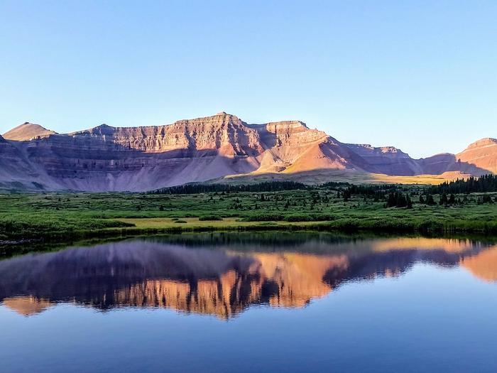
Ashley National Forest
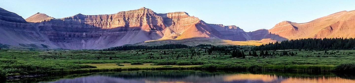
Recreational opportunities abound across 1.3 million acres on the Ashley National Forest! The Ashley National Forest manages 276,175 acres of the High Uintas Wilderness Area offering quiet solitude, as well as access to the highest peak in Utah, Kings Peak. With 1,156 campsites, 8 picnic areas, 1,151 miles of roads and trails for All-Terrain-Vehicles, opportunities for motorized camping and recreation are calling.
The Flaming Gorge National Recreation Area offers many activities including fishing, wildlife viewing, and scenic views of Flaming Gorge to name a few.
RecAreaDirections
Open with Google Map
Misc
| Stay Limit | |
| Reservable | false |
| Keywords | |
| Map Link | |
| Contact Phone | |
| Contact Email |
Permits info
Facilities
Ashley National Forest Christmas Tree Permit Tree Permit
Rock Creek Guard Station Campground
List of CampsitesOverview
Welcome to one of the gateways into the High Uintas Wilderness with multiple recreation opportunities. The Rock Creek cabin is located below the Upper Stillwater reservior in the Rock Creek Drainage on the southern slope of the beautiful Uinta Mountains. Visitors enjoy fishing, sightseeing and exploring the popular Stillwater trail.
Recreation
The Upper Stillwater Trailhead is 0.6 miles up the road and provides access to the High Uintas Wilderness, where hiking, backpacking, horseback riding, wildlife viewing and backcountry fishing are very popular activities in this scenic region.
Upper Stillwater Reservior is 0.8 miles up the road and is 1.3 miles long and has rainbow, brown and brook trout. The reservior is accessible only to watercraft that can be carried in, as the boat ramp is closed to vehicle traffic.
Rock Creek offers rainbow and brook trout fishing.
Facilities
The Guard Station cabin can sleep up to 8 overnight guest. The cabin contains 2 bunkbeds, one queen size bed and a sleeper couch, though no linens, bedding or pillows are provided. Level parking is provided for a maximum of three vehicles. The cabin has a flush toilet, running water, bathtub/shower, wood stove, electric heat and electric lights with modern appliances, including stove top and oven, full size refridgerator and a microwave. No tent or RV camping is allowed.
Guest are expected to clean cabin before leaving.
There is a phone on the front of the cabin that one can make free local calls on.
Natural Features
The cabin is situated below the Upper Stillwater Dam at an elevation of 7,945 feet. The Stillwater Dam is a rolled concrete gravity dam and was designed with a steep stepped spillway. It is an attraction for engineers.
A forest of Ponderosa Pine, Lodgepole Pine and Aspen trees provides shade. Summer wildflowers and fall colors are abundant.
Nearby Attractions
Upper Stillwater Trailhead and Upper Stillwater Campground. Rock Creek Ranch, which is under a Special Use Permit with the Ashley National Forest is across the road from the cabin. They offer snacks, soda, beer and fishing supplies. They have spots for tents and RV's as well as assorted sizes of rustic cabins for rent.
Moon Lake Guard Station Campground
List of CampsitesOverview
Welcome to one of the gateways to the High Uintas Wilderness with multiple recreation opportunities. Moon Lake Guard Station is located near the shores of the scenic two mile long Moon Lake on the southern slope of the 13,000 foot peaked Uinta Mountains. Visitors come to enjoy cool mountain air, fishing, canoeing and motor boating, scenic vistas, hiking trails and horse rides.
Recreation
Moon Lake offers great boating, canoeing and fishing. Anglers fish for tiger, rainbows, cutthroat, and brook trout, kokanee salmon, splake, and artic grayling. Tiger and rainbow trout are actively stocked annualy. The Lake Fork Trail and Brown Duck Mountain Loop hiking/esquestrain trails begin at Moon Lake Campground offering excellent opportunities in the High Uintas Wilderness where numerous alpine lakes provide great backcountry fishing. The Fish Creek Trail begins at the Moon Lake Dam and ascends northeast up to Center Park, climbing 8,200' to 10,400' over 5.6 miles.
Moon Lake Resort is adjacent to the Guard Station and offers small engine boat rentals. Flying J Outfitters is located one mile before Moon Lake Campground, at the Lake Fork Trailhead. They offer both scheduled and walk-up horse rides as well as drop and pack trips into the High Uintas Wilderness.
Facilities
The Guard Station cabin can sleep a maximum of four overnight guest. The cabin contains one twin-size bunk bed and one queen size bed, though no linens, bedding or pillows are provided. Level parking is provided for a maximum of two vehicles. The cabin has flush toilet, running water, shower, wood stove, and electric lights with modern appliances. No tent or RV camping is allowed.
There is no campfire ring and no fires are allowed.
Family reunions or other large gatherings (more than four people) are not allowed.
Guest are expected to clean the cabin before leaving.
Natural Features
The Guard Station is situated near the lake shore at an elevation of 8,000 feet where lodgepole pine, aspen, and Douglas fir provide shade away from the lake. Wildlife and flowers both flourish in the canyon.
Nearby Attractions
Moon Lake Campground and Moon Lake Resort are adjacent to the Guard Station.
Antelope Flat (Ashley National Forest, UT) Campground
List of CampsitesOverview
Antelope Flat Campground lies on the shores of the beautiful Flaming Gorge Reservoir at an elevation of 6,000 feet, on the Ashley National Forest within the Flaming Gorge National Recreation Area. Visitors love Antelope Flat for its easy access to boating, water skiing and fishing.Recreation
Flaming Gorge National Recreation Area is known not only for its beautiful red cliffs, but also for its world-class fishing for lake, brown and rainbow trout. Boating, water skiing, jet skiing, canoeing, kayaking, swimming and scuba diving are popular activities on the reservoir.Facilities
The campground contains four group sites, each with a picnic shelter, tables, campfire ring, grills and tent pads. Several family sites are available as well, each with a cabana, picnic table and campfire ring; some sites have grills.Flush toilets, drinking water and a dump station are provided. A boat ramp is located on-site. The campground is accessed via a well-maintained gravel road.
Natural Features
Nearly every site within the campground offers scenic reservoir and mountain views. Russian olive trees and cottonwoods dot the rolling, sagebrush-covered landscape. Shade is limited, and temperatures range from warm days to cool nights.Nearby Attractions
Flaming Gorge Dam offers guided tours of the working hydroelectric plant and the dam, and the adjacent visitor center contains area history exhibits.The Green River below the dam provides spectacular rafting opportunities. A trip down the river offers unique geology, outlaw history and Native American rock art.
BUCKBOARD CROSSING Campground
List of CampsitesOverview
Buckboard Crossing Campground is located on the far northwest shore of Flaming Gorge Reservoir at an elevation of 6,100 feet. Boating, fishing and water skiing are popular activities.Recreation
Fishing, boating, canoeing, water skiing and swimming are popular activities on the lake. Campers are offered the convenience of an adjacent boat ramp, marina and fish cleaning station. Buckboard Marina has boat rentals, fuel, slips, fishing licenses, bait and groceries.Facilities
The campground consists of 66 single-family campsites, most of which can be reserved. Several sites in Loop A have electrical hookups. Most sites have a shade cabana, picnic table and campfire ring. Some sites have grills and/or fire rings.Flush toilets, drinking water and showers are provided. Non-campers can use the shower facilities for a small fee. A dump station is located on-site.
Natural Features
The campground is situated in a high desert landscape with sagebrush and a few scattered trees. Natural shade is minimal. Typical weather ranges from warm days to cool nights.Nearby Attractions
Flaming Gorge Dam offers guided tours of the working hydroelectric plant and the dam itself; The adjacent visitor center contains area history exhibits.CEDAR SPRINGS CAMPGROUND Campground
List of CampsitesOverview
Cedar Springs Campground is located in the beautiful Flaming Gorge National Recreation Area on the Ashley National Forest at an elevation of 6,100 feet. Flaming Gorge Reservoir and Cedar Springs Marina are less than a mile from the campground. Exciting recreational activities abound, including boating, water skiing and fishing.Recreation
Flaming Gorge National Recreation Area is known not only for its beautiful red cliffs, but also for its world-class fishing for lake, brown and rainbow trout. Boating, water skiing, jet skiing, canoeing, kayaking, swimming and scuba diving are popular activities on the reservoir. Cedar Springs Marina is adjacent.Bear Canyon Trail, an easy 3-mile round-trip trail for hiking and mountain biking, begins nearby and leads to views of Red Canyon and Flaming Gorge.
Facilities
This small campground contains single and double-family sites with picnic tables and campfire rings. Vault toilets, drinking water, a dump station and fish cleaning station are provided. Showers are available a half-mile away at Deer Run Campground.For large group camping, the nearby Arch Dam, Greendale, Dripping Springs, Antelope Flat and Dutch John Draw Campgrounds have several group sites available.
Natural Features
Cedar Springs is situated among juniper, pinyon pine and sagebrush on a hillside above Flaming Gorge Reservoir. Shade is limited but the vegetation provides good privacy between sites, many of which have scenic views of the reservoir below.Nearby Attractions
Flaming Gorge Dam offers guided tours of the working hydroelectric plant and the dam, and the adjacent visitor center contains area history exhibits.The Green River below the dam provides spectacular rafting opportunities. A trip down the river offers unique geology, outlaw history and Native American rock art.
DEER RUN CAMPGROUND Campground
List of CampsitesOverview
Deer Run Campground is located in the beautiful Flaming Gorge National Recreation Area on the Ashley National Forest at an elevation of 6,200 feet. Flaming Gorge Reservoir is less than a mile below the campground. Exciting recreational activities abound, including boating, water skiing and fishing.Recreation
Flaming Gorge National Recreation Area is known not only for its beautiful red cliffs, but also for its world-class fishing for lake, brown and rainbow trout. Boating, water skiing, jet skiing, canoeing, kayaking, swimming and scuba diving are popular activities on the reservoir. Cedar Springs Marina is adjacent.Bear Canyon Trail, an easy 3-mile round-trip trail for hiking and mountain biking, begins nearby and leads to views of Red Canyon and Flaming Gorge.
Facilities
This small campground contains family campsites equipped with picnic tables and campfire rings. Flush toilets, showers and drinking water are provided. A dump station and marina are located in the immediate area at Cedar Springs.For larger groups, the nearby Arch Dam, Greendale, Dripping Springs, Antelope Flat and Dutch John Draw Campgrounds have several group sites available.
Natural Features
Deer Run is situated among juniper, pinyon pine and sagebrush above Flaming Gorge Reservoir. Shade is limited and the reservoir is not visible from the campground. A resident deer herd gives this site its name.Nearby Attractions
Flaming Gorge Dam offers guided tours of the working hydroelectric plant and the dam, and the adjacent visitor center contains area history exhibits.The Green River below the dam provides spectacular rafting opportunities. A trip down the river offers unique geology, outlaw history and Native American rock art.
DRIPPING SPRINGS CAMPGROUND (UT) Campground
List of CampsitesOverview
Dripping Springs Campground is situated at an elevation of 6,000 feet in rolling high desert terrain near Flaming Gorge Reservoir. The campground is part of the Flaming Gorge National Recreation Area in the Ashley National Forest. Campers frequent Dripping Springs for its close proximity to the Green River and Little Hole, both of which offer excellent rafting and world-class fishing opportunities.Recreation
Dripping Springs is surrounded by places to boat, raft, fish, hike and mountain bike. Little Hole Boat Launch and Day-Use Area on the Green River is nearby, offering great rainbow, brown and cutthroat trout fishing.The 7-mile Little Hole National Recreation Trail begins near the campground, meandering along the Green River from Flaming Gorge Dam. The trail can be done in shorter segments or as a whole.
Flaming Gorge National Recreation Area is known not only for its beautiful red cliffs but also for its world-class fishing, boating, hiking, camping, water skiing, jet skiing, canoeing, kayaking, swimming and scuba diving. Click Here to learn more about the Ashley National Forest and the Flaming Gorge NRA.
Facilities
Dripping Springs is open year-round, and campsites are available on a first-come, first-served basis outside of the reservation season.The campground offers several single-family sites with shelters, tables and campfire rings. Four group sites are available as well, with large shelters, tables, campfire rings and grills. Flush toilets and drinking water are provided.
Natural Features
Nearly every site within the campground offers scenic reservoir and mountain views. Russian olive trees and cottonwoods dot the rolling, sagebrush-covered landscape. Shade is limited, and temperatures range from warm days to cool nights.Nearby Attractions
Flaming Gorge Dam offers guided tours of the working hydroelectric plant and the dam, and the adjacent visitor center contains area history exhibits.DUTCH JOHN DRAW CAMPGROUND Campground
List of CampsitesOverview
Dutch John Draw Campground is located within a quiet cove on Flaming Gorge Reservoir at an elevation of 6,000 feet. Campers enjoy easy access to boating, water skiing, fishing and swimming.Recreation
A small boat dock is located on-site and is designated specifically for those camping at Dutch John Draw. A short trail leads to it from the campground, providing easy access to boating, water skiing, canoeing, fishing and swimming on the reservoir.A boat ramp is available less than 2 miles away at Mustang Ridge.
Facilities
This campground is a group site that can accommodate up to 50 people. Vault toilets and trash collection are provided.A large picnic shelter with excellent views of the reservoir is located on-site, with picnic tables and a grill. This site is accessed via a well-maintained gravel road; parking spurs within the site are also gravel.
Natural Features
This secluded group site is settled in a quiet cove on Flaming Gorge Reservoir. Pinyon pines dot the landscape but offer little shade. The entire site offers scenic views of the water.Nearby Attractions
Flaming Gorge Dam offers guided tours of the working hydroelectric plant and the dam, and the adjacent visitor center contains area history exhibits.The Green River below the dam provides spectacular rafting opportunities. A trip down the river offers unique geology, outlaw history and Native American rock art.
FIREFIGHTERS CAMPGROUND Campground
List of CampsitesOverview
Firefighters Campground is just 3 miles from beautiful Flaming Gorge Reservoir, within the Flaming Gorge National Recreation Area on the Ashley National Forest. The campground serves as a memorial to three firefighters who lost their lives in the 1977 Cart Creek Fire. Visitors enjoy boating, fishing, swimming and hiking.Recreation
Bear Canyon Trail begins across the road from the campground, offering hiking and biking opportunities. This easy 3-mile round-trip trail leads to views of Red Canyon and Flaming Gorge.Beautiful Flaming Gorge Reservoir is just 3 miles from the campground. The reservoir is known for its world-class fishing for lake, brown and rainbow trout.
Boating, water skiing, jet skiing, canoeing, kayaking, swimming and scuba diving are also popular activities.
Facilities
The campground offers several family sites, six of which are accessible. Each site is equipped with a picnic table and campfire ring; some sites have grills.Flush toilets, drinking water and a dump station are available. Roads and parking spurs within the campground are paved. Firewood is available for purchase from the host.
Public showers are available 2.5 miles away at Deer Run Campground.
Bootleg Amphitheater, with a screen support and bleacher seating for 120 people, is located just across the road. Educational programs are offered throughout the summer season. A scenic overlook dedicated to the firefighters is located on-site.
Natural Features
The campground is situated on a gently-sloping hillside dotted with shady ponderosa pines and juniper, at an elevation of 6,900 feet.Nearby Attractions
Flaming Gorge Dam offers guided tours of the working hydroelectric plant and the dam, and the adjacent visitor center contains area history exhibits.The Green River below the dam provides spectacular rafting opportunities. A trip down the river offers unique geology, outlaw history and Native American rock art.
FIREHOLE CANYON CAMPGROUND Campground
List of CampsitesOverview
Firehole Canyon Campground is located on the far northeastern shore of Flaming Gorge Reservoir within the Flaming Gorge Recreation Area on the Ashley National Forest. Rock Springs, Wyoming, is just 29 miles away. Boating, fishing and water skiing are popular activities.Recreation
Fishing, boating, canoeing, water skiing and swimming are popular activities on the lake. Campers are offered the convenience of an adjacent boat ramp and a beach area.Facilities
The campground contains several family campsites. Each campsite has a cabana, picnic table and campfire ring. Flush toilets, showers, drinking water and trash collection are provided. Roads and parking spurs are paved. A dump station is located on-site.Natural Features
The campground lies in a high desert environment at an elevation of 6,300 feet. Russian olive trees and sagebrush are scattered throughout the site. Shade is minimal. The site affords scenic views of the reservoir and surrounding bluffs and red rock formations.Nearby Attractions
Flaming Gorge Dam offers guided tours of the working hydroelectric plant and the dam, and the adjacent visitor center contains area history exhibits.ARCH DAM CAMPGROUND Campground
List of CampsitesOverview
Arch Dam Campground is a popular location for family reunions, church outings and other large gatherings. It is located on the Ashley National Forest within the Flaming Gorge National Recreation Area. Flaming Gorge Dam and the Green River Spillway are less than a mile away. Visitors enjoy boating, water skiing, fishing and swimming.Recreation
Beautiful Flaming Gorge Reservoir can be accessed just 3 miles from the campground. The reservoir is known for its world-class fishing for lake, brown and rainbow trout.Boating, water skiing, jet skiing, canoeing, kayaking, swimming and scuba diving are popular activities. Cedar Springs Marina is just 3 miles away.
Facilities
Arch Dam offers two large sites that can accommodate up to 75 people each; and one site that can accommodate up to 60 people. Vault toilets and drinking water are provided. Each site contains picnic tables and a campfire circle. Roads and parking spurs within the site are dirt.Public showers are available 3 miles away at Deer Run Campground.
Natural Features
Arch Dam is situated in rolling, high desert terrain dotted with sagebrush and pinyon pines. Shade is limited. Grasses and summer wildflowers dot the meadows throughout the campground, which sits at an elevation of 6,200 feet.Nearby Attractions
Flaming Gorge Dam offers guided tours of the working hydroelectric plant and the dam, and the adjacent visitor center contains area history exhibits.The Green River below the dam provides spectacular rafting opportunities. A trip down the river offers unique geology, outlaw history and Native American rock art.
HIDEOUT CANYON BOAT-IN CAMPGROUND Campground
List of CampsitesOverview
Hideout Canyon Boat-In Campground is located on beautiful Flaming Gorge Reservoir, 2 miles from the nearest road.This popular campground, which gets its name from a hiding spot used by Butch Cassidy and his gang, is only accessible to visitors who boat or hike-in to the location.
Recreation
Boating, water skiing, canoeing, fishing and swimming are popular activities right out your front door. Most patrons boat to the campground, using the Sheep Creek Bay Boat Ramp.Hikers should use the Hideout/Carter Creek Trailhead on Dowd Mountain off Forest Road 094.
Facilities
The campground contains 18 single-family sites. Each site has a cabana, picnic table and campfire ring. Flush toilets and water hydrants are provided. A vault toilet is available for off-season use.The gravel trails from the docks to the campsites are steep and change each year depending on water fluctuations.
Lucerne Valley Marina is a few miles away by boat, where gas, boat slips, fishing licenses, bait and groceries are available at the small general store.
Natural Features
Hideout Canyon is surrounded by scenic cliffs at an elevation of 6,040 feet. The campground is forested with pinyon pine and juniper, which offer only limited shade. Most sites afford partial views of the reservoir.Nearby Attractions
Flaming Gorge Dam offers guided tours of the working hydroelectric plant and the dam itself; The adjacent visitor center contains area history exhibits.The Green River below the dam provides spectacular rafting opportunities. A trip down the river offers unique geology, outlaw history and Native American rock art.
LUCERNE CAMPGROUND Campground
List of CampsitesOverview
Lucerne Campground is located on the shore of Flaming Gorge Reservoir at an elevation of 6,100 feet. Boating, fishing and water skiing are popular activities.Recreation
Fishing, boating, canoeing, water skiing and swimming are popular activities on the lake. Campers are offered the convenience of an adjacent boat ramp, marina and fish cleaning station. Lucerne Marina has boat rentals, fuel, slips, fishing licenses, bait and groceries.Facilities
This large, recently renovated campground offers nearly 140 sites campsites, many of which are accessible and have electric hookups. One group site (site B) in the G Loop is available.
Sites in Loops A through D each have a picnic table, campfire ring (no grill), windbreak, electric hookups (30-50 amp) and parking spur. Loop D also has tent pads and shade cabanas. Loops E and F have shade cabanas, picnic tables and campfire rings but no electric hookups.
Flush toilets, drinking water and showers are available throughout the campground. A dump station is located on-site.
Natural Features
The campground is situated in a high desert landscape with sagebrush and a few scattered trees. Natural shade is minimal. Typical weather ranges from warm days to cool nights.Nearby Attractions
Flaming Gorge Dam offers guided tours of the working hydroelectric plant and the dam itself; the adjacent visitor center contains area history exhibits.MUSTANG RIDGE CAMPGROUND Campground
List of CampsitesOverview
Mustang Ridge Campground is located on a high desert bluff above beautiful Flaming Gorge Reservoir at an elevation of 6,300 feet. The reservoir can be accessed within a half-mile of the campground. Recreational activities abound, including boating, water skiing and fishing.Recreation
A boat ramp is adjacent to the campground, offering great access to boating, water skiing and fishing on the reservoir. Sunny Cove Day Use Area is within a half-mile, offering a quieter place for swimming, fishing, canoeing, kayaking, hiking and rock climbing.Facilities
This large campground offers several family campsites, two of which are accessible, and one group site that can accommodate up to 40 people. Sites are equipped with picnic tables and campfire rings.Flush and vault toilets, drinking water and showers are provided. An amphitheater with bleacher seating and a screen support is located on the outer loop. Firewood is available for purchase from the host. Roads and parking spurs are paved.
Natural Features
The campground is situated among a dense pinyon pine and juniper forest dotted with sagebrush. The vegetation provides privacy between campsites but only partial shade. The outer loop campsites are on the edge of the ridge and offer expansive views of the reservoir.Nearby Attractions
Flaming Gorge Dam offers guided tours of the working hydroelectric plant and the dam, and the adjacent visitor center contains area history exhibits.The Green River below the dam provides spectacular rafting opportunities. A trip down the river offers unique geology, outlaw history and Native American rock art.
MOON LAKE GROUP CAMPGROUND Campground
List of CampsitesOverview
Moon Lake Group Campground is located on the shores of scenic Moon Lake on the southern slope of the Uinta Mountains. Visitors come to Moon Lake for its canoeing and fishing opportunities, abundant trails and scenic beauty.Recreation
Moon Lake offers great canoeing and fishing opportunities. Anglers fish for rainbow and cutthroat trout, Kokanee salmon and splake.Lake Fork Trail and Brown Duck Mountain Loop begin at the site, offering excellent hiking and horseback riding into the High Uintas Wilderness, where numerous alpine lakes provide great backcountry fishing.
Flying J Outfitters is nearby, offering guided horseback rides along area trails.
Facilities
This campground contains two group sites that can accommodate up to 75 people each, with picnic tables and campfire rings with grills. Accessible vault toilets, drinking water and trash collection are provided.A campground host is located at the nearby Moon Lake Campground, where firewood is available for purchase. Roads and parking spurs are gravel.
Natural Features
The campground is situated on the lakeshore at an elevation of 8,100 feet, where lodgepole pines and aspens dot the landscape, offering partial shade. Wildlife and summer wildflowers are abundant.Nearby Attractions
Moon Lake Resort is adjacent, offering limited supplies, groceries and boat rentals.YELLOWPINE Campground
List of CampsitesOverview
Yellowpine Campground is located next to Rock Creek in the Rock Creek Drainage on the southern slope of the beautiful Uinta Mountains. Visitors enjoy fishing and exploring the popular Rock Creek Trail.Recreation
Rock Creek offers fishing for brown, brook and rainbow trout. Whitewater rafting and kayaking opportunities are available seasonally.Rock Creek Trail, begins nearby and connects with an accessible, paved interpretive nature trail within Yellowpine.
Outside the campground, the trail provides access to the High Uintas Wilderness, where hiking, backpacking, horseback riding and backcountry fishing are very popular activities.
Facilities
The campground offers single, double and group sites, all with picnic tables, campfire rings and grills. Accessible flush toilets and drinking water are provided. A dump station is located on-site.Natural Features
This shaded campground is situated among towering Ponderosa pines at an elevation of 7,200 feet. Aspens and summer wildflowers dot the landscape. Rock Creek flows alongside the campground. Evenings in this area are cool.Nearby Attractions
Upper Stillwater Reservoir and Lower Stillwater Ponds are nearby, offering swimming, picnicking and fishing for brown and rainbow trout. Upper Stillwater is currently accessible only by hiking in. Numerous hiking trails lead into the High Uinta Wilderness Area from here.LODGEPOLE AT FLAMING GORGE Campground
List of CampsitesOverview
Lodgepole Campground is settled near beautiful Flaming Gorge Reservoir just 26 miles north of Vernal, UTAH, at an elevation of 8,000 feet. Visitors enjoy exploring local trails and day-tripping to the reservoir, only 10 miles away.
Recreation
Many campers make the short trip to beautiful Flaming Gorge Recreation Area for its world-class fishing for lake, brown and rainbow trout. Boating, water skiing, jet skiing, canoeing, kayaking, swimming and scuba diving are popular activities on the reservoir.Cedar Springs Marina is less than 10 miles from the campground.
Facilities
The campground contains several family sites each equipped with a picnic table and campfire ring. Flush toilets and drinking water are provided. Firewood is available for purchase from the host. Roads and parking spurs are paved.Natural Features
A scenic aspen forest dotted with pines covers the campground, offering pleasant shade and pretty fall color. Summer wildflowers are abundant in this shady, secluded campground.Nearby Attractions
Flaming Gorge Dam offers guided tours of the working hydroelectric plant and the dam, and the adjacent visitor center contains area history exhibits.The Green River below the dam provides spectacular rafting opportunities. A trip down the river offers unique geology, outlaw history and Native American rock art.
IRON SPRINGS GROUP ASHLEY Campground
List of CampsitesOverview
Iron Springs Group Campground is located approximately 5 miles off U.S. Highway 191, along the Red Cloud Loop Scenic Backway at an elevation of 9,200 feet. Campers enjoy exploring local off-road trails.
The Iron Springs Campground Group Sites include both the fenced-in area with picnic tables, and the areas immediately adjacent to site 1 and 2 with a quarter mile for overflow parking.
Recreation
Red Cloud Loop offers scenic driving on a maintained dirt road, providing miles of trails for ATVs, hikers and mountain bikers. The loop leads to numerous reservoirs and lakes, overlooks, historic sites and through forests and meadows.East Park and Oaks Park Reservoirs are less than 10 miles away. Both are stocked with catchable rainbow trout. A boat ramp is available at East Park; Oaks Park does not have a boat ramp. Brush Creek Caves are nearby, a popular destination for caving and geocaching.
Facilities
The campground consists of two group sites that can accommodate up to 50 people each. Vault toilets and drinking water are provided. Picnic tables and campfire circles are located at each site. Large gravel parking areas are adjacent.Natural Features
Iron Springs lies at the edge of a grassy meadow bordered by shady pines and aspens. Sagebrush and summer wildflowers dot the meadow. Many small lakes and streams can be found in the vicinity.Nearby Attractions
Flaming Gorge National Recreation Area is known not only for its beautiful red cliffs, but also for its world-class fishing for lake, brown and rainbow trout. Boating, water skiing, jet skiing, canoeing, kayaking, swimming and scuba diving are popular activities on the reservoir.
Flaming Gorge Dam offers guided tours of the working hydroelectric plant and the dam itself; The adjacent visitor center contains area history exhibits.
The Green River below the dam provides spectacular rafting opportunities. A trip down the river offers unique geology, outlaw history and Native American rock art.
The Ashley-Karst National Geologic Recreation Area offers dramatic canyons, densely forested backcountry areas, and vast networks of caves.
BROWNE LAKE GROUP SITES Campground
List of CampsitesOverview
Browne Lake Group Sites are located next to their namesake lake in a high mountain meadow, at an elevation of 8,200 feet. Visitors enjoy fishing, canoeing and exploring miles of hiking and ATV trails.Recreation
Fishing for rainbows, brook trout and kokanee salmon is a popular activity at Browne Lake, as is canoeing and other non-motorized boating.Several ATV and hiking trails are in the immediate area: Leidy Peak Trailhead is within the campground. Sheep Creek Lake, with cutthroat and brook trout fishing, is nearby.
Facilities
The campground consists of four reservable, accessible group sites that accommodate up to 40 people each. Sites contain picnic tables and campfire circles. Single-family sites are available only a first come, first served basis.Vault toilets are provided. Roads and parking spurs are dirt. The campground is accessed via a well-maintained dirt road.
Natural Features
The campground is partially shaded by pines and aspens. Summer wildflowers dot the surrounding grassy meadows. The lake is visible from most of the sites and a short trail leads to its shore.Nearby Attractions
Numerous scenic driving routes on maintained dirt roads crisscross the area around Browne Lake, providing miles of trails for ATVs, hikers and mountain bikers. Trails lead to reservoirs and lakes, overlooks, forests, meadows and historic sites.Flaming Gorge National Recreation Area is known not only for its beautiful red cliffs, but also for its world-class fishing for lake, brown and rainbow trout. Boating, water skiing, jet skiing, canoeing, kayaking, swimming and scuba diving are popular activities on the reservoir.
Flaming Gorge Dam offers guided tours of the working hydroelectric plant and the dam itself; the adjacent visitor center contains area history exhibits.
The Green River below the dam provides spectacular rafting opportunities. A trip down the river offers unique geology, outlaw history and Native American rock art.
UPPER STILLWATER Campground
List of CampsitesOverview
Upper Stillwater Campground is located below its namesake reservoir in the Rock Creek Drainage on the southern slope of the beautiful Uinta Mountains. Visitors enjoy fishing and exploring the popular Rock Creek Trail.Recreation
The Rock Creek Trail begins just outside the campground and provides access to the High Uintas Wilderness, where hiking, backpacking, horseback riding and backcountry fishing are very popular activities in this scenic region.Rock Creek offers rainbow and brook trout fishing. To access the reservoir, visitors must hike in; The road to the reservoir is not currently open to vehicle traffic.
Facilities
The campground contains one group site that can accommodate up to 32 people. It is equipped with picnic tables, grills, a campfire ring, three tent pads and RV parking. Single and double-family sites are available as well, each with a picnic table and campfire ring.Flush toilets, drinking water and trash collection are provided. A campground host is on-site. A dump station is located 3 miles away at Yellowpine Campground.
Natural Features
The campground is situated just below the Upper Stillwater Dam at an elevation of 8,000 feet. The concrete dam is visible from the campground. A forest of Ponderosa pine, lodgepole pine and aspen trees provides only sparse shade. Summer wildflowers are abundant.ASPEN (UT) Campground
List of CampsitesOverview
Aspen Campground is nestled in the scenic North Fork Drainage just off Highway 35, about 13 miles from Tabiona, Utah.The North Fork Drainage lies on the southern slope of the beautiful Uinta Mountains in northeastern Utah. Visitors enjoy fly-fishing and exploring the many local trails.
Recreation
Fishing for brook, brown and rainbow trout is a popular activity on the North Fork Duchesne. Hiking, mountain biking, OHV and horseback riding trails are in the area.Facilities
The campground contains single and double-family sites, all with picnic tables and campfire rings. Some sites overlook the river. One group site for up to 32 people is also available and is equipped with picnic tables, serving tables and a campfire circle with benches.Vault toilets and trash collection are provided. Roads and parking spurs are dirt.
Natural Features
The campground is situated in a forest of aspen, subalpine fir, lodgepole pine and spruce just above the North Fork Duchesne River at an elevation of 7,200 feet. The campground affords beautiful views of the surrounding canyon and summer wildflowers are plentiful.Nearby Attractions
The North Fork Drainage provides access to the Granddaddy Lake region of the High Uintas via Grandview Trail. Numerous sparkling lakes provide great backcountry fishing. Backpacking, hiking and horseback riding are very popular in this breathtaking area.AVINTAQUIN CAMPGROUND Campground
List of CampsitesOverview
Avintaquin Campground is located atop scenic Indian Canyon, just off Highway 191 between Duchesne and Helper.Visitors come to the area for its scenic beauty, wildlife viewing opportunities and to explore the Reservation Ridge Scenic Backway.
Recreation
Reservation Ridge Scenic Backway accesses the campground. This dirt road is open to off-road vehicles, mountain biking and hiking, and offers beautiful views of the surrounding area. Additional hiking trails are in the area. Avintaquin Creek and numerous springs are nearby.Facilities
The campground contains one group site that can accommodate up to 50 people, with several picnic tables, a campfire ring, grills, utility tables and parking for 10 vehicles. Several single-family sites are available, each equipped with a picnic table, campfire ring and utility table.Vault toilets and trash collection are provided, but there is no running water. Campers must bring their own supply.
Natural Features
The campground is situated among towering Douglas fir trees at an elevation of 9,000 feet. A variety of wildlife, including mule deer and elk, make a home around Avintaquin.HADES Campground
List of CampsitesOverview
Hades Campground is nestled in the scenic North Fork Drainage off Highway 35, about 17 miles from Tabiona, Utah.The North Fork Drainage lies on the southern slope of the beautiful Uinta Mountains in northeastern Utah. Visitors enjoy fly-fishing and exploring the many local trails.
Recreation
Fishing for brook, brown and rainbow trout is a popular activity on the North Fork Duchesne. Hiking, mountain biking, OHV and horseback riding trails are in the area.Facilities
The campground contains single and double-family sites with picnic tables and campfire rings. Some sites overlook the river. Vault toilets and trash collection are provided. Roads and parking spurs are dirt.Natural Features
The campground is situated in forest of aspen, subalpine fir, lodgepole pine and spruce just above the North Fork Duchesne River at an elevation of 7,400 feet. The campground affords beautiful scenic views of the surrounding canyon and summer wildflowers are plentiful.Nearby Attractions
The North Fork Drainage provides access to the Granddaddy Lake region of the High Uintas via Grandview Trail.Numerous sparkling lakes provide great backcountry fishing. Backpacking, hiking and horseback riding are very popular in this breathtaking area.
IRON MINE Campground
List of CampsitesOverview
Iron Mine Campground in nestled in the scenic North Fork Drainage off Highway 35, about 18 miles from Tabiona, Utah.The North Fork Drainage lies on the southern slope of the beautiful Uinta Mountains in northeastern Utah. Visitors enjoy fly-fishing and exploring many local trails.
Recreation
Fishing for brook, brown and rainbow trout is a popular activity on the North Fork Duchesne. Hiking, mountain biking, OHV and horseback riding trails are in the area.Facilities
The campground contains single and double sites, and one group site that can accommodate up to 50 people.Sites are equipped with picnic tables and campfire rings. Vault toilets, drinking water and trash collection are provided. Roads and parking spurs are dirt.
Natural Features
The campground is situated in an aspen forest dotted with subalpine fir, lodgepole pine and spruce near the North Fork Duchesne River at an elevation of 7,400 feet. The campground affords beautiful scenic views of the surrounding canyon and summer wildflowers are plentiful.Nearby Attractions
The North Fork Drainage provides access to the Granddaddy Lake region of the High Uintas via Grandview Trail. Numerous sparkling lakes provide great backcountry fishing. Backpacking, hiking and horseback riding are very popular in this breathtaking area.Charges & Cancellations
A $10.00 service fee will apply if you change or cancel your reservation. Late cancellations are subject to additional fees. For full details see NRRS Reservation Policy.MOON LAKE CAMPGROUND Campground
List of CampsitesOverview
Moon Lake Campground is located on the shores of the scenic two mile long Moon Lake on the southern slope of the 13,000 foot peaked Uinta Mountains. Visitors come to Moon Lake to enjoy cool mountain air, fishing, canoeing and motor- boating, scenic vistas, hiking trails and horse rides.Recreation
Moon Lake offers great canoeing and motor-boating. Anglers fish for tiger, rainbows and brook trout, kokanee salmon and splake. Tiger and rainbow trout are actively stocked annually. The Lake Fork Trail and Brown Duck Mountain Loop hiking/equestrian trails begin at this site offering excellent opportunities in the High Uintas Wilderness where numerous alpine lakes provide great backcountry fishing. The Fish Creek National Recreation Trail begins at the Moon Lake Dam and ascends northeast up to center park, climbing from 8,200’ to 10,400’ over 5.6 miles.The Moon Lake Resort is adjacent to the campground and offers small engine boat rentals. Flying J Outfitters is located one mile before the campground, at the Lake Fork trailhead, offering both scheduled and walk-up horse rides as well as drop and pack trips into the High Uintas Wilderness.
Facilities
This large campground contains numerous single-family sites, each with a picnic table and campfire ring with grill. Generally, parking spurs are 16 X 65 feet. Please see individual campsites for exact dimensions. Most sites have lake views; some have lake access.Flush toilets, drinking water and trash collection are provided. Water spigots are located throughout the campground and roads and parking spurs are paved. A host is on-site and firewood is available for purchase at the nearby Moon Lake Resort.
Moon Lake Resort is adjacent, offering convenience groceries, ice, soda pop, fishing bait and gear.
Natural Features
The campground is situated on the lakeshore at an elevation of 8,100 feet where lodgepole pine, aspen and Douglas fir provide some shade away from the lake. Wildlife and flowers both flourish in the canyonYELLOWSTONE GROUP CAMPGROUND Campground
List of CampsitesOverview
Yellowstone Group Campground lies along its pretty namesake river on the southern slope of the Uinta Mountains, about 40 miles from Duchesne, Utah. Visitors come to the area to enjoy its extensive off-road trail system and great fishing opportunities.Recreation
The Yellowstone River offers fishing for rainbow, brown, brook and cutthroat trout.The Yellowstone ATV Trail System is conveniently close, with over 50 miles of trail on the Petty Mountain and Dry Gulch Loops. Hiking and biking are also allowed on these trails.
Facilities
The campground contains one group site with picnic tables and campfire rings. Forty people, four vehicles and four camp trailers/RV units can be accommodated. Vault toilets, drinking water and trash collection are provided. Roads and parking spurs are gravel. Several first come, first served single sites are available as well.Natural Features
The campground sits on the banks of the Yellowstone River at an elevation of 7700 feet. A forest of aspen, maple and Ponderosa pine covers the area. Wildlife and summer wildflowers are abundant.Nearby Attractions
Yellowstone Canyon offers beautiful mountain scenery, additional first come, first served campgrounds, a small reservoir and trailheads with access to the High Uintas Wilderness.Hiking, backpacking and horseback riding are popular in the wilderness area and numerous sparkling lakes provide great backcountry fishing opportunities.
UINTA RIVER GROUP Campground
List of CampsitesOverview
Uinta River Group Campground is located about 25 miles from Roosevelt near the Uinta River at an elevation of 7,600 feet. Visitors come to enjoy the area's fishing and trail opportunities.Recreation
Anglers fish for rainbow, brown, brook and cutthroat trout on the Uinta River.The Uinta River Trailhead is just up the road, providing access to the Chain Lakes region of the High Uintas Wilderness. Hiking, backpacking and horseback riding are popular in the wilderness area, and numerous sparkling lakes provide great backcountry fishing opportunities.
Facilities
The campground contains one large group site that can accommodate up to 150 people. Several picnic tables and campfire rings with grills are scattered throughout the area.Vault toilets and trash collection are provided. The available water is not potable. Campers must bring their own supply. Roads and parking spurs are gravel.
Natural Features
The campground lies in an open meadow beneath towering Ponderosa pines. Summer wildflowers and wildlife are abundant.SKULL CREEK Campground
List of CampsitesOverview
Skull Creek Campground is located about 35 miles north of Vernal, Utah near Flaming Gorge Reservoir. Visitors enjoy hiking and biking on local trails and boating, fishing and swimming on the reservoir.Recreation
Red Canyon and Greens Lake are nearby. Canoeing and fishing for rainbow and brook trout are popular activities at Greens Lake. The Red Canyon Rim Trail is a great place for hiking, biking and wildlife watching. The Red Canyon Visitor Center offers interpretive displays and area information.Red Canyon Lodge is situated on the shore of Greens Lake. Canoe and bike rentals, horseback riding, a restaurant and gift shop are available.
Facilities
The campground contains 17 single-family sites, each equipped with a picnic table and campfire ring. Vault toilets are provided. There is no drinking water available.Natural Features
Skull Creek lies in a hillside forested with ponderosa pines and aspens near Flaming Gorge Reservoir at an elevation of 7,400 feet. The campground is partially shaded. Summer wildflowers dot the landscape.Nearby Attractions
Flaming Gorge National Recreation Area is known not only for its beautiful red cliffs, but also for its world-class fishing for lake, brown and rainbow trout. Boating, water skiing, jet skiing, canoeing, kayaking, swimming and scuba diving are popular activities on the reservoir.Flaming Gorge Dam offers guided tours of the working hydroelectric plant and the dam itself; The adjacent visitor center contains area history exhibits.
The Green River below the dam provides spectacular rafting opportunities. A trip down the river offers unique geology, outlaw history and Native American rock art.
GREENDALE Campground
List of CampsitesOverview
Greendale Campground is located in the beautiful Flaming Gorge National Recreation Area on the Ashley National Forest at an elevation of 6,900 feet. Flaming Gorge Reservoir is nearby, offering exciting recreational activities like boating, fishing and swimming.Recreation
Bear Canyon Trail is an easy 3-mile round-trip trail beginning a mile away, offering hiking and biking opportunities and leading to views of Red Canyon and Flaming Gorge Reservoir.Beautiful Flaming Gorge Reservoir is less than 5 miles from the campground. The reservoir is known for its world-class fishing for lake, brown and rainbow trout.
Boating, water skiing, jet skiing, canoeing, kayaking, swimming and scuba diving are also popular activities. Cedar Springs Marina is 3.5 miles from the campground.
Facilities
The campground offers eight single sites on the west side of the road; on the east side are two group sites for up to 40 people each. Sites are equipped with picnic tables and campfire rings with grills.Vault toilets and drinking water are provided. Roads and spurs on the west side are paved. Roads and parking areas on the east side are dirt.
Natural Features
A forest of ponderosa pines towers over Greendale, offering partial shade. Beneath the trees, grasses and plentiful summer wildflowers cover the campground. Temperatures vary from warm days to cool nights.Nearby Attractions
Flaming Gorge Dam offers guided tours of the working hydroelectric plant and the dam, and the adjacent visitor center contains area history exhibits.The Green River below the dam provides spectacular rafting opportunities. A trip down the river offers unique geology, outlaw history and Native American rock art.
GREENS LAKE Campground
List of CampsitesOverview
Greens Lake Campground is located next to its scenic namesake along Red Canyon Road at an elevation of 7,400 feet. Visitors enjoy canoeing and fishing on the lake and exploring the Red Canyon Rim Trail.Recreation
Greens Lake is a small lake for non-motorized watercraft only. It offers great canoeing and fishing for rainbow and brook trout. Red Canyon Lodge sits directly across the lake. Canoe and bike rentals, horseback riding, a restaurant and gift shop are available.Red Canyon Rim Trail, for hiking and biking, begins at the nearby visitor center, which offers interpretive displays and area information.
Facilities
The campground offers one group site that can accommodate up to 40 people. Several single family sites are available as well, each with a picnic table and campfire ring. Some sites have lake views and access. Vault toilets and drinking water are provided.Natural Features
The campground lies on the shore of Greens Lake, about 1 mile from beautiful cliffs overlooking Flaming Gorge Reservoir. Lodgepole and ponderosa pines and aspens dot the campground, providing partial shade. Summer wildflowers are plentiful.Nearby Attractions
Flaming Gorge National Recreation Area is known not only for its beautiful red cliffs, but also for its world-class fishing for lake, brown and rainbow trout. Boating, water skiing, jet skiing, canoeing, kayaking, swimming and scuba diving are popular activities on the reservoir.Flaming Gorge Dam offers guided tours of the working hydroelectric plant and the dam itself; The adjacent visitor center contains area history exhibits.
The Green River below the dam provides spectacular rafting opportunities. A trip down the river offers unique geology, outlaw history and Native American rock art.
CANYON RIM Campground
List of CampsitesOverview
Canyon Rim Campground is located in a grassy meadow high above Flaming Gorge Reservoir, along Red Canyon Road at an elevation of 7,400 feet. Visitors enjoy exploring the Red Canyon Rim Trail and canoeing and fishing at Greens Lake.Recreation
Nearby Greens Lake offers great canoeing and fishing for rainbow and brook trout. Red Canyon Lodge sits on the shore. Canoe and bike rentals, horseback riding, a restaurant and gift shop are available.Red Canyon Rim Trail, for hiking and biking, begins at the nearby visitor center, which offers interpretive displays and area information.
Facilities
This campground contains several family campsites with picnic tables and campfire rings; some sites also have grills. Vault toilets and drinking water are provided.Natural Features
The campground lies about 1 mile from beautiful cliffs overlooking Flaming Gorge Reservoir. Lodgepole and ponderosa pines dot the campground, providing limited shade. Summer wildflowers are plentiful.Nearby Attractions
Flaming Gorge National Recreation Area is known not only for its beautiful red cliffs, but also for its world-class fishing for lake, brown and rainbow trout. Boating, water skiing, jet skiing, canoeing, kayaking, swimming and scuba diving are popular activities on the reservoir.Flaming Gorge Dam offers guided tours of the working hydroelectric plant and the dam itself; the adjacent visitor center contains area history exhibits.
The Green River below the dam provides spectacular rafting opportunities. A trip down the river offers unique geology, outlaw history and Native American rock art.
RED CANYON Campground
List of CampsitesOverview
Red Canyon Campground is located in a grassy meadow high above Flaming Gorge Reservoir in northeastern Utah along Red Canyon Road at an elevation of 7,400 feet. Visitors enjoy exploring the Red Canyon Rim Trail and canoeing and fishing at Greens Lake. ( THIS IS NOT THE RED CANYON IN SOUTHERN UTAH-_ THAT ONE IS NOT RESERVABLE.)
Recreation
Nearby Greens Lake offers great canoeing and fishing for rainbow and brook trout. Red Canyon Lodge sits on the shore. Canoe and bike rentals, horseback riding, a restaurant and gift shop are available.Red Canyon Rim Trail, for hiking and biking, begins at the nearby visitor center, which offers interpretive displays and area information.
Facilities
This small campground contains family campsites with picnic tables and campfire rings. Vault toilets and drinking water are provided.Natural Features
The campground lies close to beautiful cliffs overlooking Flaming Gorge Reservoir. Lodgepole and ponderosa pines dot the campground, providing limited shade. Summer wildflowers are plentiful.Nearby Attractions
Flaming Gorge National Recreation Area is known not only for its beautiful red cliffs, but also for its world-class fishing for lake, brown and rainbow trout. Boating, water skiing, jet skiing, canoeing, kayaking, swimming and scuba diving are popular activities on the reservoir.Flaming Gorge Dam offers guided tours of the working hydroelectric plant and the dam itself; The adjacent visitor center contains area history exhibits.
The Green River below the dam provides spectacular rafting opportunities. A trip down the river offers unique geology, outlaw history and Native American rock art.
JARVIES FAMILY BOAT IN Campground
List of CampsitesOverview
Jarvies Family Boat-In Campground is located on beautiful Flaming Gorge Reservoir in Jarvies Canyon at an elevation of 6,040 feet. Campers must boat-in to the facility, and the nearest boat ramps are located at Cedar Springs and Mustang Ridge Marinas, both 20 minutes across the water.Recreation
Boating, water skiing, fishing and swimming are popular activities, all located steps from the campsites. A hiking trail passes through the site as well.Facilities
Jarvies offers eight single-family sites, all of which are reservable. Each site has a picnic shelter, table, tent pad and campfire ring with grill. One vault toilet is provided.A private dock is down a short hill on the shoreline.
Natural Features
The campground is situated among dense stands of juniper and pinyon pine on a hillside overlooking the reservoir. The vegetation offers good privacy between campsites but limited shade. Most sites have partial views of the reservoir and its surrounding red cliffs.Nearby Attractions
Flaming Gorge Dam offers guided tours of the working hydroelectric plant and the dam, and the adjacent visitor center contains area history exhibits.The Green River below the dam provides spectacular rafting opportunities. A trip down the river offers unique geology, outlaw history and Native American rock art.
JARVIES BOAT IN GROUP Campground
List of CampsitesOverview
Jarvies Boat-in Group Campground is located on beautiful Flaming Gorge Reservoir in Jarvies Canyon at an elevation of 6,040 feet. The campground is part of the Flaming Gorge Recreation Area on the Ashley National Forest. Campers must boat-in to the facility, and the nearest boat ramps are located at Cedar Springs and Mustang Ridge Marinas, both 20 minutes across the water.Recreation
Boating, water skiing, fishing and swimming are popular activities. A hiking trail passes through the site as well.Facilities
This spacious group site can accommodate up to 40 people. It is equipped with a large picnic shelter, tables, two campfire rings, two grills and three tent pads. One vault toilet is provided.A private dock is down a short hill on the shoreline.
Natural Features
The campground is situated among dense stands of juniper and pinyon pine on a hillside overlooking the reservoir. The vegetation offers limited shade. From the picnic shelter campers are awarded expansive views of the reservoir and its surrounding red cliffs.Nearby Attractions
Flaming Gorge Dam offers guided tours of the working hydroelectric plant and the dam, and the adjacent visitor center contains area history exhibits.The Green River below the dam provides spectacular rafting opportunities. A trip down the river offers unique geology, outlaw history and Native American rock art.
NAVAJO CLIFFS Campground
List of CampsitesOverview
Navajo Cliffs is an ideal group day-use site for weddings, reunions and large gatherings. It's just 7 miles south of Manila, Utah, along the scenic Sheep Creek Geological Loop at an elevation of 6,200 feet.Recreation
Sheep Creek offers rainbow trout and kokanee salmon fishing. Boating, fishing, canoeing, water skiing and swimming are popular activities on nearby Flaming Gorge.Facilities
This group day-use site can accommodate up to 80 people. Large picnic tables, a serving table, grills and a campfire ring with benches are provided. A vault toilet and garbage service is provided but there is no water. Picnickers must bring their own supply.Natural Features
The site offers beautiful views of unique Navajo Cliffs. Shady trees line the banks of Sheep Creek, which runs through the site. Wildlife is plentiful in the area. Typical weather ranges from warm days to cool nights.Nearby Attractions
Flaming Gorge National Recreation Area is known not only for its beautiful red cliffs, but also for its world-class fishing for lake, brown and rainbow trout. Boating, waterskiing, jet skiing, canoeing, kayaking, swimming and scuba diving are popular activities on the reservoir.Flaming Gorge Dam offers guided tours of the working hydroelectric plant and the dam itself; The adjacent visitor center contains area history exhibits.
The Green River below the dam provides spectacular rafting opportunities. A trip down the river offers unique geology, outlaw history and Native American rock art.
MINERS GULCH Campground
List of CampsitesOverview
Miners Gulch Campground is located next to Rock Creek in the Rock Creek Drainage at an elevation of 7,500 feet.The drainage sits on the southern slope of the beautiful Uinta Mountains. Visitors enjoy fishing and exploring the popular Rock Creek Trail.
Recreation
Rock Creek offers fishing for brown, brook and rainbow trout. Whitewater rafting and kayaking opportunities are available seasonally.Facilities
The campground is a group camping facility made up of several individual sites, which can accommodate a group of up to 40 people. Picnic tables and campfire rings are provided, as are vault toilets. The campground has no running water so campers must bring their own supply.Natural Features
This shaded campground is set back off the main road for privacy. Dense stands of aspens shade the campground, and pines, sagebrush and wildflowers dot the landscape. Evenings in this area are cool.Nearby Attractions
The Rock Creek Trail begins just over a mile away and connects with an accessible, paved interpretive nature trail in Yellowpine Campground.The Rock Creek Trail provides access to the High Uintas Wilderness, where hiking, backpacking, horseback riding and backcountry fishing are very popular activities.
Upper Stillwater Reservoir and Lower Stillwater Ponds are nearby, offering fishing for brown and rainbow trout, swimming and picnicking.
Upper Stillwater is currently accessible only by hiking in. Numerous hiking trails lead into the High Uinta Wilderness Area from here.
Rock Creek Group (UT) Campground
List of CampsitesOverview
Rock Creek Group Campground is located next to Rock Creek in the Rock Creek Drainage at an elevation of 7200 feet. The drainage sits on the southern slope of the beautiful Uinta Mountains. Visitors enjoy fishing and exploring the popular Rock Creek Trail.Recreation
Rock Creek offers fishing for brown, brook and rainbow trout. Whitewater rafting and kayaking opportunities are available seasonally.Facilities
The campground is a group camping area that can accommodate up to 75 people. Picnic tables, campfire rings and grills are provided, as are vault toilets. The campground has no running water so campers must bring their own supply.Natural Features
This shaded campground is set back off the main road for privacy. Dense stands of aspen and pine trees shade the campground, and sagebrush and wildflowers dot the landscape. Evenings in this area are cool.Nearby Attractions
The Rock Creek Trail begins just over a mile away and connects with an accessible, paved interpretive nature trail in Yellowpine Campground. The Rock Creek Trail provides access to the High Uintas Wilderness, where hiking, backpacking, horseback riding and backcountry fishing are very popular activities.Upper Stillwater Reservoir and Lower Stillwater Ponds are nearby, offering fishing for brown and rainbow trout, swimming and picnicking. Upper Stillwater is currently accessible only by hiking in. Numerous hiking trails lead into the High Uinta Wilderness Area from here.
CARTER MILITARY TRAIL YURT Campground
List of CampsitesOverview
Carter Military Trail Yurt provides primitive lodging during summer and fall months, and during the winter, it is open to the public as a warming station for snowmobilers. It is located in the Ashley National Forest, at roughly 9,800 feet in elevation. It is approximately 25 air miles northwest of Vernal, Utah, and is situated near the historic Carter Military Trail and the Highline Trail.
The yurt can be accessed by vehicle, from Vernal, Utah. Guests are responsible for their own travel arrangements and safety, and must bring their own amenities.
Recreation
The yurt provides access to numerous hiking, biking and off-road vehicle trails, including the Carter Military Trail and the Highline Trail. The Carter Military Trail served as a military supply road from the legendary Oregon Trail in southwestern Wyoming, over the Uinta Mountains and to the Uinta Basin. The route winds up and down hills, through marshes and disappears in some spots, but it remains a significant trail due to its historic and archaeological culture.Many lakes and reservoirs in the area are open to canoeing and fishing.
Facilities
The yurt is approximately 224 square-feet (less than 16 feet in diameter) and has limited amenities. Indoor plumbing, running water and electricity are not available. It can accommodate up to six people for overnight visits. Parking is available for a maximum of one RV/camp trailer and two vehicles. Tent camping is allowed outside the yurt.
The yurt has one bunk bed with full size mattresses that will sleep two-four people. No linens, bedding or pillows are provided.
The yurt is equipped with a heavy-duty propane case stove for cooking, a wood burning stove for heat and a folding table and chairs. A vault toilet is located outside.
DUE TO COVID-19, COOKWARE AND SILVERWARE WILL NOT BE PROVIDED AT FACILITIES. GUESTS MUST BRING THEIR OWN SUPPLIES AND ARE ASKED TO NOT LEAVE ANY SUPPLIES AFTER STAY FOR PUBLIC HEALTH REASONS.
The yurt remains locked; call the Vernal Ranger District office, at (435) 789-1181, three business days prior to arrival, to confirm the combination lock code. COMBINATION CODE REQUIRED to enter yurt. (Some combination locks used have off-set entry lines. If code is not working, try off-setting entry line).
One portable propane Coleman lantern is provided but guests must bring extra propane canisters and their own mantles. The Forest Service provides propane for the stove. The tanks are located outside, beneath the deck and guests must activate the tanks upon arrival and deactivate them upon departure.
Natural Features
The yurt is situated on a scenic plateau, high in the Uinta Moutains of northeastern Utah. A mixed pine forest covers the area, offering limited shade. Wildlife and summer wildflowers are abundant.
The Ashley-Karst National Geologic Recreation Area offers dramatic canyons, densely forested backcountry areas, and vast networks of caves.
The Red Cloud Loop Scenic Backway is nearby, meandering through miles of aspen groves, open meadows and lodgepole pine forests. Petroglyphs and historic sites dot the area.
contact_info
For facility specific information, please call (435) 789-1181.Nearby Attractions
Numerous scenic driving routes on maintained dirt roads crisscross the area, providing miles of trails for off-road vehicles enthusiasts, hikers and mountain bikers. Trails lead to Long Park, Oaks Park and East Park reservoirs, Hacking Lake, Red Lake and Lily Pad Lake, as well as overlooks, forests, meadows and historic sites.Flaming Gorge National Recreation Area is known not only for its beautiful red cliffs, but also for world-class fishing for lake, brown and rainbow trout. Boating, water skiing, jet skiing, canoeing, kayaking, swimming and scuba diving are popular activities on the reservoir.
GRIZZLY RIDGE YURT Campground
List of CampsitesOverview
Grizzly Ridge Yurt is located on the Ashley National Forest, approximately 20 air miles north of Vernal, in eastern Utah. It provides year-round primitive lodging for guests. The yurt is open for reservations all months except November, April and May. Hiking, off-roading, skiing and snowshoeing are the most popular activities in the area.
Call the District Office at (435) 789-1181 three business days prior to a reserved visit to confirm door lock combination. Disrict Office is closed Saturday and Sunday. Lock combination is REQUIRED to enter yurt.
Recreation
Numerous hiking, biking and off-road trails crisscross the area. Guests enjoy hiking up the trail to 9,335-foot Grizzly Ridge. In winter months, endless cross country skiing and snowshoeing trails are right out the front door.Facilities
The yurt is approximately 314 square-feet (less than 20 feet in diameter) and has limited amenities. No plumbing, running water or electricity is provided. The maximum capacity of overnight guests at the yurt is (8) people. Tent camping is allowed outside.
Two bunk beds with full size mattresses are provided that will sleep four to eight people. No linens, bedding or pillows are provided. The yurt is equipped with a heavy-duty propane camp stove for cooking, a wood-burning stove for heat, a folding table and chairs. Guests are encouraged to bring their own cooking supplies.
DUE TO COVID-19, NO COOKWARE OR SILVERWARE WILL BE PROVIDED BY FOREST SERVICE AND WE ASK GUESTS TO PLEASE NOT LEAVE ANY OF THEIR SUPPLIES AFTER STAY FOR PUBLIC HEALTH REASONS.
The yurt remains locked; call the Vernal Ranger District office, at (435) 789-1181, three business days prior to arrival, to confirm the combination lock code. COMBINATION CODE REQUIRED to enter yurt. (Some combination locks used have off-set entry lines. If code is not working, try off-setting entry line).
A portable propane Coleman lantern is supplied but guests must bring extra propane bottles and mantles. The Forest Service provides propane for the cook stove and firewood for the wood stove. A vault toilet is located outside the yurt.
Natural Features
The yurt is situated in a small clearing surrounded by pines and aspens, at an elevation of 9,200 feet. From the deck, guests are awarded beautiful views toward Red Fleet Reservoir and Vernal off in the distance. Wildlife and summer wildflowers are abundant.Nearby Attractions
Flaming Gorge National Recreation Area is known not only for its beautiful red cliffs, but also for its world-class fishing for lake, brown and rainbow trout. Boating, water skiing, jet skiing, canoeing, kayaking, swimming and scuba diving are popular activities on the reservoir, which can be accessed within 25 miles of the yurt.
The Ashley-Karst National Geologic Recreation Area offers dramatic canyons, densely forested backcountry areas, and vast networks of caves.
LIMBER FLAG YURT Campground
List of CampsitesOverview
Limber Flag Yurt is located in the Ashley National Forest, approximately 20 air miles north of Vernal, in eastern Utah. It provides year-round primitive lodging for guests. The yurt is open for reservations all months except November, April and May. Hiking, off-roading, skiing and snowshoeing are the area's most popular activities.
Call the District Office at (435) 789-1181 three business days prior to a reserved visit to confirm door lock combination. Disrict Office is closed Saturday and Sunday. Lock combination is REQUIRED to enter yurt.
Recreation
In summer months, numerous hiking, biking and off-road trails crisscross the area. In winter months, endless cross-country skiing and snowshoeing trails are right out the door.Facilities
The yurt is approximately 314 square-feet (less than 20 feet in diameter) and has limited amenities. No plumbing, running water or electricity is provided. The maximum capacity of overnight guests at the yurt complex is (8) people. Tent camping is allowed outside.
Two bunk beds with full size mattresses are provided, to sleep four to eight people. No linens, bedding or pillows are provided. The yurt is equipped with a heavy-duty propane camp stove for cooking, a wood-burning stove for heat, a folding table and chairs. Guests must bring all personal cooking supplies.
DUE TO COVID-19, NO COOKWARE OR SILVERWARE WILL BE PROVIDED BY FOREST SERVICE AND WE ASK GUESTS TO PLEASE NOT LEAVE ANY SUPPLIES AFTER STAY FOR PUBLIC HEALTH REASONS.
The yurt remains locked; call the Vernal Ranger District office, at (435) 789-1181, three business days prior to arrival, to confirm the combination lock code. COMBINATION CODE REQUIRED to enter yurt. (Some combination locks used have off-set entry lines. If code is not working, try off-setting entry line).
A portable propane Coleman lantern is supplied but guests must bring extra propane bottles and mantles. The Forest Service provides propane for the cook stove and wood for the wood stove. A vault toilet is located outside the yurt.
Natural Features
The yurt is situated at the edge of a clearing, at an elevation of 9,000 feet. Pines and aspens surround the clearing and offer some shade. From the deck, guests are awarded beautiful views toward Vernal, off in the distance. Wildlife and summer wildflowers are abundant.Nearby Attractions
Flaming Gorge National Recreation Area is known not only for its beautiful red cliffs, but also for its world-class fishing for lake, brown and rainbow trout. Boating, water skiing, jet skiing, canoeing, kayaking, swimming and scuba diving are popular activities on the reservoir, which can be accessed within 25 miles of the yurt.
The Ashley-Karst National Geologic Recreation Area offers dramatic canyons, densely forested backcountry areas, and vast networks of caves.
contact_info
For facility specific information, please call (435) 789-1181.TROUT CREEK GUARD STATION Campground
List of CampsitesOverview
Trout Creek Guard Station is located in the Trout Creek area, approximately 21 miles west of U.S. Highway 191 near Vernal, in eastern Utah. It is part of the beautiful Ashley National Forest. The Civilian Conservation Corps built the complex in 1934 as part of Franklin D. Roosevelt's New Deal instituted during the Great Depression. It was a residence for rangers who patrolled the forest on horseback prior to the age of modern vehicles.The Ashley National Forest Vernal Ranger District has chosen to rent this guard station to the public so guests can enjoy a primitive experience similar to that of the first rangers. The cabin is open for reservations all months of the year except November, April and May.
Recreation
In summer months, numerous hiking, biking and off-road trails crisscross the area. In winter months, endless snowmobiling, cross-country skiing and snowshoeing opportunities are right out the door.Facilities
The cabin can sleep two to four people on one twin-sized bunk bed. No linens, bedding or pillows are provided.
The kitchen contains basic amenities including a sink, propane stove, refrigerator, table and four chairs. DUE TO COVID-19, THE FOREST SERVICE WILL NOT BE PROVIDING COOKWARE OR SILVERWARE. GUESTS MUST BRING THEIR OWN AND ARE ASKED TO PLEASE NOT LEAVE ANY OF THESE ITEMS AFTER THEIR STAY FOR PUBLIC HEALTH REASONS.
The cabin remains locked; call the Vernal Ranger District office, at (435) 789-1181, three business days prior to arrival, to confirm the combination lock code. COMBINATION CODE REQUIRED to enter cabin. (Some combination locks used have off-set entry lines. If code is not working, try off-setting entry line).
The cabin has a wood stove inside for heat, and a campfire ring with a grill outside. A vault toilet is provided outside the cabin. Solar lights are provided, however, due to varying weather conditions, they are not reliable. Please be prepared with battery powered lanterns or flashlights.
From approximately mid-September to mid-June (winter), most amenities are shut off, including the refrigerator. The operable amenities during this time are an outdoor vault toilet, propane stove for cooking and a wood-burning stove for heat.
Click here to view a video of the details about Trout Creek Guard Station.
Natural Features
The charming red cabin sits at the edge of a meadow, just above Trout Creek. A scenic forest of pines and aspens surrounds the expansive meadow. Wildlife and summer wildflowers are abundant.contact_info
For facility specific information, please call (435) 789-1181.Nearby Attractions
Numerous scenic driving routes on maintained dirt roads crisscross the area, providing miles of trails for off-road enthusiasts, hikers and mountain bikers. Trails lead to Oaks Park, East Park and Long Park Reservoirs, as well as smaller lakes, overlooks, forests, meadows and historic sites.
The Ashley-Karst National Geologic Recreation Area offers dramatic canyons, densely forested backcountry areas, and vast networks of caves.
COLTON GUARD STATION Campground
List of CampsitesOverview
Colton Guard Station is located in the Colton Hollow area, approximately 5 miles west of U.S. Highway 191. It is near Vernal, Utah, in the Ashley National Forest. The Civilian Conservation Corps built the complex in 1933 as part of Franklin D. Roosevelt's New Deal instituted during the Great Depression. It was a residence for rangers who patrolled the forest on horseback prior to the age of modern vehicles.
The Ashley National Forest Vernal Ranger District has chosen to rent this guard station to the public so that guests can enjoy a RUSTIC experience similar to that of the first rangers. Colton Guard Station is open for reservations all months of the year, except November, April and May.
The cabin can be accessed by vehicle throughout warmer months and during the winter, access is by snowmobile, cross-country ski or snowshoe travel. Guests are responsible for their own travel arrangements and safety, and must bring several of their own amenities.
Call the District Office at (435) 789-1181 three business days prior to a reserved visit to confirm door lock combination. Disrict Office is closed Saturday and Sunday. Lock combination is REQUIRED to enter guard station.
Recreation
In summer months, numerous hiking, biking, horseback riding and off-road vehicle trails crisscross the area. In winter months, endless snowmobiling, cross-country skiing and snowshoeing opportunities are right out the front door.Facilities
A cabin and bunkhouse are located within the complex. The cabin can sleep three people on one twin-size bunk and one twin bed. No linens, bedding or pillows are provided. The bunkhouse behind the cabin can sleep up to eight additional people, on several provided twin mattresses. Tent camping is allowed outside. The maximum capacity for overnight guests is 10 people.
From mid-June to mid-September, the cabin has running water in the sink. The kitchen has basic amenities including a sink, propane range, table and four chairs. The cabin has a wood-burning stove for heat. A campfire ring is located outside. Solar lights are provided, however, due to varying weather conditions, they are not reliable. Please be prepared with battery powered lanterns or flashlights. DUE TO COVID-19 CONCERNS, COOKWARE AND SILVERWARE ARE NOT PROVIDED AND YOU MUST BRING YOUR OWN. PLEASE DO NOT LEAVE ANY OF THESE MATERIALS AFTER YOUR STAY FOR PUBLIC SAFETY.
The cabin remains locked; call the Vernal Ranger District office, at (435) 789-1181, three business days prior to arrival, to confirm the combination lock code. COMBINATION CODE REQUIRED to enter cabin. (Some combination locks used have off-set entry lines. If code is not working, try off-setting entry line).
From mid-September to mid-June (winter), most amenities are shut off. There is NO WATER and NO INDOOR TOILET. The operable amenities include the propane range, wood-burning stove and outdoor vault toilet.
Due to antiquated septic and water systems, guests are STRONGLY ENCOUAGED to use the outdoor vault toilet verses the indoor toilet for solid waste. There is NO WORKING SHOWER OR HOT WATER.
Natural Features
The complex sits in Colton Hollow, at an elevation of 8,500 feet. Aspens and pines surround the site, offering nice shade. Wildlife and summer wildflowers are abundant in the area.Nearby Attractions
Flaming Gorge National Recreation Area is known not only for its beautiful red cliffs, but also for its world-class fishing for lake, brown and rainbow trout. Boating, water skiing, jet skiing, canoeing, kayaking, swimming and scuba diving are popular activities on the reservoir, which can be accessed within 30 miles.
The Ashley-Karst National Geologic Recreation Area offers dramatic canyons, densely forested backcountry areas, and vast networks of caves.
PARADISE GUARD STATION Campground
List of CampsitesOverview
Paradise Guard Station is located on the Ashley National Forest, approximately 25 air miles northwest of Vernal, in eastern Utah. Folklore states the district ranger built the cabin in his spare time in 1922 and it has changed very little since then. In 1929, the Bartlett Sawmill was built just 75 yards south. It burned down in 1940, but some remnants of the old facility still remain.The Ashley National Forest Vernal Ranger District has chosen to rent this guard station to the public so visitors can enjoy a rustic experience similar to that of the first rangers. Guests enjoy canoeing and fishing on Paradise Park Reservoir, and exploring local hiking, biking and off-road vehicle trails.
Recreation
Paradise Park Reservoir is nearby, covering just less than 60 acres. Canoeing and fishing for rainbow and cutthroat trout are popular activities. Dead Lake, Mill Pond and Julius Park Reservoir are within a short distance.
The Ashley-Karst National Geologic Recreation Area offers dramatic canyons, densely forested backcountry areas, and vast networks of caves.
A variety of hiking, biking, horseback riding and off-road vehicle trails crisscross the surrounding area, including the 8.4-mile Deadman Lake Trail, which begins at Paradise Campground.
Facilities
The guard station complex can sleep four to eight. The cabin contains two, twin-size bunk beds for four people, though no linens, bedding or pillows are provided. Level parking is provided for a maximum of one RV/camp trailer. Ample room for tent camping is available outside.
Please note that this cabin is RUSTIC. There is no sink, stove, oven or refrigerator. The cabin has no water or plumbing, however there is a vault toilet outside for year-round use. A wood-burning stove is supplied for heat. A combination campfire ring and grill is located outside.
DUE TO COVID-19, NO COOWARE OR SILVERWARE IS PROVIDED AT FOREST SERVICE FACILITIES. GUESTS MUST BRING THEIR OWN AND ARE ASKED TO NOT LEAVE ANY SUPPLIES AFTER STAY FOR PUBLIC HEALTH REASONS.
The cabin remains locked; call the Vernal Ranger District office, at (435) 789-1181, three business days prior to arrival, to confirm the combination lock code. COMBINATION CODE REQUIRED to enter cabin. (Some combination locks used have off-set entry lines. If code is not working, try off-setting entry line).
Natural Features
The small white cabin sits at the edge of a grassy meadow surrounded by a dense spruce-fir forest, at an elevation of 10,000 feet. Paradise Creek, a tributary of the Whiterocks River, flows lazily through the meadow in front of the cabin.contact_info
For facility specific information, please call (435) 789-1181.Flaming Gorge NRA Facility
As one of the most aptly named landscapes in the country, the vast scenery of Flaming Gorge may not fit into your camera.
The Flaming Gorge National Recreation Area (NRA) is centered long the 91-mile section of the Flaming Gorge Reservoir and a rugged section of the Green River. The mix of climate and topography provide year-round recreation. The southern part includes colorful, narrow canyons, and conifer forests; the northern part is surrounded by high sagebrush deserts and rock mesas. Campgrounds, lodges, marinas, boat launches, swimming beaches, fishing areas, and hiking/ski trails are available along the 360 miles of shoreline and tucked into mountain retreats. Close at hand are the quaint communities of Manila, Green River, and Dutch John, which have accommodations and other services.


test
Hwy. 191N Travel Area Facility
Hwy. 191N Travel Area
Hwy. 44W Travel Area Facility
Hwy. 44W Travel Area
Stateline Cove Campground Campground
List of CampsitesDispersed beach camping on the sandy shore of Flaming Gorge. Located six (6) miles East of Manila, Utah on the Utah/Wyoming border. Campground has four portable and three vault toilets, some picnic tables. Terrain is high desert with no trees and sandy beaches. All sites are on a first come, first serve basis
Willows Campground Campground
List of CampsitesThis campground is ran by a concessionaire. Garbage service is available. No Water.
North Fork Camping Area Facility
North Fork Camping Area is for dispersed camping.
Kane Hollow Facility
This is a dispersed camping area.
Windy Park Camping Area Facility
This is a dispersed camping area.
Range Study Area Facility
This is a dispersed camping area.
Massey Meadow Camping Area Facility
This is a dispersed camping area.
Rock Spring Camping Area Facility
Rock Spring Camping Area
Jackson Camping Area Facility
Jackson Camping Area
Kaler Hollow Campground Campground
List of CampsitesThere are 4 tent sites at the north end of the Taylor Mountain Plateau. The Old Carter Military Trail passes by the campground. Consult the forest map for details about specific hikes. OHV use is permitted in the area north and south of the campground. The Forest Service offers a free detailed map of the areas open to unrestricted use. Please contact the Forest Service for information about exploring the Big Brush Creek Cave.
Oaks Park Campground Campground
List of CampsitesThere are 11 campsites on the south shore of large and lovely Oaks Park Reservoir. There is a pump handle well on the west shore of the reservoir. Trails lead north from the lake, and the area is open to OHV use. A trail leads south from the campground to the Big Brush Creek Cave. If you are interested in caving, please contact the Forest Service.
Mill Flat Camping Area Facility
Mill Flat Camping Area
Stonefly II River Camp Facility
Stonefly II is on the north side of river 8.2 miles below dam and 1.0 miles below Little Hole. Site has one table, one fire ring, two tent pads, a portable toilet screen and one bench. Capacity: 6-8 people
Hike in from Little Hole or boat in from the Spillway or Little Hole. Sites are along the banks of the Green River on Section B, downstream from Little Hole. Vegetation is Pinyon pine, juniper, sagebrush, Ponderosa pine and river bottom shrubs and grasses.
Reservations may be made for six sites (Bootleg, Cats Paw, Cottonwood, Big Pine I, Big Pine II, and Trail's End) by calling 1-877-444-6777 or go online at "http://www.recreation.gov". All other sites are first come, first served. Registration for campsite use must be made the day of use at Little Hole on the Camp Registration Board.
All campers are required to have a portable toilet system. There are no garbage facilities. Please pack out your garbage.
Palisades Park Picnic Site Facility
This is a picnic day-use area along the Sheep Creek Geological Loop.
Smokey Springs Day Use Fishing Site Facility
Smokey Springs Day Use Fishing Site
Moose Pond Scenic Byway Facility
Moose Pond Scenic Byway offers pond fishing, interpretive signs, a nature trail, and picnic area.
Chepeta Lake Trailhead Facility
Chepeta Lake Trailhead
Reservoir Day Use Fishing Site Facility
Reservoir Day Use Fishing Site
Uinta Ponds Day Use Area Fishing Site Facility
Uinta Ponds Day Use Area Fishing Site
Miners Gulch Fishing Parking Fishing Site Facility
Miners Gulch Fishing Parking Fishing Site
Fisherman Day Use Day Use Area Facility
Fisherman Day Use Day Use Area
Lower Stillwater Day Use Area Fishing Site Facility
Lower Stillwater Day Use Area Fishing Site
Henry's Fork Wetlands Day Use Facility
Picnic and interpretive area over looking the Henry's Fork Wetlands.
Cart Creek Pullout Facility
Cart Creek Pullout Area
Beaver Pond Interpretive Site Facility
Beaver Pond Byway
East Park Junction Trailhead Facility
East Park Junction Trailhead
Chepeta Day Use Area Facility
Chepeta Day Use Area
Flaming Gorge Dam Visitor Center Facility
Flaming Gorge Reservoir was created in 1962 with the completion of the Flaming Gorge Dam on the Green River by the Bureau of Reclamation. At 502 feet tall, the dam is part of the Colorado River Storage Project, and provides water storage,
hydroelectricity, and recreation. There are three generating units in the Flaming Gorge Power Plant, which produce enough energy annually to serve about 50,000 households.
Spillway Boat Launch Area Facility
Green River access for those looking to float section "A".
West Fork Trailhead Facility
West Fork Trailhead
Highline Trailhead Facility
Highline Trailhead
Grandview Trailhead Facility
Rock Creek Trailhead Facility
Upper Stillwater Boat Ramp Boating Site Facility
Upper Stillwater Boat Ramp Boating Site
Sunny Cove Swim Beach Facility
Swimming Area
Flaming Gorge East Facility
Flaming Gorge East Zone
Green River Camps Facility
Take a step back in time and traverse the same waters that explorers such as John Wesley Powell and William Ashley once explored. Navigate the waters and cast a rod in an adventure the whole family can enjoy. The Green River provides spectacular fishing and river-running opportunities, as well as unique geology, outlaw history and Native American rock art.
The Green River Float-In campsites contain 17 sites for river goers to float and camp along the mighty Green River. Some of these sites can be reached on foot but most of these sites can only be reached by boat.The campsites are nestled alongside the beautiful Green River in an area typical of a high desert environment. These sites are surrounded by shady juniper, cottonwood and ponderosa pine trees and during the summer various species of wildflowers dot the landscape.
Section “A” (Flaming Gorge Dam to Little hole Boat Launch) The A section of the Green River begins just below the Flaming Gorge Dam and proceeds seven miles through a narrow breathtaking canyon to the Little Hole take-out. The towering red canyon cliffs, ponderosa pine, glassy clear water, abundant trout and rapids (class I and II) are what make section "A" of the Green River world famous. The Little Hole National Recreation Trail allows foot access to all 7 miles of this stretch of river.
Section “B” (Little Hole to Brown’s Park) It’s a little more remote but that means there are a lot fewer people, if that’s the experience you’re looking for. Limited access in this section allows for healthy brown trout populations to thrive. There are 17 river camps in Section B that can be accessed only by hiking or floating in. Remember to reserve your site on the camp registration board at Little Hole or reserve certain sites in advance here on recreation.gov.
Section “C” (Browns Park to the Utah/Colorado Border) Section C is the longest of the three sections. It meanders through the high desert valley of Browns Park to the Colorado state line, with wide open features and a lot of flat water. It’s considered the best place to catch a football size trout on a dry fly, but it is also said to be the most challenging for fishing.
The Green River offers excellent fishing for rainbow, brown and cutthroat trout. For more information on fishing the Green River, please visit Utah’s Department of Wildlife Resources website .
Buckboard South Facility
Buckboard South
Flaming Gorge West Facility
Flaming Gorge West Zone
Green River Chamber of Commerce Visitor Center Facility
Flaming Gorge District Office Facility
Ashley National Forest, Flaming Gorge District Office and Visitor Center in Manila, UT provides information to travelers visiting the Flaming Gorge National Recreation Area and is located at the intersection of Highways 43 and 44. In addition to local information, visitor services include sale of interagency passes, Flaming Gorge Recreation Passes, firewood, timber, free use mineral permits. Christmas tree permits are also sold at this location beginning in mid-November.
Visitors will find literature, maps, gifts and souvenirs relating to the history, and geology of the Ashley National Forest and the Flaming Gorge area.
Pick Your Poison Facility
This one mile mountain bike trail is near Green River, WY
GREEN RIVER FLOAT-IN CAMPSITES Campground
List of CampsitesOverview
Take a step back in time and traverse the same scenic wonders that explorers such as John Wesley Powell and William Ashley once explored. The Green River provides spectacular fishing and river-running opportunities, as well as unique geology, outlaw history and Native American rock art. So come to navigate the waters and cast a rod in an adventure the whole family can enjoy.
The Green River Float-In Campsites contain 17 sites for river goers to camp along the mighty Green River. Some of these sites can be reached on foot but most of these sites can only be reached by boat.
Recreation
Section "A" (Flaming Gorge Dam to Little Hole Boat Launch)
Section "A" of the Green River begins just below the Flaming Gorge Dam and proceeds seven miles through a narrow, breathtaking canyon to the Little Hole take-out. The towering red canyon cliffs, ponderosa pine, glassy clear water, abundant trout and rapids (class I and II) make section "A" of the Green River world famous. The Little Hole National Recreation Trail allows foot access to all seven miles of this stretch of river.
Section "B" (Little Hole to Browns Park)
It's a little more remote but that means there are fewer people, if that's the experience you're looking for. Limited access in this section allows for healthy brown trout populations to thrive.
There are 17 river camps in section "B" that can be accessed only by hiking or floating in. Remember to reserve your site on the camp registration board at Little Hole or reserve certain sites in advance here on Recreation.gov.
Section "C" (Browns Park to the Utah/Colorado Border)
Section "C" is the longest of the three sections. It meanders through the high desert valley of Browns Park to the Colorado state line, with wide open features and a lot of flat water. It's considered the best place to catch a football size trout on a dry fly, but it is also said to be the most challenging for fishing.
The Green River offers excellent fishing for rainbow, brown and cutthroat trout. For more information on fishing the Green River, please visit Utah's Department of Wildlife Resources website .
Facilities
All of the river camps are equipped with a picnic table, campfire ring with benches, tent pads and a blind for a portable toilet. No potable water is available.Vault toilets can be found near Cottonwood Camp and Red Creek Camp.
Float-in distance from Boat Launch Areas to Campsite:
Web reservable sites are in red and bold
| Campsite Name (Sites in Red Can be Reserved) |
Spillway Boat Launch | Little Hole Boat Launch | Accessible By Foot |
|---|---|---|---|
| Stonefly I & II | 8.2 Miles | 1 Mile | Yes |
| Sand | 8.3 Miles | 1.1 Miles | Yes |
| Bootleg | 8.42 Miles | 1.22 Miles | Yes |
| Cats Paw | 8.55 Miles | 1.35 Miles | Yes |
| Cottonwood | 8.75 Miles | 1.55 Miles | Yes |
| Grasshopper I & II | 9.35 Miles | 2.15 Miles | No |
| Jackson Creek | 9.65 Miles | 2.45 Miles | No |
| Cicada | 9.9 Miles | 2.7 Miles | No |
| Trails End | 10 Miles | 2.8 Miles | Yes |
| Big Pine I & II | 10.5 Miles | 3.3 Miles | No |
| Pugmire Pocket | 10.75 Miles | 3.55 Miles | No |
| Red Creek I & II | 11.6 Miles | 4.4 Miles | No |
| Treetop | 12.2 Miles | 5 Miles | No |
Natural Features
The campsites are nestled alongside the beautiful Green River in an area typical of a high desert environment. These sites are surrounded by shady juniper, cottonwood and ponderosa pine trees and during the summer various species of wildflowers dot the landscape.Nearby Attractions
- Flaming Gorge National Recreation Area is known not only for its beautiful red cliffs but also for its world-class fishing, boating, hiking, camping, water skiing, jet skiing, canoeing, kayaking, swimming and scuba diving. Click Here to learn more about the Ashley National Forest and the Flaming Gorge National Recreation Area.
The Bureau of Reclamation offers guided tours of the Flaming Gorge Dams working hydroelectric plant and the dam itself; the adjacent visitor center contains area history exhibits.
In Browns Park, the Bureau of Land Management maintains the historic John Jarvie Ranch. Step back in time and explore the property where John ran a general store, trading post, post office and river ferry. Since Browns Park was a hiding place for outlaws, John became acquainted with many colorful members of Browns Parks history including, Butch Cassidy and the Sundance Kid of the Wild Bunch; outlaws Matt Warner and Isom Dart; and Queen of the Rustlers, Ann Bassett. Click Here for more information about the John Jarvie Ranch.
In the nearby town of Dutch John, there are several businesses that can provide services before and during your trip. These businesses include: - Flaming Gorge Recreation Services (435)885-3191 Raft Rental, Guided Fishing, Shuttle Service, General Store, Lodging, Bait, Gas
- Green River Outfitters (435)885-3338 - Raft Rental, Guided Fishing, Shuttle Service, General Store, Lodging, Bait, Gas
- Flaming Gorge Resort (435)889-3773 - Raft Rental, Guided Fishing, Shuttle Service, General Store, Lodging, Bait, Gas
contact_info
For facility specific information, please call (435) 781-5244.SUMMIT SPRINGS GUARD STATION Campground
List of CampsitesOverview
Summit Springs Guard Station is located a couple of miles off the Sheep Creek Geological Loop southwest of Flaming Gorge in the high Uinta Mountain Range. The Civilian Conservation Corps built the complex in 1931 as part of Franklin D. Roosevelt's New Deal. It was one of 11 guard stations built in the area to serve as homes for rangers who patrolled the forest on horseback prior to the modern age of vehicles. The complex includes the guard station, bunkhouse, parking area, and fenced yard. It is listed on the National Register of Historic Places. The Ashley National Forest has chosen to rehabilitate and rent this guard station and bunkhouse to the public so that guests can enjoy a rustic experience similar to that of the first rangers. It is available from mid-May through mid-September.
Recreation
During the summer months, numerous hiking, biking, horse-riding, and ATV trails are found nearby. Fishing at Sheep Creek Bay, one of the "arms" of Flaming Gorge, is a short 12 mile drive.Facilities
A cabin and bunkhouse are located within the complex. The cabin will sleep eight and has a furnished sitting area, kitchen stocked with pots and pans, and bathroom (two flush toilets and two showers). Propane is provided for the fridge, stove, water heater, and heater. The bunkhouse will sleep 12 on bunk beds with heat provided by a wood burning stove. There is a large area for up to four RVs or tents with access to a double vault toilet. There is a group gathering/eating area off the kitchen of the cabin with tables and fire ring. The maximum capacity for the complex is 40 people. Bring your own linens, dishes, silverware, cups, and glasses. Water is available from May 15 through September 15 depending upon weather. Limited power for lights only. Pets are not allowed in the cabin or bunkhouse.
When booking the site, small groups (1-8 people) may book at a reduced rate, but will only have access to the cabin. The bunkhouse becomes available when booked for 9-40 people at the higher rate.
Natural Features
The facilities are located at Summit Springs, at an elevation of 8,278 ft. It is set in a rolling pasture, surrounded and interspersed with aspen and pine trees. Wildlife and summer flowers are abundant during the use season.Nearby Attractions
Flaming Gorge Recreation Area is known not only for its beautiful red cliffs, but also for its world -class fishing for lake, brown, and rainbow trout. Boating, water skiing, canoeing, kayaking, swimming, and scuba diving are popular activities on the reservoirs. The dam is about 23 miles east of the complex. Sheep Creek Loop Scenic Backway (Geological Loop) is a 10 mile drive through spectacular canyon scenery and back in time. Millions of years of geologic history can be seen in a 20 minute drive, thanks to the Uinta Crest Fault and other rock features. The town of Manila is about 15 miles away, off the north end of Sheep Creek Loop where visitors can find grocery stores and other amenities.Sheep Creek Geological Loop Facility
Sheep Creek Loop runs for thirteen miles alongside the visually dramatic Uinta Fault. It returns to Utah Hwy 44, five miles south of Manila.
