
Bridger-Teton National Forest
Whether you are a new visitor to the Bridger-Teton National Forest or a local devotee already, this Recreation section of our website offers detailed information on the many recreation opportunities this Forest has to offer. With 3.4 million acres of land and water to recreate in the possibilities are endless and exploring the Forest will last a lifetime.
When it comes to recreation, the Bridger-Teton National Forest is known for the four W’s - Wildlife, Winter opportunities, Wilderness, and Wild and Scenic Rivers.
We invite you to explore, relax, and to soak in the beauty and awe that make the Bridger-Teton National Forest the amazing and unique place we love.
The easiest way to search for Recreation Activities on the Bridger-Teton National Forest is to select the Ranger District you wish to visit from the list below. Each Ranger District's recreation page has more detailed information about the various recreation areas and activities within their District. For a map of the Forest click here.
Kemmerer Ranger District
Big Piney Ranger District
Greys River Ranger District
Jackson Ranger District
Blackrock Ranger District
Pinedale Ranger District
Other areas of specific interest on the Forest include:
- Wilderness Areas
- Wild and Scenic Rivers
- Scenic Byways
- Dispersed Camping
- Recreation Sites with facilities Accessible to the Disabled.
"Recreational Drone Tips"- Know where to Fly, Follow FAA Guidelines, Protect Wildlife and the Environment, Fly Safely (Stay in Control). Also check the Federal Aviation Asministration (FAA) website: www.faa.gov/uas/ to make sure you are in compliance. It is your responsibility to know the regulations before visiting National Lands.
Know before you go! Make sure to read up on any regulations, special orders, or closures that might apply to the area or activity you are planning on visiting or pursuing. (Check the "Alerts and Notices" and "Passes and Permits" sections of our website.) This includes requirements such as Bear Food Storage in the north zone of the Forest, winter wildlife closures, and permits that may be required. Educating yourself ahead of time can make for a much more pleasant visit and will help us to conserve and protect the wildlife and natural features of your Bridger-Teton National Forest.
Share the Trails!- Information about trail and road etiquette for recreating on the Forest
RecAreaDirections
Open with Google Map
Misc
| Stay Limit | |
| Reservable | false |
| Keywords | |
| Map Link | |
| Contact Phone | |
| Contact Email |
Permits info
Facilities
Sherman Guard Station and Bunkhouse Campground
List of CampsitesOverview
As the original Sherman Ranger Station built around 1929, this bunkhouse was used as a seasonal/ summer headquarters for early Forest Service management of timber and rangelands. The Sherman Guard Station and Bunkhouse is nestled in the Horse Creek drainage in a beautiful mountain setting with lots of hiking, bird watching, many verities of wild life, flowers and so much more. In the winter, Horse Creek is a saught out destination for snow machining.
Recreation
Hunting, hiking, horse back riding, snow machining, bird watching, picnicking, sight seeing, and Fishing. Jackson Hole is less then 70 miles North, Granite Hot Sprins is about 50 miles North and East, Pinedale is less then 30 miles East.
Facilities
There is NO GUARANTEE of Water, Wood or Cookware.
Wood stove,
Solor eneregy
Water (seasonal only)
Flushing toilet & shower when water is on (mid/late June-mid Sept)
Fridge and stove top (propane) NO Oven
Bring garbage bags and take garbage with you.
Fire pit,
Bunk beds w/ matress's & covers, no bedding provided
Cooking pans, Dishes & utensils,
Be prepared to cut wood as needed.
Pets & livestock are allowed at guard station. NO PASTURE, Weed FREE Hay only, Corrals are East of bunk houses, no water trough, creek is close by
Natural Features
Willows and Pines provide sparse Shade. Grasses and summer wildflowers are abundant. Horse Creek runs not far from the guard stations. Pleanty of wildlife to see amongst the beautiful view.
Nearby Attractions
Jackson Hole with in 70 miles, Yellowstone National Park is about 200 miles , Granit Hot Springs, 50 miles, Wyoming National Trail is on the Wyoming Range along with many Trail Heads and roads to travel on. Wind River Mountain Range is just East of the guard station with many opertunities of hiking. The Green River Lake is to the east
FREMONT LAKE Campground
List of CampsitesOverview
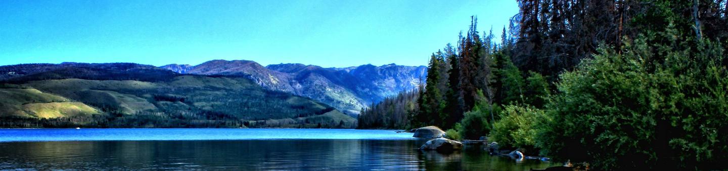
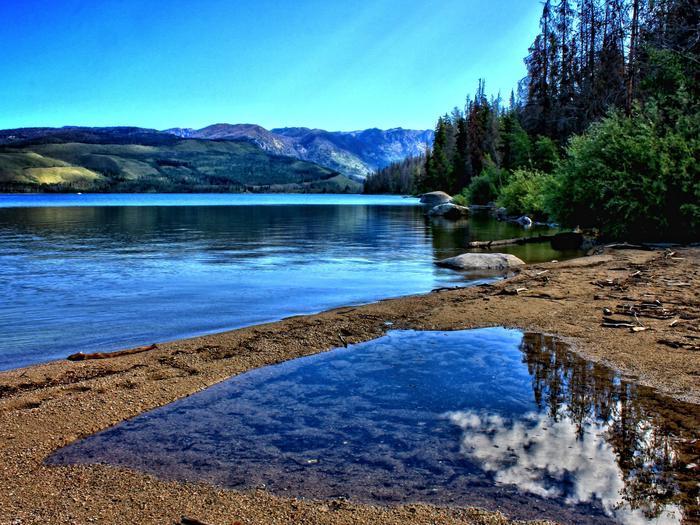
Fremont Lake Campground is located on the east shore of pristine Fremont Lake at an elevation of 7,400 feet, just 7 miles northeast of Pinedale, Wyoming, the nearest full-service community. Water sports and fishing are popular activities on the scenic lake.Recreation
The lake provides many recreational activities. Anglers enjoy fishing for lake, rainbow and brown trout, as well as kokanee salmon. Visitors also enjoy boating, sailing, canoeing, kayaking and swimming.Facilities
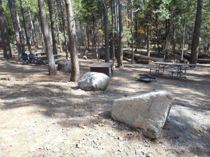
This campground offers 44 single sites, 4 double sites, and 1 group site that accomodates up to 50 people. During the peak season, two Campground Hosts are available for information and assistance. Picnic tables and fire rings with grills are provided, as are vault toilets and drinking water. A boat ramp and dock are on-site.Natural Features
Fremont Lake sits at the foot of the rugged Wind River Range, known for its craggy granite peaks and sparkling glacial lakes. The campground is situated on a forested hillside above the lake. Aspen, Douglas fir, juniper and a dense understory provide shade and privacy between campsites.Nearby Attractions
The Museum of the Mountain Man in Pinedale features a large collection of Rocky Mountain fur trade era artifacts. Exhibits include American Indian and Mountain Man displays, as well as history of the settlement of Sublette County, Wyoming.New Fork Lake Group Campground Campground
List of CampsitesOverview
Located just 24 miles north of Pinedale, New Fork Group Campground includes large picnic tables, BBQ stands, a fire ring, and a double vault toilet for your large party needs. Just a short hike away is New Fork Lake, which offers great boating, canoeing and swimming. Anglers fish for kokanee salmon, brook, lake and rainbow trout. A boat ramp is located approximately one mile from the group site. There is no drinking water available and proper food storage is required.Recreation
The 1,070-acre New Fork Lake offers great boating, canoeing and swimming. Anglers fish for kokanee salmon and brook, lake and rainbow trout. A large cement boat ramp is located a mile and a half from the campground, at the lake's northwestern shore.New Fork Trail, for hiking and horseback riding, begins at the entrance to the neighboring Narrows Campground (2.5 miles away). The trail provides back country access through New Fork Canyon into the Bridger Wilderness, and connects with several other trails. Horse corrals are located at the trailhead.
Facilities
The campground's large group site can accommodate up to 150 people, with picnic and serving tables, grills, two bear boxes for food storage, and a double vault toilet. Garbage service is located just outside of the group site on the main Forest Service road. Drinking water is not available.Natural Features
The group site lies in a grassy meadow surrounded by lodgepole pine trees, which provide only very limited shade. As there is no traditional defined parking area, the group site allows for informal camping, gatherings and family affairs.Nearby Attractions
Pinedale is 24 miles from the site and is the nearest full-service community.STATION CREEK CAMPGROUND Campground
List of CampsitesOverview
Station Creek Campground is located in beautiful Snake River Canyon, just 27 miles southwest of Jackson, in western Wyoming. It sits at an elevation of 5,800 feet. Visitors enjoy fishing and whitewater rafting on the Snake River.Recreation
Fly-fishing for cutthroat, rainbow and brown trout is a popular activity on the Snake, as is whitewater rafting and kayaking. A boat ramp is nearby.Facilities
The campground offers two group campsites that can accommodate up to 40 people each. The sites are equipped with picnic and serving tables, campfire circles, grills and food storage lockers. Vault toilets and drinking water are provided, but there is no electricity. Firewood can be purchased at the campground. Large parking areas within the facility are dirt.Natural Features
The campground is situated in a forest of lodgepole pines, which provide partial shade throughout the campground. Summer wildflowers are abundant in the area. The Snake River can be accessed across the road and down an embankment.Nearby Attractions
The city of Jackson is 25 miles north of the campground, offering restaurants, groceries, shops, galleries and ski resorts with summer activities.Grand Teton National Park is approximately 40 miles north, providing opportunities for boating, fishing, hiking, canoeing and outstanding mountain scenery.
LITTLE COTTONWOOD GROUP Campground
List of CampsitesOverview
Little Cottonwood Group Campground is located in beautiful Snake River Canyon, just 30 miles southwest of Jackson, in western Wyoming. It sits at an elevation of 5,700 feet. Visitors enjoy fishing and whitewater rafting on the adjacent Snake River.Recreation
Fly-fishing for cutthroat, rainbow and brown trout is a popular activity on the Snake, as is whitewater rafting and kayaking. A boat ramp is nearby.Facilities
The campground offers one group campsite that can accommodate up to 40 people. The site is equipped with picnic tables, a campfire circle and food storage lockers. Vault toilets, drinking water and trash collection are provided, but there is no electricity. The parking area within the campground is dirt.Natural Features
The campground is situated in a forest of pine and aspen trees, which provide partial shade. Summer wildflowers are abundant. The Snake River is below the campground, down the hillside.Nearby Attractions
The city of Jackson is about 25 miles north, offering restaurants, groceries, shops, galleries and ski resorts with summer activities.Grand Teton National Park is approximately 40 miles north of the campground. It provides opportunities for boating, fishing, hiking, canoeing and outstanding mountain scenery.
NARROWS CAMPGROUND Campground
List of CampsitesOverview
Narrows Campground is located next to scenic New Fork Lake, at the edge of the Wind River Range in northwestern Wyoming. Visitors enjoy hiking and horseback riding into the adjacent Bridger Wilderness, as well as boating and fishing on the lake.Recreation
New Fork Lake offers great boating, canoeing and swimming. Anglers fish for kokanee salmon, brook, lake and rainbow trout. A large cement boat ramp is located less than one mile from the campground.New Fork Trail, for hiking and horseback riding, begins at the campground entrance and provides back country access through New Fork Canyon into the Bridger Wilderness. The trail also connects with several other trails in the area. Horse corrals are located at the trailhead.
Facilities
The campground contains single-family campsites with picnic tables and campfire rings. Amenities include two vault toilets located at convenient locations and a campground host is located on-site. Roads and parking spurs throughout the campground are native soils.Natural Features
The campground is situated above New Fork Lake, in a dense grove of aspens, at an elevation of 7,800 feet. Shade is plentiful in most sites throughout the campground. Most sites afford scenic lake views. Summer wildflowers vividly carpet the campground. A variety of wildlife makes its home around the lake.Nearby Attractions
Pinedale is 26 miles away and is the nearest full-service community.SANDY BEACH PICNIC AREA Campground
List of CampsitesOverview
Sandy Beach Picnic Area is located on the southeast shores of pristine Fremont Lake at an elevation of 7,400 feet, just 3 miles northeast of Pinedale, Wyoming. Water sports and fishing are popular activities.Recreation
The lake offers countless recreational activities. Anglers enjoy fishing for rainbow, brown and lake trout, as well as kokanee salmon.Visitors also enjoy boating, sailing, canoeing, kayaking and swimming.
Facilities
This day-use area contains one group site that can accommodate up to 75 guests. Picnic tables, grills and a fire ring with benches are provided, as are vault toilets.A private, sandy swimming beach is on-site. A boat ramp and dock are available just outside the site. Roads and parking spurs are dirt.
Natural Features
Fremont Lake sits at the foot of the rugged Wind River Range, known for its craggy granite peaks and sparkling glacial lakes. Sandy Beach offers sweeping views of Fremont Lake, Wyoming's second largest natural lake. Thin stands of aspens line the site, providing limited shade.Nearby Attractions
The Museum of the Mountain Man in Pinedale features a large collection of Rocky Mountain fur trade era artifacts. Exhibits include American Indian and Mountain Man displays, as well as the history of the settlement of Sublette County, Wyoming.Green River Lakes - Bridger-Teton NF (WY) Campground
List of CampsitesOverview
Green River Lakes Campground is located near the shores of beautiful Lower Green River Lake, at an elevation of 8,000 feet. The lake sits on the western edge of the rugged Wind River Range in Wyoming. Visitors enjoy hiking and backpacking into the adjacent Bridger Wilderness, as well as fishing and canoeing on the lake.Recreation
The lake is open to small watercraft only, making it an excellent location for canoeing and kayaking. A primitive, carry-down boat launch is located at the lakeshore. Anglers fish for brook, cutthroat, rainbow and mackinaw trout. Hiking and horseback riding into the Bridger Wilderness and Wind River Range are popular activities enjoyed by visitors to the area. Trails in the area include the Continental Divide Trail, Highline Trail and Lakeside Trail. A trailhead parking area, horse corral and water trough are just outside the campground.Facilities
The campground contains three large-group campsites with picnic tables, food storage locker, campfire circles and grills. Sites A and B can accommodate up to 35 people each, and site C can accommodate up to 50 people. Vault toilets and drinking water are available. A campground host is located on-site. Roads and parking spurs within the campground are dirt. Parking for the group sites are not designed for large RVs or trailers.
36 additional single sites are available within the campground, they are first come/first served. No reservations.
Natural Features
Square Top Mountain towers over scenic Green River Lakes. This unique peak is part of the Wind River Range and tops out at an elevation of 11,581 feet. Most campsites afford scenic views of the peak and the lake below. Lodgepole pines dot the campground, offering very limited shade. Wildlife and summer wildflowers are abundant in the area.Nearby Attractions
Pinedale is the nearest full service community, and is located 50 miles south of the campground.ALLRED FLATS GROUP PICNIC SITE Campground
List of CampsitesOverview
Allred Flats Group Picnic Site is located below Salt River Pass in the lush forests of western Wyoming. Visitors enjoy exploring local trails on foot, horseback or by off-road vehicle, where allowed.Recreation
Numerous hiking, mountain biking and horseback riding trails are in the area, ranging from easy 1/2-mile paths to challenging 14-mile trails in the backcountry. Free trail maps can be found at the District Office.Facilities
This group picnic site, located only 1/2-mile off the main highway, can accommodate up to 50 guests and 10 vehicles. Vault toilets and drinking water are provided.The site offers several large picnic tables, a fire ring with benches and a grill. Roads and parking spurs within the site are gravel.
Natural Features
Little White Creek runs alongside the Allred Flats at an elevation of 6,500 feet, where pines and aspens offer partial shade. Summer wildflowers are abundant and fall colors are breathtaking in the area.The Bridger-Teton National Forest offers more than 3.4 million acres of public land for outdoor recreation. With its pristine watersheds, abundant wildlife and immense wildlands, the forest comprises a large part of the Greater Yellowstone Ecosystem, the largest intact ecosystem in the lower 48 United States.
Nearby Attractions
Salt River Pass offers miles of scenic driving with access onto Smiths Fork Road (#10072), and expansive views of the Wyoming and Salt River Ranges.Fishing Salt Creek just across the highway is popular.
COTTONWOOD GROUP PICNIC SITE Campground
List of CampsitesOverview
Cottonwood Group Picnic Site is located next to scenic Cottonwood Lake on the Salt River Mountains, surrounded by the forests of western Wyoming.Recreation
The lake offers great canoeing and boating for smaller craft, as well as fishing for brook and cutthroat trout.Hiking, mountain biking, off-road vehicle and horseback riding trails are in the area.
Facilities
This day-use picnic site can accommodate up to 25 guests and 8-10 vehicles. Vault toilets and drinking water are provided.
A group overnight campsite is available for reservations here.
Natural Features
The picnic site is located above Cottonwood Lake, near the peaceful North Fork Creek. A forest of pines and aspens offers shade, and vibrant summer wildflowers are abundant.The Bridger-Teton National Forest offers more than 3.4 million acres of public land for outdoor recreation. With its pristine watersheds, abundant wildlife and immense wildlands, the forest comprises a large part of the Greater Yellowstone Ecosystem, the largest intact ecosystem in the lower 48 United States.
COTTONWOOD GROUP CAMPSITE Campground
List of CampsitesOverview
Cottonwood Group Campsite is located near the scenic Cottonwood Lake below Salt River Pass in the forest of western Wyoming.Recreation
The lake offers great canoeing and boating for smaller craft and fishing for brook and cutthroat trout. Hiking, mountain biking and horseback riding trails are in the area, as well as a motorized route for trail vehicles <50". The west loop of the campground includes horse corrals. The east side, where the group site is located, includes the motorized trail head, so trail vehicles are allowed passage.Facilities
This group campsite can accommodate up to 25 guests and is most appropriate for groups camping in tents. Two vehicles can be parked at the site (van-sized vehicles are the largest the site will accommodate) and six additional vehicles can be parked at the adjacent Cottonwood Lake Day Use Area. Single-family sites are available on a first-come, first-served basis.Vault toilets and drinking water are provided.
Natural Features
Peaceful North Fork Creek flows through the campground. Its banks and the surrounding canyon are forested by dense stands of pines and aspens, which offer excellent shade and privacy. Vibrant summer wildflowers are abundant.MEADOWS CABIN Campground
List of CampsitesOverview
The historic Meadows Guard Station is a quiet hideaway beneath tall pines, where deer graze in the open meadow pasture nearby. Located 29 miles from Alpine, the cabin allows horses and provides corrals.Built in 1933 by the Civilian Conservation Corps (CCC), the cabin presents a year-round backcountry playground for activities like horseback riding, fishing, off-road vehicle riding and snowmobiling. From Memorial Day through Labor Day, guests have the convenience of a shower and flush toilet. Horse corrals are available, but horses cannot be turned out into the pasture.
Recreation
Greys River is nearby, offering pleasing fishing opportunities. Hiking, off-road vehicle riding, horseback riding and mountain biking are popular summer activities. Snowmobiling and cross-country skiing are excellent winter activities.Facilities
The rustic two-room guard station sleeps six people on three sets of bunkbeds with mattresses. Parking accommodates a maximum of one RV or trailer. The cabin has running water, a flush toilet and shower, but these are only available from approximately Memorial Day to Labor Day.No electricity is available, but a propane refrigerator, lights and cooktop are provided along with a wood stove for heat. The kitchen also has a sink and a table with chairs.
Water is only available from late May to early September. Outside these dates, guests must bring their own drinking water.
Cooking and eating utensils are not provided. Other recommended items to bring include food, bedding, flashlights, toilet paper, garbage bags, dish soap and cleaning products like bleach or disinfectant.
Do not use the adjacent pasture for personal horses.
Natural Features
The cabin sits in a shady, wooded area in the valley of Greys River. Meadow Creek runs beside the cabin.Moose, elk, eagles, and sandhill cranes are among the wildlife likely to be seen. An abundance of wildflowers color the landscape in summer.
The Bridger-Teton National Forest offers more than 3.4 million acres of public lands for outdoor recreation. With its pristine watersheds, abundant wildlife and immense wildlands, the forest comprises a large part of the Greater Yellowstone Ecosystem, the largest intact ecosystem in the lower 48 United States.
Nearby Attractions
The nearest grocery store is in Alpine, about 29 miles north of the cabin.MCCAIN CABIN Campground
List of CampsitesOverview
McCain Guard Station is a rustic cabin that is popular year-round. In summer, hikers and horseback riders frequent the cabin, and snowmobile enthusiasts make use of the cabin throughout the winter. Several trails are nearby, and the open meadows offer gentle sledding for younger riders. Winter access in by snowmobile only on a groomed trail.
Constructed in 1933 by the Civilian Conservation Corps (CCC), the cabin welcomes guests to experience the rustic getaway with impressive scenery.
Recreation
Numerous creeks and the Little Greys River meander through the area, offering fishing opportunities. Hiking, biking, horseback riding and off-road vehicle trails are also in the vicinity. This includes Big Springs Trail and the 9-mile Bailey Creek Trail along a portion of the designated Wild and Scenic Snake River Headwaters. Motorbikes are allowed on nearby Telephone Pass trail from 7/1-9/10.Facilities
The nonelectric two-room dwelling fits six overnight guests and no additional guests may camp outside. A vault toilet, picnic table and fire ring are located outside behind the cabin.
Bunkbeds with mattresses are provided. The kitchen has basic amenities including a propane cook top, propane lighting and a table and chairs. A woodstove and propane heater are also provided, with firewood stacked for winter.
No water is available, and dishes, pots, pans and utensils are not provided. Recommended items to bring include drinking water, garbage bags, dish soap, dish towels, toilet paper, a flashlight, sleeping bags and pillows and cleaning products such as bleach or disinfectant.
Natural Features
Nestled in a mountain valley at 6,900 feet in elevation, the cabin is perched near a creek that flows into Little Greys River. Pines line the hillsides, but no trees are near enough to offer natural shade to the cabin complex. Deer, moose, elk, eagles and sandhill cranes are among the wildlife likely to be seen. An abundance of wildflowers color the landscape in summer. The Bridger-Teton National Forest offers more than 3.4 million acres of public lands for outdoor recreation. With its pristine watersheds, abundant wildlife and immense wildlands, the forest comprises a large part of the Greater Yellowstone Ecosystem, the largest intact ecosystem in the lower 48 states.Nearby Attractions
The cabin is 23 miles from Alpine, where the nearest grocery store, gas station and restaurant are located. Due to gravel mountain roads, this drive takes over an hour.DEER CREEK CABIN (WY) Campground
List of CampsitesOverview
Deer Creek Cabin is a historic Forest Service guard station located 13 miles from Alpine, Wyoming. The quaint, rustic structure offers a backcountry experience with conveniences like a propane stove and a heater. The cabin compound is a free graze area for Forest Service horses to roam during the summer months.Winter access is by snowmobile only on a groomed trail.
Recreation
Greys River flows just across the road from the cabin, offering prime fishing opportunities. Hiking, biking, horseback riding and off-road vehicle trails begin nearby.Facilities
The two-room cabin sleeps six guests. Propane heating and lights are provided. Indoor plumbing is available during the summer months only, from around mid-June through Labor Day weekend. A vault toilet is available next to the cabin for colder months. A picnic table and campfire ring sit next to the cabin. A flush toilet, shower, and sink with drinking water are offered inside the cabin from approximately mid-June to Labor Day. Furnishings include a sink, propane cooktop, propane refrigerator, a table and chairs and three bunkbeds with mattresses. A wood stove and a propane heater are both available. Cooking and eating utensils are not provided. Recommended items to bring include bedding, dishes, pots and pans, utensils, garbage bags, dish soap, dish towels, toilet paper, a flashlight and cleaning products such as bleach or disinfectant.Natural Features
Lodgepole pine trees cover the complex, offering partial shade. Scenic views of the Bridger-Teton National Forest abound.Nearby Attractions
The closest town for groceries is in Alpine, just 13 miles away.CAZIER CABIN Campground
List of CampsitesOverview
Cazier Cabin is a historic Forest Service guard station built by the Civilian Conservation Corps in 1933. Located near the Greys River about 46 miles from Alpine, Wyoming, the cabin offers fishing, hiking, horseback riding, mountain biking and cross-country skiing opportunities. In winter, access is by snowmobile on a groomed trail.
Recreation
The Corral Creek Trail is easily accessed from the cabin and connects to Corral Creek Lake and the Swift, Dry and Cottonwood Creek drainages on the west side of the range. Popular activities include hiking, mountain biking, horseback riding and off-road vehicle riding on designated routes. In winter, cross country skiing is available right out the front door of the cabin. Greys River offers trout fishing.Facilities
This rustic two-room guard station sleeps eight people on four bunkbeds with mattresses. Five additional guests may camp just outside the cabin.Drinking water, flush toilet and showers are available approximately mid-June to Labor Day. In winter, an outdoor vault toilet must be used.
The cabin has a wood stove for heat. The kitchen comes with basic amenities including a sink, propane range top, propane refrigerator, a dining table and chairs.
Cooking utensils and pots are not provided. Recommended items to bring include dishes, pots and pans, utensils, garbage bags, dish soap, dish rags, toilet paper, a flashlight, sleeping bags, pillows and cleaning products, such as bleach or disinfectant. In winter, guests must also bring drinking water.
Natural Features
The cabin sits in the valley of Greys River near Corral Creek at an elevation of 7,600 feet, and offers spectacular views up the Corral Creek drainage. The cabin sits in an open space with a few tall trees. A pine forest sweeps up the nearby mountain slopes.Nearby Attractions
The cabin is rather remote. The closest town for groceries is in Alpine, a 46-mile drive north on a low-speed gravel road.SNYDER GUARD STATION (WY) Campground
List of CampsitesOverview
Snyder Guard Station is located in beautiful Snyder Basin, 22 miles west of Big Piney, Wyoming. The cabin makes an excellent destination for outdoor enthusiasts looking to hike, mountain bike, horseback ride or fish. Photographers are enchanted by the region's landscape and opportunities for wildlife watching.Open year-round, the cabin provides a horse corral for equestrian campers and allows pets as well. Winter access is by snowmobile, snowshoes or cross-country skis on a 10-mile trail.
Recreation
The Wyoming Range National Recreation Trail can be accessed nearby within the basin, offering exciting hiking, mountain biking and horseback riding opportunities. Nearby streams provide trout fishing.In winter months, nearly 100 miles of snowmobile trails are open for exploring. Cross-country skiing and snowshoeing are other popular cold weather activities.
Facilities
The rustic log cabin sleeps four people and has propane heat and propane lights. A wood burning stove was installed in 2018 to help with the heat. A vault toilet is located outside next to the building. Two bunk beds with mattresses are provided, as well as two dressers, a cabinet, and two chairs. The kitchen is equipped with a propane cook stove, a variety of cookware and utensils, a table with four chairs, a refrigerator and a sink. No electricity is available, guests must bring their own supply of water for drinking and cooking. Recommended items to bring include food, bedding, matches, dish soap, dish rags, toilet paper, garbage bags and a flashlight. Click here for more cabin details.Natural Features
The cabin sits in a grassy meadow surrounded by pine trees at an elevation of 8,000 feet. The cabin compound provides views of picturesque peaks including Riley Ridge.Moose, elk, eagles and sandhill cranes are among the wildlife likely to be seen. An abundance of wildflowers color the landscape in summer.
The Bridger-Teton National Forest offers more than 3.4 million acres of public lands for outdoor recreation. With its pristine watersheds, abundant wildlife and immense wildlands, the forest comprises a large part of the Greater Yellowstone Ecosystem, the largest intact ecosystem in the lower 48.
Nearby Attractions
Wyoming Peak is located close by for those that like to hike. Middle Piney Lake, North Piney Lake are great fishing sites along with many near-by creeks. .HOBACK GUARD STATION Campground
List of CampsitesOverview
Water & Power are NOT GUARANTEED, Hoback Guard Station was built in 1935 by the CCC to be used as a working Ranger Station, and is considered eligible to the National Register of Historic Places. About 34 miles from Jackson, Wyoming, This guard station beckons guests who want a scenic backcountry experience with the convenience of electricity and running water and great mountain scenery. Water is NOT available until Mid June-Mid Sept due to freezing temps
Recreation
Hiking, biking and horseback riding trails crisscross the surrounding mountains, leading visitors to impressive scenery like Cliff Creek Falls. 15 miles up the road is the beautiful Snake River Canyon where you can fish, raft, kayak, cliff climb, or just enjoy the breathtaking scenery. Granite Hot Springs is a natural hot springs pool that sits 10 miles back in the Bridger-Teton Forest.Facilities
There is NO GUARANTEE of water or electricity or cookware.
The log cabin is electric and can accommodate six guests. Drinking water, a flush toilet and shower are available Mid June - Mid- Sept. The kitchen is equipped with an electric stove, a variety of cookware, a table with four chairs, a refrigerator and a sink. The bedroom has three bunkbeds with mattresses and a dresser. A campfire ring with grill is located outside.
No linens or bedding are included. Guests should bring food, bedding or sleeping bags, towels, soap and garbage bags.
Pets and livestock are allowed at the guard station. Livestock may be kept in the corral behind the bunkhouse.
Natural Features
Willows and pines provide sparse shade, and grasses and summer wildflowers are abundant. A creek runs alongside the guard station, which sits at an elevation of 6,600 feet. Plenty of wildlife to see amongst the beautiful view.Nearby Attractions
Popular Jackson, Wyoming is 20 miles away, with restaurants, groceries, galleries, and ski resorts with both winter and summer activities. Grand Teton National Park is just beyond Jackson, with hiking, fishing, boating, canoeing, kayaking and breathtaking scenery. Yellowstone National Park is less then 1.5 hours away.SCALER GUARD STATION Campground
List of CampsitesOverview
Historic Scaler Guard Station, located 78 miles north of Kemmerer, Wyoming, provides an excellent hideaway for cabin camping enthusiasts. The cabin allows pets and horses. Hiking, biking, and horseback riding trails are in the vicinity.Constructed by the Civilian Conservation Corps, the former ranger guard station dates back to 1937.
Recreation
The nearby Absaroka Ridge Trailhead leads hikers and horseback riders along Fontenelle Creek, and provides access into Pomeroy Basin. This trail also attracts big game hunters. Other trails throughout the LaBarge Creek area are ideal for mountain bikers and horse travel.Facilities
The three-room guard station is a traditional 1930s-era forest cabin that sleeps six guests on three bunkbeds with mattresses. A picnic table and campfire ring are located outside in front of the cabin.
There is no running water available at this cabin. The cabin is equipped with a propane stove and oven, a propane refrigerator, lights and a wood stove. A vault toilet is located behind the structure. Some dishes, pots, pans and utensils are provided, however the presence of these items is not guaranteed.
No electricity, linens or bedding are provided. In winter, no drinking water is available, so guests should bring plenty for drinking and cooking. Recommended items to bring include dish soap, dish towerls, toilet paper, gargbag bags and a flashlight. If firewood is on site, this is a courtesy but is not guarenteed. If wood is available, please use only what you need. Always be prepared to collect wood locally or bering to site from local resources.
Natural Features
Sagebrush and grasses cover the area behind the cabin. A few pines are dispersed in the vicinity, but shade by the cabin is limited.Moose, elk, eagles and sandhill cranes are among the wildlife likely to be seen. An abundance of wildflowers color the landscape in summer.
The Bridger-Teton National Forest offers more than 3.4 million acres of public lands for outdoor recreation. With its pristine watersheds, abundant wildlife and immense wildlands, the forest comprises a large part of the Greater Yellowstone Ecosystem, the largest intact ecosystem in the lower 48 states.
KELLEY GUARD STATION Campground
List of CampsitesOverview
Kelley Guard Station is a historic Forest Service guard station built by the Civilian Conservation Corps in 1933. Located about 45 miles north of Kemmerer, Wyoming, along the Big Springs Scenic Backway, the cabin attracts overnight guests year-round and provides convenient access to hiking, mountain biking, cross country skiing and snowshoeing.Big Springs Scenic Backway is a 68-mile road that boasts magnificent mountain views, wildflowers covered meadows and river valleys where grazing sheep may be spotted.
Recreation
Hiking, mountain biking, horseback riding, fishing and off-road vehicle riding are popular summer activities in the surrounding area. Snowmobiling and cross country skiing can be done right out the front door in winter.Facilities
This rustic two-room cabin sleeps four people on two bunkbeds with mattresses. The kitchen is equipped with a propane stove, refrigerator that is shut off when not in use, propane lights and a small wood stove for heat. A picnic table and campfire ring are located outside the cabin.
Water is not available at this time. Guests should bring water for drinking and cooking. Outside vault toilet avalible year round with seasonal water faucet located outside. Some dishes, pots, pans and utensils are provided, however the presence of these items is not guaranteed.
No linens or bedding are provided. Recommended items to bring include food, bedding, dish soap, dish rags, toilet paper, garbage bags and a flashlight. If firewood is on site, this is a courtesy but is not guarenteed. If wood is available, please only use what you need. Always be prepared to collect locally or bring to site from local resources.
Natural Features
The cabin is perched on a grassy space surrounded by a stand of mixed conifers at 8,200 feet in elevation. Kelley Creek flows beside the guard station, offering a serene soundtrack of flowing water.Moose, elk, eagles and sandhill cranes are among the wildlife likely to be seen. An abundance of wildflowers color the landscape in summer.
The Bridger-Teton National Forest offers more than 3.4 million acres of public land for outdoor recreation. With its pristine watersheds, abundant wildlife and immense wildlands, the forest comprises a large part of the Greater Yellowstone Ecosystem, the largest intact ecosystem in the lower 48 states.
LA BARGE GUARD STATION Campground
List of CampsitesOverview
Historic La Barge Guard Station is located 87 miles north of Kemmerer, Wyoming in the Hams Fork Area of Bridger-Teton National Forest. The cabin is situated in beautiful La Barge Meadow, among vibrant summer wildflowers at the base of pine-covered Commissary Ridge.Constructed in 1933 by the Civilian Conservation Corps (CCC), the rustic cabin welcomes guests for sightseeing, hiking, fishing and more. Pets and horses are allowed at the cabin.
Recreation
Hiking, mountain biking and horseback riding are popular summer activities in the surrounding area. The Wagner Pass Trail begins behind the cabin, offering scenic hiking as it follows the Lander Cutoff Historical Trail. Snowmobiling and cross country skiing can be done right out the front door in winter.La Barge Creek offers pleasant trout fishing opportunities.
Facilities
The guard station is a basic, 1930s style CCC cabin with two rooms. It sleeps six people on three bunkbeds with mattresses. The cabin is available year-round. The cabin is equipped with a propane oven, refrigerator, lights and a wood stove. Water is not guaranteed and if water is on, indoor plumbing is still not available. A vault toilet is located behind the cabin. Some dishes, pots, pans and utensils are provided, but the presence of these items is not guaranteed.
No electricity, linens or bedding are provided. In winter, no drinking water is available, so guests should bring plenty for drinking and cooking. Recommended items to bring include dish soap, dish towels, toilet paper, garbage bags and a flashlight. If firewood is on site, this is a courtesy but is not guarenteed. If available, please use only what you need. Always be prepared to collect wood locally or bring to site from local resources.
Natural Features
The cabin sits near La Barge Creek in a grassy meadow at about 8,500 feet in elevation. Pine trees dot the land around the cabin and cover the surrounding hillsides.Moose, elk, eagles and sandhill cranes are among the wildlife likely to be seen. An abundance of wildflowers color the landscape in summer.
The Bridger-Teton National Forest offers more than 3.4 million acres of public land for outdoor recreation. With its pristine watersheds, abundant wildlife and immense wildlands, the forest comprises a large part of the Greater Yellowstone Ecosystem, the largest intact ecosystem in the lower 48 states.
HALF MOON LAKE CAMPGROUND Campground
List of CampsitesOverview
Half Moon Lake campground is situated just off the northeast shore of Half Moon Lake at an elevation of 7,600 feet in the Bridger-Teton National Forest, Wyoming.Recreation
This lake provides many recreational activities. Anglers enjoy fishing for rainbow trout, brown trout, lake trout and other various species of fish native to the area. Visitors also enjoy water sports such as boating, swimming, canoeing and paddle boarding. Two miles down the gravel road is an excellent hiking trail for users of all abilities.Facilities
This campground offers 17 sites; three of these provide direct lake access. Each site is well screened by willows and equipped with a picnic table and a fire ring. There are two vault toilets within the campground. Approximately 1/2 mile down the main road is the boat launch site, with a dock and additional vault toilets. No drinking water is available. Proper food storage is required.
Natural Features
Half Moon Lake was created by glacial movements and is now surrounded by the foot hills of the Wind River Mountains. Along the lakeshore and the hillsides you will find lodgepole pine, Douglas-fir and aspen stands interspersed with sagebrush and rocky outcroppings.Nearby Attractions
The Museum of the Mountain Man, located in Pinedale, features a large collection of Rocky Mountain fur trade artifacts, Native American displays, as well as history of the settlement of Sublette County. In July look for the annual Green River Rendezvous. For more information please see the Sublette County Chamber of Commerce or pinedaleonline.com.Cottonwood/Fish Creek Areas Facility
This area offers approximately 5 miles of trails open to Off-Highway Vehicles (OHV) less than 50 inch width. Trail #4202 follows the scenic Cottonwood Creek drainage providing hunting access, in the fall to the Upper Cottonwood, Sohare, and Dog Creek drainages. Trail #4203 traverses a high ridge and accesses the Upper Fish Creek Area. Other forms of non-motorized recreation allowed are, hiking, mountain biking, horseback riding, and hunting (seasonally).[Caution: the Cottonwood and Upper Fish Creek areas are located in Grizzly Bear country]
Astoria Boating Site Facility
Astoria Boat Ramp is the first boat ramp south of Hoback Junction that is available for boat launching. This boat ramp is primitive in design and is primarily used by visitors looking for scenic floating and fishing opportunities. It is generally a quieter boat ramp and provides a great option for putting in on the scenic stretch of the Snake River.
North Fork Fall Creek Area Facility
The North Fork Fall Creek Area has 7 miles of designated FS roads, is located approximately 11 miles south of the town of Wilson, Wy, and is accessed by the Fall Creek Road (Rd #31000).
Elbow Boating Site Facility
Elbow boat ramp is one of several boat ramps that you can use to launch your boat onto the scenic section of the Snake River. The boat ramp area hosts a walk-in area for carrying in/out your boat, or a drive-in launch boat ramp that was recently constructed in 2008 and funded by the Snake River Fund and visitor donations.
The drive-in boat ramp can become very busy once the water clears up and fishing season kicks into gear. If you are using this boat ramp for launching or taking off the river, make sure to be courteous to your fellow river users. If launching, rig your boat away from the ramp first or drop off your boat to the side of the ramp and then move your vehicle to the parking area before continuing to ready your boat. If taking out, load your boat quickly and then pull away to the parking lot to finish de-rigging your boat so that others have access to the ramp area. A little courtesy can go a long way to creating positive experiences for all visitors to the river.
East Table Boating Site Facility
East Table boat ramp is a quiet boat ramp that receives less use than West Table. No trailers are allowed at East Table boat ramp. If you are not planning on using a trailer for your boat, East Table is a great place to launch because it is quiet and located just a few minutes from West Table boat launch. Your group would be able to take your time getting ready without the pressure of many visitors waiting their turn to get on the river behind you. The no trailer rule is strictly enforced in order to ensure this option remains viable.
Blackrock Ranger Station Facility
The Blackrock Ranger Station is located 8 miles East of Moran Junction on Highway 26/287. The office is open Monday thru Friday from 8 a.m. until 4:30 p.m. Maps and Forest information are available at the front desk. An outdoor restroom is available for visitors. Phone number is 307-543-3900.
Interagency Visitor Center Facility
The Jackson Hole and Greater Yellowstone Visitor Center is located on the southwest corner of the National Elk Refuge at 532 N. Cache Street in Jackson.
Visitors should stop at the interagency visitor center on e north end of Jackson hole as they plan their adventures on the Bridger teton national forest. This center offers a beautiful display about the elk that visit the National Elk Refuge and a host of information about the other large animals that frequent the valley. A touch table for children, a mock bear den and an informative video about the greater Yellowstone area makes this a family friendly stop. Visitors can rent bear resistant food tubes and bear panniers at the visitor center before heading out into the Forest.
You can also visit the visitor center's website to see what services they offer.
Big Piney Ranger District Facility
The Big Piney Ranger District hosts a wide variety of cultural and natural history, recreational opportunities, timber, range, mineral reserves, and wildlife. It contains 449,000 acres of snow-capped mountain peaks, lush vegetation and clear mountain lakes and streams. The district maintains 300 miles of system trails, 25 permitted summer and fall outfitters, 11 summer homes and one developed campground.
10418 South US Highway 189
P.O. Box 218
Big Piney, WY 83113
307-276-5800
Fax 307-276-5203
Office hours: 8:00 am - 4:30 pm Monday through Friday
Greys River Ranger District Facility
- Greys River Ranger District Current Conditions page
- Alpine Area Trails Project funded by Wyoming State Trails RTP Grant
Office hours: 8:00 am - 4:30 pm Monday through Friday
Greys River Ranger District
671 North Washington St.
Afton, WY 83110
307-886-5300
Fax: 307-886-5339
Jackson Ranger District Facility
The Jackson Ranger District offers an incredible abundance of recreation areas and activities to choose from for all visitors. From internationally recognized skiing to world-famous fishing to wildlife watching, the variety is endless. The District contains the Gros Ventre Wilderness, hundreds of miles of Wild and Scenic Rivers including the famous Snake River, and many more areas that are all amazing. Because of the large variety and expanse of options, we have tried to make it easier for you to find and choose a place to recreate by breaking the Jackson Ranger District down into ten different areas, each providing more detailed information about specific trailheads, river access, camping and more. Click on any of these ten general areas listed below and then search through the activities listed on the Area's webpage to learn more. For a map of these ten recreation areas on the Jackson Ranger District click here.
NEW: Teton Division Over Snow Vehicle Use Map 2016
Cache Creek and Greater Snow King Area
Fall Creek/Munger Mountain Area
Shadow Mountain/Ditch Creek Area
>Hoback River Area (includes Granite Creek)
Snake River Range (includes Palisades Wilderness Study Area)
Jackson Ranger District
25 Rosencrans Lane
P.O. Box 1689
Jackson, WY 83001
307-739-5400
Fax: 307-739-5450
Kemmerer Ranger District Facility
WINTER CONDITIONS: Winter Wildlife Closure dates and Winter Closure Area Maps
Kemmerer Ranger District
308 Hwy 189 North
Kemmerer, WY 83101
307-828-5100Fax 307-828-5135
District Ranger: Adriene Holcomb
Pinedale Ranger District Facility
- Bridger Wilderness Area Information
- Pinedale Ranger District Outfitter & Guides
- Pinedale "Things to See and Do"
Monument Ridge Trailhead Facility
The Monument Ridge Trailhead is right off Highway 189/191 just south of the Hoback Guard Station. From the Trailhead users can hike to the Monument Ridge Lookout or connect with the Little Cliff Creek Trail.
Fall Creek/Munger Mountain Area Facility
The Fall Creek/Munger Mountain area offers recreational opportunities for Hiking, Horseback riding, mountain biking, and OHV riding.
For general summer recreation information regarding the Munger Mountain area, click here.
Palisades Wilderness Study Area Facility
The Palisades Wilderness Study Area offers miles of trails for hiking and horseback riding for someone who wishes to get off the beaten path where you will see few other people along the way.
Wyoming Range Area Facility
The Wyoming Range offers various opportunities to recreate in the great outdoors.
Lunch Counter/Kahuna Overlook Facility
The Lunch Counter/Kahuna Overlook day use area provides parking for those who wish to watch and photograph river floaters going through the famous Lunch Counter and Big Kahuna rapids, as well as direct river access for boating, fishing, and wildlife viewing. It is located in the Snake River Canyon, off of Highway 89 south of Hoback Junction. Three trails leave from the parking area.
- The first provides direct river access just above the Kahuna rapid.
- The second is a paved, wheel chair accessible trail that winds down to an overlook of the rapid, a great place to watch surfers and rafters, as well as a great view of the river and canyon.
- The third and longest trail winds down to just above the Lunch Counter rapids, and is a beautiful place to enjoy the river.
Facilities include one bathroom and several kiosks with area information. No potable water is available on site. This is a day use area only but dispersed and fee campgrounds are available nearby. NO trailers are allowed at this site due to confined parking. Cellular service is not available.
Hatchet/Flagstaff Area Facility
Stay tuned...more information to come.
Buffalo Valley Area Facility
Stay tuned...more information to come.
Wilderness Areas Facility
For information about Wilderness on the Bridger-Teton National Forest, click here!
Teton Wilderness Facility


The Teton Wilderness borders the south end of Yellowstone National Park providing a huge area of land to explore to the adventurous of spirit. While the Teton Wilderness provides critical habitat to many wildlife species, it also offers 450 miles of trails which allow access to a large variety of hunting and fishing opportunities. Home to the famous Two Ocean Creek which splits along the Continental Divide and flows to both the Atlantic and Pacific Oceans, the Wilderness hosts the headwaters of several Wild and Scenic Rivers.
For information on specific activities such as hiking and horseback riding, see the list of "Activities" below, which provides links to detailed trail information. The Teton Wilderness has some specific requirements in regards to group size and permits may be required. Make sure to check our permits section for this information. In addition, bear food storage is required throughout the north zone of the Bridger-Teton National Forest, which includes the Teton Wilderness.
For all things Wilderness including broader information about the Teton Wilderness, check out www.wilderness.net.
Bridger Wilderness Facility


The Bridger Wilderness rests within the Wind River Mountains and extends 80 miles along the Continental Divide, holding the headwaters of the Green River. Home to 7 out of 10 of the world's largest glaciers, the landscape is continuously breathtaking with hundreds of high alpine lakes, glacial cirques and wide sweeping valleys. The highest point in Wyoming, Gannett Peak rests on the shared boundary with Fitzpatrick Wilderness offering mountaineers a great and memorable challenge. With elevations ranging above 13,000 feet, winter weather is always just a breath away, the combination of elevation and potential cold working together to create a truly wild feeling throughout the Wilderness. 600 miles of trails await hikers and horseback riders who wish to temporarily lose themselves in this landscape of granite and endless hidden gems of lakes and creeks.
For information on specific activities such as hiking and horseback riding, see the list of "Activities" below, which provides links to detailed trail information. The Bridger Wilderness has some specific requirements in regards to group size and permits may be required. Make sure to check our permits section for this information. In addition, bear food storage is mandatory on the Pinedale Ranger District north of Boulder Creek within and outside of the Bridger Wilderness and is highly recommended throughout the rest of the Pinedale Ranger District. While visiting the Bridger Wilderness, you may cross over onto the Shoshone National Forest. Be aware of changing regulations when you cross over the Continental Divide into the Shoshone National Forest.
For all things Wilderness including broader information about the Bridger Wilderness, check out www.wilderness.net.
Dispersed Camping Areas (Undeveloped Campground) Campground
List of CampsitesDispersed Camping (Undeveloped Camping)
The Forest Service uses the term "Dispersed Camping" to mean that visitors to the Forest are camping outside of a developed campground facility. This means that visitors are simply finding a place in the forest where they can drive to in order to camp for free where no development other than a road exists.
General
- Camping (Tent, Car, or RV camping) anywhere in the National Forest OUTSIDE of a designated campground. In undeveloped areas of the forest, there are no services (such as potable water and trash removal) and generally no facilities (such as tables and restrooms.)
- Stay limits on the Bridger-Teton National Forest are generally 16 days with the exception of the Jackson Ranger District and Moran area.
- After 16 days you must move 5 road miles from your original campsite. After an additional 7 days, you my return to your original campsite if desired.
Jackson and Moran Area Dispersed Camping
- A 5 day stay limit is in effect from May 1st through Labor Day on the Jackson Ranger District and within certain areas of the Blackrock Ranger District. Special Order 04-04-317
- After 5 days, you must move to another Ranger District to camp. You may only return to the Jackson Ranger District after 30 days.
- A map showing the restricted areas can be found here.
- Due to over use and high impacts, certain areas in the Jackson Hole Valley have had designated sites numbered for use. This is to help lessen the amount of impact on the resource.
- These sites are: (maps included)
How to Pick a Campsite/ Camping Etiquette
- Be respectful of natural setting. Minimize your impact by using established camps, camp on hard surfaces, avoid being directly next to water, and leave the site better than you found it.
- Be respectful of other campers, keep a decent distance from other campers when possible.
Be Bear Aware
- Food Storage Order is in effect from March 1 through December 1 (order can be extended.) In most of the Pinedale, Blackrock, Grey’s River, and Jackson Ranger Districts.
- All food, attractants, and refuse must be acceptably stored or acceptably possessed during daytime hours.
- Bear Canisters (certified and properly used)
- Within Secured vehicles and hard sided trailers (no open top jeeps/ pickup beds)
- Properly Hung from trees/ poles (10ft up off the ground and 4ft from vertical pole)
Greys River Corridor Facility
The Greys River Corridor encompasses the area surrounding the Greys River itself and the Greys River Road, and offers numerous opportunities for fishing, kayaking, camping, hiking, OHV riding and horseback riding. The Greys River Road is one of the most popular forest roads on the Bridger-Teton National Forest, running for almost 60 miles from Alpine south to Tri Basin Divide. The Greys River Corridor provides access to several trails in the Wyoming and Salt River Ranges. All campgrounds in the Greys River Corridor have a 16 day stay limit, and those with water and toilets are $10 per night (those without services are free of charge). No reservations are accepted for any of the campgrounds. The main season of use is between Memorial Day and Labor Day.
Smith Fork Area Facility
The Smith Fork Area of the Greys River Ranger District offers 27 miles of scenic driving and recreation opportunities. A multitude of dispersed camping is available throughout the area with a stay limit of 16 days. Take a drive along Tri Basin Divide, a point between the headwaters of La Barge Creek and the Greys River where a drop of water may flow into one of three watershed basins: The Colorado River basin, the Columbia River Basin, or the Great Basin.
Hoback Area Facility
Just 13 miles south the city of Jackson, WY.
Hams Fork Area Facility
Known for its river and great fishing opportunities, the Hams Fork area is a marvelous place to enjoy some of Wyoming’s great landscape.
Old Togwotee Hwy/Four Mile Road Facility
Stay tuned...more information to come.
Wyoming Centennial Scenic Byway Facility
The Wyoming Centennial Scenic Byway traverses one hundred and sixty two miles through what National Geographic refers to as “one of the finest drives in the Rockies.” The Byway spans two National Forests, a National Park, US Fish and Wildlife lands, Bureau of Land Management lands, three Wyoming counties, as well as historic, recreation and scenic areas. It includes several major visitor centers, numerous visitor contact locations, traces four river corridors and provides access to numerous Wilderness trailheads. The Byway connects the communities of Dubois, Jackson, and Pinedale, each town having unique museums, galleries, events, and activities which add to the adventures and experiences of both visitors and residents. Many visitors drive portions of the Byway on their way to Yellowstone and Grand Teton National Parks.
The Wyoming Centennial Scenic Byway constitutes 163 miles of U.S. Highway 26/287 and U.S. Highway 26/89/191 between Pinedale and Dubois, Wyoming.
Audio Podcasts
There are several audio podcasts available for visitors to learn more about the historical, cultural, and natural features of why the Centennial Scenic Byway was established. Click here to listen to these podcasts.
Interpretive Signs Along the Byway
As you drive the Byway you will come across multiple turnouts, viewing areas, and visitor centers that offer interpretation of the landscape, history and culture of the Byway. Below we've posted just a few of the beautiful signs that have been installed along the Byway to help peak your interest.
Finding the True West in Dubois
Dubois Native American History and Culture
Ancient Trails - Map of the Byway from Jackson
Jackson Hole Area Things to See and Do
For More Information
More detailed information about the Wyoming Centennial Scenic Byway is available through the America's Byways website.
Big Spring Scenic Backway Facility
This 68-mile Scenic Backway hosts beautiful mountain views, wide river valleys and a multitude of wildlife viewing opportunities. Historically, this Backway was part of the Oregon Trail and in some areas you can still see tracks and ruts left from the early pioneer's wagons. Come recreate and soak in the history of the Big Spring Scenic Backway.
The Backway is an unimproved Forest Service road where 4-wheel drive is highly recommended. Driving the Backway is very remote travel and requires excellent map navigation skills.
For more detailed information go to the America's Byways website.
Horsetail Creek Single-Track Motorcycle Area Facility
This area offers a 10 mile loop of advanced single-track motorcycle trail. This trail offers challenging opportunities characterized by steep and narrow trail through timber, meadows, narrow canyons, and high scenic ridgelines between the Horsetail and Ditch Creek drainages. Trail area is accessed only by the Horsetail Creek Trailhead located on the north side of the Gros Ventre Road—Rd #30400. This trailhead is located about 12 miles from the town of Jackson. The Horsetail Creek Trail is open to single-track motorcycle recreation July 1 through September 9. Other forms of non-motorized recreation allowed are, hiking, mountain biking, horseback riding, and hunting (seasonally). [Caution: The Horsetail Creek area is located in Grizzly Bear country]
Bacon Creek Area Facility
This area accesses the Bacon Creek, Wolf Gulch, and Sunday Peak Areas including Road #30438 which connects the Upper Gros River and the Lower Fish Creek Areas with over 3 miles of roads open to all vehicles with licensed drivers. Trail #4204 follows Bacon Creek through a remote and scenic valley for approximately 3 miles and is open to Off-Highway Vehicles (OHV) less than 50 inches width. Other forms of non-motorized recreation allowed are, hiking, mountain biking, horseback riding, and hunting (seasonally). [Caution: The Bacon Creek Area is located in Grizzly Bear country]
Lower Gros Ventre Corridor Facility
Lower Gros Ventre Corridor—the following designated FS roads are open for motorized use between May1 through November 31 annually. These roads are lightly maintained gravel and dirt roads which during wet conditions that can be difficult to travel on (caution advised).
30359, 30360, 30361, 30362, 30363, 30364, 30374A, 30400 (first 10.18 mi only), 30400A
Upper Gros Ventre Corridor Facility
Upper Gros Ventre Corridor—the following designated FS roads are open for motorized use between June1 through November 31 annually. These roads are lightly maintained gravel and dirt roads which during wet conditions that can be difficult to travel on (caution advised).
30364, 30365, 30375, 30376, 30377, 30380, 30380A, 30380B, 30400 (from 10.18 mi to 24.67), 30400B, 30400C, 30400D, 30400E, 30401, 30404, 30408, 30408A
Green River Lake Lodge Campground
List of CampsitesOverview
The Green River Lakes Lodge is located 50 miles north of Pinedale, Wyoming. The lodge is available as a rental for day use events such as weddings, family reunions, or meetings for up to 50 guests, or as an overnight rental for smaller groups of up to 12 guests.
Recreation
During the summer months, hiking and horseback riding into the Bridger Wilderness and Wind River Range are popular activities enjoyed by visitors to the area. The lake is open to small watercraft only, making it an excellent location for canoeing, kayaking, and paddle boarding. There is a small boat launch located on the lakeshore, but turnaround space is limited and the access route steep. Anglers fish for brook, cutthroat, rainbow and Mackinaw trout. Fall and winter opportunities abound also, from hunting and late season hiking to snowmobiling and ice fishing. Access in winter is via 20 mile groomed snowmachine trail.
Facilities
The cabin contains flush toilets and showers (summer only), propane and wood heat, and the lodge is furnished. The master room has an outstanding view of the lake, a double bed, its own fireplace and bathroom. The second bedroom has two twin bunk beds and an attached bathroom. A propane refrigerator and stove are provided for your culinary delights, while dinners are shared overlooking the lake. Although the cabin has several amenities, guests do need to provide their own food, sleeping bags, sleeping pads, linens, towels, dish soap, matches, first aid kit, toilet paper, and garbage bags. Firewood is not provided. Lighting may be available, however guests are advised to bring an additional light sources in case of emergency. The cabin will need to be cleaned before leaving and basic cleaning equipement is provided.
Natural Features
The lodge is set upon the lakeshore of the lower Green River Lake, at an elevation of 8,000 feet. A commanding view of Square Top can be seen right from the living room of the two bedroom/two bath rental unit. The lower lake sits on the western edge of the rugged Wind River Range and the Bridger Wilderness. The area is replete with wildlife and provides access to scenic mountain views, as well as plentiful opportunities for recreation.
Nearby Attractions
Nearby is a developed campground, and trails for non-motorized use including the popular Continental Divide National Scenic Trail, as well as fishing and canoeing on the lake. During the winter months, a system of groomed snowmobile trails provide access to the lodge. Pinedale is the nearest full service community, and it located 50 miles south of Green River Lakes.
Coal Creek Interpretive Site Facility
The Coal Creek Interpretive Site is a kiosk with information on forested ecosystems of the area.
Meadow Lake Boating Site Facility
This is an undeveloped boat ramp, no pavement, suitable for small watercraft only. No dock is available and a single vault toilet is onsite. The drive in is a bit rough, high clearance vehicles recommended.
Teton Pass Facility
There are multipe trails through the Teton Pass area for hikers, bikers, horseback riding and other recreational use.
With the increasing popularity of the Teton Pass area, it is important that all trail users understand and practice proper trail etiquette. When you encounter other trail users, make verbal contact by saying 'hello' or 'good morning' to get their attention. Once contact has been made, yield the right-of-way to other trail users. Remember, equestrians have the right-of-way in all circumstances with Hikers secondary. Mountain Bikers need to take special care when approaching other users, you should slow to a walking speed when passing and yield to all other trail users. Also, trail users traveling uphill have the right-of-way over downhill traffic. Courtesy is important and contagious!
Before you strike out, think about your responsibility to TREAD LIGHTLY and protect the environment you enjoy.
--------------------------------------------------------------------------------
How to TREAD LIGHTLY:
Responsible Mountain Biking
Preparation
Obtain a map of the area you wish to explore and determine which areas are open for use.
Contact the land manager for area restrictions and if crossing private property, be sure to ask permission from the land owner.
Check the weather forecast.
Prepare for the unexpected by packing a small backpack full of emergency items.
Safety on the trail
Wear a helmet, eye protection and other safety gear.
Buddy up with two or three riders as riding solo can leave you vulnerable if you have an accident or breakdown.
Drinking and riding don't mix.
Rules and common courtesy
Be considerate of others on the road or trail.
Ride only where permitted.
Leave gates as you find them.
Yield the right of way to those passing or traveling uphill.
Pack out what you pack in.
Remember, designated wilderness areas are reserved for the most primitive outdoor adventure.
Minimum impact camping
Select lightweight equipment, possibly in earth-tone colors that will blend with the surroundings.
Use existing campsites whenever possible.
Avoid building fires.
Negotiating terrain
When climbing, shift to a gear that provides comfortable forward momentum and maintains traction.
When descending, apply enough brake to maintain control, but avoid locking your bike's wheels.
Avoid trails that are obviously wet and muddy to avoid trail damage.
Cross streams slowly, at a 90-degree angle to the stream. Walking may be preferable as stream bottoms are often slippery.
Pinedale District Office Facility
The Pinedale Ranger District office is a great place for visitors to stop in before beginning their adventure on the Bridger - Teton National Forest. Here, visitors can learn a bit about the mammals and fish that inhabit the area. As the gateway to the famous Wind River Range, recreationists can get the latest trail and snow conditions from the helpful Forest staff. Also, the interpretive gift shop provides a myriad of books, toys, and field guides about the area. Visitors can rent bear resistant food tubes and horse panniers there as well as pick up outdoor essentials like bear spray and maps.
Pinedale Ranger District
29 East Fremont Lake Rd.
P.O. Box 220
Pinedale, WY 82941
307-367-4326
District Ranger: Rob Hoelscher
Alpine Visitor Center Facility
The Alpine visitor center is located off Highway 89 in Alpine, Wyoming.
Situated at the confluence of the Greys and Snake Rivers, recreationists can come in and learn about the area, the beautiful riparian habitat, the abundant wildlife that frequents these river corridors and offering brochures and information about the Greater Yellowstone area! This visitor center is a lovely stop before heading to Jackson Hole and Yellowstone. Recreationists can find many field guides, books, postcards about the area and other fun games for the car ride that help make the experience on the Bridger-Teton National Forest more meaningful.
Atherton Creek Boating Site Facility
The Atherton Creek Boating Site is the main boating access for Slide Lake, located within the Atherton Creek Campground. It is located at the end of the paved portion of the Gros Ventre Road, where a dirt road leads visitors into the campground or down to the lake. In addition to the boat ramp, there is a small dock extending into the lake, and is a beautiful place for fishing, swimming, or hanging out with family and friends. Bathrooms and potable water are available nearby in the campground. The parking area is very large and can accommodate trailers. No cellular service is available.
Hams Fork Interpretive Site Facility
The Hams Fork Interpretive Site is a kiosk at this entrance to the Kemmerer Ranger District with current forest Information.
Fontenelle Interpretive Site Facility
The Fontenelle Interpretive Site is a kiosk at this entrance to the Kemmerer Ranger District with current forest Information.
Long Lake Trailhead Facility
Long Lake Trailhead is only accessible via boat and the trail is not maintained, but provides access to Long Lake and the Bridger Wilderness. It is located on the far Northern shores of Fremont Lake, approximately an 11-mile boat ride in. There is no established mooring location for your boat, so plan accordingly.
Cabin Creek Trailhead Facility
This trailhead is located in the Snake River Canyon, off of Highway 89 south of Hoback Junction. The trailhead itself is a few hundred feet down a very rough dirt road that requires 4 wheel drive and high clearance. The actual trailhead is in a small opening next to Cabin Creek surrounded by large trees and willows. This is the main access to the Cabin Creek Trail #4064, a non-motorized trail which provides a wonderful moderate hike or horse ride into the Palisades Wilderness Study Area. The trail is particularly popular in the spring when yellow mule's ear flowers are blooming and in the fall when the aspens are turning color. No facilities are located on site, although there are a few tiny dispersed camping sites. Single kiosk with a map. Trailhead is large enough for trailer turnaround. No cellular service.
Munger Mountain Single-Track Motorcycle System Facility
This area offers approximately 17 miles of intermediate and advanced single-track motorcycle trails that form many loop opportunities and follow timbered swales, meadows, valleys, high scenic ridgelines and expansive mountain summits in the Snake River Highlands. This popular area is accessed by two trailhead locations: North Fall Creek TH (about 1 mi north of Red Top Meadows on the Fall Creek Road—Rd #31000). The Munger Mountain Trailhead is located about 3 miles south of the North Fall Creek TH, along the Fall Creek Road. Both trailheads are within 16 mi of the town of Jackson. The Munger Mountain Trail System is open to single-track motorcycle recreation July 1 through September 9. Other forms of non-motorized recreation allowed are, hiking, mountain biking, horseback riding, and hunting (seasonally).
Click here for a MAP of the Munger Mountain single-track motorcycle trail system.
Cache Creek and Greater Snow King Area Facility
The Cache Creek and Greater Snow King area encompasses miles and miles of trails for visitors to access minutes from their doorstep year-round. This area includes Game Creek Trailhead as well as Curtis Canyon and Flat Creek. Need to take your dog for a run? Want to get out for a quick afternoon ride on the horses? Or just need to sit and think by a quiet stream? This area offers all of this and more. Winter recreation in this area includes alpine and cross-country skiing, snowmobiling, and snowshoeing to name just a few of the winter activities available in this location. Be prepared to share the trails with a multitude of visitors as this area is incredibly popular among our local residents. Whether it be winter or summer or somewhere inbetween, there is always something you can get out and do in this area. Even with the heavy use this area receives, wildlife is abundant and includes moose, bear, mountain lion, deer and many bird species. Make sure to pay attention to your surroundings and be prepared to encounter wildlife on the trail.
- Get our winter map and information for the Greater Snow King area.
Gros Ventre Wilderness Facility


The Gros Ventre Wilderness is a gem in the Greater Yellowstone Ecosystem. The Wilderness provides critical habitat for many species of wildlife, hosts the headwaters of multiple Wild and Scenic Rivers and offers miles and miles of trails to wander for years via horseback or foot. In addition, the Gros Ventre Wilderness is famous for it's incredible geological features, from alpine peaks to red, purple and yellow rocky slopes, the area is home to the well-known Gros Ventre Slide National Geological Site as well as the more recently formed Crystal Slide and many others.
For information on specific activities such as hiking and horseback riding, see the list of "Activities" below, which provides links to detailed trail information. The Gros Ventre Wilderness has some specific requirements in regards to group size and permits may be required. Make sure to check our permits section for this information. In addition, bear food storage is required throughout the north zone of the Bridger-Teton National Forest, which includes the Gros Ventre Wilderness.
For all things Wilderness including broader information about the Gros Ventre Wilderness, check out www.wilderness.net.
Hoback River Area Facility
Within the Hoback River Area lies an abundance of recreational opportunity and amazing scenery waiting for you to enjoy. Driving south of Jackson 15 miles and heading east on Highway 191, you will find yourself driving through one of the most beautiful canyons in the surrounding area. Winding through this canyon is the designated Wild and Scenic Hoback River where crystal clear water lends itself to world-class fishing, early-season boating and peaceful camping. Off of Highway 191 to the north lies the Granite Creek drainage. This scenic valley is home to the designated Wild and Scenic Granite Creek which winds it's way from the Gros Ventre Wilderness down through the mountains until it's rocky junction with the Hoback River. The Granite Creek valley provides miles of trails for hiking, horseback riding, snowmobiling, and cross-country skiing. Also nestled at the head of the valley where the Gros Ventre Wilderness begins, is the Granite Creek Campground and Granite Creek Hot Springs as well as the beautiful Granite Falls. Enjoy a scenic drive and a soak in the hot springs during the fall or take the valley by dogsled to reach those hot waters in the winter. Year-round opportunities await those looking for adventure in the outdoors.
Shadow Mountain/Ditch Creek Area Facility
Shadow Mountain road network- the following designated FS roads are open for motorized use between May 1 through November 31 annually. These roads are lightly maintained gravel and dirt roads which during wet conditions that can be difficult to travel on (caution advised). 30340, 30340B, 30340C, 30340D, 30344, 30350 (exception June 1 - Nov 30), 30352
North Shadow Mountain OHV Trail System-
This area offers over 11 miles open to Off-Highway Vehicles (OHV) less than or equal to 50 inches width between June 1st through November 30th. This area is characterized by heavily timbered routes interspersed with small meadows and narrow gorges, as well as high ridgelines with spectacular views of the Gros Ventre Mountains and the Teton Range in nearby Grand Teton National Park. This trail system can be accessed by two trailheads along the north side of Shadow Mountain off of the Shadow Mountain Road- Rd #30340. Riders with a valid drivers license can access an additional 8 miles of roads open to all vehicles in the Shadow Mountain Area. (Caution: Unlicensed OHV's are not allowed on roads in Grand Teton National Park.)
Upper North Shadow Mountain Trailhead- Located 25 miles northeast of the town of Jackson, Wyoming along the Gros Ventre Road (Rd#34100)
Lower North Shadow Mountain Trailhead- Located 24 miles northeast of the town of Jackson, Wyoming along the Gros Ventre Road (Rd#34100). Note: Accesses OHV trail system via 1 mile of Shadow Mountain Road (Rd #30340) and best for parking large trailers.
Ditch Cr Road Area- Roads #30350 and #30352 can be ridden by licensed OHV riders between the dates of June 1st and November 30th. No motorized trails are located in the Ditch Cr Area. (Caution: OHV's are not allowed on the western part of the Ditch Cr Road--#30350 which begins within Grand Teton National Park.
Snake River Range Facility
The Snake River Range offers miles and miles of trails for hiking, mountain biking and horseback riding.
Teton Pass Area Facility
Teton Pass offers many miles of biking and hiking as well as excellent backcountry skiing and snowmobiling. With new trails built in the last few years there may be a trail in the Teton Pass area that you haven't visited yet. The area is also great for checking out the local wildflowers and wildlife. Teton Pass is a premier destination for winter recreation. It is also home for wildlife, notably moose. An attitude of respect and responsibility is essential. Your actions can help ensure future access and protect this special place.
Know before you go:
When planning to ski or snowmobile Teton Pass make sure you check avalanche before you go: http://www.jhavalanche.org/index.php
Teton Pass - Practice Respect and Responsibility
Teton Pass - Winter Map and Rules
Willow Creek Area Facility
The Willow Creek Area offers some great backcountry exploring for hiking, horse-back riding, hunting and biking. Willow Creek itself is a Wild and Scenic River, having protection for it's water quality, flows and historic and scenic values far into the future.
Mosquito Creek Motorized Area Facility
The Mosquito Creek Area has over 12 miles of designated FS roads, is located just over 4 miles south of the town of Wilson, Wyoming, and is accessed by the Fall Creek Road (Rd #31000).
Blackrock Ranger District Facility
The Blackrock Ranger District is comprised mostly of the Teton Wilderness. It borders Grand Teton and Yellowstone National Parks. It is home to the headwaters of the Yellowstone River and the Continental Divide.
NEW: Teton Division Over Snow Vehicle Use Map October 2016
Office hours: 8:00 am - 4:30 pm Monday through Friday
Blackrock Ranger District
Hwy 26/287
P.O. Box 278
Moran, WY 83013
307-543-2386
Fax: 307-543-9149
Pearson Creek Trailhead Facility
A scattering of parking spots are available on short loop spurs. The trail starts with a ford across the Greys River on the south side of Moose Flat campground, so crossing early in the season can be hazardous.
LaBarge Creek Area Facility
Stay tuned...more information to come.
Green River Snowmobile Trailhead Facility
This is a wintertime trailhead, with a large plowed parking area and a toilet for your convenience. If you are planning a snowmobile tour on the Pinedale Ranger District, this is the main access to groomed trails. This trailhead provides access to over 75 miles of State groomed trails, including the Continental Divide Snowmobile Trail
Togwotee Pass Area Facility
Stay tuned...more information to come.
Star Valley Front Facility
The Star Valley Front includes nearly 60 miles along Hwy 89 from Salt Pass to the town of Alpine. This area provides several access points to thousands of acres of the forest, including hiking trails, and dispersed camping opportunities.
