
Kisatchie National Forest
There are many recreational activities throughout the Kisatchie National Forest. The Forest is divided into five districts: 1) Calcasieu Ranger District, Evangeline Unit is located in Rapides Parish nearest to Alexandria and Pineville, Vernon Unit in Vernon Parish nearest to Leesville; 2) Catahoula Ranger District is located in Grant Parish, nearest to Pollock, Dry Prong, Bentley; 3) Winn RAnger District is located in Winn Parish nearest to Winnfield; 4) Kisatchie Ranger District is located in Natchitoches Parish nearest to Natchitoches; and 5) Caney Ranger District is located in Webster and Clairborne Parishes, nearest to Homer, Minden, and Shreveport.
Click on the "Find an Area" tab to the right of the screen and select the District you are interested in to see what they have to offer.
Fishing and hunting on the Kisatchie National Forest are in some of Louisiana's most beautiful landscapes. The regulations for Louisiana Hunting and Fishing are applied on the Forest, although there are added regulations in some areas. See more information under the Hunting or Fishing tabs in the left-hand column.
There are numerous trails throughout the Forest that are marked as multi-use trails. Distances vary from 1/2 mile to nearly 30 miles. Most traverse across rolling hills with many scenic areas scattered throughout. Check with the District website page for more detailed information and maps of all the available trails.
The streams and tributaries are not drinkable so bring plenty of water. Know your surroundings and check the weather before your trip.
The Calcasieu, Kisatchie, and Catahoula Districts have off-highway vehicle trails. The Kisatchie District's Sandstone Trail is seasonally closed from January 1 - April 30 of each year for repairs. All trails have the chance of closure due to excessive rain and will be posted as such on the OHV Status webpage as soon as possible. Or you may dial 1-866-Check with the District Office before your trip.
Bird watching, Sightseeing, Scenic Drives, Overlooks, Wilderness Areas and Scenic Rivers, and other areas of interest abound throughout the Forest.
RecAreaDirections
Open with Google Map
Misc
| Stay Limit | |
| Reservable | false |
| Keywords | |
| Map Link | |
| Contact Phone | |
| Contact Email |
Permits info
Facilities
Cane Campground
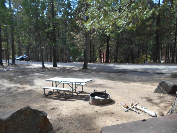
List of CampsitesOverview
This location is available on a first-come, first-served basis only. Visitors are required to physically arrive at the campground to purchase and claim a site. Once on-site, you may be able to pay for your campsite(s) by scanning a QR code using the Recreation.gov mobile app, and the Scan and Pay feature.
If this option is available, you will need to first download the free Recreation.gov mobile app https://www.recreation.gov/mobile-app prior to your arrival as some remote areas have limited or no cellular service.
Cloud Crossing Recreation Area Campground
List of CampsitesOverview
This location is available on a first-come, first-served basis only. Visitors are required to physically arrive at the campground to purchase and claim a site. Once on-site, you may be able to pay for your campsite(s) by scanning a QR code using the Recreation.gov mobile app, and the Scan and Pay feature.
If this option is available, you will need to first download the free Recreation.gov mobile app https://www.recreation.gov/mobile-app prior to your arrival as some remote areas have limited or no cellular service.
Corral Ohv Camp Campground
List of CampsitesOverview
This location is available on a first-come, first-served basis only. Visitors are required to physically arrive at the campground to purchase and claim a site. Once on-site, you may be able to pay for your campsite(s) by scanning a QR code using the Recreation.gov mobile app, and the Scan and Pay feature.
If this option is available, you will need to first download the free Recreation.gov mobile app https://www.recreation.gov/mobile-app prior to your arrival as some remote areas have limited or no cellular service.
Fullerton Recreation Area Campground
List of CampsitesOverview
This location is available on a first-come, first-served basis only. Visitors are required to physically arrive at the campground to purchase and claim a site. Once on-site, you may be able to pay for your campsite(s) by scanning a QR code using the Recreation.gov mobile app, and the Scan and Pay feature.
If this option is available, you will need to first download the free Recreation.gov mobile app https://www.recreation.gov/mobile-app prior to your arrival as some remote areas have limited or no cellular service.
Gum Springs Recreation Area Campground
List of CampsitesOverview
This location is available on a first-come, first-served basis only. Visitors are required to physically arrive at the campground to purchase and claim a site. Once on-site, you may be able to pay for your campsite(s) by scanning a QR code using the Recreation.gov mobile app, and the Scan and Pay feature.
If this option is available, you will need to first download the free Recreation.gov mobile app https://www.recreation.gov/mobile-app prior to your arrival as some remote areas have limited or no cellular service.
Kincaid Camp Campground
List of CampsitesOverview
This location is available on a first-come, first-served basis only. Visitors are required to physically arrive at the campground to purchase and claim a site. Once on-site, you may be able to pay for your campsite(s) by scanning a QR code using the Recreation.gov mobile app, and the Scan and Pay feature.
If this option is available, you will need to first download the free Recreation.gov mobile app https://www.recreation.gov/mobile-app prior to your arrival as some remote areas have limited or no cellular service.
Kisatchie Bayou Recreation Area Campground
List of CampsitesOverview
This location is available on a first-come, first-served basis only. Visitors are required to physically arrive at the campground to purchase and claim a site. Once on-site, you may be able to pay for your campsite(s) by scanning a QR code using the Recreation.gov mobile app, and the Scan and Pay feature.
If this option is available, you will need to first download the free Recreation.gov mobile app https://www.recreation.gov/mobile-app prior to your arrival as some remote areas have limited or no cellular service.
Loran Camp Campground
List of CampsitesOverview
This location is available on a first-come, first-served basis only. Visitors are required to physically arrive at the campground to purchase and claim a site. Once on-site, you may be able to pay for your campsite(s) by scanning a QR code using the Recreation.gov mobile app, and the Scan and Pay feature.
If this option is available, you will need to first download the free Recreation.gov mobile app https://www.recreation.gov/mobile-app prior to your arrival as some remote areas have limited or no cellular service.
Lotus Ohv Camp Campground
List of CampsitesOverview
This location is available on a first-come, first-served basis only. Visitors are required to physically arrive at the campground to purchase and claim a site. Once on-site, you may be able to pay for your campsite(s) by scanning a QR code using the Recreation.gov mobile app, and the Scan and Pay feature.
If this option is available, you will need to first download the free Recreation.gov mobile app https://www.recreation.gov/mobile-app prior to your arrival as some remote areas have limited or no cellular service.
Stuart Lake Campground
List of CampsitesOverview
This location is available on a first-come, first-served basis only. Visitors are required to physically arrive at the campground to purchase and claim a site. Once on-site, you may be able to pay for your campsite(s) by scanning a QR code using the Recreation.gov mobile app, and the Scan and Pay feature.
If this option is available, you will need to first download the free Recreation.gov mobile app https://www.recreation.gov/mobile-app prior to your arrival as some remote areas have limited or no cellular service.
Valentine Lake Recreation Area Campground
List of CampsitesOverview
This location is available on a first-come, first-served basis only. Visitors are required to physically arrive at the campground to purchase and claim a site. Once on-site, you may be able to pay for your campsite(s) by scanning a QR code using the Recreation.gov mobile app, and the Scan and Pay feature.
If this option is available, you will need to first download the free Recreation.gov mobile app https://www.recreation.gov/mobile-app prior to your arrival as some remote areas have limited or no cellular service.
Beaver Dam Campground (Kisatchie National Forest, LA) Campground
List of CampsitesOverview
Beaver Dam Campground is situated on the shores of Upper Caney Lake in the Caney Lakes Recreation Complex. The campground is located in a beautiful setting among woods, lakes and hills. Swimming, boating, fishing and water skiing are the top activities.Sugar Cane National Recreation Trail passes right next to the campground and offers varied terrain for hikers and bikers. The Sugar Cane trail was named for the crop that was once cultivated here, in addition to cotton.
Recreation
Bass, crappie, catfish, bluegill and sandbass can be caught in the lakes. The Sugar Cane Trail spans 5.7 miles and the Lost Man Loop spans 2 miles. Both are open to hiking and mountain biking.Facilities
Campsites come with electric and water hookups. The group picnic area accommodates up to 200 guests while each campsite fits up to eight campers. A sanitary dump station, drinking water and flush toilets are provided.Natural Features
Beaver Dam sits at an elevation of 160 feet along the north shores of the 125-acre Upper Caney Lake. The group picnic area is near Lower Caney Lake, spanning 250 acres.Kisatchie National Forest, the only national forest in Louisiana, spans 604,000 acres and mostly consists of bayous with bald cypress groves and old growth pine.
Nearby Attractions
The city of Minden has restaurants, shopping and golfing.Catahoula National Wildlife Management Preserve (NWMP)1 Facility
Catahoula National Wildlife Management Preserve (NWMP)1
Keifer Prairie Facility
Keifer Prairie
Malaudos Glen Facility
Malaudos Glen
Tantock Prairie Facility
Tantock Prairie
Evangeline Unit Facility
The Evangeline Unit of the Calcasieu Ranger District offers outdoor enthusiasts a great variety of recreation opportunities just 20 minutes west of Alexandria, Louisiana in central Louisiana. Whether you prefer hiking, OHV riding, horseback riding, fishing, boating, swimming, picnicking, bird watching, nature studies -- or even the challenge of riding mountain bikes, these 97 thousand acres of forests and lakes in the Kisatchie National Forest have something for you to see and do -- year around.
Castor Creek Scenic Area Facility
Castor Creek Scenic Area is a boggy hardwood bottomland system that lays on the edge of the boundary for the United States Air Force Bombing Range. The Wild Azalea National Recreation Trail travels straight through the most pronounced portions of this beautiful and diverse ecosystem.
Vernon Unit Facility
The Vernon Unit of the Calcasieu Ranger District offers outdoor enthusiasts a great variety of recreation opportunities! Visitors to this district unit can enjoy the recreation serenity of a longleaf pine ecosystem and the historic pasts of Fullerton Lake Recreation Complex and Little Cypress Recreation Complex.
With numerous scenic areas, bogs and special interest areas, the Vernon Unit has a very unique selection of ecological interests for both nature studies and wildlife viewing. Changing plant life across the seasonal calendar gives the Vernon Unit a completely different look throughout the year.
Enduro Camp Facility
The Enduro camp has vaulted restrooms. There are no trash receptacles so please bring out what you bring in. There is no water available at this site so be sure to bring plenty of your own.
Ouiska Chitton Natural Area Facility
Ouiska Chitton Natural Area
Cooter's bog Facility
Cooter's bog
Drakes Creek Facility
Drakes Creek
Longleaf Scenic Area Facility
Longleaf Scenic Area
Caney Ranger District Facility
The Caney Ranger District is divided into three land areas called "Units". These Units are: Caney Lakes, Middle Fork, and Corney Lake Unit. The Caney Ranger District Office is located on Highway 79 just south of Homer, Louisiana.
Caney Lakes Unit Facility
The Caney Lakes Unit has much to offer its visitors from the National Sugar Cane Recreation Trail to two completely different lake types to choose from for recreation. Both the Upper and Lower Caney Lakes are beautiful and have much to offer.
Middle Fork Unit Facility
The Caney Ranger District's Middle Fork Unit has two hunter camps and is used primarily for seasonal hunting. Wildlife and bird watchers, plant enthusiasts, and nature lovers enjoy this Unit. Located to the east of Summerfield and to the north of Homer, the Middle Fork Unit has become a locally popular place to just get away.
Corney Lake Unit Facility
The Corney Lake Unit includes the Corney Lake Recreation Area which is a beautiful 2,300 acre reservoir which has become a very popular fishing and waterfowl hunters destination. Facilities are included on both sides of the lake with the south shore offering more modern fixtures. Also included in the Corney Lake Unit is a hunter camp which is located just northwest of the Corney Lake Complex.
Sugar Creek Hunter Camp Facility
Sugar Creek Hunter Camp
Catahoula District Facility
The Catahoula Ranger District encompasses 121,500 acres and is a very popular district with residents of north Rapides and Grant Parishes with its close proximity to Alexandria/Pineville, Ball, and Tioga.
Catahoula National Wildlife Management Preserve (NWMP) Facility
Catahoula National Wildlife Management Preserve (NWMP)
Stuart Seed Orchard Facility
The Catahoula Ranger District has a seed orchard and nursery that was built by the Civilian Conservation Corps in 1934. The Orchard and its water reservoir, which is now Stuart Lake, was named in honor of Robert Y. Stuart who was Chief of the Forest Service (1928-1933).
Kisatchie District Facility
Locally known as the "Little Grand Canyon," visitors to the Kisatchie District will enjoy panoramic views from the sandstone bluffs of the Longleaf Vista Recreation Area; feel the cool currents, view the natural white sandy shoreline, and rocky rapids at Kisatchie Bayou Recreation Area; experience a wilderness challenge in the nationally designated Kisatchie Hills Wilderness; drive leisurely along the 17-mile Longleaf Trail Scenic Byway; experience ATV trail riding on the Sandstone Multi-Use Trail; or ride your horse on the Caroline Dormon Horse Trail.
Winn District Facility
Visitors to the Winn Ranger District can enjoy camping at Gum Springs Campground, horseback riding on the Gum Springs Horse Trail, exploring the mysteries of Saline Bayou, hunting in the Catahoula National Wildlife Management Preserve, camping and picnicking at Cloud Crossing, or hiking on the Dogwood Interpretive Trail.
Wildlife and botanic enthusiasts have seemingly unlimited areas to explore including a number of native prairies.
Rockhounding, Gold Panning, and Fossil Collecting Facility
Although the chances for locating gold or other valuable rocks or minerals on the Kisatchie are very rare, some may like to try their hands at finding minerals or panning for gold. These are the guidelines when rockhounding or gold panning in the Kisatchie National Forest.
- Rockhounding, the recreational removal of small quantities of rocks or fossils, and gold panning may take place on most of the forest – provided only small quantities of material are removed for personal, non-commercial purposes.
- Only common invertebrate and plant fossils may be removed. Uncommon and Vertebrate fossils are protected by federal law.
- Gold Panning is not allowed on the Catahoula Ranger District and the Evangeline Unit of the Calcasieu Ranger District for the protection of the endangered Pearlshell Mussel.
- Gold pans may be used for gold panning in the beds of streams, but the banks of streams cannot be disturbed by digging or removing materials. You cannot remove rocks with a pick, shovel, sluice box or similar large tools.
- Rockhounding and gold panning are not allowed in the Kisatchie Hills wilderness, caves or Saline Bayou, a wild and scenic river.
- Any disturbance to or removal of historical or archaeological artifacts is prohibited by federal law.
Can I take some fossils home from the Kisatchie National Forest?
Yes, you can take a few fossil rocks home, provided:
- You are not in a designated Wilderness area.
- You are collecting for non-commercial purposes (such as hobby, recreational, or educational purposes.)
- You do not create significant ground disturbance.
- You are not using any mechanized equipment.
Fossil collecting for commercial purposes is not allowed.
Always check with the District Ranger offices to determine the following:
- The location is on National Forest land.
- Rock hounding is permitted in the area.
Wild Azalea Seep Area Facility
The Wild Azalea Seep Area is comprised of approximately 60 acres of land. It is a very well-developed and little disturbed bayhead swamp or acid seep forest that begins near the head of the Wild Azalea National Recreation Trail at the origin of a creek branch in sandy longleaf pine hills, and continues at least to where the flow enters Lemotte Creek. The swamp averages about 50 yards wide along the ill-defined flow of the stream, and is quite mucky in spots.
