
National Forests in Mississippi
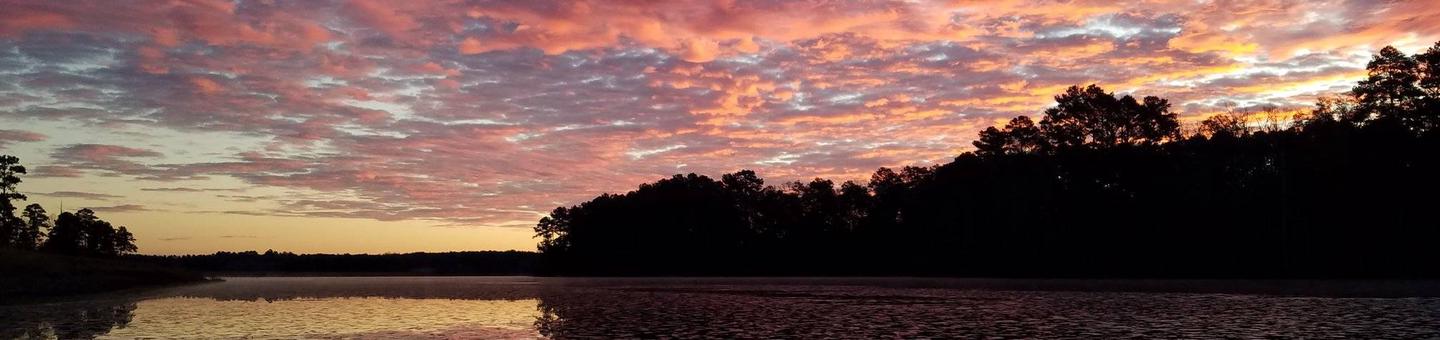
The six National Forests in Mississippi provide excellent opportunities for outdoor recreation across the state. 1.2 million acres of forest land provide a diversity of terrain, diverse ecosystems, numerous lakes, rivers, and streams. In addition to hosting native plant and animal communities, forests are also rich in cultural history. USDA Forest Service land is spread across Mississippi, making the great outdoors quickly accessible to visitors. Discover all the popular water related recreation we have to offer. Swimming, boating, and warm water fishing are favorite pastimes. Picnic sites and pavilions near the water are available for small and large family gatherings. The Black Creek Scenic River provides a distinctive canoeing experience. Developed and dispersed camping areas provide overnight accommodations that support hunting, water-based recreation, and destination camping. The National Forests in Mississippi are also a major provider of recreational trails in the state. Approximately 265 miles of non-motorized hiking, biking, and horseback riding trails challenge visitors and provide great scenery. We also offer approximately 90 miles of designated motorized trails open to off-highway vehicles.
RecAreaDirections
Find us in Mississippi!
Open with Google MapMisc
| Stay Limit | |
| Reservable | false |
| Keywords | |
| Map Link | |
| Contact Phone | |
| Contact Email |
Permits info
Facilities
Big Biloxi Recreation Area Campground
List of CampsitesOverview
This location is available on a first-come, first-served basis only. Visitors are required to physically arrive at the campground to purchase and claim a site. Once on-site, you may be able to pay for your campsite(s) by scanning a QR code using the Recreation.gov mobile app, and the Scan and Pay feature.
If this option is available, you will need to first download the free Recreation.gov mobile app https://www.recreation.gov/mobile-app prior to your arrival as some remote areas have limited or no cellular service.
Clear Springs Recreation Area (MS) Campground
List of CampsitesOverview
This location is available on a first-come, first-served basis only. Visitors are required to physically arrive at the campground to purchase and claim a site. Once on-site, you may be able to pay for your campsite(s) by scanning a QR code using the Recreation.gov mobile app, and the Scan and Pay feature. Only pay for a site that you have verified as vacant.
If this option is available, you will need to first download the free Recreation.gov mobile app https://www.recreation.gov/mobile-app prior to your arrival as some remote areas have limited or no cellular service.
This campground has 22 campsites and is generally open all year long. This location may be inaccessible at any time during the year due to weather and road conditions.
Recreation
Visitors will be able to bike, hike, canoe, fish, and view wildlife.
Facilities
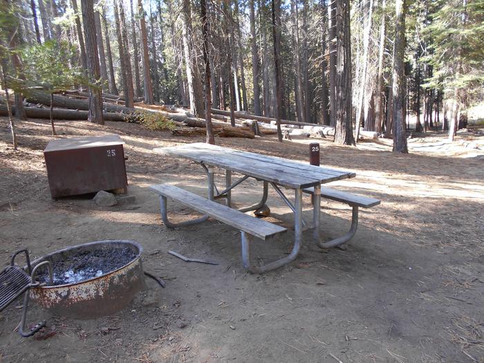
Facilities include camping, with 22 units with hookups for water and electricity. A group camp site(reservation required) 8 picnic tables within the day use area; A pavilion for 25-30 people(reservation required). Flush toilets and hot showers; A one mile hiking trail around the lake; An amphitheater. 10 miles hiking/mountain biking trail.
Natural Features
Clear Springs Recreation Areas is nestled in a secluded area of roling hills. The area, surrounded by tall stands of pine and mixed hardwood treees, provide visitors with a shady forest atmostpehere. A 10 acre lake connects both camping areas.
contact_info
This location is unstaffed. To speak with our main office for general information, please call: (601) 384-5876.Nearby Attractions
- Okhissa lake is a 1,075 acre lake approximately 15 minutes away from the campground. It has a swim area, day use area, one boat launch. Fish that can be caught include catfish, largemouth bass, crappie, bluegill and other small panfish.
Cypress Creek Landing Campground
List of CampsitesOverview
This location is available on a first-come, first-served basis only. Visitors are required to physically arrive at the campground to purchase and claim a site. Once on-site, you may be able to pay for your campsite(s) by scanning a QR code using the Recreation.gov mobile app, and the Scan and Pay feature.
If this option is available, you will need to first download the free Recreation.gov mobile app https://www.recreation.gov/mobile-app prior to your arrival as some remote areas have limited or no cellular service.
Marathon Lake Campground
List of CampsitesOverview
This location is available on a first-come, first-served basis only. Visitors are required to physically arrive at the campground to purchase and claim a site. Once on-site, you may be able to pay for your campsite(s) by scanning a QR code using the Recreation.gov mobile app, and the Scan and Pay feature.
If this option is available, you will need to first download the free Recreation.gov mobile app https://www.recreation.gov/mobile-app prior to your arrival as some remote areas have limited or no cellular service.
Recreation
Marathon Lake provides various recreational oppurtunties. This includes activities such as biking, hiking, boating, picnicking, fishing, camping, swimming, wildlife viewing, and volleyball.
Facilities
- 34 campsites with water and electricity
- 14 picnick tables
- Sand volleyball court (no ball provided)
- BBQ grills
- 2 Pavilions (can be reserved for groups, please call local Forest Service Office at 601-469-3811)
- Boat Launch
- Swimming area with sandy beach
- Hiking Trail (1.7 miles in length)
- Water fountains
- Sanitation facilities with showers and flush toilets
- Dump station for trash
Natural Features
Marathon Lake is a 50-acre lake located in Smith County. It got its' name from Marathon Lumber Company which closed in 1929. You will enjoy the beauty and seclusion of this quiet campground located approximately 15 miles southeast of Forest, MS and 25 miles northeast of Raleigh, MS. Marathon Recreation area is equipped with 34 camping sites (with water and electric hook-ups), boat ramp, swimming area, 2 bath houses (warm showers), picnic shelters, picnic tables and a hiking trail. The lake has been stocked with catfish, bass and crappie and is open to bream fishing. A dump station is available. The area has a volunteer Campground Host on site most of the time.
contact_info
This location is staffed. Please call (601) 469-3811 to speak with local staff.Shockaloe Trail Bc 1 Campground
List of CampsitesOverview
This location is available on a first-come, first-served basis only. Visitors are required to physically arrive at the campground to purchase and claim a site. Once on-site, you may be able to pay for your campsite(s) by scanning a QR code using the Recreation.gov mobile app, and the Scan and Pay feature.
If this option is available, you will need to first download the free Recreation.gov mobile app https://www.recreation.gov/mobile-app prior to your arrival as some remote areas have limited or no cellular service.
Turkey Fork Recreation Area Campground
List of CampsitesOverview
Turkey Fork Recreation Area is the most popular recreation area on the DeSoto National Forest and one of the most visited outdoor recreation areas in south Mississippi, offering three bathhouses, a picnic area, two swim areas, a boat ramp, a floating pier, 20 RV campsites, and 8 primitive camping sites, which surround a 240-acre lake
The lake is stocked with catfish, bass, and bluegill. Recreational opportunities at Turkey Fork include fishing, water sports, camping, picnicking, and hiking. With all these opportunites, a visit to Turkey Fork Recreation Area will provide its visitors with an enjoyable outdoor experience and memories to take home.
Recreation
Turkey Fork is a popular recreation destination offering premier fishing, camping, picnicking and watersports activities, such as swimming and skiing.
It has a boat ramp, floating dock, two swim areas, and three bathhouses. The 240 acre lake stocked with bass, crappie, and bluegill. Day use visitors will find secluded picnicking sites located near the beach. A ¾ mile hiking trail connects the day use area to the camping area.
Facilities
The campground has six RV campsites available for reservation. Additional RV campsites are available on a first-come, first served basis. Each campsite has water and electric hookups, picnic table, and fire-ring with grill. Flush toilets, and showers is available at the campground bathhouse. A campground host is on-site.
Natural Features
Turkey Fork Recreation Area is built around the 240-acre Turkey Fork Reservoir.
CHOCTAW LAKE Campground
List of CampsitesOverview
Scenic Choctaw Lake Campground wraps around Choctaw Lake in the Tombigbee National Forest of Mississippi. Its location provides visitors with ample opportunities for recreation, including fishing, boating, hiking and biking. A day-use area is popular for picnicking and has a swiming beachRecreation
Choctaw Lake Recreation Area offers a range of outdoor opportunities, including camping, picnicking, hiking and biking. The lake offers boating, swimming and fishing. Anglers can look forward to a catch of largemouth bass, bream, catfish and crappie.An accessible walking trail around the lake is available for a leisurely stroll, as well as a moderate skill level, 3-mile trail, that takes off from the campground. A variety of birds and wildlife may be seen along these paths.
Facilities
The campground offers nearly two dozen campsites, some of which are accessible. Additional sites are available on a first-come, first-served basis. Each site is equipped with full utility hookups, a picnic table and campfire ring with grill.Individual and group picnic shelter sites are also available within the day-use area and swimming beach. Accessible flush toilets, showers drinking water are provided. A campground host is on-site.
Natural Features
The campground is situated between smaller Cabin Lake and larger, 100-acre Choctaw Lake. It is near the Natchez Trace Parkway, Noxubee Wildlife Refuge and French Camp, all popular destinations in the area.contact_info
This location is unstaffed. To speak with our main office for general information, please call: (662) 285-3264.Nearby Attractions
The campground is located 5 miles south of the town of Ackerman, 11 miles northwest of Louisville and 20 miles southwest of Starkville.The Noxubee Hills hiking and biking trailhead is located at the Choctaw Lake Recreation area as well. The 26-mile trail has vault toilets at each end and is rated moderate-to-experienced, for biking and hiking.
The Choctaw Lake recreation area is also within 20 miles of Mississippi State University. Athletic, cultural and scholastic events abound there.
DAVIS LAKE CAMPGROUND Campground
List of CampsitesOverview
Davis Lake Recreation Area is home to beautiful Davis Lake, Campground and Day Use Area, popular for all kinds of recreational opportunities, including swimming, fishing, boating, birding and wildlife viewing. The surrounding scenic forests make Davis Lake a picturesque place to spend quality time outdoors.Recreation
Davis Lake covers 200 acres and provides multiple recreational opportunities. A grassy swimming beach is situated on the shore, where many anglers cast for largemouth bass, hybrid striped bass, crappie, catfish and bream. The campground has 14 sites on the lake, many of them with space to anchor a boat. A 2-mile trail wanders along the north edge of the lake to several earthen fishing piers.Visitors can also spend time birding, watching for a variety of geese and ducks that migrate through the area. Hawks, herons, bluebirds and doves are also plentiful, among many other species. Wildlife viewing is also available, as foxes and bobcats call the area home.
The Chickasaw OHV Trail is a newly renovated 12-mile motorized trail that is within three miles of the campground. The trailhead lies between the Davis Lake recreation area and the Natchez Trace Parkway. It is within a mile of the Owl Creek Mounds archaeological interpretive site. It is open between April 1 and Oct. 31, for hunting. The trail accommodates off-road vehicles 48-inches in width or less.
Cyclists and hikers will enjoy the Tanglefoot Trail. This multiple-use Rails-to-Trails path is located 5 miles west of Davis Lake. It runs 43.5 miles from Houston to New Albany, MS through Houlka, Algoma, Pontotoc, Ecru, and Ingomar.
Facilities
The recreation area offers more than two dozen campsites, a picnic area, a group shelter, accessible flush toilet facilities and a dump station. Davis Lake has multiple fishing docks, including some that are accessible.Campsites are equipped with tables, lantern posts and campfire rings with grills. Drinking water is provided.
A picnic shelter can also be reserved on-site, for an additional $40 per day fee.
Natural Features
The campground is situated in a hilly, mixed hardwood and pine forest that stretches along the eastern shore of the lake. It is located within 4 miles of the Natchez Trace Parkway, a 444-mile drive through exceptional scenery and 10,000 years of North American history.contact_info
This location is unstaffed. To speak with our main office for general information, please call: (662) 285-3264.Nearby Attractions
The recreation area is located 21 miles south of Tupelo, Mississippi, and 12 miles north of Houston.The Owl Creek Mounds, an archaeological interpretive site containing Native American ruins, is about 50 miles away.
The Witchdance Horsetrail is an 18-mile horseback riding trail that can be accessed from both the Payamatha Trailhead (on Highway 32, west of the Natchez Trace and east of Highway 15), or the Witchdance trailhead, that lies on the Natchez Trace Parkway (approximately 5 miles east of Houston).
CHEWALLA LAKE RECREATION AREA Campground
List of CampsitesOverview
Chewalla Lake Recreation Area is located in the Holly Springs Ranger District in northern Mississippi. Visitors enjoy swimming and relaxing on the sandy beach on the lake shore, as well as canoeing, kayaking and fishing.Recreation
Chewalla Lake covers 260 acres and is a no-wake lake, making it a perfect location for swimming, canoeing and kayaking. Anglers enjoy fishing for smallmouth bass, bream, crappie and catfish. A boat ramp is located on-site.Facilities
DUE TO COVID THE RESTROOMS AND TENT CAMPING ARE UNAVAILABLE. The campground offers sites for RV camping. Each site is equipped with a picnic table and campfire ring. RV sites have electric and water hookups. During the season the campground is open 24 hours and does not close on the major holidays, i.e. Memorial Day, July 4th and Labor Day, allowing families and friends to celebrate together. Don't fret if you happen to arrive later in the day or evening for your reservation we will leave a note up on the site showing that its reserved.
Natural Features
The lake is surrounded by a dense forest of pine and hardwoods, such as sweet gum and oak. Many dogwoods are scattered throughout the campground, creating a beautiful, blooming display in the springtime.The campground lies on land once used heavily for farming. Erosion has caused deep gullies to form throughout the area, but split-rail fences line the gullies, adding character to the facility.
Nearby Attractions
Holly Springs is 8.5 miles northwest of the lake. This charming town is known as the Antebellum Capitol of the mid-south. More than 200 buildings in town are listed on the National Register of Historic Places. A variety of dining and shopping options are available, as well as grocery stores and gas stations.Bienville Facility
Marathon Lake and Shongelo Lake are our primary recreation areas with activities ranging from picnicking to fishing.
Shongelo Lake Facility
This small recreation area is located 5 miles north of Raleigh, MS and 21 miles south of Forest, MS. Shongelo Lake is a 5-acre lake offering bank fishing. A swimming area, 7 picnic sites, picnic shelter and hiking trail make this site appealing for family day-use enjoyment.
Shongelo is a fee area and is open seasonally from May through September.
Beaver Lake Facility
Beaver Lake is a 67-acre manmade lake dating from the days of railroad logging. One of the original railroad tramlines serves as a dam that traps and holds overflow water from a nearby creek. A shallow lake, Beaver Lake offers excellent opportunity for small boat fishing. Limited accessibility does not offer much opportunity for bank fishing. Small parking area. No camping or swimming is permitted. WMA user permit is required. Open year-round. State fishing laws and regulations apply.
Greentree Reservoir Facility
Greentree Reservoir is a 33-acre manmade lake frequently visited by local fishermen. Both boat and limited bank fishing is possible. Facilities include a boat ramp and a small parking area. No camping or swimming is permitted. No fee is charged. Open year-round. State fishing laws and regulations apply.
Tishkill Lake Facility
Tishkill Lake is a 60-acre manmade lake. Most of the lake is on private land. A public boat ramp and small parking area on National Forest land does provide public access to the lake. Fishing opportunities are limited to boats as public shoreline is not suitable. No camping or swimming is permitted. No fee is charged. Open year-round. State fishing laws and regulations apply.
Harrell Prairie Facility
Harrell Prairie is the largest and least disturbed prairie in Mississippi. Unique yearlong, Harrell Prairie is especially spectacular in the Spring when the variety of flowers and grasses are most abundant.
Bienville WMA Facility
Bienville WMA is under the management of Mississippi Department of Wildlife, Fisheries, and Parks. For information concerning permits or open and closing, contact the local WMA office or go to: www.mdwfp.com.
Caney Creek WMA Facility
Caney Creek Wildlife Management Area is under the management of Mississippi Department of Wildlife, Fisheries, and Parks. For information concerning permits or open and closing, contact the local WMA office or go to: www.mdwfp.com.
Chickasawhay Facility
Travel to the Chickasawhay Ranger District on any day and discover the hidden beauty that lies among the rustling pines. If you are lucky enough to venture out on a sunny day, the rays of sunshine peaking through the tall dark green pines will take your breath away. Even on a rainy day, you can drive through the forest and see tall stands of longleaf pine with the ground covered in beautiful bright kelly green bracken fern.
Delta Facility
Blue Lake Recreation Area, Little Sunflower River Recreation Area, primitive camping and multiple use trails compose the recreation program at Delta National Forest. Primary recreation activities include hunting, camping, wildlife viewing, horseback riding, and fishing. More detailed information about these areas and activities is described below.
Delta WMA Facility
The U.S. Forest Service cooperatively manages Delta National Forest as a state wildlife management area, Sunflower WMA, through a Memorandum of Understanding with Mississippi Department of Wildlife, Fisheries and Parks. See the Sunflower WMA page for area regulations, maps and license information. All hunting and fishing related questions should be directed to Sunflower WMA managers Bobby Hodnett or Jason Kerr at (662) 828-3456. Wildlife Bureau Office (601) 432-2199.
De Soto Facility
The De Soto is characterized by gently rolling terrain covered by southern pine ridges and hardwood bottoms with clear, tea-colored streams meandering throughout. Year-round recreation opportunities abound for the hiker, bicyclist, camper, canoeist, ATV rider, horse enthusiast, hunter, and fisherman. Length of stay limits do apply within our camping areas. Visitors who seek solitude will be able to find within one of the state's two wilderness areas- the Black Creek or Leaf - both located on the De Soto. The district is also home of the Mississippi's only national Scenic River, Black Creek, famous for its wide, white sandbars and relaxed floating pace. Two National Recreation Trails, the Black Creek and the Tuxachanie, offer over 60 miles for the hiker to explore the pinewoods. Other trails on the district included Bethel and Rattlesnake Bay ATV trails, Big Foot horse trail, Leaf hiking trail, and Bethel bicycle trail. The nature observer may delight in experiencing the varied ecosystems found on the De Soto, from dry, sandy longleaf pine/scrub oak ridges to frequently flooded tupelo/bald cypress swamps, and from the steep upland hardwood forests of Ragland Hills to the vast pitcher plant savanna at Buttercup Flats.
Black Creek - National Wild and Scenic River Facility
Black Creek, with it's deep, black water and white sand bars and colorful vertical bluffs, meanders through the De Soto National Forest with trees and flowering shrubs hanging over the banks. Mississippi's only National Wild and Scenic River flows for 40 miles of within the National Forest. Plants flourish and wildlife abounds. Wood ducks and otters are often seen by those visiting the stream. Primitive camping is allowed all along the stream within the National Forest and a number of trails can be accessed near the river.
Moody's Landing Facility
Five miles downstream from Brooklyn, MS, a sandbar serves as the landing for this site on the Black Creek float trip.
Fairley Bridge Landing Facility
Site serves as the end point for both the Black Creek float trip and hiking trail
Holly Springs Facility
Holly Springs
Puskus Lake Facility
Puskus Lake Recreation Area is a fairly remote area for those who do not like the big crowds and do not need modern conveniences. The visitor will discover a pleasant and quiet environment. This recreation area surrounds a 96 acre lake stocked with largemouth bass and bluegill with occasional crappie or catfish. Facilities include 19 campsites, 13 picnic sites, boat ramp, fishing piers, and a 1-mile hiking trail.
Puskus Lake Recreation Area is open year-round unless weather conditions require the area to be closed. Puskus is a fee area and the fee station is located just beyond the entrance gate. No attendant will be on duty. Therefore, users should make sure that they have correct currency before arriving at the recreation area.
Tombigbee Facility
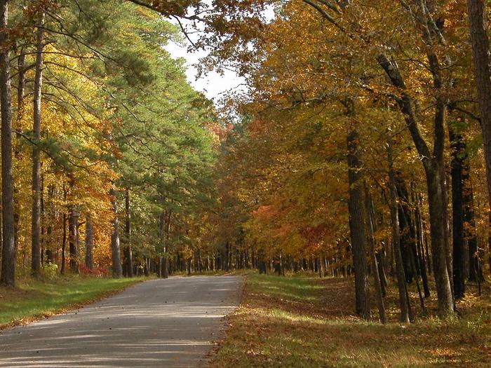
The Tombigbee National Forest is located in northeastern Mississippi. Before the establishment of this forest, much of the land was abandoned farmland with rapidly eroding soils. Its rolling hills are now covered with pine and hardwood forests. They are rich with wildlife and intermingled with private farms and woodlots. National Forest system lands on this forest is scattered across numerous counties.
Homochitto Facility
There are numerous recreational activities available to pursue on the Homochitto National Forest. Traditional activities as hunting, fishing, camping and hiking abound. Or you may decide to Mountain bike some of the South's finest trails. Follow our links and chose your favorite activity.
Woodman Springs Shooting Range Facility
The range offers a shooting shelter and 25, 50, 100 yard markers.The range is handicap accessible.
DELTA NATIONAL FOREST - CAMPING Campground
List of CampsitesOverview
The Delta National Forest glimmers like a great, green jewel surrounded by lazy rivers and spreading agricultural fields. The Delta is a large, contiguous block of bottomland hardwood forest, seasonally flooded timber, and small sloughs draining into the Big and Little Sunflower Rivers in the Yazoo Basin of the Mississippi River. It is the only entirely bottomland hardwood ecosystem in the National Forest System.Recreation
Enjoy camping, wildlife viewing, hiking, ATV riding, horseback riding, bird and butterfly watching, canoeing, kayaking, hunting, and fishing all within the Delta National Forest.Facilities
Facilities are spread throughout the Forest. There are four restroom facilities located along FS Roads 715, 717, 720, and 707. All sites are primitive and potable water is available at the Delta Ranger District work center on FSR 703.Natural Features
The Delta National Forest lies in the Mississippi Alluvial Valley and is surrounded by bayous, rivers, and lakes. The terrain is relatively flat, with majestic Bald Cypress trees and other hardwoods.Nearby Attractions
Nearby attractions within an hour's drive includes Highway 61, the Mississippi Blues Trail; the Mississippi Mound Trail; Jim Henson Muppet Museum; Vicksburg Military Park; Theodore Roosevelt National Wildlife Refuge Complex and Holt Collier National Wildlife Refuge; B. B. King Museum; and a host of cultural experiences.contact_info
This location is unstaffed. To speak with our main office for general information, please call: (662) 873-6256.Owl Creek Mounds Archeological Site Facility
Owl Creek Mounds Archeological site was established in 1964. It contains Indian Mounds dating to the early Mississippian period (A.D. 1000 to 1200). This area is on the National Register of Historic Places. Originally there were five mounds around a central plaza, two mounds are located on National Forest Land.
Owl Creek Mounds Site is open year-round unless weather conditions require the area to be closed. No user fees required.
Black Creek Wilderness Area Facility
The Black Creek Wilderness was established in 1984 and contains slightly more than 5,000 acres. The Black Wilderness is named after its dominant feature - Black Creek, which flows through its center. The wilderness contains a segment of the Black Creek Wild and Scenic River and about 10 miles of the Black Creek National Recreation Trail.
Black Creek bisects the wilderness, creating a large hardwood floodplain containing oxbow lakes and stands of sweetgum, loblolly pine, spruce pine, willow oak, bald cypress, sweetbay, and red maple. The terrain is fairly gentle, with elevations ranging from 100 to 270 feet above sea level. The only development in this area is the Black Creek Trail.
No facilities are provided. Only foot travel is permitted on the trail. Black Creek Wilderness is open year-round unless weather conditions require the trail to be closed. No user fees required.
Leaf Wilderness Area Facility
Leaf Wilderness is a 940-acre tract of land in the floodplains of the Leaf River. All but the western edge of the wilderness, which is uplands, consist of meandering sloughs, oxbow lakes, and level terrain. Vegetation is mostly loblolly-shortleaf pine forest and oak-gum-cypress-spruce pine on the river bottoms.
Access to this area is from the 1.5-mile hiking trail. This area is open to foot travel only. Leaf Wilderness is open year-round unless weather conditions require the area to be closed. No user fees required.
P.O.W. Lake Recreation Area Facility
This recreation site lies beside a 7-acre lake at the southern end of the Tuxachanie National Recreation Hiking Trail. This is an abandoned World War II German Prisoner of War Camp and Navy rifle range. The old ammunition bunkers are still present. This rustic area provides primitive camping, fishing, and hiking. The lake provides fishing opportunities for bass, bream, white perch, and catfish. There are no restrooms or drinking water. The lake has foot access only.
The P.O.W. Lake Recreation Area is open year-round unless weather conditions require the area to be closed. No user fees required.
Black Creek Shooting Range Facility
The Black Creek Shooting Range offers a large backstop with targets ranging from 25, 50, and 100 yards. Shooting bench available. Open from sunrise to sunset, seven days a week.
Big Creek Landing Facility
Big Creek Landing, located on a high bank overlooking Black Creek Wild and Scenic River, serves as the northern terminus and beginning/end point for both the Black Creek float trip and the Black Creek Hiking Trail. Here the stream ranges from 20 to 100 feet wide and, depending on the season and rainfall, 1 to 15 feet deep.
Big Creek Landing is a small recreation area. Facilities include one camping or picnicking site and a concrete boat launch. Drinking water and sanitary facilities are not available.
Big Creek Landing is open year-round unless weather conditions require the area to be closed. No user fees required
Cypress Creek Landing Facility
Cypress Creek Landing is located high on a bluff overlooking Black Creek. It is 7 miles downstream from Janice Landing.
