
Francis Marion and Sumter National Forests
Recreation on the Francis Marion and Sumter National Forests is as varied as the South Carolina landscape from the mountains to the coast. Click a link to activity of your choice in the left column of this page to explore two forests full of opportunities!
2019 Recreation Fee Increases
Sustainable Recreation
We'll post cautions and weather closures in the conditions report below, but please...
 OHV Riders - Call Before You Haul!
Conditions may change quickly! Please check the Call Before You Haul telephone hotline at (803) 561-4025 for the most recent OHV trail closures and openings. Forks Area Trail System for off-road bicycles is also included. The hotline will provide you with the most current updates. Trails are frequently closed after prolonged or heavy rainfall when usage would result in resource damage. Updates are made on weekdays only. It is not updated on weekends or federal holidays. Please note: The date recorded in the hotline trail report reflects the date the trail was opened or closed. The message will remain the same until the open/closed status changes.
Enoree Weekly Rifle Range Cleaning Closures: Indian Creek and Leeds rifle ranges are closed Monday and Thursday 8 a.m. - 9:30 a.m. Philson Crossroads and Fairforest rifle ranges are closed Tuesday and Friday 8 a.m. - 9:30 a.m. Please call the Enoree Ranger District at (803) 276-4810 if you are interested in volunteering to clean up your rifle ranges.
Enoree Seasonal Hunting Camps: Collins Creek, Poulous Loop, Rocky Branch, and the seasonal loop of Sedalia Campground are open September-December for deer season and April for turkey season.
Piedmont OHV Trails Season: Enoree, Cedar Springs, and Parsons Mountain OHV Trails are open from the last Friday of March until the first Monday in January. Wambaw Cycle Trail is open year-round.
Upper Chattooga Season: Boating season on the Upper Chattooga is from December-April on the Upper Chattooga Wild and Scenic River corridor. Paddling is only allowed on this highly technical section of the river on days after flows reach 350 cfs or greater at the USGS Burrells Ford Gauge and only during daylight hours.
Zoom in on the map below to see recreation areas on the Francis Marion and Sumter National Forests
RecAreaDirections
Open with Google Map
Misc
| Stay Limit | |
| Reservable | false |
| Keywords | |
| Map Link | |
| Contact Phone | |
| Contact Email |
Permits info
Facilities
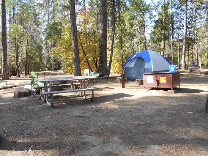
Brick House Campground (SC) Campground
List of CampsitesOverview
Brick House Campground is located on SC Route 66, 3.5 miles east of I-26, situated in the heart of the Enoree Ranger District in Newberry County. The campground is surrounded by a mixed pine-hardwood forest with an elevation of approximately 550 feet. Long hot summers and mild winters are the norm for the Enoree Ranger District. Winter temperatures range from low 40's to upper 60's degrees and summer temperatures range from high 80's to high 90's. Wild azaleas are clumped by the old homesites and wildflowers and dogwoods dot the landscape. This site offers a great opportunity for all season camping. Ample hunting opportunities for wild turkey and whitetail deer are available in the surrounding general forest. The campground is located 51 miles north of Columbia and is 41 miles south of Spartanburg.
Recreation
Brick House offers a year-round primitive, single loop campground with 21 campsites. The small campground offers a primitive laid back setting that one can relax and enjoy in. During big game deer and turkey season nine campsites are available on a first-come, first-serve basis and are paid for at the campground kiosk using the scan and pay system and a smart phone. Twelve campsites are available by reservation only year round through recreation.gov.
- The 30 mile Buncombe Horse Trail offers a variety a loops which riders can choose between a short or all day ride. The trail is open to horses, hikers and mountain bikers.
- The 24 mile Enoree OHV Trail is a short 10 minute drive north of Brick House. The motorized trail is open to atvs, utvs, and dirt bikes that are 50 inches and less in width. Bring your own equipment. The trail has a user fee and is closed when trail conditions are too wet for riding.Call the "Call Before You Haul" hotline.
- The surrounding national forest lands are a great place for big game deer and turkey hunting along with other small game hunting. Hunting and fishing in South Carolina is regulated by the South Carolina Department of Natural Resources. Visit www.dnr.sc.gov for more about the SCDNR.
Facilities
Brick House offers year-round access to 21 campsites campground. All sites have some shade throughout the day. The campground has a gravel road and parking spurs that all vehicles need to be parked on. Campsite parking spurs are level and vary in size and grade. Not all sites can accommodate all vehicles. All sites have a picnic table, fire ring, and a lantern post. Up to two horses per campsite are allowed but need to be highlined or kept in portable corrals. Two, double vault toilet buildings are centrally located at each end of the campground. There is no water, no electrical hookups, and no dump station available. Cell coverage can be spotty. Pets are welcome but must be leashed at all times within the campground.
Campsites: 1, 2, 3, 4, 6, 8, 10, 11, 13, 14, 15, and 16 are for reservation only year round through recreation.gov. and have a 14 day stay limit within 30 rolling days.
Campsites 5, 7, 9, 12, 17, 18, 19, 20, and 21 are on a first-come, first-serve basis during fall big game deer and spring turkey seasons. These sites are extended stay sites during this time and campers can stay longer than the 14 day stay limit. Campers choose an open site and return to the kiosk and pay with a smart phone and the scan and pay system. Outside of hunting season these sites are avaible by reservation only.
Natural Features
Over 700,000 acres of pine-hardwood forest with gently rolling terrain make up the Enoree Ranger District. Headleys Creek runs through the area a bit over half a mile away from the campground by road.
Nearby Attractions
- Enoree OHV Trail- 10 minutes up the road is a 24 mile designated trail for motorized atvs, utvs and dirt bikes that are 50 inches wide or less. Warning: the trail closes when trail conditions are too wet for riding. Use the Call Before You Haul hotline to check trail status.
- Newberry Opera House, Newberry, SC. https://www.newberryoperahouse.com/
Woods Ferry Campground (SC) Campground
List of CampsitesOverview
The rolling hills of Enoree Ranger District in Chester County are home to the Woods Ferry Recreation Area which includes the Woods Ferry Campground, Woods Ferry Picnic Area, Woods Ferry Boat Ramp. The Woods Ferry Recreation Area is situated in the piedmont of South Carolina along the east bank of the Broad River with elevation averaging around 350 feet and is approximately 40 miles southwest of Rock Hill and 57 miles southeast of Spartanburg.
The surrounding area is the rolling hills of upland pine and maturing hardwood forests. It offers a wonderful change is scenery from the area’s typical pine forests. The highlight of the area is the Broad River corridor. The many variety of hardwood trees create an umbrella with their leaves in the summer, keeping you cool during your trail ride or hike. Thatches of pine are mingled in and the sun shines through them providing you warmth in the winter.
Wander on the Woods Ferry Horse Trail and you’ll see wild azaleas clumped by the old homesites and dogwoods are scattered through-out the forest. Inhale fragrance of the honeysuckle in these peaceful surroundings.
The forest and river environment draw a variety of wildlife to the area. Visitors interested in nature watching have an opportunity to see birds such as red-shouldered hawks, great blue herons, osprey, wood ducks, barred owls and the American Bald Eagle.
Recreation
The Woods Ferry Recreation Area offers Woods Ferry Campground users access to a wide range of recreational activities such as picnicking, fishing, canoeing, wildlife viewing or trail riding. Its location on the Broad River makes fishing and boating easily accessible.
- The Woods Ferry Day Use Picnic Area: picnic tables and grills, two group picnic shelters with group grills, three fishing platforms to fish or view wildlife from. A valid South Carolina fishing license is required to fish on the national forests.
- The Woods Ferry Horse Trail is a 26 mile trail system that traverses along the Broad River and hardwood drains of the area. The trail is open to horses, hikers and mountain bikers.
- Broad River- boating, canoeing and kayaking opportunities abound with current access south of the Neal Shoals Dam, 2 miles downstream from the Woods Ferry Campground.
- The surrounding national forest lands are a great place for big game deer and turkey hunting along with other small game hunting. Hunting and fishing in South Carolina is regulated by the South Carolina Department of Natural Resources. Visit www.dnr.sc.gov for more about the SCDNR.
Facilities
Woods Ferry Campground is open year-round and has 15 single campsites, one double campsite and one group campsite. All sites are available by reservation only. The campground road is gravel with gravel parking spurs. Campsite parking spurs vary in size and grade. Not all sites can accommodate all sizes of campers and camper vehicles. Sites have a picnic table and rock fire ring, and some have a lantern post. This campground also offers the opportunity to camp with horses in designated sites. 10 campsites have horse corrals. Other campsites offer a designated area where horses can be highlined or where portable corrals can be set up behind the white banded trees around the perimeter of the campground. Vault toilets are centrally located to both ends of the campground. There is “NO WATER OR ELECTRICAL HOOK-UPS” available. Water spigots are centrally located throughout the campground. Campers can access the 26 mile Woods Ferry Horse Trail from the campground. The trail allows for horses, hiking and mountain biking.
The Woods Ferry Campground is about a two tenths of a mile easy walk from the campground to the picnic area and Broad River. Great fishing and bird watching opportunities exists along the banks of the Broad River.
Natural Features
The Woods Ferry Recreation Area is situated in the piedmont of South Carolina, along the east bank of the Broad River and adjacent to the 26 mile Woods Ferry Horse Trail. It lies within a beautiful wooded floodplain surrounded by upland pine woods and maturing hardwood forests.
The Francis Marion and Sumter National Forests encompass more than 629,000 acres in four districts throughout South Carolina, from the low country Atlantic Coast to the western foothills along the Georgia border. For more information on Francis Marion and Sumter National Forests https://www.fs.usda.gov/scnfs
Nearby Attractions
- Leeds Shooting Range, Enoree Ranger District, Sumter National Forest. Bring your own weapon, target and target holder to practice from designated shooting tables down range with at a maximum distance 100 yards. Click here for more information https://www.fs.usda.gov/activity/scnfs/recreation/otheractivities.
- Olde English Tourism District. https://www.oldeenglishdistrict.com/about/district. Find upcoming events, restaurants, artists, farmers markets surrounding the Woods Ferry Recreation Area.
- Historic Brattonsville. https://www.visityorkcounty.com/things-to-do/history-culture/historic-brattonsville/
Poulous Loop Group Campground (SC) Campground
List of CampsitesOverview
Poulous Loop Group Campground is located on the Enoree Ranger District of Sumter National Forest. It's location in the piedmont of South Carolina, Chester County, provides year round camping opportunities. t's surrounded by a mixed pine-hardwood forest with an elevation of approximately 400 to 500 feet. Long hot summers and mild winters are the norm for the Enoree Ranger District. Winter temperatures range from low 40's to upper 60's degrees and summer temperatures range from high 80's to high 90's.
Popular activities include hunting, hiking, mountain biking, horseback riding and wildlife viewing.
Recreation
Poulous Loop offers a rustic primitive camp setting ideal for exploring the surrounding area's hunting and trail riding opportunities.
The surrounding forest environment sustains abundant wildlife populations, making it one of the most desirable hunting areas in the state for big-game deer and turkey seasons. Hunting and fishing in South Carolina is regulated by the South Carolina Department of Natural Resources. Visit www.dnr.sc.gov for more about the SCDNR.
The Woods Ferry Horse Trail is a 26 mile trail system that parallels the Broad River corridor and meanders in and around upland pine and hardwood drains of the area. The trail is open to horses, hikers and mountain bikers and can be easily accessed by following forest service gravel road 301F to access the trail junction.
Facilities
The Group Campground is available by reservations only. Reservations can be made 12 months in advance. Amenities include a vault toilet and fire pit. There is no water, no electricity, no wifi and cell coverage is sporadic. The campground is a large grassy area within a mature pine stand that provides plenty of shade. There is plenty of room for RV, trailer, horse trailer and tent camping in the natural grassy areas on either side of the graveled campground loop road. The area also has plenty of space to either highline horses or set up portable stalls. The campground has plenty of areas to set up field games such as a volleyball net, corn hole boards, horse sets, just bring what you need and enjoy.
There is a minimum of one person and a maximum of 100 people and a minimum of one vehicle with a maximum of fifteen vehicles. A vehicle plus one camper or one horse trailer is considered as one vehicle count. ATV's, UTV's, Golf Carts are not allowed.
Natural Features
Acres of pine-hardwood forest and gently rolling terrain surround Poulous Loop Group Campground. The Francis Marion and Sumter National Forests encompass more than 629,000 acres in four districts throughout South Carolina, from the low country Atlantic Coast to the western foothills along the Georgia border.
Nearby Attractions
- Leeds Outdoor Shooting Range, Enoree Ranger District, Sumter National Forest. Leeds Range is accessibleBring your own equipment, target and target holder to target practice from designated shooting tables down range maximum distance 100 yards. Manufactured stationary targets only. There is a user fee for range use.
- Olde English Tourism District- oldeenglish.com. Find upcoming events, restaurants, artists, farmers markets surrounding the Woods Ferry Recreation Area.
- Historic Brattonsville- 28 miles
Collins Creek Seasonal Campground (SC) Campground
List of CampsitesOverview
Collins Creek Seasonal Campground is located on the Enoree Ranger District of Sumter National Forest. It's location in the piedmont of South Carolina, Union County, and provides for year round camping opportunities. The campground is surrounded by a mixed pine-hardwood forest with an elevation of approximately 440 feet. Long hot summers and mild winters are the norm for the Enoree Ranger District. Winter temperatures range from low 40's to upper 60's degrees and summer temperatures range from high 80's to high 90's.
Outside of hunting season the campground is available for reservation as a whole for an individual, family, or a group retreat.
Recreation
Collins Creek Seasonal Camp offers a rustic primitive camp setting ideal for exploring the surrounding acres of the Enoree Ranger District of the Sumter National Forest. Hunting, fishing, boating and hiking opportunities abound.
The surrounding forest environment sustains abundant wildlife populations, making it one of the most desirable hunting areas in the state for big-game deer and turkey seasons. Collins Creek Seasonal Campground is centrally located and has thousands of acres surrounding where hunters can try their luck at bagging a deer or turkey during big game hunting seasons. Hunting and fishing in South Carolina is regulated by the South Carolina Department of Natural Resources. Visit www.dnr.sc.gov for more about the SCDNR.
With the campground centrally located to the Broad, Enoree and Tyger Rivers it provides a great opportunity for boating, fishing or just splashing around to cool down. (Caution: Water levels fluctuate with the rainfall and rivers have a slight current. During late summer months the rivers become impassable. Checkout our forest website on boating information).
Jews Harp Spring Trail offers an easy leisurely hike to an old spring site. The trail starts on the Maybinton Road, SR-45. From the campground users can access the trail by bushwacking through the woods to the Maybington Road or hiking the forest service gravel road out to the Maybinton Road.
Outside of hunting season the campground is available for reservation as a whole for an individual, family or group.
Facilities
Collins Creek Seasonal Camp offers a primitive camp setting with one large campground loop. The road is flat and graveled and is easily traveled. The campground has 36 campsites. Campsites have shady grassy areas and all have a rock or metal fire rings with some having lantern holders. Most all sites will accommodate a variety of camping equipment.
Campground amenities include centrally located water spigots, one outdoor shower with walled privacy blind, and vault toilets. The campground doesn't provide picnic tables, electricity or wifi and cell coverage is sporadic. Trash receptacles are located within the campground.
There is a minimum of one person and a maximum of eight people allowed per site. There is a minimum of one vehicle plus camper with a maximum of two vehicles plus two campers or two tents or one camper and one tent. ATV's, UTV's, Golf Carts are not allowed unless street legal in SC.
Natural Features
Over 700,000 acres of pine-hardwood forest with gently rolling terrain make up the Enoree Ranger District. Collins Creek Campground is centrally located to some of the best hunting and fishing opportunities in the state. The creek that gives the campground its name flows southward from east of the campground. An old spring, Jews Harp Spring, can be found just north of the campground. The campground is also centrally located for easy access to the Tyger, Enoree and Broad Rivers.
Nearby Attractions
- Union County Historical Museum, Union, SC. https://www.unioncountymuseum.com/
- Newberry Opera House, Newberry, SC. https://www.newberryoperahouse.com/
Rocky Branch Seasonal Campground (SC) Campground
List of CampsitesOverview
Rocky Branch Seasonal Campground is located on the Enoree Ranger District of Sumter National Forest. It's location in the southeastern corner of the district in Fairfield County. The Broad River flows near the area, a couple miles west of Rocky Branch. It offers seasonal camping opportunities to hunt whitetail deer and wild turkey during big game deer and turkey seasons. The campground is situated on hilly terrain in a dense pine forest with an elevation of approximately 500 feet. Long hot summers and mild winters are the norm for the Enoree Ranger District. Early winter temperatures range from low 40's to upper 60's degrees and summer temperatures range from high 80's to high 90's.
Recreation
Rocky Branch is a seasonal hunt camp on the Enoree Ranger District open mid-September through early January for big game deer season and the month of April for spring turkey season. Wild turkey and deer can be found in the area. The area offers opportunities for wildlife viewing, as well as appreciation of the Piedmont forest and scenery.
Facilities
Rocky Branch Seasonal Camp offers a primitive camp setting with one campground loop. The road is flat and graveled and is easily traveled. The campground has ten campsites. Campsites consist of a shady grassy area with a rock fire ring. Many sites will only accommodate smaller camper trailers or tents.
The campground has one vault toilet and a trash receptable. The campground doesn't provide picnic tables, electricity or wifi and cell coverage is sporadic. No hookups available.
There is a minimum of one person and a maximum of eight people allowed per site. There is a minimum of one vehicle plus camper with a maximum of two vehicles plus two campers or two tents or one camper and one tent per site if the site will accommodate them. Many of these sites will only accommodate one vehicle with one camper. Golf carts are not allowed.
Natural Features
Rocky Branch is surrounded by forest and hilly terrain. It's located in the piedmont of South Carolina. The creek that gives the campground its name flows south of the campground parallel to Rocky Creek, located north of the campground. Both creeks merge and flow into the Broad River west of the campground.
Nearby Attractions
Olde English Tourism District- oldeenglish.com. Find upcoming events, restaurants, artists, farmers markets in surrounding Fairfield County.
Charges & Cancellations
Sedalia Campground (SC) Campground
List of CampsitesOverview
Sedalia Campground is located on the Enoree Ranger District of Sumter National Forest. It's location in the piedmont of South Carolina, Union County and provides year round camping opportunities. The campground is surrounded by a mixed pine-hardwood forest with an elevation of approximately 570 feet. Long hot summers and mild winters are the norm for the Enoree Raanger District. Winter temperatures range from low 40's to upper 60's degrees and summer temperatures range from muggy high 80's to high 90's. Sedalia offers five year round primitive campsites and an additional seven seasonal campsites during big game deer and turkey seasons. Sedalia is also a trailhead access point to the Enoree Passage of the Palmetto Trail.
Recreation
Sedalia Seasonal Camp offers a rustic primitive camp setting ideal for exploring the surrounding acres of the Enoree Ranger District of the Sumter National Forest. Hunting, fishing, boating and hiking opportunities abound.
The surrounding forest environment sustains abundant wildlife populations, making it one of the most desirable hunting areas in the state for big-game deer and turkey seasons. Sedalia Campground is centrally located and has thousands of acres surrounding where hunters can try their luck at bagging a deer or turkey during big game hunting seasons. Hunting and fishing in South Carolina is regulated by the South Carolina Department of Natural Resources. Visit www.dnr.sc.gov for more about the SCDNR.
With the campground centrally located to the Enoree and Tyger Rivers it provides a great opportunity for boating, fishing or just splashing around to cool down. (Caution: Water levels fluctuate with the rainfall and rivers have a slight current. During late summer months the rivers become impassable. Checkout our forest website on boating information).
The Enoree Passage of the Palmetto Trail which is part of the Statewide Mountain to the sea trail which traverses across South Carolina with many passages already built and open. The Trail offers an easy to moderate hiking opportunity across the Enoree district.
Facilities
The campground has one vault toilet , rock fire rings, trash receptable, and one water spigot that is near the entrance to the campground. The campground doesn't provide picnic tables, electricity, no hookups, no wifi and cell coverage is sporadic. Campsites vary in size but many will accommodate most any size RV's, trailers and tents. Campsites consist of a shady grassy area with a rock fire ring.
There is a minimum of one person and a maximum of eight people allowed per site. There is a minimum of one vehicle plus camper with a maximum of two vehicles plus two campers or two tents or one camper and one tent per site if the site will accommodate them. Many of these sites will only accommodate one vehicle with one camper. Golf carts are not allowed.
Natural Features
Sedalia campground features rolling terrain and mixed forests in its vicinity. The Tyger River runs across the landscape about a mile north of Sedalia and the Enoree River running south of Sedalia. Three man made lakes combine to make up the Johns Creek Lake Complex just south west of Sedalia Campground and provide fishing opportunities.
Nearby Attractions
- The Tyger River has several access points for watercraft, the nearest of which is the Minnow Bridge Road access a few miles down the road from Sedalia. Johns Creek Lake complex just down the road from Sedalia offers opportuntities such as fishing, hiking and boating with a trolling motor only. Bring your own equipment.
- Union County Historical Museum and the Cross Keys House.
- Olde English Tourism District- oldeenglish.com. Find upcoming events, restaurants, artists, farmers markets in surrounding Union County.
Charges & Cancellations
Enoree Rifle Ranges Activity Pass
CHERRY HILL CAMPGROUND Campground
List of CampsitesOverview
Open April 1 - October 31.
Cherry Hill is near the Chattooga Wild and Scenic River and many miles of hiking trails. Site amenities include centrally-located drinking water, cooking grills, tables and lantern posts as well as a restroom with flush toilets and hot showers.
When you make a reservation, post one of the following on the clip provided at your site: a) Your confirmation letter; b) Your reservation number; c) The name of the person that the site is reserved for.
BUCK HALL RECREATION AREA Campground
List of CampsitesOverview
Buck Hall Recreation Area offers a premier location to enjoy the outdoors. It is situated along the Intracoastal Waterway and provides great access to Cape Romain National Wildlife Refuge, 65,000 acres of marsh, tidal creeks and beaches; and Bulls Bay, the coast's best shrimp baiting area.Recreation
The area is primarily used for shrimp baiting and fishing. Anglers can expect a huge variety of fish, including bass, flounder, sea trout, snapper, mackerel, swordfish, crab, shrimp, clams, oysters and more.The campground provides access to boating and ocean sailing. Fishing boats and often very large pleasure boats can be seen as they travel the popular Intracoastal Waterway.
A long portion of the Palmetto Trail, which leads from the marshes of the ocean to the mountains of South Carolina, is accessible from the recreation area. Most of the trail is unpaved and can be used for hiking, biking or horseback riding, although a few sections are restricted to foot traffic only.
Facilities
The recreation area boasts a large picnic area and multiple campsites for tent and RV camping. Full hookups are available. Each site is equipped with a table, lantern post and campfire ring with grill.Accessible flush toilets, showers and drinking water are provided. The picnic area is equipped with tables, grills, an accessible walkway and fish cleaning stations. A lighted parking area and boat ramp are on-site.
Natural Features
The popular campground sits at sea level, alongside the Intracoastal Waterway. It is part of the Francis Marion National Forest in South Carolina. The campground itself is grassy and open, with very few trees and limited shade.Nearby Attractions
Charleston, South Carolina is about 30 miles southwest of the campground.Charges & Cancellations
Reservation Fees
In addition to camping fees a non-refundable reservation fee of $8.00 for telephone bookings and $6.00 for website bookings applies.
Cancellation Fees
Cancellations up to 2 days before a reservation start date incur a $10.00 cancellation fee in addition to the non-refundable reservation fee.
Late Cancellations
A cancellation the day before or on the day of arrival incurs a $10.00 cancellation fee and will also forfeit the first night's use fee (not to exceed the total paid for the original reservation). Cancellations for single night's reservation will forfeit the entire use fee but no cancellation will apply. Non-refundable reservation fees still apply.
CASSIDY BRIDGE PRIMITIVE CAMP Campground
List of CampsitesOverview
Cassidy Bridge Primitive Camp is situated in the Andrew Pickens Ranger District in Oconee County in the western corner South Carolina. The camp sits on the Chauga River, with the Chattooga River a short drive away. Popular activities include hunting, hiking, horseback riding, fishing, whitewater rafting and sightseeing. Campers: Please remember to lock the gate after driving through, do not leave it unlocked. Thank you
Recreation
Big-game and turkey hunting are very popular activities in the area. The camp is also a favorite of groups who enjoy hiking, whitewater rafting and fishing.Facilities
The campground is open free of charge during big game (October 1st - December 31) and turkey (April 1 - 30) hunting seasons. During the rest of the year, the camp is available for group reservations. Reservations can be made 12 months in advance.Amenities include a pit toilet and RV parking.
Natural Features
The camp is located in a wooded area on the banks of the Chauga River in the foothills of the Blue Ridge Mountains, a part of the Francis Marion and Sumter National Forests. More than 629,000 acres are encompassed in four districts throughout South Carolina, from the lowcountry Atlantic Coast to the western foothills along the Georgia border.Nearby Attractions
The Chattooga River and commercial river outfitters are within a 15-minute drive.WHETSTONE HORSE CAMP Campground
List of CampsitesOverview
Whetstone Horse Camp is located in the Andrew Pickens Ranger District in Oconee County in the western corner of South Carolina, about 13 miles northwest of Walhalla. The Chattooga River flows nearby. With over 30 miles of horseback riding trails, Whetstone serves as a base for those who like to ride and camp.Recreation
The Rocky Gap Trail on the South Carolina side of the river and the Willis Knob Horse Trail on the Georgia side provide excellent horseback riding and hiking opportunities. Visitors also enjoy exploring the nearby Chattooga River.Facilities
The campground is open year-round and has 18 sites with parking spurs for horse trailers. All of the 18 Sites are by reservation only.
Each site is equipped with a picnic table, fire ring and lantern post. Vault toilets and drinking water are provided. Hitching racks are located throughout the facility.
Natural Features
The camp is situated in the foothills of the Blue Ridge Mountains, near the Rocky Gap and Willis Knob Horse Trails.The Francis Marion and Sumter National Forests encompass more than 629,000 acres in four districts throughout South Carolina, from the lowcountry Atlantic Coast to the western foothills along the Georgia border.
Nearby Attractions
The town of Walhalla is 13 miles away. The town holds an annual Oktoberfest celebration the third weekend of October.Stumphouse Tunnel, a 19-century uncompleted railroad tunnel, and Isaqueena Falls make for interesting visits. Both are located just 20 minutes from the camp.
Sumter National Forest Facility
Sumter National Forest has three districts: the Long Cane: the Enoree: and the Andrew Pickens.
2019 Recreation Fee Increases
Francis Marion National Forest Facility
Status of Recreation sites after government shutdown:
All sites are open with the exception of the following:
- Buck Hall Campground - closed while work is still underway on the water system. Reservations have been canceled through Feb. 7 in anticipation to re-open
- Wambaw Cycle Trail - closed until the trail can be assessed for hazards. Anticipate opening later this week.
- Boggy Head Rifle Range - closed. The site was used and abused heavily during the shutdown. Users ignored the site inappropriately and left trash. It is closed until the site can be thoroughly cleaned.
Note: Please mark your calendar for Sat., Feb. 2 for the annual Francis Marion National Forest annual cleanup. If you would like to volunteer meet at the Huger Recreation Area at 9 a.m. For more information please contact the Francis Marion Ranger District at 843-336-2200.
2019 Recreation Fee Increases
Andrew Pickens Ranger District Facility
The Andrew Pickens Ranger District is home to the Wild and Scenic Chattooga River, a popular angling and whitewater destination. The Ellicott Rock Wilderness offers opportunities for solitude and primitive camping. The district also has numerous waterfalls and hiking trails to satisfy every challenge level.
Tamassee Creek Facility
Tamassee Creek, easily accessible by foot, provides a great bird-watching opportunity. Habitats include shallow beaver ponds, shrubby hedgerows, farmland, fast moving stream and mature forest. Here you will find warblers, verios and resident species.
Burrells Ford Facility
Burrells Ford campground is open year round with no charge. A pit toilet and picnic tables are available. Walk .25 miles to camp on the Chattooga River.
Grapevine Facility
Primitive campsite.
Long Bottom Ford Facility
Primitive campsite.
Chauga Scenic River Facility
The Chauga Scenic River is popular with anglers. Trout can be caught here, as well as largemouth bass, redeye bass, bluegill and catfish.
Oconee Connector Facility
Whether hiking or biking, the Oconee Connector provides spectacular views from a 1000-foot high ridge line, especially in the fall and winter. You will also pass through dense hardwood forest and hike on a historic road.
Station Creek Falls Facility
Station Creek Falls
Long Cane Ranger District Facility
The Long Cane is home to the Forks Area Trail System, an internationally known biking trail network. Both piedmont districts offer outstanding hiking, boating, hunting, target shooting and equestrian opportunities.
Parsons Mountain Lake Facility
Small fresh water lake, mixed pine and hardwood forests.
Fish Your National Forests: This site can be accessed by Passenger Car; Fish available include: Bass, Catfish, Panfish; Types of fishing available include: Shore, Motorized boat, Float tube, Spin, Bait; Fishing pier and boat launch available
Lick Fork Lake Facility
Described as one of the lesser known “jewels of the forest,” the nine campsites and 12-acre lake surrounded by dense woods provide visitors with a quiet place to relax and easy access to a variety of outdoor activities. Highlights include an accessible fishing pier and a boat ramp for non-motorized boats.
Click here for a printable guide and vicinity map.
Little River Boat Ramp Facility
Located on Little River in the western part of the Long Cane Ranger District, Little River Boat Ramp provides access to some of the finest fishing along the backwaters of Clark Hill Reservoir.A specially designed boat ramp, which is level and incorporates plenty of open space, makes it easier to put in or take boats out of the water.
Click here for a printable guide and vicinity map.
Cuffytown Creek Facility
Cuffytown Creek
Candy Branch Rifle Range Facility
Ranges include right-handed, left-handed and accessible shooting benches, 25 and 100-yard backstops and permit the use of pistols and rifles.
Printable guide and vicinity map
Beaver Dam Rifle Range Facility
Ranges include right-handed, left-handed and accessible shooting benches, 25 and 100-yard backstops and permit the use of pistols and rifles.
Click here for a printable guide and vicinity map.
Enoree Ranger District Facility
The Enoree is well-known for its recreation opportunities on the Enoree, Tyger and Broad rivers, as well as a challenging Off-Highway Vehicle (OHV) trail. It also offers outstanding hiking, boating, hunting target shooting and equestrian opportunities.
Francis Marion Ranger District Facility
Please note:
FMRD Recreation Sites closing Sept 11, 4:30PM due to Hurricane
Due to Hurricane Florence, all recreation sites on the Francis Marion Ranger District, including the office, will be closed by 4:30 on Tuesday, September 11. Our sites will reopen after post-storm assessments are made. If you need immediate assistance, please call 843-336-2200.
The Francis Marion, located in the coastal plain of South Carolina, is bounded to the north by Santee River and to the east by the Intracoastal Waterway and the Atlantic Ocean. The forest is situated between two major metropolitan areas: Myrtle Beach (30 miles to the north) and historic Charleston (40 miles to the south).
This part of coastal South Carolina is a popular tourist destination, well-known for its freshwater and saltwater recreational opportunities, golf and tennis, beautiful coastal scenery and historical landmarks dating from prehistoric times through the Revolutionary and Civil War eras.
The forest offers a wide variety of recreation opportunities ranging from hiking, biking, motorcycle and canoe trails to rifle ranges and a boat launch on the intracoastal waterway.
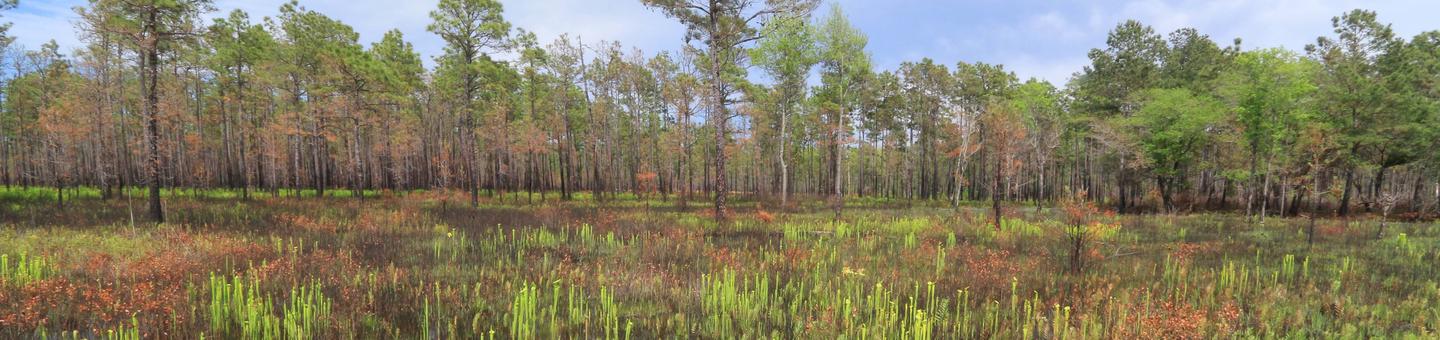
Little Hellhole Reservoir Birding Area Facility
Due to its significance to resident and migratory birds, the Francis Marion has been designated as an Important Bird Area by both the National Audubon Society and the American Bird Conservancy. Important Bird Areas are defined as sites that have been documented to support significant populations of particular species or a significant diversity of species. The Francis Marion provides essential stopover habitat for autumn and spring migrating birds, as well as critical breeding habitat.
Two species known to occur on the Francis Marion and listed on the National Audubon’s red list include the red-cockaded woodpecker (RCW) and Bachman’s sparrow (Aimophila aestivalis). Both species can be found on the forest with great regularity.
Approximately 12 species of migratory birds listed on the National Audubon’s yellow list have been documented on the forest as well. Significant numbers of species with high conservation priority such as the black-throated green warbler (Dendroica virens), Swainson’s warbler (Limnothlypis swainsonii), prothonotary warbler (Protonotaria citrea), worm-eating warbler (Helmitheros vermivora), brown-headed nuthatch (Sitta pusilla), RCW, Chuck-will’s Widow (Caprimulgus carolinensis), wood duck (Aix sponsa), and northern parula (Parula Americana) have also been documented.
Several recent reports of the ivory-billed woodpecker have surfaced from the Santee River and Wambaw Swamp Wilderness, but the species presence has yet to be confirmed by scientists. The swallow-tailed kite, a state endangered species, is frequently seen soaring over the forest with its long forked tail. The bird is known to nest 60-130 feet up in trees throughout the forest.
The red-cockaded woodpecker population has made a tremendous recovery since Hurricane Hugo devastated the forest in 1989. Today the forest functions as a donor population to help establish the birds in other locations.
Nicholson Creek Swamp Facility
Due to its significance to resident and migratory birds, the Francis Marion has been designated as an Important Bird Area by both the National Audubon Society and the American Bird Conservancy. Important Bird Areas are defined as sites that have been documented to support significant populations of particular species or a significant diversity of species. The Francis Marion provides essential stopover habitat for autumn and spring migrating birds, as well as critical breeding habitat. Two species known to occur on the Francis Marion and listed on the National Audubon’s red list include the red-cockaded woodpecker (RCW) and Bachman’s sparrow (Aimophila aestivalis). Both species can be found on the forest with great regularity.
Approximately 12 species of migratory birds listed on the National Audubon’s yellow list have been documented on the forest as well. Significant numbers of species with high conservation priority such as the black-throated green warbler (Dendroica virens), Swainson’s warbler (Limnothlypis swainsonii), prothonotary warbler (Protonotaria citrea), worm-eating warbler (Helmitheros vermivora), brown-headed nuthatch (Sitta pusilla), RCW, Chuck-will’s Widow (Caprimulgus carolinensis), wood duck (Aix sponsa), and northern parula (Parula Americana) have also been documented.
Several recent reports of the ivory-billed woodpecker have surfaced from the Santee River and Wambaw Swamp Wilderness, but the species presence has yet to be confirmed by scientists. The swallow-tailed kite, a state endangered species, is frequently seen soaring over the forest with its long forked tail. The bird is known to nest 60-130 feet up in trees throughout the forest.
The red-cockaded woodpecker population has made a tremendous recovery since Hurricane Hugo devastated the forest in 1989. Today the forest functions as a donor population to help establish the birds in other locations.
Santee River Floodplain Wildlife Viewing Area Facility
Due to its significance to resident and migratory birds, the Francis Marion has been designated as an Important Bird Area by both the National Audubon Society and the American Bird Conservancy. Important Bird Areas are defined as sites that have been documented to support significant populations of particular species or a significant diversity of species. The Francis Marion provides essential stopover habitat for autumn and spring migrating birds, as well as critical breeding habitat. Two species known to occur on the Francis Marion and listed on the National Audubon’s red list include the red-cockaded woodpecker (RCW) and Bachman’s sparrow (Aimophila aestivalis). Both species can be found on the forest with great regularity.
Approximately 12 species of migratory birds listed on the National Audubon’s yellow list have been documented on the forest as well. Significant numbers of species with high conservation priority such as the black-throated green warbler (Dendroica virens), Swainson’s warbler (Limnothlypis swainsonii), prothonotary warbler (Protonotaria citrea), worm-eating warbler (Helmitheros vermivora), brown-headed nuthatch (Sitta pusilla), RCW, Chuck-will’s Widow (Caprimulgus carolinensis), wood duck (Aix sponsa), and northern parula (Parula Americana) have also been documented.
Several recent reports of the ivory-billed woodpecker have surfaced from the Santee River and Wambaw Swamp Wilderness, but the species presence has yet to be confirmed by scientists. The swallow-tailed kite, a state endangered species, is frequently seen soaring over the forest with its long forked tail. The bird is known to nest 60-130 feet up in trees throughout the forest.
The red-cockaded woodpecker population has made a tremendous recovery since Hurricane Hugo devastated the forest in 1989. Today the forest functions as a donor population to help establish the birds in other locations.
Waterhorn Area Facility
Upland forest, bottomland hardwood/swamp
Old Georgetown Road Pond Facility
Old Georgetown Road Pond is one of several small ponds on the Francis Marion National Forest that provides good fishing for bass, bream and catfish.
Click here for a printable Francis Marion fishing opportunity guide.
Upper Nebo Pond Facility
Covering approximately 1.5 acres, Upper Nebo Pond is one of several small ponds on the Francis Marion National Forest that provides good fishing for bass, bream and catfish.
Click here for a printable Francis Marion fishing opportunity guide.
Bluebird Pond Facility
Bluebird Pond covers approximately three acres and provides good fishing for bass, bream and catfish.
Click here for a printable Francis Marion fishing opportunity guide.
Lower Nebo Pond Facility
The 1.5-acre Nebo Pond provides good fishing opportunities for bream, bass and catfish.
Click here for a printable Francis Marion fishing opportunity guide.
Brasstown Falls Facility
Primitive campsite.
Hellhole Bay Wilderness Facility
Hellhole Bay Wilderness (2,125 ac) may take its name from a large forest opening possibly formed by early wildfire behavior in the area. A shallow canoe trail a little over a mile long and often less than a foot deep crosses the bay and is passable during the wetter times of the year. But in dryer months it becomes a muddy trail and can be difficult to hike. Heavy thick undergrowth, wet unstable ground and numerous water moccasins add to the challenges. There is no boat ramp but paddlers can access wilderness from Hell Hole Rd.
Explore this wilderness in winter and early spring to avoid biting insects and water moccasins.
Take a compass and a good map, it is easy to get disoriented navigating the swamp.
Little Wambaw Swamp Wilderness Facility
Little Wambaw Swamp Wilderness (5,047 ac) features wild orchids, pickerel weed and bladderwort as part of its dense understory. Impressively large bald cypress and water tupelo trees grow throughout, some in areas believed to be virgin timber. The remains of raised railroad tram lines cross the area and may provide slightly higher ground for camping, but wading in the sloughs and bottomland hardwood forest is a necessity to explore the wilderness. There are no trails, and some areas are thick with undergrowth in the cypress/tupelo swamp. However there are beautiful areas of mature bottomland hardwoods comprised of oaks, hickories, sycamores and maples that are well worth experiencing. As with all lowcountry wildernesses, it is best to explore in winter and early spring. Access the area at the perimeter using FS roads 220A, 217A and B.
Wambaw Swamp Wilderness Facility
Wambaw Swamp Wilderness (4,815 acres) is thick with wild orchids, pickerel weed, sedges, lizard’s tail and ferns and is challenging to explore. There are no trails in the wilderness so those hardy enough to take on a slow-paced slog generally rely on orienteering skills to navigate. The wilderness is comprised of bottomland hardwood forest and is edged with small pine stands. While it offers little dry land, the water level is usually too low for boating. Mature cypress and tupelo trees and relatively open understory, especially off FS road 154 near Coffee Creek, provide some easier hiking and an opportunity to explore a place where very few people go.
Beaverdam Creek Facility
Beaverdam Creek
