
National Forests and Grasslands in Texas
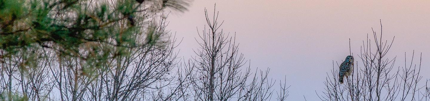
The National Forests in Texas provide a variety of outdoor recreation opportunities! There are dozens of developed recreation areas and trailheads, offering camping experiences ranging from highly developed to primitive. Camping is offered on a first-come, first-served basis in developed recreation areas, and some larger or more popular areas (Ratcliff Lake, Cagle, Double Lake), offer reservations through www.recreation.gov. Forest visitors can now camp up to 28 days at selected recreation areas in the National Forests and Grasslands in Texas. Click here to see this list of sites that offer the extended 28-day camping.
There is a day-use fee at highly developed areas with swimming or boating facilities. Campground facilities generally include tent pads, picnic tables, parking spurs for trailers, lantern posts, grills, potable water, and toilets.
View the Recreation Matrix to see the amenities that the campgrounds have to offer.
Other helpful information:
Outdoor Adventures tabloid | NFGT Hunting Guide tabloid | Hunting FAQs | Hunter Camp Maps | Annual Day-Use Pass Brochure
Links of interest:
Recreation.gov | National Park Service | Texas Parks & Wildlife
RecAreaDirections
N/A
Open with Google MapMisc
| Stay Limit | |
| Reservable | false |
| Keywords | |
| Map Link | |
| Contact Phone | |
| Contact Email |
Permits info
Facilities
Black Creek Lake Campground
List of CampsitesOverview
This location is available on a first-come, first-served basis only. Visitors are required to physically arrive at the campground to purchase and claim a site. Once on-site, you may be able to pay for your campsite(s) by scanning a QR code using the Recreation.gov mobile app, and the Scan and Pay feature.
If this option is available, you will need to first download the free Recreation.gov mobile app https://www.recreation.gov/mobile-app prior to your arrival as some remote areas have limited or no cellular service.
Black Creek Lake Campground has 14 campsites and is open year-round. Black Creek Lake is a 35 acre lake with a concrete boat ramp for access.
Facilities
Located on the north shore of the 35-acre Black Creek Lake, Black Creek Recreation Area has a picnic area and boat launch facility. The area also has walk-in camping sites available.
Nearby Attractions
Non-motorized trails
Bois D' Arc Campground
List of CampsitesOverview
This location is available on a first-come, first-served basis only. Visitors are required to physically arrive at the campground to purchase and claim a site. Once on-site, you may be able to pay for your campsite(s) by scanning a QR code using the Recreation.gov mobile app, and the Scan and Pay feature.
If this option is available, you will need to first download the free Recreation.gov mobile app https://www.recreation.gov/mobile-app prior to your arrival as some remote areas have limited or no cellular service.
Bois D'Arc Trailhead has 28 campsites with picnic tables. Bois D'Arc Trailhead also has a pailion with grill.
Facilities
The overnight trailhead has 28 campsites, sanitary facilities, horse washing area and potable water.
Nearby Attractions
Lake Davy Crockett and Coffee Mill Lake
Boles Field Campground
List of CampsitesOverview
This location is available on a first-come, first-served basis only. Visitors are required to physically arrive at the campground to purchase and claim a site. Once on-site, you may be able to pay for your campsite(s) by scanning a QR code using the Recreation.gov mobile app, and the Scan and Pay feature.
If this option is available, you will need to first download the free Recreation.gov mobile app https://www.recreation.gov/mobile-app prior to your arrival as some remote areas have limited or no cellular service.
Boykin Spring Campground
List of CampsitesOverview
This location is available on a first-come, first-served basis only. Visitors are required to physically arrive at the campground to purchase and claim a site. Once on-site, you may be able to pay for your campsite(s) by scanning a QR code using the Recreation.gov mobile app, and the Scan and Pay feature.
If this option is available, you will need to first download the free Recreation.gov mobile app https://www.recreation.gov/mobile-app prior to your arrival as some remote areas have limited or no cellular service.
Caney Creek Campground
List of CampsitesOverview
This location is available on a first-come, first-served basis only. Visitors are required to physically arrive at the campground to purchase and claim a site. Once on-site, you may be able to pay for your campsite(s) by scanning a QR code using the Recreation.gov mobile app, and the Scan and Pay feature.
If this option is available, you will need to first download the free Recreation.gov mobile app https://www.recreation.gov/mobile-app prior to your arrival as some remote areas have limited or no cellular service.
Facilities
Boat Launch, Vault toilet(s)
Nearby Attractions
Sam Rayburn Reservoir
Coffee Mill Campground
List of CampsitesOverview
This location is available on a first-come, first-served basis only. Visitors are required to physically arrive at the campground to purchase and claim a site. Once on-site, you may be able to pay for your campsite(s) by scanning a QR code using the Recreation.gov mobile app, and the Scan and Pay feature.
If this option is available, you will need to first download the free Recreation.gov mobile app https://www.recreation.gov/mobile-app prior to your arrival as some remote areas have limited or no cellular service.
Coffee Mill Campgrouns has 13 campsites and is open year-round. There is boat access to the 750 acre Coffee Mill Lake and a new fishing pier.
Facilities
Located on the north shore of the 750-acre Coffee Mill Lake, Coffee Mill Recreation Area was completed in 1968 with additional major construction done by volunteers in the early 1990s. The lake was built in the 1930s and provides many recreation opportunities.
Nearby Attractions
Lake Davy Crockett and non-motorized trails.
Red Hills Lake Campground
List of CampsitesOverview
This location is available on a first-come, first-served basis only. Visitors are required to physically arrive at the campground to purchase and claim a site. Once on-site, you may be able to pay for your campsite(s) by scanning a QR code using the Recreation.gov mobile app, and the Scan and Pay feature.
If this option is available, you will need to first download the free Recreation.gov mobile app https://www.recreation.gov/mobile-app prior to your arrival as some remote areas have limited or no cellular service.
Stubblefield Lake Campground
List of CampsitesOverview
This location is available on a first-come, first-served basis only. Visitors are required to physically arrive at the campground to purchase and claim a site. Once on-site, you may be able to pay for your campsite(s) by scanning a QR code using the Recreation.gov mobile app, and the Scan and Pay feature.
If this option is available, you will need to first download the free Recreation.gov mobile app https://www.recreation.gov/mobile-app prior to your arrival as some remote areas have limited or no cellular service.
Tadra Point Campground
List of CampsitesOverview
This location is available on a first-come, first-served basis only. Visitors are required to physically arrive at the campground to purchase and claim a site. Once on-site, you may be able to pay for your campsite(s) by scanning a QR code using the Recreation.gov mobile app, and the Scan and Pay feature.
If this option is available, you will need to first download the free Recreation.gov mobile app https://www.recreation.gov/mobile-app prior to your arrival as some remote areas have limited or no cellular service.
TADRA Point Trailhead has 20 parking spurs and 6 pull thoughs with numerous hitching posts available. There is water for horses and a pavilion with grill.
Facilities
Located south of Cottonwood Lake along FS Road 900, TADRA Point Trailhead is at the confluence of the five loops that comprise the 75-mile LBJ Multi-Use Trail System.
The trailhead was constructed through the volunteer efforts of local equestrian groups and is used throughout the year as headquarters for various non-commercial group events, including equestrian endurance rides.
Nearby Attractions
Cottonwood Lake and Little Cottonwood Lake
Townsend Campground
List of CampsitesOverview
This location is available on a first-come, first-served basis only. Visitors are required to physically arrive at the campground to purchase and claim a site. Once on-site, you may be able to pay for your campsite(s) by scanning a QR code using the Recreation.gov mobile app, and the Scan and Pay feature.
If this option is available, you will need to first download the free Recreation.gov mobile app https://www.recreation.gov/mobile-app prior to your arrival as some remote areas have limited or no cellular service.
Valley View Group Use Campground
List of CampsitesOverview
This location is available on a first-come, first-served basis only. Visitors are required to physically arrive at the campground to purchase and claim a site. Once on-site, you may be able to pay for your campsite(s) by scanning a QR code using the Recreation.gov mobile app, and the Scan and Pay feature.
If this option is available, you will need to first download the free Recreation.gov mobile app https://www.recreation.gov/mobile-app prior to your arrival as some remote areas have limited or no cellular service.
Valley View Campground has 15 campsites and a 20' x 40' pavilion with grill. There is water for horses.
Facilities
Valley View Group Use Facility is located within the 1,500-acre Designated Bird Dog Training Area on the LBJ Grasslands. This area is available for groups on a first-come, first-served basis.
For permit information, contact the Caddo/LBJ Ranger office. The facility was constructed through a volunteer agreement with local dog training enthusiasts.
The facility includes 15 camp units, a 20-by-40-foot pavilion with a “Texas-sized” charcoal grill, and a barrier-free double restroom.
Nearby Attractions
Non-motorized trails and small ponds
West Lake Davy Crockett Campground
List of CampsitesOverview
This location is available on a first-come, first-served basis only. Visitors are required to physically arrive at the campground to purchase and claim a site. Once on-site, you may be able to pay for your campsite(s) by scanning a QR code using the Recreation.gov mobile app, and the Scan and Pay feature.
If this option is available, you will need to first download the free Recreation.gov mobile app https://www.recreation.gov/mobile-app prior to your arrival as some remote areas have limited or no cellular service.
West Lake Crockett Campground has 12 campsites. Located on 450 acre Lake Davy Crockett.
Facilities
Located on the northwest shore of the 450-acre Lake Crockett, West Lake Crockett Recreation Area was completed in 1968. Lake Crockett was built in the 1930s as a recreation site for the area.
Visitors may fish from the shore.
Nearby Attractions
Coffee Mill Lake and Bois D'Arc Trailhead.
DOUBLE LAKE RECREATION AREA Campground
List of CampsitesOverview
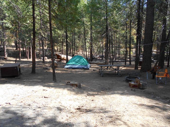
Double Lake Recreation Area was built in 1937 by the Civilian Conservation Corps and offers a little of everything, including camping, fishing, swimming, picnicking, hiking and simply relaxing in nature. A variety of tent, RV and group campsites are available.Recreation
Double Lake is stocked with bass, bream and catfish. There are three fishing piers and a limited access boat ramp with parking nearby for trailers. Only boats with small electric motors are allowed. Boat and canoe rentals are available seasonally.A 5-mile hiking trail leads to Big Creek Scenic Area, and there is access to part of the 128-mile Lone Star Hiking Trail. A 20-mile mountain bike trail meanders around the lake.
Swimmers can relax on a sandy beach after taking a cool plunge.
Learn more about recreation in the national forest.
Facilities
Double Lake Recreation Area facilities includes family camping units, group camping, picnicking units, a picnic shelter, beach with swimming area and a concession stand with bathhouse.Natural Features
The area has rolling hills forested with hardwood and pines. The campground is surrounded by the 23-acre Double Lake.Temperatures are moderate to cool from September through May, and hot and humid from June to August. Winters are cool and wet.
BOLES FIELD CAMPGROUND Campground
List of CampsitesOverview
Boles Field is located in the northern portion of Sabine National Forest in eastern Texas, near the border of Louisiana. The area centers around a cemetery for fox hounds established at the turn of the century, and some of the world's most well-known hunting dogs are buried here.
Campsites: First come, first served; 20 campsites with electric and water.
Camping Fee: $6; 14 days camping limit; up to 2 tents;8 people per site
Recreation
With the Toledo Bend Reservoir just six miles miles away, Boles Field offers an opportunity to visit one of the nation's most regarded freshwater fishing sites. The National Forests and Grasslands in Texas provide excellent opportunities for bird watching and wildlife viewing. East Texas lies in the path of warblers, vireos and other species of neotropical migrants, and birders look forward to the spring migration.Facilities
Uniquely developed for large gatherings, Boles Field has an amphitheater which holds approximately 100 people and group shelter that accommodate family events. Both are for day-use only.
Campsites: First come, first served; 20 campsites with electric and water; equipped with water and electric hookups. Horses are allowed in the campground.
Camping Fee: $6; 14 days camping limit; up to 2 tents;8 people per site
Day Use Shelter & Amphitheater available for Reservation: 877-444-6777 or through website (www.Recreation.gov)
Natural Features
The campground sits in a pine and hardwood forest near the Toledo Bend Reservoirs, two large east Texas lakes. Wildlife is abundant, and the area is a hot spot for migratory birds.Nearby Attractions
BOYKIN SPRINGS RECREATION AREA Campground
List of CampsitesOverview
Located on Boykin Springs Lake in Angelina National Forest, this recreation area offers a little of everything, including camping, hiking, fishing, picnicking and relaxing in nature. It is situated in eastern Texas near the Louisiana border.The facility has both a campground and day-use area. The group shelter must be reserved; the campground is first-come, first-served.
Recreation
The group picnic area provides direct access to the Sawmill Trail, a hiking trail that winds through the forest to the Aldridge Sawmill Historical Site.
Activities: fishing, no designated swimming area, hiking trail
From US 69: SH 63 SE 11 miles; FSR 313 S 2.5 miles. 936-897-1068; recreation.gov
31.05186, -94.26804
Facilities
The group picnic shelter accommodates up to 74 guests and is available for reservation. It is adjacent to the hiking trail and creek.
The campground has several standard sites for tents and RVs, as well as a few tent-only sites. Drinking water, flush toilets and hot showers are available at the campground.
Campsites: All campsites are first come, first served; 17 campsites No electric or water. Back-in campers and tents; campsite can accommodate up to 23 ft. in length
Camping Fee: $10; 14 days camping limit; up to 2 tents;8 people per site
Day Use Shelter available for Reservation: 877-444-6777 or through website (www.Recreation.gov)
Natural Features
Boykin Creek and the nine-acre Boykin Springs Lake both pass through the facility, and the Sam Rayburn Reservoir is nearby.The area is forested with pines and hardwoods. Wildlife is abundant, and the region is a hot spot for migratory birds.
Nearby Attractions
Aldridge Sawmill Historical Site
Sam Rayburn Reservoir
CAGLE RECREATION AREA Campground
List of CampsitesOverview
Cagle Recreation Area is a popular campground and day-use area that sits along the shoreline of Lake Conroe on the west fork of the San Jacinto River, just 1 hour north of Houston, Texas. The area offers great camping, fishing, hiking, hunting, birding and water sports year-round.Recreation
Anglers are drawn to the 22,000-acre Lake Conroe for its forested lake shore and open water. The lake is particularly noted for black bass and year-round fishing. Swimming is not allowed, but fishing, hiking, picnicking and shoreline wading are sure to provide plenty of fun for kids. Hikers and mountain bikers can try the 2-mile Cagle Trail within the facility. Learn more about recreation in the national forest.Facilities
The campground offers sites with full-service hookups organized into two loops. Each loop has sites overlooking Lake Conroe and restrooms with flush toilets, sinks and hot showers. The facility also has a boat ramp with large parking area, hiking and bicycle trails and a picnic area overlooking the lake.Natural Features
Cagle is nestled among the pines of the Sam Houston National Forest. This area is covered with beautiful large pine and hardwood trees plus thousands of colorful wildflowers. Mid-February redbud tree blossoms followed by dogwood blossoms in early March put on a spectacular display of flowers.Lake Conroe and the surrounding forest provide wintering habitat for the endangered bald eagle.
Temperatures are moderate to cool from September through May, and hot and humid from June to August. Winters are cool and wet.
Nearby Attractions
Visitors can explore the national forest's 85 miles of off-road vehicle, equestrian and mountain bike trails. The 128 mile Lone Star Hiking trail is nearby with a portion of the trail located near Lake Conroe.RATCLIFF LAKE RECREATION AREA Campground
List of CampsitesOverview
Ratcliff Lake Recreation Area was built in 1936 by the Civilian Conservation Corps. It surrounds a picturesque 45-acre lake that was once a log pond and a source of water for the Central Coal and Coke Company sawmill which operated from 1902 to 1920.The facility is open year-round and includes a large campground, picnic areas, a reservable amphitheater, a swim area and many opportunities for outdoor recreation. Camping is available year-round.
The Davy Crockett National Forest, named for the legendary pioneer, contains more than 160,000 acres of East Texas woodlands, streams, recreation areas and wildlife habitat. Located in Houston and Trinity Counties, the forest is centrally located within the Neches and Trinity River basins.
Recreation
Swimming, fishing, hunting, hiking and picnicking are the area's main activities. The designated swimming area and playground provides much fun for the kids (no lifeguard on duty).Fishing piers are available for anglers to try for largemouth bass, bream and channel/blue catfish. Only electric motors are allowed on the lake. Principal game for hunting on the national forest includes squirrel, deer, quail, dove, turkey and waterfowl.
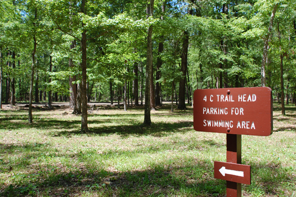
Three main hiking trails can be accessed from the facility: the 1.5-mile Tall Pines, 0.75-mile Trail Tamers and the 20-mile Four C, which winds through many types of forests to a scenic overlook.
Learn more about recreation in the national forest.
Facilities
Ratcliff Lake has 56 campsites, both first-come, first-served and reservable. Campsites in Dogwood Loop have electrical hookups and can accommodate vehicles up to 50 ft. Flush toilets, hot and cold showers and trash bins are also provided. Two picnic shelters and an amphitheater are also reservable.The day-use area has 17 single family picnicking units, a swimming area, flush toilets, two wooden fishing piers, one earthen pier, one fishing platform and a boat ramp.
Natural Features
The campground is heavily forested with loblolly pine, oak and other hardwoods, and surrounds Ratcliff Lake. A wide variety of wildlife exists in the area, including the endangered red-cockaded woodpecker.Nearby Attractions
The Big Slough Wilderness Area, located along the Neches River about five miles north of Ratcliff, is free of modern development and gives the visitor a place for solitude and primitive experiences.ANGELINA (Sam Rayburn Reservoir Area) 936-897-1068 Facility
Located in the heart of east Texas, the 153,179-acre Angelina National Forest is located in Angelina, Nacogdoches, San Augustine and Jasper counties. The forest lies in the Neches River Basin and on the north and south shores of Sam Rayburn Reservoir, a 114,500-acre lake on the Angelina River formed by the construction of Sam Rayburn Dam in the early 1960's.

DAVY CROCKETT (Lufkin/Crockett Area): 936-655-2299 Facility
The Davy Crockett National Forest, named for the legendary pioneer, contains more than 160,000 acres of East Texas woodlands, streams, recreation areas, and wildlife habitat. Located in Houston and Trinity Counties, the forest is centrally located within the Neches and Trinity River basins. The Davy Crockett National Forest was proclaimed a National Forest by President Franklin Roosevelt on October 15, 1936.
Black Creek Lake: (940) 627-5475 Facility
Located on the north shore of the 35-acre Black Creek Lake, Black Creek Recreation Area has a picnic area and boat launch facility. The area also has walk-in camping sites available.
Neches Bluff Overlook: (936) 655-2299 Facility
This is a trailhead for the 4C Hiking Trail. Neches Bluff Overlook, located at the north end of the trail, offers a panoramic view of pine-hardwood forests in the Neches River bottomlands with picnic and primitive camping facilities.
Rhodes Lake: (940) 627-5475 Facility
Rhodes Lake, located northeast of Alvord off CR 2690, is 18 acres in size and has a boat ramp. Motorized boating is allowed.
SABINE (Toledo Bend Reservoir Area): 409-625-1940 Facility
Located in the pineywoods of east Texas, the 160,656-acre Sabine National Forest is the easternmost of the four national forests in Texas and forms part of the boundary between Texas and Louisiana. The forest is situated on the western slopes of the Sabine River watershed within Sabine, San Augustine, Shelby, Jasper, and Newton counties.

SAM HOUSTON (Houston/Conroe/Huntsville Area) Facility
Sam Houston National Forest, one of four National Forests in Texas, is located 50 miles north of Houston. The forest contains 163, 037 acres between Huntsville, Conroe, Cleveland and Richards, Texas. With land in Montgomery, Walker, and San Jacinto counties, the Sam Houston National Forest is intermingled with privately owned timber lands and small farms.

