
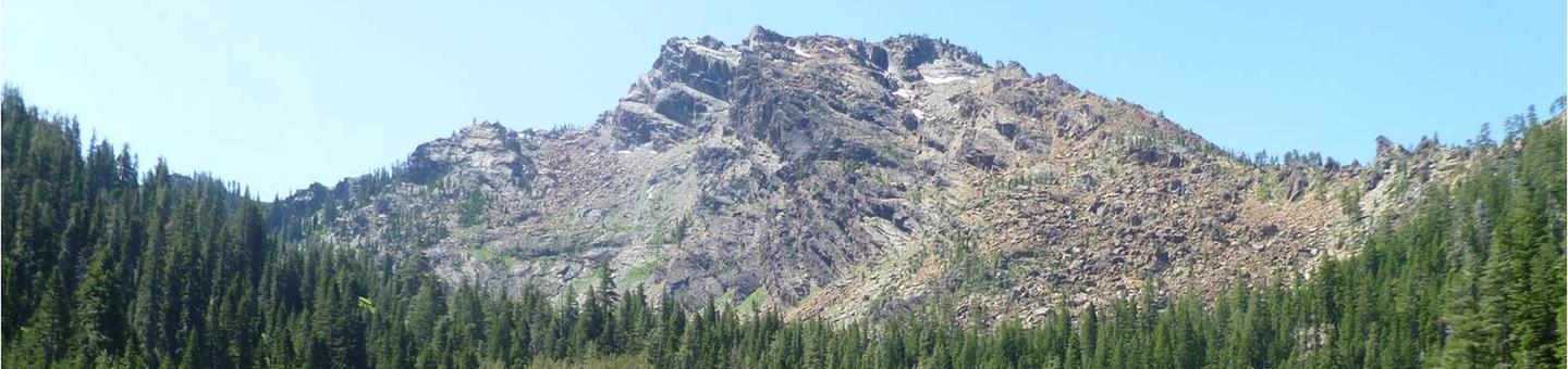
Klamath National Forest

A man hikes along a trail on a high ridge overlooking a beautiful valley.
Want to kick back and relax under shady pines by a sparkling lake? Looking for a "base camp" for a day of hiking, boating, white water rafting, fishing, or swimming? Want to just get out of the house for the day for a nice picnic in the great outdoors? If so, the Klamath National Forest can offer you that and more!
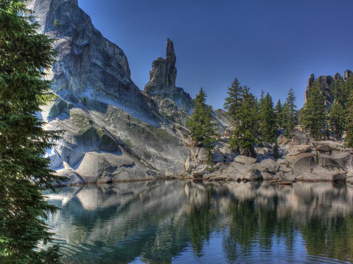
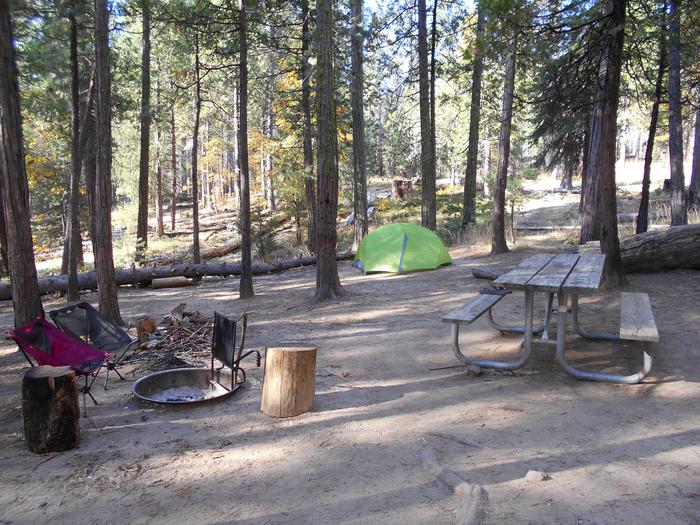
With nearly one million acres for your enjoyment, relaxation, and exploration, you can experience the solitude of the wilderness or enjoy camping near others in developed campgrounds. Camp in densely forested woodlands or open meadows, discover secluded flats along river banks and enjoy panoramic views of majestic mountains.
A continuing goal of the Klamath National Forest is to make these recreational opportunities accessible to persons with disabilities.
RecAreaDirections
Open with Google Map
Misc
| Stay Limit | |
| Reservable | false |
| Keywords | |
| Map Link | |
| Contact Phone | |
| Contact Email |
Permits info
Facilities
HIDDEN HORSE EQUESTRIAN CAMPGROUND Campground
List of CampsitesOverview
The Hidden Horse Equestrian Campground is located at the Southern edge of the Klamath National Forest on the South Fork of the Salmon River. Offering a total of six equestrian sites, only one of these sites, #6, is available for reservation.Recreation
The Hidden Horse Equestrian Campground is adjacent to the Trinity Alps Wilderness, Russian Wilderness and the Pacific Crest National Scenic Trail. From this site, you can ride to three trailheads that access several wilderness lakes and countless miles of trails.Facilities
Campsite #6 offers pull-through parking and four iron horse corrals measuring 12' x 12'.Natural Features
The Klamath National Forest encompasses nearly 2 million acres of land straddling the California and Oregon border.The Klamath is a vast array of mountains, streams, lakes, and, at elevations ranging from 450 to 8,900 feet, is home to diverse plant life and nearly 400 animal species. The partially shaded campground sits at an elevation of 5,800 feet.
Nearby Attractions
Trinity Alps Wilderness, Russian Wilderness and the Pacific Crest Trail all are nearby and offer hiking and horseback riding opportunities.Klamath National Forest Christmas Tree Permit Tree Permit
CARTER MEADOWS HORSE GROUP Campground
List of CampsitesOverview
The Carter Meadows Horse Group Campground lies at the southern edge of the Klamath National Forest on the South Fork of the Salmon River. Designed for large groups with horses, the camp's proximity to the Trinity Alps Wilderness and the Pacific Crest Trail makes the site popular with riders and hikers.Recreation
The Carter Meadows Horse Group Site is adjacent to the Trinity Alps Wilderness and the Pacific Crest Trail. From this site, groups can ride to three trailheads that access several wilderness lakes and many miles of trails.Fishing is available in nearby streams and wilderness lakes.
Facilities
The Carter Meadows Horse Group Site is designed for up to 25 people and 25 horses. It includes an area for dispersed tent or trailer camping and three sections of corrals of varying sizes: seven one-horse corrals, three 2-horse corrals and three 3-4 horse corrals.The site also includes a gravel parking area, a gated entrance, a hitch rack and a mounting ramp.
Natural Features
The Klamath National Forest encompasses nearly 2 million acres of land straddling the California and Oregon border.The Klamath is a vast array of mountains, streams and lakes and, at elevations ranging from 450 to 8,900 feet, is home to diverse plant life and nearly 400 animal species. The partially shaded campground sits at an altitude of 5,800 feet.
Nearby Attractions
A short drive away, the Carter Meadows Summit is accessible for day hikes along the Pacific Crest Trail to Hidden and South Fork Lakes.INDIAN SCOTTY GROUP SITE Campground
List of CampsitesOverview
Indian Scotty Group Site is located next to the Wild and Scenic Scott River in Klamath National Forest. Visitors enjoy swimming, tubing, whitewater boating. and fishing on the river. Several trailheads for the Marble Mountains Wilderness are nearby.Recreation
During summer, when flows in the Scott River are low, campers can fish, swim, or go tubing in the river. During the higher flows of spring, the Scott River offers class IV-V whitewater runs through the Scott River canyon. Several Marble Mountain Wilderness trailheads are easily accessed from the camground, including Boulder, Kelsey, and Lovers Camp.Facilities
Indian Scotty is set in an open grassy area surrounded by trees. The site is particularly suited for RVs up to 30 feet in length because of its configuration. Some campsites have views of the river. A campfire circle and grill are provided. A playground is available on-site.Natural Features
The riverside group site sits in a forest of cedar, Douglas fir and Pondarosa pine at an elevation of 2,400 feet. Mount Shasta, not part of the Klamath, is visible from some areas within the compound.The Klamath National Forest encompasses nearly 2 million acres of land straddling the California and Oregon border. The Klamath encompasses a vast array of mountains, streams and lakes and, at elevations ranging from 450 to 8,900 feet, is home to diverse plant life and nearly 400 animal species.
SARAH TOTTEN CAMPGROUND Campground
List of CampsitesOverview
Sarah Totten Campground is located within the Klamath Wild and Scenic River corridor, about 33 miles east of the town of Happy Camp. The campground has nine family sites and two group sites. The group sites are reservable during the peak-use season, mid-May to mid-October. The family sites are first-come first-served. The campground's upper loop with four family sites and one group site is open year-round. A boat-launching area with a sandy surface provides river access for anglers with drift boats and whitewater boaters.
Recreation
The class II-III Klamath River can be accessed from the campground, and lends itself to fishing, tubing, whitewater rafting and kayaking. Hiking trails are available in the vicinity.Facilities
The campground offers two group sites and nine single-family sites. The group sites can accommodate a maximum of 30 people each. They feature an area for dispersed tent camping and several picnic tables and campfire rings with grills. Other amenities include accessible vault toilets, drinking water spigots, trash collection and a parking area for vehicles and trailers.Natural Features
The campground sits in a shaded area next to the Klamath River at an elevation of 1,400 feet.
The Klamath National Forest encompasses 1.7 million acres of land straddling the California-Oregon border. The Klamath contains a vast array of mountains, streams and lakes. With elevations ranging from 450 to 8,900 feet, the forest is home to diverse plant life and nearly 400 animal species.
Nearby Attractions
The campground is close to the historic town of Hamburg, once a stomping ground for wealthy fly fisherman and sportsmen, including author Zane Grey. Crumpled structures and rock foundations are all that remain of Hamburg's erstwhile structures, including Johnston's Store and Hotel, Bailey Post Office and Bucket of Blood Saloon.CURLY JACK CAMPGROUND Campground
List of CampsitesOverview
Curly Jack Campground is situated along the Klamath Wild and Scenic River near the town of Happy Camp. Visitors enjoy whitewater boating and fishing on the river, and exploring local hiking trails.Recreation
Fishing, birding, hiking and whitewater boating are popular options, as is scenic driving along the State of Jefferson Scenic Byway. Visitors can access a Class III section of the Klamath River from the campground. The campsite is a put-in and take-out point for whitewater rafting - boats must be carried across a gravel bar.Facilities
The campground offers shaded single family sites, as well as four group sites that can accommodate up to 30 people each. Many sites have a view of the river. Group sites feature a general area for dispersed tent camping and a large gravel parking area for extra vehicles and trailers.Natural Features
The campsground sits at an elevation of 1,075 feet on the banks of the Klamath River opposite the town of Happy Camp. The Klamath National Forest is comprised of a vast array of mountains, streams and lakes straddling the California and Oregon border. The nearly 2-million acre forest includes five wilderness areas, one scenic byway, 200 miles of wild and scenic river and 1,100 miles of hiking and equestrian trails. Elevations range from 450 to 8,900 feet, making for varied topography and diverse plant and animal life.Nearby Attractions
The campground is within walking distance to the town of Happy Camp, where there are restaurants and a grocery store. A whitewater rafting outfitter and several fishing guides are based in Happy Camp.TREE OF HEAVEN CAMPGROUND Campground
List of CampsitesOverview
Tree of Heaven Campground is situated next to the Klamath Wild and Scenic River, making it popular with whitewater boaters and anglers. Visitors also enjoy birding and hiking along an interpretive trail.Recreation
Fishing, birding, and whitewater boating on the class II-III Klamath River are popular options. The campground contains a quarter-mile interpretive trail and a large group day use area with a volleyball net and horseshoe pit.Facilities
The campground has 21 sites. Vault toilets and drinking water are provided. A paved boat ramp provides access to the Klamath River.Natural Features
The campground sits at an elevation of 2,100 feet on the Wild and Scenic Klamath River, a short distance from the State of Jefferson Scenic Byway.The Klamath National Forest encompasses a vast array of mountains, streams and lakes straddling the California and Oregon border. The nearly 2-million acre forest includes five wilderness areas, one scenic byway, 200 miles of wild and scenic river and 1,100 miles of hiking and equestrian trials. Elevations range from 450 to 8,900 feet, making for varied topography and diverse plant and animal life.
JUANITA LAKE GROUP CAMPSITE Campground
List of CampsitesOverview
Juanita Lake campground offers a group campsite adjacent to Juanita Lake on the Klamath National Forest. The lake offers a unique combination of recreation opportunities including many water-based activities like fishing and swimming.
Recreation
The 55 acre Juanita Lake is excellent for small rowboats, rafts, and canoes. There is a paved boat launch ramp, a dock in the summer, and fish cleaning station. No motors are permitted on the lake. The lake is regularly stocked with trout and has a bass and catfish population.Those wanting to explore will enjoy the 1.5 mile paved, barrier free trail that circles the lake with two fishing jetties for easy lake access. For the more ambitious hiker, there is a 6 mile hike with a 2,700 foot elevation gain climbing up to Ball Mountain Lookout.
Visitors interested in cooling off will delight in a swim or simply wading and water-play from the shoreline.
Facilities
The group site is located next to Juanita Lake in a private location away from the main campground. There are four parking areas that can accommodate approximately 15 vehicles. The site offers drinking water (two spigots), eight picnic tables, a large group campfire ring, four pedestal grills, eight lantern hangers, five bear-proof trash cans and two vault toilets. All camp/tent areas have views of the lake. There is limited RV parking at the group site. This site is more suited for non-RV group use.Natural Features
The partially shaded campground sits at an altitude of 5,130 feet and is located on the shores of Juanita Lake surrounded by a ponderosa pine forest. The lake is a favorite bird watching area with bald eagles and osprey regularly fishing the lake. Sit among the pines and fish or watch a diverse array of wildlife that uses the area.Nearby Attractions
The Butte Valley Wildlife Area is within four miles.Klamath National Wild & Scenic River Facility
The Klamath River was designated a Recreational River within the National Wild & Scenic Rivers System in 1981. The Klamath River enters California from Oregon just north of the Goosenest Ranger District. As it heads west it is impounded by two dams which form Copco Lake and Iron Gate Reservoir. Nine miles further west it turns south and follows Interstate 5 for a few miles before again turning west and entering the Happy Camp/Oak Knoll Ranger District. The next 85 miles provide many opportunities for recreation and scenic vistas before the river enters the Six Rivers National Forest. This is a high-use recreation zone. Human waste must be packed out. A scat machine is available in Happy Camp for disposing of collected human waste.
Our interactive river map will help you plan your river trip. It includes information on put-ins and take-puts, rapids, and potential camping sites. You will need to download Google Earth to view the map. You can also book a river trip with one of our permitted outfitters.
Before you start your river trip please complete a trip documentation card. Trip cards are available at river access sites, and may be turned in at the Happy Camp Ranger District office or dropped into one of the trip card boxes available at put-ins. The trip cards help Forest Service staff estimate river use, help us focus our limited staff resources on busier river sections, and help us know if boaters are on a river section if the need for an emergency evacuation arises.
Sections of the Klamath River downstream from Happy Camp are subject to temporary river use restrictions during the summer in observance of Karuk Tribal ceremonies. Please refer to the current schedule for information on the current year's river access restrictions. 2021 Klamath River Closures for Karuk Tribal Ceremonies
A. Ash Creek River Access Facility
The entrance to Ash Creek River Access is a short dirt road to a small turn around. The ramp to the river is sand and not designed for trailers and RV's. There is limited parking. No facilities.
S. Coon Creek River Access Facility
Parking for Coon Creek River Access is on Hwy 96. There is a paved access road to the water's edge but no room for turn around or parking. The Forest Service provides a portable toilet here in summer months. A short hike up Ukonom Creek is the scenic Ukonom falls.
U. Dillon Creek River Access Facility
Parking for Dillon Creek River Access is on Hwy 96 across the road from the Dillon Creek Campground. Access the Klamath River by hiking down an undeveloped trail along the Dillon Creek. The Dillon Creek Trail starts on the north side of Dillon Creek near the bridge, and continues several miles upstream along Dillon Creek. The Dillon Creek Campground is a fee area, please do not park in the campground for day use.
X. Ti Bar River Access Facility
The road off Hwy 96 down to the cobble bar at Ti Bar will accommodate RV's. There is an information sign, permanent restroom, ample parking and shaded dispersed camping area. Large rigs should check for overhead clearance when parking under trees.
Y. Rock Creek River Access Facility
Parking for Rock Creek River Access is only on Hwy 96 and is limited. There is a 1/4 mile steep hiking trail to the river.
Z. Stuarts Bar River Access Facility
Downstream from the R. Lyle Davis bridge is a dirt road leading to a steep graded road to the river bar under the bridge. There is parking available.
Due to steepness and very sharp switchback, this access is not recommended for vehicles towing jet boat trailers, etc.
Zz. Green Riffle River Access/Mandatory Take Out Facility
You must exit the Klamath River here. This is the last legal take out before the Ishi Pishi Falls (class 6). A 1/2 mile long graded road leads to the river bar with an unimproved road to the water's edge.
Norcross Trailhead Facility
The Norcross Trailhead is located at the southern end of the Norcross Campground. Completely destroyed in the Panther Fire in 2008, Norcross Campground has been rebuilt and reopened in late 2009. Water is available for horses but not for human consumption. There are two main trails out of Norcross heading into the Marble Mountain Wilderness; the Elk Creek Trail and the Kelsey National Recreation Trail along Bear Creek to Bear Valley and Bear Lake. The Elk Creek Trail can be ridden or hiked as 4 different loops with a variety of destinations and mountain lakes.
Salmon/Scott River Ranger District Facility
Water activities, boating, floating and swimming abound on the two Wild and Scenic Rivers of the Salmon and the Scott.
Big Flat Campground Campground
List of CampsitesBig Flat campground has 9 campsites, and access to many trails in the Trinity Alps Wilderness, including the Caribou Lakes. There is no potable water or garbage service provided, but there are vault toilets in the campground. There is also a small corral. Due to elevation, accessibility determined by snow levels.
Hotelling Campground Campground
List of CampsitesHotelling campground has 4 campsites right on the South Fork of the Salmon River. Easy access makes it a popular destination all summer long with the locals.
Salmon National Wild & Scenic River Facility
The Salmon River was designated a Scenic River and Recreational River within the National Wild & Scenic Rivers System in 1981. The South Fork Salmon was also designated a Scenic and Recreational River in 1981. The North Fork Salmon was designated a Wild and Recreational River within the national system in 1981. The watersheds of two great wilderness areas combine to form the Salmon River. The North Fork of the Salmon River begins high up in the Marble Mountains Wilderness while the South Fork of the Salmon finds its origins in the Trinity Alps Wilderness. The two forks join forces at a place aptly called Forks of Salmon. Twenty miles further west and the Salmon River empties into the Klamath and continues on to the Pacific Ocean. This area is rich with history and culture of native people and of gold seekers and pioneers.
Nordheimer Flat River Access Facility
The river access is a graded gravel road to a cobble bar.
Nordheimer Campground is administered by the Six Rivers National Forest.
Bonally Mine River Access Facility
Bonally Mine River Access
Saw Pit Flat River Access Facility
This acces to the North Fork of the Salmon River is a short road to a cobble bar for parking. Boats must be carried a short distance to the water.
Red Bank River Access Facility
Red Bank River Access
Jack Ass Creek River Access Facility
Jack Ass Creek River Access
Henry Bell River Access Facility
Henry Bell River Access
Methodist Creek River Access Facility
Methodist Creek River Access
Matthews Creek River Access Facility
This access on the South Fork of the Salmon River has a short road to a large parking area on the cobble bar. Boats must be carried a short distance to the water. This access is located adjacent to Matthews Creek Campground, a fee site. Do not park in campsites.
Johnson Bar River Access Facility
Located on the Scott River this access is a graded road to a cobble river bar.
Lighthill Mine River Access Facility
Access to the Scott River here is a rough, steep road to an old mining claim. Boats must be carried a short distance to the water. There is a nice swimming hole here and it is a popular take out point for rafters.
Sugar Pine Gulch River Access Facility
Sugar Pine Gulch River Access
Townsend Gulch River Access Facility
Entry to the Scott River here is a graded gravel ramp to the water's edge. There is limited parking. Schuler Gulch rapids is located downstream. Be sure to scout ahead!
Gold Flat River Access Facility
Gold Flat River Access
Thompkins Creek River Access Facility
Thompkins Creek River Access
Canyon Creek River Access Facility
To reach Canyon Creek River Access, turn off Scott River Road on Canyon Creek Road. Cross the bridge and find the access area at .2 mile. This site consists of a small parking area with trail access to a put in eddy at the base of a long rapids. There is a reliable guage on the west pier of the bridge. READINGS OVER 3.5 ON THE GUAGE ARE CONSIDERED DANGEROUS.
Etna Summit Trailhead Facility
The Pacific Crest Trail crosses County Road 1C01 at Etna Summit (5960'). The trail heads north into the Marble Mountain Wilderness and south into the Russian Wilderness. This area has great views and cooler temperatures than the Scott Valley below. There is parking available.
Due to elevation, accessibility determined by snow levels.
Shackleford Trailhead Facility
The Shackleford Creek trail begins here and heads southwest into the Marble Mountains Wilderness. Stock water and corrals are available at the trailhead. This trail goes to Summit Lake, Campbell Lake and Cliff Lake but has no direct connection to the PCT. One can expect to see cattle in this area during the managed grazing season.
Box Camp Trailhead Facility
Box Camp Trailhead
Paradise Trailhead Facility
Paradise Trailhead
Deacon Lee Trailhead Facility
Deacon Lee Trailhead
Duck-Eaton Trailhead Facility
Duck-Eaton Trailhead
Music Creek Trailhead Facility
Music Creek Trailhead
Taylor Lake Trailhead Facility
Taylor Lake Trailhead
Carter Meadows Summit Trailhead Facility
Carter Meadows Summit Trailhead
Middle Boulder Trailhead Facility
Middle Boulder Trailhead
East Boulder Trailhead Facility
East Boulder Trailhead
Fish Lake Trailhead Facility
Fish Lake Trailhead
Long Gulch Trailhead Facility
Long Gulch Trailhead
Trail Gulch Trailhead Facility
Trail Gulch Trailhead
Bigflat Trailhead Facility
The Bigflat Trailhead is the starting point for popular hikes to the Trinity Alps Wilderness including Caribou Lakes.
Scott National Wild & Scenic River Facility
The Scott River was designated a Scenic River within the National Wild & Scenic River System in 1981.
Whaleback Launch Site Facility
A popular paragliding launch site at 7437 ft (2267 m) elevation with spectacular views of Mt. Shasta and the Shasta Valley. The Whaleback (8,528 ft; 2599 m) is one of the highest points on the Goosenest Ranger District. For additional launch site information and safety guidelines go to the Rogue Valley Hang Gliding and Paragliding Association website.
Juniper Flat OHV Area Facility
The Juniper Flat OHV recreation area is a popular destination for off road riders from the Yreka, Weed and Mt Shasta Areas. It is located in the Shasta Valley in a flat area of sandy soils and lava flows amidst juniper and sage vegetation. Juniper Flat is approximately 15 miles from Weed and 25 miles from miles from Yreka and Mt. Shasta.
The Juniper Flat OHV Area, located on the Goosenest Ranger District, provides riders with 48 acres of open riding terrain and has a day use parking area, picnic tables, vault toilets, and a loading/unloading ramp. In addition, the Goosenest Ranger District offers 657 miles of road open to OHV use. For details about roads open to off highway vehicles please pick up a current copy of the Klamath National Forest Motor Vehicle Use Map, which is available free of charge at all Klamath National Forest Offices and is available on this website.
Find your way there by using the Goosenest South Motor Vehicle Use Map (MVUM).
Always be sure to wear proper safety gear and make sure your vehicle has the appropriate tags from the California Department of Motor Vehicles.
Humbug OHV Recreation Area Facility
The Humbug OHV Area, located on the Happy Camp/Oak Knoll Ranger Districts, provides riders with 14 miles of trails (open to vehicles 50 inches or less in width), a youth riding area, and 5 acres of open riding terrain. It has a day use parking area, picnic tables, two campsites, vault toilets, and a loading/unloading ramp. In addition, the Happy Camp/Oak Knoll Ranger Districts offer 695 miles of road open to OHV use. For details about roads open to off-highway vehicles please pick up a current copy of the Klamath National Forest Motor Vehicle Use Map, which is available free of charge at all Klamath National Forest Offices and is available on-line at www.fs.usda.gov/klamath.
Always be sure to wear proper safety gear and make sure your vehicle has the appropriate tags from the California Department of Motor Vehicles.
Living Memorial Sculpture Garden Facility
The Living Memorial Sculpture Garden is an exceptional 136-acre art installation and war memorial along Highway 97 on the Goosenest Ranger District of the Klamath National Forest. Created in 1988 by a dedicated group of veterans, the site is now maintained under an agreement with the USDA Forest Service.
The site includes the Hot LZ Memorial Wall, The Labryinth, and ten scultures by artist Dennis Smith.
The Living Memorial Scultuire Garden is located on the west side of Highway 97, 0.9 mile north of the intersection with the A-12 Road, 13 miles north of weed, and 27 miles south of Macdoel. Please note there is no water, no restroom, and no garbage service. The Grass Lake Rest Area is located 8.6 miles north on Highway 97.
For more information, please visit the Living Memorial Sculpture Garden web site at www.weedlmsg.org.

Happy Camp Town Trailhead Facility
The trailhead for this 1 mile long trail is on the north side of the Elk Creek County Road (7C 002), approximately 1 mile south of the road's crossing over the Klamath River. The trail climbs a steep hillside to gain views of the Happy Camp area and the Klamath River.
Benjamin Creek Trailhead Facility
This mult-use trail is 5.5 miles in length, and provides views of the Klamath River. To reach the trailhead, drive south 2 miles from Happy Camp, CA on Highway 96. Turn right and go north on Crocker Rd. .10 mile to Forest Road 17N16. Go south on Forest Road 17N16 1.1 miles to the trailhead on the south side of the road.
Cook and Green Pass Trailhead Facility
This trailhead provide access to the Pacific Crest Trail and the Boundary National Recreation Trail. The Boundary National Recreation Trail is 7.9 miles long and is located along, but oustide of, the southern boundary of the Red Buttes Wilderness. To reach this trailhead, drive north 12 miles from Highway 96 on Forest Road 48N20 to the Cook and Green Pass (elevation 4,770 ft). To reach the Boundary Trail, hike south along the Pacific Crest Trail for approximately 5.5 miles to its junction with the Boundary Trail.
