
Mendocino National Forest
Recreation Information
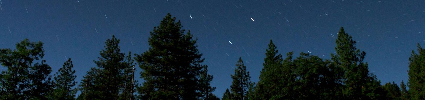
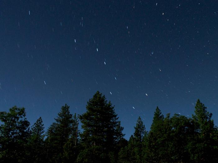
Howard Lake is located on the Covelo Ranger District.
Want to kick back and relax under shady pines by a sparkling lake? Looking for a "base camp" for a day of hiking, boating, fishing, or swimming? Want to just get out of the house for the day for a nice picnic in the great outdoors? If so, the Mendocino National Forest can offer you that and more!
Offering nearly one million acres for your enjoyment, relaxation, and exploration, you can experience the solitude of the wilderness or enjoy camping near others in developed campgrounds. Camp in densely forested woodlands or open meadows, discover secluded flats along river banks and enjoy panoramic views of majestic mountains.
A continuing goal of the Mendocino National Forest is to ensure accessible recreational opportunities are available to everyone.
Policy on Pet Dogs
Pets in Developed Recreation Sites: Under 36 CFR 261.16(j) Animals, other than a seeing eye dog, must be crated, caged, or upon a leash not longer than six feet, or otherwise under physical restrictive control.
Find Popular Campgrounds
To use our web site to help you plan your visit to the Forest, navigate by choosing your planned recreational activity in the left menu. If you have a favorite area in mind, it may be faster to use the map below or the "Find An Area" link in the right-hand column. The current status of the more popular campgrounds and trailheads, is listed in the table below the map with a link to more information.
Alerts & Notices
Also be sure to look at the Alerts & Notices page to view any emergency closures or other information that might affect your visit.
RecAreaDirections
Open with Google Map
Misc
| Stay Limit | |
| Reservable | false |
| Keywords | |
| Map Link | |
| Contact Phone | |
| Contact Email |
Permits info
Facilities
Camp Discovery Group Camp (Red Bluff Recreation Area) Campground
List of CampsitesOverview
Camp Discovery Group Campground is a reservation only campground located just outside the full service town of Red Bluff, California. The campground has 11 screened sleeping cabins, showers, dish washing facilities, vault toilets, amphitheater, two cabanas with picnic tables, preperation tables, secure storage areas, lighting, and four large grills. Additional tent camping is available under the small conifer forest at the same location. There are Sycamore, Oak, and Cottonwood shade trees. Other visitor facilities include day use areas, campground, 4.2 miles of hiking/walking trails, boat ramp, and the Sacramento River Discovery Center.
Recreation
Visitors can enjoy the 4-mile paved nature trail, which winds through flowering grasslands, wetlands and oak woodlands, providing access to an abundance of plants and wildlife, as well as incredible views of Mount Shasta, Mount Lassen and the Yolla Bolly Mountains. The nearby river provides visitors with access to a variety of water-related recreation opportunities, including fishing, boating, water skiing, jet skiing, swimming and canoeing. A variety of fish can be seen in the river, including Chinook, Steelhead, and Striped Bass.
Natural Features
The campground is surrounded by mature Sycamore, Oak, and Cottonwood trees. The Sacramento River is less than a five minute walk away.
Nearby Attractions
Camp Discovery Group Campground is located in the middle of the Northern Sacramento Valley. It is two miles from the city of Red Bluff, 25 miles from Rolling Hills Casino, 34 Miles from Redding California, 40 miles from Lake Shasta, and 60 miles from Lassen Volcanic National Park.
Charges & Cancellations
Please review the rules and reservations policies for questions about refunds an d changing your reservation.
MASTERSON GROUP CAMPGROUND Campground
List of CampsitesOverview
Tucked away in the towering pines of the Mendocino National Forest, the Masterson Campground is perfect for your next big get-together. The large grassy meadows of the campground are surrounded by a dense blanket of forest, offering visitors an outdoor experience of tranquility and solitude.Recreation
The campground's open meadow areas allow for group games and activities, and a large fire ring provides the perfect place for a nighttime campfire circle and s'mores session. Plaskett Lake, a short one-mile walk from the campground, offers a variety of trout for the fishing enthusiast, as well as canoeing and other non-motorized boating activities. Mendocino National Forest's 913,306 acres of mountains and canyons allow for a variety of recreational opportunities, including hiking, backpacking, boating, fishing, hunting, nature study and off-highway vehicle riding. Whether it's deer, birds, rabbits, chipmunks or perhaps the occasional bear, wildlife viewing is always a popular activity for visitors. The area is also an extremely popular destination during hunting season.Facilities
Masterson offers traditional primitive camping with the added convenience of toilets and running water. The site can hold up to 75 guests and 25 vehicles comfortably.Natural Features
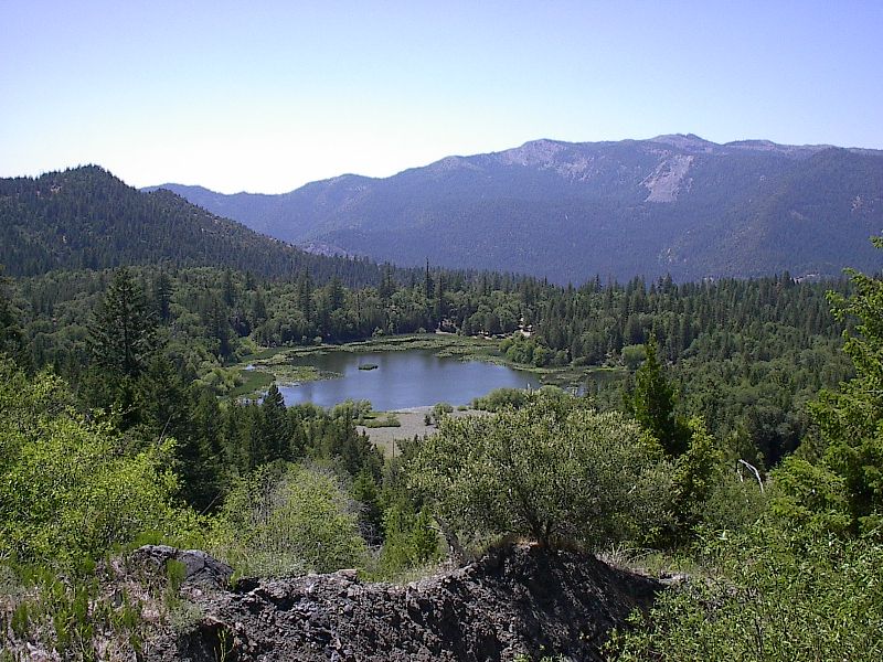
The Mendocino National Forest, California's only national forest that is not crossed by a paved road, straddles the eastern spur of the Coastal Mountain Range in northwestern California, just a three-hour drive north of San Francisco and Sacramento. Sprinkled throughout the dense green forest are several lakes, offering visitors additional recreational opportunities against a stunning and secluded backdrop.Nearby Attractions
The nearby Plaskett Lake Campground is a family campground that can handle additional visitors for larger parties. The day use site at Plaskett Lake is a great place to spend the day. Plaskett Lake is also planted with trout.GRAY PINE GROUP CAMPGROUND Campground
List of CampsitesOverview
Perched 1,700 feet above sea level in the expanse of the Mendocino National Forest, the Gray Pine Group Camp is a beautiful recreation oasis for large groups and parties.Recreation
Mendocino National Forest's 913,306 acres of mountains and canyons offer a variety of recreational opportunities, including horseback riding, hiking, backpacking, boating, fishing and hunting, nature study and off-highway vehicle riding. Whether it's deer, birds, rabbits, chipmunks or perhaps the occasional bear, wildlife viewing is always a popular activity for visitors. The area is also an extremely popular destination during hunting season.Facilities
Gray Pine Group Camp offers traditional camping and can hold up to 75 guests comfortably.Natural Features
The Mendocino National Forest, California's only national forest that is not crossed by a paved road, straddles the eastern spur of the Coastal Mountain Range in northwestern California, just a three-hour drive north of San Francisco and Sacramento. Sprinkled throughout the dense green forest are several lakes, offering visitors additional recreational opportunities against a stunning backdrop.Nearby Attractions
Popular OHV riding trails are easily accessible from the campground. Visit www.fs.usda.gov/mendocino for more information.PINE MOUNTAIN LOOKOUT Campground
List of CampsitesOverview
Rustic Pine Mountain Lookout was constructed in 1933 and used for fire detection until 1942. During World War II, the lookout served as part of an aircraft defense monitoring system that extended throughout California. This lookout is historically significant because it only offers 180-degree views of the surrounding terrain, while other lookouts have 360-degree views. The lookout is typically open from May through October and is accessible by car. Guests are responsible for their own travel arrangements and safety, and will need to bring several of their own supplies for a comfortable and enjoyable experience at the lookout.Recreation
The lookout mostly offers a prime location for relaxing and enjoying the views. Guests craving more active pursuits can find hiking trails and hunting areas nearby. Floating and fishing on the Eel River are popular pastimes enjoyed by visitors to the area.Facilities
The inside of the cabin is equipped with a set of bunk beds and four cots, touch lights, a dining table with chairs and storage cabinets. A fire extinguisher and first aid kit are provided for emergency use. A picnic table, fire ring and grill are located outside. An outhouse with a vault toilet is a short distance away. There is no water and electricity. Guests must bring their own water supply, as well as trash bags to pack out their trash. The bunk bed does not have box springs or mattresses. Items such as bedding, lanterns or flashlights, firewood, cookware, utensils and extra toilet paper are not provided.Natural Features
The lookout is perched on an outcropping, at an elevation of 4,400 feet. It is in a mixed forest of ponderosa pine, Douglas fir, black oak and madrone trees. Bucknell Creek and the Eel River are the major drainages in the area. The windows afford views of endless mountain peaks and offer a good vantage point for watching the evening sunsets. A variety of bird species inhabit the forest, and guests may spot eagles, owls, hawks and osprey. Mountain lions, black bears, black-tailed deer, flying squirrels, bobcats and Tule elk also live in the area. Please be safe around snakes and bears.Nearby Attractions
The historic town of Upper Lake is approximately 19 miles to the south. This former logging and ranching town offers excellent bird watching, various recreational activities, shops, restaurants and events. The Lake Pillsbury recreation area is seven miles to the northeast. This is the largest lake in Mendocino National Forest and offers many recreational opportunities.contact_info
This location is unstaffed. To speak with our main office for general information, please call: (707) 275-2361.SYCAMORE GROVE (RED BLUFF) CAMPGROUND Campground
List of CampsitesOverview
Sycamore Grove Campground sits along the banks of the sparkling Sacramento River at a 300-foot elevation, within the 488-acre Red Bluff Recreation Area. The area is an isolated parcel of the Mendocino National Forest in Northern California, in Red Bluff, CA. Visitors to the campground enjoy shady oak and sycamore trees and grassy fields within a beautiful riparian environment.Recreation
Visitors can enjoy the 4-mile paved nature trail, which winds through flowering grasslands, wetlands and oak woodlands, providing access to an abundance of plants and wildlife, as well as incredible views of Mount Shasta, Mount Lassen and the Yolla Bolly Mountains. The nearby river provides visitors with access to a variety of water-related recreation opportunities, including fishing, boating, water skiing, jet skiing, swimming and canoeing. A variety of fish can be seen in the river, including Chinook, Steelhead, and Striped Bass.Facilities
The campground offers more than two dozen, single-family and double campsites, available for tent and RV camping. Campsites are equipped with tables and campfire rings with grills. Potable water is provided.
Natural Features
Sycamore Grove is a beautiful campground that is open year-round. Campsites and open areas throughout the campground are covered in lush, green grass, with shade trees towering overhead. The campground provides access to a variety of hiking and biking trails, as well as the scenic Sacramento River, which is open to all types of water sports.contact_info
For facility specific information, please call (530) 934-3316.Nearby Attractions
Sycamore Grove Campground is located in the middle of the Northern Sacramento Valley. It is two miles from the city of Red Bluff, 25 miles from Rolling Hills Casino, 34 Miles from Redding California, 40 miles from Lake Shasta, and 60 miles from Lassen Volcanic National Park.Wolf Creek Visitor Station Facility
Located at the entrance of the Fouts Springs area on Forest Road M10. Available facilities include accessible restrooms and a self-service information kiosk.
Dixie Glade Campground Campground
List of CampsitesThis campground is located on Forest Road M10, just above the Fouts Springs OHV area. There are 7 sites with tables and grills. Corrals and hitching post are available for packstock animals. A short trail (.8 mile) connects to the Deafy Glade Trail providing access to the Snow Mountain Wilderness.
Letts Lake Campground Campground
List of CampsitesThe main feature of the area is a 35-acre lake for non-motorized vessels, trout fishing and swimming. A one-mile trail leads along the lake shore. There are accessible restrooms and a popular fully-accessible fishing pier.
Mill Creek Campground Campground
List of CampsitesThe stream flow is best in winter and early spring. Small roadside campground.
North Fork Campground Campground
List of CampsitesThe camp is located in an open grove of oak trees adjacent to a year long stream.
Lake Pillsbury Facility
The largest lake on the Forest has 2,280 acres of surface area and 31 miles of shoreline. Please remember that camping in Lake Pillsbury basin is allowed only in designated campgrounds.
The campgrounds at Lake Pillsbury are operated and maintained by Pacific Gas and Electric. More information on Pacific Gas & Electric campgrounds is available by calling 916-386-5164. All of the campgrounds at Lake Pillsbury are open from May to September, except Oak Flat which is open all year.
Lake Pillsbury campsites are designated for up to 2 vehicles each (there is a fee for additional vehicles) and a maximum of 6 people. The vault toilets are a modern no-odor type.
- Camping is on a first-come, first-served basis, with no reservations required except for the Fuller Grove Group Campground.
Fuller Grove Group Campground Campground
List of CampsitesCampground next to Fuller Boat Ramp. Accessible facilities include tables, fire rings, a food storage locker and restrooms.
Yolla Bolly-Middle Eel Wilderness Facility
In the Wintun Indian language, "Yo-la" means "snow covered", and "Bo-li" means "high peak." The second part of this Wilderness' name refers to the headwaters of the Middle Fork Eel River, which originates in this remote and rugged land. This area was first protected in 1931 when it was classified as a primitive area. Further protection was given when this area became part of the National Wilderness Preservation System, created by the passage of the Wilderness Act of 1964. The Wilderness Act of 1984 added another 2,000 acres to the Yolla Bolly-Middle Eel Wilderness, for a total of about 151,626 acres.
The Wilderness is roughly oval in shape, being about 19 miles long in the north-south direction and 24 miles wide in the east-west direction. The majority of the Wilderness lies in two districts of the Mendocino National Forest (Covelo and Grindstone Ranger Districts). The far northern portion of the Wilderness is in the Yolla Bolly Ranger District of the Shasta-Trinity National Forest. To the far west, a part of the Wilderness is in the Mad River Ranger District of the Six Rivers National Forest, and the Bureau of Land Management has a small portion of the Wilderness (also on the western edge).
The lowest point of the Wilderness is along Cottonwood Creek (2,600' elevation). This is just four and a half miles from the highest point, Mount Linn, at an elevation of 8,092 feet. Several other peaks push their way above 7,000 feet and provide fine views (weather and smoke permitting) of Mount Lassen, Mount Shasta, the Trinity Alps, the Kings Range and sometimes the Pacific Ocean.
Asa Bean Trailhead Facility
Trailhead.
Blands Cove Trailhead Facility
Trailhead.
Foster Glade Trailhead Facility
Trailhead.
Green Springs Campground Campground
List of CampsitesCampground - 4 camping sites with fire rings.
Trailhead - Access to the Yolla Bolly Wilderness.
Corrals available at Trailhead.
Ides Cove Backpacker Trailhead Facility
Trailhead with 2 sites; tables and fire rings.
Ides Cove Horsepacker Trailhead Facility
Trailhead with 3 sites; tables and fire rings. Vault toilet.
Rock Cabin Trailhead Facility
Trailhead.
Smokehouse Ridge Trailhead Facility
Trailhead.
Soldier Ridge Trailhead Facility
Trailhead.
Sticklake Trailhead Facility
Trailhead.
Bathhouse Trailhead Facility
Trailhead.
Sanhedrin Wilderness Facility
The 10, 571 acre Sanhedrin Wilderness was established in 2006 by Public Law 109-362, the Northern California Coastal Wild Heritage Wilderness Act. The Great Sanhedrin was the supreme council of the ancient Hebrews and the imposing ridge that crowns this Wilderness was named after that high council. The terrain in this area is moderately steep and rugged. The Wilderness is managed by the Forest Service, but includes areas of private land.
Elevations in the Wilderness vary from 6,175 feet at Big Signal peak to 1,600 along Thomas Creek. The major creeks in the area drain westward to the Eel River. Soils are moderately to highly erodible, and an unstable fault zone transects the Rocky Point-Ascherman Ranch area.
Trails in the Sanhedrin
Developed trails do not exist within the Sanhedrin at this time, providing a truly untrammeled Wilderness experience. The only public access point for this area is by the lookout on Big Signal Peak at the end of Forest Road 20N04. From this location, visitors can enjoy off trail hunting, hiking, and camping activities.
Although you may come across an old road or cattle trail while visiting the Sanhedrin, no managed trails existed upon designation of the Wilderness. Employees and wilderness stewardship volunteers have begun to identify potential opportunities to designate and maintain foot and horse trails in the Sanhedrin for future use and enjoyment.
We recommend that when visiting the area you bring the U.S. Geological Survey (USGS) 7.5-minute topographic maps that cover the region: USGS maps for the Sanhedrin Wilderness include Sanhedrin Mountain, Brushy Mountain, Foster Mountain, and Van Arsdale Reservoir. PDF MAP »
Red Bluff Recreation Area Boat Ramp Activity Pass
The sparkling Sacramento River bisects 488 acres of riparian forest, flowering grasslands, wetlands, and oak woodlands providing very diverse nature viewing experiences. Visitor facilities are closed.
Chico Seed Orchard Facility
The Chico Seed Orchard is located on 209 acres, in Chico, CA. Development started in 1904 when the site was assigned to the Agricultural Research Service for the purpose of plant breeding research and plant introduction from all over the world.
The primary function at the CSO is to develop and provide high quality, source identified seed adapted to current and future planting environments to enhance reforestation success and promote gene conservation in Region 5 while focusing on the production of ponderosa pine and Douglas-fir seed. The seed produced not only benefits ecological restoration efforts, it also provides for wildfire recovery, watershed restoration, riparian habitat for threatened and endangered species, Native American culture values, recreation areas, and forest health including research and disease resistance.
The secondary function is to provide for recreation, public service and education. Recreational activities include taking a stroll down a self-guided mile long paved accessible nature trail, dog walking (leash laws apply), wildlife and bird watching, and picnicking at one of seven established sites. The site contains one restroom and trash services but does not provide drinking water for the public. The main gate on site is open from 7 a.m. to 3:30 p.m., Monday through Friday except on holidays. The pedestrian gate is open in the summer seven days a week, except on holidays, from 7 a.m. through 7 p.m. and from 7 a.m. through 5 p.m. in the winter. Visitors are not allowed on the property after dark.
General Campgrounds & Trailheads Campground
List of CampsitesThe Mendocino National Forest is one of 18 National Forests in California, and is nearly one million square acres in size. Forest Service employees you are most likely to come in contact with, in campgrounds and recreation areas, are here to protect and maintain all the resources of the National Forest. One of their primary responsibilities is to maintain the recreation values of the Forest and to enhance - whenever possible - your Mendocino National Forest visit.
There are campgrounds on the Mendocino National Forest that use the Pack it In, Pack it Out program for dealing with waste. This means that garbage cans are not provided. Campers and hikers are asked to bring their own garbage bags and take their garbage with them when leaving the area. While this seems like an inconvenience, the funds saved are used to provide additional recreational facilities. Do not bury litter; forest animals can smell it and will dig it up.We appreciate your cooperation and assistance in helping to manage, protect and conserve the various resources of this forest.
You must obtain a California Campfire Permit if you plan to build a campfire or use a stove, unless you are in a developed recreation area (campground or picnic area). Permits are available free-of-charge at offices of the Forest Service, the Bureau of Land Management, and the California Department of Forestry and Fire Protection.
Please visit, call, or write one of our Forest Service offices for more information. Unless otherwise indicated, office hours are Monday through Friday, 8:00 am - 4:30 pm. Most district offices also maintain weekend hours during the summer months. All forest offices are wheelchair accessible.
Rattlesnake Firefighter Overlook - Picnic Facility
Interpretive area with one picnic table.
Sugar Spring Campground Campground
List of CampsitesNorth side of Thomes Creek.
Long Point Trailhead Facility
Trailhead sits about a mile south of Grindstone Creek.
Thomes Gorge Trailhead Facility
This trail starts from the Thomes Gorge trail head on Forest Road M4 and is named for the people indigenous to this locale. The trail begins in arid chaparral, with extensive views of the foothill country. Passing through gray pine and meandering around seasonal vernal pools, the trail drops into the spectacular geologic formations of Thomes Gorge, ending near the deep, sparkling pools of Thomes Creek. In summer it's a hot midday hike with little water along the way. Be sure to pack plenty to drink. The trail can also be accessed via the Mud Flat Road, Forest Road 23N35.
Nail Track OHV Play Area Facility
Great place to learn how to ride. Across the road from Middle Creek Campground.
Howard Meadows Campground Campground
List of CampsitesHas 6 developed sites and 1 vault toilet. No water.
Lakeview Dispersed Campground Campground
List of CampsitesDispersed Camping. No services.
