
Six Rivers National Forest
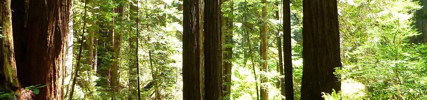

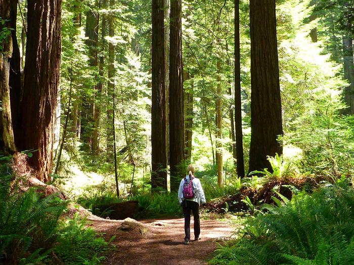
The Six Rivers National Forest offers nearly one million acres of forest for your enjoyment, relaxation, and exploration. Within a six-hour drive north of the Bay Area, you can experience the solitude of hiking in the wilderness on over 100 miles of trails, enjoy camping near others in developed campgrounds, or the solitude of camping in the backcountry. The forest is also a prime location for plenty of world-class fishing, as well as home to one of most barrier-free fishing locations in the nation.
RecAreaDirections
Open with Google Map
Misc
| Stay Limit | |
| Reservable | false |
| Keywords | |
| Map Link | |
| Contact Phone | |
| Contact Email |
Permits info
Facilities
GRASSY FLAT CAMPGROUND Campground
List of CampsitesOverview
Grassy Flat Campground borders California's northern Redwood Highway in the expansive Six Rivers National Forest.This shady campground provides ample sightseeing and recreation opportunities and is just steps away from the wild whitewater of the Smith River, which is famous for its bright blue waters and scenic pathway through the forest.
Recreation
Popular activities include swimming and sunbathing, rafting and fishing in the Smith River, which is just steps from the campground. Anglers enjoy healthy fishing populations of salmon, steelhead and cutthroat trout.Visitors also enjoy hiking, horseback riding and biking in the area. There are no trailheads in the campground, but Elk Camp Ridge, High Dome and French Hill trailheads are all within 10 miles of the site.
Facilities
The campground provides multiple single-family sites for tent or RV camping. Some sites are available on a first-come, first-served basis. Each site is equipped with tables and campfire rings with grills. Accessible vault toilets are provided. Water is not available at this facility.Natural Features
Grassy Flat is located in a Douglas fir and hardwood forest. Smith River boasts up to Class 5 whitewater rapids. The region, thick with vegetation, is also freckled with huckleberry shrubs.The Six Rivers National Forest lies east of Eureka in northwestern California, stretching southward from the Oregon border for about 140 miles. U.S. 101, the famed "Redwood Highway," parallels the inland Forest along the coastline. The Forest is just east of the Redwood National Park.
Nearby Attractions
Madrone Flat, located across the bridge, provides excellent river access. Various state parks, providing scenic exploration opportunities, are just a short drive from the campground.Annual events in the area include the Gasquet Raft Race in July and the Del Norte County Fair in August. A small airport is about 6 miles away, in the town of Gasquet.
PATRICK CREEK CAMPGROUND Campground
List of CampsitesOverview
Patrick Creek Campground sits at the confluence of Patrick Creek and the middle fork of Smith River in the vast Six Rivers National Forest of northern California.The campground has a special charm, with steps, rock walls, restrooms and sunken campfire circles built in the 1930s by the Civilian Conservation Corps.
Recreation
Popular activities include swimming, sunbathing, rafting and fishing in the Smith River, which is just adjacent to the campground. Anglers can expect healthy fishing populations of salmon, steelhead and cutthroat trout.Visitors also enjoy hiking, horseback riding and biking in the area. There are no trailheads in the campground, but Elk Camp Ridge, High Dome and French Hill trailheads are all within 10 miles of the site.
Facilities
The campground offers multiple single-family accessible campsites, available for tent and RV camping. Tables and campfire rings with grills are provided. Accessible flush toilets and drinking water are also available.Natural Features
Patrick Creek is located in a mature forest of Douglas firs in the northernmost part of California. A popular historic lodge and restaurant lie just across the highway from the campground. The Six Rivers National Forest lies east of Eureka in northwestern California, stretching southward from the Oregon border for about 140 miles. U.S. 101, the famed "Redwood Highway," parallels the inland Forest along the coastline. The Forest is just east of the Redwood National Park.PANTHER FLAT CAMPGROUND Campground
List of CampsitesOverview
Panther Flat Campground sits in the vast Six Rivers National Forest in northern California. This shady, secluded campground is just steps from the Smith River, which is famous for its bright blue waters and scenic pathway through the forest.Recreation
Popular activities include swimming, sunbathing, rafting and fishing in the Smith River. Anglers enjoy healthy fishing populations of salmon, steelhead and cutthroat trout.Visitors also enjoy hiking, horseback riding and biking in the area. There are no trailheads in the campground, but Elk Camp Ridge, High Dome and French Hill trailheads are all within 10 miles of the site. A Botanical trail to a unique Darlingtonia bog is just a mile away.
Facilities
The campground offers multiple single-family sites and at least one double site, available for tent and RV camping. It is one of the most modern campgrounds in the area and has some of the largest parking aprons. Some sites are available on a first-come, first-served basis.Campsites are equipped with tables and campfire rings with grills. Accessible flush toilets, coin-operated hot showers and drinking water are provided. The Visitor Center at the Gasquet Ranger Station provides free maps and brochures of the area.
Natural Features
Set in a mature forest of Douglas fir, cedar and Pacific madrone trees, the campground is a short walk from the pristine Smith River. The river boasts up to Class 5 whitewater rapids. The region, thick with vegetation, is also freckled with huckleberry shrubs.The Six Rivers National Forest lies east of Eureka in northwestern California, stretching southward from the Oregon border for about 140 miles. U.S. 101, the famed "Redwood Highway," parallels the inland Forest along the coastline. The Forest is just east of the Redwood National Park.
Nearby Attractions
California's Redwood National Park and the Pacific Ocean are within 20 miles of the campground.Annual events include Gasquet Raft Race in July and Del Norte County Fair in August.
BOISE CREEK Campground
List of CampsitesOverview
Boise Creek Campground is nestled between Brush Mountain and Brannan Mountain in northern California's vast Six Rivers National Forest.The campground sits under a canopy of large Pacific madrone evergreen, Douglas fir and California bay trees, less than two miles from the small mountain town of Willow Creek, known as the Bigfoot capital of the world.
Fishing, swimming and whitewater rafting are all close by in the popular Trinity River.
Recreation
Fishing, swimming and whitewater rafting are all available in the Trinity River. The area also provides opportunities for biking, hiking and horseback activities, as well as fishing for migratory salmon and steelhead trout.Campers can walk the 1/2-mile trail from the campground to the nearby Boise Creek and find a swimming hole or explore native plants and wildlife. A drive on the nearby Trinity Scenic Byway is a favorite activity of many visitors.
Facilities
The campground offers several single-family campsites, three of which are for tent camping only. All campsites are furnished with tables and campfire rings with grills. Vault toilets and drinking water are provided.Natural Features
The campground sits at a 680-foot elevation and provides several shady campsites on a creek about two miles west of the Trinity River. A forest of conifers covers the campground, and stands of oak woodland dot the landscape, providing habitat for eight threatened and endangered species, including the bald eagle and the peregrine falcon.The Six Rivers National Forest lies east of Eureka in northwestern California, stretching southward from the Oregon border for about 140 miles. U.S. 101, the famed "Redwood Highway," parallels the inland Forest along the coastline. The Forest is just east of the Redwood National Park.
Nearby Attractions
Boise Creek Campground is located less than two miles west of Willow Creek, where most services are available, including fuel, propane, medical services, restaurants, groceries and laundry facilities. Visitors can also check out the town's 18-hole public disc golf course or participate in the area's numerous cultural and social events, like the annual Bigfoot Days on Labor Day weekend. Three miles southwest of Willow Creek lies the Brush Mountain Lookout tower, which, at 3,988 feet, provides a 360-degree view of the forest's sweeping canyons and valleys.FIR COVE CAMPGROUND Campground
List of CampsitesOverview
Fir Cove Campground is located on beautiful eastern shore of Ruth Lake, a 13,800-acre jewel situated in the thickly forested mountains of northern California. A variety of recreational opportunities abound.
Fir Cove is one of three Forest Service campgrounds in the area, and one of two on the lake. Bailey Canyon Campground is the companion to Fir Cove. It is located east of Fir Cove and is first-come, first-serve.
Recreation
The lake provides boating, water skiing, fishing and countless other recreation opportunities.Anglers can enjoy a catch of small and largemouth bass, catfish, rainbow trout, Kokonee salmon, bluegill and crappie.
Forested peaks and valleys offer ample opportunities for hunting, hiking and off-road vehicle use. The Bailey Vista and Lakeview Trailheads start from Fir Cove, and the Picket Peak Trailhead starts from Bailey Canyon.
Facilities
The campground offers several tent-only and multiple combined sites, many of them overlooking the lake. All sites are within a short walk from Ruth Lake. Sites 11 and 12 are companion sites.Tables and campfire rings with grills are provided, as well as accessible vault toilets and drinking water.
Natural Features
The campground straddles a seasonal creek that empties into Ruth Lake. It is nestled in a mixture of mature Douglas fir, oak, pine and cedar trees at an elevation of about 2,700 feet.The Six Rivers National Forest lies east of Eureka in northwestern California, stretching southward from the Oregon border for about 140 miles. U.S. 101, the famed "Redwood Highway," parallels the inland Forest along the coastline. The Forest is just east of the Redwood National Park.
BEAR BASIN LOOKOUT AND CABIN Campground
List of CampsitesOverview
On a high, narrow mountain ridge at 5,280 feet, Bear Basin Lookout and Pierson Cabin offer visitors an awe-inspiring experience and a quiet haven away from crowds. Excellent views of the Siskiyou Wilderness to the east and the Pacific Ocean to the west are why visitors love staying in the heart of the Six Rivers National Forest of northern California.The current lookout building was previously situated at Camp Six, where it was used to spot forest fires. That structure was moved from Camp Six to Bear Basin Butte in 1996. The original Bear Basin Butte lookout existed in the 1930s.
During the summer and early fall months (July 1 - September 30), the rental includes both the lookout tower and a modern 1930s-style cabin built in the 1990s.
This is a remote location. Access to the cabin is variable and the road is not maintained for winter use. High-clearance, four-wheel drive vehicles are recommended, and guests are also advised to carry chains and a shovel. Guests should note that even during the summer, the paved portion of the road (South Fork Road) frequently has numerous rocks and debris. The last half mile of the access is on a steep gravel road. Quality tires and high-clearance vehicles are recommended. Guests are responsible for their own travel arrangements and safety, and must bring several of their own amenities.
Recreation
Bird watching is available, as well as great hiking opportunities in the nearby Siskiyou Wilderness. Please don't forget to pick up a Siskiyou Wilderness Map at your nearest Forest Service Visitor Center or local outdoor store before venturing into the wilderness. Horseback riding trails may be accessed nearby, and wildlife viewers may catch a glimpse of deer or bears, which make their home in the area.Facilities
The lookout and cabin can accommodate up to eight guests, but up to 12 guests are permitted for an extra fee. The cabin has an entry room with a countertop suitable for organizing supplies and preparing food. Three double beds are provided (one of which is a bunk above the other) in the cabin and a futon in the lookout. The cabin also has a four-seat dining table, three chairs, a bench, a book case, and a wood-burning stove (firewood is provided).Board games and various books may be available for use. A vault toilet, picnic tables and a campfire ring are outside. No water or electricity is available. Guests should bring plenty of water, food, bedding, flashlights and other basic camp gear (click here for more cabin details).
Nearby Attractions
The Smith River National Recreation Area Visitor Center is about 21 miles, or roughly one hour by vehicle, from the lookout.Doe Flat and Island Lake Trailheads, which access the Siskiyou Wilderness, are within three miles of the lookout.
NORDHEIMER GROUP SITES Campground
List of CampsitesOverview
Nordheimer Group Sites sit near the Salmon River in the expansive Klamath National Forest of northern California. Visitors enjoy whitewater rafting, fishing and boating activities.Recreation
The Salmon River is a popular area for swimming and sunbathing, rafting and kayaking. The region is also popular for hiking and biking. The Orleans Mountain Trail begins nearby.Facilities
The campground offers four group sites, each able to accommodate up to 50 guests. The sites are equipped with picnic tables, campfire circles and grills. Vault toilets are within walking distance from each site. Roads and parking areas are gravel.Natural Features
The campground is located in a Douglas fir and hardwood forest, which provides partial shade throughout the day. A few fruit trees remain from past homesteading activities. A variety of wildlife makes its home around the Salmon River area. Sites A, B, and C have large grassy meadows, surrounded by forest. Site D overlooks the Salmon River with easy walking access for boaters and swimmers. The Klamath National Forest lies northeast of Eureka in northeastern California, stretching southward from the Oregon border. The Marble Mountain wilderness is located nearby with beautiful views of the mountains and numerous trailheads to access them.Nearby Attractions
The Marble Mountain Wilderness Area is adjacent to the campground, with ample hiking and horseback riding opportunities available, as well as high country fishing in any of the area's 89 lakes.PEARCH CREEK CAMPGROUND Campground
List of CampsitesOverview
Pearch Creek Campground lies just north of the small town of Orleans in the Klamath river valley of the Six Rivers National Forest. Lush foliage provides welcome shade and relative privacy for each of the campground's sites.Recreation
Salmon and steelhead fishing in the nearby Klamath River is considered some of the best in northern California. Both Kalamath and Salmon Rivers are popular destinations for whitewater rafting, swimming and kayaking. Both are within a short drive.Facilities
The campground offers several single-family campsites, suitable for both tent and RV-style camping. Each site has picnic tables and campfire rings with grills. Many have rock camp stoves as well. Vault toilets and drinking water are provided.Natural Features
The campground is located in a mature Douglas fir and hardwood forest. The sound of nearby Pearch Creek can be heard from most sites and the campground remains shady and cool during hot summer days. Moss-covered rocks and tree trunks add to the cooling atmosphere of Pearch Creek.Nearby Attractions
Trailheads to the Marble Mountain WildernessOAK BOTTOM CAMPGROUND Campground
List of CampsitesOverview
THIS IS NOT OAK BOTTOM CAMPROUND AT WHISKEYTOWN NATIONAL RECREATION AREA!!! CALL 530-359-2269 FOR INFO. Oak Bottom Campground is located on a gently sloping hillside in the expansive Six Rivers National Forest in northwest California. It offers a peaceful camping environment, far from road noise and other distractions.Recreation
Located near California's Salmon River, the campground is popular with whitewater enthusiasts in the spring. Many challenging rapids ranging from class 3 to 5 are available. Swimming is also popular in the summer and numerous river access areas are a short drive or walk from the campground. In the fall, salmon and steelhead trout fishing in the nearby Klamath River is known to be some of the best in the state.Facilities
The campground offers several single-family sites. Each site is equipped with a table and grill, and vault toilets and drinking water are provided. A campground host may be available to answer any questions or provide information.Natural Features
The campground loops around a forested hillside of mixed Douglas fir and hardwood forest at a 700-foot elevation. Large deciduous trees provide ample shading for multiple sites within the campground, and a variety of wildlife makes its home in the area.Nearby Attractions
The small town of Somes Bar is 2.5 miles from the campground, where propane, groceries, a post office and tackle are available at a general store.MAD RIVER CAMPGROUND Campground
List of CampsitesOverview
Mad River Campground is located on banks of its namesake river, about two miles south of Ruth Lake in the thickly forested mountains of northern California.Recreation
Fishing is a popular activity and anglers can expect to catch a variety of trout in the Mad River. Nearby Ruth Lake is open for boating, swimming and other water-related activities. A marina and boat ramp are available for easy lake access, and maps and directions to the marina are located on the information boards in the campground.Facilities
The campground offers multiple single-family campsites, available for tent and RV camping. Some sites are available on a first-come, first-served basis. A majority of the sites are adjacent to the Mad River.Tables and campfire rings are available at each site. Accessible vault toilets and drinking water are also provided.
Natural Features
The campground is situated on a bluff overlooking the river among a forested area of oak trees and evergreen shrubs. Portions of the campground are capped with tall Douglas fir trees, providing ample shade.The Six Rivers National Forest lies east of Eureka in northwestern California, stretching southward from the Oregon border for about 140 miles. U.S. 101, the famed "Redwood Highway," parallels the inland Forest along the coastline. The Forest is just east of the Redwood National Park.
Nearby Attractions
The 13,800-acre Ruth Lake is about three miles south of the campground.FISH LAKE CAMPGROUND Campground
List of CampsitesOverview
Fish Lake Campground lies on the shore of its namesake at the northwestern edge of Six Rivers National Forest. Lily pads thrive on the lake, and Douglas fir and cedar trees provide ample shade and a secluded camping experience.Recreation
Canoeing and swimming are popular activities on the lake. The kayaking, whitewater rafting and fishing at the nearby Klamath, Trinity and Salmon Rivers is considered some of the best in northern California.Campers can hike a system of trails, including the Blue Lake, Red Lake and Fish Lake trails, all of which have trailheads in the campground.
Visitors also enjoy fishing for trout, bluegill, and bass in the lake or explore native plants and wildlife throughout the lush region.
Facilities
Most sites are suitable for both tent and RV camping. Vault toilets, drinking water, tables and combination fire ring grills are provided.Natural Features
Located about 1,780 feet above sea level, the campground is nestled in a mixed hardwood and conifer forest with fir and Port Orford cedar trees that provide low-level shade and friendly midsummer breezes.Fish Lake is believed to be the second-largest freshwater lake in California's Humboldt County. Some campsites offer sweeping lake views, while others are within a short walk of the water.
Nearby Attractions
Weitchpec, California, located about 12 miles north of the campground, is home to a Native American Yurok tribe, and Yurok tribal offices, a community center, a small grocery store and gas station are available.DILLON CREEK CAMPGROUND Campground
List of CampsitesOverview
Dillon Creek Campground sits along its namesake creek in the lush forests of northern California. Visitors enjoy a variety of water sports on the nearby Klamath River.Recreation
The Klamath and Salmon Rivers offer excellent fishing, swimming and whitewater rafting opportunities. Fishing for salmon and steelhead during the fall and early winter months is considered the finest in California. Hunting is also a popular pastime, with game including blacktail deer, black bear, blue grouse and quail.Facilities
This campground has several single-family campsites, all equipped with picnic tables and campfire rings with grills. Vault toilets and drinking water are provided. A host may be on-site, and roads throughout the campground are paved.Natural Features
The campground is situated in a forest of mixed hardwoods and conifers at an elevation of 1,780 feet. The Klamath River, a popular site for salmon fishing, runs alongside the site.Smith River National Recreation Area Facility
Recreational activities abound in the Smith River NRA. The beautiful Smith River offers fishing for steelhead, trout, and salmon. During the summer months, the pure, clean waters of the Smith River are perfect for swimming, rafting, or fishing and the forested mountainsides present occasions for hiking, bird watching, wildflower walks, or perhaps just lounging in the sun.
Winter temperatures drop into the 40s and 50s, with an occasional snow storm. The rainy season normally runs from October through April with an average annual rainfall of 92.55 inches. Summers are dry with highs in the 80-100 degree range. Contact the National Recreation Area Headquarters at the Gasquet Ranger Station for current weather conditions.
- Camping Guide - Smith River NRA, rev. 4/2015 - PDF
- Campsite Spur Dimensions - Smith River NRA, rev. 1-2015 - PDF
- Trail Guide - Smith River NRA, rev. 2-2002 - PDF
- River Access Trails - Smith River NRA, rev. 8-2014 - PDF
- River Access Trails - Smith River NRA, rev. 8-2014 - Word
- Lakes - Smith River NRA, rev. 3-2003 - PDF
- Things to Do in an Hour or Two - Smith River NRA, rev. 2-2003 - PDF
- Darlingtonia Trail - Smith River NRA, rev. 3-2003 - PDF
- Myrtle Creek Trail - Smith River NRA, rev. 2-2000 - PDF
- Bear Basin Lookout and Pierson Cabin Brochure, rev. 2-2015 - PDF
- Fish of the Smith River, rev. 12/2002 - PDF
North Fork Campground Campground
List of CampsitesNorth Fork Campground is a quiet, semi-shaded, remote campground bordered by the North Fork of the Smith River. This is a perfect place to “get away from it all” and to stay before rafting the Wild North Fork. The campground is also popular with four-wheel-drive groups who enjoy driving the jeep trails and back roads of the area.
The landscape surrounding the campground is dramatically steep and rocky. The vegetation is sparse due to the serpentine soil which stunts plant growth. The Biscuit Fire swept through the area in 2002, burning much of the vegetation in the surrounding area.
Spring and early summer bring beautiful wildflowers to the area including the fragrant western azalea and beautiful blue brodiaeas. The campground is within the North Fork Smith River botanical area, which harbors many rare plants adapted to the serpentine soil.
Access to the North Fork of the Smith River is ¼ mile west of the campground at the North Fork river access (also known as Brown's Flat and Major Moore's). There are some nice pools but the water is very chilly and the shoreline is very cobbled except for a small patch of sand at the upstream end. It is a good place to sit on a rock and soak your feet on a hot day.
Click on the "Photos and Multimedia" link on the right sidebar to view a photo of the North Fork river access.
Elk Camp Ridge (#2E04) Facility
Originally a pack train trail between Crescent City, CA and the gold mines of the Illinois Valley in Oregon, this scenic trail presents panoramic views of high mountain peaks, the Pacific Ocean, and the North and Middle Forks of the Smith River. The first half-mile from the lower trailhead was burned over in the Panther Fire of 1996. Parts of the trail were burned over in the Panther Fire of 1996 and and the Biscuit Fire of 2002. The trail was last maintained in 2011.
Dry Lake Facility
Dry Lake, encompassing 3.25 acres, lies in a quiet setting of willow, alder, oaks, firs, and myrtles (bay). The lake is currently stocked with rainbow trout. Maximum depth is nine feet. Dry lake is located off of County Road 405.
Island Lake Facility
Island Lake encompasses 4 acres. Exposed granite, willows and alders contribute to the tranquil scenery. The lake is currently stocked with rainbow trout.
Muslatt Lake Facility
Surrounded by oaks and firs, Muslatt Lake only encompasses a little over 1 acre.
Sanger Lake Facility
Sanger Lake, formed by glacial scour, encompasses 6 acres and is currently stocked with brook trout.
Sanger is stocked annually in July with fingerling trout, between 500 and 1000 fish each year.
Siskiyou Wilderness Facility
The forested mountains, valleys and meadows of the Siskiyou Wilderness in Del Norte, Humboldt and Siskiyou counties of northwestern California offer vistas of incredible beauty, diverse scenery and limitless opportunities for solitude.
The Wilderness, named for the mountains that cross it, is administered by three national forests: Six Rivers, Klamath and Siskiyou.
Rain falling in the Siskiyou Wilderness (from 40" on lower eastern slopes to 200" on the high western slopes) drains into three watersheds: the Smith, Klamath, and Illinois Rivers. The Siskiyou Wilderness is unique in that some parts can be accessed year round in the lower elevations, providing opportunities for recreation not found elsewhere. July through mid-October is the best time to travel in the wilderness, although severe weather can occur in any month. Access to some trails may be restricted to summer months because of snow and/or seasonal road closures to prevent the spread of Port-Orford-cedar root disease. Summer temperatures can reach into the 90s.
Lower Trinity Ranger District Facility
The Lower Trinity Ranger District is bisected by State Highway 299, the main travel route in Northwestern California to reach the Northcoast. Willow Creek is Approximately 100 miles west of Redding and 45 miles east of Eureka/Arcata. At one time, a major timber producing area, Willow Creek no longer supports a major manufacturing industry. Willow Creek however, is a recreation destination for sport fishing, including salmon and steelhead, kayakers, and river rafters who heavily use the Main Stem and South Fork of the Trinity River most of the year. The area is also famous for Bigfoot, achieving notoriety through the years as a hub for sightings. Hunting also is a big draw to the area with large deer and bear populations.
East Fork Campground – Six Rivers NF (CA) Campground
List of CampsitesOverview
East Fork Group site is nestled along the East Fork of Willow creek in northern California's vast Six Rivers National Forest.
The campground sits under a canopy of Big Leaf Maple, Douglas Fir and Port Orford Cedar, less than 5 miles from the small mountain town of Willow Creek, known as the Bigfoot capital of the world.
Fishing, swimming and whitewater rafting are all close by in the popular Trinity River.
Recreation
Fishing, swimming and whitewater rafting are all available in the Trinity River. The area also provides opportunities for biking, hiking and horseback activities, as well as fishing for migratory salmon and steelhead trout. You could always head out in search of the elusive Bigfoot on the many Forest roads in the area. Stop by the Lower Trinity Ranger Districts office at 50 Hwy 96 in Willow Creek and pick up a Six Rivers Forest map and pick up some local knowledge from the front desk staff.
Facilities
East Fork Group Site has vault style toilets available, picnic tables and fire rings. There is no water available in the campground so please bring plenty of drinking and cooking water.
Natural Features
The campground is along a small creek that is great for wading and and in a few spots swimming. It sits at a 680-foot elevation and provides several shady campsites about four miles west of the Trinity River. A forest of harwoods, Big Leaf Maple and conifers covers the campground, and stands of oak woodland dot the landscape, providing habitat for eight threatened and endangered species, including the bald eagle and the peregrine falcon.
The Six Rivers National Forest lies east of Eureka in northwestern California, stretching southward from the Oregon border for about 140 miles. U.S. 101, the famed "Redwood Highway," parallels the inland Forest along the coastline. The Forest is just east of the Redwood National Park. From Willow Creek, turn north on highway 96 and drive the Bigfoot Highway up through the Hoopa Indian Reservation to the Klamath river corridor in Weitchpec where the Trinity river flows into the Klanmth river and then on down to the Pacific ocean.a
Nearby Attractions
In the nearby town of Willow Creek stop by and visit the Bigfoot museum. If you're around the weekend of Labor day you can stop at the Veterans Park and enjoy their Bigfoot Daze celebration, watch the parade then go check out some local vendors at the park. If you're interested in learning about some of the local tribes, drive into Hoopa and check out Hoopa Tribal Museum. 40 miles west there are many attractions along the Pacific Coast, from ocean fishing, walking along it's many beaches or perhaps hunting the beautiful agates in a few local hotspots. Oh, and don't foget about the majestic California Redwoods, Once you hit highway 101 you can go either north or south and see some of the coasts many wonders.
Mill Creek Lake Loop (#6E73) Facility
Trail in the western side of the Trinity Alps Wilderness, takes off from trail 6E14 and goes around lower Mill Creek Lake. Fishing and camping opportunities. Beautiful scenery.
Mill Lake Facility
Mill Creek lies at about 5,900 feet in elevation and encompasses 5 acres. The lake lies in a beautiful setting surrounded by willows, alders and manzanitas. Impressive steep granite cliffs hold the southeast portion of the lake.
Trinity River Facility
The Trinity River's headwaters begin in the rugged Trinity Alps, making it's way through the wilderness, settling into deep valleys, transitioning to spacious glides and inviting beaches until finally meeting up with the mighty Klamath River at Weitchpec.
The natural beauty has been one of the most popular sights for north coast river recreation. Scenic Highway 299 makes easy access to many points of interest. In the warm spring and summer months, inner tubers and rafters enjoy rides along the river. The river is legendary for its salmon and steelhead fishing opportunities. Access provides fishing opportunities by means of drift boat or walk-in riverside spots.
Mad River Ranger District Facility
The Mad River Ranger District is located on Highway 36 approximately 50 miles east of Highway 101 and the Eureka/Arcata area and 100 miles west of Interstate 5 and the cities of Redding and Red Bluff. Traveling south for 20-30 miles on county roads brings you to the communities of Ruth and Zenia.
The Mad River Ranger Station is at an elevation of 2550 feet. The remainder of the district varies from 2000 to 6000 feet.
The climate is characterized by warm, dry summers and cool, wet winters. Average precipitation in the area is 60" with the majority of the moisture falling between October and April. Snow is uncommon at elevations under 3000' but many areas on the district receive substantial snowfall.
Bailey Canyon Campground Campground
List of CampsitesThere is a 14-day limit for occupying a campground, and pets on leashes are permitted.
Ruth Lake Facility
Due to concerns with aquatic invasive species, all boats and flotation devices prior to entering Ruth Lake must be inspected. Loacations and cost info are available at 707-574-6332
Ruth Lake is a seven-mile long reservoir located in the southern portion of Trinity County. The reservoir was formed by the damming of the Mad River in 1962, and has served both as a functional supplier of water to Humboldt County and a recreational area for fisherman, boaters, water skiers and swimmers alike. The reservoir lies in calm, beautiful surroundings of hills covered by ponderosa pine and white fir. The reservoir sits at an elevation of 2,654 feet, which affords cool winters, warm summers, and amazing springs and falls. Off the beaten path, approximately 70 miles from Eureka, Ruth Lake can be especially appreciated for its rainbow trout, and bass fishing, offering a marina and two boat ramps for your convenience. All facilities are located on Mad River Road off of Highway 36.
Eel River Facility
The Eel River makes it's 100 mile long stretch through some of the most pristine redwood groves in the state. The mouth of the mighty river opens up 15 miles south of Eureka after weaving its path through both Mendocino and Humboldt counties. It is amazing to think that at the turn of the century, the Chinook salmon was over a half million strong in this river. Though the present numbers are only a fraction of their former glory, one can still enjoy salmon, some trout fishing and the largest steelhead run in California.
Mount Lassic Wilderness Facility
7,280 acres on the Mad River District
Orleans Ranger District Facility
The District is one of four on the Six Rivers National Forest, encompassing approximately 500,000 acres. Located about 30 miles from the Northern Coast of California and subsequently under a coastal influence that produces a long summer season.
E-Ne-Nuck Campground Campground
List of CampsitesA popular spot for fishing enthusiasts alike, this small campground offers 10 campsites for those desiring to stay at a prime location to get their catch. It is conveniently located by some of the best fishing holes on the Klamath River and nearby streams. It offers potable water, one vault toilet and a variety visitors to chat and swap fishing stories with in the later part of summer and fall.
Fish Lake Facility
Fish Lake is located in the southwestern portion of the Orleans Ranger District. As one of the most popular recreational areas on the District, Fish Lake offers camping, fishing and hiking on over 5 miles of trails that link Fish Lake with Red Mountain and Blue Lakes. The 0.6 mile long lake is over 30 feet deep and stocked with Rainbow trout throughout the season. The lake also offers smallmouth bass, and blue gill. For those using water craft there is a cement boat ramp and parking area on the northern end. Outboard motors are not allowed on the lake. Due to the presence of Port-Orford-cedar root disease, the lake and campground are closed during the wet weather months.
Blue Lake Facility
Blue Lake lies in a beautiful mountain setting in the Orleans Ranger District. Surrounded mature trees and ferns, the lake is approximately 2.5 acres. Blue Lake is connected to Fish Lake via a 3.7 mile trail system.
Klamath National Wild and Scenic River Facility
The spectacular Klamath River is both the second largest and second longest river in California. The river makes its way through over 200 miles both the Cascade and Coast Mountain Ranges offering many recreation opportunities to its visitors. Summer months bring rafters to the area and jet boat rides are offered out of the town of Klamath. The river is renowned for its fishing opportunities of Chinook (King Salmon), coho (Silver Salmon), and steelhead. The river is easily accessible off of Highway 96. Several ramps exist to provide easy launching for your boat.
Nordheimer Group Campground Campground
List of CampsitesNordheimer Group Campground is located in a Douglas-fir and hardwood forest close to the Wild and Scenic California Salmon River. Roads and parking areas are gravel. Group sites A, B, and C have large grassy meadows, surrounded by forest. Site D overlooks the Salmon River with easy walking access for boaters and swimmers. Restrooms are portable in sites A, B and C. Site D has its own accessible vault type restroom. Combination fire ring grills and picnic tables are provided at each site. Popular activities include swimming/sunbathing, rafting, kayaking, hiking, wildlife viewing and biking.
Nordheimer is in the heart of the Salmon River whitewater area. Rafting activities begin in the spring and continue until the water levels drop in early summer. Remnants from historic mining operations can still be seen in this remote but beautiful camping area. A few fruit trees remain from past homesteading activities. Nordheimer is a must for those seeking beauty and seclusion. Boat access to the rivers edge is available at Nordheimer with 4x4 vehicles. The campground offers spacious and secluded sites.
Ukonom Ranger District Facility
The Ukonom Ranger District, while within the geographic boundary of the Klamath National Forest, has been administered by the Six Rivers National Forest since September 1999. This was done through an agreement between the two national forests and approved by the Region 5 Regional Forester. The Ukonom Ranger District shows on both the Six Rivers and Klamath national forest maps. The Marble Mountain Wilderness is within the Ukonom Ranger District.
Oak Bottom River Access Facility
The Oak Bottom River Access, located directly across from the campground, provides access to the Salmon River which is renowned for it's class 3-5 whitewater. The lower portion of the Salmon offers excellent swimming and tubing opportunities. Additional river accesses include Brannon's Bar, George Geary, and Blue Hole.
Ullathorne River Access Facility
Located approx. 2 miles downstream from Orleans , this river access is a very popular bank fishing spot as well as boat launch. There is a gravel dirt road down to an information kiosk and ample parking.
For all boating on the Klamath, please read the restrictions on the Karuk Ceremonial dates. Water and garbage service are not provided. Bring enough water for drinking, cooking and washing as well as extra water to drown campfires each day. Please take all trash, garbage, fish guts and dog droppings with you when you leave.
Orleans Bar River Access Facility
Located in Orleans just below the bridge over the Klamath River. This access has a gravel dirt road to the river’s edge and is an excellent place launching drift and jet boats. This long gravel bar requires 4 wheel drive at times later in the fall. Very popular bank fishing spot for Salmon, Steelhead and Chad.
For all boating on the Klamath, please read the restrictions on the Karuk Ceremonial dates. Water and garbage service are not provided. Bring enough water for drinking, cooking and washing as well as extra water to drown campfires each day. Please take all trash, garbage, fish guts and dog droppings with you when you leave.
Stuarts Bar River Access Facility
Located approx. 12 miles upstream from Orleans, this access consists of a very windy gravel dirt road down to the Klamath River. Due to its steepness and sharp turns, this access is not recommended for jet boats RV’s or vehicles towing long trailers. A very popular take out for rafters and drift boats.
For all boating on the Klamath, please read the restrictions on the Karuk Ceremonial dates. Water and garbage service are not provided. Bring enough water for drinking, cooking and washing as well as extra water to drown campfires each day. Please take all trash, garbage, fish guts and dog droppings with you when you leave.
Whitmore Creek River Access Facility
This access consists of a maintained foot trail leading down to the confluence of Whitmore Creek and the Klamath River. Very popular spot for Salmon and Steelhead anglers. Trail length .3 miles.
Cascade Falls River Access Facility
This access is located along the Salmon River Road and leads down to Cascade Falls, a Class IV rapid during spring rafting season. Perched above the falls, this access offers an excellent view of whitewater enthusiasts enjoying the river and access to swimming.
Nordheimer River Access Facility
This access is located just outside of the Nordheimer Campground. To access the river, drive through the campground and down to the river. Excellent spot for rafting, fishing or swimming.
Salmon River within the Klamath National WSR Facility

"Freight Train" Rapid on the Salmon River
Under the Klamath Wild and Scenic River designation, the entire Salmon River system with it North and South Forks were designated a Scenic River and Recreational River within the National Wild & Scenic Rivers System in 1981. The watersheds of two great wilderness areas combine to form the Salmon River. The North Fork of the Salmon River begins high up in the Marble Mountains Wilderness while the South Fork of the Salmon finds its origins in the Trinity Alps Wilderness. The two forks join forces at a place aptly called Forks of Salmon. Twenty miles further west and the Salmon River empties into the Klamath and continues on to the Pacific Ocean. This area is rich with history and culture of native people and of gold seekers and pioneers.

"Last Chance" Rapid on the Salmon River
In the early 1980’s, the Salmon River was discovered as a premier opportunity for whitewater rafting, offering 14 miles of Class IV and V rapids. Every spring, river enthusiasts flock to the Salmon River to enjoy the annual snowmelt provided whitewater.

Spring Snowmelt on the Salmon River
Marble Mountains Wilderness Area Facility
The Marble Mountain Wilderness is one of California’s oldest formally designated wilderness areas. Originally established in 1931 as the Marble Mountain Primitive Area, it later became one of the original wilderness areas established by the Wilderness Act of 1964. It contains over a quarter of a million acres of rugged mountainous terrain, diverse vegetation and picturesque high elevation lakes and streams. It was named for Marble Mountain, a monolith of white limestone standing 6,880 feet above sea level. Boulder Peak at 8,229 feet is the highest point in the wilderness and the mouth of Wooley Creek at the wilderness boundary is the lowest point at 640 feet.
Big Bar River Access Facility
Located approx. 8 miles downstream from Orleans, Big Bar offers a gravel dirt road to an excellent boat launch for drift and jet boats. There is an information kiosk, ample parking and excellent access to the river’s edge for fishing. This is a popular take-out for boaters floating down from Orleans through the “gorge”.
For all boating on the Klamath, please read the restrictions on the Karuk Ceremonial dates. Water and garbage service are not provided. Bring enough water for drinking, cooking and washing as well as extra water to drown campfires each day. Please take all trash, garbage, fish guts and dog droppings with you when you leave.
Mouth of the Salmon River Access Facility
This access is located in Somes Bar approx. ½ mile down Ishi Pishi Road on both sides of the bridge over the Klamath River. On the east end of the bridge there is a foot trail down to the confluence where the Salmon River meets the Klamath River. This is a very popular fishing spot for Salmon and Steelhead. (Check the Fish & Game regulations for this area)
On the west end of the bridge there is a gravel dirt road that goes under the bridge ending across from the confluence. A popular put-in for rafters floating down through the Ikes rapids to Orleans.
For all boating on the Klamath, please read the restrictions on the Karuk Ceremonial dates. Water and garbage service are not provided. Bring enough water for drinking, cooking and washing as well as extra water to drown campfires each day. Please take all trash, garbage, fish guts and dog droppings with you when you leave. Dogs on leash only.
Dillon Creek River Access Facility
This access is located approx. 24 miles upstream from Orleans directly across the highway from Dillon Creek Campground. The access consists of a short foot trail down to the confluence of Dillon Creek and the Klamath River. This is a very popular Steelhead fishing spot as well as swimming in Dillon Creek.
For all boating on the Klamath, please read the restrictions on the Karuk Ceremonial dates. Water and garbage service are not provided. Bring enough water for drinking, cooking and washing as well as extra water to drown campfires each day. Please take all trash, garbage, fish guts and dog droppings with you when you leave.
Green Riffle River Access Facility
Located approx. 11 miles upstream from Orleans, this river access consists of a steep gravel dirt road down to the river. This is a MANDATORY TAKE-OUT! Ishi Pishi Falls, a class VI rapid is located downstream and this is the last available river access.
For all boating on the Klamath, please read the restrictions on the Karuk Ceremonial dates. Water and garbage service are not provided. Bring enough water for drinking, cooking and washing as well as extra water to drown campfires each day. Please take all trash, garbage, fish guts and dog droppings with you when you leave.
Red Cap River Access Facility
This access consists of a maintained foot trail that leads to the Klamath River. Directly across the river is the confluence of Red Cap Creek and the Klamath River. This is a very popular spot for Salmon and Steelhead anglers. Trail length is .3 miles.
Reynolds Creek River Access Facility
This access consists of a maintained foot trail leading down to the Klamath River. Reynolds Creek enters the Klamath on the opposite side. A very popular spot for anglers. Trail length is .3 miles.
Brannons Bar River Access Facility
This access consists of a gravel road down to the Salmon River. A very popular take-out for the Butler and Nordheimer runs and is a popular spot for summertime swimming.
Stanshaw Equestrian Camp & Trailhead Facility

Stanshaw Equestrian Trail Camp Trailhead
This dispersed camping area is an excellent base camp for equestrian recreationists heading out on the Stanshaw trail in the Marble Mountains Wilderness Area. Offering one restroom, five large campsites with tables and fire rings, and several corrals with running water for animals. Located at 4,900 feet elevation, daytime temperatures are always comfortable during the summer season.
George Geary River Access Facility
This access to the Salmon River is designated Day Use Only, no overnight camping. It has a graded gravel ramp to a cobble bar for parking. Boats must be carried a short distance to the water. There is limited parking and some shade. There are 2 picnic tables and a vault toilet.
Ten Bear Trailhead Facility
This dispersed camping area offers several corrals, water for animals, and two campsites; this place is great for a hunter's camp. It is the trailhead for Ten Bear trail, in the Marble Mountains Wilderness.
Big Rock Day Use Area & River Access Facility
Located approximately 1/4 mile on Highway 96 from the Highway 299 intersection in the town of Willow Creek, Big Rock offers day use for those who want to spend the day on the Trinity River. It is a popular spot in the summer months for swimming, sunbathing, picnicking and just relaxing. This site offers river access to fisherman and non-motorized boaters wishing to float the lower section of the Trinity River. It contains shaded picnic areas for those wanting to enjoy the river scenery out of the sun. There are two vault toilets for the convenience of river-bound visitors, and offers a place for those needing a break from the road.
Dolan's Bar River Access Facility
Located approximately one and a half miles upriver from Orleans, this site offers river access for motorized and non-motorized boaters and anglers. From highway 96, river access is only 3/4 of a mile away, down a gravel dirt road accessible by car. The road brings you to a spaceous river bar, providing plenty of area to park a car or camp. Being on a long sweeping curve of the river, the water is fairly calm at this access and is a popular fishing spot. The lower portion of the bar is an ideal place for swimming in the summer. A vault toilet is provided but no potable water is available.
Persido Bar River Access Facility
Located approx. 19 miles upstream from Orleans, this access offers a bathroom, information kiosk and plenty of river access for bank fishing. The boat launch is large enough to launch drift and jet boats and is a very popular access for rafters floating down from Happy Camp. Due to the high use of this access, no parking or camping is allowed at the boat ramp, only at the south end of the river bar.
For all boating on the Klamath, please read the restrictions on the Karuk Ceremonial dates. Water and garbage service are not provided. Bring enough water for drinking, cooking and washing as well as extra water to drown campfires each day. Please take all trash, garbage, fish guts and dog droppings with you when you leave. Dogs on leash only.
Ti Bar River Access Facility
Located approx. 17 miles upstream from Orleans, Ti-bar River Access offers a paved road to excellent dispersed camping with tables, fire rings, bathroom and information kiosk. The boat launch is a gravel dirt road to the river with a steep drop-off. 4 wheel drive is required at times to launch boats. Not suitable for jet boats.
For all boating on the Klamath, please read the restrictions on the Karuk Ceremonial dates. Water and garbage service are not provided. Bring enough water for drinking, cooking and washing as well as extra water to drown campfires each day. Please take all trash, garbage, fish guts and dog droppings with you when you leave.

Ti Bar Restroom.
Bloomer Falls River Access Facility
This river access consists of a short road to a small turn around where a foot trail will lead you to across the rocks to Bloomer Falls. Here the river cuts through bedrock creating a Class IV rapid.
Butler Creek River Access Facility
This access is very popular among boaters on the Salmon River. It is used as a take-out after the Nordheimer section or a put-in for the Butler run. This access is also popular for picnicking and swimming.
Rock Creek River Access Facility
This river access is a maintained foot trail leading down to the Klamath River. The confluence of Rock Creek is just downstream on the opposite side. This is a popular spot for anglers. Trail length is.2 miles.
Bluff Creek River Access Facility
This access consists of a maintained foot trail leading down to the confluence of Bluff Creek and the Klamath River. A very popular spot for Salmon and Steelhead anglers. Trail length is .2 miles.
Ikes Falls River Access Facility
This access is a .5 mile long fairly steep road leading down to the Klamath River just below Ikes Falls. High Clearance vehicles recommended.
Halverson Creek River Access Facility
This river access is a maintained foot trail leading down to the Klamath River to the popular “Ice Cream Riffle”, a destination for Fly Fishermen. Trail length is .6 miles.
Blue Hole River Access Facility
This river access is a short foot trail down to a sandy beach and very deep swimming hole. This is a good access for tubing on the Salmon River.
Forks River Access and Boat Ramp Facility
Launch your boat or enjoy the fishing, swimming, and sunbathing opportunities at this Smith River access. Restroom facilities available at boat-trailer parking lot.
Doe Flat Trailhead Facility
Steinacher Creek Path Facility
This short access to a pretty glade along Steinacher Creek starts at the end of the stub of the Steinacher Creek Road. It initially follows the route of the fully decommissioned Steinacher Creek Road, then descends into the ravine of the creek. Expect abundant poison oak. The condition was fair as of summer 2015, with few obstacles. (Updated June 2016.)
Approximate length: 0.8 miles
Wooley Creek Path Facility
This very short access to Wooley Creek near its mouth starts near the end of the stub of the Steinacher Creek Road, off an unpaved road loop at the ridgeline dividing the Salmon River and Wooley Creek watersheds.
It is steep and has some narrow spots. Not suitable for stock. In good condition. (Updated July 2016.)
Approximate length: 0.2 miles
McCash Loop (#5823) Facility
This trail provides access to Big Meadow and Long Meadow, with a number of good campsites, mostly undulating through forest along the meadow margins. At the top of Long Meadow, the trail makes a ridiculously steep ascent. It then follows the ridge top, with views to the north, passing a junction with Torgerson Meadow Trail, and after a short drop reaches the Haypress Trail on Sandy Ridge.
McCash Loop received maintenance in 2014. The trail was clear at that time, except for blockages at the extreme eastern end at Haypress Trail. There has been no recent maintenance. There may be new down timber, mostly after the upper end of Long Meadow, particularly in areas affected by wildfire in recent years. (Updated June 2016.)
Approximate length: 4.2 miles
