
Hoosier National Forest
Hoosier National Forest, in the hills of south central Indiana, provides a wide mix of opportunities and resources for people to enjoy. Rolling hills, back-country trails, and rural crossroad communities make this small but beautiful 204,000 acre Forest a local treasure. Forest managers work with the public to develop a shared vision of stewardship focused on restoring, maintaining, and interpreting the cultural and natural resources of our public lands.
RecAreaDirections
https://www.fs.usda.gov/hoosier/
Supervisor's Office 811 Constitution Avenue Bedford, IN 47421
(812) 275-5987 or 1-866-302-4173 FRS: 1-800-877-8339.
Open with Google MapMisc
| Stay Limit | |
| Reservable | false |
| Keywords | |
| Map Link | |
| Contact Phone | |
| Contact Email |
Permits info
Facilities
INDIAN CELINA LAKE Campground
List of CampsitesOverview
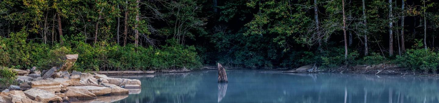
The Indian-Celina Lake Recreation Area is a tranquil getaway in the midst of the Hoosier National Forest. Both the Celina and Indian Lakes are within the area, offering camping, boating, fishing and hiking, as well as tours of a historic site.Recreation
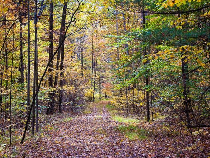
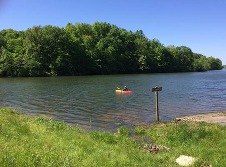
Indian and Celina lakes are two of four fishing lakes along Highway 37. The lakes offer many miles of shoreline and coves for fishing for pan fish. Boat ramps are open year-round, and an accessible fishing pier is available on Celina Lake. Anglers can expect a variety of catfish, largemouth bass, bluegill and crappie. The sandstone block, historic Rickenbaugh House was built in 1874 and is open to visitors periodically throughout the year. The home and adjacent historic cemetery are popular among visitors. A variety of hiking trails exist within the area, including the relatively easy, 1 mile Rickenbaugh Interpretive Trail, which is located behind the historic Rickenbaugh House. The Two Lakes Loop National Recreation Trail encircles both Indian and Celina lakes and winds through many acres of natural and peaceful forests. The trail is 16 miles, but can encompass multiple, shorter day hikes.Facilities
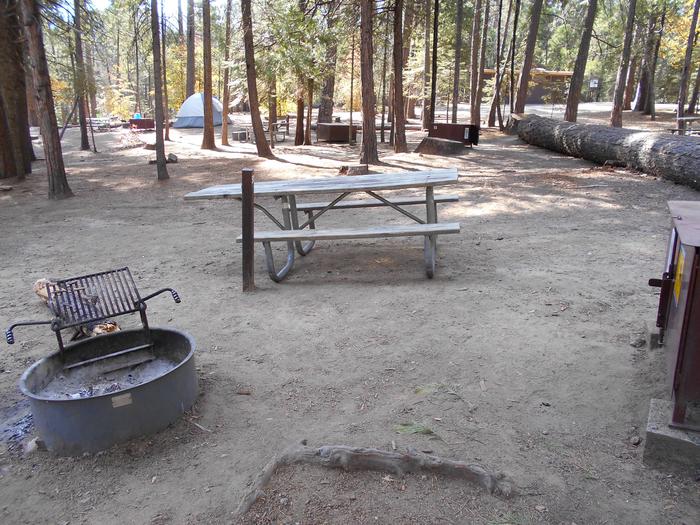
The area offers dozens of individual campsites, divided in two loops. Campsites are available for tent and RV camping. Utility hookups are available in some of the sites and the parking surfaces are paved.Each site is equipped with tables and campfire rings with grills. Accessible flush toilets, showers and drinking water are provided. A day-use area is also available, and provides access to the nearby boat ramp. Picnic tables are available there and at the historic site.
Natural Features
The area is located in south-central Indiana, in a dense hardwood and pine forest, on 152-acre Indian and 164-acre Celina lakes. A variety of wildlife make its home in the area.HARDIN RIDGE Campground
List of CampsitesOverview
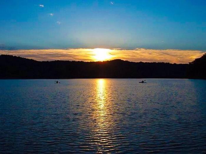
Hardin Ridge is a 1,200-acre recreational complex located on the shores of Monroe Reservoir in Hooiser National Forest. The complex includes six shady campground loops, two picnic areas with shelters, and two rental cabins. The area offers something for everyone, with activities like camping, picnicking, boat launching, swimming, nature walks, and interpretive programs offered in a forested environment.Recreation
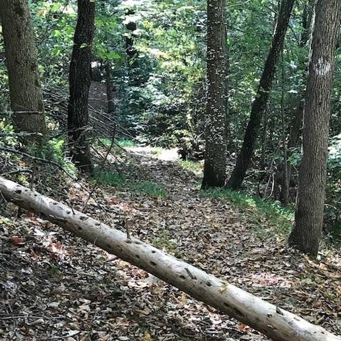
A 300-foot swimming beach on Lake Monroe offers a place for children to play and swimmers to sunbathe and enjoy the water. The beach offers a combination of sand and sun, with a shady grass-covered hillside above. There are no lifeguards on duty. No glass containers or pets are allowed in the beach area. The Hardin Ridge Trail is a 2-mile hiking and bicycle trail that runs from the day use area to the various campground loops. This trail roughly follows the main campground road and provides a safe surface for families to hike or bike, as well as a scenic overlook. Fishing is allowed anywhere along the lakeshore within the recreational complex, but several quiet inlets provide secluded fishing holes along the lake's banks. Popular catches include blue gill, striped bass, large mouth bass and crappie. On the Ted T. Turtle interpretive trail, visitors can travel 1.2 miles through a scenic hardwood forest, along a small creek and down to Lake Monroe and back. On the trail, visitors have the opportunity to learn about the history, geology, and wildlife common to southern Indiana. For visitors interested in boating, the lake has a 3-lane launch ramp that is open year-round. A 75 vehicle/trailer parking area is also available as well as a fully accessible loading dock provided at the boat ramp.Facilities
There are 197 camp sites at Hardin Ridge, 36 of which are walk-in tenting only sites. With the exception of Eads and Southern Point loops, the areas have electric hookups at about half the sites (walk-in sites to do not have electric hookups). Centralized water, flush toilets and showers are provided. In addition to the campground loops, there are two picnic areas with numerous tables, along with three shelter houses, two of which overlook the lake. Two of the shelters also have electricity and lights. If the shelters are not reserved, they may be available on a first-come, first-served basis. There is ample space in the fields around the picnic sites for games. The Hardin Ridge Recreation Area has two primitive cabins available for rent. The cabins each offer 6 bunk beds, one of which is a double bed, for a total sleeping capacity of 7 people. The cabins are located on the shores of Lake Monroe, between the boat launch and swimming beach. There is a picnic shelter nearby and a shared toilet between the two cabins.Natural Features
Monroe Reservoir spans 10,750-acres and is the largest lake in Indiana. There is an overlook on Hardin Ridge Road that is spectacular in any season and gives visitors a high vantage point of the lake, colorful marinas across the water and a vast expanse of forest. The entire area is forested with hardwoods and is well-shaded to give visitors the feel of being in the deep woods. In spring, the dogwoods and redbuds bring bright color to the forest and in fall, the foliage offers colors in vibrant hues of yellow, orange and red.TIPSAW LAKE Campground
List of CampsitesOverview
The Tipsaw Lake Recreation Area is located on the shores of its namesake lake in south-central Indiana's Hoosier National Forest. It offers camping, picnic areas, boating, swimming, hiking, biking and educational programs. Visitors enjoy the scenic views of the forest and all it has to offer.Recreation
Boating, fishing and swimming in the lake are popular activities. Electric motors are allowed, and fishing for pan fish is considered excellent. The boat ramp and parking area is open year-round.A beautiful swimming beach with playground equipment and a modern bathhouse is also available. The beach offers a combination of sand and sun or a shady, grass-covered hillside.
A 5.9-mile trail for hiking and mountain biking runs from the day-use area around the lake. The trail includes scenic overlooks of the lake and valley and traverses a variety of forest types. A trail permit is available for purchase and is required for mountain bikers age 17 and older.
Facilities
The area offers dozens of individual, double and group campsites, available for tent and RV camping. Group sites can accommodate up to 65 people.Each site is equipped with tables and campfire rings with grills. Accessible flush toilets, showers and drinking water are provided. A beach area is fully accessible and is equipped with washing stations and changing rooms. Electric and water hookups are available at some sites and parking surfaces are paved.
A day-use area is also available and provides access to the beach and picnic areas and shelters, as well as the boat ramp. Horseshoe pits and and open areas for games are nearby.
Natural Features
The campground is adjacent to 131-acre Tipsaw Lake, in a hardwood and pine forest. Situated at an elevation of 380 feet, the campground is composed of five loops that offer dozens of campsites. Some sites are shaded and the roads are paved.Mano Point Fishing Area Facility
Mano Point is a fishing access point on the Ohio River.
Mano Point is named for an artifact found when the site was being built in the 1960s. A mano is a grinding stone used along with a larger stone called a metate to grind flour. Based on the number of artifacts collected here in the 1960s, we believe this was once the site of a Native American village which stood here on the banks of the Ohio River from the Early Archaic Period (7500-6900 BC) to the Late Archaic Period (4000-1000 BC).
There is an interpretive sign to tell the story of the early residents. Prehistoric sites and artifacts are protected by Federal law.
Charles C. Deam Wilderness Facility
The Charles C. Deam Wilderness offers 36 miles of trails for hiking, backpacking, and horse riding through scenic hardwood forest and varied terrain with views of nearby Monroe Lake. The area was designated a wilderness in 1982 and encompasses nearly 12,953 acres of the Hoosier National Forest. Wilderness designation places this area in a special legal status (subject to the 1964 Wilderness Act). It is managed to preserve a natural condition and provide opportunities for solitude.
Since its designation as a wilderness, visitor use in the area increased to a point that significant damage was occurring. Special restrictions are in place to protect the wilderness character. Visitors to this special place are asked to follow these restrictions to lessen your impact and share responsibility in preserving this unique natural resource.
Underground Railroad: Lick Creek Facility
Lick Creek – Hoosier National Forest
The Underground Railroad consisted of a large secret network of travel routes and safe havens for freedom seekers escaping slavery. The Ohio River divided freedom and enslavement along several Border States, including Indiana.
Located 20 miles north of the Kentucky border, Lick Creek was a mixed community mostly of free African Americans and Quakers. Located in today’s Hoosier National Forest, it was an important component of the Underground Railroad. It was originally settled in 1811 by Jonathan Lindley, a white Quaker, and 11 other white and black families from North Carolina.
Settlers in the region brought with them an Upland South culture. The origins of this culture can be found mostly in western Virginia, North Carolina, and eastern Mississippi. Developed out of a mixture of European traditions, it mostly belonged to white middle class southerners.
By the 1860s, the population of African Americans in the area was over 1,000 and Lick Creek was often referred to as “Little Africa.” This influx of free African Americans and Quakers, and the influence of the African Methodist Episcopal Church point to involvement with the Underground Railroad.
The settlement continued to grow in the mid-nineteenth century. However, after the Civil War African Americans started to leave Lick Creek. Although their departure remains somewhat of a mystery, most probably headed north to industrial jobs. By 1911, there were no longer any African Americans residing in Lick Creek.
Sources:
Cheryl LaRoche, Free Black Communities and the Underground Railroad: the Geography of Resistance.
Lick Creek Trail: http://www.fs.usda.gov/recarea/hoosier/recreation/hiking/recarea/?recid=41572&actid=50
This information about the Underground Railroad is part of a geo-located multi-forest interpretive program. Please contact the U.S. Forest Service Washington Office Recreation, Heritage, and Volunteer Resources program leadership with any questions or to make changes. SGV – Recreation Data and Information Coordinator.
Underground Railroad: African American Landowners Facility
African American Landowners of Lick Creek
In the exodus of about 200 Quakers from North Carolina to Indiana in the mid-1800s, a substantial portion of the group were free African Americans. They travelled alongside white Quakers, who although offered a certain degree of protection, did not always provide a welcoming invitation once in Indiana.
Despite restricted liberties in Indiana, free Blacks found refuge in the Lick Creek settlement, now part of the Hoosier National Forest. In 1831, Mathew Thomas became one of the first Black land owners in the Lick Creek area. By that time, 96 African Americans lived in the region. Although Thomas was born free, in 1821 his mother indentured him to Zachariah Lindley, a founding settler of the Lick Creek community from North Carolina. Upon completion of his service, Thomas purchased eight acres. Two years later he paid the state’s bond of $1,000 to secure his freedom.
Other local African Americans followed in Thomas’s footsteps. In 1832, recent free Black migrants from North Carolina - Benjamin Roberts, David Dugged, and Peter Lindley - purchased forty acres each of land from the United States government. These homesteads became the center of the Lick Creek settlement.
By 1840, 10 African Americans owned land totaling 780 acres in the Lick Creek community. The settlement reached its maximum size in 1855 of over 1,500 acres.
The increasing hostility, racial intolerance, and limiting laws imposed by the state supported the need for African Americans to form strong family and communal networks within the settlement. However, after the Civil War African Americans slowly left Lick Creek; by the turn of the twentieth century there were no longer Blacks living in the area.
Sources:
Cheryl LaRoche, Free Black Communities and the Underground Railroad: The Geography of Resistance.
Indiana Historical Bureau, “Being Black in Indiana,” http://www.in.gov/history/2548.htm
USDA Forest Service, “Lick Creek African American Settlement,” http://www.fs.usda.gov/Internet/FSE_DOCUMENTS/stelprdb5303625.pdf
Lick Creek Trail: http://www.fs.usda.gov/recarea/hoosier/recreation/hiking/recarea/?recid=41572&actid=50
This information about the Underground Railroad is part of a geo-located multi-forest interpretive program. Please contact the U.S. Forest Service Washington Office Recreation, Heritage, and Volunteer Resources program leadership with any questions or to make changes. SGV – Recreation Data and Information Coordinator.
Underground Railroad: The Lindley Family Facility
The Lindleys were a Quaker family in North Carolina; Thomas Lindley started a family mill on Cane Creek in 1755. During the Revolutionary War, the Lindley Mill turned into a bloody battle which left Thomas himself a casualty.
Jonathan Lindley, one of Thomas’s sons, led a pilgrimage of eleven families from North Carolina to Lick Creek in southern Indiana in what is now the Hoosier National Forest. Jonathan’s eldest son, Zacharias, settled into Lick Creek two years prior to the caravan. The Lindleys originally intended to move further north into the region, but local Indian skirmishes held them closer to the Kentucky border.
Upon arrival to Lick Creek, Jonathan established the Lick Creek Friends Meeting, the first Quaker institution in southern Indiana. He also served as the first representative of his county in the new State of Indiana’s General Assembly.
Jonathan’s grandson Thomas Elwood Lindley, built a house in Paoli near Lick Creek in the mid-nineteenth century. Jonathan, an influential Quaker, fought slavery at the institutional level and served in the Indiana State Legislature. Although the function of the Lindley house during the Underground Railroad is unknown, the house is listed on the National Historic Register of Historic Places. The restored house currently operates as a museum near Lick Creek.
Eli and Elizabeth Lindley (other relatives) owned a house in Chambersburg that was a known station in the Underground Railroad. A local Quaker descendant of the Lindleys, Howard Hall, described a trap door covered by a rug near a fireplace in the Lindley house that hid escapees.
Sources:
Cheryl LaRoche, Free Black Communities and the Underground Railroad: the Geography of Resistance
USDA Forest Service, “Underground Railroad in Indiana: Lick Creek, Hoosier National Forest,” http://www.fs.usda.gov/detail/r9/home/?cid=stelprd3790778
USDA Forest Service, “Lick Creek African American Settlement,” http://www.fs.usda.gov/Internet/FSE_DOCUMENTS/stelprdb5303625.pdf
Orange County Historical Society, “The Lindley House,” http://www.historicorangecounty.org/lindley.html NCPedia, “Jonathan Lindley,” http://ncpedia.org/biography/lindley-jonathan Our State, “Mill with a Meaning: Lindley’s Mill,” https://www.ourstate.com/lindleys-mill/
“Looking at History: Indiana’s Hoosier National Forest Region, 1600 to 1950,” http://www.foresthistory.org/ASPNET/Publications/region/9/hoosier/sec1a.htm
This information about the Underground Railroad is part of a geo-located multi-forest interpretive program. Please contact the U.S. Forest Service Washington Office Recreation, Heritage, and Volunteer Resources program leadership with any questions or to make changes. SGV – Recreation Data and Information Coordinator.
Underground Railroad: Civil War Soldiers Facility
The Lick Creek settlement in today’s Hoosier National Forest was an active free Black community in southern Indiana in the mid-1800s. Along with other African Americans in Indiana, Lick Creek offered up some of their own to fight in the Civil War.
Simon Locust, an African American, served one year with Company E 13th Infantry Regiment of the United States Colored Troops (USCT). Locust was drafted into USCT in 1864 along with about 1,500 African Americans in Indiana. Locust returned to the Lick Creek area after the war and was the only veteran listed as living in Orange County. He died in 1891 and was also the last person to be buried in the local church’s cemetery, the only remnant of Lick Creek left today.
Unlike Locust, Martin Scott was of mixed heritage and passed as white in order to fight with white troops in Company I 19th Indiana Infantry Division in 1864. Confederate soldiers captured Scott and held him captive after he was wounded in the left thigh at the Battle of the Wilderness. Private Scott was imprisoned at Andersonville, Georgia until July 1865. Scott took a risk pretending to be a white man; however, if the Confederates had found out he was part black he would have been killed upon capture.
Recently freed Solomon and Margaret Newby arrived at the Lick Creek settlement in 1840 from North Carolina. The first of their three children, James Harling Newby, was born free in Indiana in 1843. The Newby family left Lick Creek and migrated to North Buxton, Canada. In 1863 at age 20, Newby felt compelled to fight in the Civil War and left Canada to go to Philadelphia where he enlisted in Company I, 3rd Regiment Infantry, USCT.
Cheryl LaRoche, Free Black Communities and the Underground Railroad: the Geography of Resistance
National Forest Service, “Lick Creek African American Settlement”, http://www.fs.usda.gov/detail/hoosier/learning/history-culture/?cid=fsbdev3_017495
19th Indiana Brigade, “Martin Scott,” http://www.19thindianaironbrigade.com/Scott,_Martin.html
Lick Creek Trail: http://www.fs.usda.gov/recarea/hoosier/recreation/hiking/recarea/?recid=41572&actid=50
This information about the Underground Railroad is part of a geo-located multi-forest interpretive program. Please contact the U.S. Forest Service Washington Office Recreation, Heritage, and Volunteer Resources program leadership with any questions or to make changes. SGV – Recreation Data and Information Coordinator.
Underground Railroad: Indiana State Laws Facility
Indiana State Laws and the State Register for Blacks
As escaped slaves made their difficult journeyed toward freedom, Indiana seemed like a promised land – a free border state along the Ohio River. However, many already free African Americans and those who escaped via the Underground Railroad faced harsh discrimination in the so-called “free” state. Those who lived and passed through today’s Hoosier National Forest in southern Indiana during the 19th century did not always get the freedoms they had hoped for.
The Indiana state constitutions of 1816 and 1851 both demonstrated racial prejudices and forced even more hardships on African Americans who lived or passed through the state. When Indiana became a state in 1816, the constitution prohibited slavery but nothing was done to protect the civil rights of the Black population. The 1816 laws prohibited African Americans from voting, serving in the militia, and other basic civil rights.
In 1831, Indiana legislature required all African American residents and newcomers to register with their local authorities and pay a $500 bond as a guarantee of good behavior. The laws not only racially discriminated against Blacks and half black individuals, but since the bond required a White witness and the register required the Black person’s physical description, the laws publically reinforced racial superiority.
As tensions over slavery grew nationally, racial hostilities rapidly increased in Indiana. The state’s Constitution of 1851 prohibited any Black or half black individual from entering, passing through, or settling into the state of Indiana. Those who entered were fined between $5-10. However, African Americans already in the state were allowed to stay.
With Indiana being an important place for freedom seekers, the Underground Railroad in the region became even more crucial after 1851.
Sources:
Earl E. McDonald, “The Negro in Indiana Before 1881”, Indiana Magazine of History (1931) 27, https://scholarworks.iu.edu/journals/index.php/imh/article/view/6622/6965
PBS, “Race-Based legislation in the North,” http://www.pbs.org/wgbh/aia/part4/4p2957.html
Indiana Historical Bureau, “Constitution of 1816,” http://www.in.gov/history/2460.htm
Indiana Historical Bureau, “Being Black in Indiana,” http://www.in.gov/history/2548.htm
Stephen Middleton, The Black Laws in the Old Northwest, 197-204.
This information about the Underground Railroad is part of a geo-located multi-forest interpretive program. Please contact the U.S. Forest Service Washington Office Recreation, Heritage, and Volunteer Resources program leadership with any questions or to make changes. SGV – Recreation Data and Information Coordinator.
Underground Railroad: William Paul Quinn Facility
William Paul Quinn was born on April 10, 1788 in Calcutta, India, and grew to be a rugged 6’3” tall man. After his introduction to Christianity by an Englishwoman, Mary Wilder, Quinn’s family ostracized him. Seeking refuge in England, Quinn espoused an Anglicized name and later moved to New York in 1806.
Upon arrival in New York, he became a member of the Hicksites, an anti-slavery activist Quaker group. However, in 1808, when Quinn reached Maryland he converted to Methodist. The African Methodist Episcopal Church (AME) ordained Quinn as a Deacon in 1818 and in 1838 he became an elder of the church.
Starting in 1836, Quinn built churches along the Ohio River southwest of the Lick Creek community in today’s Hoosier National Forest. Quinn’s chapels not only brought in several hundred new people into the AME denomination, they also served as a vast network to connect small churches to the larger community. Since there were churches on both sides of the Ohio River – the boundary between a free and slave state – those such as in the Lick Creek Community served as a vital component in the Underground Railroad for the region.
William Paul Quinn’s life’s work centered on spreading the word of his faith and leading anti-slavery activism. In 1844, the church elected him a Bishop after he established several churches in Indiana, Missouri, and Kentucky to oppose the institution of slavery. At the 1849 AME conference, Quinn was named the Senior Bishop. He held this position until his death on February 3, 1873 in his home in Richmond, Indiana where he lived with his wife, Mary Jane.
In William Paul Quinn’s honor, the AME founded an African American college in Austin, Texas in 1872 – the oldest in the state – to provide an education to newly free African American men and women. The school, Paul Quinn College, moved to Waco, Texas in 1881 and again in 1990 to Dallas.
Sources:
African Methodist Episcopal Church 7th District, “AME Pioneers: The Four Horsemen,” http://www.ame7.org/history/pages/4_horsemen.htm
“William Paul Quinn,” http://www.blackpast.org/aah/quinn-william-paul-1788-1873
Cheryl LaRoche, Free Black Communities and the Underground Railroad: The Geography of Resistance.
This information about the Underground Railroad is part of a geo-located multi-forest interpretive program. Please contact the U.S. Forest Service Washington Office Recreation, Heritage, and Volunteer Resources program leadership with any questions or to make changes. SGV – Recreation Data and Information Coordinator.
Underground Railroad: Lick Creek Church Facility
Quakers and the Underground Railroad in Indiana
Quakers are members of the Religious Society of Friends, a Christian movement that began in the late 17th century. Most Quakers viewed slavery as a disgraceful institution that not only affected the enslaved but also the life of the slave owners and their treatment of other human beings.
In the 19th century, Quakers in the southern United States faced persecution because of their social and moral views about the institution of slavery. This eventually led to their pilgrimage to the Midwest.
Quakers in Indiana, specifically the region that encompasses today’s Hoosier National Forest, migrated from Guilford, Chatham, and Orange County, North Carolina. Persecution and increasingly restrictive laws in North Carolina caused this mass exodus. North Carolina law no longer allowed manumission of one’s slaves without a $1,000 fee and then the freed individual had to leave the state immediately.
These restrictive laws prompted Quakers to create a trusteeship system to free (manumit) their slaves. This system allowed for slaveholding Quakers to entrust an enslaved individual to another Quaker until that person could be freed and relocated out of the state. Often these trustees and other Quakers who wanted to escape the laws fled to Indiana.
Once in Indiana, African Americans were not always warmly welcomed to the state. Quakers played a vital role in facilitating their settlement and helped other fugitive slaves reach freedom through the Underground Railroad in the region.
A notable Underground Railroad station in the region was the Quaker settlement of Chambersburg. Close to the Kentucky border, Quaker conductors would guide freedom seekers through Chambersburg and often to the Lick Creek settlement or beyond.
Sources:
“The Underground Railroad in Indiana,” http://visions.indstate.edu/civilwar/railroad.html
Cheryl LaRoche, Free Black Communities and the Underground Railroad: the Geography of Resistance
US Forest Service, “Underground Railroad in Indiana: Lick Creek, Hoosier National Forest,” http://www.fs.usda.gov/detail/r9/home/?cid=stelprd3790778
This information about the Underground Railroad is part of a geo-located multi-forest interpretive program. Please contact the U.S. Forest Service Washington Office Recreation, Heritage, and Volunteer Resources program leadership with any questions or to make changes. SGV – Recreation Data and Information Coordinator.
Underground Railroad: Cultural Landscape Facility
The African Methodist Episcopal Church (AME) grew out of the Free African Society that was founded in 1787. Discouraged and upset by blatant racial discrimination against free African Americans within the American Methodist church, members created an African Congregation. Although some wanted to affiliate with Protestant Episcopal, Richard Allen – a founder of the Free African Society – led a small group who were committed to remaining Methodists.
In order to assert religious autonomy, Allen sued for the rights of his congregation in 1807 and 1815 to prevent White members from interfering with his congregation.
Prior to the Civil War, AME was located mainly in the Northeast and Midwest, although churches did appear in some slave states. For instance, Bishop William Paul Quinn helped establish churches along the Ohio River in both free and slave states.
The AME churches, especially the Bethel Congregation in Pennsylvania, were known for aiding fugitive slaves on their journey to freedom as part of the Underground Railroad. Although there is no clear record, it seems likely that Quinn’s anti-slavery work and the AME churches he helped establish along the Ohio River played a role in those quests for freedom. AME churches in Indiana near today’s Hoosier National Forest most likely participated by providing shelter and aid to fugitives; community members also may have served as Underground Railroad “conductors.”
The AME church served as the focal point of the Lick Creek settlement. In 1843, early Lick Creek pioneers Thomas and Matilda Roberts sold an acre of their land to five trustees to establish the church. The trustees were Elias Roberts, Mathew Thomas, Thomas Roberts, Isaac Scott, and Samuel Chandler. The deed stated that the trustees needed to build a place for worship for members of the AME. Lick Creek’s AME church operated until 1869.
The AME church was built near the settlement’s Black Methodist Union Meeting House on land owned by resident Ishmael Roberts. Although it is unclear when, the Methodist House was eventually abandoned and likely replaced by another AME church.
Sources:
National Forest Service, “Lick Creek African American Settlement”, http://www.fs.usda.gov/detail/hoosier/learning/history-culture/?cid=fsbdev3_017495
National Park Services, “Aboard the Underground Railroad,” https://www.nps.gov/nr/travel/underground/pa3.htm
American Methodist Episcopal Church, “Our History,” http://ame-church.com/our-church/our-history/
Lick Creek Trail: http://www.fs.usda.gov/recarea/hoosier/recreation/hiking/recarea/?recid=41572&actid=50
This information about the Underground Railroad is part of a geo-located multi-forest interpretive program. Please contact the U.S. Forest Service Washington Office Recreation, Heritage, and Volunteer Resources program leadership with any questions or to make changes. SGV – Recreation Data and Information Coordinator.
Underground Railroad: James Guthrie Facility
In the early 19th century, a substantial number of North Carolinian Quakers migrated to southern Indiana in what is today the Hoosier National Forest. They left to escape the oppressive slave laws of North Carolina.
In 1741, North Carolina enacted laws that denied slave owners the right to manumit their slaves. Quakers, who came to oppose slavery altogether, bypassed the state law through a trusteeship emancipation system. Through this system, slaves were entrusted with slave-owning Quakers until they could be freed (with the purchase of bonds) and resettled into free states.
James Guthrie, who was born into slavery, received his freedom through the trusteeship system. In 1842, Quaker Nathanial Newlin purchased Guthrie in order to grant him freedom, but then claimed the laws prevented him from doing so. Instead, Nathanial deeded James to his brother, Thomas, with the condition that Thomas grant James his freedom. Thomas left North Carolina with James and joined the pilgrimage of Quakers to Paoli, Indiana, near Lick Creek.
Indiana required that all Blacks register with the state. In 1847, James Guthrie was described in the register as a “six-foot pureblooded African.” Despite the struggles of living in Indiana as a free individual, Guthrie found community in the Lick Creek region and was eventually able to purchase 40 acres of land from the government.
Sources:
Cheryl LaRoche, Free Black Communities and the Underground Railroad: The Geography of Resistance.
Indiana Historical Bureau, “Being Black in Indiana,” http://www.in.gov/history/2548.htm
This information about the Underground Railroad is part of a geo-located multi-forest interpretive program. Please contact the U.S. Forest Service Washington Office Recreation, Heritage, and Volunteer Resources program leadership with any questions or to make changes. SGV – Recreation Data and Information Coordinator.
