
Mark Twain National Forest
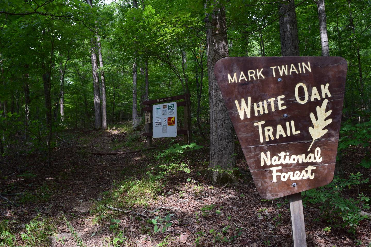
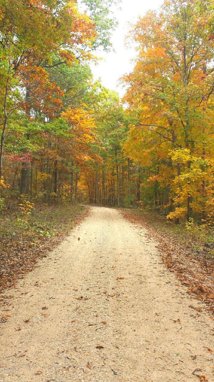
Mark Twain National Forest has a wide range of popular recreation opportunities. The forest has over 750 miles of trails. There are trails for hiking, horseback riding, mountain biking, and motorized use. The trails vary in length and difficulty.
Approximately 200 miles are completed of the 500-mile Ozark Trail, connecting from St. Louis to the Arkansas border. Plans are to connect the Missouri section with the Ozark Highlands Trail in Arkansas.
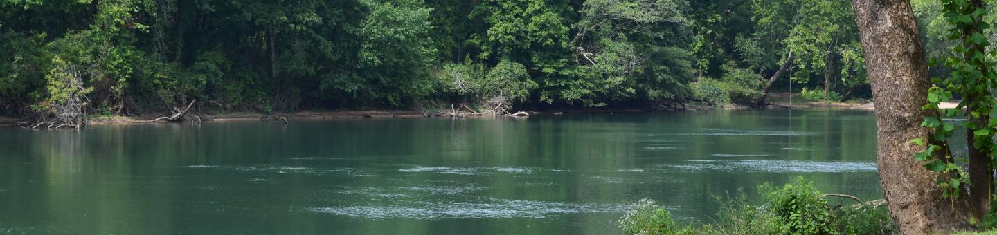
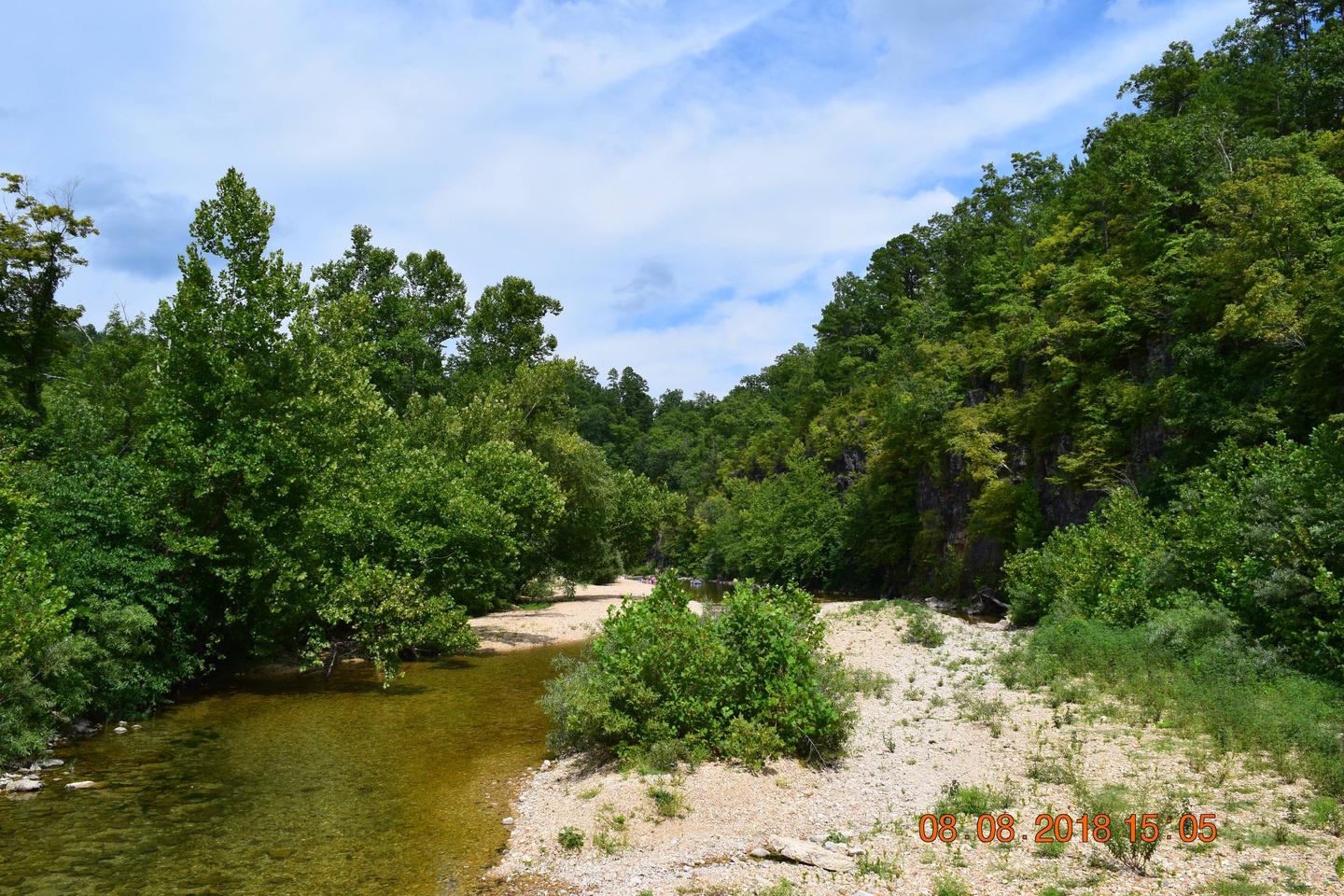
The Forest has more than 350 miles of perennial streams, most suitable for floating with canoes, kayaks, rafts, and inner tubes. The Forest and Missouri Department of Conservation maintain river accesses on popular streams.
Permitted outfitters provide services to the public at various locations throughout the forest.
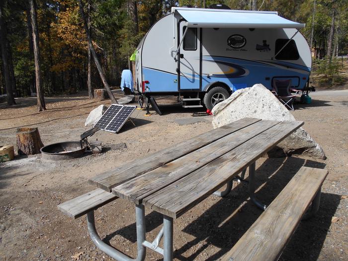
There are more than 35 campgrounds and picnic areas usually located near a special attraction such as a spring, stream, lake, towering bluff or other scenic area. Campgrounds and picnic areas vary from a few table sites to developed campgrounds. There are no cabins available for rent on the forest at this time.
The forest manages more than 78,000 acres as semi-primitive areas where the only access is by hiking, horseback, or mountain bike. Another 265,000 acres offer semi-primitive motorized recreation. These areas provide moderate to high opportunities for solitude. Hunting and fishing, with a valid Missouri Department of Conservation fishing license, are permitted in these areas.
In addition, Mark Twain National Forest has seven Congressionally-designated Wilderness areas and 26,000 “special areas.” Special areas are managed for the protection of unusual environmental, recreation, cultural or historical resources, and for scientific or educational studies.

The Recreational Sites are broken down by Districts which are located in 1 of 4
zones. Each zone contains maps of recreation opportunities for that zone,
included on these map are some of the local government facilities that are also
available.
Zone 1 Cedar Creek, Houston and Rolla Ranger District
Zone 2 Ava, Cassville and Willow Springs Ranger District
Zone 3 Eleven Point and Poplar Bluff Ranger Districts
Zone 4 Potosi, Fredericktown and Salem Ranger Districts
For District specific Recreational Opportunities
Ava/Cassville/Willow Springs
Eleven Point
Houston/Rolla/Cedar Creek
Poplar Bluff
Potosi/Fredericktown
Salem
For up-to-date information on closures and other current conditions, see "Alerts
& Notices" on the left.
RecAreaDirections
Open with Google Map
Misc
| Stay Limit | |
| Reservable | false |
| Keywords | |
| Map Link | |
| Contact Phone | |
| Contact Email |
Permits info
Facilities
COUNCIL BLUFF RECREATION AREA Campground
List of CampsitesOverview
The Council Bluff Recreation Area is perfect for anyone looking to enjoy the outdoors. The Wild Boar Campground and sheltered picnic area, available for individual families or large groups, is next to the largest lake in the Mark Twain National Forest. The area provides ample opportunities for camping, picnicking, hiking, fishing, swimming and more.Recreation
Boating is a popular pastime on the lake, but all boats on the lake must operate at a no-wake speed. Visitors can access the water via the two boat ramps located at the lake.Canoeing, swimming and fishing are also available. Anglers can expect a catch of a variety of freshwater fish, including bass bluegills, catfish and crappies.
The 12-mile Council Bluff Trail encircles the lake, with spurs to the campground. Hikers can enjoy scenic views of the lake and a look at the Mark Twain wilderness.
Waterfowl hunting is permitted on Council Bluff Lake and the nearby Enough Fields provide upland game opportunities. A variety of wildlife makes its home in the heavily wooded area.
Facilities
The Wild Boar Ridge Campground offers multiple single-family, large group and walk-in sites, available for tent and RV camping. Each is equipped with tables, lantern posts and campfire rings or campfire circles, with grills.The large group sites can accommodate up to 50 people and a nearby picnic pavilion can hold up to 75. The pavilion is paved, with a roof overhead and is equipped with multiple tables and grills.
Accessible vault toilets and drinking water are provided. Electricity is not available, but some sites will accommodate RVs up to 40 feet in length. Some sites are available on a first-come, first-served basis.
The beach provides accessible flush toilets, drinking water and coin-operated showers. A small play area with a slide and climbing structure is adjacent to the beach.
Natural Features
Located in southern Missouri, the Council Bluff Lake was created by a dam across Big River. It is 440 acres in size and 87 feet deep in some places.The Chapel Hill Beach is at the eastern end of the campground and provides 54,000 square-feet of sandy beach. Visitors can either walk or drive to the lake.
Nearby Attractions
The Trace Creek section of the Ozark Trail is located just west of the recreation area.RED BLUFF CAMPGROUND Campground
List of CampsitesOverview
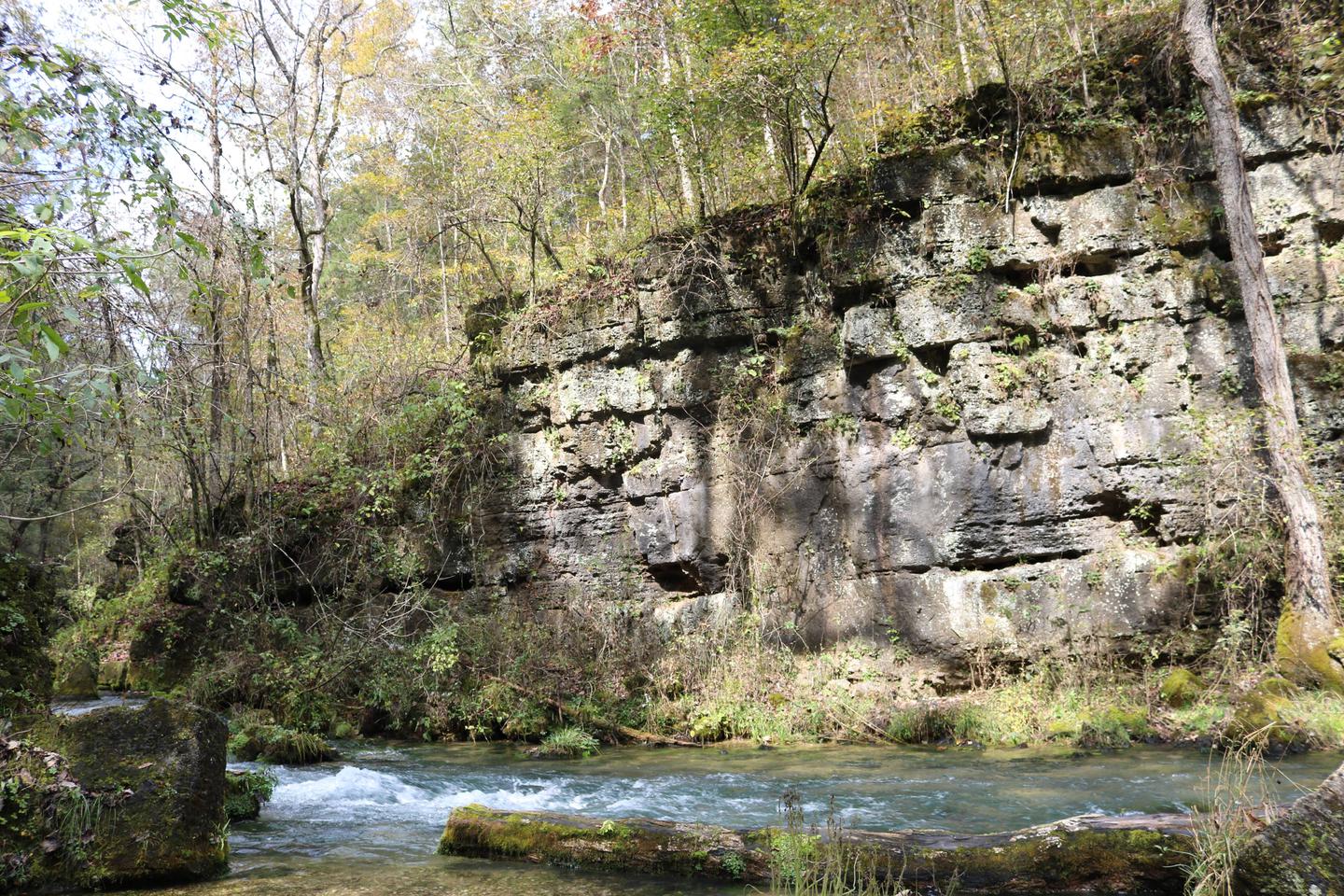
Red Bluff Campground is named for towering red bluffs along Huzzah Creek, carved by the elements over the past 10,000 years. The area used to be home to timber mills, but now provides a serene spot for camping and enjoying nature.Recreation
Most sites are within 100 yards of Huzzah Creek, where tubing and swimming are enjoyed by visitors. The water can be swift-moving at times and rocks and drop-offs are not marked. Fishing is also popular in the area and anglers can expect to find bass, perch and catfish.The Red Bluff Trail lies within the boundaries of the campground. It is a 1.2-mile loop that winds through a pine plantation and big oak timber, into an adjoining hollow before returning to the campground. The short trail provides an opportunity for visitors to enjoy a variety of ecological communities, while reaping the benefits of a half-hour of hiking.
Facilities
The campground offers several large sites available for tent and RV camping. Individual picnic sites are available as well, some of which have shelters. An accessible group picnic shelter can also be reserved and can accommodate up to 75 people. Additional sites are available on a first-come, first-served basis.Each site is equipped with a table and campfire ring with grill. Vault toilets and drinking water are provided. The roads within the campground are paved.
Natural Features
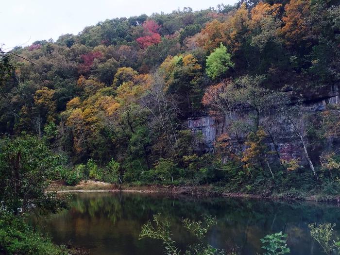
Large, red bluffs on the opposite side of Huzzah Creek, gravel bars along the creek, a mixture of pools and riffles and natural vegetation provide a backdrop for a very relaxing camping experience at the campground. Red Bluff is located in the Potosi-Fredericktown Ranger District of the Mark Twain National Forest.Nearby Attractions
This campground is located in southeastern Missouri, approximately one mile from the town of Davisville.SILVER MINES Campground
List of CampsitesOverview
Silver Mines Campground is located on the St. Francis River in the Mark Twain National Forest. It offers a variety of recreational opportunities and abundant historic and geological wonders.Recreation
Parts of the river are available for swimming, while other portions provide good fishing. Whitewater kayaking is a popular activity during the springtime when water runs high. Depending on water levels, the state holds an annual kayaking competition the third weekend of March.The 2-mile Silver Mines Trail follows both sides of the river, leading to various picnic areas. A 1.2-mile trail spurs to a popular conservation area, where visitors can view spectacular rock formations along the river.
Facilities
The campground offers dozens of single-family campsites, as well as large group sites, all available for tent and RV camping. Some sites have 30-amp electric hookups. The large group sites can accommodate up to 75 and 100 people. Additional sites are offered on a first-come, first-served basis.Picnic tables and campfire rings with grills are provided, as are accessible vault toilets and drinking water. Parking spurs vary from asphalt, to grass, to gravel or dirt.
Natural Features
This beautiful area is located along the St. Francis River, the only river in Missouri classified as a whitewater river. It is widely used for kayaking during springtime. The campground is located at a historic mining operation and is known for its Precambrian granite and felsite rocks. A variety of wildlife makes its home in the area.Nearby Attractions
The Millstream Gardens Conservation Area is located eight miles west of Fredericktown, or four miles west of the campground, on Highway 72. It is home to the scenic Tiemann Shut-ins and other spectacular sights along the riverbed.FLOAT CAMP PICNIC AREA Campground
List of CampsitesOverview
Float Camp Picnic Area is located only 150 feet from the cool waters of the crystal clear Current River. Visitors enjoy floating the river, fishing and hiking. A campground is only a half-mile away for those who want to stay longer than a day.Recreation
The swift-moving river allows for enjoyable float trips, as well as canoeing and great fishing. Swimming is also a popular pastime.Visitors enjoy horseshoe pits and volleyball courts, as well as hiking and other recreational opportunities nearby.
Facilities
The day-use picnic area offers an accessible group shelter that can accommodate up to 75 people. The site is equipped with electricity, tables and grills. Individual sites are available on a first come, first served basis. Accessible vault toilets, drinking water and trash collection are provided.Natural Features
The picnic area is nestled under a mature forest of hardwoods, which offers plentiful shade. It is adjacent to the Current River.Nearby Attractions
Doniphan is four miles away and offers float trip outfitters, restaurants and lodging.SUTTON BLUFF RECREATION AREA Campground
List of CampsitesOverview
Roomy campsites surrounded by open lawn and natural shading, cool breezes, abundant songbirds and scenic views all await visitors at the Sutton Bluff Recreation Area. The campground is a popular site for those using the nearby designated Sutton Bluff off-road vehicle trails.Recreation
A 20 mile off-road vehicle trail can be accessed from the campground. Permits are required for off-road vehicle use in the area. The Karkaghne section of the Ozark Trail, which is popular among backpackers, hikers and mountain bikers, is accessible from a trailhead less than a mile from the campground. The West Fork of Black River provides access to a serene, slow-moving mountain stream and a natural gravel beach. Visitors enjoy wading in the waters, however the current is not strong enough to enable floating the river. Anglers can enjoy a variety of bass and bluegill.Facilities
The campground offers multiple single-family sites and a large group site that can accommodate up to 32 guests. Each site is equipped with tables and campfire rings with grills, and electric hookups are available for RVs. Accessible vault and flush toilets, hot showers and drinking water are also provided. Firewood and ice are available by purchase from the campground host. A group picnic pavilion, equipped with about 10 tables, as well as grills, is perfect for large parties or family functions. Camping Sites #29, #32 and #33 have short parking spaces that are not able to accommodate large RVs/Trailers. Please take this into account when reserving sites.Natural Features
Sutton Bluff is located 13 miles outside Centerville, Missouri, on the Black River. It is nestled among a variety of short-leaf pine trees and shrubs, and a number of campsites sit alongside the West Fork of the Black River.Nearby Attractions
The small mining town of Centerville is located roughly six miles from the campground.PINEWOODS LAKE REC AREA Campground
List of CampsitesOverview
Pinewoods Lake Recreation Area sits next to Pinewoods Lake in southeastern Missouri. It is an ideal location to enjoy lake fishing and scenic trails.Recreation
A 1.3-mile walking trail surrounds the lake. Most of the trail has a concrete surface and is accessible. The entire trail is relatively flat, with no difficult sections. Circling the 32-acre lake, the trail provides views of the lake, songbirds and wildlife, and an abundance of wildflowers.The lake offers a floating fishing pier and a concrete boat ramp. Anglers can enjoy fishing for bass, sunfish and catfish.
Facilities
The day-use picnic shelter can accommodate up to 75 people. It is equipped with tables and large grills. Accessible vault toilets are provided. Trash collection service is not available; visitors must carry out all garbage.Natural Features
The lake is located on the southeastern quadrant of the Mark Twain National Forest. The area is densely wooded.Nearby Attractions
Ellsinore is the closest city to the campground, just 3 miles away, with a few dining options, a grocery store and fuel station.LANE SPRING RECREATION AREA Campground
List of CampsitesOverview
Lane Spring Recreation Area provides a peaceful setting along Little Piney Creek and a scenic patio overlooking beautiful Lane Spring. A large, accessible picnic area with two pavilions can be reserved. The site has multiple first come first serve campsites if an overnight stay is desired. A variety of outdoor recreation opportunities are in the area.Recreation
Trout fishing is popular along the portion of the creek nearest Lane Spring, as it is managed by a wild trout fishery. The fish population is self-sustained instead of being stocked. Only artificial lures and flies may be used, and a daily limit is applied of one trout measuring 18 inches or longer. Bass and sunfish are also plentiful.The 1.25-mile Blossom Rock Trail and the 1.5-mile Cedar Bluff Trail traverse through lush bottomland vegetation with abundant wildflowers, before climbing to views of the river and rock outcroppings. Birding and wildlife viewing is popular along the trails.
Facilities
The recreation area offers a picnic area with two group picnic pavilions, each equipped with tables, grills and electric outlets. Each can accommodate up to 100 people. If unreserved, the pavilions are available on a first-come, first-served basis. Each pavillion has 10-20 parking spots with handicap accessible paths to pavillions. These parking spots are not reservable, however there are additional parking spaces that have access to the spring and playground. Additional individual picnic sites are available near the spring. Several family campsites are available as well. Each site is equipped with a table, lantern post and campfire ring with grill. Vault toilets and drinking water are provided.Natural Features
The recreation area is situated along Little Piney Creek, with some waterfront campsites available. A beautiful hardwood forest covers the area, which lies in the northwestern portion of the Mark Twain National Forest.An accessible shaded stone patio overlooks tranquil Lane Spring, a bubbling spring with watercress and native plant species. It is bordered by a variety of trees, including sycamore, cypress, oak and many others.
COBB RIDGE Campground
List of CampsitesOverview
Cobb Ridge Campground is adjacent to the Chadwick Riding area, which is popular among and off-road vehicles (dirt bikes; ATVs and side by sides 50 inches or less) enthusiasts. Numerous trails provide nearly 80 miles of interconnecting loops that vary from easy to difficult terrain, winding in and out of deep, forested hollows and down long ridge tops. Family and group camping is available, providing access to Missouri's beautiful Mark Twain National Forest.Recreation
Visitors to the area mostly come for the plentiful off-road vehicle trails (motorcycle; ATVs and side by sides 50 inches or less). Some trail segments are very rocky, steep, rough, rutted and are technically challenging, while others that don't drain well have been built up with concrete. Hiking on the trails is also permissible but requires caution. If using the trails, you will need a Chadwick riding permit - they are available at our District office; Kay's Country Store in Chadwick, MO; or Casey's General Store in Sparta, MO. Cost is $45 for an annual; $7/day for motorcycles, ATVs and side by sides. $3 for mountain bike. You will need make/model and VIN# of vehicle along with rider information. The permit is valid for the machine and cannot be transferred.Facilities
The Cobb Ridge Campground provides a variety of campsite sizes, styles, development and locations. Single, double and triple camp units are designed to accommodate groups of various sizes. Campsites include traditional back-in units and easily maneuvered pull-through units; some with electrical hookups and others with only basic facilities. Tent camping is also an option. At each electric site, there are 30 and 50 amp service along with a 110 outlet.Most sites are fairly private, but some are close together and open enough to promote visiting between other camps. Additional sites are available on a first-come, first-served basis. When available, an on-site host is at the campground.
The sites are equipped with tables and campfire rings with grills. Flush toilets, vault toilets, and showers are provided. Hydrants are located throughout campground for all campers to use - no individual water hookups available. Trash collection facilities are provided.
Natural Features
The Chadwick area is mostly forested with oak, hickory and pine woods on rocky ridge tops, with a few small open forest glades. Steep ridges break into narrow hollows with scattered surface rock and occasional rock ledges and patches of eastern red cedar.Nearby Attractions
The campground is 30 miles from Springfield, Branson, Silver Dollar City and Shepherd of the Hills attractions. Lake Taneycomo is 20 miles south of Cobb Ridge.NOBLETT LAKE Campground
List of CampsitesOverview
Noblett Lake Picnic Pavilion provides a sheltered place among forests, streams and wildlife, for groups to picnic near Noblett Lake. It is a great location for birding, canoeing and boating.Recreation
Noblett Lake is a popular location for boating, canoeing and fishing. Only electric trolling motors or non-motorized boats are allowed on the lake.Visitors enjoy the day-use picnic area and the Ridge Runner Trail, a 22-mile remote path that loops hikers through the scenic Ozark Mountains.
Facilities
The pavilion offers seating for up to 75 people. If over 75 people, a special use permit is required; please contact Darla Rein at (417) 683-4428. It is equipped with electricity, tables and grills. There is a vault toilet. Trash collection services are provided. There is no water available; visitors must bring their own. There is no overnight camping allowed in the day use area. Dispersed camping (no amenities provided) is allowed in area across from Noblett Trailhead (old Oak Hill camping area) and below dam (old Sycamore Loop camping area). A parking area for the pavilion and the adjacent trail is available.Natural Features
The pavilion is set in a forest of oak and pine trees, on the Salem Plateau. It is near Noblett Lake and south of the town of Willow Springs.Nearby Attractions
West Plains, Willow Springs, Cabool and Mountain Grove are the closest towns.WATERCRESS Campground
List of CampsitesOverview
***Watercress sustained substantial damage to the pavilions during the 2017 flood, they are not reservable at this time, however the boat ramp is still open for public use.*** Watercress Campground lies on the banks one of the forest’s greatest treasures; the Current River. Floats on the river provide views of southeastern Missouri that otherwise can't be seen. The area is home to a variety of birds and wildlife and recreation opportunities are plentiful in the surrounding area.Recreation
Boating and canoeing on the Current River, as well as on other nearby rivers, are popular activities. A boat ramp for both motorized and non-motorized boats is available on the east bank of the Current River. Anglers enjoy fishing for bass, walleye, sunfish and the occasional catfish.Big Spring, Missouri's largest spring, is just five miles from the campground. Hikers at Watercress area enjoy the Songbird Trail, a 1.2-mile loop that leads to Watercress Spring, passing remnants of Civil War-era earthwork that overlook the Current River.
Facilities
The campground offers 17 campsites for tent or RV camping and the sites are available on a first-come, first-served basis. Each site is equipped with a table and campfire ring. Vault toilets and drinking water are provided.Two group picnic shelters which can accommodate up to 75 people each are located alongside the river. Each is equipped with tables and grills. A seasonal trash collection dumpster is also available between April 1 and October 1 at the campground entrance.
Natural Features
Located within the town of Van Buren, the campground and day use area are adjacent to the Current River, which flows past scenic bluffs, springs, caves as it meanders through the Mark Twain National Forest toward Doniphan, MO.Nearby Attractions
The campground is adjacent to the Ozark National Scenic Riverways, which is a series of protected rivers in the area managed by the National Park Service. More information about the National Park Service sites can be found here.MARKHAM SPRINGS Campground
List of CampsitesOverview
Markham Springs Campground is set on the Black River in a scenic and historic recreation area in the southwestern corner of Missouri's Mark Twain National Forest. The area provides access to multiple trails and recreational opportunities.Markham Springs Recreation Area gets its name from former owner, M. J. Markham, who acquired the property in 1901 and operated a lumber mill at the site until the 1930s.
The Fuchs House, a five-bedroom concrete and native stone home, also sits on the property, along with a neighboring mill. At times, it is also available for rent.
Recreation
River and stream fishing are popular activities near the campground. The Black River boasts bass, sunfish, walleye and catfish. Many anglers fish from boats, but others fish from the riverbanks. Canoeing and kayaking is also possible on the river.Various day hikes within the Markham Springs Trail System are accessible from the campground. Eagle Bluff Trail is a 1.5-mile loop along the river, where birding and wildlife viewing are favorite pastimes.
Facilities
The campground offers single and double sites for tent and RV camping. Some rather primitive sites are located in a wooded setting near the river.Electric hookups are provided, as well as tables and campfire rings with grills. Lantern posts are also available. Accessible vault toilets, drinking water, showers and trash collection are provided.
Natural Features
Located adjacent to the Black River, the recreation area contains a small pond that dates back to the 1800s. The area is covered by a dense forest of colorful trees, including ash, elm, maple and poplar.Nearby Attractions
The small town of Williamsville is just 3 miles from the campground, offering a general store and fuel station.SHELL KNOB REC SITE PAVILION Campground
List of CampsitesOverview
Shell Knob Recreation Site is situated along a bluff overlooking the White River arm of beautiful Table Rock Lake, in an unincorporated portion of Shell Knob. It is a great location to relax and enjoy being away from it all. The site can best be described as resembling a city park with a view. Even though it is near numerous subdivisions, Shell Knob is an unincorporated community.Recreation
A tennis court, sand volleyball court, a double horseshoe pit and a playground are available. A short walking trail leads to a scenic overlook of Table Rock Lake.Facilities
The site includes a lighted pavilion with kitchen facilities, numerous picnic tables and two parking areas. Accessible vault toilets are provided. Drinking water is available only during warm weather months. Only the pavilion can be rented, not the entire site. There is no stove or refrigerator available in the kitchen. There is a sink with hot/cold water available in kitchen. Grill is available outside for use. When picking up key at Harter House for gate and kitchen, a $25 deposit is required and will be refunded when key is returned to Harter House.Natural Features
The pavilion was once the site of Civilian Conservation Corps camp, which operated from 1936 to 1942. Several historic features are still visible within the site. The surrounding area is heavily wooded and provides scenic forest views.Nearby Attractions
Table Rock Lake, which offers all kinds of recreational opportunities, is adjacent to the Shell Knob Recreation Site.LOGGERS LAKE CAMPGROUND Campground
List of CampsitesOverview
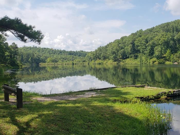
Located deep in the interior forests of Shannon County, Logger's Lake Campground is situated along the southeast shore of Logger's Lake. Constructed in 1942, this spring-fed lake is maintained as a fishery and is a destination for anglers looking for non-motorized boating and quiet bank fishing.Recreation
Logger's Lake offers good fishing for large-mouth bass, sunfish and channel catfish. The Day Use area has a small swim beach, boat ramp, picnic tables, and grills.Facilities
The campground area is located on the southeast lakeshore and all sites have a view of the lake, with only light vegetation in between. There are 14 sites with each site offering a table, fire ring, tent pad, and some offer lantern posts. Drinking water and vault toilets are centrally located. There are two boat ramps, and a barrier-free fishing pier. Group camping is available at Oak Knoll.Natural Features
The campground is located on 22-acre, spring-fed Logger's Lake. A variety of colorful vegetation, clear creeks and springs provide a picturesque setting.Eleven Point/Doniphan Ranger District Facility
The Eleven Point Ranger District takes its name from the Eleven Point River, designated a National Wild and Scenic River in 1968.
Some unique features of the Eleven Point Ranger District include Greer Spring which is the largest spring on National Forest land and the Scenic Eleven Point River. Floating offers spectacular close-up views of rocky bluffs, springs, vegetation, birds and animals.
Camping is permitted on gravel bars as well as in one of seven (7) primitive campgrounds accessible only by boat.
Other recreation opportunities include: hunting, hiking, wildlife watching, mountain biking, horseback riding, fishing and camping.
The district has four (4) developed campgrounds, seven (7) primitive float camps, over (10) ten undeveloped camping areas located throughout the district, and many other special attractions like rivers and springs.
If your interest is tubing, tubing is popular at Deer Leap, Float Camp, and Watercress Campgrounds.
If your interest is in hiking, there is over 122 miles of trail available ranging from ½ mile easy loop trails to several days journey on the Ozark Trail or 18 miles located in the Irish wilderness.
Eleven Point National Wild and Scenic River Facility
The Eleven Point National Wild and Scenic River was established in 1968 as a 44-mile scenic river, free of impoundments with a largely undeveloped shoreline and watershed. This portion of the river between Thomasville, Missouri and the Highway 142 bridge is near Gatewood, Missouri. It became one of the 8 initial units of the National Wild and Scenic River system in 1968.
The Eleven Point National Wild and Scenic River meanders through the picturesque Ozark hills of southern Missouri. Its course is cut in the shadows of steep bluffs, through sloping forested valleys, and low-lying riparian ecosystems. Barely more than a small stream at its upper reaches near Thomasville, it gains considerable width and depth as its proceeds south-eastward.
Springs pouring from dolomite bluffs or rushing up from a vast network of underground flow systems provide a continuous source of water and beauty. Alternating stretches of rapids and deep clear pools wind around moss covered boulders and shading bottomland hardwood trees.
Greer Spring is the world's 10th biggest spring and doubles the size of the river while turning it into a cold water fishery.
Access to the River: There are currently eleven designated access points to the river by vehicle. Of these access points, 7 sites have amenities. The remaining 4 access sites have no amenities. In addition, there are 7 float camps designated on the river to provide overnight camping for river users, most of these are only accessible by boat.
Boating on the River: The river has been designated for both motorized and non-motorized use. The motorized users must adhere to a 25 horsepower limit.
Fishing: There are opportunities aplenty for small mouth bass and pan fish. Special regulations apply. Visit the Missouri Department of Conservation website for more information. Trout fishing starts at the confluence of the Greer spring branch and the river. This is the beginning of the blue ribbon trout section which extends about 6 miles to Turner Mill spring. More detailed information is available below under Fishing.
For Steam Flow and Flooding forecast.
A printable Brochure is available.

Ava/Cassville/Willow Springs Ranger District Facility
Visitors to Ava/Cassville/Willow Springs District will find different landscapes from oak-hickory forests , shortleaf pine forests, and glades. Glades are open areas of native tall prairie grasses characterized by dry, shallow soils and limestone outcroppings.
The unique blending of eastern forest and western desert habitats makes a home for such varied wildlife as the bald eagle and the roadrunner, armadillos and wild turkey, white-tailed deer and black bears.
The sunlit balds and deep hollows, narrow ridgetops and steep slopes, secluded pastures and clear streams characteristic of the Ozarks are the trademark of the District. This is the landscape so eloquently described in Harold Bell Wright's famous book, The Shepherd of the Hills.
Nearby vacation destinations -- Branson, Silver Dollar City, Bass Pro, and Table Rock Lake -- make the District one of Missouri's favorite playgrounds.
If you drive through this area, you will be delighted at every turn by scenic views. Hike your way through the Forest and you will find solitude and tranquility.
The beautiful North Fork River is the pride of Willow Springs Area. A total of nine major springs flow into the river; two of the largest, Big Springs and Blue Spring, contribute some 18 million gallons of cold, clear water every day. The river is popular with canoeists as well as anglers.
The District contains three of seven Congressionally-designated Wilderness Areas; Devils Backbone, Hercules Glades, and Piney Creek Wildernesses.
The District has the Forest’s only National Forest Scenic Byways; Blue Buck Knob, Glade Top Trail; and Sugar Camp.
Houston/Rolla/Cedar Creek Ranger District Facility
The Houston/Rolla/Cedar Creek District covers about 207,000 acres in seven counties in south/central Missouri. The oak/hickory and pine forests intermixed with tallgrass prairie lands in the north provide opportunities for hunting, wildlife watching, wildflower viewing, hiking, dispersed camping and other uses.
The district is rich with rivers and streams: the beautiful bluffs of the Big Piney River, the Gasconade River and the Little Piney River in the south and central portions of the district and the Cedar Creek at the north end. Fishing and canoeing opportunities abound, including several river access points on the Big Piney and Gasconade Rivers. Smaller creeks such as Mill Creek and Spring Creek, supplied by springs, provide other fishing or water-based recreational opportunities, including trout fishing. Paddy Creek Wilderness with the 18-mile Big Piney Trail provides solitude for horseback riders and hikers. A total of over 80 miles of trails, including the Kaintuck, Cole Creek and Cedar Creek trails, provide multi-use trails open to mountain bikes, horses, overnight backpacking, and hikers and allow scenic views of rock outcrops and stream drainages. Other shorter trails provide hikes at the campgrounds. Four developed campgrounds provide picnic and camping sites, some with electric hook-ups. Other trailheads provide dispersed camping with ample parking for horse trailers and other users.
Big Piney River Facility
The Big Piney River offers 21 miles of water to enjoy floating, fishing and swimming. There are several river access on National Forest lands and others on the Missouri Department of Conservation
Stone Mill Spring Facility
Stone Mill Spring Branch is owned by the USDA Forest Service (USFS) and cooperatively managed by the USFS, Missouri Department of Conservation, and the Fort Leonard Wood Natural Resources Branch.
Park and walk down a trail that is approximately .25 mile to the beautiful Stone Mill Spring. This is a day use recreation area along the Big Piney River, managed as a trout fishery. Picnic tables, benches and grills are available, as well as a 1-mile hiking trail that provides views of the Big Piney River.
Stone Mill Spring is a very narrow spring that flows 18 million gallons a day, before it runs down and empties into the Big Piney River. That is enough water to fill 27 Olympic swimming pools each day.
It is named after a historical mill that operated in the 1880’s.
This site is only accessible and mostly used by those on the Fort Leonard Wood Base.
Slabtown Recreation Area Facility
This is a small, quiet access and camping area along the Big Piney River.
Slabtown is downriver from Mason Bridge, about 8 miles. This stretch is more open and deeper.
Traveling downriver from Slabtown you can paddle or boat to Ross Bridge, a 10 mile trip. This section is faster and shallower. Between Ross Bridge and East Gate, a 12-mile float, you will be floating through Fort Leonard Wood. Ross Bridge will be the last take-out before you float through Fort Leonard Wood.
The 1-mile Slabtown Bluff Trail offers hiking along scenic bluffs overlooking the Big Piney River and surrounding bluffs and rock outcrops.
Hendrickson Boat Launch Facility
This boat launch is located on the Black River near the town of Hendrickson. This is a popular location to launch for fishing. The site features an accessible loading platform, and also has a large parking lot.
Potosi/Fredericktown Ranger District Facility
The 201,582 acres of Potosi Ranger District offer many developed and undeveloped sites for camping and picnicking. Because of the karst topography prevalent in this area, caves with springs that feed the rivers and streams can often be seen. They are currently closed to all visitors to protect bats from contamination by white-nosed-syndrome. Courtois and Huzzah Creeks are well-known "floating" streams, typical of the Ozarks, and much-loved by canoeists who flock there in summertime for the crystal clear water and safe passage. A portion of the Ozark Trail traverses Potosi District, and the segment encompassing the Berryman Trail is popular for mountain biking events. The 9,183 acre Bell Mountain Wilderness has beautiful views and challenging trails in a secluded and primitive setting.
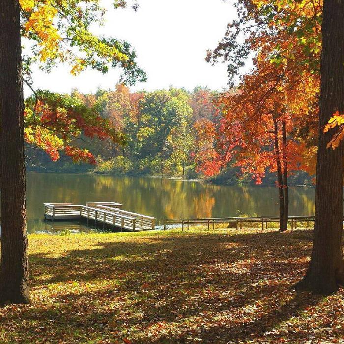
Council Bluff Recreation Area is the largest lake in the Mark Twain National Forest. Providing a more developed experience, it features a sandy swimming beach, drinking water, restrooms, and many barrier-free facilities on a beautiful 440 acre lake, encircled by a 12 mile moderate hiking and mountain biking trail. Boar Ridge Campground along the spine of a forested Ozark ridge above the lake, offers a unique camping experience.
The 83,953 acre Fredericktown District features the rugged St. Francois Mountains and St. Francis River. In Spring, the "shut-ins" at Silver Mine are a magnet for kayak enthusiasts, who take advantage of the high water rapids. Marble Creek provides a quiet campground for family outings, and Crane Lake welcomes hikers to take the trail around it as part of their trek along the Ozark Trail. Rockpile Mountain Wilderness offers 4,240 acres of heavily-forested land, including some of the state`s last remaining virgin forest nestled in a narrow gorge.
Paddy Creek Wilderness Facility
Wilderness recreation is a unique experience that requires special skills and techniques, such as no-trace camping, to ensure that the character of the land truly remains wild. Emphasis in a wilderness area is on the primitive. Signing and trail marking will be minimal; developed campsites, footbridges, and garbage collection are non-existent. A wilderness is a special area set aside by Congress which “generally appears to have been affected primarily by the forces of nature with the imprint of man’s work substantially unnoticeable…” Before you start, be prepared with adequate supplies; water sources with the wilderness are not recommended for drinking, and must be purified if used. Group size is limited to 10 persons.
This 7035-acre wilderness is located in northwestern Texas County. In the early 1800’s Sylvester Paddy began the first logging of the area, transporting timber from this area by river to St. Louis. Until the 1930’s the area was homesteaded and grazed as open range. It became federally designated wilderness in 1983.
Big Paddy and Little Paddy Creeks characterize the Paddy Creek Wilderness with steep cliffs and rock outcrops along the drainages. These creeks have water in them throughout most of the year. In the Wilderness are a few old fields in drainages but the rest is forested. Black, white, and post oaks, hickories and shortleaf pine are the main trees. Throughout the area, wildlife typical of the Missouri Ozarks is present. White-tailed deer, wild turkey, squirrel, rabbit, fox, coyote and bobcat are common.
A printable brochure (pdf format) is available for download. Trail System Map (printable) and Trail System Map GEO Referenced for use with Map Apps
Trails: There are 18 miles of designated trails within the wilderness. The elevation of the area changes 500 feet between a point near Roby Tower on the western edge of the area, and Paddy Creek as it meets the eastern boundary of the Wilderness. Signs and trail marking are minimal or non-existent and the use of maps and compass is recommended. Travel is by foot or on horseback; No Motorized or Mechanized vehicles are permitted.
