
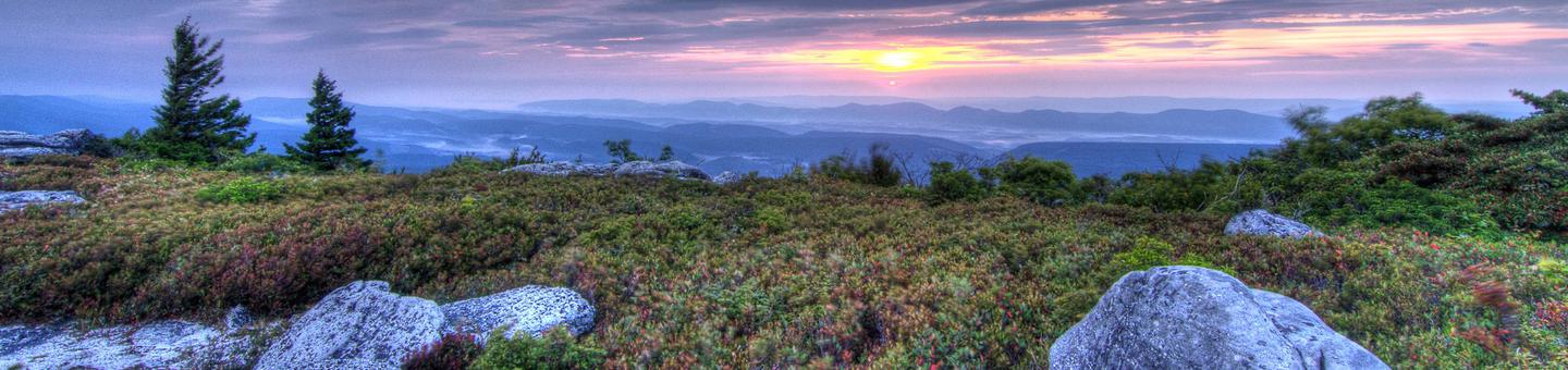
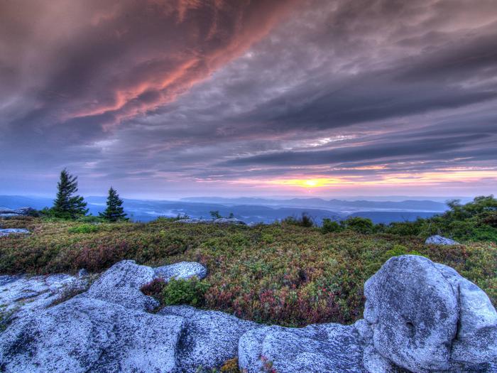
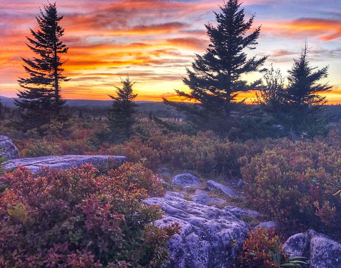
Monongahela National Forest

The gate of the Stuart Recreation Area welcomes visitors to leisure on the Monongahela National Forest.
The Monongahela National Forest is a recreation destination and major tourism attraction. The extensive backwoods road and trail system is available for hiking, mountain biking and horseback riding. There are many miles of railroad grades that are a link in the recreation use of the forest. Recreation ranges from self-reliant treks in the wildernesses and backcountry areas to the challenges of mountain climbing to traditional developed site camping. Hunting, fishing, and wildlife viewing are also popular uses.
The national importance of the recreation resource of the Monongahela has been recognized through the designation of the Spruce Knob – Seneca Rocks National Recreation Area (NRA), the first NRA in the Forest Service, National Scenic Byway status for the Highland Scenic Highway, and eight Wilderness Areas.
RecAreaDirections
Open with Google Map
Misc
| Stay Limit | |
| Reservable | false |
| Keywords | |
| Map Link | |
| Contact Phone | |
| Contact Email |
Permits info
Facilities
Hopkins Mountain Fireman's Cabin Campground
List of CampsitesOverview
Hopkins Mountain Fireman's Cabin is approximately 17 miles north of White Sulphur Springs, West Virginia. It sits at an elevation of 3,162 feet. Guests enjoy the area for its magnificent views, animal watching, hunting and historic background. The Hopkins Mountain Fireman’s Cabin and Fire Tower site were constructed by the Civilian Conservation Corps (CCC) in 1935. Also on the property is a logging tramway, in use from about 1908 to the 1920s, and the Civil War Trail, used in 1863 for the rapid retreat of the 64th Virginia Battalion after the Battle of Droop Mountain. The fireman’s residence, measures 14 feet by 20 feet and has been virtually unaltered since construction.
Recreation
Hopkins Mountain Fireman's Cabin provides beautiful overlooks, hiking trails, animal watching and hunting.
Facilities
Hopkins Mountain Fireman's Cabin is available for reservations Spring through Fall. The cabin can comfortably accommodate 2 people on two twin single beds (bunk bed) each with mattresses. There is a tent pad located on site for sleeping another 8 guests. The group size is limited to 12. Guests and campers need to bring their own food, toiletries, towels, bedding and trash bags. A vault toilet is located at the cabin site. The cabin is equipped with electricity, refrigerator and heat. Be prepared to cook meals on the outside grill. Firewood is limited to what is dead and down within the area. Two picnic tables are provided along with a lantern post, fire ring, firewood shed and sawbuck. There is no water available on the site but drinking water, flush toilets, and showers can be obtained at Blue Bend Recreation Area from May to October.
Natural Features
Hopkins Mountain Fireman's Cabin is located a short distance from Blue Bend Recreation Area where Anthony Creek provides opportunities for picnicking, swimming, trout fishing and hunting. The Blue Bend Recreation Area provides access to BIg Draft WIlderness, a beautiful wilderness hiking experience. Blue Bend Loop Trail is a 5 mile trail with 3 scenic overlooks and connects to Anthony Creek Trail which winds its way along Anthony Creek for 3.8 miles and provides access to the South Boundary trail a 4.8 mile though hike.
Nearby Attractions
Blue Bend Recreation Area and Campground, Big Draft Wilderness, Greenbrier River Trail, Lake Sherwood campground and Day Use area, Historic towns of Lewisburg and White Sulphur Springs.
HORSESHOE RECREATION AREA Campground
List of CampsitesOverview
Horseshoe Recreation Area is located in north-central West Virginia, 7 miles from the town of St. George. The campground is tucked in a valley along the Horseshoe Run River, providing excellent opportunities for fishing and wildlife viewing.Recreation
Day hiking options include the 1.8-mile Losh Trail, the Dorman Ridge Trail at 1.3 miles, and Two Camp, a short 0.3 mile hike. Fishing for trout is a popular pastime and hunting is allowed in an area about a mile beyond the recreation area.Facilities
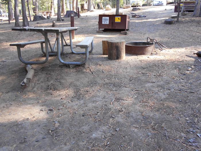
Each site offers picnic tables, grills, and waste receptacles and standard sites have electric hookups. There are accessible vault toilets and non-accessible flush toilets. Hand pumps and a drinking fountain with faucet are available. The camp store sells firewood and ice. The two group picnic shelters are accessible. The large electric pavilion has an occupancy limit of 75, and the small non-electric pavilion has an occupancy limit of 10.Natural Features
Within the recreation area, open fields are mowed and gravel roads are maintained along the river. The Monongahela Forest extends over the north central highlands of the state, straddling many of the region's highest peaks. Elevation ranges from 1,000 to 4,863 feet above sea level.Variations in terrain and precipitation have created one of the most ecologically diverse national forests in the country.
Nearby Attractions
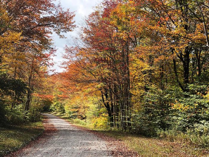
Take a scenic drive throughout the forest. Fall brings incredible foliage colors to the region.STUART RECREATION AREA Campground
List of CampsitesOverview
Stuart Recreation Area is set in a mixed forest along the banks of the Shavers Fork River. The river provides excellent fishing and is regularly stocked with trout. Hiking trails lead to outstanding overlooks, local caves and Blackwater Falls.Recreation
River swimming is a lot of fun, and there are plenty of trout to tempt anglers of all skill levels. The 2-mile River Loop Hiking Trail is enjoyed by many visitors, and is a great way to watch for birds and wildlife.Facilities
The campground lies on a single loop with long spurs. Drinking water and accessible flush toilets and showers are provided, with a dump station is on-site. Each site comes with a campfire ring, tent pad, lantern post and electric hookups.The day-use area has three picnic pavilions with maintained fields and a beach on the riverfront.
Natural Features
The campground is perched along a bend on the Shavers Fork River. Shavers is a tributary of the Cheat River, a popular rafting river with rocky rapids.Stuart is in the Allegheny Mountains of West Virginia. The Monongahela Forest extends over the north central highlands of the state, straddling many of the region's highest peaks. Elevations here range from 1,000 to 4,863 feet above sea level.
Nearby Attractions
The town of Elkins is a 14-minute drive from the campground. An annual Mountain State Forest Festival takes place here every October.BLUE BEND REC AREA Campground
List of CampsitesOverview
Blue Bend Recreation Area is a quaint wooded area filled with plenty of hiking, picnicking and camping opportunities. Constructed in the 1930s by the Civilian Conservation Corps, the rustic wood tables and shelters appeal to many day and overnight visitors.The recreation area, along Anthony Creek, has a selection of single family campsites and 2 picnic shelters. The large group picnic shelter accommodates 75 people and can be reserved in peak season.
Recreation
Swimming is nice and refreshing in Anthony Creek, and anglers can find trout here. The Blue Bend Recreation Area provides access to the BIg Draft WIlderness. A popular excursion into the wilderness is the 5-mile Blue Bend Loop Trail, which connects to the Anthony Creek Trail. Blue Bend Loop Trail offers 3 scenic overlooks.Facilities
Flush toilets and showers are available in summer, and vault toilets can be used through the spring and fall seasons. Running water is also seasonal, but a hand pump is available through spring and fall.Each site is on a parking spur with a picnic table, campfire ring, trash bin and lantern post.
Natural Features
At an elevation of 1,860 feet, the campground is in a pleasant, wooded valley facing Round Mountain in the Monongahela National Forest. The forest comprises about a million acres of forest that attracts 1.3 million visitors each year.A variety of animals make their home here, including black bear, coyote, wild turkey, white-tailed deer, red and gray fox, bobcat, fisher, otter and mink.
Nearby Attractions
LAKE SHERWOOD Campground
List of CampsitesOverview
Lake Sherwood Recreation Area is a complete family destination offering a wide variety of activities and camping options. Standard, tent-only and group camping facilities are perched along Lake Sherwood, the largest lake in the Monongahela National Forest.Swimming beaches, a picnic area, boat ramp and several hiking trails are among the features of the area.
Recreation
Anglers seek tiger muskie, channel catfish, bullhead, bluegill and largemouth bass. Boating is a big draw as well.Hikers have the option of exploring Lake Sherwood Trail, Upper Meadow Trail, Meadow Mountain Trail and Meadow Creek.
Facilities
Each campsite has a parking spur, tent pad, picnic table, fire ring and lantern post. Showers are accessible.All camping areas are served by restrooms with running water, flush toilets, hot showers and electricity (available during the summer season only). In the spring and fall, vault toilets and a hand pump well are available.
The parking aprons are gravel and some are up to 20 feet wide. No electrical, sewage or water hook-ups are available, but there is a dump station on-site.
Other amenities include a playground, picnic shelters and volleyball courts.
Natural Features
At an elevation of 2,600 feet, Lake Sherwood spans 156 acres. The recreation area is part Monongahela National Forest, which comprises about a million acres of forest in West Virginia, and attracts 1.3 million visitors each year.A variety of animals make their home here, including black bear, coyote, wild turkey, white-tailed deer, red and gray fox, bobcat, fisher, otter and mink.
Nearby Attractions
The Greenbrier Resort in White Sulphur Springs, West Virginia is a 15 minute drive. The West Virginia State Fair, held in August each year, is located 30 minutes away in Lewsiburg, West Virginia.BIG BEND (WV) Campground
List of CampsitesOverview
Big Bend is a family-oriented campground along a bend on the South Branch Potomac River in Smoke Hole Canyon. With its convenient position on the river, the campground creates a recreation hub for fishing, tubing, kayaking and swimming.About 1.3 million people visit the Monongahela National Forest each year. The forest is a drivable distance from metropolises like Washington, D.C., and Pittsburg, yet still offers a remote and scenic camping getaway.
Recreation
The Big Bend Loop Trail is a one-mile nature trail that circles the campground. The majority of the trail follows along the river bend.Thirty miles of maintained trails can be found nearby, and mountain biking is permitted on most trails.
Facilities
Big Bend offers 46 sites; 18 sites are non-reservable. Twelve sites on the river loop have tent pads. All sites have a lantern holder, picnic table and fire ring. Drinking water is available. There are two pit toilets, one shower house, and flush toilet restrooms in each loop. There is also a dump and fill station.Natural Features
Big Bend Campground is in the northern portion of the Monongahela National Forest, boasting beautiful old growth trees that become vibrant with color in fall.The river runs north through the Smoke Hole Canyon, which bears a name of uncertain origin. One theory is Native Americans used the caves of the gorge for smoking meat, which created "smoke holes." Another is that misty fog often lies along the river and ascends in what looks like smoke from a hole.
Nearby Attractions
The Highland Scenic Highway provides an unforgettable drive through narrow, steep valleys and rolling, tree-topped mountains. Estimated time to drive on this byway is two to four hours, and highlights include Cranberry Glades Botanical Area, Summit Lake and Falls of Hills Creek.SENECA SHADOWS Campground
List of CampsitesOverview
Seneca Shadows Campground overlooks Seneca Rocks and is surrounded by mountains on both the east and west. Hiking and nature study at Seneca Rocks are just a couple of the popular activities in the area. The North Fork South Branch Potomac River is nearby, making fishing a popular pastime.Two local caves beckon ambitious explorers, and the 900-foot high Seneca Rocks can be viewed from most campsites.
Recreation
Rock climbers and hikers adore Seneca Rocks. Both sports will take visitors to the top of the impressive rocky tops with rewarding views of the mountains and valleys beyond. The hiking trail can be accessed across the street from the Seneca Shadows Campground.Seneca Rocks Visitor Center provides a catch-and-release fishing area, viewing platforms, educational displays and a gift shop.
Facilities
Seneca Shadows is a modern campground with flush toilets, lantern posts, picnic tables and campfire rings. The large facility has a selection of walk-to tent sites, standard RV sites and tent-only group sites. Loop C has electric hookups. Firewood is available for sale on-site.Natural Features
The campground sits in the river valley within the Monongahela National Forest, which extends over the north central highlands of the state, straddling many of the region's highest peaks. Elevations range from 1,000 to 4,863 feet above sea level.Variations in terrain and precipitation have created one of the most ecologically diverse national forests in the country.
Nearby Attractions
Campers make Seneca Shadows a convenient base camp while traveling through the Potomac Highlands. Explore the scenic roadways, especially when fall colors are at their peak.BLUE MEADOW Campground
List of CampsitesOverview
Blue Meadow is a group campground. In the event that this campground has not been reserved, it may be opened for overflow. At this time, sites 1-17 may be claimed as individual campsites on a first come, first serve basis.Recreation
Anthony Creek attracts anglers looking for trout. The "Blue Hole" in the creek is a favorite spot for swimming. Nearby Big Draft Wilderness provides an opportunity to explore more remote areas of teh Forest. Anthony Creek Trail follows the creek in a narrow valley filled with rhododendron and many flowering forest trees. Blue Bend Loop Trail offers 3 scenic overlooks. Both trails are recommended for hikers and bird watchers.Facilities
Blue Meadow's group campground is divided into 17 campsites, including 4 walk-to sites. It comes with picnic tables, grills, lantern posts and trash collection services.Vault toilets are available, but drinking water is not on-site. Drinking water can be accessed from the Blue Bend Campground.
Natural Features
At an elevation of 1,860 feet, the campground is in a pleasant, wooded valley along Anthony Creek. Across the creek lies Round Mountain.The Monongahela National Forest comprises about a million acres of forest that attracts 1.3 million visitors each year. A variety of animals make their home here, including black bear, coyote, wild turkey, white-tailed deer, red and gray fox, bobcat, fisher, otter and mink.
Nearby Attractions
The Greenbrier Resort in White Sulphur Springs, West Virginia is a 15 minute drive. The West Virginia State Fair, held in August each year, is located 30 minutes away in Lewsiburg, West Virginia.MIDDLE MOUNTAIN CABINS Campground
List of CampsitesOverview
The Middle Mountain Cabins are nestled in a small grassy opening near a small pond and Camp Five Run, a hiking trail that leads into the Laurel Fork South Wilderness. The cabins are secluded and offer a quiet retreat for visitors. Rented as a single unit, Middle Mountain Cabins include a main cabin with a kitchen, and two historic sleeping cabins.The cabins occupy a 3.5-acre space about 18 miles south of Wymer. The two smaller cabins were built in 1939 and served as bunk houses for Forest Service employees.
Recreation
Middle Mountain Cabins (elevation 3,750 feet) are located on a half-acre grassy field surrounded by red spruce and yellow birch. The cabins sit near the Laurel Fork South Wilderness. Several other trails around the Middle Mountain Cabins include the High Falls of Cheat Trail # 345, which is a 2.9-mile trek to the beautiful waterfalls.The West Fork Rail Trail #312 is an old railroad grade and runs along the West Fork of the Greenbrier River. The Allegheny Trial # 701 spans many districts on the Monongahela National Forest.
Fishing is popular on the Cheat, Glady Fork, Shavers Fork, and West and East Forks of the Greenbrier River. Lake fishing is popular at Spruce Knob Lake and Buffalo Lake. A state fishing license, National Forest Stamp, a Conservation stamp, and a trout stamp are required.
Facilities
The main cabin is a single story log building with a gabled roof that extends to cover a full length porch. Inside are exposed log rafters and tie beams. Outside there is a picnic table, grill and campfire ring. A four car gravel parking area is located beside the grassy clearing.All cabins have fireplaces. Firewood is provided, but the supply is not guaranteed. There is no water in the cabin, but an outside handpump for drinking water is available. An outdoor vault toilet is located onsite. Each sleeping cabin contains two sets of bunk beds, while the main cabin contains one full size bed for a total capacity of 10 people.
The kitchen includes a gas stove, cabinets, a table with six chairs, two lounge chairs, some pots, pans, dishes and silverware. There is no electricity available. Visitors should bring food, matches or a lighter, an ax, small saw, bedding, lanterns for each cabin, flashlights, food, ice chests, and personal gear. Food should be protected as field mice and bears frequent the area.
Natural Features
Middle Mountain Cabins (elevation 3,750 feet) is located on a half-acre grassy field surrounded by red spruce and yellow birch. The cabins sit near the 11,839-acre Laurel Fork South Wilderness.The Laurel Fork of the Cheat River is characterized by its narrow valley floor with regularly dissected slopes and long narrow ridges. The continuous forest cover of primarily Beech, Maple, Birch, and Cherry is occasionally broken up by beautiful meadows along the river.
Nearby Attractions
A convenience store and fuel can be found in Bartow and a larger grocery store can be found in Elkins. Due to rural mountain roads, visitors should expect to drive for at least an hour to reach these towns.JESS JUDY Campground
List of CampsitesOverview
Jess Judy is a group camping facility located on the South Branch of the Potomac River, in West Virginia;s eastern panhandle, about 1.5 miles south of Big Bend. Canoeing, fishing and hiking are popular activities.About 1.3 million visitors come to the Monongahela National Forest each year, and it's no surprise why. The forest is a drivable distance from cities like Washington D.C. and Pittsburgh, yet the density of flora, fauna and picturesque mountains seem like a world away from any city.
Recreation
Visitors enjoy canoeing and fishing on the river, and hiking on local trails. Thirty miles of maintained trails can be found nearby and mountain biking is permitted on most of them. One highly recommended trail for hikers and backpackers is the North Fork Mountain Trail.Facilities
The campground has three primitive group sites that can accommodate up to 40 people each. No drinking water is available, so please bring your own supply. Accessible vault toilets are provided.Natural Features
Jess Judy is situated in the northern portion of the Monongahela National Forest, on the western banks of the river. The region boasts beautiful old-growth forests that become vibrant with color in fall.the South Branch of the Potomac River runs north through Smoke Hole Canyon, which bears a name of uncertain origin. One theory is Native Americans once used the caves in the canyon for smoking meat, which created "smoke holes." Another is that misty fog often lies along the river and ascends in what looks like smoke from a hole.
Nearby Attractions
Traverse through narrow, steep valleys and over rolling, tree-topped mountains on the Highland Scenic Highway. This 43-mile drive includes highlights like Cranberry Glades Botanical Area, Summit Lake, and the Falls of Hills Creek.GATEWOOD GROUP Campground
List of CampsitesOverview
Gatewood Group Campground is ideally located just two miles from Spruce Knob Lake in the Monongahela Forest, creating an ideal base camp for hikes and wildlife watching.Recreation
With over 500 miles of hiking trails, visitors are have many options in the forest, including the Gatewood Nature Trail.With some of the most beautiful overlooks in the area, Spruce Knob Lake offers fishing and boating opportunities (fish are stocked). No swimming is allowed.
Unobstructed views of the night sky bring stargazer clubs to this spot all summer long.
Facilities
Three group sites are available that can accommodate up to 20 people each. Picnic tables and campfire rings are provided, as are accessible pit toilets. Drinking water is NOT available in the campground.Natural Features
The campground is situated on a ridge in the Allegheny Mountains of West Virginia. The Monongahela Forest extends over the north central highlands of the state, encompassing many of the region's highest peaks. Elevations range from 1,000-4,863 feet, and Gatewood sits at 4,300 feet.Variations in terrain and precipitation have created one of the most ecologically diverse national forests in the country.
Nearby Attractions
Spruce Knob, West Virginia's highest peak, lies just 9 miles from the campground. It overlooks forested ridges and grassy open pastures. Visitors can drive or hike to the top. Rock climbing is also a popular activity.SPRUCE KNOB LAKE Campground
List of CampsitesOverview
Spruce Knob Lake Campground is tucked in a beautiful hardwood forest less than a mile from Spruce Knob Lake. The campground provides a peaceful setting with easy access to boating on the lake and hiking through the mountainous region.Spruce Knob is the highest peak in West Virginia. A stone and steel observation tower is perched atop the peak, offering breathtaking 360-degree views of the area.
Recreation
Sixty miles of picturesque hiking trails crisscross the region, and the campground provides direct access to the pleasant 1-mile Big Bend River Loop.Trout fishing is available nearby at 25-acre Spruce Knob Lake, and in surrounding creeks. Facilities at the lake include a small boat ramp, parking area and vault toilets. A wooden pier along the shoreline provides barrier-free access to the lake.No swimming is allowed.
Facilities
The campground has accessible vault toilets and a solar-powered system for drinking water. No electric hookups are available. Firewood is for sale on-site.Natural Features
The campground is situated on a wooded ridge overlooking the lake. To the east is 4,863' Spruce Knob. The vegetation atop Spruce Knob has adapted to a harsh, exposed environment. One-sided red spruce deformed by constant exposure to strong westerly winds cling to the high rocky ridges. Blueberry and huckleberry plants cover the ground.Due to its location, the campground may experience cold fogs and strong winds year-round.
Nearby Attractions
The half-mile Whispering Spruce Trail circles Spruce Knob and provides panoramic views of the beautiful area.Spruce Knob-Seneca Rocks National Recreation Area Facility
Encompassing 100,000 acres, the scenic Spruce Knob-Seneca Rocks National Recreation Area (NRA) contains the highest peak in West Virginia, some of the best rock climbing on the east coast, outstanding views and a chance to enjoy America's great outdoors.
Visitor facilities include the Seneca Rocks Discovery Center, Seneca Shadows and Big Bend Campgrounds, and the Spruce Knob Tower. Many thousands of acres of unspoiled quiet land await discovery. Use your imagination to see how the area may have looked to the early settlers, as they crested the mountain ridges or moved up the river. Imagine living a self-sufficient life on a high hillside farm. Envision the Native Americans gathering food on hunting forays. You will discover not only beauty, but a sense of history in the NRA.
Bear Heaven Campground Campground
List of CampsitesA small primitive campground located approximately 14 miles northeast of Elkins, West Virginia, on Forest Road 91 (Stuart Drive) near the Otter Creek Wilderness. 8 available sites are nestled along rock outcroppings that offer unique landscapes.
There is stream fishing and hiking located nearby. Middle Point Trail #140, 3.7 miles in length is located along Forest Road 91 (Stuart Drive) west of the Campground. The Otter Creek Wilderness offers several trails and more challenging experiences just next door.
Gauley Ranger District Facility
The Gauley Ranger District is located in Richwood, WV.
Big Rock Campground Campground
List of CampsitesSmall, wooded 5 unit campground adjacent to the Cranberry River.
Located on Forest Road 76, approximately 7 miles north of Richwood, WV.
Cranberry Campground Campground
List of CampsitesA popular semi-primitive campground adjacent to the Cranberry River and the "lower-gate" entrance to the Cranberry Backcountry. This campground receives very high use during trout stocking from the beginning of spring through the end of June and again in the fall from September through October. During these high use times there are usually more campers waiting than there are sites available. During high use, the centrally located Bishop Knob Campground can usually accommodate campers when no sites are available along the Cranberry or Williams River Corridors.
Located on Forest Road 76, 13.5 miles from Richwood, West Virginia, and 7 miles from Dyer, West Virginia.
Island Campground Campground
List of CampsitesThis primitive campground is a favorite among fisherman for being adjacent to Long Run and the East Fork of the Greenbrier River.
For hikers, this campground is located close to the East Fork Trail #365. This is an 8 mile trail with some difficult terrain to traverse. Also close by is the shorter Smoke Camp Trail #324. It is 1.8 miles in length for those looking for more of a day hike.
Island Campground is located approximately 5 miles north and east of Bartow, West Virginia.
Williams River Sites Facility
There are 30 separate, rustic campsites located along Williams River Road, designated as Forest Roads 86 and 216. Many of these sites are close to the river, and are very popular with anglers. These campsites, as well as Tea Creek and Day Run Campgrounds, are the only places camping is permitted along Williams River. Toilets are closed in winter.
Campsites are scattered along the Williams River Road, from the Three Forks area upstream to a point near the river's headwaters.
Laurel Fork Campground Campground
List of CampsitesLocated along the Laurel Fork River between Laurel Fork North and South Wilderness areas, this primitive campground offers visitors a nice camping opportunity in the Middle Mountain area on the site of an old Civilian Conservation Corps location.
Day hiking and backpacking opportunities are available leaving from this campground as well through the Laurel Fork North and South Wilderness.
Marlinton Ranger District Facility
The Marlinton Ranger District is located in Marlinton, WV.
Day Run Campground Campground
List of CampsitesLocated just off the Highland Scenic Highway this small developed campground is a perfect getaway for fisherman and hikers. Many of the 12 camping sites boarder the upper scenic Williams River and the campground is within walking distance of many popular trails. Each site is equipped with a wooden picnic table, lantern post, and fire ring. Several campsites also have a tent pad, although all sites are suitable for tent or trailer camping.
Pocahontas Campground Campground
List of CampsitesWith a convenient location just off State Route 92 this campground is great for families and outdoor enthusiasts. Two Lick Trailhead is located within the campground and providing easy and accessible access. Also each campsite is furnished with a fire ring, picnic table, and lantern ring.
Tea Creek Campground Campground
List of CampsitesTea Creek Campground is a spacious 28-site campground is tucked away at the intersection of the Williams River and Tea Creek. This campground is a recreational hub of the area. There are four trailheads located within the campground and walking distance to most of the Tea Creek Trail System.
Each camping site is equipped with a parking spur, picnic table, fire ring with a grill, waste receptacle and a lantern hookup. Visitors are encouraged to use the three bear-proof trash cages located throughout the campground during their visit.
Red Creek Campground Campground
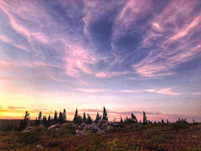
List of CampsitesRed Creek Campground is a primitive, small campground that sits on top of the Allegheny Plateau and within the Dolly Sods Scenic Area. The climate and plant life here resembles Northern Canada. A stone’s throw from the campground is Dolly Sods Wilderness which offers a unique wilderness hiking opportunity for those looking for adventure. This area features unique scenery and unusual plant communities. Flowering laurel, rhododendron and azaleas highlight this area from May through June. Huckleberry picking is popular during the month of July. And for those looking for wildlife, bird banding is performed in late summer and during the fall. Located approximately 20 miles northwest from Petersburg, West Virginia and 24 miles north of Seneca Rocks.
Seneca Rocks Facility
Seneca Rocks is one of the best-known landmarks in West Virginia. These rocks have long been noted as a scenic attraction and are popular with rock climbers.
The rocks are a magnificent formation rising nearly 900 feet above the North Fork River.
Cranberry Backcountry Area Facility
This area is under construction.
