
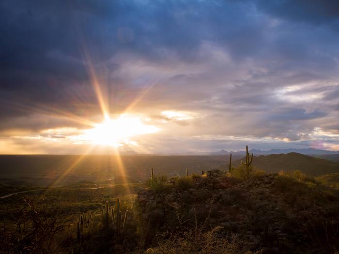
Coronado National Forest
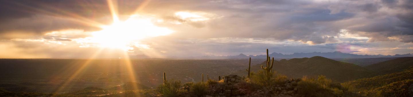
Recreation activities on the Coronado National Forest are nearly as diverse as the people who come to visit. The most popular ones are hiking, camping, birding, horseback riding, picnicking, sightseeing, and visiting historic areas.
Fishing and boating are available but limited in this arid land, while opportunities for the fast-growing sport of mountain biking are growing. Winter sports are possible in the higher elevations; Mt. Lemmon Ski Valley in the Santa Catalina Mountains is the most southern ski area in the United States.
RecAreaDirections
Open with Google Map
Misc
| Stay Limit | |
| Reservable | false |
| Keywords | |
| Map Link | |
| Contact Phone | |
| Contact Email |
Permits info
Facilities
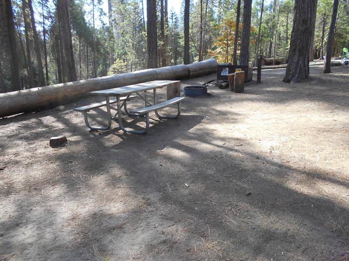
Riggs Lake Campground
List of CampsitesOverview
Riggs Flat Lake is located at the end of Swift Trail, a road that winds along the top of the Pinaleno Mountains. It is a small picturesque lake, 11 acres in size, set in alpine forest and meadow.
Its cold waters are stocked during the summer with rainbow, brown and brook trout, and anglers report that the fishing is usually good. Best baits for the rainbows are corn, cheese, garlic cheese, salmon eggs, and worms. The brown and brook trout are taken on artificial lures and flies as well. Small boats are permitted on the lake, but most people fish from the shoreline.
If the big ones aren’t biting, there is always plenty of scenery to enjoy. In addition to the views of the lake and the surrounding forest, West Peak is visible from the vicinity of the lake. So are Aravaipa Valley and the Galiuro Mountains to the west if you don't mind taking a short hike to get to an overlook.
Recreation
Day use: A Coronado National Forest or Interagency (America the Beautiful) pass must be displayed. Day use passes can be purchased at the site for $8.
For visitors who do not want to use facilities, there is a small fee-free parking area outside of the campground.
A valid Arizona fishing license and trout stamp (available at outdoor stores around the state) is required for all anglers 14 years of age and older. Six trout is the daily limit and the possession limit. Using live bait fish is prohibited. Fishing season is May to October, day and night. Boats are permitted on the lake, but only single electric motors may be used.
Facilities
Nearest first aid - Mt. Graham Community Hospital in Safford.
Boat ramp, fee charged for some activities, picnic tables, toilets, parking
contact_info
This location is unstaffed. To speak with our main office for general information, please call: (928) 428-4150.Nearby Attractions
Sollers Cabin (AZ) Campground
List of CampsitesOverview
The Sollers Cabin is a two-story, six room cabin suitable for up to eight people. The cabin consists of 3 bedrooms, a dining/living room, 1 and ½ bathrooms, and a fully equipped kitchen. Two of the bedrooms have queen-sized beds, while the third has a twin-over-double bunkbed. The living room contains two queen-size futons. The dining room has a table which seats eight. The kitchen is equipped with an electric stove and oven, microwave, refrigerator, pots, pans, utensils, dishes, a toaster and a coffee pot. The house has electricity, electric heating, and running water. While the cabin has amenities for comfortable lodging, guests do need to provide some of their own supplies, including food, sleeping bags, linens, pillows, towels, dish soap, matches, a first aid kit, toilet paper and garbage bags. Although electricity is available, it is recommended that guests bring an additional light source in case of emergencies.
Recreation
The Sollers Cabin is approximately one hour from Tucson, Arizona, and provides excellent access to a myriad of recreational opportunities, including hiking, camping, birding, horseback riding, picnicking, sightseeing, mountain biking, rock climbing, and visiting historic areas. Fishing is also available at nearby Rose Canyon Lake. Winter sports are available at higher elevations, depending on snowfall; Mt. Lemmon Ski Valley in the Santa Catalina Mountains is the southernmost ski area in the United States.
Natural Features
The Santa Catalina Mountains comprise one of the "sky islands" in the Coronado National Forest. From the desert floor to the upper slopes of Mt. Lemmon, biozones vary from Sonoran Desert to subalpine forest, with wildlife communities that are equally diverse. An extensive trail network offers opportunities for day and extended trips, with easy access to the nearby Pusch Ridge Wildernes
Nearby Attractions
Numerous attractions are also available nearby, including: the Sky Island Scenic Byway (General Hitchcock Highway), Rose Canyon Lake, Mt Lemmon Ski Valley, The University of Arizona Mt. Lemmon Sky Center, the hamlet of Summerhaven, Arizona, as well as numerous hiking trails, and opportunities for photography and picnicking. Attractions within one hour's drive include Sabino Canyon Recreation Area and Saguaro National Park East.
ROSE CANYON Campground
List of CampsitesOverview
Rose Canyon Campground is just 17 miles northeast of Tucson, Arizona, off the Catalina Highway Scenic Drive near the summit of Mt. Lemmon. This area is popular for day use as well as overnight camping. With a high elevation, forested setting, two group picnic areas and opportunities for hiking, wildlife viewing and fishing, Rose Canyon offers a great summer respite from the city.Recreation
The lake is sheltered by trees and offers a pleasant setting for a walk in the woods, relaxing on the shore or spending an afternoon fishing for stocked trout. A one-mile trail around the lake is convenient for anglers and hikers. The trail is accessible from the lower parking area to a floating dock near a dam.The surrounding national forest boasts a variety of hiking and mountain biking trails, including several that traverse the 9,157-foot Mt. Lemmon.
Facilities
The campground offers spacious, single-family campsites, as well as two group day use areas with picnic shelters, which can be reserved for up to 120 guests.
The campground is equipped with picnic tables, campfire rings with grills and vault toilets.
Natural Features
The campground sits high on the slopes of the Santa Catalina Mountains, at an elevation of 7,000 feet. Because of its elevation, it can be much cooler than the lower-elevation campgrounds in the area. The campsites are spacious and spread out among stands of large ponderosa pines and clusters of Gambel oak. During the summer rainy season, Rose Creek meanders through the area to the six-acre Rose Canyon Lake at the lower end of the campground.The Coronado National Forest covers 1.78 million acres of southeastern Arizona and southwestern New Mexico. Elevations range from 3,000 to 10,720 feet in 12 widely scattered mountain ranges, or "sky islands," that rise dramatically from the desert floor, supporting biologically diverse plant communities.
contact_info
For facility specific information, please call (520) 576-1325.Nearby Attractions
Catalina Highway, also known as General Hitchcock Highway and Sky Island Scenic Byway, is the only paved road that leads to the upper reaches of Mt. Lemmon and the Santa Catalina Range. It is one of the most scenic highways in the southwest and is a popular day trip.Other notable attractions include Saguaro National Park, Sabino Canyon and Colossal Cave.
SHOWERS POINT GROUP SITE Campground
List of CampsitesOverview
The cool shade of tall ponderosa pines and an overlook of Palisade Canyon from the campgrounds edge make Showers Point Group Site a popular place for groups to spend a weekend or an afternoon. Visitors can relax in shaded campsites, picnic at nearby Rose Canyon, hike and mountain bike on nearby trails or take a scenic drive on Catalina Highway.Recreation
Within easy walking distance from Showers Point is one of the most scenic overlooks in the Santa Catalinas. From this towering bluff visitors can see the lower slopes of the Santa Catalina Range and the Santa Cruz Valley stretching toward Mexico. Tall, pyramid-shaped Mt. Wrightson of the Santa Rita Mountains stands prominent on the horizon.Visitors enjoy hiking through the Santa Catalina backcountry, via the Palisade Trail that departs near the campground. The trail drops down the southwestern slopes of the mountain range to the popular Sabino Canyon Recreation Area.
Fishing is also available at the nearby six-acre Rose Canyon Lake. A day-use fee is applicable at Rose Canyon
Facilities
The three group campsites at Showers Point are well spread out over this spacious location and include large, leveled tent pads and picnic shelters. Each site is tent-only for up to 25 guests. The facility is equipped with water faucets and toilets.Natural Features
Showers Point Group Campground sits high on the slopes of the Santa Catalina Mountains at 7,700 feet. Because of its elevation, it can be much cooler than the lower-elevation campgrounds in the area. The campsites are spacious and spread out among stands of big ponderosa pines and clusters of Gambel oak.The Coronado National Forest covers 1.78 million acres of southeastern Arizona and southwestern New Mexico. Elevations range from 3,000 to 10,720 feet in 12 widely scattered mountain ranges, or "sky islands," that rise dramatically from the desert floor, supporting biologically diverse plant communities.
contact_info
For facility specific information, please call (520) 314-0069.Nearby Attractions
Catalina Highway, also known as General Hitchcock Highway and Sky Island Scenic Byway, is the only paved road that leads to the upper reaches of Mt. Lemmon and the Santa Catalina Range. It is one of the most scenic highways in the southwest and provides a popular day trip.Other notable attractions include Saguaro National Park, Sabino Canyon and Colossal Cave.
KENTUCKY CAMP CABIN AND HEADQUARTERS BUILDING Campground
List of CampsitesOverview
Kentucky Camp Cabin and Headquarters is located in the Santa Rita Mountains near Sonoita, Arizona in the Coronado National Forest. The five adobe buildings originally served as headquarters for the Santa Rita Water and Mining Company from 1902 to 1906. The facility also served as a cattle ranch from the 1920s through the 1960s. The Forest Service acquired the land in 1989 and it has since become an ideal location for guests seeking a unique lodging experience, rich in mining and ranching history.
For a more detailed look at Kentucky Camp's history and facilities, please click here
Recreation
The area has popular hiking, mountain biking, and horseback riding trails which range from gentle walking paths, to steep, strenuous trails leading to the top of 9,453-foot Mt. Wrightson and other nearby peaks. The Arizona Trail runs through Kentucky Camp. Two-track and dirt roads are available for off-highway vehicle travel around Kentucky Camp; however, off-highway vehicles may not be ridden within the site's boundaries. Birders congregate in southeastern Arizona as it is touted as one of the country's most revered birding areas. With fifteen species of hummingbirds, 36 species of wood warblers, and over 256 documented bird species, the area is a birder's paradise.Facilities
This facility consists of a cabin and headquarters building. The cabin can accommodate up to five people, and is equipped with two twin beds, a twin bunkbed and a full-sized futon. The kitchen has basic amenities including a small refrigerator, microwave, hot plate, coffee pot, dishes, utensils, cookware, and a table and chairs. The cabin has propane heat. Outside, there is a grill and picnic table for outdoor dining. A vault toilet, stall for solar showers, and an outdoor sink are located on site. The cabin has electricity, but no indoor running water. Guests must bring their own food, sleeping bags, linens, towels, dish soap, matches, a first aid kit, toilet paper and garbage bags.
Natural Features
Spanning four life zones and several ecosystems between the Sonoran desert and the "Sky Island" mountain peaks, the area surrounding the camp and cabin supports abundant and biologically diverse plant and animal communities. Mountain peaks, high desert grasslands, and seasonal streams provide diverse habitat for the area's abundant wildlife. White-tailed and mule deer, rabbits, wild turkeys, and squirrels are commonly seen, along with numerous bird species. While black bear, Coati, foxes, ring-tailed cats, bobcats and mountain lions are more elusive.Nearby Attractions
Numerous attractions are available nearby in Madera Canyon. Attractions within a one-hour drive include the Mining Museum, Titan Missile Museum, Whipple Observatory, Arizona-Sonora Desert Museum, San Xavier Mission, the Amerind Foundation, and Tumacacori National Historical Park.HALF MOON RANCH Campground
List of CampsitesOverview
Half Moon Ranch is a ranch style house located in East Cochise Stronghold in the Dragoon Mountains of the Coronado National Forest, approximately 1-1/2 hours east of Tucson. The house is situated in a dramatic canyon that provides excellent rock climbing, hiking, mountain biking, and horseback riding opportunities.Recreation
The area around Half Moon ranch has long been considered a bouldering and rock climbing paradise, boasting backcountry and protected routes ranging from one to seven pitches in length, and from 5.6 to 5.12 in difficulty. Most approaches are 30-60 minutes in length, although there are a number of known areas that are easily accessible from the roads. In addition, the nearby Cochise Stronghold Campground has interpretive tales for both natural and cultural resources and history.Facilities
Half Moon Ranch is a seven-room ranch style house, suitable for groups of up to 10 people. The house has two bedrooms, two full bathrooms, a living room, a dining room and a kitchen. The master bedroom has a queen-size bed; the second bedroom has a twin-over-double bunk bed and a single bed. The living room contains two double futons and a wood stove (firewood is provided). The dining room has a table and chairs that seats six. A small dinette set with seating for four is located in the kitchen. The kitchen is equipped with a stove, oven, microwave and refrigerator, pots, pans, utensils, dishes, coffeepot. The house has electricity and running water. Outside, guests will enjoy using the propane grill and picnic table for outdoor cooking and dining. Although the cabin has amenities for comfortable lodging, guests do need to provide some of their own supplies, including food, sleeping bags, linens, pillows, towels, dish soap, matches, a first aid kit, toilet paper and garbage bags. Although electricity is available, it is recommended that guests bring an additional light source in case of emergencies. A barn and corrals are located to the east of the main house. There is a covered storage area for hay.. Up to six horses/mules are permitted in the corrals, and feed for the horses must be certified weed-free.Natural Features
Half Moon Ranch is surrounded by the rugged beauty of the Dragoon Mountains and Cochise Stronghold. At an elevation of 5,000 feet, the sparsely wooded area is a protective rampart of granite spires, sheer cliffs, and balanced rocks and boulders which were once the refuge of the Apache Chief, Cochise. The ranch house lies in a mountain range or "sky island" in the Coronado National Forest, rising dramatically from the desert floor and supporting abundant and biologically diverse plant and animal communities.Nearby Attractions
The Half Moon Ranch is located approximately 9 miles west of Sunsites, Arizona. Attractions in the area include the Chiricahua National Monument, Fort Bowie National Historic Site, the Amerind Foundation, the ghost towns of Gleeson, Dos Cabezas, and Courtland, and the Willcox Playa.SHAW HOUSE Campground
List of CampsitesOverview
Shaw House is a stone masonry cabin located in East Cochise Stronghold in the Dragoon Mountains of the Coronado National Forest. The house is nestled in a dramatic landscape of canyons and rock formations offering guests to the area a unique lodging experience. Nearby trails provide excellent hiking, mountain biking, and horseback riding opportunities.Recreation
With rugged granite formations, wooded slopes, seasonal streams, and an amazing variety of plants and wildlife, the Cochise Stronghold area is a popular recreation destination. Long considered a haven for rock climbing and bouldering, the area features backcountry and protected routes ranging from one to seven pitches in length, and from 5.6 to 5.12 in difficulty. Most approaches are 30-60 minutes in length, although there are a number of known areas that are easily accessible from the roads. Nearby trails also provide excellent hiking, mountain biking, and horseback riding opportunities. There are signed interpretive trail for both natural and cultural resources at the nearby Cochise Stronghold Campground.Facilities
Shaw House is an eight-room residence, suitable for groups of up to 10 people. The house has three bedrooms, two bathrooms, a living room, a dining room and a kitchen. The master bedroom has a queen-size bed; the second bedroom has two twin-over-double bunk beds, and there is a double-sized futon in the third bedroom. The living room contains two full-sized futons, and several end tables. Both bathrooms have showers, sinks, and toilets.
The dining room is furnished with a table and seating for six. The kitchen is equipped with a stove, oven, microwave, refrigerator, pots, pans, utensils, dishes, and coffeepot. The house has electricity and running water. Outside, guests will enjoy using the propane grill and picnic table for outdoor dining. The cabin also has a screened in porch.
Although the cabin has amenities for comfortable lodging, guests do need to provide some of their own supplies, including food, sleeping bags, linens, pillows, towels, dish soap, matches, a first aid kit, toilet paper and garbage bags. Although electricity is available, it is recommended that guests bring an additional light source in case of emergencies.
Natural Features
Shaw House is surrounded by the rugged beauty of East Cochise Stronghold. The sparsely wooded Dragoon Mountains form a protective rampart of granite spires, sheer cliffs, balanced rocks and boulders, which were once the refuge of the Apache Chief, Cochise. The area is abundant with wildlife, including white-tailed and mule deer, rabbits, wild turkeys, and squirrels. Bats, black bear, Coati, foxes, ring-tailed cats, bobcats, and mountain lion find habitat in the area as well, but are more often seen in the twilight and nocturnal hours.Nearby Attractions
The Shaw House is located approximately ten miles west of Sunsites, Arizona. Attractions in the area include the Chiricahua National Monument, Fort Bowie National Historic Site, the Amerind Foundation, and the Willcox Playa.SABINO CANYON RECREATION AREA CACTUS RAMADA 2 Campground
List of CampsitesOverview
Cactus Ramada 2 is a reservable group picnic site within the extremely popular Sabino Canyon Recreation Area at the edge of Tucson, Arizona. The facility is accessible and can accommodate up to 25 people. Groups can picnic, hike and ride horseback in this desert oasis of Coronado National Forest.Recreation
Hikers are drawn to Sabino Canyon for its beauty, scenery and challenge. Three popular trails begin at the recreation area and offer access to the dramatic landscape of the Santa Catalina Front Range, famous for its deep canyons and soaring ridges. A sunset hike reveals the lights of Tucson framed by the black silhouette of surrounding mountains.The self-guided Desert Nature Trail at the Sabino Canyon Visitor Center provides an excellent way to get to know the plants that have adapted to living in this demanding environment.
Several area trails can also be used for mountain biking and horseback riding.
Facilities
The group site can accommodate up to 25 people. Amenities include a vault restroom, picnic shelter, three accessible picnic tables, one serving table, one bear-proof trash can and one large grill. Access to Cactus Ramada 1 is through the use of the Sabino Canyon shuttle service or by foot travel 1/3-mile to the Cactus Picnic Area from the parking area. There are also many individual first-come, first-served picnic sites scattered throughout area. A visitor center and bookstore are nearby.Natural Features
The recreation area is located along Sabino Creek at an elevation of 2,800 feet at the foot of the Santa Catalina Mountains. For many who come to visit the Southwest, this area provides their first close encounter with the Sonoran Desert and the fascinating variety of plants and animals that make it their home.Winter temperatures are pleasant, and springtime brings the desert to life with numerous flowering cacti and desert wildflowers.
Nearby Attractions
The recreation area or visitor center can be used as a home base for exploring scenic and natural areas of Sabino Canyon. The city of Tucson is just a short drive away and has many attractions and amenities. Other notable places nearby include Saguaro National Park and Colossal Cave.SABINO CANYON RECREATION AREA CACTUS RAMADA 1 Campground
List of CampsitesOverview
Cactus Ramada 1 is a reservable group picnic site within the extremely popular Sabino Canyon Recreation Area at the edge of Tucson, Arizona. The facility is accessible and can accommodate up to 45 people. Groups can picnic, hike and ride horseback in this desert oasis of Coronado National Forest.Recreation
Hikers are drawn to Sabino Canyon for its beauty, scenery and challenge. Three popular trails begin at the recreation area and offer access to the dramatic landscape of the Santa Catalina Front Range, famous for its deep canyons and soaring ridges. A sunset hike reveals the lights of Tucson framed by the black silhouette of surrounding mountains.The self-guided Desert Nature Trail at the Sabino Canyon Visitor Center provides an excellent way to get to know the plants that have adapted to living in this demanding environment.
Several area trails can also be used for mountain biking and horseback riding.
Facilities
The group site can accommodate up to 45 people. Amenities include a vault restroom, picnic shelter, four accessible picnic tables, one serving table, two bear-proof trash cans, two grills and a campfire circle. Access to Cactus Ramada 1 is through the use of the Sabino Canyon shuttle service or by foot travel 1/3-mile to the Cactus Picnic Area from the parking area. There are also many individual first-come, first-served picnic sites scattered throughout area. A visitor center and bookstore are nearby.Natural Features
The recreation area is located along Sabino Creek at an elevation of 2,800 feet in the foot of the Santa Catalina Mountains. For many who come to visit the Southwest, this area provides their first close encounter with the Sonoran Desert and the fascinating variety of plants and animals that make it their home.Winter temperatures are pleasant, and springtime brings the desert to life with numerous flowering cacti and desert wildflowers.
Nearby Attractions
The recreation area or visitor center can be used as a home base for exploring scenic and natural areas of Sabino Canyon. The city of Tucson is just a short drive away and has many attractions and amenities. Other notable places nearby include Saguaro National Park and Colossal Cave.CALABASAS Campground
List of CampsitesOverview
Calabasas Group Campground is a place for groups of up to 250 people to enjoy scenery and privacy in a remote, natural setting. Weddings, family reunions and other social gatherings are especially popular during winter due to pleasant seasonal temperatures, yet it is open year-round.Calabasas is situated in Coronado National Forest in southern Arizona, home to a variety of ecosystems and recreation opportunities. It is located a short distance off Ruby Road near Peña Blanca Lake, 67 miles south of Tucson and 14 miles northwest of Nogales, Arizona.
Recreation
A major attraction at Calabasas Group Site is nearby Peña Blanca Lake. The 45-acre, man-made lake provides birding, boating and fishing opportunities year-round. Anglers can try for rainbow trout, bass, sunfish, crappie and catfish.Groups also enjoy picnicking in the camping area, hiking or mountain biking on area trails or visiting historic sites.
Facilities
The camping area can be reserved by one group at a time. Facilities at Calabasas include 14 tables, 12 campfire rings with grills, three pedestal barbecue grills, benches, a parking area and toilets. The site is spread out, so there is enough space to set up additional tables and facilities.There is no drinking water available; visitors must bring their own.
Natural Features
Campsites within the group area are spread out among a stand of oak trees within a shallow, grassy valley. A few well-worn pathways lead to low hilltops in the area where visitors will find good views of the surrounding valleys and mountains. Calabasas sits at an elevation of 4,000 feet.The Coronado National Forest covers 1.78 million acres of southeastern Arizona and southwestern New Mexico. Elevations range from 3,000 to 10,720 feet in 12 widely scattered mountain ranges or "sky islands" that rise dramatically from the desert floor, supporting plant communities as biologically diverse as those encountered on a trip from Mexico to Canada.
Nearby Attractions
Visitors can take an educational day trip to Tumacácori National Historical Park, which protects three Spanish colonial mission ruins, and Tubac Presidio State Historic Park, which preserves the ruins of the oldest Spanish Presidio site in Arizona. The border town, Nogales, is also close by.Tumacácori National Historical Park
PEPPERSAUCE Campground
List of CampsitesOverview
With its picturesque vegetation and dramatic setting at the foot of 9,157' Mt. Lemmon in southeastern Arizona, Peppersauce Campground is an outstanding area for enjoying an afternoon picnic or a weekend campout. This year-round facility is a popular stop among off-road vehicle enthusiasts and families. Hunting, hiking and scenic driving opportunities are nearby. It is located 8 miles from the town of Oracle.Recreation
The Santa Catalina Mountains are known for their exceptional hiking. Hikers can find access to the Arizona Trail, which runs from Mexico to Utah, about 5 miles from the campground along Forest Road 38. Off-road vehicle trails are also available in the area.A few nearby caves afford visitors the opportunity for caving and spelunking.
Facilities
Peppersauce Campground has one reservable group camping area for up to 35 people at a time. The facility is equipped with vault toilets, several tables and benches, a grill, campfire rings and lantern posts. The parking area can hold up to 10 vehicles. First-come, first-served individual campsites are also available.A campground host is available on-site for visitor assistance.
Natural Features
Campsites at Peppersauce are spread throughout a creekside oasis of enormous Arizona sycamore and walnut trees that provide shade in summer and color in autumn. The campground sits at an elevation of 4,700 feet alongside Peppersauce Creek. The creek is normally dry except during heavy rains or the area's summer monsoon season. Campers should be aware that the creek is prone to flash flooding during rain events.Nearby Attractions
Visitors can explore several historic, cultural and natural attractions within a day trip, including the University of Arizona's Biosphere 2, the city of Tucson, Saguaro National Park, Sabino Canyon and Colossal Cave.MOLINO Campground
List of CampsitesOverview
Visitors are drawn to Molino Campground for its group camping area, scenic mountain surroundings and hiking and mountain biking opportunities. While most other campgrounds in the Catalina Mountains are closed in winter, Molino Campground and its picnic area are open in late fall, winter and early spring. The pleasant winter weather at this elevation makes it a great time to visit.Molino Basin is conveniently located 5.5 miles from the base of Mt. Lemmon on the Catalina Highway, and about 10 miles northeast of Tucson.
Recreation
Hiking, mountain biking and horseback riding are popular activities. The Arizona Trail, which extends from Mexico to Utah, passes through the campground, and the Molino Trail leads to the Pusch Ridge Wilderness (hiking and horseback riding only). A variety of additional trails, including some on 9,157' Mt. Lemmon, are available in the area for those who wish to venture away from the campground for the day.Facilities
This facility has a few dozen individual campsites available on a first-come, first-served basis, along with a reservable group camping and picnic area. The group area is accessible with a paved walkway, and is equipped with a large picnic shelter covering several picnic tables, two serving tables, grills and food storage lockers for bear safety. Six cleared tent pads, as well as one accessible tent site, are adjacent to the picnic area. Most of the tent sites are open and sunny. RVs and trailers are permitted.Visitors must bring their own drinking water; none is provided.
Natural Features
Campsites sit amid a high desert oak scrub ecosystem at an elevation of 4,500 feet on the slopes of the Santa Catalina Mountains. Along the banks of Molino Creek, which flows during and immediately after rain or snowmelt, species such as cottonwood, Arizona live oak and mesquite provide a scenic setting. Views are dominated by rugged, rocky hills. Colorful wildflowers bloom in spring.Nearby Attractions
Catalina Highway (also known as General Hitchcock Highway and Sky Island Scenic Byway), the only paved road that leads to the upper reaches of Mt. Lemmon and the Santa Catalina Range, is one of the most scenic highways in the Southwest and definitely worth a day trip.Other notable attractions include Saguaro National Park, Sabino Canyon, Colossal Cave and the city of Tucson.
REEF TOWNSITE GROUP AREA Campground
List of CampsitesOverview
This high-mountain group campground and day use area is located on a site that was once occupied by the old mining town of Reef. Many relics of Reef's mining history, including the remains of the town's old water system, are still visible in and around the campground. Groups of up to 50 people can enjoy walking an interpretive history trail, hiking, horseback riding and watching wildlife in this cool mountain setting.Recreation
Reef Townsite Loop Trail, an interpretive trail that highlights the mining history of this area and showcases beautiful views, begins and ends at the northeastern edge of the campground.The national forest has a variety of hiking and mountain biking trails for those who wish to leave the facility for a day trip.
Facilities
Reef Townsite can accommodate one group of up to 50 people at a time. Facilities include a picnic shelter that contains six picnic tables, two large group barbecue grills and two food preparation tables, as well as toilets, a parking area and a large shaded area for tents.Natural Features
This site rests on the "Reef" rock formations in the in the Huachuca Mountains. At an elevation of 7,200 feet, it provides a cool respite from the heat of surrounding lower deserts in summer.The Coronado National Forest covers 1.78 million acres of southeastern Arizona and southwestern New Mexico. Elevations range from 3,000 to 10,720 feet in 12 widely scattered mountain ranges, or "sky islands," that rise dramatically from the desert floor, supporting biologically diverse plant communities.
ROCK BLUFF GROUP SITE Campground
List of CampsitesOverview
Rock Bluff Group Site is just a short distance from Parker Canyon Lake in a remote and scenic region of the Coronado National Forest in southeastern Arizona. The site is open to groups of up to 50 people to enjoy camping and picnicking, as well as fishing and boating at the lake.Recreation
Campers can enjoy an interpretive trail around the lake that begins a quarter-mile walk from Rock Bluff. Trailside benches are located at some of the best wildlife viewing areas. Bald eagles are regularly sighted during the winter, and osprey are sometimes seen migrating through the area in the fall.
For those who like to fish, Parker Canyon Lake offers both cold and warm water species, including stocked rainbow trout and resident bass, sunfish and catfish. Boating is available with a limit of one 10-horsepower motor or less. Day use fee $8/day or $10/week
Facilities
The camping area consists of three sites with two tables and two campfire rings each. Tables and grills are clustered on small, walled patios. The facility provides trash collection and toilets.Natural Features
The group camping area sits at an elevation of 5,400 feet in a small, rocky canyon dotted with oaks and junipers. Animals unique to the southwest, such as coatimundi, javelina and roadrunners, occasionally make appearances around the lake.The Coronado National Forest covers 1.78 million acres of southeastern Arizona and southwestern New Mexico. Elevations range from 3,000 to 10,720 feet in 12 widely scattered mountain ranges, or "sky islands," that rise dramatically from the desert floor, supporting biologically diverse plant communities.
Nearby Attractions
A lakeside developed recreation site, including a boat ramp, fishing pier, general store and boat rentals, is located just a short drive from the group area.
Day use fee $8/day or $10/week per vehicle (pay on site with exact amount) or pay online ahead of time at https://www.recreation.gov/sitepass/74388
We also honor all America The Beautiful national passes for day use.
Passes must be clearly displayed when in Day Use Areas.
CAMP RUCKER GROUP SITE Campground
List of CampsitesOverview
The Camp Rucker Group Site is not available for reservations at this time for site re-design and facility improvements.
- The group camp area is now open to individual party walk-in camping.
- Individual sites are $15 per night; cash payment on-site.
Camp Rucker sits in the beautiful and remote Chiricahua Mountains of southeastern Arizona.
Recreation
The Rucker and Tex Canyon scenic drive takes visitors over the southern reaches of the Chiricahua Mountains through beautiful canyon country, several forest campgrounds and a number of trails into the Chiricahua Wilderness. History buffs might want to stop at the historic Rucker Military Camp and Ranch, a remnant of the region's warring between U.S. Cavalry and Chiricahua Apaches.Facilities
Camp Rucker has one spacious group campsite that includes eight picnic tables, two large serving tables, campfire rings with grills, bear-proof trash containers and vault toilets.The site was designed for groups. However, if the area has not been reserved by a group, individuals are permitted to camp.
Natural Features
Located at an elevation of 5,533 feet, Camp Rucker is situated in a grassy area with plenty of open space between the oak, juniper and Arizona walnut trees that provide welcome shade on a summer day.A short distance from the camp, Rucker Creek runs intermittently throughout the year. Monte Vista Peak to the northeast and a number of other minor peaks and foothills provide a scenic backdrop.
Nearby Attractions
Campers can take a day trip to Chiricahua National Monument. The monument protects some of the most scenic areas of the Chiricahua Mountains, a wonderland of rocks and forests with many opportunities for hiking and photography.Click here for more about the Chiricahua National Monument.
TREASURE PARK - EAST Campground
List of CampsitesOverview
Treasure Park East sits along the scenic Swift Trail in the deserts of southern Arizona. The picturesque mountain meadow setting offers visitors an escape from the desert heat and opportunities for viewing wildlife and wildflowers, as well as group camping, hiking, mountain biking and picnicking.
The location boasts an interesting history. Legend has it that a treasure of stolen gold and silver was buried here by a band of outlaws in the 1850s. They reportedly marked the site with a triangle formed by three colored granite stones, though no buried treasure was ever found.
Recreation
The campground lies along the Swift Trail Scenic Drive, which takes visitors from the Sonoran Desert at 2,900 feet to alpine meadows and forest on the 9,000+ foot ridges of the Pinaleño Range. Because of its diverse habitat, the area is well-known for birding and wildlife watching.
The Swift Trail provides access to a number of hiking, horseback riding and mountain biking trails, along with several other campgrounds that invite you for an afternoon picnic. A trip up to Rigg’s Lake, stocked with trout by Arizona Game & Fish, or to the Columbine Visitors Center could make a worth-while day trip as well.
Facilities
Treasure Park East can accommodate a single group of up to 100 guests at a time. The site is equipped with picnic tables, a group campfire ring with grill, a parking area and a drinking water spigot nearby, with water available seasonally. Dead-and-downed firewood may be collected in and around the campsite.
Note: There are no toilets on site. One portable/self-contained toilet is required for every 15 people.
Natural Features
This site lies within the mixed conifer area of the Pinaleño Mountains at an elevation of 9,000 feet. The high elevations makes this area very pleasant in summer compared to the heat of lower deserts.
The Coronado National Forest covers 1.78 million acres of southeastern Arizona and southwestern New Mexico. Elevations range from 3,000 to 10,720 feet in 12 widely scattered mountain ranges, or "sky islands," that rise dramatically from the desert floor, supporting biologically diverse plant communities.
Nearby Attractions
The Mount Graham Wilderness Study Area, which includes the 10,720-foot Mount Graham, the tallest mountain in southern Arizona. Columbine Visitors Center, Riggs Lake, and a variety of trails can be accessed along the Swift Trail Scenic Drive.
The town of Safford is approximately a 1 hour drive from the Treasure Park campground, heading north on SR 191. Safford is home to our Ranger Station, where you can go to find information about trails, camping, hunting and fishing, and other questions you may have about our district (open Monday-Friday, 8am-4:30pm).
Charges & Cancellations
Please review the Rules & Reservations Policies page on recreation.gov
TREASURE PARK - NORTH Campground
List of CampsitesOverview
Treasure Park North sits along the scenic Swift Trail in southern Arizona. The picturesque mountain meadow setting provides an escape from the desert heat and opportunities for viewing wildlife and wildflowers, as well as group camping, hiking, mountain biking and picnicking.
The location boasts an interesting history. Legend has it that a treasure of stolen gold and silver was buried here by a band of outlaws in the 1850s. They reportedly marked the site with a triangle formed by three colored granite stones, though no buried treasure was ever found.
Recreation
The campground lies along the Swift Trail Scenic Drive, which takes visitors from the Sonoran Desert at 2,900 feet to alpine meadows and forest on the 9,000+ foot ridges of the Pinaleño Range. Because of its diverse habitat, the area is well-known for birding and wildlife watching.
The Swift Trail provides access to a number of hiking, horseback riding and mountain biking trails, along with several other campgrounds that invite you for an afternoon picnic. A trip up to Rigg’s Lake, stocked with trout by Arizona Game & Fish, or to the Columbine Visitors Center could make a worth-while day trip as well.
Facilities
Treasure Park North can accommodate a single group of up to 100 people at a time. The site is equipped with picnic tables, a group campfire ring with grill, a parking area and a drinking water spigot nearby, with water available seasonally. Dead-and-downed firewood may be collected in and around the campsite.
Note: There are no toilets on site. One portable/self-contained toilet is required for every 15 people.
Natural Features
This site lies within the mixed conifer area of the Pinaleño Mountains at an elevation of 9,000 ft. The high elevations makes this area very pleasant in summer compared to the heat of lower deserts.
The Coronado National Forest covers 1.78 million acres of southeastern Arizona and southwestern New Mexico. Elevations range from 3,000 to 10,720 feet in 12 widely scattered mountain ranges, or "sky islands," that rise dramatically from the desert floor, supporting biologically diverse plant communities.
Nearby Attractions
The Mount Graham Wilderness Study Area, which includes the 10,720-foot Mount Graham, the tallest mountain in southern Arizona. Columbine Visitors Center, Riggs Lake, and a variety of trails can be accessed along the Swift Trail Scenic Drive.
The town of Safford is approximately a 1 hour drive from the Treasure Park campground, heading north on SR 191. Safford is home to our Ranger Station, where you can go to find information about trails, camping, hunting and fishing, and other questions you may have about our district (open Monday-Friday, 8am-4:30pm).
Charges & Cancellations
Please review the Rules & Reservations Policies page on recreation.gov
UPPER HOSPITAL FLAT GROUP SITE Campground
List of CampsitesOverview
Upper Hospital Flat is a great place for groups to escape the summer heat of surrounding deserts and retreat to a scenic meadow in the Pinaleño Mountains of southeastern Arizona. The area is known for camping, scenic driving, picnicking, birding, wildlife viewing, hiking, mountain biking and history.
In the 1880s, the campground served as the site for a field hospital for ailing soldiers from nearby Fort Grant, hence its name. The restorative powers of this cool, high-elevation location also attracted officers and their families seeking a summer refuge from desert heat. Today, Hospital Flat serves as popular getaway for outdoor enthusiasts and campers.
Recreation
The campground lies along the Swift Trail Scenic Drive, which takes visitors from the Sonoran Desert at 2,900 feet to alpine meadows and forest on the 9,000+ foot ridges of the Pinaleño Range. Because of its diverse habitat, the area is well-known for birding and wildlife watching.
Nearby Hospital Flat Campground includes a 0.75-mile nature trail that gives interpretive information about the meadow and its plant and animal inhabitants.
The Swift Trail also provides access to a number of hiking, horseback riding and mountain biking trails, along with several other campgrounds that invite you for an afternoon picnic. A trip up to Rigg’s Lake, stocked with trout by Arizona Game & Fish, or to the Columbine Visitors Center could make a worth-while day trip as well.
Facilities
Upper Hospital Flat can accommodate a group of up to 50 people. Several first-come, first-served individual sites are located nearby in the Hospital Flat Campground (must pay separately). The group site is equipped with a picnic table, parking area and campfire ring with a grill. Dead-and-down firewood may be collected in and around the campsite.
Note: There are no toilets on site. One portable/self-contained toilet is required for every 15 people.
The road leading into the group site is mainly suitable for higher-clearance vehicles.
Natural Features
The campground sits along Big Creek in a mixed conifer forest, adjacent to a meadow that comes to life with wildflower blooms in late summer. The 9,000-ft. elevation offers pleasant summer temperatures.
The Coronado National Forest covers 1.78 million acres of southeastern Arizona and southwestern New Mexico. Elevations range from 3,000 to 10,720 feet in 12 widely scattered mountain ranges, or "sky islands," that rise dramatically from the desert floor, supporting biologically diverse plant communities.
Nearby Attractions
The Mount Graham Wilderness Study Area, which includes the 10,720-foot Mount Graham, the tallest mountain in southern Arizona. Columbine Visitors Center, Riggs Lake, and a variety of trails can be accessed along the Swift Trail Scenic Drive.
The town of Safford is approximately a 1 hour drive from the Hospital Flat campground, heading north on SR 191. Safford is home to our Ranger Station, where you can go to find information about trails, camping, hunting and fishing, and other questions you may have about our district (open Monday-Friday, 8am-4:30pm).
Charges & Cancellations
Please review the Rules & Reservations Policies page on recreation.gov
STOCKTON PASS Campground
List of CampsitesOverview
Named after "Old Man Stockton," a rancher who settled in this area in the 1870s, Stockton Campground lies off the beaten path in the high desert of the Pinaleño Mountains in southeastern Arizona.
Groups of up to 30 people can come here to camp and enjoy hiking, picnicking and wildlife viewing. The facility is located on a beautiful scenic drive with panoramic views of the mountains.
Recreation
A leisurely drive on SR 266 reveals large cattle ranges, rugged mountain ranges, and broad grasslands dotted with desert plants, a true southwestern experience. The Pass is open year-round, though summer can bring soaring temperatures and muddy rainstorms.
The area offers excellent hiking, and trails are easily accessed from the campground. The Shake Trail #309 winds through the high desert landscape and begins a climb that continues to the Swift Trail, high in the Pinaleño Mountains.
The campground’s setting is also inviting for an afternoon picnic, with tables set in a desert grassland with the occasional oak, manzanita tree, or cactus.
Facilities
Stockton Pass has one group camping area that can be reserved by a single group of up to 30 people at a time. Amenities include vault toilets, several picnic tables, pedestal grills and campfire rings with grills. Bear-proof trash cans are provided to keep visitors and wildlife safe. Several first-come, first-served individual sites are located nearby (must pay separately). Dead-and-downed firewood may be collected in and around the campsite.
Natural Features
This site encompasses an area of beautiful desert grassland mixed with oak woodlands. Many species of birds and wildlife live in the area, including deer, black bear and mountain lions.
Stockton Pass serves as a route over the Pinaleño Mountains into Sulphur Springs Valley. The campground is located at the apex of the pass and offers good views of the south slopes of some of the mountain range's highest peaks, as well as views of surrounding valleys and mountains. With an elevation of 5,600 feet, temperatures are cooler than the surrounding low deserts in summer but still allow for camping in fall and winter.
The Coronado National Forest covers 1.78 million acres of southeastern Arizona and southwestern New Mexico. Elevations range from 3,000 to 10,720 feet in 12 widely scattered mountain ranges, or "sky islands," that rise dramatically from the desert floor, supporting biologically diverse plant communities.
Nearby Attractions
SR 266 West will take you out to the Galiuro Wilderness area, equipped with a variety of additional trails, including the West Divide Trail #289/Powers Garden Trail #96, which will bring you to the Power’s Family Cabin. The Power’s family were pioneers that farmed, ranged and mined in the Rattlesnake Canyon in the early 1900s until three members of the family were involved in a gunfight with law officers on a gold claim they were working. Two of the members escaped, at the time becoming the object of one of the longest manhunts in Arizona’s history.
SR 266 East will bring you back to SR 191, where you could continue heading north to reach the town of Safford (approximately a 1 hour drive from the Stockton Pass campground). Safford is home to our Ranger Station, where you can go to find information about trails, camping, hunting and fishing, and other questions you may have about our district (open Monday-Friday, 8am-4:30pm).
Charges & Cancellations
Please review the Rules & Reservations Policies page on recreation.gov
UPPER ARCADIA Campground
List of CampsitesOverview
Upper Arcadia sits along Swift Trail in southeastern Arizona, providing an escape from desert heat and a pleasant place to take in the high desert scenery in spring and fall. Visitors enjoy hiking, camping, birding and picnicking.
Recreation
The campground lies along the Swift Trail Scenic Drive, which takes visitors from the Sonoran Desert at 2,900 feet to alpine meadows and forest on the 9,000+ foot ridges of the Pinaleño Range. Because of its diverse habitat, the area is well-known for birding and wildlife watching.
The Swift Trail provides access to a number of hiking, horseback riding and mountain biking trails, along with several other campgrounds that invite you for an afternoon picnic. A trip up to Riggs Lake, stocked with trout by Arizona Game & Fish, or to the Columbine Visitors Center could make a worth-while day trip as well.
The Arcadia Trail #328 starts at the Upper Arcadia Campground and leads up the mountain to Shannon Campground. A 1-mile spur off this trail leads to the top of Heliograph Peak, one of the highest mountains in southeastern Arizona.
Facilities
The group camping area can accommodate up to 75 people. Amenities include drinking water (available seasonally), vault toilets, picnic tables, and campfire rings with grills. Bear-proof food lockers and trash cans are provided to keep visitors and wildlife safe. Dead-and-down firewood may be collected in and around the campsite. Several first-come, first-served sites are located nearby (must pay separately).
Natural Features
The shady campground is in a thick forest of tall ponderosa pines interspersed with Gambel oaks and Arizona walnuts, at an elevation of 6,700 feet.
The Coronado National Forest covers 1.78 million acres of southeastern Arizona and southwestern New Mexico. Elevations range from 3,000 to 10,720 feet in 12 widely scattered mountain ranges, or "sky islands," that rise dramatically from the desert floor, supporting biologically diverse plant communities.
Nearby Attractions
The Mount Graham Wilderness Study Area, which includes the 10,720-foot Mount Graham, the tallest mountain in southern Arizona. Columbine Visitor Center, Riggs Lake, and a variety of trails can be accessed along the Swift Trail Scenic Drive.
The town of Safford is approximately a 30 minute drive from the Upper Arcadia campground, heading north on SR 191. Safford is home to our Ranger Station, where you can go to find information about trails, camping, hunting and fishing, and other questions you may have about our district (open Monday-Friday, 8am-4:30pm).
Charges & Cancellations
Please review the Rules & Reservations Policies page on recreation.gov
KENT SPRINGS CABIN Campground
List of CampsitesOverview
Kent Springs Cabin is located in the Madera Canyon Recreation Area, 15 miles southeast of Green Valley, Arizona in the Coronado National Forest. Located in an area boasting unique natural features and historical sites, the secluded and private cabin is an ideal location for guests seeking relaxation and recreation although less than an hour from Tucson.Recreation
Madera Canyon hiking trails are well-known throughout the Southwest, and vary from paved, accessible trails and gentle walking paths to steep, strenuous trails leading to the top of 9,453-foot Mt. Wrightson. Madera Canyon is also touted as one of the country's most revered birding areas. With fifteen species of hummingbirds, the Sulphur-bellied Flycatcher, the Flame-colored Tanager, 36 species of wood warblers, and over 256 documented bird species, the area is a birder's paradise.Facilities
With 1,500 square feet of indoor space, including two bedrooms, one full bathroom, two living rooms, and a fully-equipped kitchen, the Kent Springs Cabin accommodates up to 8 people comfortably. It also has a large deck overlooking a creek, and parking is available on site. Sleeping accommodations include a queen bed, a twin over double bunk bed, a roll-away single bed, and a double futon couch. The kitchen is equipped with an electric range/oven, refrigeratior, and microwave. There is a large dining table with benches, and a fireplace in the large living room. The cabin is largely barrier-free to provide access to more visitors. Although the cabin has several amenities, guests must also provide some of their own supplies, including food, sleeping bags, linens, towels, dish soap, matches, a first aid kit, toilet paper and garbage bags. Firewood is provided.Natural Features
Kent Springs Cabin is located in the heart of Madera Canyon within the Santa Rita Mountains. Spanning four life zones and several ecosystems between desert and mountain peaks, the area has become a well-known "sky island," supporting abundant and biologically diverse plant and animal communities. The area supports a variety of wildlife, including white-tailed and mule deer, rabbits, wild turkeys, and squirrels. Black bear, Coati, foxes, ring-tailed cats, bobcats, and mountain lion are more elusive. Sixteen species of bats have been recorded in the canyon.Nearby Attractions
The cabin is located less than a half-hour from Green Valley and within an hour of Tucson and Nogales, Arizona. Attractions within an hour drive include the Mining Museum, Titan Missile Museum, Whipple Observatory, Arizona-Sonora Desert Museum, San Xavier Mission, historic Tubac, and Tumacacori National Historical Park.WHITETAIL CAMPGROUND Campground
List of CampsitesOverview
Whitetail Campground offers group campsites in the foothills of the Catalina Mountains of southeastern Arizona, 5 miles south of the town of Summerhaven and the top of Mt. Lemmon. Groups can enjoy picking, hiking, camping and wildlife watching while enjoying a cool respite from hot summer. The facility can accommodate groups for day or overnight use.Recreation
Hiking and sightseeing are popular activities. The surrounding national forest boasts a variety of trails, including some on the 9,157-foot Mt. Lemmon, for those who wish to venture away from the campground for the day.The University of Arizona runs an observatory just up the road, and visitors can also drive a few minutes to the small town of Summerhaven, which offers amenities and attractions on Mt. Lemmon's summit.
Anglers can try for stocked trout at nearby Rose Canyon Lake.
Facilities
All five group areas have picnic shelters that can accommodate between 40 to 90 people each and come equipped with drinking water, electricity (small appliances only), trash collection and vault toilets.
Natural Features
Whitetail Campground sits high on the slopes of the Santa Catalina Mountains at an elevation of 8,000 feet. Because of its elevation, it can be much cooler than the lower-elevation campgrounds in the area. The campsites are spacious and spread out among stands of big ponderosa pinesThe Coronado National Forest covers 1.78 million acres of southeastern Arizona and southwestern New Mexico. Elevations range from 3,000 to 10,720 feet in 12 widely scattered mountain ranges, or "sky islands," that rise dramatically from the desert floor, supporting biologically diverse plant communities.
Nearby Attractions
Catalina Highway, also known as General Hitchcock Highway and Sky Island Scenic Byway, is the only paved road that leads to the upper reaches of Mt. Lemmon and the Santa Catalina Range, offering a scenic day trip.Other notable attractions include Saguaro National Park, Sabino Canyon and Colossal Cave.
LOWER TWILIGHT GROUP SITE Campground
List of CampsitesOverview
Lower Twilight Group Site offers groups a secluded camping escape from the summer desert heat. The scenic mountain setting is a great base for hiking, wildlife viewing and picnicking. The facility sits along the Swift Trail in southeastern Arizona, adjacent to Upper Twilight Group Site.
Recreation
The campground lies along the Swift Trail Scenic Drive, which takes visitors from the Sonoran Desert at 2,900 feet to alpine meadows and forest on the 9,000+ foot ridges of the Pinaleño Range. Because of its diverse habitat, the area is well-known for birding and wildlife watching.
The Swift Trail provides access to a number of hiking, horseback riding and mountain biking trails, along with several other campgrounds that invite you for an afternoon picnic. A trip up to Riggs Lake, stocked with trout by Arizona Game & Fish, or to the Columbine Visitors Center could make a worth-while day trip as well.
Facilities
Lower Twilight can accommodate a single group of up to 50 people for camping. Parking is available for up to six vehicles. Amenities include picnic tables, campfire rings with grills, and bear-proof food lockers and trash cans. Vault toilets are located at Upper Twilight Group Site, a short walk away. Dead-and-down firewood may be collected in and around the campsite.
Natural Features
At an elevation of 7,400 feet, the campground lies beneath a nice canopy of ponderosa pine trees in the scenic Pinaleño Mountains in Coronado National Forest. Temperatures are very pleasant in summer compared to the heat of surrounding lowers deserts.
The Coronado National Forest covers 1.78 million acres of southeastern Arizona and southwestern New Mexico. Elevations range from 3,000 to 10,720 feet in 12 widely scattered mountain ranges, or "sky islands," that rise dramatically from the desert floor, supporting biologically diverse plant communities.
Nearby Attractions
The Mount Graham Wilderness Study Area, which includes the 10,720-foot Mount Graham, the tallest mountain in southern Arizona. Columbine Visitors Center, Riggs Lake, and a variety of trails can be accessed along the Swift Trail Scenic Drive.
The town of Safford is approximately a 45 minute drive from the Twilight campground, heading north on SR 191. Safford is home to our Ranger Station, where you can go to find information about trails, camping, hunting and fishing, and other questions you may have about our district (open Monday-Friday, 8am-4:30pm).
Charges & Cancellations
Please review the Rules & Reservations Policies page on recreation.gov
UPPER TWILIGHT GROUP SITE Campground
List of CampsitesOverview
At an elevation of 7,400 feet, Upper Twilight Group Site offers groups a secluded camping escape from the summer desert heat. The scenic mountain setting is a great base for hiking, wildlife viewing and picnicking. The facility sits along the Swift Trail in southeastern Arizona, adjacent to Lower Twilight Group Site.
Recreation
The campground lies along the Swift Trail Scenic Drive, which takes visitors from the Sonoran Desert at 2,900 feet to alpine meadows and forest on the 9,000+ foot ridges of the Pinaleño Range. Because of its diverse habitat, the area is well-known for birding and wildlife watching.
The Swift Trail provides access to a number of hiking, horseback riding and mountain biking trails, along with several other campgrounds that invite you for an afternoon picnic. A trip up to Rigg’s Lake, stocked with trout by Arizona Game & Fish, or to the Columbine Visitors Center could make a worth-while day trip as well.
Facilities
Upper Twilight can accommodate a single group of up to 50 guests. Amenities include vault toilets, parking areas for up to six vehicles, picnic tables, and a group campfire ring with a grill. Bear-proof food lockers and trash cans are provided to keep visitors and wildlife safe. Dead-and-downed firewood may be collected in and around the campsite.
Natural Features
The campground lies beneath a nice canopy of ponderosa pine trees in the scenic Pinaleño Mountains in Coronado National Forest. Temperatures are very pleasant in summer compared to the heat of surrounding lowers deserts.
The Coronado National Forest covers 1.78 million acres of southeastern Arizona and southwestern New Mexico. Elevations range from 3,000 to 10,720 feet in 12 widely scattered mountain ranges, or "sky islands," that rise dramatically from the desert floor, supporting biologically diverse plant communities.
Nearby Attractions
The Mount Graham Wilderness Study Area, which includes the 10,720-foot Mount Graham, the tallest mountain in southern Arizona. Columbine Visitors Center, Riggs Lake, and a variety of trails can be accessed along the Swift Trail Scenic Drive.
The town of Safford is approximately a 45 minute drive from the Twilight campground, heading north on SR 191. Safford is home to our Ranger Station, where you can go to find information about trails, camping, hunting and fishing, and other questions you may have about our district (open Monday-Friday, 8am-4:30pm).
Charges & Cancellations
Please review the Rules & Reservations Policies page on recreation.gov
PORTAL BUNKHOUSE Campground
List of CampsitesOverview
The Portal Bunkhouse is a two-room cabin located one mile west of Portal, Arizona. Constructed in 1933 by the Civilian Conservation Corps, the Bunkhouse is listed on the National Register of Historic Places. The structure is one of the finest remaining examples of river-cobble masonry construction from that era.Recreation
Cave Creek Canyon is located on the eastern slope of the Chiricahua Mountains in southeastern Arizona, about 2.5 hours from Tucson. It is world-renowned for its dramatic rock formations and diverse wildlife. Birding is exceptional year-round, and particularly rewarding during the summer months. Hiking and rock-climbing are also popular activities, and picnic areas dot the canyon for its many hikers.Facilities
The Portal Bunkhouse is a two-room cabin, suitable for up to four people. It has electricity, heater, and running water. The cabin has a bedroom with bathroom including a shower, sink, and toilet; and a kitchen with a dining area. The bedroom has a twin-over-double bunk bed and a single bed. A small dinette with seating for four is located in the kitchen, which is equipped with a stove, oven, microwave, refrigerator, and coffee pot. Pots, pans, utensils, and dishes are provided. Outside, guests will enjoy using the propane grill and picnic table for outdoor dining.
Although the cabin has amenities for comfortable lodging, guests will need to provide some of their own supplies, including food, sleeping bags or linens, pillows, towels, dish soap, matches, a first aid kit, toilet paper, and garbage bags. It is recommended that guests bring additional drinking water, and a flashlight in case of emergencies.
Natural Features
The Portal Bunkhouse is located at the entrance to Cave Creek Canyon at an elevation of 5,000 feet. The canyon's soaring cliffs, with their caves and pinnacles, are often described as "Arizona's 'Secret' Grand Canyon." Cave Creek, a perennial stream, flows through the canyon nearby. The diverse wildlife that can be seen in the canyon include a stunning variety of bird species.Nearby Attractions
The Portal Bunkhouse is located approximately 1 mile west of Portal, Arizona. Attractions in the area include Chiricahua National Monument, Fort Bowie National Historical Park, historic Camp Rucker, the Geronimo Surrender sites, and the International Border and the border community of Douglas, AZ.PORTAL CCC HOUSE Campground
List of CampsitesOverview
The Portal CCC House is a five-room cabin located just west of Portal, Arizona. The fieldstone masonry cabin has been determined eligible for the National Register of Historic Places and is one of the few remaining structures from the 1930s-era Cave Creek Civilian Conservation Corp (CCC) Camp. The CCC House was built to serve as the camp's garage; the large vehicle entries were later filled in and the structure was converted to housing for a telephone switchboard and its operator. While the historic appearance has been maintained on the exterior, the interior was remodeled to provide modern amenities for visitors.Recreation
Cave Creek Canyon is located on the eastern slope of the Chiricahua Mountains in southeastern Arizona, about 2 1/2 hours from Tucson. Cave Creek Canyon is world-renowned for its dramatic rock formations and diverse wildlife. Birding is exceptional year-round, and particularly rewarding during the summer months. Hiking and rock-climbing are also popular activities, and the canyon has numerous picnic areas along Cave Creek for hikers.Facilities
The Portal CCC House is a five-room cabin, suitable for up to five people. It has electricity and running water. The cabin has two bedrooms, one bathroom, and a large kitchen/dining area. The first bedroom has a twin-over-double bunk bed; the second has a queen-sized futon. A table with seating for four is located in the dining area, which also has a wood burning stove (firewood is provided). The kitchen is equipped with a stove, oven, microwave, refrigerator, and coffee pot. Pots pans, utensils, and dishes are provided. Outside, guests will enjoy using the propane grill and furniture for outdoor dining. Although the cabin has amenities for comfortable lodging, guests will need to provide some of their own supplies, including food, sleeping bags or linens, pillows, towels, dish soap, matches, a first aid kit, toilet paper, and garbage bags. It is recommended that guests bring additional drinking water and flashlight in case of emergencies.Natural Features
The Portal CCC House is located at the entrance to Cave Creek Canyon at an elevation of 5,000 feet. The canyon's soaring cliffs, with their caves and pinnacles, are often described as "Arizona's 'Secret' Grand Canyon." Cave Creek, a perennial stream, flows nearby.Nearby Attractions
The Portal CCC House is located approximately one mile west of Portal, Arizona. Attractions in the area include Chiricahua National Monument, Fort Bowie National Historical Park, historic Camp Rucker, the Geronimo Surrender sites, and the International Border and the border community of Douglas, Arizona.PALISADES RANGER RESIDENCE CABIN Campground
List of CampsitesOverview
The Palisades Ranger Residence Cabin is located within the Palisades Administrative Site in the Santa Catalina Mountains, 20 miles northeast of Tucson, Arizona. The cabin is reached via the East Catalina Highway, which becomes the General Hitchcock, a historic and scenic drive that takes visitors through multiple biozones from the Sonoran Desert to the dense forests at 8,000 feet elevation. The cabin has indoor plumbing, electricity, a full kitchen, furniture, beds and an enclosed front yard.Recreation
The Palisades Ranger Residence Cabin is approximately one hour from Tucson, Arizona, and provides excellent access to a myriad of recreational opportunities, including hiking, camping, birding, horseback riding, picnicking, sightseeing, mountain biking, rock climbing, and visiting historic areas. Fishing is also available at nearby Rose Canyon Lake. Winter sports are available at higher elevations, depending on snowfall; Mt. Lemmon Ski Valley in the Santa Catalina Mountains is the southernmost ski area in the United States.Facilities
The Palisades Ranger Residence is a five room cabin, suitable for up to four people. The cabin consists of a bedroom, dining room, living room, bathroom, and fully-equipped kitchen. The bedroom has a twin-over-double bunkbed, while the living room contains a queen-size futon. The dining room has a table and four chairs. The kitchen is equipped with a propane stove/oven, microwave, refrigerator, pots, pans, utensils, dishes, and a coffee pot. The house has electricity, a propane heater, and running water.
While the cabin has amenities for comfortable lodging, guests do need to provide some of their own supplies, including food, sleeping bags, linens, pillows, towels, dish soap, matches, a first aid kit, toilet paper and garbage bags. Although electricity is available, it is recommended that guests bring an additional light source in case of emergencies.
