
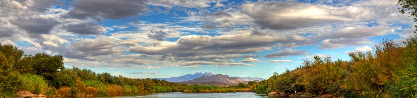
Tonto National Forest
Tonto National Forest Installs Automated Fee Machines
The Tonto National Forest has installed new Automated Fee Machines for your convenience at designated recreation sites. Starting Monday, August 14th 2017, the following campgrounds require camping passes to be bought at these fee machines. America the Beautiful Interagency Senior or Access Pass holders receive 50% discount (persons over 62 or have a permanent disability). The Tonto Daily Pass, Discovery Passes, and Interagency Passes are no longer accepted as a “camping” pass for these sites. Campsite fees must be purchased/paid at the designated fee machines.

Automated Fee Machine Campsite, Location and Fee information
Permitted Outfitting and Guiding Companies
There are more than 80 companies permitted to provide high quality recreation opportunities on the Tonto National Forest. Most of these companies offer guided tours that provide the safety, knowledge, and experience of qualified guides with quality equipment, while others provide in-demand equipment and basic instruction for visitors to explore the Forest on their own. Activities include hiking, camping, canyoneering, horseback riding, fishing, kayaking, stand up paddleboarding, motorized watercraft tours, jeep tours, UTV and ATV tours, road biking, and mountain biking. Each company follows strict operating procedures, safety practices, and Forest Service regulations to protect the environment while working hard to ensure you have the most exciting recreational experience possible on the Tonto National Forest.
Below are the permitted outfitting and guiding companies on the Tonto National Forest. Call today to schedule your next adventure!
You can also check out our many Resorts and Marinas to find additional services such as fresh food, boat repair and storage, and shuttle services.
RecAreaDirections
Open with Google Map
Misc
| Stay Limit | |
| Reservable | false |
| Keywords | |
| Map Link | |
| Contact Phone | |
| Contact Email |
Permits info
Facilities
Tortilla Campground Campground
List of CampsitesOverview
Tortilla Campground is a winter campground just outside of the Phoenix metropolitan area. From October through April each year, urban dwellers take advantage of cooler temperatures and enjoy boating, fishing, hiking, rock climbing and scenic driving throughout the surrounding Tonto National Forest. Campers awake to a scenic backdrop of rugged bluffs, saguaro cactus and desert skies. The campground is located directly across from Tortilla Flat Restaruant and general store, which is just a short walk away.
Recreation
The area is rich with human history, scenery and outdoor recreation. The campground lies along the Canyon Lake Apache Trail Scenic Byway, a former Apache Tribal route turned stagecoach road. Visitors may hear stories of lost cowboys and gold mining. The drive to the campground provides ample scenery and a vista point perfect for photography and wildlife viewing. The campground is just down the road from Canyon Lake which provides a number of recreational opportunites such as kayaking, fishing, and boating. The Superstition Wilderness has a well-developed trail system, and the western end of the wilderness receives heavy use during the cooler times of the year. Use caution as trail conditions can be fair or poor, and several are unsuitable for horses. Also make sure to check out many of the developed recreation sites along Canyon lake for shoreline and fishing dock access, but keep in mind these sites require a day pass not included in the camping fees.
Facilities
The campground is large yet compact, with campsites in close proximity of one another. Every campsite has a view of the surrounding desert, some with views of mountain peaks and cliffs. The facility accommodates RVs and has sewage hookups. Each campsite comes with a picnic table and a campfire ring with a cooking grate. Services at the end of Tortilla Flat include a post office, restaurant, gift shop and public cellular credit card phone (emergency 911). Canyon Lake and Marina is located two miles west and includes public boat launches and picnic/fishing sites, a restaurant, excursion boats and boat rentals.
Natural Features
The Superstition Wilderness Area is starkly beautiful and untamed. A series of dams has created numerous lakes along the Salt River. Blossoming plants bring the desert to life each spring with vibrant wildflowers. This area is a photographers dream with plenty of opportunities to capture Bighorn Sheep, Deer, and other desert widlife. The area can be harsh for travelers not equipped to meet nature on her own terms. Soaring temperatures and little water are typical conditions in the summer. In winter, temperatures are typically pleasant during the day but drop significantly at night. Visitors should come prepared for anything, even the occasional rain or snow.
Nearby Attractions
Fish Creek Vista Point is approx. 7 miles east on AZ-88, this area provides great views of the desert and an accessible interpretive trail great for learning about the history of the area.
FRAZIER HORSE CAMPGROUND Campground
List of CampsitesOverview
The Frazier Horse Campground is nestled into a Sonoran desert landscape at Roosevelt Lake, one of Arizona's most outstanding water-based recreation areas. The lake is the largest of four reservoirs within a 2-hour drive of Phoenix and Tucson. The facility has the first lakeside horse camp built in the Southwestern Region of the Forest Service. From the recreation site, trail users access the Arizona Trail, an 800-mile (1,287-kilometer), non-motorized trail.Recreation
Bring your horses and head out to the Arizona Trail right from camp via the Cottonwood trail. There are many other trails in the area but they require trailering your horses.Facilities
Frazier Horse Campground is an equestrian campground and offers a vault toilet, horse drinker, potable water hydrant, and horse corrals.Natural Features
Roosevelt Lake was dedicated by President Theodore Roosevelt in 1911 and boasts 112 miles of shoreline and peaceful coves. When full, the lake provides 21,500 acres of surface water. Frazier Horse Campground is situated near the lake’s shoreline. Views of the blue water and sunsets against the Sierra Ancha, Salome, and Superstition Wilderness areas are a sight that keep many visitors coming back year after year.The area around Frazier Horse Campground is often alive with abundant wildlife such as mule deer, coyotes, geese, fox, javalina, and the occasional bald eagle.
Nearby Attractions
Discover two nearby National Scenic Byways (AZ Hwy 88 Apache Trail and AZ Hwy 288 Spines to Pines Highway). Local areas to consider around Frazier Horse Campground include Roosevelt Dam, Tonto National Monument, the Arizona Trail, endless miles of jeep trails, the Towns of Payson and Globe, and the Superstition, Sierra Ancha, and Four Peaks Wilderness areas. Don't forget to stop by the Tonto Basin Environmental Center to learn about the history of the area.CHRISTOPHER CREEK Campground
List of CampsitesOverview
With an elevation over a mile-high(5640 ft), Christopher Creek Campground's crisp, fresh air and vibrant views are a joy to behold. The facility is tucked along the banks of the spring-fed Christopher Creek, which passes just below the Mogollon Rim.The Mogollon Rim, pronounced by locals as "muggy-own," is a 200-mile long cliff in northern Arizona that ranges between 5,000 and 7,000 ft in elevation. The unique landscape was created by extreme erosion and faulting that has sculpted spectacular canyons and buttes. The rim serves as the geographical dividing line between the cool high country above and the hot, dry desert below. Christopher Creek is located in the desert portion, but is balanced by the cool waters of the creek and forested surroundings.
Recreation
After a day of horseback riding or mountain biking, take a dip in one of the facility's three swimming holes to cool off from the summer sun. Or if winter is more your thing, visit during the snowy months to take advantage of the miles of cross-country skiing available. Each spring, the creek is stocked with rainbow trout, allowing anglers the opportunity to cast their hearts out for rainbows as well as brook and brown trout.Facilities
The family-friendly campground has 43 sites on both sides of the creek, plus a group site that accommodates a maximum of 25 people. 37 campsites are reservable, 3 campsites are available for first-come-first-served customers and 3 sites are occupied by the camp hosts.
Natural Features
Christopher Creek provides creek side dwelling in Tonto National Forest, at the base of the Mogollon Rim. Sites are surrounded by ponderosa pines, junipers, oaks and manzanita evergreen shrubs.contact_info
For facility specific information, please call (928) 474-7900.Nearby Attractions
The small town of Christopher Creek is just a short drive away and offers a few restaurant options for those who tire of cooking at the campground.. A series of lakes called the Rim Country Lakes are about a 10 minute drive east. Woods Canyon Lake is one of the most popular recreational lakes in the state and offers options for boating as well as a nature trail that loops around the lake's perimeter.HOUSTON MESA Campground
List of CampsitesOverview
Houston Mesa Campground is located in the forested northern section of Tonto National Forest, just one mile north of Payson, Arizona and less than two hours from Phoenix.With family, equestrian and tent-only campsites, this campground can accommodate a range of visitors and offers plenty of ways to enjoy the outdoors, including several miles of hiking and horseback riding trails nearby.
As the fifth largest forest in the United States, the Tonto National Forest is one of the most-visited "urban" forests in the United States (approximately 5.8 million visitors annually). Its boundaries are Phoenix to the south, the Mogollon Rim to the north and the San Carlos and Fort Apache Indian reservations to the east.
Recreation
Many visitors come to Houston Mesa to horseback ride, hike, camp and picnic. Houston Mesa Loop Trail is a 9-mile round trip through a pinyon and juniper woodland and can be accessed from the horse camping area. The Houston Mesa Interpretive Trail is a 0.5-mile self-guided trail.Facilities
Houston Mesa has 74 campsites, including 29 equestrian sites for campers with horses or mules, and 17 tent-only sites for those who want a quieter experience. There are several amenities to make campers feel at home, including showers (coin-operated) and flush toilets. All of the sites are accessible.
The horse camping section (Mule Deer Loop) is across the street from the main campground and features 29 individual sites with tables and grills. Corrals are also available. Campers who reserve these sites must have horses or mules.
Natural Features
The campground is located at an elevation of 5,200 ft. in a mixed forest and shrub area, with spacious campsites offering both sun and shade. Winters are pleasant and cool with cold nighttime temperatures, while summers are warm and sunny, providing a nice getaway from the hotter deserts around Phoenix. Hawks, eagles, javelina, deer, fox, skunk and coyote live in the area.Nearby Attractions
Campers who make the quick trip to the town of Payson, one mile south, will find restaurants, shopping and other conveniences.Scenic driving and outdoor recreation abound in the surrounding Tonto National Forest, which embraces almost 3 million acres of rugged and spectacularly beautiful country, ranging from saguaro cactus-studded desert to pine-forested mountains beneath the Mogollon Rim.
SHARP CREEK Campground
List of CampsitesOverview
Sharp Creek is a small campground located in an area of central Arizona known for its pleasant temperatures, spectacular scenery and outdoor recreation. There are tent-only, family and group sites to accommodate a wide range of visitors.Recreation
The campground is in a central location for hiking, fishing, boating and picnicking.Anglers can try for trout in nearby Christopher Creek. Hikers can access the historic Highline National Recreational Trail, which runs for 51 miles along the base of the Mogollon Rim, from the 260 Trail three miles east of the campground. Two lakes nearby offer additional fishing and boating options.
Facilities
Sharp Creek is a small campground with 20 campsites conveniently spread out into four loops. Campsites are spacious, comfortable and well-maintained, with some shade. Each has a picnic table, grill, campfire ring and lantern holder. One loop contains three group campsites that can each accommodate 50 people. A group picnic shelter is available as well. A dump station is located at nearby Ponderosa Campground.Natural Features
Sharp Creek sits at a cool 6,000 feet elevation, perfect for escaping the desert heat of southern Arizona and getting away to shaded forests and refreshing creeks and lakes. It is surrounded by a thick ponderosa pine forest below the Mogollon Rim. The clear waters of Christopher Creek are less than a mile away.The Mogollon Rim, pronounced by locals as "muggy-own," is a 200-mile long cliff in northern Arizona that ranges between 5,000 and 7,000 feet in elevation. The unique landscape was created by extreme erosion and faulting that has sculpted spectacular canyons and buttes. The rim serves as the geographical dividing line between the cool high country above and the hot, dry desert below.
Nearby Attractions
The small town of Christopher Creek is less than a mile away and has a few restaurant and shopping options for basic conveniences.Woods Canyon and Willow Springs Lakes sit above the Mogollon Rim, only a 10-minute drive away, and offer boating and fishing.
PONDEROSA (AZ) Campground
List of CampsitesOverview
Named for the towering pines under which it sits, Ponderosa Campground is tucked in the rolling forests of northern Arizona.As the fifth-largest forest in the country, the Tonto National Forest is one of the most-visited urban forests in the United States, boasting about 5.8 million visitors annually. Its boundaries are Phoenix to the south, the Mogollon Rim to the north and the San Carlos and Fort Apache Indian reservations to the east.
Recreation
Most visitors enjoy walking along the campground's nature trail, traveling into the town of Payson, taking advantage of the area's hiking trails and lakes or simply relaxing at the campsite.Scenic driving and outdoor recreation abound in the surrounding Tonto National Forest. A series of lakes called the Rim Country Lakes are about a 15 minute drive east. Woods Canyon Lake is one of the most popular recreational lakes in the state and offers options for boating.
Facilities
The facility provides 48 single campsites and two group sites that can accommodate up to 50 people guests each. The campsites are clean, flat and spacious with a good amount of shade from pine trees.Natural Features
The ponderosa pine trees make this a memorable campground. Larger ponderosas release a vanilla scent into the air and have a relatively open understory, making the area perfect for camping. Mixed into the understory are junipers, oaks and manzanita shrubs.The campground sits on the border of the Mogollon Rim, pronounced by locals as "muggy-own," a 200-mile-long cliff in northern Arizona that ranges between 5,000 and 7,000 feet in elevation. The unique landscape was created by extreme erosion and faulting that has sculpted spectacular canyons and buttes. The rim serves as the geographical dividing line between the cool high country above and the hot, dry desert below.
contact_info
For facility specific information, please call (928) 468-7135.Nearby Attractions
The nearby town of Payson, Arizona, offers restaurants, shopping and other conveniences.Burnt Corral Campground Campground
List of CampsitesOverview
Burnt Corral Campground and Recreation Area (elevation 1914') is about 5.8 miles south of Roosevelt Dam along the Apache Trail (AZ Hwy 88) along the shoreline of Apache Lake. It is nestled amongst the saguaros, mesquites, and palo verdes, and offers opportunities to boat, swim, fish, relax, hike, and sightsee.
Recreation
Burnt Corral Campground offers something for almost everyone. Motorboating, fishing, water-skiing, and paddlesports are very popular because of the developed and undeveloped lake access from within the campground. Others may enjoy hiking nearby trails, being challenged by local jeep trails, or practicing their landscape photography, or simply relaxing with a good book.
Facilities
Burnt Corral Campground includes 76 camp units, vault toilets, potable water hydrants, 6 day-use picnic units, paved boat launch, boat boarding dock; Each campsite includes a parking spur, fire ring with grill, a shade ramada, and a picnic table. This campground provides access to visitors who are mobility impaired.
Natural Features
Burnt Corral Campground is situated in what may be the most stunning Sonoran Desert landscape in Arizona. The contrast of sunshine, clear blue water, and saguaro's surrounded by the Four Peaks and Superstition Wilderness' is a magnificant sight to see. While shade is scarce in the desert, campsites are situated amongst mature mesquite and palo verde trees, and desert chaparral. Apache Lake is 17 miles long making it the longest in the chain of reservoirs on the lower Salt River below Roosevelt Dam.
Nearby Attractions
Roosevelt Dam, Apache Lake Marina, Tortilla Flats, Tonto National Monument (Cliff Dwellings), Roosevelt Lake, Apache Trail Scenic Byway (AZ Hwy 88), Spines to Pines Scenic Byway (AZ Hwy 288). The City of Globe and Town of Payson are only an hour away.
Salt River Canyon Wilderness Permit Permit
Overview:
The Upper Salt River runs through the Salt River Canyon Wilderness, often referred to as Arizona's other Grand Canyon. While it lacks the size of the Grand Canyon, it certainly measures up in terms of outstanding, rugged geology and sheer scenic beauty. It is one of a few rivers to flow through the saguaro cactus forests of the Sonoran Desert, a truly exotic landscape.A Tonto National Forest Upper Salt River boater permit is required to float the Salt River Canyon Wilderness from March 1st to May 15th annually. The Upper Salt River is a solid Class III-IV river and requires whitewater boating skills. As the water level drops the river becomes more technically difficult, and at low water a few of the rapids approach Class V. Because it is a free flowing river, it also has the potential to go to flood stage and become very dangerous in just hours.
The weather varies greatly in the Sonoran Desert, and it is not uncommon to find yourself wearing shorts and a t-shirt, and later wearing your winter weather gear. It is a good idea to check the weather before you leave for your trip, as there is no cell phone service in the canyon. Water levels vary from year to year, so it is wise to check on the snow pack in Arizona's White Mountains.
You must launch on your permitted entry day. Typically boaters launch on river right from First Campground on Apache Road 1 just down from where the Highway 60 Bridge crosses the Upper Salt River. The take-out for the permitted wilderness section is just downstream of the Highway 288 Bridge on river left, 52.3 miles downstream from First Campground. Most people with boater permits plan a four or five day river trip.
There are no trails in the Salt River Canyon Wilderness, but many of the side canyons are great hikes. The wildflowers in the Sonoran Desert can be magical in the spring, and just walking out into the desert from any of the camps can lead to fabulous scenic hiking.
There are several grocery stores in Globe, the nearest town to the Salt River Canyon Wilderness. There are four companies with permits to shuttle visitors to launch and take-out points along the Upper Salt. These include: Wilderness Aware Rafting (800) 231-2738, Mild to Wild Rafting (800) 567-6745, Salt River Rafting (800) 425-5253 and Canyon Rio Rafting (800) 637-4604. The shuttle takes approximately three hours round-trip if you do not stop in town.
If you have questions, you may call the River Manager, Don Sullivan, at (928) 402-6236.
Schoolhouse Campground (AZ) Campground
List of CampsitesOverview
Schoolhouse Campground is located in close proximity to the eastern shores of Roosevelt Lake with an elevation of 2,100 feet. Roosevelt is Arizona's largest lake offering a number of great water based recreation opportunites such as fishing, motorized and non-motorized boating, and lakeside hiking.
Recreation
Schoolhouse Campground offers easy access to Roosevelt Lake with a paved boat ramp. This provides excellent opportunities for boating, kayaking, canoeing, and other water-based recreation activites. Fishing is another popular activity where anglers fish for Largemouth and Small mouth Bass; Crappie; Sunfish; Channel and Flathead Catfish.
Other activities in this area include, hiking, biking, wildlife viewing, and photography.
Facilities
This campground offers 40 campsites within Mesquite Loop, which can accomidate RVs, trailers, and multi-vehicle parking. Each individual campsite has the capacity to hold 10 individuals and 3 vehicles, while the double campsites can hold up to 20 individuals with 6 vehicles. Most sites offer pull through parking, a shade ramada, picnic tables, and campfire rings with grills. This site also offers fully accessible campsites with paved parking and stand-up grills.
Other amentities include a paved boat launch area for motorized and non-motorized boating, potable water, and vault toilets.
Natural Features
The campground loop provides spacious sites perfect for RVs and trailers with mesquite trees throughout, and views of the mountains and native Sonoran Desert plants and wildlife. This is a small campground ideal for individuals or families looking for a quiet area to get away.
Nearby Attractions
Two National Scenic Byways (AZ Hwy 88 Apache Trail and AZ Hwy 288 Spines to Pines Highway). Roosevelt Dam, Tonto National Monument, the Arizona Trail, endless miles of jeep trails, Towns of Payson and Globe, Superstition, Sierra Ancha, and Four Peaks Wilderness'. Don't forget to stop by the Tonto Basin Environmental Center learn about the history of the area.
Windy Hill Campground Campground
List of CampsitesOverview
Located on central Arizona's largest lake, Windy Hill offers great water recreation opportunities to the public. Because of its close proximity to the Lake, Windy Hill allows fishing, non-motorized and motorized boating, along with hiking trails. There are plenty of developed campsites available at Windy Hill, which allows for an easy, quick escape during any time of the year for families and individuals.
Recreation
Fishing is popular activity where anglers can expect to catch a variety of fish species, such as Largemouth and Smallmouth Bass; Crappie; Sunfish; Channel and Flathead Catfish. This campground is also situated right on the shore of Roosevelt Lake which is open to boating, kayaking, and other water-related activites. A fully accessible boat ramp and fishing dock are available for easy lake access, and maps and other important site details can be found at the kiosks at the entrance to the campground.
Facilities
- 147 camp units with shade ramadas, fire rings with grills, picnic tables, and potable water hydrants.
- Toilets and showers are located throughout the camp loops.
- There are playgrounds and an amphitheater.
- Picnicking allowed only at the Blevins Picnic Site.
- Maximum occupancy per individual camp unit is 10. Maximum occupancy per double camp unit is 20.
- Maximum number of vehicles per individual camp unit is three. Maximum number of vehicles per double camp unit is six. All vehicles must completely fit within the designated parking area.
- Check-in time is 12:00 pm, and check-out time is 10:00 am
Nearby Attractions
Two National Scenic Byways (AZ Hwy 88 Apache Trail and AZ Hwy 288 Spines to Pines Highway). Roosevelt Dam, Tonto National Monument, the Arizona Trail, endless miles of jeep trails, Towns of Payson and Globe, Superstition, Sierra Ancha, and Four Peaks Wilderness'. Don't forget to stop by the Tonto Basin Environmental Center learn about the history of the area.
Cholla Campground Campground
List of CampsitesOverview
Cholla Campground at Roosevelt Lake, is one of several campgrounds on the shores of the largest lake/reservoir located entirely in the State of Arizona. It is situated within a lush sonoran desert landscape at an elevation of 2168'. Cholla Campground is also the largest solar powered campground in the United States. Each of its 206 campsites have shade ramadas, firepits, grills, and picnic tables. Playgrounds, showers and toilet facilites are scattered throughout the campground. The area around Cholla Campground is often alive with abundant wildlife such as mule deer, coyotes, geese, fox, javalina, and the occasional bald eagle.
Recreation
Recreation opportunities abound at Cholla Campground. Launch your bass boat, ski boat, or pontoon boat from the developed boat ramps within the recreation site and play on the water all day long. If motorsports aren't your thing, there's an abundance of places to explore from your kayak, canoe, or paddleboard. While you're visiting, you can also hike a portion of the Arizona Trail, visit the Tonto National Monument cliff dwellings, explore endless miles of jeep trails or drive a portion of the Apache Trail or Spines to Pines Highway. If if you're looking for a day in town, consider the easy 45 minute drive Globe or Payson where you can shop for antiques, buy ice cream and learn about Arizona's rich mining and timber history. Roosevelt Lake is a landscape photograhers dream so don't forget your camera (and sunscreen).
Facilities
Cholla Campground has 206 campsites. Each site has shade ramadas, firepits, grills, and picnic tables. Scattered throughout the campground are playgrounds, showers and toilet facilites. Highly developed boat ramps with accessible boat boarding ramps are also available within the Campground.
Natural Features
Roosevelt Lake was dedicated by President Theodore Roosevelt in 1911 and boasts 112 miles of shoreline and peaceful coves. When full, the lake provides 21,500 acres of surface water for your recreating pleasure. Cholla Campground is situated within a Sonoran Desert Landscape along the lakes shorelines. Views of the blue water and sunsets against the Sierra Ancha, Salome, and Superstition Wilderness' are a sight that keep many visitors coming back year after year.
Nearby Attractions
Two National Scenic Byways (AZ Hwy 88 Apache Trail and AZ Hwy 288 Spines to Pines Highway). Roosevelt Dam, Tonto National Monument, the Arizona Trail, endless miles of jeep trails, Towns of Payson and Globe, Superstition, Sierra Ancha, and Four Peaks Wilderness'. Don't forget to stop by the Tonto Basin Environmental Center learn about the history of the area.
REYNOLDS CREEK GROUP CAMPGROUND Campground
List of CampsitesOverview
The Reynolds Creek Group Campground is a rustic and secluded, creek side camp located on the Pleasant Valley Ranger District in the Tonto National Forest. The primitive group camping area is nestled between towering ponderosa pine at an elevation of 5,250 feet and provides a great base camp for a wide range of recreational activities including, hiking, fishing, hunting, and nature photography.Recreation
The site is located between the Salome and Sierra Ancha Wilderness Areas and adjacent to the From the Desert to the Tall Pines National Scenic Byway. Two trailheads are located within a quarter mile of the campground and provide access to the Wilderness Areas as well as a lookout tower.Facilities
The site includes two large ramadas, eight picnic tables, group grill, one large metal campfire ring, and one vault toilet.
Natural Features
The group site is located adjacent to Reynolds Creek, which runs year round. Opportunities for wading, fishing, and hiking abound. Berry picking is a popular activity in the fall. A thick stand of ponderosa pine covers the group area, offering pleasant shade. A large meadow provides the perfect place for group activities and games.
Nearby Attractions
Workman Creek is located two miles to the south and has cascading waterfalls and plenty of opportunities for berry picking in the fall. Hikers and equestrians can explore the area's majestic scenery on meandering trails.FRAZIER GROUP CAMPGROUND Campground
List of CampsitesOverview
The campground overlooks Roosevelt Lake and is nestled in the saguaro cactus-studded Sonoran Desert.Recreation
In addition to camping, horseback riders, hikers, and mountain bikers can access the Arizona National Scenic Trail from the campground via the Frazier Trail. There are many other trails in the area.Facilities
Frazier's large open parking area accommodates trailers and pull vehicles arranged in a variety of parking configurations. Facilities include vault toilets, a shelter with group-sized picnic tables, grills, and fire rings, a watering trough, and water hydrants.Natural Features
At an elevation of 2,200 feet, the group site has stunning views of the blue water and sunsets against three mountainous wilderness areas.Nearby Attractions
Multiple opportunities for enjoying spectacular scenery and learning about the area's pre-history, history, flora, fauna, or geology include visiting Tonto National Monument cliff dwellings (National Park Service), driving portions of the Apache Trail Historic Road (State Hwy 88) and Desert to Tall Pines Scenic Road (State Hwy 288) or visiting the Tonto Basin Visitors Center.GRAPEVINE GROUP CAMPGROUND Campground
List of CampsitesOverview
Groups are drawn to Grapevine Campground's unique setting and expansive facilities. The site's location near Roosevelt Lake's shoreline and nestled in the Saguaro cactus-studded Sonoran Desert and facilities such as a boat ramp and event area provide a perfect setting for fishing tournaments, family reunions, and even weddings year-round.Recreation
In addition to camping, Grapevine provides opportunities for boating, fishing, jet skiing, water skiing, and exploring peaceful coves from non-motorized watercraft. Additional activities include a playground for children, sports field, and a shoreline trail for hikers and mountain bikers.Facilities
Nine group sites accommodate a wide range of facilities. Each group site includes flush toilets, water hydrants, and shelters with group-sized picnic tables, grills, and fire rings. The group sites also include individual camp units each with a fire ring/grill, picnic table, and parking. Additional facilities include showers, boat ramp with platform to assist individuals getting in boats, and an event area.Group Sites:
- COOT group site has 14 separate camping units.
- GOOSE group site has 15 separate camping units.
- GREBE group site has 17 separate camping units.
- MALLARD group site has 18 separate camping units.
- TEAL group site has 15 separate camping units.
- PINTAIL group site has 18 separate camping units.
- EGRET group site has 14 separate camping units.
- HERON group site has 15 separate camping units.
- CORMORANT group site has 12 separate camping units.
Natural Features
At an elevation of 2,200 feet, each group site has stunning views of the blue water, the Sierra Ancha mountains, and sunsets against three mountainous wilderness areas.Nearby Attractions
Multiple opportunities for enjoying spectacular scenery and learning about the area's pre-history, history, flora, fauna, or geology include visiting Tonto National Monument cliff dwellings (National Park Service), driving portions of the Apache Trail Historic Road (State Hwy 88) and Desert to Tall Pines Scenic Road (State Hwy 288) or visiting the Tonto Basin Visitor Center.CAVE CREEK GROUP SITE Campground
List of CampsitesOverview
Cave Creek Group Site is located 20 miles north of Cave Creek and Carefree, Arizona. It is a historic campground constructed in the 1930s by the Civilian Conservation Corps (CCC). This site is a short drive from the blistering heat of Phoenix offering cooler temps, a clear running creek, and plentiful shade to relax and enjoy nature. With food prep areas, grills and covered picnic tables, you're all set for a weekend with your loved ones you'll never forget!Recreation
At this site you'll enjoy camping, hiking, mountain biking, picnicking, sightseeing, exploring, bird and wildlife viewing, and there is even a game area for volleyball and horseshoes.Facilities
There are 12 picnic tables, three central grills, a covered food prep area and one serving table. The tables are stoneware consisting of deep crimson jasper interspersed with common fieldstone. There are also two large covered ramadas, four benches, a game area, campfire area, vault toilets, and trash service.Natural Features
This group campsite is nestled in a narrow valley of juniper and sycamore trees providing abundant shade. Water flowing through seven springs is minimal and only several inches in depth. The area has one large open camping area and a nearby trailhead offering access to over 48 miles of hiking and mountain biking trails. Bring your camera during springtime to get photos of the desert wildflowers in bloom.Nearby Attractions
Across the road, Cave Creek trailhead offers over 48 miles of hiking trails - great for overnight backpacking trips. Bronco Trailhead further south, offers parking for 40 vehicles plus trailers and six horse pens. Just seven miles south is Sears-Kay ruin. Listed in the National Register of Historic Places, this site features the remains of an ancient Native American tribe's hilltop village. For spectacular scenic views take Forest Road 562 to Humboldt Mountain. Or, you can simply stay on site and observe nature and hunt for crawdads in the nearby creek.KELLNER GROUP CAMPGROUND Campground
List of CampsitesOverview
Kellner Group Site is nestled at the base of the beautiful Pinal Mountains south of Globe, Arizona. Several picnic areas are separeted from the larger group area creating a semi-secluded setting. This site's interesting rock walls and steps were built by the Civilian Conservation Corps. It sits in the riparian area of Kellner Canyon, which frequently has a small stream running through it following winter runoff.Recreation
Kellner Group Site recreation opportunities include hiking, exploring and wildlife viewing. The Pinal Mountains are considered a "Sky Island" and make for excellent bird watching opportunities. A short seven-mile drive leads to Icehouse Canyon Day Use Area which hosts trailheads for Six Shooter Canyon Trail, Ice House Canyon Trail, Kellner Canyon Trail and the Telephone Trail.Facilities
The unique rock walls and steps of Kellner Group Picnic Site were built by the Civilian Conservation Corps in 1940s. The site is at the end of a gated, 3/4 mile long road, giving it privacy and a remote feel. There are five picnic units with tables and grills, one group fire ring, and a vault toilet. The site can accommodate up to 25 people. Due to a small parking area with minimal turnaround room, parking is limited to five vehicles under 20 feet. This site is available for overnight and day use.Natural Features
Kellner Group Site boasts spectacular views of the Pinal Mountains, which rise 3,500 feet above it. The riparian area and stream host large sycamore and white oak trees which give it shade. Wildlife in the Pinal Mountains includes a large variety of birds, chipmunks, squirrels, coatimundi, and coos whitetail deer. A fire came very close to this area in the spring of 2017 and has affected some of the vegetation.Nearby Attractions
Kellner Group Site is next to the City of Globe which offers an array of restaurants, as well as antique, grocery, and feed and tack stores. It is roughly an hour's drive from the Salt River Canyon, where several overlooks allow you to capture the magnificent beauty of "Arizona's other Grand Canyon." Roosevelt Lake and the Apache Trail are also within driving reach.TIMBER CAMP RECREATION AREA and GROUP CAMPGROUNDS Campground
List of CampsitesOverview
Timber Camp Recreation Area has one of the most popular family and group campgrounds in the Tonto National Forest offering both day-use sites and over-night areas.Recreation
Abundant recreation opportunities such as cross-country horseback riding, hiking, in-season hunting, exploring, off-highway vehicle use and wildlife viewing are in close proximity. In the spring, whitewater rafting trips on the Upper Salt River launch a mere 20-minute drive from the site. Brundrett 2 and the equestrian sites are excellent places to stage authorized outdoor group events (a separate permit may be required). While there are no dedicated equestrian trails, the surrounding terrain is ideal for cross-country horseback riding.Facilities
Brundrett 2 is a group camping area available for advanced reservations for overnight and day use. The stay limit is 14 days, and trailers must be less than 45 feet. Brundrett 2 accommodates up to 150 people maximum and offers a large open gravel lot providing ample space for group activities. There is an open parking area for approximately 15 RVs or 25 passenger vehicles. Accessible vault toilets, campfire rings, grills, a pavilion and tables are provided.The equestrian site is available for advanced reservations for overnight and day use. This is a Non Electric site. Non-equestrian use is permitted. The stay limit is 14 days, and trailers must be less than 45 feet. There is a 150 person maximum for this group site. The facility offers steel corrals, two hitching rails, manure bins and open parking for about 25 vehicles pulling trailers up to 45 feet. In addition, the area includes a large group gathering area with pavilion with picnic tables, group cooking grill and serving tables. The group site is fenced, and the front entrance gated.
Brundrett 1 is a first-come, first-served camping area with 13 individual campsites (12 single occupancy, 1 double occupancy) and a fee payable on site. This area has a large shade pavilion, picnic tables, fire grills and rings and two accessible vault toilets.
There is a first-come, first-served day use facility located nearby.
Natural Features
Located within the Timber Camp Mountains and surrounded by a ponderosa pine and juniper woodland, this area offers a cool get away from the hot summer months. Five miles east of the site, the area eventually meets the ledges and beautiful vistas of the Salt River Canyon and the Salt River Canyon Wilderness.Nearby Attractions
Approximately 10 miles north along Highway 60, on White Mountain Apache Tribal Lands, lies Seneca Lake and Falls, a popular recreation area for sightseeing and fishing (WMAT permit required). As you continue further north along Highway 60, the road cascades down into the Salt River Canyon where several overlooks allow you to capture the magnificent beauty of "Arizona's other Grand Canyon". Only 24 miles south from Timber Camp, the City of Globe offers an array of restaurants, as well as antique, grocery, and feed and tack stores.Bob Bear Trail Permit
The Bob Bear Trail provides access to the headwaters of the Fossil Creek Wild and Scenic River and the Fossil Springs Wilderness on the Tonto and Coconino national forests.
