
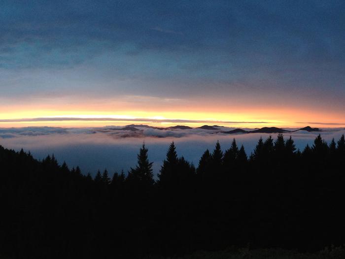
Rogue River-Siskiyou National Forest
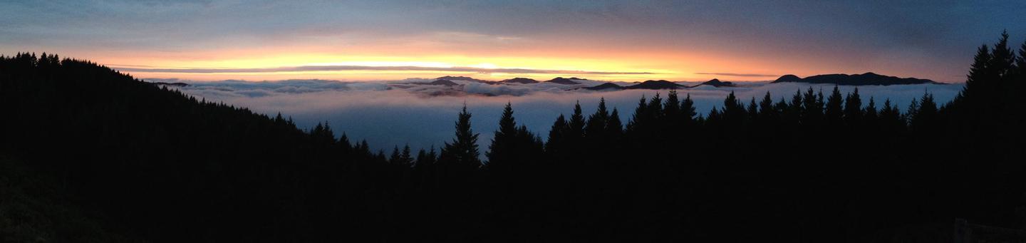
Find Your Hidden Rogue!
Recreational opportunities abound on the RRSNF: white water kayaking and rafting, wilderness exploration, lake and stream fishing, snowmobiling... Hundreds of miles of trails welcome users of all types and abilities: those on horses, bicycles, motorcycles, skis, and foot will all find their adventure on the RRSNF!
Come explore, discover your hidden, inner rogue, and get outdoors!
Recreation Opportunity Guides:Online!
These printable guides include trail and site information, as well as driving directions and full-color maps! Click below for more information!

 Spotlight: Go There! Accessible Recreation on the Rogue River Siskiyou NF
The RRSNF has two sites that are wheelchair-accessible: Ludlum House and Packers Cabin, both of which are located on the Gold Beach Ranger District! In this acclaimed video series, you can join John Williams from Wheelchair Destinations as he takes you to these two sites, and highlights all that they have to offer for everyone!
Recreation Map A map showing recreation areas.
RecAreaDirections
Open with Google Map
Misc
| Stay Limit | |
| Reservable | false |
| Keywords | |
| Map Link | |
| Contact Phone | |
| Contact Email |
Permits info
Facilities
FAREWELL BEND CAMPGROUND Campground
List of CampsitesOverview
Farewell Bend Campground is a picturesque campground in the midst of old growth forest and adjacent to the Rogue River and Crater Lake National Park. The campground is well-known for its amazing children's play area.
Recreation
Farewell Bend offers outstanding fishing and swimming in the Rogue River and nearby Union Creek, as well as Lost Creek to the south. The Rogue River and Rogue Gorge trail systems connect to both Crater Lake National Park to the north and Lost Creek Lake to the south, and run through Natural Bridge and Rogue Gorge. Crater Lake National Park is just minutes away. Natural Bridge and Rogue Gorge are within easy walking distance and are must see attractions. All hiking venues are in the midst of old growth forest, with views of Mount McLoughlin.
Facilities
This large campground contains a variety of campsites to accommodate groups, families and individuals. Drinking water and flush toilets are provided, as well as picnic tables and grills. Firewood is available for purchase at the Campground Host Site.
Natural Features
Drives to nearby Crater Lake National Park to the northeast and Lost Creek Lake to the south are wonderful opportunities for visitors to the area.
This is a premier fishing campground adjacent to the Rogue River. In addition, hikers will enjoy easy access to the Union Creek and Upper Rogue River Trails. Sights to see include Rogue Gorge and Natural Bridge.
contact_info
For facility specific information, please call (541) 560-3400.Nearby Attractions
Visitors are encouraged explore the area including: Rogue River, Rogue Gorge, Rainbow Bridge, Lost Creek and Crater Lake National Park. Groceries and a hot meal are close by in Prospect, Oregon, and at the Union Creek Resort.
UNION CREEK CAMPGROUND - ROGUE RIVER Campground
List of CampsitesOverview
Union Creek Campground is located west of Crater Lake National Park in Western Oregon. The campground is a picturesque site in the midst of old growth forest. Both Union Creek as well as the confluence of Union Creek and the Rogue River are in the area. Hiking trails include easy access to the Union Creek and Upper Rogue River Trails. Three full service RV sites are located just outside of the campground entrance, monitored by the Union Creek Campground host. These sites are accessible on a dirt road (Road 390). As there are problems with the map on recreation.gov, please see the campground map at roguerec.com
Please note: This is the Union Creek Campground located in southwestern Oregon in the Rogue River-Siskiyou National Forest, west of Crater Lake National Park (near Medford). This is not the Union Creek Campground located in eastern Oregon near Baker City.”
Recreation
Those fishing and hiking in the area can expect outstanding views of Mount McLoughlin. Hikers will enjoy the Rogue Gorge Trail System. Sights to see include Rogue Gorge, Natural Bridge and Crater Lake National Park.Facilities
This large campground contains a variety of campsites to accommodate groups, families and individuals. Sites are large enough to accommodate RVs and trailers. Drinking water and vault toilets are provided, as well as picnic tables and grills. A public phone is available within walking distance at the front of the Highway 62 turnoff to the campground. Firewood is available for purchase at the Campground Host Site.Natural Features
Drives to nearby Crater Lake National Park to the northeast and Lost Creek Lake to the south are wonderful opportunities for visitors to the area.This is a premier fishing campground with nearby access to both Union Creek and the Rogue River.
Nearby Attractions
Visitors are encouraged explore the area including: Rogue River, Rogue Gorge, Rainbow Bridge, Lost Creek and Crater Lake National Park. Groceries and a hot meal are close by in Prospect, Oregon, and at the Union Creek Resort.contact_info
For facility specific information, please call (541) 865-2735.FISH LAKE CAMPGROUND - ROGUE RIVER Campground
List of CampsitesOverview
Fish Lake Campground is a remote and picturesque site in the midst of old growth forest adjacent to Fish Lake, offering some of the best fishing in the area. A boat launch for Fish Lake (10 mph) is within the campground and many amenities are offered at nearby Fish Lake Resort.Recreation
Fish Lake Campground offers outstanding fishing, swimming and hiking. Kayaking, canoeing, paddle boarding and boat access (10 mph) are available from the boat ramp. Numerous hiking trails are within easy access, including the Fish Lake, High Lakes, Brown Mountain, and the famous Pacific Crest Trail, as well as the Sky Lakes Wilderness and Mount McLoughlin Trail system. Many biking trails exist, including back-country and county highways.Facilities
This large campground contains quiet and secluded campsites to accommodate groups, families and individuals. Many sites are large enough to accommodate RVs and trailers but cannot accommodate RV hookups at this time. Drinking water and flush toilets with wash basins are provided, as well as a fish cleaning station, picnic tables and grills. Firewood is available for purchase at the Campground Host Site.Natural Features
Visitors will enjoy easy access to Fish Lake and Willow Lake to the north. Beautiful Fish Lake is supplied by over 45 underground volcanic streams.contact_info
For facility specific information, please call (541) 865-2735.Nearby Attractions
Additional campgrounds nearby include adjacent Doe Point and North Fork Campgrounds, Whiskey Springs and Fourbit Ford Campgrounds; all several miles away off OR-821. Groceries and a hot meal are close by in Butte Falls, or within walking distance at the Fish Lake Resort.DOE POINT CAMPGROUND Campground
List of CampsitesOverview
This remote and picturesque campground is in the midst of old growth forest adjacent to Fish Lake offering some of the best fishing in the area.Recreation
Doe Point Campground offers outstanding access to fishing, swimming and hiking. Kayaking, canoeing, paddle boarding and boat access (10 mph) are available from the Fish Lake boat ramp. Numerous hiking trails are within easy access, including the Fish Lake, High Lakes, and Brown Mountain trails, the famous Pacific Crest Trail, as well as the Sky Lakes Wilderness and Mt. McLoughlin Trail systems. Many biking trails exist, including backcountry and county highways.Facilities
This large campground contains campsites to accommodate groups, families and individuals. Many sites are large enough to accommodate RVs and trailers but cannot accommodate RV hookups at this time. Drinking water and flush toilets with wash basins are provided, as well as a fish cleaning station, picnic tables and grills. Firewood is available for purchase at the Campground Host Site.Natural Features
Visitors will enjoy easy access to Fish Lake which is a premier fishing lake supplied by over 45 underground volcanic streams.Nearby Attractions
Many amenities are offered at nearby Fish Lake Resort. Excellent fishing and swimming are also available at Willow Lake to the north on OR-821. Groceries and a hot meal are close by in Butte Falls, or within walking distance at the Fish Lake Resort. Additional campgrounds nearby include adjacent Fish Lake and North Fork Campgrounds, Whiskey Springs and Fourbit Ford Campgrounds several miles away off OR-821.contact_info
For facility specific information, please call (541) 865-2735.HART-TISH PARK at APPLEGATE LAKE Campground
List of CampsitesOverview
Located in southwest Oregon in the Rogue River-Siskiyou National Forest, Hart-Tish Park is surrounded by a variety of landscapes, boasting nearby volcanic peaks, rivers and old-growth forests.Hart-Tish Park offers several acres of beautifully groomed lawn sloping down to the shores of Applegate Lake. Visitors can spot the peaks of the majestic Red Buttes Wilderness while looking south over the lake.
Recreation
Hart-Tish Campground sits on the shores of Applegate Lake, a popular recreation lake located north of the Red Buttes Wilderness Area. Visitors enjoy swimming, cycling, boating, canoeing, fishing and hiking the various trails near the lake.Collins Mountain Trail, named for two brothers who mined in this vicinity during the 1850s and 60s, begins at the Hart-Tish Park picnic area. The trail crosses Upper Applegate Road and drops down to Grouse Creek, where it passes an abandoned miners' cabin and several mine adits, as well as an an inactive Bigfoot trap. Leaving Grouse Creek, the trail climbs steeply for one mile to the ridge top, gaining 1,000 foot elevation, and begins a long traverse of the western slope of Collins Mountain.
Panoramic views of Applegate Lake and the Siskiyou Crest are seen at several locations along the trail.
The inactive Bigfoot trap, found at the beginning of the trail, was built in 1974 by the North American Wildlife Research Team. The trap was inspired by a miner who lived near the Applegate River who claimed to have found 18-inch-long, human-like tracks in his garden. The organization operated the trap, keeping it baited with carcasses for six years, but caught only bears. Currently the Forest Service keeps an eye on the trap, but otherwise does not maintain it.
Facilities
Hart-Tish Campground has seven traditional tent campsites and eight lakeside RV parking spots. All tent campsites are a short walk in of approximately 75 yards, with carts provided for transporting gear. The RV sites are a sectioned-off portion of the day-area use parking. The RV sites back-up directly to the lake shoreline. It's a beautiful setting, but there may be day-use car traffic in close proximity to the boat launch area. RV campers are allocated two parking spots to help accommodate slide-outs and extra gear. Drinking water and flush toilets are available, as well as an on-site General Store. Kayak and Paddle Board rentals are available at $30 for 3-hrs or $45 all-day. This is also a boat ramp offered. Please note, there is a two-night minimum when you desire to reserve a Friday or Saturday night. Please Note: There is NO INTERNET service at the Lake. We realize the error listed in campsite description, we are working on fixing that.Natural Features
The unique character of the landscapes comprising the area has led to the designation of over 340,000 acres of the forest as wilderness, and over 200 miles of streams as National Wild and Scenic Rivers.The forest itself is composed of two distinct geological provinces, the Cascade Range and the Siskiyou Mountains. The Cascade Range is dominated by snow-capped volcanic peaks like the 9,495-foot Mt. McLoughlin, located within the Sky Lakes Wilderness.
The Siskiyou area embodies the most complex and treasured plant communities in the Pacific Northwest. World-class wild rivers, biological diversity, remarkable fisheries and complex watersheds all define the Siskiyou.
Diverse landscapes provide habitat for a wide range of wildlife, from spotted owls and bull elk to salamanders and sandhill cranes.
Nearby Attractions
The nearby Rogue River National Recreation Trail, stretching 40 miles between Grave Creek and Big Bend, offers some of southwestern Oregon's most scenic landscapes and rewarding hiking experiences. This hiking-only trail follows the north bank of the Rogue River as it winds its way toward the Pacific Ocean.Visitors enjoy Crater Lake National Park and learning about its unique natural and cultural history. At 1,943 feet deep, Crater Lake is the deepest lake in the United States and one of the ten deepest lakes in the world.
CHINQUAPIN GROUP CAMPGROUND Campground
List of CampsitesOverview
The Chinquapin Group Campground is located at the former site of the Camp Oregon Caves Civilian Conservation Corps (CCC) camp. During the Great Depression from 1933- 1941 the Camp Oregon Caves Civilian Conservation Corps (CCC) camp was home to over 200 men who worked on projects in the Siskiyou National Forest and the Oregon Caves National Monument. Today, the only structure currently remaining at the site is the historic Grayback Ranger Station, constructed by CCC crews around 1936 and located immediately adjacent to the Chinquapin Group Campground. The large Port- Orford cedar tree located near the back of the parking area was dedicated in 2011 as the 56th Oregon State Heritage Tree and is a living reminder of the Civilian Conservation Corps (CCC) and Camp Oregon Caves CCC camp. The large meadow at the Chinquapin Group Campground makes a great location for group events such as reunions, church camps, school field trips and scouting events. Water, picnic tables and fire rings are readily available at three locations in the campground and a restroom is located at the back of the parking area. Within a short walking distance there are swimming areas in Grayback Creek and creek side trails with meadows, marshes, spring wildflowers, wildlife and berry picking. No electricity is available at the Chinquapin Group Campground. Visitors can continue 10 miles east on Hwy 46 and visit Oregon Caves National Monument for a tour of one of the few marble caves in the world.Recreation
The Grayback Interpretive #1204 follows Grayback Creek adjacent to Chinquapin Group Campground and is open to hikers who occasionally may use the toilet in the campground.
SQUAW LAKES Campground
List of CampsitesOverview
Squaw Lakes Campground is nestled in the deep shade of a mixed-conifer forest on the banks of Squaw and Little Squaw Lakes. The facility provides tent-only campsites that are reachable via foot trails. The unique, remote setting offers visitors stunning scenery and access to a multitude of recreational opportunities.Recreation
Hiking and fishing top the list of recreational opportunities at Squaw Lakes Campground. Two mountain lakes, a river and a handful of hiking trails are accessible from the campground.Anglers enjoy the remote location and scenic backdrop of two natural lakes, providing excellent fishing opportunities for coldwater and warmwater species. Squaw Lake, larger than its sister, sustains rainbow and cutthroat trout, yellow perch, brown bullhead and black bass. Little Squaw Lake provides a rare fishery for 8-11" wild, native coastal cutthroat trout. A 0.25-mile hiking trail connects the lakes. Motors are not permitted on the lakes.
From the campground, Little Squaw Trail is a 1-mile interpretive hike that provides visitors with many opportunities for picnicking and swimming. The 2-mile Summit Lake Trail travels through a mixed conifer forest and small water crossings.
Facilities
Squaw Lakes Campground contains 10 individual sites and five group sites. All sites are walk-in and designated for tent camping only. They are reachable by walking on foot trails from the parking area. Vehicles must be parked outside the gated area, and all personal belongings must be carried to the campsite. The closest campsites are approximately 1/4 mile from parking and the farthest campsites are approximately 1.5 miles from parking.
During specific hours (variable) we do offer an ATV portage service for your camping gear. We will not transport people. This service is at the discretion of the Camp Host, and charged at $25 per trip. For more info: https://applegatelake.com/squaw-portage
Picnic tables, campfire rings and vault toilets are provided. Drinking water is provided via a hand-pump, located near site # 2. Most sites are located at the water's edge.
Please note, there is a two-night minimum when you desire to reserve a Friday or Saturday night. Visit www.applegatelake.com for more information.
Natural Features
The Rogue River-Siskiyou National Forest is composed of two distinct geological provinces: the Cascade Range and the Siskiyou Mountains. The Cascade Range is dominated by snow-capped volcanic peaks such as 9,495 foot Mt. McLoughlin within the Sky Lakes Wilderness. The Siskiyou area embodies world-class rivers, remarkable fisheries and the most complex and treasured plant communities in the Pacific Northwest.Diverse landscapes provide habitat for a wide-range of wildlife, from spotted owls and elk to salamanders and sandhill cranes.
Charges & Cancellations
Please see the recreation.gov rules & regulation policies. These policies are system-wide, and not specific to each facility. We are NOT staffed to handle or manage cancellations and/or changes via telephone. Please do not call or leave any messages for these issues. Please NOTE: In Southern Oregon, we unfortunately get difficult conditions due to forest fire smoke. The USFS has the difficult decisions as to whether to temporarily close these facilities, or for them to remain open. If the facilities are closed, refunds will be honored. If the facilities remain open, the sites will be maintained, and reservations will be honored. If you have any specific questions regarding cancellations/changes or mofications to your existing reservation, it may be evaluated on a case-by-case basis. Please email us at applegatelake@gmail.com.
WILLOW PRAIRIE HORSECAMP Campground
List of CampsitesOverview
Willow Prairie Horse Camp is nestled in tall timber at an elevation of 4,400 feet just southwest of Mt. Mc Loughlin, near a beautiful meadow of the same name. The camp offers many amenities to make you and your horses feel at home.The camp was converted to a horse camp in 1990 with the addition of 19 miles of interconnecting horseback riding trails. The renovation was made possible through a partnership between the Forest Service and the Coalition of Equestrian Clubs, which provided much of the labor for this wonderful facility.
Recreation
Willow Prairie Horse Camp offers equestrian access to a wide variety of trails. Rugged peaks, sparkling lakes and forested areas provide the backdrop for many of these rides.Facilities
Willow Prairie offers large equestrian sites, each with corrals, a picnic table, campfire ring with grill and ample parking. Vault toilets and drinking water are provided.A watering trough is available for horses, and a trailer is left on-site for campers to deposit manure and hay upon departure.
Natural Features
The unique character of the Rogue River-Siskiyou National Forest is composed of two distinct geological provinces: the Cascade Range and the Siskiyou Mountains. The Cascade Range is dominated by snow-capped volcanic peaks such as 9,495' Mt. Mc Loughlin within the Sky Lakes Wilderness. The Siskiyou area embodies world-class wild rivers, remarkable fisheries and the most complex and treasured plant communities in the Pacific Northwest.Adjacent to the camp is a wetland area featuring beaver dams and several large ponds where wildlife abounds. Sandhill cranes, Canada geese, ducks, elk, deer and many others frequent the area.
Nearby Attractions
Willow Prairie Guard Station was constructed on the edge of the meadow in 1924 by a Forest Service road crew. Its main purpose at that time was as a firefighter guard station. The original cabin was recently restored by local volunteers and employees of the Butte Falls Ranger District.Fish Lake is just 10 minutes from Willow Prairie. Visitors enjoy fishing, boating, canoeing and swimming. A small resort on the lake offers motor boat and canoe rentals.
BOLAN MOUNTAIN LOOKOUT Campground
List of CampsitesOverview
Sadly, the Bolan Mountain Lookout has burned in the Slater Fire. It is a total loss. The Rogue-River Siskiyou National Forest will explore options to rebuild and will provide updates as they become available. For questions or concerns regarding your reservation, please call the Recreation.gov help desk.
Bolan Mountain Lookout is surrounded by glass windows on all sides, providing visitors with an unparalleled view of the sheer drop-offs sharp cliffs, and breath-taking views of the rugged Siskiyou Mountains.
The current structure was built in 1953 to replace an original lookout that once stood in its place. The historic lookout is available for rent during the snow-free season with a maximum length of stay being 5 consecutive nights, and guests must bring several of their own amenities.
Recreation
Hikers may enjoy spending a day hiking the Bolan Lake Trail down to Bolan Lake. Hemmed in by conifer forest, the lake is stocked with trout, and is an ideal setting to enjoy fishing, non-motorized boating such as kayaking or picnicking at its banks.The lookout is also a prime spot for nature and scenic photography due to the stunning vistas provided. For visitors interested in astronomy, Stargazing is a popular activity on clear nights.
Facilities
The 14 x 14 foot one room cabin is designed to house a maximum of four people, and offers a primitive camping experience. The 30 to 40 steps up to the lookout are steep and uneven, so visitors should use caution when climbing to the main cabin.
The room is equipped with a table, two chairs, a single bed without a mattress, a footstool, cleaning supplies and a fire extinguisher.
A primitive vault toilet is located near the lookout.
No water is available on site, so guests must pack in water for drinking, cooking and washing. Guests must also provide their own camp stove, light source, sleeping bag, sleeping pad, towels, dish soap, matches, cooking gear, toilet paper and garbage bags.
Natural Features
From the lookout, guests are treated to expansive views of the Red Buttes and Siskiyou Wilderness areas, Preston Peak and Bolan Lake. To the north are far views of the Kalmiopsis Wilderness and the Illinois River Valley. On a clear day, even Mount Shasta is visible to the southeast.Bolan Lake is a 12 acre, high mountain lake with a shoreline of Douglas fir, pine and hemlock. A dip in the cool waters provides much needed relief from a hot summer day. Clear nights provide guests with a dazzling display of stars and planets.
Nearby Attractions
Oregon Caves National MonumentDiscover the "Marble Halls of Oregon" nestled deep inside the Siskiyou Mountains. The caves formed as rainwater from the ancient forest above dissolved the surrounding marble and created one of the world's few marble caves. The highly complex geology found at the Monument contributes to the unusual and rare plants and animals found nowhere else but here. Experience the extensively decorated and adventurous "Marble Halls of Oregon."
Kalmiopsis Wilderness
Kalmiopsis Wilderness is a wilderness area in the Siskiyou Mountains of southwestern Oregon, within the Rogue River-Siskiyou National Forest. It was designated wilderness by the United States Congress in 1964 and now comprises a total of 179,755 acres. There are approximately 153 miles of trails on 24 established hiking trails in the area. The Kalmiopsis Wilderness was named for Kalmiopsis leachiana, a slow-growing plant related to the rhododendron, which was discovered in the area in 1930.
Red Buttes Wilderness
The Unites States Congress designated the Red Buttes Wilderness in 1984 - it now includes a total of 19,940 acres. Management of the Red Buttes Wilderness, located on the California/Oregon border, is shared by the Klamath National Forest and the Rogue River - Siskiyou National Forest. The majority of the Wilderness lies within the boundaries of the Rogue River-Siskiyou National Forest."
BALD KNOB LOOKOUT Campground
List of CampsitesOverview
Bald Knob Lookout is perched atop Bald Knob at an elevation of 3,630 feet in the Rogue River-Siskiyou National Forest. The lookout offers visitors a unique lodging experience and panoramic views of the surrounding area.Originally developed in 1931 as a lookout site, Bald Knob served as an Aircraft Warning Service (AWS) observation station between 1942 and 1944. The Forest Service removed and replaced the original with the present flat top structure in 1963.
The lookout tower is available for reservations from Memorial Day through October, and guests must bring several of their own amenities to ensure a safe and comfortable stay.
Recreation
Hiking, birding, and wildlife viewing are popular among guests to this lookout. Seasonal changes envelope the area as snow melt gives rise to spring time flowers, and vivid autumn colors welcome a landscape blanketed with snow. The Panther Ridge Trail is accessible from the facility and follows an historic Native American travel corridor. Approximately 95% of this trail is within the Wild Rogue Wilderness, and is closed to any kind of motorized vehicles or equipment. The trail travels under magnificent stands of old-growth timber and through rhododendron and scrub oak undergrowth. Another notable trail is the nearby Coquille River Falls Trail. The hike switches back and forth through a virgin stand of undisturbed Douglas-fir, hemlock, and Port-Orford cedar trees, ending at the Coquille River Falls. Learn more about the geology of waterfalls along the Coquille River.Facilities
The 16 x 16 foot one-room flat top cabin is equipped with basic amenities, including a propane stove, heater, refrigerator and lights. Furnishings include a single bed and a small table and chairs.Outside amenities include a picnic table and campfire ring. A primitive vault toilet is located approximately 100 feet from the tower. There is no water on site, so visitors must bring plenty of their own for drinking, cooking and washing.
Guests must also supply their own food, cooking utensils, sleeping bags, sleeping pads, towels, dish soap, matches, cooking gear, toilet paper and garbage bags. Although propane lighting is available, bringing an additional light source is recommended.
The site has sufficient space for one small tent, but strong winds could blow a tent off the mountain unless adequately weighted down inside.
Natural Features
Visitors to the Bald Knob Lookout will be treated to spectacular views overlooking Eden Valley to the north, the Rogue River to the south, and the forests beyond.The unique character of the landscapes comprising the Rogue River-Siskiyou National Forest has led to over 340,000 acres of the Forest to be preserved as a designated wilderness area, and over 200 miles of streams as National Wild and Scenic Rivers.
Diverse landscapes provide habitat for a wide range of wildlife, from spotted owls and bull elk to salamanders and sandhill cranes. These species, along with many others, depend on the undeveloped wilderness, undisturbed wetlands, clean streams, and diverse forests to live.
Nearby Attractions
Visit Crater Lake National Park and learn about its unique natural and cultural history. Reaching depths of 1,943 feet, Crater Lake is the deepest lake in the United States and one of the ten deepest lakes in the world.Experience 172 miles of diverse river and mountain landscapes along the Rogue-Umpqua National Scenic Byway. Travel from rolling oak-covered hills and towering coniferous forests, to roaring white water rapids and incised inter-canyon lava flows. The highway travels alongside the Upper Rogue and North Umpqua Wild and Scenic Rivers that contain world-class fisheries.
WILLOW PRAIRIE CABIN Campground
List of CampsitesOverview
Willow Prairie Cabin is located in the southwest portion of the magnificent volcanic Cascade Mountain Range at the foot of Mt. McLoughlin, at an elevation of 4,300 feet. The Willow Prairie Guard Station cabin was constructed on the edge of the meadow in 1924 by a Forest Service road crew. Its main purpose at that time was as a firefighter guard station.In 1990, the cabin was converted to a horse camp and was recently restored by local volunteers and employees of the Butte Falls Ranger District. Today it is available for rent by groups with or without horses.
Recreation
The cabin is adjacent to the Willow Prairie Campground , and is surrounded by 19 plus miles of horse trails. In addition to horseback riding, enjoy camping, hunting and winter sports, such as cross country skiing, snowshoeing and snowmobiling.The wetlands adjacent to the cabin provide an excellent area for birding enthusiasts to watch for sandhill cranes, great blue herons, Canada geese, ducks and red-tailed hawks.
Facilities
The one-room cabin can accommodate up to four people, however it is furnished with only two sleeping cots. It has two shutter-style windows without glass, a wood stove for heat, and rustic furnishings, including a table and chairs. There is counter space for meal preparation and places to hang lanterns. Water is available at the campground.Outside amenities include a campfire ring and picnic table for outdoor dining. Firewood is often available intended for indoor use only, however the supply cannot be guaranteed. The supply may run low and what is there may have to be split by the visitor with the tools provided. Guests are encouraged to bring their own. A vault toilet is located in the adjacent campground near the cabin.
Guests must supply their own camp stove, cookware, utensils and dishes, sleeping bags, towels, dish soap, matches, first aid kit, light source, toilet paper and garbage bags.
There are four 12 x 12 foot paddocks and water troughs near the cabin for up to four horses.
Natural Features
The Rogue River-Siskiyou National Forest is composed of two distinct geological provinces - the Cascade Range and the Siskiyou Mountains.The Cascade Range is dominated by snow-capped volcanic peaks such as 9,495 foot Mt. McLoughlin located within the Sky Lakes Wilderness. The Siskiyou area embodies the most complex and treasured plant communities in the Pacific Northwest. Wild rivers, biological diversity, remarkable fisheries resources, and complex watersheds define the Siskiyou.
Adjacent to the cabin and camp is a wetland area featuring a beaver swamp and several large ponds where wildlife abounds. From majestic sandhill cranes and Canada geese, to bull elk and deer, these species, along with many others, depend on the surrounding undeveloped wilderness, undisturbed wetlands, clean streams, and diverse forests to live.
LAKE OF THE WOODS LOOKOUT Campground
List of CampsitesOverview
Lake of the Woods Lookout is surrounded by mountainous terrain, forested hillsides and spectacular views within the Rogue River-Siskiyou National Forest in southwestern Oregon.The flat-roofed cabin was originally a "ground house" located on Barklow Mountain in the Powers Ranger District. It was flown by helicopter to its present location and placed on a 12 ft. tower and catwalk in 1974. It was then staffed during fire seasons from 1974 to 1996.
The lookout offers some amenities, but guests are asked to bring a few of their own supplies to ensure a safe and comfortable stay.
Recreation
Hiking, mountain biking and stargazing are popular among guests at the lookout. Seasonal changes envelope the area as snowmelt gives rise to spring time flowers, and vivid autumn colors welcome a landscape blanketed with snow.Logging roads and trails extend from the area, providing guests with opportunities to explore the area's old-growth forests, rugged and steep river canyons and a variety of wildlife.
Far away from city lights, the lookout provides a fantastic opportunity for stargazing. Guests to the lookout search for constellations, planets and are treated to an occasional meteor slashing the night sky.
Facilities
The lookout is a one-room cabin, able to accommodate up to four people. It is equipped with a double bed with a mattress, a table and two chairs, a propane stove, propane and solar lights, cleaning supplies and a fire extinguisher. A solar shower is provided, however, guests must provide the water.
On site, adjacent to the lookout, there is a picnic table and a campfire ring for outdoor dining. A pit toilet is also located outside the tower.
There is sufficient room for one tent, but the ground is extremely rocky.
Guests to this lookout should be prepared for a rustic camping experience, and will need to bring several of their own supplies. There is no water on site, so visitors must bring a sufficient amount for drinking, cooking and washing. Guests must also provide their own sleeping bags, sleeping pads, towels, dish soap, matches, cooking gear, first aid kit, toilet paper and garbage bags.
Although lighting is provided, it is recommended guests bring an additional light source in case of emergency.
Natural Features
Lake of the Woods Lookout provides a panoramic view with vistas of the Pacific Ocean, the Kalmiopsis and Wild Rogue Wilderness areas, and the Wild and Scenic Illinois and Rogue River canyons. In the spring, the nearby Lake of the Woods, which is actually a fairly small shallow pond, is surrounded by wildflowers and welcomes the arrival of several species of birds and butterflies. As summer progresses, the lake fills in with tall reeds and grasses. Lightning storms are a part of the thrill of staying at a lookout, but they are also extremely dangerous. If a lightning storm should occur, guests are urged to follow these safety rules to minimize the danger: Stay indoors or completely inside your car If you are trapped outside during a lightning storm, move to lower ground and stay low to the ground. Do not stand under trees or other high objects. If you are in the lookout building, close the windows and doors. Lightning follows air currents: Do not touch anything metal. The Lookout has metal stairs and a metal walkway around the cabin; It is imperative guests do not stand at these locations during storms.Nearby Attractions
Opportunities for swimming and fishing are within 10 miles of the lookout.SNOW CAMP LOOKOUT Campground
List of CampsitesOverview
SNOW CAMP LOOKOUT IS CLOSED UNTIL FURTHER NOTICE. Snow Camp Lookout sits at the peak of Snow Camp Mountain at an elevation of 4,223 feet, offering guests spectacular panoramic views of the surrounding area. The fire lookout is the most recent of three structures built atop Snow Camp Mountain. The structures onsite were used as fire lookouts and an Aircraft Warning System station during World War II. The original cabin was destroyed in the 2002 Biscuit Fire, a massive blaze that burned more than a half-million acres in Oregon and California, but was reconstructed just two years later. Today the lookout offers a unique lodging experience for guests seeking a bit of solitude and relaxation. Although the cabin offers some basic amenities, guests must bring a few of their own supplies to ensure an enjoyable stay.Recreation
Hiking, mountain biking, stargazing, and wildlife viewing are popular among guests to this lookout.An important component of the historic fabric of the watershed is the trail system. Hikers may want to wander trails that originally followed older aboriginal routes. "Chief" Elwin Frye, a packer for the Forest Service, identified a portion of the Snow Camp Trail as an Indian travel route. The trail is one of the oldest in the Forest, and provides access to Windy Valley, a pristine mountain meadow with a small crystal clear creek.
At night the lookout is an ideal setting for stargazing, as constellations and planets put on a dazzling display.
Facilities
The renovated fire lookout is a 15' x 15' structure, originally designed for one or two people. It is furnished with a double bed with a mattress, a table and chairs, cabinets and counter space for food preparation. It is also equipped with a wood-burning cook stove and a picnic table for outdoor dining. A pit toilet is located near the lookout. There is no water on site, so visitors must bring sufficient supplies for drinking, cooking and washing. Guests must also provide their own sleeping bags, sleeping pads, towels, dish soap, matches, cooking gear, toilet paper and garbage bags. Although visitors can drive within sight of the lookout, the 200-yard hike to the summit can be strenuous when carrying gear. The final 200 yards to the lookout are open to administrative traffic only.Natural Features
On a clear day, guests at Snow Camp Lookout will see ocean waves crashing along Kellogg Beach, Point St. George and Castle Rock near Crescent City, California. Effects of the 2002 Biscuit Fire and the 2017 Chetco Bar Fire are obvious within the surroundings, though forested mountains and grassy hillsides dotted with pine trees extend from the lookout as well.PACKERS CABIN Campground
List of CampsitesOverview
Packers Cabin was originally built during the 1930s and served as the headquarters for the Forest Service packer who supplied lookouts and field crews by horse or mule pack trains.Today, visitors no longer need to hitch up a team of mules and trek for days to enjoy staying in the quiet, remote cabin within the Rogue River-Siskiyou National Forest.
The accessible cabin offers most items needed for a comfortable lodging experience, though guests will need to bring some of their own amenities to ensure a safe and comfortable stay.
Recreation
Hiking, wildlife viewing and fishing top the list of recreational opportunities in the area surrounding Packer's Cabin.Anglers will enjoy the remote location and scenic backdrop of the nearby Chetco River, providing angling opportunities for trout, steelhead, and salmon in season. The Chetco starts in steep, deeply dissected, sparsely vegetated, mountainous terrain within the Kalmiopsis Wilderness. Over its 55.5 mile length, the Chetco drops from 3,700 feet to sea-level as it empties into the Pacific Ocean between the towns of Brookings and Harbor, about 5 miles north of the California border.
The Oregon Redwoods Trail provides a unique accessible hiking opportunity that travels through a grove of majestic old-growth redwood trees. Located along Peavine Ridge in the Winchuck River drainage, guests will learn about old-growth tree ecology, fire history, wildlife, and botany in the area. Redwood trees in this area represent the only coastal redwoods found in the Pacific Northwest Region, located at the limit of their northern range.
The trail is an out/back design with a short loop at the far end, where a picnic stop is provided. A short wooden deck provides access to the inside of a hollowed redwood tree.
Facilities
Packer's Cabin is a facility that meets accessibility standards and is equipped with ramps, decks, wide doorways and door handles to make the cabin as barrier-free as possible for anyone wishing to take a step back in history and live the life of a forest ranger.
The cabin accommodates up to 12 people comfortably and is furnished with one double bunk and ten single bunks with mattresses. There is a table and chairs, a work surface for food preparation, and a wood-burning stove. Picnic tables and a campfire ring are located near the cabin, as well as an accessible vault toilet.
There is no water on site; visitors must bring a sufficient supply for drinking, cooking and washing. A natural spring is located nearby, but the water is not recommended for consumption.
Guests must also provide their own sleeping bags, sleeping pads, a light source, towels, dish soap, matches, cooking gear, first aid kit, toilet paper and garbage bags.
Tent space is available near the cabin.
Natural Features
The landscapes comprising the Rogue River-Siskiyou National Forest has led to the designation of over 340,000 acres of the Forest as wilderness, and over 200 miles of streams as National Wild and Scenic Rivers. The forest itself is composed of two distinct geological provinces - the Cascade Range and the Siskiyou Mountains. The Cascade Range is dominated by snow-capped volcanic peaks such as the 9,495 foot Mt. McLoughlin, located within the Sky Lakes Wilderness. The Siskiyou area embodies the most complex and treasured plant communities in the Pacific Northwest. Wild rivers, biological diversity, remarkable fisheries, and complex watersheds define the Siskiyous. Packer's Cabin, when built, was adjacent to a large meadow. The trees started encroaching on the meadow and over time, the cabin became nestled in a grove of large fir trees. The Forest Service is now in the 2nd stage of restoring the original meadow habitat. Packer's Cabin now has lots of sun. There will be meadow enhancement information available at the cabin. The cabin lies in the area of the 2017 Chetco Bar Fire. Visitors will expeirence a landscape in transition.Nearby Attractions
The Pacific Ocean is 17 miles from this site.QUAIL PRAIRIE LOOKOUT Campground
List of CampsitesOverview
THIS FACILITY IS CLOSED TO RESERVATIONS UNTIL FURTHER NOTICEQuail Prairie Lookout offers guests a unique lodging experience in the Rogue-Siskiyou National Forest in western Oregon. On a clear day, visitors are treated to spectacular views of the Kalmiopsis Wilderness from the top of the 41-foot tower.
The tower was completed in 1963 and served as one of the last lookouts built by the southwestern Oregon Forest Service until the mid 1990's, when it was converted for recreational purposes.
Today campers can enjoy a unique lodging experience in the historic structure, which offers basic amenities and spectacular views of the surrounding area. Although the facility provides basic amenities, guests must bring a few of their own supplies to ensure a safe and comfortable stay.
Recreation
The nearby Upper Chetco Trail is the main east/west route through the Kalmiopsis Wilderness. It offers access to the Chetco River and two main tributaries. Heavy vegetation provides shade but eliminates most views, and at least three significant long and steep sections provide a challenging backpacking experience.Anglers will enjoy the remote location and scenic backdrop of the nearby Chetco River, providing angling opportunities for trout, steelhead, and salmon in season. The Chetco starts in steep, deeply dissected, sparsely vegetated, mountainous terrain within the Kalmiopsis Wilderness.
At night the lookout is an ideal setting for stargazing, as constellations and planets put on a dazzling display.
Facilities
The one-room lookout rests on the top of a 41-foot timber tower, surrounded by a catwalk. It is furnished with a single bed, a table and two chairs, a stool, broom and fire extinguisher. It also features a wood stove, a propane stove for cooking and a propane refrigerator. A vault toilet is located near the tower.There is no water or electricity available at the site. Guests must bring water for drinking, cooking and washing. In addition, visitors will need to supply a light source, sleeping bags, sleeping pads, cooking gear, towels, dish soap, matches, a first aid kit, toilet paper and garbage bags. Firewood is provided.
Natural Features
The lookout affords panoramic views of the Kalmiopsis Wilderness and the Chetco River drainage. The Kalmiopsis Wilderness is an area of great geological and botanical interest. Many of the rocks were formerly parts of the oceanic crust, while diverse plant life provides evidence of adaptation to the area's harsh soils.The Kalmiopsis leachian, a shrub discovered in the Gold Basin area in 1930, is a relic of the pre-ice age. The Kalmiopsis Wilderness is named after this unique endemic plant.
Diverse landscapes provide habitat for a wide-range of wildlife, from spotted owls and black-tail deer to salamanders and salmon. These species, along with many others, depend on surrounding undeveloped wilderness, undisturbed wetlands, clean streams, and diverse forests to live.
ONION MOUNTAIN LOOKOUT Campground
List of CampsitesOverview
THIS FACILITY IS CLOSED TO RESERVATIONS UNTIL FURTHER NOTICEOnion Mountain lookout sits atop a 12-foot tower at an elevation of 4,438 feet, offering guests expansive mountain views in southwestern Oregon.
The original Onion Mountain Lookout was a raised platform, built on top of a tower in 1916. In 1924, a second lookout without a tower was built on site. The current structure was placed on site in 1952 and served as a fire lookout and Aircraft Warning Service observation station.
The lookout offers a unique lodging experience in the Rouge River-Siskiyou National Forest, but visitors are required to bring a few of their own supplies to enjoy a safe and comfortable stay.
Recreation
Hiking, mountain biking, stargazing and wildlife viewing are popular among guests to this lookout.On trails throughout the area, hikers will enjoy mountain views, old-growth forest canopies and natural pools for swimming.
The lookout is located near the Taylor Creek/Onion Way mountain loop, a trail popular among mountain biking enthusiasts.
At night, the rustic cabin becomes an astronomer's heaven as the expansive night sky is littered with a dazzling display of stars and planets.
Facilities
The cabin offers a 14 x 14 foot room with large windows on all sides. It is designed for one or two people, and is furnished with a bed with a mattress, a table and chairs. Amenities include a propane cooking stove, refrigerator, and lanterns. There is no propane heater.There is also no water on site, so visitors must bring sufficient supplies for drinking, cooking and washing. Guests must also provide their own sleeping bags, sleeping pads, towels, dish soap, matches, cooking gear, toilet paper and garbage bags.
A primitive vault toilet is located near the lookout as well as space for four or five tents.
Natural Features
On a clear day, Onion Mountain offers panoramic views of layered mountainous terrain and forest stretching out in all directions.Onion Mountain is named for the tiny wild onions that grow among the rocks at the summit. In early summer, the area is dotted with plumes of Bear Grass, bright yellow Snow Mountain Buckwheat and purple penstemon.
Nearby Attractions
Visit Crater Lake National Park and learn about its unique natural and cultural history. Reaching depths of 1,943 feet, Crater Lake is the deepest lake in the United States and one of the 10 deepest lakes in the world.Oregon Caves National Monument is within a hour's drive.
IMNAHA GUARD STATION Campground
List of CampsitesOverview
The Imnaha Guard Station is located in the southwest portion of Oregon's magnificent volcanic Cascade Range, at an elevation of 3,800 feet. The facility offers a quiet remote setting and access to a multitude of recreational opportunities--an ideal destination for guests seeking both relaxation and outdoor activities. The cabin offers most of the amenities needed for a comfortable stay, though guests will need to bring some of their own supplies, such as lanterns or flashlights. This cabin does not feature indoor lighting.
Recreation
Hiking and wildlife viewing are popular among guests visiting this cabin.Bird songs are common throughout the forest surrounding the cabin. The varied thrush and the hermit thrush are the "seldom-seen" inhabitants of the dense timber, though their distinct calls lift from the forest floor. The loud drumming of the dilapidated woodpecker, the largest woodpecker in North America, is also heard occasionally. Nuthatches, chickadees, and Steller's jays are all common at Imnaha.
Diverse landscapes in the Rogue river-Siskiyou National Forest provide habitat for a wide-range of wildlife in the area, from spotted owls and bull elk to squirrels and salmon. These species, along with many others, depend on surrounding undeveloped wilderness, undisturbed wetlands, clean streams, and diverse forests to live.
Facilities
The Imnaha Guard House has a living room, bedroom, bathroom and kitchen, and is designed to accommodate up to six occupants. The bedroom is furnished with a full-size bed, a small closet and two dressers. The kitchen is equipped with a table and chairs, as well as a sink and small countertop for meal preparation. The bathroom has running water, a shower and flush toilet.The stove and refrigerator are operated by propane, and potable water for drinking and cooking is available from the faucet. A picnic table in the backyard permits comfortable outside dining.
The cabin features a lava-rock fireplace in the front room. Firewood is stocked and stored outside and in the garage at the beginning of the season and intended for indoor use only. There are no guarantees of firewood. The supply may run low and what is there may have to be split by the visitor with the tools provided. Visitors should bring their own cookware, utensils and dishes, sleeping bags, towels, dish soap, matches, toilet paper and garbage bags.
A very small Forest Service campground with four sites, also called Imnaha, is located within sight of the cabin. However, the cabin's yard is fenced, and campers typically respect the privacy of the cabin occupants.
Natural Features
Imnaha Guard Station is surrounded by an old-growth forest composed of Douglas-fir, white fir, and incense cedar, as well as some ponderosa pine, sugar pine, and western white pine. A notably large, 300-year-old Douglas-fir, known as "The Big Tree," towers above the canopy near the Imnaha cabin.Imnaha Springs is just up a trail behind the cabin. The startlingly large volume of water that bubbles from the springs is crystal clear and almost ice cold. Imnaha Springs forms separate rivulets that flow along a scenic path through yellow monkeyflower and moss.
contact_info
This location is unstaffed. To speak with our main office for general information, please call: (541) 560-3400.Nearby Attractions
Visit Crater Lake National Park and learn about its unique natural and cultural history. Reaching depths of 1,943 feet, Crater Lake is the deepest lake in the United States and one of the 10 deepest lakes in the world.LUDLUM HOUSE Campground
List of CampsitesOverview
The Ludlum House is situated at the base of a mixed-conifer forest at the confluence of Wheeler Creek and the Winchuck River in southwestern Oregon, offering guests a unique setting for recreation and relaxation.The house was rebuilt in 1999 as a near-replica of the original two-story Ludlum family vacation house. Mr. Ludlum, an oil-company executive, constructed the house in 1939, then sold the property to the Forest Service following World War II.
The accessible home offers some of the amenities needed for a comfortable lodging experience, although guests will need to bring several of their own supplies to ensure a safe and enjoyable stay.
Recreation
Hiking, wildlife viewing and fishing top the list of recreational opportunities in the area surrounding the Ludlum House.Just steps away from the banks of the Winchuck River, the cabin provides fantastic fishing opportunities for Coho salmon, Chinook salmon, cutthroat trout and steelhead trout. The river is closed to fishing above the Wheeler Creek confluence to provide a refuge for wild fish, but anglers will some excellent steelhead waters below this point, including several miles on the Rogue River-Siskiyou National Forest. Standard winter steelhead tactics such as drift fishing, floating jigs, or swinging flies work well on this gravel and cobble-bottomed river. Flies such as spruce flies or bucktail streamers work well for sea-run cutthroat.
The Oregon Redwoods Trail provides a unique accessible hiking opportunity through a grove of majestic old-growth redwood trees. Guests will have the opportunity to learn about old-growth tree ecology, fire history, wildlife, and botany in the area along Peavine Ridge in the Winchuck River drainage.
Redwood trees in this area represent the only coastal redwoods found in the Pacific Northwest Region, located at the limit of their northern range. The trail is an out/back design with a short loop at the far end, where a picnic stop is provided. A short wooden deck provides access to the inside of a hollowed redwood tree.
Facilities
Ludlum House is two stories and features one room on a lower floor, and a three-quarter dividing wall upstairs. The first floor, porch and surrounding grounds are all accessible. Picnic tables and a campfire ring are located near the cabin, as well as an accessible vault toilet. While the house and grounds can accommodate up to 60 guests maximum, there are no beds. The house is minimally furnished with a table and chairs, a sink and food preparation counter and a wood stove. There is no firewood available at this site, visitors must bring their own. Guests must also provide their own sleeping bags, sleeping pads, a light source (battery powered lights are preferred), towels, dish soap, matches, cooking gear, first aid kit, toilet paper and garbage bags. Water is available on site from a hand pump. Solar lighting is available, though it is recommended that guests bring an additional light source (battery operated lights). The use of candles is prohibited. Tent space and room for trailer parking is available near the cabin.Natural Features
The Ludlum House is somewhat secluded and surrounded by a towering old-growth forest, with an expanse of lawn stretching out before it. Within an 1.5 hour drive from the house, guests have access to the rugged southern Oregon and northern California coasts and further south, the Redwood National Park.The nearby Winchuck River flows into the Pacific Ocean about 0.5 miles north of the Oregon and California border and approximately 5 miles south of Brookings, Oregon. Five major tributaries, Wheeler Creek, East Fork, Fourth of July Creek, Bear Creek and South Fork, make up the Winchuck River system. Mt. Emily, at 2,926 feet, is the highest point in the basin.
Diverse landscapes provide habitat for a wide-range of wildlife, including black-tailed deer and an occasional black bear, to squirrels and salmon. Sensitive wildlife species such as Spotted Owl and Marbled Murrelet are present in the watershed as well. These species, along with many others, depend on the surrounding undeveloped wilderness, undisturbed wetlands, clean streams, and diverse forests to live.
MCKEE BRIDGE COMMUNITY KITCHEN Campground
List of CampsitesOverview
Situated along the rocky banks of the Applegate River, the McKee Bridge Community Kitchen is a fantastic day-use picnic shelter and registered National Historic Site. The shelter is constructed with large pine timber and features Civilian Conservation Corps (CCC) masonry, including a beautiful stone fireplace. Groups often reserve McKee Community Kitchen when holding a wedding ceremony on the neighboring historic covered bridge. Located in southwest Oregon in the Rogue River-Siskiyou National Forest at an elevation of 1,600 feet, this day-use area boasts nearby volcanic peaks, scenic rivers and fantastic old-growth forests.Recreation
The area surrounding this day-use area offers outdoor enthusiasts the opportunity to hike, fish, swim, ski and enjoy a multitude of outdoor activities throughout the year.Nearby Applegate Lake is a recreation lake located north of the spectacular Red Buttes Wilderness Area. The lake is popular for swimming, cycling, boating, canoeing, fishing and hiking the various trails.
Mule Mountain Trail offers visitors a special opportunity to access the hillsides above the Applegate Valley and witness the seasonal changes in wildlife activity. It is a long distance hike winding up and around the arid ridges of the Oregon Siskiyou Range. In the spring time, dwarf star tulips, lilies, shooting stars, larkspurs and buttercups puncture the needle and leaf mat and adorn the grass floor.
Facilities
The McKee Bridge Community Kitchen is a covered group site. Reservation is for Community Kitchen shelter. The nearby picnic area is separate and not included in the reservation.Natural Features
The unique character of the Rogue River-Siskiyou National Forest is composed of two distinct geological provinces; the Cascade Range and the Siskiyou Mountains.The Cascade Range is dominated by snow-capped volcanic peaks, such as 9,495 foot Mt. McLoughlin, located within the Sky Lakes Wilderness.
The Siskiyou area embodies the most complex and treasured plant communities in the Pacific Northwest. World-class wild rivers, biological diversity, remarkable fisheries resources and complex watersheds define the Siskiyou.
Diverse landscapes provide habitat for a wide-range of wildlife, from spotted owls and bull elk to salamanders and sandhill cranes.
Nearby Attractions
The United States Congress designated the Red Buttes Wilderness in 1984 and it now includes a total of 19,940 acres. Management of the Red Buttes Wilderness, located on the California/Oregon border, is shared by the Klamath National Forest and the Rogue River - Siskiyou National Forest.
Several, nearby lakes are close to McKee. Acorn Woman Peak looks south to Acorn Woman Lakes, a semi-primitive developed recreation area that accepts camping reservations from May through October. Applegate lake is a large reservoir with boat ramps, campgrounds, viewpoints and a developed recreation area named Hart tish. Both Acorn Woman Lakes and Applegate Lake are open for fishing year-round.
BEAVER SULPHUR Campground
List of CampsitesOverview
Nestled in the deep shade of a mixed-conifer forest on the banks of bubbling Beaver Creek, Beaver Sulphur Group Campground offers an ideal setting for groups and large family gatherings.
Located in southwest Oregon in the Rogue River-Siskiyou National Forest, the campground's proximity to a hiking trails and scenic waterways provides visitors with access to a multitude of recreational activities.
Recreation
Beaver Sulphur Group Campground offers outdoor enthusiasts the opportunity to hike, fish, hunt and enjoy a multitude of outdoor activities throughout the year.
A handful of hiking trails are accessible from the campground and in the surrounding areas.
The nearby Mule Mountain Trail offers a special opportunity to access the hillsides above Applegate Valley and witness the seasonal changes in wildlife activity. It is a long-distance hike, winding up and around the arid ridges of the Oregon Siskiyous. In the spring, dwarf star tulips, lilies, shooting stars, larkspurs and buttercups puncture the needle and leaf mat and adorn the grass floor.
Nearby Applegate Lake is a popular recreation lake, located north of the spectacular Red Buttes Wilderness Area. The lake is popular for swimming, cycling, boating, canoeing, fishing and hiking the various trails near the lake.
Facilities
Beaver Sulphur Group Campground offers a large, reservable group site that has individual spurs for tents and trailers. The site is equipped with picnic tables, campfire rings and vault toilets.
Natural Features
The unique character of the landscapes comprising the Rogue River-Siskiyou National Forest has led to the designation of over 340,000 acres of the forest as Wilderness, and over 200 miles of streams as National Wild and Scenic Rivers.The forest itself is composed of two distinct geological provinces, the Cascade Range and the Siskiyou Mountains.
The Cascade Range is dominated by snow-capped volcanic peaks, such as 9,495 foot Mt. McLoughlin, located within the Sky Lakes Wilderness. The Siskiyou area embodies the most complex and treasured plant communities in the Pacific Northwest. World-class wild rivers, biological diversity, remarkable fisheries resources and complex watersheds define the Siskiyou.
Diverse landscapes provide habitat for a wide-range of wildlife, from spotted owls and bull elk to salamanders and sandhill cranes.
Nearby Attractions
The United States Congress designated the Red Buttes Wilderness in 1984 and it now includes a total of 19,940 acres. Management of the Red Buttes Wilderness, located on the California/Oregon border, is shared by the Klamath National Forest and the Rogue River - Siskiyou National Forest. The majority of the Wilderness lies within the boundaries of the Rogue River-Siskiyou National Forest. Several lakes are accessible in the forest. Squaw Peak looks south to Squaw Lakes, a semi-primitive developed recreation area that accepts camping reservations from May through September. Applegate lake is a large reservoir with boat ramps, campgrounds, viewpoints and a developed recreation area named Hart tish. Both Squaw Lakes and Applegate lake are open for fishing year-round.BIG ELK GUARD STATION Campground
List of CampsitesOverview
With a history that dates back to 1907, Big Elk Guard Station is the oldest continuously used administrative site within the Rogue River-Siskiyou National Forest, and a delightful setting for guests seeking a comfortable and unique getaway. For many decades the guard station served as summer headquarters for solitary forest "guards" who built trails, fought forest fires and patrolled the land on horseback. Most recently the site was used to house Forest Service seasonal fire crews. The cabin is one of the few remaining examples of Forest Service log construction in the Forest and is listed on the National Register of Historic Places.Recreation
Hiking opportunities abound in the area, including the Pacific Crest National Scenic Trail to the south and west of Brown Mountain. The Brown Mountain Trail is also nearby, crossing through the Brown Mountain lava flows located between Fish Lake Campground and Lake of the Woods.Additional opportunities for fishing, hiking, mountain biking, cross country skiing and snowmobiling exist closer to the highly developed recreation areas around Howard Prairie Lake and Fish Lake Resorts. Both resorts have a restaurant, boats for rent and camping.
Facilities
Big Elk Guard Station is a rustic log cabin with a main room and a kitchen on the ground floor and two upper-story bunkrooms with one queen bed and two twin beds, reached by a double landing stairway. The first floor rooms include a large, comfortable living room with a mortared-rock fireplace and a kitchen with a table and chairs, a dry sink, and an electric range and refrigerator.
The original fir flooring remains intact. There are electric lights throughout the cabin. The cabin is heated with a wood stove and firewood is provided on site for indoor use only. There are no guarantees of firewood. The supply may run low and what is there may have to be split by the visitor with the tools provided. No drinking water is provided. Visitors must bring plenty of their own water for drinking, cooking and washing. Water can be obtained at the North Fork Campground approximately 1 mile north on Forest Service Road #37.
A picnic table and fire ring are available for outdoor dining, and an outbuilding, built by the Civilian Conservation Corps, acts as a storage shed for firewood. A vault toilet is located near the cabin, as well as additional space for tent camping.
Natural Features
Big Elk Guard Station sits on the fringe of Big Elk Meadow, a grassy expanse that floods as a shallow in spring and dries out in the summer, providing excellent grazing grounds for a dozen or more horses.Just a short stroll across the meadow, guests are treated to views of Mt. McLoughlin and the edge of a 20,000 year old lava flow from Brown Mountain. The surrounding forest, which includes lodgepole pine, quaking aspen, Shasta red fir and Douglas fir, add to the incredible beauty of the site.
A variety of wildlife ranging from blacktail deer, elk, mountain lion, black bear, bald eagle and other bird species can be found in the area.
Nearby Attractions
Visit Crater Lake National Park and learn about its unique natural and cultural history. At a depth of 1,943 feet, Crater Lake is the deepest lake in the United States and one of the ten deepest lakes in the world.Experience 172 miles of diverse river and mountain landscapes along the Rogue-Umpqua National Scenic Byway. Travel from rolling oak-covered hills and towering coniferous forests, to roaring white water rapids and incised inter-canyon lava flows. The highway travels alongside the Upper Rogue and North Umpqua Wild and Scenic Rivers that contain world-class fisheries.
LODGEPOLE GUARD STATION Campground
List of CampsitesOverview
The guard station at Lodgepole Meadow was built in 1935 by the Civilian Conservation Corps to replace the original station built in 1911. Lodgepole Meadow was used as a remote guard station for the early Forest Service crews working in the area.During WWII, Herb and Zella Wright, a husband and wife lookout team, lived throughout the winter high up on the Blue Rock Lookout several miles away watching for enemy aircraft. Lodgepole Guard Station served as their base camp.
Today, Lodgepole Guard Station is a perfect destination for horse enthusiasts, families, couples or large groups looking for a unique camping experience in the Rogue River-Siskiyou National Forest.
Recreation
The meadow offers plenty of room and even terrain for a large group of visitors to spread out, camp, horseback ride, hike, mountain bike or just relax.Additional horseback riding trails are a short trailer ride away, and include the Alta Lake, Middle Fork and Seven Lakes Trails, all of which lead into the Sky Lakes Wilderness.
Facilities
Considered to be an outstanding example of Civilian Conservation Corps construction in the Pacific Northwest, the one story cabin offers a large living room, kitchen and bathroom. The cabin is furnished with a full-sized bed with a mattress and a log style couch (with a fold-out bed). The kitchen is equipped with a refrigerator and stove, powered by propane fuel, basic cooking utensils, a table and chairs. The bathroom has a flush toilet and shower.A propane heater provides heat for the cabin. Lighting is not available at the site, so bringing an additional light source is necessary.
Guests will need to bring several of their own supplies, including food, sleeping bags, sleeping pads, towels, dish soap, matches, toilet paper and garbage bags.
A former bunkhouse, tool shed, barn and stable with several horse paddocks, are also on site. There is additional space for tent camping, as the existing yard can accommodate up to three, 4-person, family size (9' x 12') tents.
Natural Features
Lodgepole Guard Station is surrounded by 40 acres of cross-fenced pastures dotted with pines, and surrounded by forested rolling hills. The large grassy meadow has a long history of being a major grazing area for horses and cattle, and that tradition continues today.Diverse landscapes of the Rogue River Siskiyou National Forest provide habitat for a wide-range of wildlife in the area, including spotted owls and bull elk to salamanders and salmon. These species, along with many others, depend on the surrounding undeveloped wilderness, undisturbed wetlands, clean streams, and diverse forests to live.
Nearby Attractions
Visit Crater Lake National Park and learn about its unique natural and cultural history. At a depth of 1,943 feet, Crater Lake is the deepest lake in the United States and one of the 10 deepest lakes in the world.Experience 172 miles of diverse river and mountain landscapes along the Rogue-Umpqua National Scenic Byway. Travel from rolling oak-covered hills and towering coniferous forests, to roaring white water rapids and incised inter-canyon lava flows. The highway travels alongside the Upper Rogue and North Umpqua Wild and Scenic Rivers that contain world-class fisheries.
JIM CREEK GROUP CAMPGROUND Campground
List of CampsitesOverview
Jim Creek Group Campground provides your group with a peaceful camping experience in the Rogue River-Siskiyou National Forest.
Recreation
A popular day use area with access to the Upper Rogue River Trail is just a few minutes away. This trail traverses the scenic section of the upper Rogue River and provides fishing access in many places. A managed off-highway vehicle (OHV) trail system with two play areas and an OHV friendly campground are within a few minutes drive of this group campground.Facilities
Jim Creek Group Campground is a rustic site with limited amenities. The campground accommodates tents only and up to 40 people. Picnic tables and a campfire ring are available as well as a vault toilet just a short hike down the trail set away from the camp area. No water or garbage service is available.
Natural Features
This campground is very secluded and is set in an old growth grove of Douglas-fir trees adjacent to Abbott Creek. Abbott Creek, a tributary of the Rogue River, offers a sandy beach and swimming and wading during hot summer days.Nearby Attractions
Visit Crater Lake National Park and learn about its unique natural and cultural history. At a depth of 1,943 feet, Crater Lake is the deepest lake in the United States and one of the ten deepest lakes in the world.Experience 172 miles of river and mountain landscapes along the Rogue-Umpqua Scenic Byway. Travel from rolling oak-covered hills and towering coniferous forests, to roaring white water rapids and incised inter-canyon lava flows. The highway travels alongside the Upper Rogue and North Umpqua Wild and Scenic Rivers that contain world-class fisheries.
SQUAW PEAK LOOKOUT Campground
List of CampsitesOverview
Squaw Peak Lookout was constructed in 1942. It is an L-4 style cabin, and is on the National Historic Site Registry. The lookout is surrounded by glass windows on all sides, providing visitors with an unparalleled view of the steep drop-offs and breath-taking views of the rugged Siskiyou Mountains. This historic lookout is available for rent during the snow-free season with a maximum length of stay being 5 consecutive nights. Guests must bring most of their own amenities.
Recreation
The lookout is also a prime spot for nature and scenic photography due to the stunning vistas provided. For visitors interested in astronomy, stargazing is a popular activity on clear nights.Facilities
The 14 x 14 foot one room cabin is designed to house only one or two people, and offers a primitive camping experience. The room is equipped with a small wooden table, and the center of the building has a working Osborne Firefinder on its work table. Broom, mop, and fire extinguisher are on site, as well as a small storage box with toilet paper, forest and ranger district maps and information about the lookout and its surroundings. A primitive vault toilet is located near the lookout. No water is available on site, so guests must pack in water for drinking, cooking and washing. Guests must also provide their own camp stove, light source, sleeping bag, sleeping pad, towels, dish soap, matches, cooking gear, and garbage bags.Natural Features
From the lookout, guests are treated to expansive views of the Red Buttes Wilderness area, Squaw Lake and the Little Applegate Valley. To the north are far views of the Rogue Valley and Mt. McLaughlin and to the east is Wagner Butte and Dutchman Peak. On a clear day, visitors can see the rim of Crater Lake, Mt. Bailey and Mt. Thielson. Clear nights provide guests with a dazzling display of stars and planets.Nearby Attractions
The United States Congress designated the Red Buttes Wilderness in 1984 and it now includes a total of 19,940 acres. Management of the Red Buttes Wilderness, located on the California/Oregon border, is shared by the Klamath National Forest and the Rogue River - Siskiyou National Forest. The majority of the Wilderness lies within the boundaries of the Rogue River-Siskiyou National Forest. Several lakes are accessible in the forest. Squaw Peak looks south to Squaw Lakes, a semi-primitive developed recreation area that accepts camping reservations from May through September. Applegate Lake is a large reservoir with boat ramps, campgrounds, viewpoints and a developed recreation area named Hart Tish. Both Squaw Lakes and Applegate Lake are open for fishing year-round.FLUMET FLAT GROUP CAMPGROUND Campground
List of CampsitesOverview
The large meadow at the Flumet Flat Group Campground makes a great location for group events such as reunions, church camps, school field trips and scouting events. Located in southwest Oregon in the Rogue River-Siskiyou National Forest, the campground's proximity to a hiking trails and scenic waterways provides visitors with access to a multitude of recreational activities.Recreation
Flumet Flat Group Campground offers outdoor enthusiasts the opportunity to hike, fish, hunt and enjoy a multitude of outdoor activities throughout the year. A handful of hiking trails are accessible from the campground and in the surrounding areas. The nearby Mule Mountain Trail offers a special opportunity to access the hillsides above Applegate Valley and witness the seasonal changes in wildlife activity. It is a long-distance hike, winding up and around the arid ridges of the Oregon Siskiyous. In the spring, dwarf star tulips, lilies, shooting stars, larkspurs and buttercups puncture the needle and leaf mat and adorn the grass floor. Nearby Applegate Lake is a popular recreation lake, located north of the spectacular Red Buttes Wilderness Area. The lake is popular for swimming, boating, canoeing, and fishing. In the area around the lake, visitors can enjoy cycling and hiking the various trails.Facilities
Flumet Flat Group Campground offers a large, reservable group site that has individual spurs for tents and trailers. The site is equipped with picnic tables, campfire rings and a vault toilet. No water or electricity is available at the site.Natural Features
Within a short walking distance, there are swimming and fishing areas on the Applegate River. The Gin Lin National Recreation Trail, with a self-guided tour of 19th century mining, is located just south of Flumet Flat. It offers a 3/4 mile loop with trail markers that correspond to the information in the brochure. History, spring wildflowers, wildlife, and a view looking down on the Applegate River make this a popular year-round attraction. Beware of rattlesnakes and ticks, which commonly occur in the Applegate Valley.Nearby Attractions
The United States Congress designated the Red Buttes Wilderness in 1984 and it now includes a total of 19,940 acres. Management of the Red Buttes Wilderness, located on the California/Oregon border, is shared by the Klamath National Forest and the Rogue River - Siskiyou National Forest. The majority of the Wilderness lies within the boundaries of the Rogue River-Siskiyou National Forest. Several lakes are accessible in the forest. Squaw Peak looks south to Squaw Lakes, a semi-primitive developed recreation area that accepts camping reservations from May through September. Applegate lake is a large reservoir with boat ramps, campgrounds, viewpoints and a developed recreation area named Hart tish. Both Squaw Lakes and Applegate lake are open for fishing year-round.NORTH FORK CAMPGROUND (OR) Campground
List of CampsitesOverview
North Fork Campground is a remote and picturesque small campground is in the midst of old growth forest located off Forest Road 37 from Highway 140.Recreation
Numerous hiking trails are within easy access, including the Fish Lake, High Lakes, Brown Mountain and the famous Pacific Crest National Scenic trail.Facilities
This small campground contains a variety of campsites to accommodate all types of visitors and campers, including group, family, and single campsites. Drinking water is available. The campground has two vault toilets. Firewood is available for purchase from the off-site Host.Natural Features
The campground offers easy access to Fish Lake, which is a premier fishing lake supplied by over 45 underground volcanic streams. A volume of hiking trails include the High Lakes and Fish Lake Trail systems, as well as the Pacific Coast Trail and Mount McCloughlin Trail. Many biking trails exist, including back-country and county highways.contact_info
For facility specific information, please call (541) 865-2700.Nearby Attractions
A boat launch for Fish Lake (10 mph) is within a few miles from this campground and many amenities are offered at nearby Fish Lake Resort. Kayaking, canoeing, paddle boarding, and boat access (10 mph), including a boat ramp are provided. Excellent fishing and swimming are also available at Willow Lake to the north on OR-821. Groceries and a hot meal are close by in Butte Falls, or within walking distance at the Fish Lake Resort. Additional campgrounds nearby include Fish Lake and Doe Point Campgrounds with Whiskey Springs and Fourbit Ford Campgrounds eleven miles away off OR-821.WHISKEY SPRINGS CAMPGROUND Campground
List of CampsitesOverview
The campground is a large bisected loop in a dense stand of Douglas fir, cedar and other conifers next to Whiskey Springs Pond. The dense canopy from the Douglas fir trees filters the sunlight providing a good environment for a variety of ground covers. Tall shrubs and young conifers provide privacy between campsites. This campground has a classic "forest feel" to it. Beavers are said to live in the pond.Recreation
The trailhead for the Whiskey Springs Interpretive Trail is located within the campground.Facilities
This small campground contains a variety of campsites to accommodate all types of visitors and campers, including group, family and single campsites. Drinking water is available. The campground has vault toilets. Firewood is available for purchase from the host.Natural Features
Quiet and secluded this campground is located on the site of the original supply road (Old Military Road) for Fort Klamath.Nearby Attractions
The campground is quiet and secluded located in the City of Medford, OR, watershed. This remote and picturesque campground is a short distance from Willow Lake and Fish Lake, and nearby to Four Bit Ford Campground.contact_info
For facility specific information, please call (541) 865-2700.FOURBIT FORD CAMPGROUND Campground
List of CampsitesOverview
Fourbit Ford campground and campsites are located along Fourbit Creek in the City of Medford, OR, watershed. This remote and picturesque campground is a short distance from Willow Lake and Fish Lake, and nearby to Whiskey Springs Campground.Recreation
Numerous hiking trails are within easy access, including the Mt. McLaughlin Trail #3716.Facilities
This small campground contains a variety of campsites to accommodate all types of visitors and campers, including group, family and single campsites. Drinking water is available at nearby Whiskey Springs Campground. The campground has one vault toilet. Firewood is available for purchase from the off-site Host.Natural Features
Quiet and secluded this campground is located on the site of the original supply road (Old Military Road) for Fort Klamath. Sites are located along Fourbit Creek.contact_info
For facility specific information, please call (541) 865-2700.Grassy Knob Wilderness Facility
The United States Congress designated the Grassy Knob Wilderness in 1984 and it now maintains 17,159 acres.
Covered in a tangled rain forest of coniferous evergreens thick with an ankle-grabbing understory, Grassy Knob Wilderness lies rugged and steep. Access is limited and off-trail hiking rates as an extremely rough experience. Elevations vary from almost sea level to more than 2,000 feet on summits that include Grassy Knob (2342’) on western boundary of the wilderness. The Wild and Scenic Elk River outlines the southern boundary of the area.
This terrain provides habitat for Port Orford cedar, drooping with its characteristic twisting limbs in rare stands of old growth with some trunks exceeding six feet in diameter. The primary drainage of Dry Creek provides habitat for a healthy population of spawning salmon. Many small turbulent streams tumble for short distances over waterfalls and through ravines cool with shade during typically hot summers. In autumn the red leaves of the vine maples highlight moss-laden glens. Winter brings an average of 130 inches of rain born in the nearby Pacific. Weather changes may be remarkable and rapid.
Please follow special wilderness regulations outlined below and use Leave No Trace techniques when visiting the Grassy Knob Wilderness to ensure protection of this unique area.
- Key access points: Trailhead and trail information
Red Buttes Wilderness Facility
The 20,796 acre Red Buttes Wilderness straddles the crest of the Siskiyou Mountains. The twin summits of Red Buttes anchor the southern extreme of the area in California, where reddish peridotite rock, nudged up from a 425-million-year-old seafloor by plate shifts in the earth's crust, now supports unusual plant communities. The area's geology is ancient and very complex; some of the highest points were carved by glaciers during the last Ice Age.
The area is about 13 miles long and six miles wide, with elevations ranging from about 2,800' in the lower Butte Fork Canyon to 6,739' on the east summit of the Red Buttes. Rocky buttes, forested ridges, and small glacial-carved lake basins characterize this rugged terrain, with a dense jumble of manzanita, snowbrush, and other brushy plants carpeting the dry south-facing slopes.
Cold streams rush through extensive stands of old-growth ponderosa pine, sugar pine, western white pine, incense cedar, and Douglas-fir. White fir, Shasta red fir, and mountain hemlock grow on upper slopes. The endemic Brewer's spruce and Sadler oak, as well as Alaskan yellow cedar (on the far southern fringes of its natural range), and other unusual plant species are found here. Even the area's many different evergreen-broadleaf brush species are rarely found growing in such close proximity.
Big sugar pines (some over 8' in dia.) dominate the lower-elevation forest of the Butte Fork canyon, which provides habitat for black bears, cougars, deer, and coyotes. The rarely seen ring-tail cat (a reclusive relative of the raccoon) inhabits the area, peregrine falcons nest on remote cliffs, and bats roost in the rock overhangs and sinkholes near the Buttes.
Summers are typically dry, but snow buries much of the higher country from November until May. Along the main Siskiyou Crest portion of the Boundary Trail (California) the south-facing route requires travelers to carry plenty of water.
Rogue Umpqua Divide Wilderness: Rogue-Siskiyou Facility
The 35,701 acre Rogue-Umpqua Divide Wilderness is located in southwest Oregon, ten miles west of Crater Lake National Park. Elevations range from 3000 to 6800 feet along the divide between the Rogue and Umpqua Rivers. Geologic history has created many unique volcanic and sedimentary rock outcrops. Dense conifer forest gives way to a mosaic of big trees and sub-alpine meadows in the higher elevations.
Meadow wildflowers are abundant in summer and diverse plant communities provide habitat for everything from hummingbirds to black bears. Water is abundant in streams and a handful of lakes. About 100 miles of trails access the area, providing loop opportunities and ridgetop vistas. Nearly all trails in the Rogue-Umpqua Divide pass through sub-alpine meadows. For those who want to experience large old-growth forests, Acker Divide Trail #1437 and Cripple Camp Trail #1435 have these qualities.
Snow accumulations are transitory below 4000 feet and the entire area is usually snow free by mid-July.
- Key access points: Trailhead and trail information.
Siskiyou Wilderness: Rogue River-Siskiyou NF Facility
The United States Congress designated the Siskiyou Wilderness in 1984 and it now maintains a total of 182,628 acres. Siskiyou Wilderness is located in the highest portion of the Siskiyou Mountains in Northern California and is shared by three National Forests: Klamath, Six Rivers and Rogue River-Siskiyou.
The territory is characterized by forested ridges and high craggy peaks with lower slopes densely covered with brush. Patches of snow often linger year round on the steep northern faces of the highest peaks. The area contains fragile mountain meadows, open glades, shallow lakes, and the Wild and Scenic South Fork of the Smith River, which forms a large portion of the western boundary. Clear Creek and the headwaters of the East Fork of the Illinois River flow perennially through the Wilderness. Summer populations of steelhead attract anglers.
The region is noted for its great diversity of plant life, and includes one of the world's largest concentrations of lily species and perhaps as many as 20 species of conifers. Here grows the rare Brewers spruce known as the "weeping" spruce. Forage is limited, and stock users are advised to carry weed-free feed. Summers are usually very warm, but cold can strike any night of the year and severe storms are common year-round.
The Clear Creek National Recreation Trail crosses 20.5 miles of the northern portion and provides access to some of the more scenic parts of the Wilderness. Human use is light and concentrated on the trails that lead to lakes. Much of the area lacks trails and is difficult to access cross country because of the dense brush.
Sky Lakes Wilderness: Rogue River-Siskiyou NF Facility
United States Congress designated the Sky Lakes Wilderness in 1984 and it now maintains 113,849 acres. It includes three major lake (former glacial) basins as it stretches along the crest of the volcanic Cascade Mountains from the border of Crater Lake National Park on the north to State Highway 140 in the south: Seven Lakes, Sky Lakes, and Blue Canyon basins. All of southern Oregon seems to lie at your feet from the rugged summit of volcano Mount McLoughlin (9,495’), and then extends out northward into Sky Lakes' broad plateau-like ridges, dotted with many lakes.
You'll find creeks and ice-cold springs grassy meadows, and scores of clear sub-alpine lakes. Several of the lakes were found, by 1980s-90s Environmental Protection Agency baseline study of acid-rain conditions in Western U.S. mountain lakes, to have among the most chemically pure water known of all lakes on the globe. Most of the area's lakes, some of them stocked with game fish, are set against a backdrop of tall trees that reach to the edge of the lakeshore.
An overall high-elevation forest consisting largely of Shasta red fir, western white pine, and mountain hemlock yields to lodgepole pine around many of the lakes, as well to moisture-loving Engelmann spruce here and there. Hardy, long-lived whitebark pines are found near the summits of Mt. McLoughlin and Devil's Peak. The forest's understory is dominated by species of huckleberry, as well as manzanita, snowbrush, and heather.
Elk herds spend much of the summer and early fall in the northern third of the region. The entire area supports roving populations of pine martens and fishers, black bears, cougars, coyotes, as well as pikas and golden-mantled ground squirrels and other species of wildlife. During October and November, migrating birds pass over in the hundreds of thousands, often stopping at the high lakes. Ospreys regularly visit Sky Lakes to try their luck at fishing. Swarms of mosquitoes hatch from snowmelt until mid-August.
Traveling via horseback into the Sky Lakes Wilderness? This brochure helps equestrians who will be exploring the Sky Lakes Wilderness to understand their role in protecting the special values of this amazing place on the RRSNF.
Wild Rogue Wilderness Facility
The United States Congress designated the Wild Rogue Wilderness in 1978 and it now maintains 36,453 acres. Surrounding the Wild and Scenic Rogue River, the rugged canyon landscape of the Wild Rogue Wilderness provides watershed protection for the Wild portion of the river. The area is characterized by steep terrain of near vertical cliffs, razor-sharp ridges and cascading mountain creeks. Look for diverse flora and fauna among the near vertical cliffs, razor-sharp ridges and cascading waters of numerous mountain creeks of the Rogue River watershed.
While the Rogue River flows through the core of the Wilderness, legislation specifically directed that it be managed under Wild and Scenic River direction. Because of this, there are some activities and development, such as motorboat use and lodges, which would normally not occur in a wilderness. The Rogue River is nationally known for its salmon and steelhead fishing and whitewater rafting opportunities, both of which require permits.
Approximately 15 miles of the 40 mile Rogue River National Recreation Trail #1160 provides year-round hiker only access to the river corridor from Graves Creek down to Illahe. The Panther Ridge Trail #1253 follows Panther Ridge from Clay Hill to Buck Point along the upper elevation of the northern wilderness border. A side trail provides access to the unique vista of Hanging Rock, which is a large rock outcrop on a sheer vertical cliff. It provides excellent views into Eden Valley and the Rogue River Canyon. Other outstanding views can be obtained from the Mt. Bolivar Trail #1259 which provides access to the summit of Mt. Bolivar at 4,319 feet. The Mule Creek Trail, located on the Bureau of Land management portion of the wilderness, provides a steep route on an out mining trail between the river and Panther Ridge. In general cross country travel is not advised due to steep slopes and heavy vegetation.
Glendale - Powers Bicycle Recreation Area Facility
The Oregon Coast is a cycling attraction that is gaining worldwide recognition for its stunning and diverse landscapes, and the areas just inland from that majestic Highway 101 are equally impressive! The Glendale-Powers route offers the opportunity to bicycle through the ancient forests on the west side of the Rogue River-Siskiyou National Forest, along the beautiful Coquille River! Escape into a world of pristine beauty as you pass through wildflower-filled meadows, ride along clean, clear waters, and enjoy the majesty of the towering trees. Every turn of the road reveals all manner of big and small wildlife, including elk, bobcat, quail, and trout. This area provides for such amazing road biking opportunities, there is even an family-friendly annual ride, the Tour de Fronds! The 74 miles of paved road winds through the stunning Coast Range, and some of the largest stands of old-growth Douglas-fir and Port Orford Cedar, and connects the historic towns of Glendale and Powers. Keep your eyes open for historic markers placed along the historic route to help guide your exploration.There are numerous stops along the way to take in the scenery and learn the history of the area, including:
- Big Tree Observation Site - the world's largest Port Orford Cedar
- Numerous awe-inspiring waterfalls, including the spectacular Coquille River Falls
- Bobby Creek Research Natural Area
- The historic Cedar House
- Coos County Park in Powers
- Mt. Bolivar, with an elevation of 4,375 feet offers a commanding view of the Wild Rogue Wilderness.
- RRSNF Map (414 KB JPG)
- Tour de Fronds maps
Six Mile Day Use Facility
Located along the Illinois River Road (Forest Road 4103). The road bed cinches down into a single lane, advancing along the steep cliffs, then slopes to a level river terrace. There are two log cabin style picnicking pavilions on site. The pavilions and the more traditional day use area are linked by way of a small arched metal foot bridge spanning over Six Mile Creek. This site supports more passive recreation, with less beach access.
Facilities
- No fire pit
- No picnic table
- No drinking water
- No toilet
- No garbage disposal - Please pack it out
Gold Beach Ranger District Facility
Gold Beach Ranger District is the only RRSNF Ranger District with an office directly on Oregon's rugged and beautiful coastline--stop in and check out our trail maps and other recreation resources!
29279 Ellensburg Ave
Gold Beach, OR 97444
Phone: (541) 247-3605
Powers Ranger District Facility
Powers Ranger District encompasses the northwestern portion of the RRSNF, and the office is located at:
42861 Highway 242
Powers OR 97466
Phone: (541) 439-6200
Siskiyou Mountains Ranger District Facility
Star Ranger Station (541) 899-3800
6941 Upper Applegate Road
Jacksonville, Oregon 97530
WEDNESDAYS ONLY AT THE FOLLOWING ADDRESS:
1860 Ashland Street (Fire Station #2)
Ashland, Oregon 97520
Wild Rivers Ranger District Facility
Wild Rivers Ranger District has offices in two locations, one in Grants Pass and one in Cave Junction.
- 2164 N.E. Spalding Avenue Grants Pass, OR 97526
- Telephone: (541) 471-6500
TTY: (866) 510 6861
- Telephone: (541) 471-6500
- 26568 Redwood Highway Cave Junction, OR 97523
- Telephone: (541) 592-4000
TTY: (541) 592-4011
- Telephone: (541) 592-4000
High Cascades Ranger District Facility
The High Cascades Ranger District has two offices to serve the public, at the following locations:
Prospect Ranger Station (541) 560-3400
47201 Highway 62
Prospect, Oregon 97536
Butte Fall Ranger Station (541) 865-2700
730 Laurel St.
Butte Falls, Oregon 97522
Chetco Divide / Vulcan Peak Trailhead Facility
There is a bulletin board/registration box in the parking lot.
Provides access to:
- Chetco Divide Trail #1210 and Vulcan Peak Trail #1120 which access Kalmiopsis Wilderness
Facilities
- No picnic table
- No fire pit
- No drinking water
- Vault toilet
- No garbage disposal - Please pack it out
Foster Bar Campground Campground
List of CampsitesFoster Bar Campground is located on edge of large meadow next to the mighty Wild and Scenic Rogue River. Just downstream is the "take-out" boat ramp for rafters and fishermen; this portion of the river is world-renowned for its fishing opportunities! This is also a very important historic area, as it's the location of the last battle fought during the Rogue River Indian Wars.
The Lower Rogue River Trail #1168 accesses the Rogue River for fishing.
Facilities
- 8 campsites (4 tent only, 4 tent or trailer) with picnic table, and fire pits
- Campground host available
- Drinking water
- Flushing toilets and scat machine
- Garbage disposal
Illinois River West Trailhead Facility
There is a registration board and access to undeveloped campsites at Oak Flat.
Provides access to:
Facilities
- No picnic table
- No fire pit
- Horse Corral
- No drinking water
- Vault toilet
- No garbage disposal - Please pack it out
Lower Rogue River West Trailhead Facility
Provides access to:
Facilities
- No picnic table
- No fire pit
- No drinking water
- Vault toilet
- No garbage disposal - Please pack it out
Miller Bar Boating Site Facility
Miller Bar Boating Site is located on the Wild and Scenic Chetco River, upriver from Brookings, Oregon.
Mule Creek North Trailhead Facility
Provides access to:
- Mule Creek Trail #1159 which accesses Wild Rogue Wilderness.
Facilities
- No picnic table
- No fire pit
- No drinking water
- No toilet
- No garbage disposal - Please pack it out
Nook Bar Boating Site Facility
.
Quosatana Boat Ramp Facility
Quosatana Boat Ramp is located within the Quosatana Campground, and offers a place for boaters to launch onto the Wild and Scenic Rogue River at Quosatana Riffle.
Redwood Nature Trailhead Facility
There is a bulletin board provided on site.
Provides access to:
Facilities
- No picnic table
- No fire pit
- No drinking water
- Vault toilet
- No garbage disposal - Please pack it out
Rogue River Dispersed Campsites Campground
List of Campsites.
Snaketooth Pistol And Rifle Site Facility
.
Lower Rogue River - Foster Bar Trailhead Facility
Bulletin boards are provided on site.
Provides access to:
- Lower Rogue River Trail #1160 which accesses Wild Rogue Wilderness.
Facilities
- No picnic table
- No fire pit
- No drinking water
- Vault toilet
- No garbage disposal - Please pack it out
Lower Rogue River - Mule Creek Trailhead Facility
Bulletin boards are provided on site.
Provides access to:
Facilities
- No picnic table
- No fire pit
- No drinking water
- Vault toilet
- No garbage disposal - Please pack it out
Brown Mountain South Trailhead Facility
Provides access to:
Facilities
- No picnic table
- No fire pit
- No drinking water
- No toilet
- No garbage disposal - Please pack it out
Candy Facility
A rolling side loop off of upper Lollipop (Named after Taylor Cain, an active volunteer and past president of a local ski club).
Daley Creek Campground Campground
List of CampsitesThis is a semi-primitive camping area located near the confluence of Beaver Dam and Daley Creeks.
Facilities
- 6 campsites (3 tent sites, 3 trailer sites) with picnic tables, and fire pits
- No drinking water
- Vault toilet
- No garbage disposal - Please pack it out
Fish Lake Picnic Site Facility
Within Fish Lake Campground.
Facilities
- 2 picnic tables
- Drinking water
- Flush toilets
- Garbage disposal
- Historic Picnic Shelter - shelter has 3 picnic tables and a barbeque
Fish Lake Resort Facility
A truly beautiful setting in pristine old growth forest at the foot of Mt. McLoughlin (9,495 feet). The resort offers 11 cabins for lodging, 45 full hook-up RV sites, electric-only sites and no hook-up sites for tenting. Shower and laundry facilities for our registered guests.
Hummingbird Meadows Trailhead Facility
Provides access to:
Facilities
- No picnic table
- No fire pit
- No drinking water
- No toilet
- No garbage disposal - Please pack it out
Jim Creek Picnic Site Facility
Facilities
- No picnic tables
- No fire pits
- No drinking water
- Vault toilet
- No garbage disposal - Please pack it out
PCNST #2000 - State Highway 140 to Crater Lake NP Facility
For those who have the time, this is a beautiful section of the Pacific Crest National Scenic Trail. This section lies within the beautiful Sky Lakes Wilderness. It offers outstanding vistas and many opportunities for side excursions. The saddle between Devil’s Peak and Lee Peak is usually impassable to horses through most of July due to the steep snowfield on the north side. The lake basins are notorious for hungry mosquitoes in early summer. Many hikers prefer to tackle this one early in the season since melting snowdrifts provide water where later in the season there is none. Travelers on horseback should wait until August.
Carry lots of water! This trail follows ridge tops and drinking water is very scarce along most of its length, unless you take Pacific Crest National Scenic Trail side excursions.
More information:
Varmint Creek Trailhead Facility
Provides access to:
Facilities
- No picnic table
- No fire pit
- No drinking water
- No toilet
- No garbage disposal - Please pack it out
Squaw Lakes Day Use Facility
Adjacent to Squaw Lakes Campground.
Facilities
- 10 picnic sites
- No fire pit
- Drinking water available in campground
- Toilets available in campground
- Garbage disposal during operating season
Sturgis Trailhead Facility
Provides access to:
Facilities
- No picnic table
- No fire pit
- No drinking water
- No toilet
- No garbage disposal - Please pack it out
Pearsoll Peak Lookout Facility
.
Shan Creek Trailhead Facility
Provides access to:
Facilities
- No picnic table
- No fire pit
- No drinking water
- No toilet
- No garbage disposal - Please pack it out
Rogue River (Wild & Scenic): Lower Section Facility
The mighty Rogue River flows 215 miles from its headwaters in Crater Lake National Park to the Pacific Ocean in Gold Beach, Oregon. It has two Congressionally-designated National Wild and Scenic sections: the Wild & Scenic Upper Rogue River and the Wild & Scenic Lower Rogue River! The 84-mile long Wild & Scenic Lower Rogue River was one of the original rivers designated under the Wild & Scenic Rivers Act of 1968, and carries that title from the mouth of the Applegate River to the Lobster Creek Bridge.
Designated for Outstandingly Remarkable Values that include Scenery, Recreation, and Fish, steelhead and salmon fishery, challenging whitewater, and extraordinary wildlife viewing opportunities have all made the Lower Rogue a national treasure. The Lower Rogue River is home to abundant species of wildlife, including black bear, river otter and Chinook salmon. Popular activities include whitewater rafting, fishing, kayaking, jet boat tours, stand-up paddle boarding, hiking and backpacking, and swimming.
The Wild Section of the Lower Rogue River is one of the most popular whitewater runs in the world, with permitted outfitters and guides taking visitors downriver throughout the summer and fall season. Unique among boating experiences, groups may float from lodge to lodge in sections of the Rogue, or camp along the banks for the full wilderness experience. For the wild section, the most remote and challenging whitewater, competitively allocated float permits are required from May 15 - October 15. This section is managed cooperatively by both the RRSNF and the Bureau of Land Management's Medford District. Permitted shuttle services are available.
Those who would prefer traveling on foot can see the Lower Rogue via the 40-mile long Rogue River National Recreation Trail, which follows the entire length of the Wild section! Backpackers will venture into the Wild Rogue Wilderness; 15 miles of the trail will reward visitors with sweeping views and solitude.
For more information, watch the Rogue River Permit Guidelines Video.
Check out:
•Rogue River Float Guide
•More information on permits, trip planning, and safety
•Oregon River Levels
•Frequently Asked Questions
•Wild Rogue River Map, Camping and Bear Information
•The Scoop on Poop
•Recommended Shuttle Routes
Pistol River Facility
The Pistol River is a medium-sized coastal river that enters the ocean approximately 15 miles below Gold Beach. The Pistol River mouth is blocked by a sandbar through late summer, which prevents sea-run cutthroat from entering the stream until late August or September. The river is closed for salmon fishing on the Rogue River-Siskiyou National Forest, and it is difficult to fish to from a boat because there are no public launch points. The river does not receive hatchery supplementation, but there is a stable run of wild winter steelhead up to 15 pounds.
Union Creek Facility
Union Creek is a popular trout stream that flows into the North Fork of the Rogue River about 10 miles north of Prospect, Oregon. The creek is stocked with catchable rainbow trout from late May to August. Rumors exist of large brown trout entering Union Creek to feed on hatchery rainbows. Union Creek can be accessed from Highway 62, Forest Road 6230, or from a trail located above Union Creek Resort.
Illinois River Facility
The Wild and Scenic Illinois River was accepted into the Oregon State Scenic Waterways System in 1970 and the Federal Wild and Scenic River system in 1977. It provides opportunities for day-use, as well as overnight float trips, including trips through the Kalmiopsis Wilderness during higher flows. Expert boating skills and rubber water craft are needed. The emerald green water of the Illinois provides a cool break from the hot summer temperatures. Primitive camping and numerous hiking trails are available along the river corridor.
The river runs from the southeast, across the Coast Range in a northwestern direction to its confluence with the Rogue River near the community of Agness. The Wild Section of the river flows through steep canyons for nearly 29 miles between the confluence of Briggs Creek and Nancy Creek. It has 150 rapids, 11 of which are Class IV and one of which has a most difficult rating of Class V. It is one of the most inaccessible sections of wild river in the country, and should only be run by highly skilled and experienced boaters.
Kalmiopsis Wilderness Facility
The United States Congress designated the Kalmiopsis Wilderness in 1964, and it now totals180,095 acres. This Wilderness includes the headwater basin of the Chetco and North Fork Smith Rivers, and a portion of the Illinois River canyon. This is a harsh, rugged area with a beautifully unique character that resonates with anyone who ventures into its interior! Elevations range from 500 to 5,098 feet (Pearsoll Peak). The area is characterized by deep, rough canyons, sharp rock ridges, and clear rushing mountain streams and rivers.
Diversity of topography and geology provide excellent habitats for a wide variety of botanical species. Much of this diversity results from plant species adapting to life in harsh soils that are derived from peridotite and serpentinite rocks. Both are rich in heavy metals, such as magnesium, iron, chromium and nickel, which in high amounts, can be toxic to most plants. The diversity of plant habitat is the result of a combination of geologic forces (uplift, folding and faulting), erosional and depositional forces (glaciation, weather, climate and the action of rivers), and periodic fires. The wilderness' namesake plant, an endemic shrub known as Kalmiopsis leachiana, was discovered in 1930 in the Gold Basin area by the botanist Lilla Leech. The plant is a relic of the pre-ice age, and the oldest member of the Health (Ericaceae) Family. For those with a more serious interest in botany, there is a plant list for the Kalmiopsis Wilderness available at the Wild Rivers Ranger District and Gold Beach Ranger District.
Copper Salmon Wilderness Facility
The 13,757-acre Copper Salmon Wilderness is tucked away in the northwest corner of the Rogue River-Siskiyou National Forest, 11 miles east of Port Orford on the Elk River, and includes the North and South Forks of Elk River and the upper Middle Fork of Sixes River.
The area contains one of the nation's largest remaining stands of low-elevation old-growth forest, and in the north Fork of the Elk, one of the healthiest salmon, steelhead, and cutthroat trout runs in the continental United States. Its forests feature Douglas-fir trees as large as 10 feet in diameter and up to 300 feet in height, and large disease-free stands of Port-Orford cedar. The Copper Salmon Wilderness also has an abundance of wildlife, including marbled murrelets, northern spotted owls and Roosevelt elk, mountain lions and black bears.
- Key access points: Trailhead and trail information
Wild Rivers Coast Scenic Bikeway Facility
A Wild and Scenic river, lush cranberry bogs, towering basalt sea stacks and vast ocean views await riders on the Wild Rivers Coast Scenic Bikeway.
Designated in 2015, this Scenic Bikeway is one of the most incredible ways to experience the rugged beauty of the scenic Oregon coastline and the lush inland forests! The 60-mile ride is anchored in the quaint fishing hamlet of Port Orford, the oldest town on the Oregon coast. Here you can count on a great cup of coffee, and you’ll find quiet, locally-owned hotels and eclectic art galleries.
You can complete the route in one day or take your time with several out-and-back rides. A perfect start point is the historic Battle Rock Park in Port Orford, where you’ll enjoy views of Redfish Rocks Marine Reserve, a protected habitat for marine mammals and nesting shorebirds.
A 17-mile stretch of the Bikeway travels through the Rogue River-Siskiyou National Forest and along the Wild and Scenic Elk River, past pools teeming with native salmon and trout and a beautiful old-growth forest in the Grassy Knob Wilderness. Camping is available, allowing visitors to extend their time next to the crystal clear blue-green waters of this amazing river:
Visit the Elk River Fish Hatchery or cool off at one of many swimming holes.
A steady, gentle climb brings you to Cape Blanco State Park on the westernmost point of Oregon. At the tip of the cape stands Cape Blanco Lighthouse, the oldest working lighthouse in the state, built in 1870.
Another out-and-back ride just a few easy miles from Port Orford leads to Paradise Point State Recreation Site, where you can pedal up to a sandy beach with sunset-worthy ocean views. If your legs are up for a very steep 1-mile hill challenge, a climb to Port Orford Heads State Park will reward you with history and scenery. Short trails lead to remnants of the town’s history as a Coast Guard lifeboat station. Inspiring panoramic views of the rugged coastline show how far you’ve come — on a clear day, you’ll see Paradise Point, Cape Blanco and the Redfish Rocks Marine Reserve.
New London Trailhead Facility
Provides access to:
Facilities
- No picnic table
- No fire pit
- No drinking water
- No toilet
- No garbage disposal - Please pack it out
Da-Ku-Be-Te-De - Hart-tish Park Trailhead Facility
Provides access to:
Facilities
- No picnic table
- No fire pit
- Drinking water
- 2 flush toilets
- No garbage disposal - Please pack it out
Dagelma Trailhead Facility
Provides access to:
Facilities
- No picnic table
- No fire pit
- No drinking water
- No toilet
- No garbage disposal - Please pack it out
Elliot Ridge Trailhead Facility
Provides access to:
Facilities
- No picnic table
- No fire pit
- No drinking water
- No toilet
- No garbage disposal - Please pack it out
Four Corners - Coggins Saddle Trailhead Facility
Provides access to:
Facilities
- No picnic table
- No fire pit
- No drinking water
- No toilet
- No garbage disposal - Please pack it out
Grouse Gap Sno-Park Facility
Grouse Gap Sno-Park is located near the summit of Mt. Ashland, and is the access point to the Mt. Ashland Southside (Grouse Gap) Nordic Ski Trail System. A popular place starting place for snowshoers and crosscountry skiers, Grouse Gap Sno Park is located at the far end of the Mt. Ashland Ski Area parking lot.
KNOW BEFORE YOU GO
CHAIN AND TRACTION TIRE REQUIREMENTS
PLEASE NOTE: There is more than 2,000 vertical feet of elevation gain on the road from I-5 to the Mt. Ashland Ski Area parking lot. Winter driving conditions can change rapidly in the mountains. It is recommended to carry tire chains.
When you travel in winter conditions, you must carry chains or traction tires in or on your vehicle, and must use them, when required by the signs posted. Under some conditions, four-wheel and all-wheel drive vehicles may be exempt from the requirements to use chains.
For more information on Oregon’s chain and traction tire requirements, go to Oregon Department of Transportation travel web page, Tripcheck.
WINTER DRIVING CHECKLIST
Traveling in Oregon’s snow country can be hazardous, especially if you are caught in a severe storm. Know predicted weather conditions before you go!
The following checklist will help you be prepared in case you must travel during heavy snow.
- Is there sufficient anti–freeze in your radiator?
- Are the windshield wipers in good condition, and is the reservoir filled with winterized washer fluid?
- Are the muffler and exhaust system in good condition? A leaking exhaust system can fill a closed car with carbon monoxide gas.
- Is the gas tank filled? Long waits during storms are common.
- Is the defroster in good working order?
- Extra equipment— The following items will help you in case of an emergency, such as getting stuck in a snowbank:
- Small shovel
- Flares
- Bag of sand, rock salt or a skid mat
- Ice scraper and brush to remove ice and snow from your vehicle
- Rags or paper towels to clean the windshield.
- Battery booster cables
- Warm, waterproof clothing, boots and gloves
- Blankets
- Flashlight with extra batteries
- Emergency food supply
- Extra drinking water
Harr Point Campground Campground
List of CampsitesCampground is on the east shore of Applegate Lake and is accessible only by the Payette Trail #970 or by boat. Persons accessing this site by boat may find current information about lake levels helpful. This is a semi-primitive site.
Facilities
- 5 campsites (tent-sites) with picnic tables, and fire pits
- No drinking water
- Vault toilet
- No garbage disposal - Please pack it out
Little Grayback Lower Trailhead Facility
Provides access to:
Facilities
- No picnic table
- No fire pit
- No drinking water
- No toilet
- No garbage disposal - Please pack it out
O'brien Creek Lower Trailhead Facility
Provides access to:
Facilities
- No picnic table
- No fire pit
- No drinking water
- No toilet
- No garbage disposal - Please pack it out
PCNST #2000 - California Cook and Green Pass Facility
After ascending northward up the steep slopes of California’s Klamath River Canyon, the Pacific Crest National Scenic Trail reaches the watershed divide between the Klamath River drainage on the south and that of the Applegate River (a tributary of the Rogue River) to the north. Locally, this divide is known as the Siskiyou Crest. After passing Kangaroo Mountain and Lilypad Lake, skirting the edge of Red Buttes Wilderness, the trail stays on the south side of the divide (within the Klamath National Forest) as it winds across the reddish-orange peridotite rock of rugged Red Buttes. A few miles farther on, passing Brewer’s weeping spruce, the rare McNab cypress, and other vegetation endemic to the Siskiyou Mountains, the trail reaches the Siskiyou Crest at Cook and Green Pass, where two roads converge.
Seattle Bar Day Use Facility
Seattle Bar is primarily a trailhead and horse staging area for the nearby Applegate Lake trail system and the Stein Butte / Elliott Creek Ridge OHV trail system. Easy access to Applegate Lake activities and ample picnic opportunities are also available.
Facilities
- 5 picnic sites
- No fire pit
- No drinking water
- Vault toilet
- Garbage disposal during operating season
Whisky Ridge Viewpoint Facility
.
White Rabbit Trailhead Facility
Provides access to:
Facilities
- No picnic table
- No fire pit
- No drinking water
- No toilet
- No garbage disposal - Please pack it out
Bear Camp Viewpoint Facility
.
Black Butte Trailhead Facility
Provides access to:
- Black Butte Trail #1272, Black Butte Tie Trail #1273 which access the northern section of Siskiyou Wilderness.
Facilities
- No picnic table
- No fire pit
- No drinking water
- No toilet
- No garbage disposal - Please pack it out
Divers Hole Day Use Facility
Located along the Illinois River Road (Forest Road 4103), where the Illinois River widens out and forms a deep pool. The depth of this pool, its proximity to the main road and the surrounding shallow terraces provide easy access to the beach.
Facilities
- No fire pit
- No picnic table
- No drinking water
- No toilet
- No garbage disposal - Please pack it out
Elk Creek Trailhead Facility
Provides access to:
Facilities
- No picnic table
- No fire pit
- No drinking water
- No toilet
- No garbage disposal - Please pack it out
Grayback Interpretative Trailhead Facility
Provides access to:
Facilities
- 10 day use sites
- No picnic table
- No fire pit
- No drinking water
- No toilet
- No garbage disposal - Please pack it out
IV Visitor Info Center Interpretive Site Facility
.
Kerby Flat Trailhead Facility
Provides access to:
Facilities
- No picnic table
- No fire pit
- No drinking water
- No toilet
- No garbage disposal - Please pack it out
Limestone Trailhead Facility
Provides access to:
Facilities
- No picnic table
- No fire pit
- No drinking water
- No toilet
- No garbage disposal - Please pack it out
River Bench Campground Campground
List of CampsitesSeveral walk in campsites along the Illinois River. River Bench Day Use and Campground are located on a lower river terrace, within a forested setting. Must hike down one of two access trails to use.
Facilities
- 8 walk in campsites with picnic tables, and fire pits
- No drinking water
- Vault toilet within walking distance
- No garbage disposal - Please pack it out
Trailheads, Sno-Parks, and Staging Areas Facility
Gold Beach Ranger District
- Bombsite
- Chetco Divide/Vulcan Peak
- Chetco Gorge
- Chimney Camp North
- Chimney Camp South
- Fairview Meadow
- Francis Shrader Old Growth
- Game Lake
- Illinois River West
- Lower Rogue River East
- Lower Rogue River West
- Mulle Creek North
- Mule Creek South
- Myrtle Tree
- Oregon Redwoods
- Red Mountain
- Redwood Nature
- Snow Camp
- Sourdough
- Tincup
- Upper Chetco
- Upper Rogue River - Foster Bar
- Upper Rogue River - Mule Creek
- Vulcan Lake / Johnson Butte
High Cascades Ranger District
- Alkali Creek Falls
- Alta Lake
- Anderson Camp
- Big Fir
- Blue Canyon
- Boundary Springs
- Brown Mountain North
- Brown Mountain South
- Buck Canyon
- Claude Lewis
- Cold Springs
- Daley Creek
- Douglas Ingram Memorial Tree
- Farewell Bend
- Fish Lake
- Geyser Springs
- Giant Sugar Pine/Green Creek Tie
- Giant White Pine
- Golden Stairs
- Hole-In-The-Ground
- Hummingbird Meadows
- Logging Arches
- Lower South Fork
- Meadow Creek
- Middle Fork
- Middle South Fork Rogue
- Middle South Fork
- Minnehaha
- Muir Creek
- National Creek Falls
- North Fork Little Butte
- Pacific Crest National Scenic Trail - Highway 140
- Pederson
- Prospect
- Red Blanket
- Seven Lakes
- Sherwood Meadows Lower
- Soda Springs Lower
- Soda Spring Upper
- Sphagnum Bog
- Summer Home
- Thousand Springs
- Tom and Jerry
- Twin Ponds
- Union Creek East
- Union Creek West
- Upper Rogue River - Big Bend
- Upper Rogue River - County Line
- Upper Rogue River - Hamaker
- Upper Rogue River - River Bridge North
- Upper Rogue River - River Bridge South
- Upper Rogue River - Woodruff Bridge
- Upper South Fork
- Varmint Creek South
- Varmint Creek
- Whiskey Springs
- Wiley Camp
- Willow Prairie
Powers Ranger District
- Azalea Lake
- Barklow Mountain
- Big Tree
- Coquille River Falls
- Elk Creek Falls
- Grassy Knob
- Iron Mountain South
- Iron Mountain North
- Johnson Creek
- Mt. Bolivar
- Panther Ridge - Bald Knob
- Panter Ridge - Buck Point
- Panther Ridge - Clay Hill
- Panther Ridge - Hanging Rock
- Sucker Creek North
- Sucker Creek South
Siskiyou Mountains Ranger District
Wild Rivers Ranger District
JACKSON CAMPGROUND ON THE APPLEGATE RIVER Campground
List of CampsitesOverview
Jackson Campground is located on the beautiful Applegate River in the Applegate Valley near Medford, Grants Pass and historic Jacksonville.Recreation
Jackson Campground sits on the shores of the Applegate River, a popular recreation site located north of the Red Buttes Wilderness Area. Visitors enjoy swimming, cycling, boating, canoeing, fishing and hiking the various trails near the river.Nearby is the inactive Bigfoot trap, found at the beginning of the trail, built in 1974 by the North American Wildlife Research Team. The trap was inspired by a miner who lived near the Applegate River who claimed to have found 18-inch-long, human-like tracks in his garden. The organization operated the trap, keeping it baited with carcasses for six years, but caught only bears. Currently the Forest Service keeps an eye on the trap, but otherwise does not maintain it
Facilities
The campground has eight tent only campsites, three dry RV sites and one group site. Campsites are located along the Applegate River. Camp trailers are not recommended due to tight corners and short campsite spur lengths. The day use area is adjacent to campground.
Drinking water and flush toilets are available. There are NO showers
Kayak and paddle board rentals are available at nearby Applegate Lake, $30 for 3-hrs or $45 all-day. There is also a boat ramp offered at the Lake.
Please note, there is a two-night minimum when you desire to reserve a Friday or Saturday night.
Natural Features
The unique character of the landscapes comprising the area has led to the designation of over 340,000 acres of the forest as wilderness, and over 200 miles of streams as National Wild and Scenic Rivers.The forest itself is composed of two distinct geological provinces, the Cascade Range and the Siskiyou Mountains. The Cascade Range is dominated by snow-c apped volcanic peaks like the 9,495-foot Mt. McLoughlin, located within the Sky Lakes Wilderness.
The Siskiyou area embodies the most complex and treasured plant communities in the Pacific Northwest. World-class wild rivers, biological diversity, remarkable fisheries and complex watersheds all define the Siskiyou.
Diverse landscapes provide habitat for a wide range of wildlife, from spotted owls and bull elk to salamanders and Sandhill cranes.
Nearby Attractions
Stop by historic Jacksonville while in the area or enjoy special events like the Britt Festival.The nearby Rogue River National Recreation Trail, stretching 40 miles between Grave Creek and Big Bend, offers some of southwestern Oregon's most scenic landscapes and rewarding hiking experiences. This hiking-only trail follows the north bank of the Rogue River as it winds its way toward the Pacific Ocean.
Visitors enjoy Crater Lake National Park and learning about its unique natural and cultural history. At 1,943 feet deep, Crater Lake is the deepest lake in the United States and one of the ten deepest lakes in the world.
