
Olympic National Forest
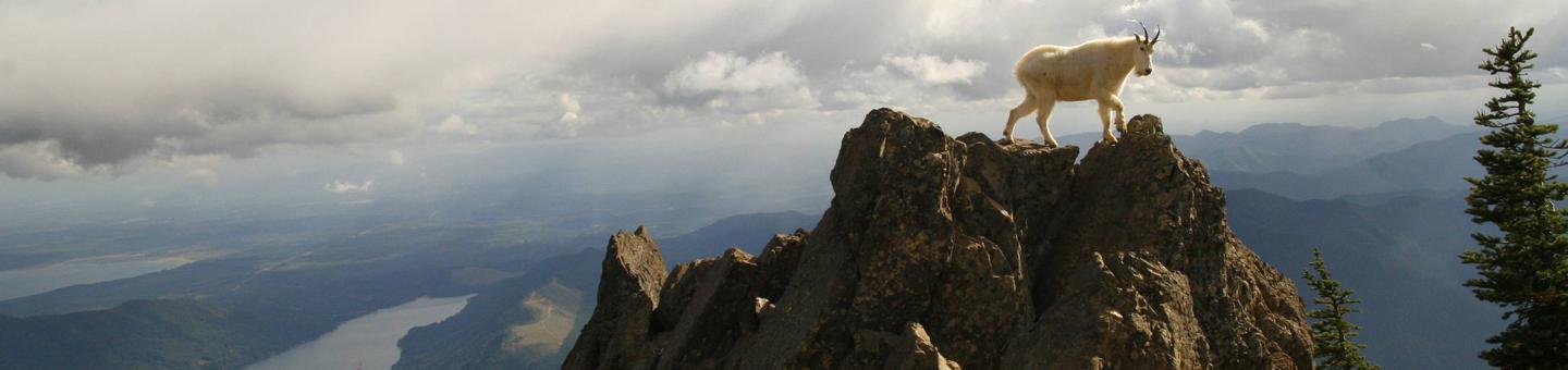
Olympic National Forest offers diverse recreation opportunities for everyone. Experience the rushing rivers, coastal rain forests, alpine wildflowers and views of the Puget Sound from mountain peaks. Wilderness areas offer solitude and a chance to experience the rich biodiversity of the Olympic Peninsula.
Provide & view feedback about our trails at our online trail register.
Jump to recreation current conditions below the map.
The Olympic Outlook is our free forest-wide recreation newspaper available at forest offices.
Where do you want to go?
Know Before You Go!
- Review information to help plan your trip including maps, recreation passes, forest regulations, & safety.
- Go to Washington hunting seasons.
RecAreaDirections
Open with Google Map
Misc
| Stay Limit | |
| Reservable | false |
| Keywords | |
| Map Link | |
| Contact Phone | |
| Contact Email |
Permits info
Facilities
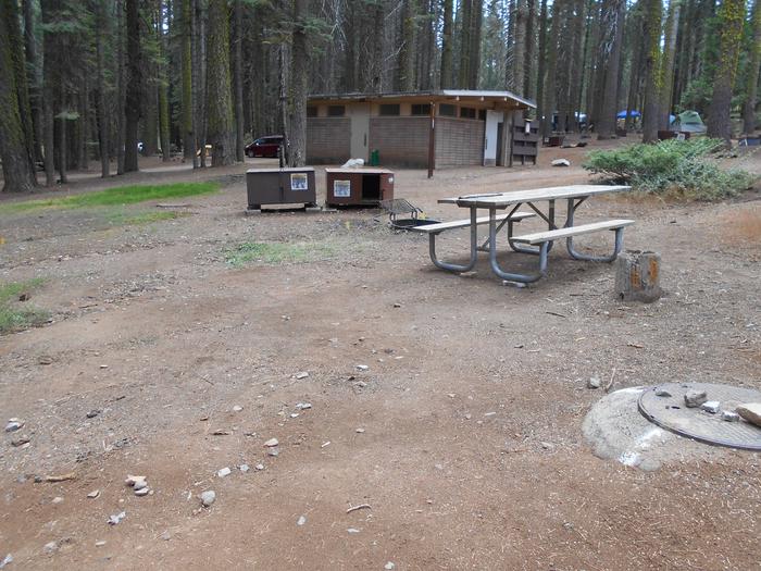
WILLABY CAMPGROUND Campground
List of CampsitesOverview
With all campsites located near the shoreline of glacially carved Lake Quinault, visitors are sure to enjoy the beautiful shoreline and interpretive opportunities in the area. From old-growth trees in the surrounding rain forest to excellent fishing, Willaby Campground's location is ideal for outdoor enthusiasts.Recreation
The forest features 10 miles of hiking trails and many waterfalls within walking distance of the campground. Lake Quinault is part of the Quinault Indian Nation As such,You must have a fishing permit and or boat permit through the Quinault Indian Nation. Both may be purchased through local merchants. Lake Quinault Lodge offers boat and kayak rentals as well as a number of interpretive tours.Facilities
There are 21 campsites that can accommodate tents, trailers and RVs up to 16 feet in length, however no hook ups are provided. Some sites are in wooded areas and others are not; many of the sites have a view of the lake. The campground has a potable water system. The site also has a barrier-free flush toilet as well as several accessible camp and picnic sites.Natural Features
The forested slopes of Olympic National Park provide a scenic backdrop across Lake Quinault. Towering conifers including Sitka spruce, Douglas-fir, western hemlock and western red cedar provide dense shade for this beautiful setting. The forest floor is covered with lush rain forest plants including moss, ferns, false lily-of-the-valley and oxalis.contact_info
For facility specific information, please call (360) 288-2525.Nearby Attractions
Nearby, Lake Quinault Lodge offers a restaurant and gift shop. Short trails in the area include the Big Spruce Tree Trail, Forest Service Nature Trail, Kestner Homestead Trail and the Maple Glade Trail. Explore the ocean beaches close-by as well as the National Fish Hatchery. For a more adventuresome day, drive up the valley to hike along the rivers or climb the 4,200 ft. Colonel Bob Peak for expansive views of the mountains and valleys on a clear day.COHO CAMPGROUND Campground
List of CampsitesOverview
Coho Campground is situated on the west shore of Wynoochee Lake, part of the emerald paradise that is Olympic National Forest. Evergreen conifers and hardwoods provide a beautiful wooded setting.Recreation
Recreational opportunities abound, including picnicking, swimming, hiking, boating, hunting and fishing, all possible within the area. The Working Forest Nature Trail, an accessible trail beginning inside the campground, is a 1/2-mile interpretive journey into how the natural resources are hard at work providing opportunities and commodities for the American public.Facilities
The campground offers 44 standard campsites that will accommodate tents, trailers and RVs up to 36' in length. Two group sites will accommodate up to 16 people each. There are nine walk-in tent camping units, one of which will accommodate 12 people.
Three yurts are also available for reservation with each accommodating a maximum of six people and two vehicles. There is a short walk of 300-500 feet to reach each yurt. Yurt sites #57 and #58 do not allow additional tents, trailers, or RV camping. Yurt site #50 will accommodate an additional tent. The yurts are non-smoking units .
Coho has flush toilets, drinking water and trash collection, as well as picnic tables, campfire rings and a paved road. Trails and a boat ramp are also available. An RV dump station is located just outside the campground on Forest Road 2294.
Natural Features
Olympic National Forest is located on the Olympic Peninsula in the northwest corner of Washington State, known as the Evergreen State. The Olympic Peninsula is an unique geographic province consisting of five major landscapes: temperate rain forest, rugged mountain terrain, large lowland lakes, cascading rivers and saltwater beaches. Here the flora and fauna provide interest beyond the imagination.Nearby Attractions
Scenic Spoon Creek Falls and Wynoochee Falls are both accessed by short trails nearby. The 16-mile Wynoochee Lake Shore Trail circles the entire lake and is open to mountain bikes.At the nearby Wynoochee Dam, visitors can enjoy exhibits at the vista overlook and a dramatic view of the river gorge just below the dam. Swimming and picnicking facilities are available at the dam.
LOUELLA CABIN Campground
List of CampsitesOverview
Located in the northeast portion of Olympic National Forest, Louella Cabin offers guests a unique lodging experience. It was built in 1912 by Forest Service employee, E. M. Cheney, who dedicated the structure to his wife, Louella. A fireguard was stationed at the cabin during the summer and fall. During the Great Depression, a Civilian Conservation Corps (CCC) camp was built in the lower part of the meadow below the cabin and consisted of barracks, a bathhouse and mess hall. The CCC has worked on many projects in the area, including fire lookouts, trails, bridges, roads and planting trees after forest fires. After the CCC camp closed in 1939, the guard station was used by various agencies until 1976. Today, the site offers guests year-round recreation and relaxation in Olympic National Forest. Access to the cabin is by vehicle; however, snow chains may be required in winter. The cabin offers several amenities, but guests will need to bring a few of their own supplies for a truly enjoyable stay.Recreation
The cabin is conveniently located near the Buckhorn Wilderness, which offers excellent opportunities for backpacking, horseback riding, hunting, mountain climbing and hiking, with over 58 miles of trails. Anglers will enjoy fishing the Dungeness River, and are drawn to it for steelhead and cutthroat trout, as well as chinook, coho and pink salmon. The river has its headwaters high on Mount Mystery in Olympic National Park, and descends into Dungeness Bay on the Strait of Juan de Fuca.Facilities
The four-room cabin can accommodate six people. The living room has a futon. One bedroom has a queen bed and the other has twin bunk beds. The kitchen has a table and chairs, cook stove, refrigerator, dishes, pots, silverware and cooking utensils. The cabin also has electricity and a propane heater. Propane is furnished. An outdoor portable toilet is available that is serviced weekly. There is also a fire ring near the cabin for outdoor barbecuing and campfires, as well as a covered picnic table. No drinking water is available at this facility. Guests must bring enough water for cooking, drinking and other household uses throughout their stay. Guests need to provide their own sleeping bags, pillows, flashlights, towels, dish soap, matches, cleaning supplies first aid kit, toilet paper and garbage bags. All trash and food must be packed out, and guests are expected to clean the cabin before leaving. Please leave nothing behind, if you would like to make a donation of goods to the cabin please contact the Ranger Station for a list of needs.Natural Features
Louella Cabin sits on a gentle slope overlooking a valley and flanked by a canopy of towering Douglas fir.Buckhorn Wilderness is accessible from the cabin. Located in the northeast corner of Olympic National Forest, the wilderness area is divided into northern and southern portions by the Dungeness River. The northern portion descends from higher mountainous terrain to lowlands, heavily forested in fir, hemlock, and cedar with an understory of moss, ferns, and berry bushes. South of the river, the terrain soars skyward to alpine meadows and rocky ridges.
Magnificent old-growth western hemlock, western red cedar and Douglas fir dominate the forest, providing habitat for elk, black-tailed deer, black bears and mountain lions.
Nearby Attractions
Take some time to visit the area around the historic Tubal Cain mine in the nearby Buckhorn Wilderness or hike to views of the Olympic mountains and Buckhorn Wilderness from the Ned Hill Lookout site. Visitors also enjoy access to Olympic National Park from this area. Take some time to visit Olympic National Park, known for its diverse and spectacular ecosystems.HAMMA HAMMA CABIN Campground
List of CampsitesOverview
The Hamma Hamma Cabin is a historic cabin that offers guests a tranquil setting to relax and recreate. Formerly a guard station, the cabin was built from 1936-1937 by the Civilian Conservation Corps. The facility was used as an administrative site for Forest Service fire and trail crews. The site is nominated to the National Register of Historic Places for the skill and craftsmanship that went into its construction and architecture. The cabin is open year-round and is typically accessible by car; however, snowy conditions may require alternative transportation such as cross-country skis or snowshoes. Many amenities are offered, so guests only need to bring a few of their own supplies for an enjoyable stay.Recreation
Hamma Hamma Cabin is conveniently located near The Brothers Wilderness, Mt. Skokomish Wilderness, Hood Canal, and Olympic National Park. Numerous activities, such as hiking, mountain climbing, fishing, hunting and river walks are available in the area. From Hamma Hamma Cabin, guests can wander the Living Legacy Trail, an interpretive trail that details the work of the Civilian Conservation Corps. At only a quarter mile, the trail offers a scenic, open view of the Hamma Hamma River. In the spring, Harlequin ducks arrive from the sea to nest in this freshwater spot. Lena Lake Trail #810 offers a great hike a few miles west of the cabin. Anglers will enjoy fishing the scenic Hamma Hamma River for chum, pink, chinook, coho and steelhead.Facilities
Hamma Hamma Cabin can accommodate up to six guests. The single-story cabin features a living room with a hexagonal bay window overlooking the Hamma Hamma River drainage, and is furnished with a futon that unfolds into a bed. There are two bedrooms, one with a double bed and one with bunk beds, all with mattresses. The kitchen is equipped with a table and chairs, stove, dishes, pots, silverware and cooking utensils. The bathroom has a flush toilet. The cabin is equipped with a propane heater and propane lights. An outdoor picnic table and fire ring are available for cooking and campfires. Drinking water is not available. The indoor plumbing is for the toilet only and is not potable. Guests must bring plenty of water for drinking, cooking and washing. Guests need to provide their own sleeping bags, linens, towels, dish soap, matches, first aid kit, toilet paper and garbage bags. All food and garbage must be packed out, and guests are expected to clean the cabin before leaving. Please leave nothing behind, if you would like to make a donation of goods to the cabin please contact the Ranger Station for a list of needs.Natural Features
Hamma Hamma Cabin sits on a landscaped clearing surrounded by old-growth Douglas firs, dogwoods and rhododendrons. The scenic Hamma Hamma River flows nearby, which is fed by the Mildred Lakes within the Mt. Skokomish Wilderness and drops from the eastern slope of the Olympic Range into the Hood Canal. The name Hamma Hamma comes from a Twana village once located at the river's mouth and called Hab'hab, referring to a reed that grows along the river's banks. The Brothers and Mt. Skokomish Wilderness, located in the southeast corner of Olympic National Forest, are accessible from the area. Bold rocky summits and numerous sharp spires dot the ridges at elevations ranging from 2,000 to over 6,000 feet. Magnificent old-growth western hemlock, western red cedar and Douglas fir dominate the forest in the lower elevations, providing habitat for elk, black-tailed deer, black bears and mountain lions. Higher elevations display firs, pines, dwarf juniper and open rock faces.Nearby Attractions
Take some time to visit the 3.5 mile Lena Lake trail or go beyond to the Valley of the Silent Men.INTERROREM CABIN Campground
List of CampsitesOverview
Interrorem Cabin is located beneath magnificent stands of Big Leaf Maple trees, offering guests an ideal location for relaxation and recreation. The cabin was built in 1907 as the first administrative site in the Olympic National Forest. Emery J. Finch, Ranger and Hoodsport pioneer, built the cabin for his new bride, Mabel, and they moved in 1908. Today, the site offers guests a unique lodging experience year-round in Olympic National Forest. The cabin is accessible by car. Basic amenities are offered, but guests will have to bring some of their own supplies and gear.Recreation
A nature trail with interpretive signs and historic photos that describe the life of Emery and Mabel Finch is located behind the cabin. Mr. Finch, an avid fisherman, was responsible for building the Ranger Hole Trail, a path to his favorite fishing spot on the Duckabush River. A few trout and some wonderful views of the river can be caught here.Facilities
The historic 24x20-foot one-story cabin is a square, peeled-log building and includes an open porch across its facade and a pyramidal cedar shake roof. It can accommodate up to four guests. The kitchen is furnished with a table and chairs, cookware, utensils, propane cook range, and lights. The living room has a futon and the bedroom has twin bunk beds. A propane heater keeps it cozy during the winter months. Propane is furnished.
Potable water is available from an outdoor hand pump. An outhouse with vault toilet, fire ring and picnic table are located on the cabin grounds.
No electricity or indoor plumbing is available at this facility. Guests need to provide their own sleeping bags, pillows, towels, dish soap, cleaning supplies matches, first aid kit, toilet paper and garbage bags. All trash and food must be packed out, and guests are expected to clean the cabin before leaving. Please leave nothing behind, if you would like to make a donation of goods to the cabin please contact the Ranger Station for a list of needs.
Natural Features
Interrorem Cabin sits on a grassy clearing located in the Duckabush Recreation Area, with nearby access to the Duckabush River, The Brothers Wilderness, Olympic National Park and the Hood Canal. The Brothers Wilderness is located in the eastern portion of the Olympic National Forest just south of Buckhorn Wilderness and north of Mt. Skokomish Wilderness. The cold,clear Duckabush River runs through the drainage. At 6,866 feet, The Brothers is the highest peak in the area, with a double summit that ranks among the most popular climbs in the Olympics. Near the cabin, western hemlock, western red cedar and Douglas fir dominate the dense forest, providing habitat for elk, black-tailed deer, black bears and mountain lions. Higher elevations are home to the endemic Olympic Marmot.Nearby Attractions
Murhut Falls, a short hike to a beautiful waterfall. Also nearby are several public access sites to the fjord-like Hood Canal. Visitors can also enjoy taking some time to visit Olympic National Park, known for its diverse and spectacular ecosystems.Mount Skokomish Wilderness Facility
The 13,015 acre Mt. Skokomish Wilderness is located in the southeast portion of the Olympic National Forest, north of Lake Cushman in Mason County. This Wilderness includes very steep terrain ranging in elevation from 800 feet near Lake Cushman to the 6,612 foot summit of Mt. Stone. Other major peaks include Mt. Skokomish 6,434', Henderson 6,000', Pershing 6,154', and Washington 6,255'. Barren ridges and numerous steep-faced rock outcrops are present throughout this Wilderness.
Stands of old-growth occur on the lower slopes consisting primarily of Douglas-fir, western hemlock and western red cedar. At the upper elevations, subalpine fir and western white pine give way to rock and scattered alpine vegetation commonly found in the subalpine and alpine zones.
The Hamma Hamma River is the only major stream flowing through the Wilderness. Mildred Lakes are a popular destination in the Wilderness.
Please follow regulations and use Leave No Trace techniques to help keep this area wild, clean, and pristine.
- Elevation Range: 800' to 6,612'
- Mt. Skokomish Wilderness recreation opportunity guide (PDF)
- Key Access Points: Trail and trailhead access information
Wonder Mountain Wilderness Facility
This 2,349 acre Wilderness is one of the smallest wildernesses in the Western United States. Wonder Mountain Wilderness borders the Olympic National Park and is located west of Lake Cushman in Mason County. Terrain is generally rugged and ranges from a low of 1,740 feet in McKay Creek to the summit of Wonder Mountain at 4,758 feet. The lower slopes are heavily timbered with dense stands of Douglas- fir, western hemlock, and Pacific silver fir. Massive rock outcrops and precipitous pinnacles are common in the higher elevations.
Wonder Mountain is the highest peak in the Wilderness. Wonder Ponds and several other ponds are located in the high headwaters of McKay Creek. There are no rivers or major streams in the Wilderness.
Please follow regulations and use Leave No Trace techniques to help keep this area wild, clean, and pristine.
- Elevation Range: 1,740' to 4,758'
- Wonder Mountain Wilderness recreation opportunity guide (PDF)
- Key Access Points: ALERT! Cross-country access only. There are no constructed trails in the Wonder Mountain Wilderness. The two major access roads have seasonal closures from October 1 to May 1 to protect wildlife.
Pacific Ranger District-Forks Facility
 437 Tillicum Lane
Forks, WA 98331
Phone: (360) 374 6522
TDD (360) 374 6522
Available at Forks office: Maps. Firewood, mushroom, salal and Christmas tree permits. See: Special Forest Product permit information.
Klahowya Campground Campground
List of CampsitesAdjacent to the south shore of the Sol Duc River, the rain forest setting hosts an accessible interpretive nature trail, fishing, picnicking, and trails to explore the natural beauty.
During the summer when the river is low water, there is tubing or float run between the 'Day Use' areas next to Sites 9 and 45.
Interpretive programs are presented in the amphitheater during the summer.
Camp Creek Olympic Discovery Trailhead Facility
This site provides western access to the Olympic Discovery Trail that parallels the winding course of the Sol Duc River. It is a dog-friendly trail that is also open to touring bikes, mountain bikes, stock, wheelchairs, and hikers. The trail follows the original Spruce Division Railroad Grade east for about six miles. This six miles section of trail also passes through 100 year old temperate forest stands of western hemlock and giant sword ferns.
Historic area: In 1916, due to World War I, the Spruce railroad was initiated to harvest the giant spruce in the Sol Duc Valley. The properties of the wood from these giants made it suitable for airplanes, created for the war. At the turn of the century, much of the surrounding lands were early homesteads.
Along this trail segment, near Camp Creek, is the start of the great 1951 Forks Fire. The fire burned over 30,000 acres from this railroad grade into Forks in less than eight hours.
Amenities iclude: An accessible vault toilet, picnic tables, two stock trailer parking pads, a hitching post and a short stock trail on the north end of the trailhead to access the Olympic Discovery Trail.
Gatton Creek Campground/Day Use Area Campground
List of CampsitesGatton Creek Campground is located on the south shore of Lake Quinault next to Gatton Creek, a small rainforest stream. Campsites and the picnic units are located along the shore of the lake with views across the water to the forested slopes of Olympic National Park.
The area provides opportunities to swim and use non motorized boats nearby. There are 5 walk-in campsites that accommodate tents. There are also 3 picnic units. Nearest boat ramps are located at Willaby and Falls Creek Campgrounds.
Access Gatton Creek Trail #888 from the trailhead across from the campground along South Shore Road.
Lake Quinault Lodge Facility
A grand and rustic lodge built in 1926 in the heart of the Quinault Rain Forest among ancient Sitka spruce, Douglas fir, western red cedar, and western hemlocks, on the south shore of Lake Quinault. The two-story historic lodge was built in the mid-20s and has welcomed thousands of visitors from all over the world including President Franklin D. Roosevelt in the early 1930s.
A restaurant, gift shop, indoor swimming pool, sauna, game room and small conference room are available.
Nearby trails make it easy to explore the temperate rain forest found on the western side of the Peninsula. The Quinault National Recreation Trail System adjacent to the lodge on the south shore of Lake Quinault contains many family friendly hiking options to explore this unique ecosystem. To view segments of the trail and learn more explore the Quinault National Recreation Trail System interactive map.
Quinault Rain Forest Trailhead Facility
Provides access to: Quinault Rain Forest Nature Trail #855 and the Quinault National Recreation Trail System.
Large parking lot that will accommodate large recreation vehicles, vehicles pulling trailers and buses. Visitor information board and two day use picnic sites with tables are available.
To view all segments of the Quinault National Recreation Trail System and learn more explore the Quinault National Recreation Trail System interactive map.
Big Creek Upper Loop #827.1 Facility
This trail passes through mature second growth and affords the hiker an excellent walk in the forest. Upper Big Creek Loop Trail #827.1 makes a four mile loop around Big Creek Basin. To access the trail, start at the picnic shelter, cross the lower Big Creek Bridge and then turn left. The trail proceeds in a northerly direction for 1.7 miles to a bridge across Branch Creek. Near this point a side loop trail goes to the confluence of Big and Branch Creeks. From Branch Creek, Mt. Ellinor Connector Trail #827.2 connects the Loop trail to the Lower Mt. Ellinor trail in 1.3 miles. The Loop trail runs northeasterly 400 to the Big Creek Bridge then continues, crossing several creeks, until the campground is reentered at 4.0 miles. Each creek crossing and confluence are excellent places to enjoy lunch (benches provided) in beautiful surroundings.
Via trails Big Creek Upper Loop Trail #827.1, Mt. Ellinor Connector Trail #827.2, and Mt. Ellinor Trail #812, a hiker can trace the historic climbing route from Big Creek Campgound to the summit of Mt. Ellinor, total 6.2 miles.
Brown Creek Campground Campground
List of CampsitesBrown Creek Campground is located along the shore of the South Fork Skokomish River at the confluence with Brown Creek. Evergreen conifers and hardwoods provide lots of shade at this campground. There are 20 campsites in Brown Creek Campground: twelve will accommodate trailers and RVs and eight of the sites are suitable for tents. There is one ADA accessible campsite. Six sites at Brown Creek Campground along forest Road 2430 are open year-round. There is also an accessible vault toilet also open year-round nearby at Brown Creek Trailhead.
The family friendly Brown Creek Nature Loop Trail #877 can be accessed from within the campground. There are accessible vault toilets and potable water within the main campground during the season.
Collins Campground Campground
List of CampsitesCollins is a quiet campground located along the shore of the Duckabush River. Several of the campsites are near the river. There are 16 campsites, 10 that will accommodate tents, trailers, and RVs. Six of the campsites are tent sites with spurs for parking.
Warning: River contains swift water, rapids, and waterfalls. River is not floatable. Use extreme caution in or near the water.
Dungeness Forks Campground Campground
List of CampsitesCampground is located at the fork of the Dungeness and Graywolf Rivers and is a shaded, forested area with evergreen conifers.
There are 10 campsites that will accommodate tents. Trailers and motorhomes are not recommended due to steep one lane unpaved road access.
Falls View Campground Campground
List of CampsitesForest of conifers and rhododendrons located high above the Big Quilcene River. Nearby Hood Canal and Quilcene Bay are known for their oysters and clam beds with swimming, boating and waterskiing also available. Many hikes are within ½ to one-hour drive from Falls View Campground.
Two separate camping loops will accommodate different types of camping vehicles. The right loop offers 14 trailer/RV sites, including six pull through sites for larger RV’s. Some will accept trailers or motorhomes up to 35 feet. The left loop has 16 camper/tent sites.
Falls View Canyon/Falls View Loop Trailhead is within the campground which provides access to Falls View Canyon Trail #868 and Falls View Loop Trail.
Hamma Hamma Beaver Pond #815 Facility
This 0.5 mile trail is a rolling grade in a wetland pond setting. There is a bench overlooking the pond.
Hamma Hamma Campground Campground
List of CampsitesCampground is located along the shore of the Hamma Hamma River. Evergreen conifers and hardwoods provide lots of shade. The Living Legacy Trail leaves from a trailhead in the campground. The first 1/4 mile is accessible and overlooks the Hamma Hamma River.
There are 15 campsites that will accomodate tents, trailers, and RV's up to 21 feet in length. Tables, fire rings, paved road, and accessible vault toilets are available. Toilet access surface is compact gravel.
Lebar Horse Camp Facility
Large evergreen conifers and hardwoods provide plenty of shade. 13 campsites are available that accomodate a horse trailer and camper with room to hitch horses to a highline near each camp unit.
Vault toilet and picnic shelter. No potable water is available at this time.
Please note: This campground is reserved for visitors with stock. Nearby Brown Creek Campground is open for campers without stock.
Skokomish Upper/Lower South Fork Trailhead Facility
Provides access to: Lower South Fork Skokomish River Trail
Bogachiel Rain Forest River Trailhead Facility
Provides access to: Bogachiel Rain Forest River Trail #825 and Ira Spring Wetland Trail which create a loop option.
Bogachiel Rain Forest Trail follows the Bogaciel River and enters Olympic National Park at 1.5 miles, where it becomes Bogachiel River Trail. (No dogs allowed in Olympic National Park)
There is ample parking available, vault toilet, and a information bulletin board.
Gatton Creek Trailhead Facility
Provides access to: Gatton Creek Trail #888 which is part of the Quinault National Recreation Trail System.
This trailhead is located across South Shore Road from Gatton Creek Campground at Quinault Lake.
Mt. Muller - Rd. 3040 North Trailhead Facility
Provides access to: Mt. Muller Trail #882
Copper Creek Trailhead Facility
Provides access to: Copper Creek Trail #876
Dead Fall Trailhead Facility
Provides access to: Deadfall Trail #849 an alternative route to Mt. Zion via the east side.
Lower Big Quilcene Trailhead Facility
Provides access to: Lower Big Quilcene Trail
Lower Dungeness/Gold Creek Trailhead Facility
Provides Access to:
Lower Dungeness Trail #833.3 - A multi-use trail within conifer forest above Dungeness River.
Gold Creek Trail #830 - Mulit-use trail within conifer forest on steep mountain slopes in the Dungeness drainage. The trail is heavily wooded with viewpoints. Water is scarce.
Snow Creek Trailhead Facility
Provides access to: Snow Creek Trail #890 part of the Pacific Northwest Trail.
Wynoochee Lake Shore Trailhead - Coho Campground Campground
List of CampsitesProvides access to: Wynoochee Lake Shore Trail #878.
Potable water and flush toilets are available at Coho Campground when the campground is open during the summer season. Parking is available at the walk-in or boat launch parking lots inside the campground.
Buckhorn Wilderness Facility
Buckhorn Wilderness is located in the northeast portion of the Olympic National Forest. A patented mining claim involving 216 acres of private land is within the Wilderness. This Wilderness encompasses 44, 258 acres and is the largest on the Olympic National Forest. It includes very steep terrain ranging in elevation from 1,000 feet near the Gray Wolf River, to the summit of Mt. Fricaba at 7,134 feet. Other major peaks include Buckhorn Mountain, 6,988', Iron Mountain, 6,950' and Tyler Peak 6,350'. Barren ridges and steep, rocky cliffs and peaks are common in the higher elevations.
Stands of old-growth Douglas-fir, western hemlock and western redcedar occur on the lower slopes. At the higher elevations, subalpine fir and western white pine give way to alpine meadows. The Gray Wolf, Dungeness and Big Quilcene Rivers are the major streams flowing through the Wilderness.
Please follow regulations and use Leave No Trace techniques to protect this unique area.
- Elevation Range: 1,000' to 7,134'
- Buckhorn Wilderness recreation opportunity guide (PDF)
- Key Access Points: Trail and trailhead access information
The Brothers Wilderness Facility
The Brothers Wilderness is located on the east side of the Olympic National Forest, north of Lena Lake in Jefferson County. Except for a relatively gentle valley area in the East Fork of Lena Creek, the entire 16,682 acre Wilderness is quite precipitous with tree covered slopes extending to about 5,000 feet. Elevation ranges from 699 feet near the Dosewallips River to the 6,866 foot summit of The Brothers. Other major peaks include Mt. Jupiter Ridge, and St. Peter's Dome. Western hemlock, Douglas-fir and western red cedar dominate the lower slopes. Pacific silver fir and mountain hemlock cover the upper slopes before giving way to subalpine fir and mountain meadows and rock outcrops.
The Duckabush River is the only major stream flowing through the Wilderness. Jupiter Lakes and several small ponds are located on Jupiter Ridge.
Please follow regulations and use Leave No Trace techniques to help protect this unique area.
- Elevation Range: 600' to 6,866'
- Printable The Brothers Wilderness recreation opportunity guide (PDF)
- Key Access Points: Trail and trailhead access information.
Colonel Bob Wilderness Facility
Colonel Bob Wilderness is located east of Lake Quinault in the southwest corner of Olympic National Forest. This 11,961 acre wilderness contains steep, rugged topography. Elevations range from 300 feet in the Quinault Valley to 4,509 feet along the eastern boundary.
Most of the Wilderness lies above the 1,500 foot elevation level. The lower slopes are moderately to heavily forested with stands of western hemlock and Pacific silver fir, mixed with western redcedar, Douglas-fir and Sitka spruce.
The Colonel Bob Wilderness has temperate rain forest conditions with an annual precipitation that exceeds 150 inches. Lush ferns, shrubs, moss, wild flowers and lichens carpet the forest floor. At higher elevations, subalpine and alpine vegetation, green meadows, rock outcrops and rugged peaks dominate the wilderness landscape. The view of Lake Quinault is spectacular.
Please follow regulations and use Leave No Trace techniques to protect this unique area.
- Elevation Range: 300' to 4,509'
- Colonel Bob Wilderness recreation opportunity guide (PDF file)
- Key Access Points:
Upper West Fork Humptulips Trailhead Facility
Provides upper access to: West Fork Humptulips Trail #806
Mt. Ellinor Lower Trailhead Facility
Provides lower access to: Mt. Ellinor Trail #812
The lower trail climbs gently through the forest for the first mile, and then becomes steeper and increasingly rough. At timberline, 2.5 miles from the lower trailhead, the trail intersects the winter climbing route to the right and the summer trail route to the left. This is a good turnaround point for inexperienced hikers.
Brown Creek Interpretive Trailhead Facility
Provides access to: Brown Creek Nature Loop Trail #877 a 0.8 mile accessible trail with interpretive signs and great wildlife viewing opportuinities.
This trailhead is located adjacent to Brown Creek Campground along the shore of the South Fork Skokomish River near it's confluence with Brown Creek. There are six year-round campsites outside the main campground along Forest Road 2340 along Brown Creek and South Fork Skokomish River.
This trailhead provides a year-round accessible vault toilet. There is potable water available at this trailhead during the season only.
