
Alpine Loop
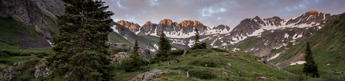
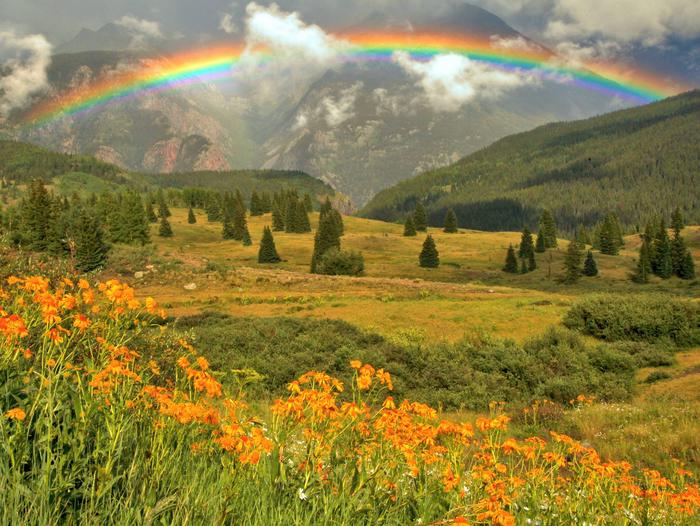
The Alpine Loop leaves pavement and people behind, crossing the remote, rugged, spectacular heart of the San Juan Mountains. Created by the forces of nature, these mountains, valleys, streams, and lakes now offer visitors the chance to explore the wild back country of Colorado. If height is what you are looking for, the
Alpine Loop has hiking trails that access five of Colorado's "fourteener&" peaks (14,000 feet or more) and Cinnamon and Engineer pass both demand a high clearance, 4-wheel drive vehicle to climb over the 12,000 plus foot passes. Pristine mountain views, hiking and biking trails, great camping
opportunities, and ample solitude are some of the rewards for taking the road less traveled.
###Early Trails and People
The trails that visitors enjoy today were developed by early travelers to the area. Native American Indians came to the area to hunt and gather food. In the late 1800s miners created a network of roads in their quest for silver, gold, lead, and zinc. The towns they established are abandoned now, but some buildings remain for visitors to see.
RecAreaDirections
Navigating the Byway:
The Alpine Loop follows back country roads through the Alpine Triangle BLM recreation area. The byway has endpoints near Ouray and Silverton, but can also be accessed through Lake City to the east.
From the north, the byway begins just south of Ouray. Follow the byway east through Engineer Pass or south toward Silverton along the Animas River. From Lake City, follow the byway either west toward Engineer Pass or south and then west as the byway follows the Gunnison River toward Cinnamon Pass. Continue on from the pass to complete the loop and head either north to Ouray or south to Silverton.
Misc
| Stay Limit | |
| Reservable | false |
| Keywords | |
| Map Link | |
| Contact Phone | |
| Contact Email |
Permits info
Facilities
no data available
