
Chesapeake Country Scenic Byway
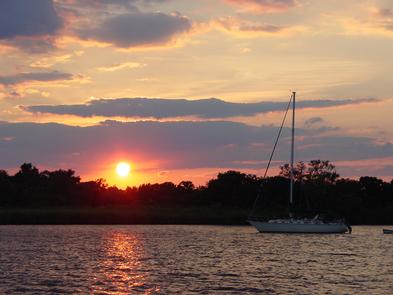
Celebrate life on the Chesapeake Bay. Observe watermen bringing their bounty to shore, visit historic towns, and travel through scenic stretches of productive farmland. See the truly special landscape of the Mid-Atlantic Region and gain an appreciation for the working life of Maryland's Eastern Shore farmers, watermen, and merchants.
RecAreaDirections
Getting to the Byway:
Baltimore/Washington International Airport (BWI), MD
* Take exit 1 to Aviation Blvd/MD-170.
* Turn left at Cromwell Park Dr.
* Merge onto I-97 southbound.
* Take the exit onto US-301 N/US-50 E
* Turn left at the end of the exit ramp onto Route 8 to Stevensville.
* Turn left onto Route 18, the beginning of the byway.
Ronald Reagan Washington National Airport (DCA), VA
* From George Washington Parkway, take exit onto I-395 northbound to Washington.
* Turn right at New York Ave/US-1/US-50.
* Take exit 37 and merge onto MD-8 to Stevensville.
* Turn left onto Route 18, the beginning of the byway.
Washington-Dulles International Airport (IAD), VA
* Take the exit to VA-267 eastbound.
* Take the exit to I-495 northbound.
* Take exit 19A and merge onto US-50 northbound.
* Turn left at the end of the exit ramp onto Route 8 to Stevensville.
* Turn left onto Route 18, the beginning of the byway.
In good driving conditions, you can get to the byway in 1 hour and 20 minutes. However plan for 2 hours and 10 minutes in traffic.
Washington, DC
* Take the first exit off of Route 50/301.
* Turn left at the end of the exit ramp onto Route 8 to Stevensville.
* Turn left onto Route 18, the beginning of the byway.
Navigating the Byway:
The Upper Eastern Shore section of the Chesapeake Country Scenic Byway runs between the east side of the Chesapeake Bay Bridge and the Chesapeake and Delaware (C&D) Canal.
###Stevensville to Kent Narrows###
* Begin your experience in Stevensville on Kent Island.
Follow MD 18, out of Stevensville, through Chester, and across the old Kent Narrows Bridge to Kent Narrows.
###Kent Narrows to Church Hill
* Return to MD 18 and continue through Grasonville.
* Along this stretch of the byway, areas of open agricultural fields and woodland will lead you to Nesbitt Road.
* At Nesbitt Road, take US 301 and return to MD 18 by taking your first left after crossing under the US 50 overpass.
* Follow MD 18 to downtown Queenstown, one of Maryland's earliest colonial ports of entry.
* Continue along MD 18 to MD 213.
* Turn left onto MD 213, which will take you to downtown
Centreville, Queen Anne's county seat.
* Continue on MD 213 North towards Church Hill.
###Church Hill to Chestertown###
* Return to MD 213 North. The predominantly rural landscape and working agricultural lands along the way will lead you through Kingstown and over the Chester River Bridge, which serves as a scenic gateway into Chestertown, a colonial port on the Chester River.
* Follow MD 213 North to discover Washington College, the only college George Washington authorized to use his name.
###Chestertown to Rock Hall###
* Continue a short distance north on MD 213, and turn left onto MD 291.
* Bear right onto MD 20 West, which will take you to Rock Hall.
###Rock Hall to Georgetown###
* From MD 20, make a left onto MD 291 and then another left onto MD 213 North.
* Continue north to Galena.
* Follow MD 213, making a left at the only traffic light in
Galena.
* A short drive farther on MD 213 North, you will come to the river port of Georgetown on the southern bank of the Sassafras River.
###Georgetown to Chesapeake City###
* On the other side of the Sassafras River, you enter Cecil County and the town of Fredericktown. The communities of Georgetown and Fredericktown line the two sides of the Sassafras River.
* Continue on MD 213 North towards Cecilton.
* Return to MD 213 North, following to Cayots Corner and
Chesapeake City.
Misc
| Stay Limit | |
| Reservable | false |
| Keywords | |
| Map Link | |
| Contact Phone | |
| Contact Email |
Permits info
Facilities
no data available
