
Crowley's Ridge Parkway - Missouri
Sharecropping, cotton, sand, swamps, peaches, yucca plants and the Old South – this route in the southeast Missouri Bootheel has them all. The geography of Crowley's Ridge isolated it like an island. As settlers moved in, they formed a close-knit community maintaining their culture, religion and values while changing the landscape.
Crowley's Ridge Parkway is not only rich in geological history but Civil War history as well. The byway runs along Missouri State Route 25 in Dunklin County starting at the Stoddard County line heading south ending at Kennett, Missouri and runs from the Intersection of Business Highway 25 and County Highway 7 and West on Highway WW to Campbell, Missouri.
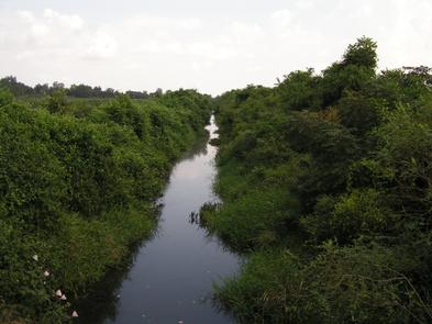
Crowley's Ridge as a geological formation is home to unique plant and animal species due to the climate and land changes over millions of years. These changes are what made the area what it is today. The unique soils allow for farmers to raise crops from peaches and watermelons to cotton and pink-eye purple hull peas.
Crowley's Ridge Parkway is also rich in Civil War history. The Ridge tells the story of numerous Union and Confederate skirmishes; the Succession Treaty at Clarkton; Missouri founding "The Independent State of Dunklin"; the story of Billy DeMint and the Civil War actions of M. Jeff Thompson, Missouri's Swamp Fox and Sam Hildebrand, The Big River Bushwacker.
When the Civil War ended, there were stories of hope offered by the generosity of two former slaves, Charles and Bettie Birthright. The Birthrights dedicated their lives to the education of the children of Dunklin County and donated resources to construct the first multi-story brick educational structure in Dunklin County. At death, the Birthrights bequeathed their estate in Tuscaloosa, Alabama to Stillman Institute (now Stillman University) for the education of young black ministers. The largest building on Stillman campus is Birthright Hall in honor of Charles and Elizabeth Birthright.
RecAreaDirections
Getting to the Byway:
###Missouri Section * Take I-55 south to New Madrid. * Get on US-62 and go west to Main St. in Malden where the byway begins. ####From Memphis, TN * Take I-40 west to AR-284 in Forrest City, AR where you enter the byway. * Continue north to the MO section of the byway. ####The Eastern End of the Byway The eastern end of the byway can be reached by US Highway 62 east from St. Francis, Arkansas. This route is a continuation of Arkansas' Crowley's Ridge National Scenic Byway. ####The Southern End of the Byway The southern end of the byway at Kennett can be reached from either Rector, Arkansas (on Arkansas' Byway), on Highways 90 and 84, or from I-55 at exit 19 going west on Highway 84. ####The Northern End of the Byway The northern end of the byway can be reached from I-55 (exit 66 at Sikeston) going west on US Highway 60 to Dexter, and then traveling south on Highway 25.
Navigating the Byway:
###Missouri Section
####From Kennett to Malden
* The byway starts on SR 25 in Kennett.
* Drive 25 miles north on SR 25 to Malden. At the Y-junction with US 62 south of Malden, continue left on SR 25.
* Continue following SR 25 as it winds through downtown Malden.
* Turn west on J in Malden.
####From Malden to MO/AR Border
* Take J west five miles from Malden to the junction with WW.
* Turn south (left) and follow WW five miles to Campbell.
* In Campbell, take US 62 south to the St. Francis River and the MO/AR border.
* Cross the river into Arkansas.
Misc
| Stay Limit | |
| Reservable | false |
| Keywords | |
| Map Link | |
| Contact Phone | |
| Contact Email |
Permits info
Facilities
no data available
