
Death Valley Scenic Byway
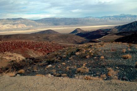
A gateway to over 3.3 million acres of spectacular scenery, expansive vistas, rare desert wildlife, and historical and cultural sites; this byway travels through Death Valley National Park's sculpted hills and shifting sand dunes and even dips below sea level. Death Valley features the lowest point and the hottest place in North America.
Death Valley National Park requires an entrance fee.
Site passes can be purchased here.
RecAreaDirections
Getting to the Byway:
Las Vegas, NV
* Get on I-15 south.
* Turn onto NV-160 west.
* Follow NV-160.
* Turn left at W. Bell Vista Ave.
* Merge onto Ash Meadows Road as you cross the state border into California turning into State Line Road.
Navigating the Byway:
* Begin at the eastern entrance of Death Valley National Park, roughly 13 miles west of Death Valley Junction on Hwy 190.
* Continue along Hwy 190 northwest past Furnace Creek and Stovepipe Wells, were the road will turn southwest.
* Continue past Panamint Valley and Father Crowley Point.
* End at the western boundary of Death Valley National Park.
Misc
| Stay Limit | |
| Reservable | false |
| Keywords | |
| Map Link | |
| Contact Phone | |
| Contact Email |
Permits info
Facilities
no data available
