
Geronimo Trail Scenic Byway
Immerse yourself in the Apaches' history and the hot mineral springs used by Geronimo and his warriors. Visit the historic mining towns that flourished and died with the gold and silver fortunes. From desert lakes to forested mountains, the Geronimo Trail captures the spirit of freedom and independence.
RecAreaDirections
Getting to the Byway:
Albuquerque, NM
- Drive south from Albuquerque on I-25 to Truth or Consequences, New Mexico.
- Exit at Truth or Consequences on Exit 79, and proceed through town past the only stop light until the road divides into one-way downtown streets.
- Continue two blocks to Geronimo Trail Visitors and Interpretive Center, located adjacent to Geronimo Springs Museum.
El Paso, TX
* From El Paso proceed north on I-10 to Las Cruces, New Mexico,
and take I-25 north at the junction.
* Take Exit 63 to get on NM 152.
Navigating the Byway:
The byway begins in Truth or Consequences, New Mexico. From there, you can explore the northern section of the byway or the southern. You may take a side trip that connects the two sections, but a high-clearance vehicle is necessary for that.
###Southern Section###
* Begin at the Geronimo Trail Interpretive Center on N Broadway (one-way northbound), take a left turn to Main St, the opposite one-way street.
* Follow Main St as it turns into S Broadway St. Stay on S Broadway St as it continues through Truth or Consequences to Williamsburg, approximately three miles.
* In Williamsburg, turn left onto NM-187 (the last intersection before entering the freeway). Travel south on NM-187 for 14 miles, following the Rio Grande to the junction with NM-152.
* An RV park overlooking Caballo Lake is at the junction with NM-152. Turn right on NM-152 and continue to the towns of Hillsboro and Kingston.
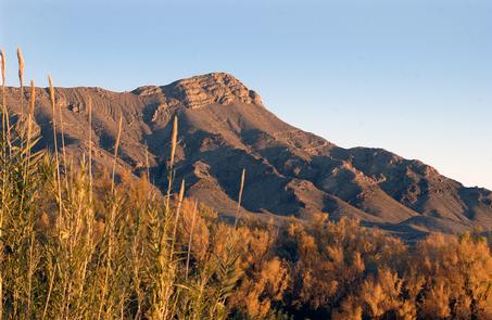
* NM-152 beyond Kingston climbs up the eastern slope of the Black Range Mountains and tops out at Emory Pass, elevation 8,828 feet.
* From Emory Pass the road winds down to the small village of San Lorenzo. It is 53 miles from the turnoff near Caballo Lake to San Lorenzo.
* The road has many twists, turns, and hairpin curves, so the driving time will be about one and one-half hours.
* You may return across the Black Range to Truth or Consequences along the byway, or take a side trip on the Trail of the Mountain Spirits Scenic Byway.
###Northern Section###
* The northern portion of the Geronimo Trail begins at the Geronimo Trail Interpretive Center on N Broadway.
* Follow N Broadway until it turns onto Main St, continue to the stop light at Date and 3rd.
* Turn right on Third, which is NM-51, and follow it to the junction with NM-179.
* Dam Site spur:
* Continue on NM-51 to NM-177.
* Drive until you see the brown sign saying Dam Site.
* Return on NM-51 for two miles, to the junction of NM-179, and turn right toward the City of Elephant Butte. It is an additional two miles to the junction of NM-195.
* Turn left to go to Elephant Butte State Park and the City of Elephant Butte. Follow NM-195 for 4.5 miles, northwest until it intersects with NM-181.
* Turn right on NM-181 and cross under the I-25 overpass. Travel 2.5 miles on NM-181, past the turnoff to the Municipal Airport.
* At the intersection of NM-52, turn left and travel away from the valley and toward the distant mountains. Cuchillo is six miles from the intersection, and Winston is 28 miles.
* At Winston, turn left, traveling through the town to Chloride, 2.5 miles away. After exploring Chloride, return to Winston by the same road.
* At the Winston Store, turn left on NM-52 and drive nine miles to the junction of NM-59, leading directly toward the mountains.
* Turn left on NM-59 and follow it for 31 miles to the Beaverhead Ranger Station, where there is a work station, rest area, and large parking lot.
* It takes about two and a half hours to drive from Truth or
Consequences to Beaverhead.
Misc
| Stay Limit | |
| Reservable | false |
| Keywords | |
| Map Link | |
| Contact Phone | |
| Contact Email |
Permits info
Facilities
no data available
