
Lincoln Heritage Scenic Highway
The Lincoln Heritage Scenic Highway travels through six communities as it winds its way through the knobs of Kentucky. This corridor exhibits significant historic and cultural resources around every turn. It embraces a set of four strong aspects: Abraham Lincoln, US History and the Civil War, Bourbon Heritage, and Religious Heritage.
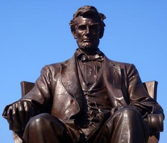
A great portrayal of American history and culture can be experienced along the Lincoln Heritage Scenic Highway. Abraham Lincoln was born and raised near Hodgenville. When Lincoln was elected president and the Civil War began, Kentucky was one of the essential border states and the Lincoln Heritage Scenic Highway played a significant role in the outcome of the Civil War.
Religion is also important along the byway. The Abbey of Our Lady of Gethsemani is America’s oldest Trappist Monastery and manifests the prominence of religion along the corridor.
Bourbon also plays a prominent role in byway history. The Bourbon Trail and its eight bourbon distilleries pass through the Lincoln Heritage Highway. Bourbon is known as America’s official spirit and has a rich history and proud tradition along the corridor. The Bourbon Trail is a unique destination that entices visitors from around the globe.
The Lincoln Heritage Scenic Highway represents an escape from the ordinary, a true symbolism of the adventure of the open road, and a snapshot of early American life.
RecAreaDirections
Getting to the Byway:
Blue Grass Airport, KY
* Head southwest on Aviator Rd toward Airport Rd/Man O War.
* Turn right at Airport Rd/Man O War.
* Turn left at KY-1968/Parkers Mill Rd.
* Turn right at Man O War Blvd.
* Turn right at Harrodsburg Rd/US-68.
* Turn left at US-127.
* Turn left at Danville Rd/US-127.
* Turn left at 127/Harrodsburg Rd.
* Turn left at 127/150/KY-34/KY-52/W Main St (Lincoln Heritage Scenic Highway Corridor).
Louisville International Airport, KY
* Exit the airport on Terminal Drive and get onto I-264 eastbound.
* Almost immediately get onto SR-130/I-65 south.
* Take I-65 south for approximately 1 1/4 miles.
* At the fork stay to the left and follow the signs for Nashville/I-65 south for 1/2 miles.
* Take a slight right at I-65 south and follow for approximately 14 3/4 miles.
* Take exit 112 for KY-245 toward Bardstown/KY-61/Clermont for 1/4 mile.
* Turn left at Clermont Rd/KY-245 and continue to follow KY-245 for 15 1/2 miles.
* Turn right at North 3rd Street/US-150/US-31 East and follow for 1 1/4 miles.
Bowling Green, KY
* Take 231/Campbell Lane/Scottsville Road and continue to follow Scottsville Road for approximately 2 1/4 miles.
* Turn left onto the ramp to Louisville (I-65) and follow for 1/4 miles.
* Merge onto I-65 North and follow I-65 North for 57 3/4 miles.
* Take exit 81 for KY-84 toward Sonora.
* Turn right at KY-84/East Western Avenue and continue to follow KY-94 for 6 3/4 miles.
* Turn left at KY-84/South Lincoln Boulevard/US-31 East and follow for 1/4 mile.
* Take a right at East High Street.
Elizabethtown, KY
* Head northeast on KY-1357/St. John Road toward West Dixie Ave/US-31 West.
* Turn left at West Dixie Avenue/US-31 West and follow for approximately one mile.
* At Main Street/Public Square, take the 2nd exit onto East Dixie Ave/KY-61/US-31 West for 1 3/4 miles.
* Turn left at KY-61/Lincoln Parkway and continue for 9 miles.
* Turn left at West Main Street and follow Main Street for approximately 1/2 mile.
* Continue straight onto KY-210/KY-84/East Main Street/US-31 East
Navigating the Byway:
* The Lincoln Heritage Scenic Highway corridor is approximately 71.2 miles traveling through the central part of the Bluegrass State.
* It begins just south of Hodgenville on KY 31E at the Abraham Lincoln Birthplace National Historic Site.
* The corridor travels northeast along US 31E (SR 84, SR 46) from just south of Hodgenville to Bardstown.
* The corridor then heads east on US 150 (SR 52, SR 605, SR 152) from Bardstown to Danville.
* The corridor ends in Danville where US 150/US 127/KY 52/KY 34 intersects with S 4th Street/N 4th Street/W Main Street.
* The corridor passes through the towns of Hodgenville, New Haven, Bardstown, Springfield, Perryville, and Danville.
Misc
| Stay Limit | |
| Reservable | false |
| Keywords | |
| Map Link | |
| Contact Phone | |
| Contact Email |
Permits info
Facilities
no data available
