
Ormond Scenic Loop & Trail
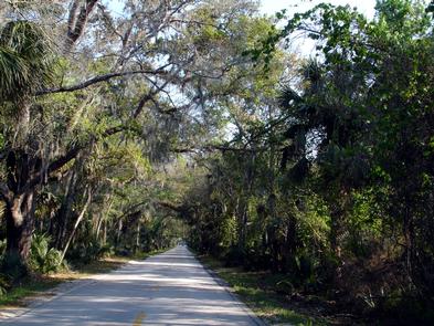
The Ormond Scenic Loop and Trail includes four state and six local public parks, as well as ten miles of gorgeous Florida beachfront. Take advantage of the unique opportunity to visit three “Old Florida” environments while driving, biking, or hiking along a connected figure-eight shaped corridor.
Take the opportunity on the corridor to observe varied plant and animal species along the beach, such as the endangered Florida Scrub Jay and nesting sea turtles. You can also view northern right whales and humpback
whales offshore during migration seasons. Keep your eyes peeled, and you might spy dolphins as well.
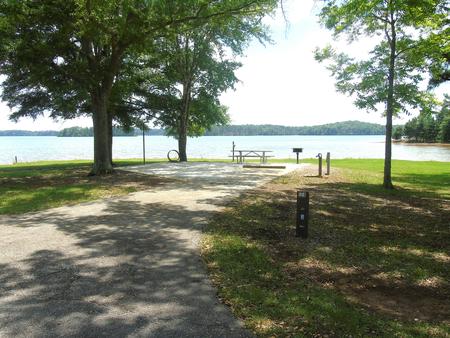
The Ormond Scenic Loop and Trail is an easily navigated loop of roadways traversing some of the most beautiful and diverse natural scenery remaining in all of Florida. There is ready access to the Atlantic Ocean and North Peninsula and to several state and public parks. If you're seeking a cultural and/or historic experience, you can find museums and historic public buildings and homes along the corridor, in Tomoka State Park, and in locations just off the corridor. Recreational opportunities also abound, with numerous parks and trails offering boating, fishing, hiking, swimming, bicycling, beach-walking, and much more. Vast expanses of water and natural Florida scrub vegetation create beautiful scenic vistas waiting to be photographed. With all it has to offer, this byway is truly a national treasure.

RecAreaDirections
Getting to the Byway:
Orlando-Sanford Airport, FL
* Head west on Red Cleveland Blvd
* Turn right at E. Lake Mary Blvd/Silver lake Dr
* Take a slight left at E. Lake Mary Blvd/Silver Lake Dr
* Turn right onto State Hwy 417 N ramp to I-4 (toll road)
* Merge onto SR-417 N (Central Florida Greenway)
* Take exit 55A to merge onto I-4 E
* Take the exit on the left onto I-95 N
* Take exit 268 for State Hwy 40
* Turn right at W. Granada Blvd/SR-40/Tomoka Rd
* Turn left at SR-5/US-1/S Yonge St
* Turn right at Lincoln Ave
* Turn right at N. Beach St, which is the southwest corner of the Ormond Scenic Loop and Trail
Daytona Beach, FL
* Head north on SR A1A
* Turn west on Highbridge Road
* This corner is the northeast section of the corridor
Flagler Beach, FL
* Head south on SR A1A
* Turn right on Highbridge Road
* Start on the corner of SR A1A and Highbridge Road, which is the northeast corner of the corridor
Navigating the Byway:
* Travel south on SR A1A to Granada Blvd. (SR 40).
* Turn right onto Granada Blvd.
* Follow SR 40 to North Beach St.
* Turn right on North Beach St.
* Turn left onto Pine Tree Dr. and drive west to Ormond Lakes Blvd.
* Return to the junction of Pine Tree Dr. and North Beach St.
* Continue on North Beach St., which turns into Old Dixie Highway.
* Follow Old Dixie Highway until Walter Boardman Lane.
* Turn right onto Walter Boardman Lane.
* Turn east onto Highbridge Road and go back to SR A1A.
* The byway corridor also includes John Anderson Dr. from SR 40, close to where SR A1A and SR 40 intersect, north to Highbridge Road.
Misc
| Stay Limit | |
| Reservable | false |
| Keywords | |
| Map Link | |
| Contact Phone | |
| Contact Email |
Permits info
Facilities
no data available
