
King Range National Conservation Area
Overview
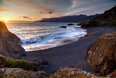
A spectacular meeting of land and sea, the King Range National Conservation Area seems to thrust straight out of the surf. King Peak, the highest point at 4,088 feet, is only 3-miles from the ocean. King Range is the Nation's very first National Conservation Area, designated in 1970.The King Range encompasses 68,000 acres along 35-miles of California's dramatic north coast, where the landscape was too rugged for highway building, forcing State Highway 1 inland. Accessible by only a few back roads, this remote region of mountains and seascapes is also known as California's Lost Coast.
The King Range's Douglas fir-covered peaks attract hikers, hunters, and campers, while the coast beckons to surfers, anglers, beachcombers, and many others. World-class mountain bike trails, and 42,585 acres of coastal wilderness are two of the highlights of this incredibly unique area.
The King Range NCA contains over 80 miles of hiking trails spanning from the beach to the highest peaks. Most of the upland trails are strenuous due to the steep rugged nature of the area. In addition to mileage, pay attention to the elevation changes listed in the trail descriptions. A number of connector trails allow for loop hikes.
The backcountry was designated as official wilderness on October 17, 2006 and the BLM manages it accordingly, so expect no facilities and minimal signing on trails. Some of the lesser used trails (such as Rattlesnake Ridge, Spanish Ridge and Cooskie Creek) may be somewhat overgrown and difficult to follow. Its best to carry a map and compass with you, and call the BLM office before your trip to get the latest trail conditions.
Winter Weather & Ocean Advisory: Winter storms & waves in the King Range NCA can make portions or all of the Lost Coast Trail dangerous and even impossible to traverse, regardless of tidal level. Additionally, heavy rains may cause downed trees or landslides along upland trails. Heavy rains may cause stream crossings to become hazardous and may impede travel. We at BLM recommend that you do not cross creeks that are above your knee. Be patient. Wait for water level to subside. Please contact the King Range Project Office at (707) 986-5400 or the Arcata Field Office at (707) 825-2300 for updates on current conditions and check The National Weather Service (http://www.weather.gov/eka/) for current coastal conditions.

RecAreaDirections
The King Range National Conservation Area (NCA) is located about 230 miles north of San Francisco and 60 miles south of Eureka.
All roads leading to the King Range NCA are narrow, steep and winding. Allow plenty of time between destinations, have a full tank of gas, and be alert to oncoming traffic.
All main roads are normally accessible to passenger cars except during heavy winter storms. Primitive roads may be closed seasonally. Directional signs mark all major intersections in the King Range NCA giving the road name and distances to primary recreation sites.
NORTH ACCESS: U.S. 101 to the Ferndale exit. Once in Ferndale, follow signs to Petrolia. One mile past Petrolia, turn right on Lighthouse Road; it is 5 more miles to the Mattole Recreation Site. Allow 1 1/2 hours for the 42 mile trip.
CENTRAL ACCESS: U.S. 101 to South Fork - Honeydew exit. Follow the signs to Honeydew (23 Miles). Turn left in Honeydew to Honeydew Creek Recreation Site and Smith-Etter Road. Allow 1 hour for the 24 mile trip. Turn right to Mattole Beach and Trailhead. Allow 45 minutes for the 18.5 mile trip.
SOUTH ACCESS: U.S. 101 to the Redway/Garberville exit. Follow signs to Shelter Cove/King Range NCA. Allow 45 minutes for the 22 mile trip to Shelter Cove.
Open with Google MapMisc
| Stay Limit | 14 days per calendar year within King Range NCA |
| Reservable | false |
| Keywords | |
| Map Link | |
| Contact Phone | |
| Contact Email |
Permits info
Facilities
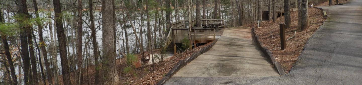
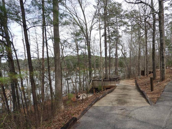
Lost Coast Trail Facility
Overview
Lost Coast Trail - North (Mattole - Black Sands Beach). 24.6 miles, mostly level.
The Lost Coast Trail offers one of the few coastal wilderness hiking experiences in the United States. Hikers will be treated to exceptional wildlife viewing opportunities such as sea lions, elephant seals, river otters, eagles, bobcats, deer and more. Tidepools, teaming with life, line the coast. In spring spectacular arrays of wildflowers cover the hillsides and bluffs.
Overnight camping along the Lost Coast Trail requires a Backcountry Permit. Permits can be obtained through Recreation.gov, on the King Range Wilderness Permits (Lost Coast) page. No walkup permits are available.
Allow at least three days for the entire hike. Much of the trail is beach hiking with several stretches of 1-2 ft. rounded boulders. Wear sturdy hiking boots. Water sources are plentiful along the beach. Stream crossings may be impassable during/after heavy winter rains (no bridges). The area near Punta Gorda; from Sea Lion Gulch to Randall Creek; and from Miller Flat to Gitchell Creek, may be impassable during high tide. Carry a tide table and hike these stretches during an outgoing tide of three feet or less to avoid being trapped. Always be aware of the ocean. Large sets of waves can occur at any time, sweeping unsuspecting hikers into the ocean. Large waves and/or high winds will amplify the effects of tides, causing areas normally passable at a particular tide to become impassable. Several privately owned cabins exist along the Lost Coast and are not for public use; BLM does not maintain any facilities along this trail - please respect private property rights. NO CAMPING AT BLACK SANDS BEACH TRAILHEAD. Camping is allowed north of Telegraph Creek.
Lost Coast Trail - South (Hidden Valley - Needle Rock in Sinkyone Wilderness State Park). 9 miles, 875 ft. climb, 2600 ft. descent.
Mountain meadows, old-growth forests and ridgetop vistas through coastal chaparral offer hikers an interesting contrast to the northern leg of the Lost Coast Trail. Hikers can also continue for 19 more miles through redwood groves and fern clad glens of Sinkyone Wilderness State Park. NOTE: The State Park has different regulations regarding trail use and camping (e.g. no pets or mountain bikes; camping is only allowed in designated areas). Contact State Parks for information on obtaining a permit, or for roads and trails conditions.

