
Red Cliffs National Conservation Area
The approximately 45,000 acres of public land in the NCA are located in south-central Washington County. The NCA is an important component of the Red Cliffs Desert Reserve, a multi-jurisdictional land base that has been collaboratively managed by BLM, the State of Utah, Washington County, and local municipalities since 1996 to protect populations and habitat of the threatened Mojave Desert tortoise and other at-risk native plant and animal species.More than 130 miles of non-motorized recreation trails (hiking, mountain biking, and equestrian trail riding) are available for public use in the NCA. The Red Cliffs Recreation Area offers camping and day use areas, in a developed site where fees are collected. All motorized vehicle travel, including Off-Highway Vehicles, is limited to designated roads in the NCA. No motorized or mechanized vehicle travel is allowed in the Red Mountain and Cottonwood Canyon Wilderness areas.
RecAreaDirections
Take Interstate 15 north from St. George, Utah, to Exit 22*. At the end of the freeway off-ramp, turn right onto Old Highway 91 (frontage road). Travel south 2 miles and turn right after passing the sign for the Red Cliffs Recreation Area. Continue under two freeway tunnels and follow the paved road for 1.3 miles into the campground. *If heading south from Cedar City, Utah, take Exit 23. Turn left on Silver Reef Road, then turn right onto Main Street. Travel south for 3.5 miles on Main Street (which turns into Old Highway 91). Continue the directions above.
Open with Google MapMisc
| Stay Limit | |
| Reservable | false |
| Keywords | |
| Map Link | |
| Contact Phone | |
| Contact Email |
Permits info
Facilities
Red Cliffs Campground Campground
List of CampsitesOverview
Red Cliffs Recreation Area includes a campground, day use areas, a non-motorized trail system, and interpreted public use sites. Dinosaurs left their footprints, now visible in the sandstone. Ancestral Puebloans lived here in the 10th century, growing corn, beans, and squash along Quail and Leeds Creek. Mid-19th century pioneers farmed here, supplying the area’s silver miners with food. Located within the Red Cliffs
National Conservation Area, the Recreation Area is managed to conserve and protect the natural and cultural resources of the public lands.
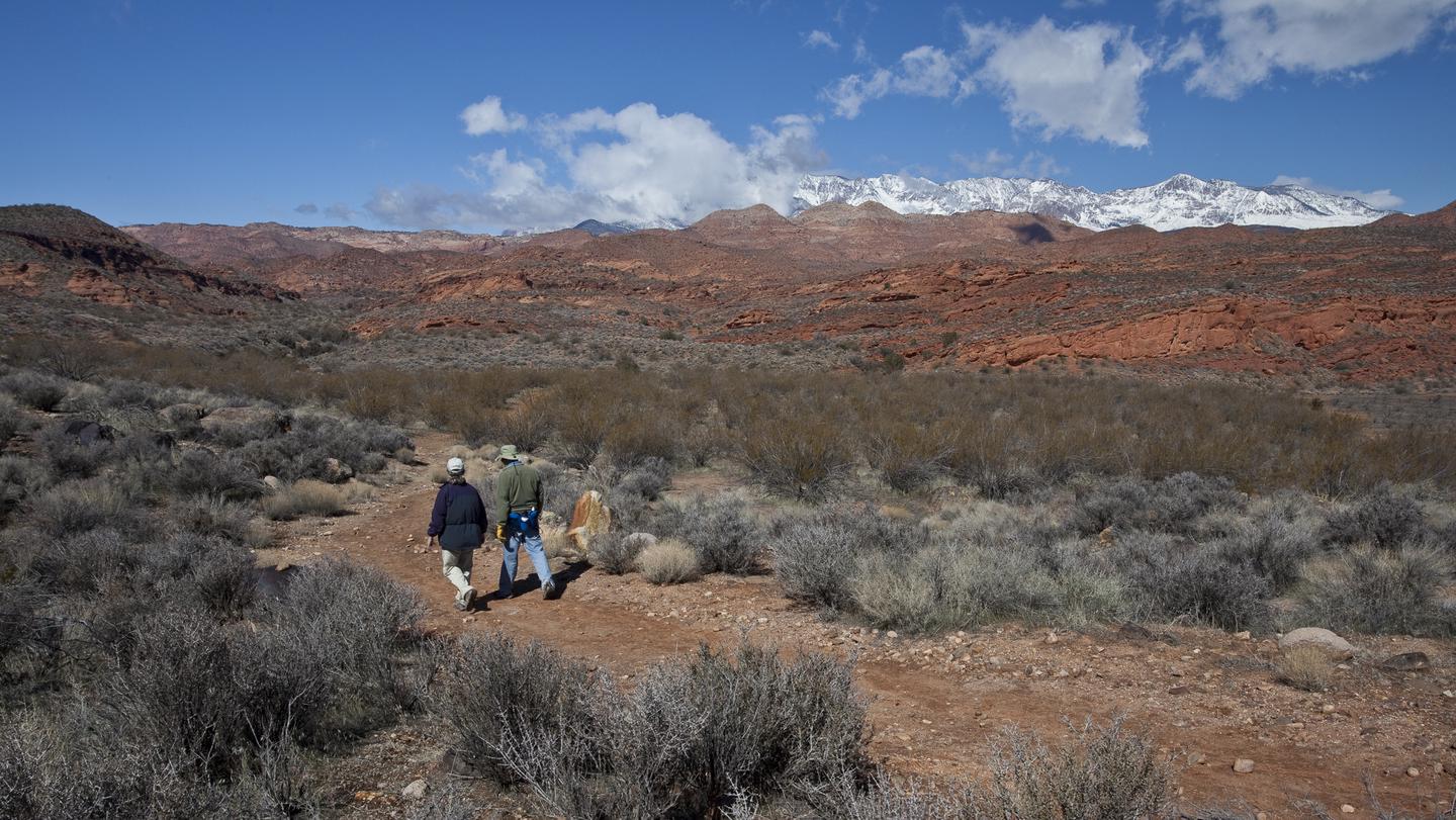
Recreation
The Red Reef Trail follows Quail Creek into the Cottonwood Canyon Wilderness and is a very popular hike in the spring when seasonal runoff fills water pockets and plunge pools in the stream channel. There are many other trails in the Recreation Area that are scenic and enjoyable for hikers and mountain bikers, for shorter, moderately difficult rides. The White Reef Trailhead accommodates both large and small horse trailers, making it an ideal place for equestrians to start a longer distance ride on the Prospector Trial which connects to the equally popular Church Rocks Trail for extended riding.
Facilities
The Red Cliffs Recreation Area ‘s campground is open year round and includes 11 campsites with shade shelters, picnic tables, potable water, and grills. Sites 8 and 11 are accessible for visitors with disabilities, while sites 6,7, and 10 have pull-through parking. Only two vehicles are allowed per campsite. Accessible vault toilets are located between sites 5 and 7. Pets must be on a leash and under control at all times. Quiet hours are from 9 pm to 7 am.
Reservations are required for campsites and can be made at www.recreation.gov, or by calling 1-877-444-6777. First come first serve camping is not permitted and camping payment cannot be made on site.
Fees
Camping fees are $15 per night, plus an reservation administrative fee and are paid only on recreation.gov or by calling 1-877-444-6777. The Day Use Fee is $5 per vehicle and can only be paid on site. Interagency Annual, Access, Senior and Military Passes are honored for half off camping and for day use fees. All fees collected at this site are used to fund operations, improvements, and repairs to the recreation area.
Camping Restrictions
Stays are limited to 14 days. To protect the area’s natural resources and to minimize impacts to private property, camping is prohibited on BLM managed lands within one mile of the recreation area. Vehicles over 11' 9" cannot acesss the Red Cliff's Recreation Area including the campground.
Natural Features
The campground and day use areas of the Recreation Area are located at the base of towering red cliffs of Navajo Sandstone. Quail Creek flows through the campground and supports mature cottonwood trees and willows that provide shade for many of the campsites and the day use areas. You may see a flock of Gambel’s quail or hear canyon wrens as you hike the trails the follow Quail and Leeds Creeks. If you’re lucky, you might spot a Mojave desert tortoise or a Gila monster, whose beaded skin and bold color patterns make it a standout among desert reptiles. To protect all of these native species and their habitats, please stay on designated trails.
Nearby Attractions
Quail Creek State Park. Zion National Park.
Charges & Cancellations
Cancellations: When reservation is cancelled a $10.00 cancelation fee is charged. This cancellation fee is in addition to the non-refundable reservation service fee. Late Cancellations: When a reservation is cancelled on the day before or the day of arrival the $10.00 cancellation fee will be charged and the first night use fee will be forfeited (not to exceed the total paid for the orginal reservation). No Shows: If a customer does not arrive and/or does not cancel reservation by check out time (11 :00am) the day after the scheduled arrival date a $20.00 service fee charged and will forfeit the first night's user fee.
Anasazi Trail Facility
Recommended Users: Mountain Bikers, Hikers, Equestrians. Singletrack trail. 0.5 miles in length. Difficulty: Easy/Easiest. The trail starts on the east side of the campground across the street from campsite #11. Anasazi Trail leads to an interpreted heritage site (Red Cliffs Archaeological Site). Several prehistoric Ancestral Puebloan sites have been stabilized and interpreted for public visitation. Although the area is largely sandy red sandstone, the trail has a compacted surface. A pleasant little section travels through a shady riparian zone, but the majority of the trail is a classic desert experience through sagebrush, creosote bush, and yucca. Loop: For just under a 1 mile loop, take the 0.5 mile Anasazi Trail to the Red Cliffs Archaelogical Site, return 0.1 miles to the intersection with Metate Trail. Turn right on the Metate Trail and travel 0.06 miles to the intersection with the Red Reef East Trail. Turn left on the Red Reef East Trail and in 0.25 miles you will return to the campground between campsites #8 & 9. For a slight variation, turn left on Mano Trail when it intersects the Red Reef East Trail at 0.2 miles. Follow Mano Trail until it intersects Anasazi Trail in 0.04 miles. Turn right to return to your start point across from campsite #11.
Mano Trail Facility
Recommended Users: Mountain Bikers, Hikers, Equestrians. Singletrack trail. 0.04 miles in length. Difficutly: Easy/Easiest. This trail is a connector between the Anasazi and Red Reef East trails. For just under a 1 mile loop, take the Red Reef East Trail (which begins between campsites #8 & #9) to Metate Trail. Turn right on Metate Trail until it intersects with the Anasazi Trail. Turn left on the Anasazi Trail and follow it for just over 0.1 miles to reach the Red Cliffs Archaeological Site. Return to the intersection of the Metate and Anasazi trails. Turn left on the Anasazi Trail and follow it until reaching the intersection of the Mano Trail. Take the Mano Trail north for 0.04 miles. Turn left at the intersection with the Red Reef East Trail and return to your starting point within the campground.
Metate Trail Facility
Recommended Users: Mountain Bikers, Hikers, Equestrians. Route. 0.06 miles in length. Difficulty: Easy/Easiest. This trail is a connector. Wide and sandy, it connects the Anasazi and Red Reef East trails. For just under a 1 mile loop, take the Red Reef East Trail (which begins between campsites #8 & #9) to Metate Trail. Turn right on Metate Trail until it intersects with the Anasazi Trail. Turn left on the Anasazi Trail and follow it for just over 0.1 miles to reach the Red Cliffs Archaeological Site. Return to the intersection of the Metate and Anasazi trails. Turn left on the Anasazi Trail and follow it until reaching the intersection of the Mano Trail. Take the Mano Trail north for 0.04 miles. Turn left at the intersection with the Red Reef East Trail and return to your starting point within the campground.
Red Reef Trail Facility
Trail Description
- Trail Distance: 5.74 miles (one way)
- Approximate Elevation Gain/Loss: 600 feet
From the Red Reef Trailhead
- The Red Reef Trail follows the Quail Creek drainage as it enters the Cottonwood Canyon Wilderness and then passes into the Cottonwood Forest Wilderness of the Dixie National Forest. Ten of thousands of visitors hike this first 0.6-mile section of trail each spring when snowmelt from the Pine Valley Mountains creates short cascades of water that pools in slickrock bowls of the beautiful red Navajo Sandstone.
- To continue beyond this popular destination, hikers must use a series of small toe holds carved into the sandstone to ascend this first obstacle. After 0.4 miles the route will leave the Quail Creek drainage and enter a side canyon on the left.
From the Cottonwood Trailhead
- Hikers will begin on the Cottonwood Canyon trail (0.3 miles) from there the trail will fan out into five different trails. The Red Reef trail is sandwiched between the Cottonwood Canyons and Prospector trails. Be sure to follow early trail markers to make sure you are on the correct route. The Red Reef Trail will then enter the Cottonwood Canyon Wilderness and follow along a tributary of Cottonwood Creek.
Point to point
- The full route (5.74 miles) includes difficult sections with steep and rugged terrain where hikers will need to use their hands to navigate steep chimneys and various obstacles. Technical climbing gear is not required, but some hikers may use ropes for additional safety. Be prepared for class 2 to class 3 hiking. A good pair of hiking shoes with traction is highly recommended. Within designated Wilderness areas, the route is not signed and may require route finding.
Parking
- Day-use parking in the Red Cliffs Recreation Area is extremely limited and will fill to maximum capacity on weekends, holidays, and most days during the spring and fall months.
- To avoid being turned away, be sure to arrive early in the morning to find a designated parking space. Parking on vegetation or along the road is prohibited.
- Please be respectful of other visitors by not parking in, or walking through, reserved campsites. If all designated day-use parking is full, visitors may use the White Reef Trailhead as an overflow lot.
Restrooms
- Vault toilets are located near campsite seven in the Red Cliffs Campground, and at the Cottonwood and White Reef trailheads.
Pets
- Pets are permitted but must be kept on a leash outside of the Wilderness boundaries. Pet waste disposal bags are provided at each of the trailheads. Be responsible and carry waste bags with you until they can be deposited into a trash receptacle. Never leave them on the side of the trail.
Safety
- Quail Creek has a high potential for flash flooding. Flash floods are a sudden increase in the depth and speed of water in rivers or streams due to heavy rain from thunderstorms. Always check the weather forecast and flash flood potential before entering a narrow canyon.
- Leave an itinerary with someone and check in when you are done.
- The depth of the water in pools can vary, especially after flood events. Never jump into a pool without first verifying depth. Severe ankle and knee injuries have occurred.
- The desert is an extreme environment. Carry enough water, one gallon per person per day, and drink it.
- Cell phone reception is extremely limited.
Leave No Trace
- Keep food away from all wildlife, and never approach or touch a wild animal.
- Protect the canyon walls, rocks, and trees from graffiti and vandalism.
- Stay on established trails to protect vegetation and fragile biological soils.
- Protect the natural sounds of the canyon by talking softly and using headphones for music.
- Drones are not permitted within the National Conservation Area or within any designated Wilderness areas.
Red Reef East Trail Facility
Recommended Users: Hikers. Two-track. 0.89 miles in length. Difficulty: Moderate. Red Reef East Trail starts in the campground between campsites #8 and #9. Cross the stepover heading east. Cross a second stepover at the intersection of the Mano Trail. Continue following the wide two-track for just 0.15 miles. Turn sharply to the right and head downhill into a large sandy wash. Cross the wash directly to pick up the trail on the other side. Continue for a couple hundred feet and reach the intersection with the Metate Trail. Continue heading east on the wide, well defined two-track for another 0.4 miles to reach the intersection with the Tipple Trail. Continuing east for another 0.10 miles will bring you to the National Conservation Area (NCA) boundary. Red Reef East Trail is used as a connector trail to the Mano, Metate, and Tipple trails, although it continues as a road beyond the NCA boundary heading east to the Silver Reef area. The trail is and old two-track, possibly a remnant of early mining days used to access claims. The views to the north are of the wild and beautiful Red Reef within the BLM Cottonwood Canyon Wilderness and the USFS Cottonwood Wilderness. Loop: For just under a 1 mile loop, take the Red Reef East Trail to Metate Trail. Turn right on Metate Trail until it intersects with the Anasazi Trail. Turn left on the Anasazi Trail and follow it for just over 0.1 miles to reach the Red Cliffs Archaeological Site. Return to the intersection of the Metate and Anasazi trails. Turn left on the Anasazi Trail and follow it until reaching the intersection of the Mano Trail. Take the Mano Trail north for 0.04 miles. Turn left at the intersection with the Red Reef East Trail and return to your starting point within the campground.
Tipple Trail Facility
Recommended Users: Mountain Bikers, Hikers, Equestrians. Two-track trail. 1 mile in length. Difficulty: Moderate/More Difficult. To reach Tipple Trail take Red Reef East Trail for just under 0.7 miles. Turn right onto Tipple Trail. The trail ends at the National Conservation Area boundary, but continues as a road heading east to the Silver Reef area. Be aware that this trail crosses Leeds Creek. Leeds Creek runs water year-round and at times may be too high to safely cross on foot.The trail is and old two-track, possibly a remnant of early mining days used to access claims. Its name comes from the one mining ruin (a tipple*) still visible from the trail. The views to the north are of the wild and beautiful Red Reef within the BLM Cottonwood Canyon Wilderness and the USFS Cottonwood Wilderness. From its highest elevations, long distance views are possible into the St. George basin to the south.Loop: For a 4.2 mile grand tour of the White Reef Sub-Area, start at the White Reef Trailhead (see directions under the White Reef Trail). Take the White Reef Trail from the trailhead for 0.2 miles. Turn right on Leeds Reef Trail and continue to Adit Trail for 1.44 miles. Turn left on Adit Trail and continue for 0.23 miles until reaching Tipple Trail. Turn left onto Tipple Trail and follow it until it ends 1 mile later at Red Reef East Trail. Turn left on Red Reef East Trail and continue to the Red Cliffs Campground for 0.7 miles. The trail ends between campsites #8 and #9. Turn left on the road. Follow the road back to the White Reef Trailhead for another 1.6 miles.*A tipple is a structure used for loading material onto some type of carrier (truckbed, railcar, etc.)
