
Burr Point Overlook
Burr Point Overlook
Burr Point Overlook
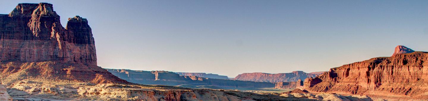
The dirt access route runs easterly across the Burr Desert flat lands ending at the cliff tops of the Dirty Devil River. Views across, up, and down the canyon are stunning and have as backdrops the Abajos, the La Sal, and the Henry Mountains. Burr Point Overlook is also occasionally used as a trailhead to access the Dirty Devil River. This access however has been described as challenging, techincal, and risky. There are no developed facilities at Burr Point Overlook.

Burr Point Overlook
Burr Point Overlook
RecAreaDirections
11 miles east of State Route 95 at milepost 17
Open with Google MapMisc
| Stay Limit | |
| Reservable | false |
| Keywords | |
| Map Link | |
| Contact Phone | |
| Contact Email |
Permits info
Facilities
no data available
