
Gooseberry Mesa National Recreation Trail
Gooseberry Mesa National Recreation Trail is located on Gooseberry Mesa in southern Utah's red rock country. At an elevation of 5,200 feet, views from the mesa rims are spectacular. Rising to the north are the massive sandstone sentinels of Zion National Park. Spread out below the west rim is a panorama of colorful desert mesas and water carved canyons.
The Gooseberry Mesa National Recreation Trail is actually a system of trails sweeping across the mesa. Developed in the late 1990's through cooperative efforts, it received National Recreation Trail status in 2006.For information on recommended trail users, maps, difficulty ratings, and other important facts please download the Gooseberry Mesa Brochure.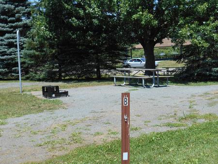
RecAreaDirections
White Trailhead - From City of St. George travel north on Interstate 15. Take exit 16 to Hurricane City. Turn right on Main Street. Take the first left onto State Route 59. Turn left on Smithsonian Butte National Backcountry Byway. At 2.8 miles from the SR 59, turn left and travel northwest 3.3 miles until reaching the Gooseberry Trailhead. Turn left at the Gooseberry Trailhead and travel west for 1.3 miles to reach the White Trailhead.
Open with Google MapMisc
| Stay Limit | |
| Reservable | false |
| Keywords | |
| Map Link | |
| Contact Phone | |
| Contact Email |
Permits info
Facilities
Bowls and Ledges Trail Facility
Recommended Users: Mountain Bikers, Hikers. Singletrack trail. 1.1 miles in length. Difficulty: More Difficult. : The name of the trail speaks to what you will find here: bowls and ledges. Use caution. Although this trail is rated More Difficult, more advanced skills are required in some sections.
Connector Trail Facility
Recommended Users: Mountain Bikers, Hikers. Singletack trail. 0.08 miles in length. Difficulty: Easiest. The Connector Trail is used as a bail-out route from the North Rim Trail. Conversely it offers quick access to the North Rim Trail from the White Trail.
Hidden Canyon Trail Facility
Recommended Users: Mountain Bikers, Hikers. Singletrack trail. 1.9 miles in length. Difficulty: Most Difficult. Hidden Canyon is aptly named. The trail is a mix of dirt and slick rock that winds though and around a maze of sandstone hills. In addition to narrow passages and slots, there are plenty of domes and bowls.
North Rim Trail Facility
Recommended Users: Mountain Bikers, Hikers. Singletrack trail. 2.1 miles in length. Difficulty: More Difficult. A classic single track with a mix of dirt, rock, trees, and exposure. Like the Windmill Trail, the rim offers great views.
South Rim Trail Facility
Recommended Users: Mountain Bikers, Hikers. Singletrack trail. 5.9 miles in length. Difficulty: Extreme. The South Rim Trail is demanding. From steep drop-offs, difficult climbs, sharp turns, and narrow ledges, this trail offers a lot of challenges for the experienced rider. Sections of this trail are known as “God’s Skateboard Park,” “Cattle Grate,” and “Rattlesnake Rim,” which all tell a little something about the conditions. We give it an Extreme rating for its exposure along the rim and the potential to get into serious trouble (or fun). There are a couple of bail-outs spots at 1.55 miles to the White Trail and again at 2.65 miles on a gravel road that leads back to the White Trail.
Yellow Trail Facility
Recommended Users: Mountain Bikers, Hikers. Singletrack trail. 0.54 miles in length. Difficulty: Most Difficult. Although this trail is entirely on SITLA (School Institutional Trust Lands), it is listed here in order to describe all the Gooseberry Mesa trails in their entirety. The Yellow Trail was user created as a means to avoid the sandy sections of the White Trail. If you choose to use this trail, please respect private property and stay on the trail.
Practice Trail Facility
Recommended Users: Mountain Bikers, Hikers. Singletrack trail. 1.3 miles in length. Difficulty: More Difficult. The Practice Trail starts and ends on the White Trail and makes a nice 2.35 mile loop ride from the White Trailhead for beginning slick rock riders. Ride the Practice Trail for the sheer fun of it or to test your bike handling skills. Since Gooseberry offers a variety of technical riding, it is best to use this trail to gauge your riding ability and fitness if you are new to the experience.
White Trail Facility
Recommended Users: Mountain Bikers, Hikers, OHVers. Two-track/Singletrack. 3.09 miles in length. Difficulty: Easiest. This trail is an old 4x4 road that bisects the Gooseberry Mesa. It’s has a few sandy patches, but nothing particularly deep.Like the entire mesa, the White Trail gradually slopes up 2% to the west, making it easier and faster to ride back to the trailhead after riding the other trails. Many mountain bikers ride out to the west rim on singletrack and loop back to the trailhead using the White Trail. At 2.4 miles (just about at the intersection with the Yellow Trail), the White Trail becomes sandy, and narrow; OVHs are not allowed to continue beyond this point.* Since this is a mixed user trail, all users should exercise caution and keep a sharp eye out for others.*NOTE: This trail is open to motorized users for only a portion of its length. Motorized users cannot reach the west rim and should not attempt to do so. Motorized users cannot use any other trails unless the trails are specifically designated “open” for motorized use.
