Wolford Recreation Special Recreation Management Area
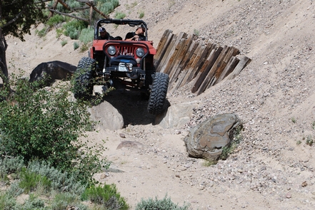
There are approximately 120 miles of designated roads and motorized trails in the Wolford Mountain Special Recreation Management Area. Motorized use is restricted to designated routes only. Some routes are open only to certain types of vehicles – signs indicate allowable uses. Motorized use is prohibited from December 15 through April 15 for the protection of wildlife and their habitat during the winter and spring. You can obtain a free copy of the Wolford Mountain Travel Management Area Map and additional information from the Kremmling Field office.
Cretaceous Ammonite ACEC
Fossil collection is prohibited at this site, where the fossils of more than 100 invertebrate species can be found. The Kremmling Cretaceous Ammonite Locality takes visitors 72.5 million years back in time where they can view well-preserved specimens of tropical and subtropical mollusk fossils. Even the smallest rocks may contain scientifically and educationally valuable finds. This area has the highest concentration of such fossils in the world and is perfect for avid fossil enthusiasts as well as those visiting for the first time.

RecAreaDirections
There are multiple access points. County Roads 2, 22, 25, 26, 224, 227 provide access to and through the Wolford Mountain Area. In the Northern portion, drive north from Kremmling on Highway 40 past Wolford Reservoir and take the Antelope Pass Road on the right.
Open with Google MapMisc
| Stay Limit | 14 Day Stay Limit |
| Reservable | false |
| Keywords | |
| Map Link | |
| Contact Phone | |
| Contact Email |
Permits info
Facilities
Sidewinder Trail Facility
Recommended Users: Mountain Bikers, Hikers. Singletrack trail. 1.7 miles in length. Difficulty: Moderate/More Difficult (IMBA Trail Difficulty Rating System). Sidewinder can be reached from two trails: Barrel Roll and Precipice. As its name implies it gently winds up a narrow little mesa through a series of switchbacks. At the top of the mesa the trail forms a small loop to take advantage of the terrain and spectacular views. Although the plant community is a typical black brush desert, there are some interesting eroded rock features and views of Santa Clara River and surrounding mesas that are hard to beat.While it may be tempting to ride or hike off trail, particularly straight up or straight down, don’t. This mesa, like the other mesas nearby, has substantial areas of cryptobiotic soils. Many of the desert’s smallest wildflowers also find a home on the mesa’s slopes, but can’t be seen until bloom time in Spring.
Muddy Creek Fishing Access and Kremmling Cliffs Facility
Muddy Creek is a tributary of the Colorado River and provides anglers another great option to pursue both Rainbow and Brown trout in the Colorado River Basin. The creek is split in half by Wolford Reservoir and the most popular section to fish is the tailwater section below the dam. The majority of the river above the reservoir is privately owned. Below the dam, anglers have approximately 5 miles of river to explore. The river sits in a fairly wide open meadow and doesn't provide much protection from the elements. The trout in Muddy Creek grow to respectable sizes and 14"-16" fish are not uncommon. Reports of fish much larger than that below the dam are somewhat frequent as well. Trails offer access upstream and downstream for access to approximately 1.5 miles of Muddy Creek. There is a vault restroom at the parking area. For more Information, please contact the Kremmling Field Office.
Wolford Red Desert Overlook Facility
The Wolford Mountain area provides unrestricted use for the foot traffic throughout the area. The 0.2 – mile Wolford Reservoir trail is designated for foot and horse traffic. The trail descends through the sagebrush habitat, providing access to the shore of Wolford Mountain Reservoir. The area is intermixed with Private property.
Wolford Reservoir Dam Site Facility
The Ritchard Dam holds the 1,500 surface-acre Wolford Mountain Reservoir. Parking and restrooms support access to the dam and shoreline, popular with fishermen. Anglers can also access Muddy creek for fishing below the dam and spillway.

 CuteCamper
