
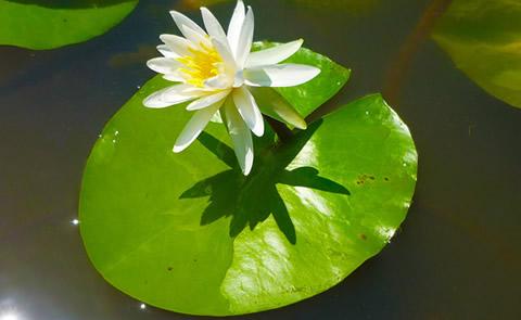
Traverse Lake
The Lake Traverse Project is a multipurpose project located on the Minnesota ? South Dakota border. The project consists of two dams, one dike and two lakes, Traverse and Mud. The main purpose of the project is to control flooding along the northward flowing Bois de Souix River, which joins the Ottertail River to become the Red River of the North. The significant feature of the project is the Browns Valley Dike on the south end of Lake Traverse, keeping it separate from Big Stone Lake. The dike sits on the continental divide, which marks the outlet of Glacial Lake Agassiz. Waters on the north side of the dike flow into Hudson?s Bay, and on the south, waters flow into the Minnesota River and on to the Mississippi River.
RecAreaDirections
From Wheaton, 4 miles north on US 75, 4 miles west on MN 236.
Open with Google MapMisc
| Stay Limit | |
| Reservable | false |
| Keywords | |
| Map Link | |
| Contact Phone | |
| Contact Email |
Permits info
Direction
From Lone Pine, CA, travel 13 miles west, on Whitney Portal Road. The trailhead is on the right side of the road at Whitney Portal.
Important Information
General Notes:
Come Prepared! Get in shape. Come early to acclimate to the high altitude. 22 miles to the summit and back, combined with the affects of high altitude make this a strenuous trip. Stay together as a group in case your friends need help. Bring adequate supplies of food, water and clothing, the weather can change very quickly.
Dispose of Waste Properly! All Mt. Whitney visitors must pack-out their solid human waste. Pack-out kits are distributed with wilderness permits. You must carry the waste bag back down the mountain to the poop disposal box at the trailhead. In addition, all visitors must pack-out all of their trash, food and gear.
Traveling in Bear Country! Historically, there has been a high level of bear activity in the Mt. Whitney area. From Memorial Day weekend through October 31, overnight visitors must store all food, food related trash and scented items in bear-proof containers. At the trailhead, all food and scented items must be removed from vehicles and stored in the bear proof lockers located in parking areas. Dispose of trash in bear proof trash receptacles at the trailhead.
Safety Is Your Responsibility! Wilderness travel involves an element of risk. Climbing Mt. Whitney is difficult and potentially dangerous. Every year visitors become sick or injured; some die. High elevation can add stress to pre-existing medical conditions as well as contribute to altitude related illnesses and severe electrolyte imbalances. You should be prepared for emergences.
USFS Webpage for: Mt. Whitney Trail
Long Description
The Mount Whitney trail is a non-technical, but strenuous, route to the summit of Mt. Whitney in summer conditions. When there is snow or ice on the trail, a higher level of expertise is necessary to safely climb the mountain. Most years the trail is relatively free of snow from July to the end of September. Early spring and late fall trips may encounter winter mountaineering conditions.Mt. Whitney is extremely popular. In order to continue to allow a large number of visitors climb Mt. Whitney, every visitor must be committed to protecting this wilderness area. If you choose to visit Mt. Whitney, you will be requred to pack out your solid human waste. Before reserving a trip to Mt. Whitney, review the Important Information to make sure that a trip to Mt. Whitney is right for you.
Parking Instructions
Parking is available at Whitney Portal. Frequently during summer, all parking spaces are occupied. Please car pool whenever possible. The picknick area parking is not for hikers.
Facilities
no data available
