
Lower Deschutes Wild and Scenic River
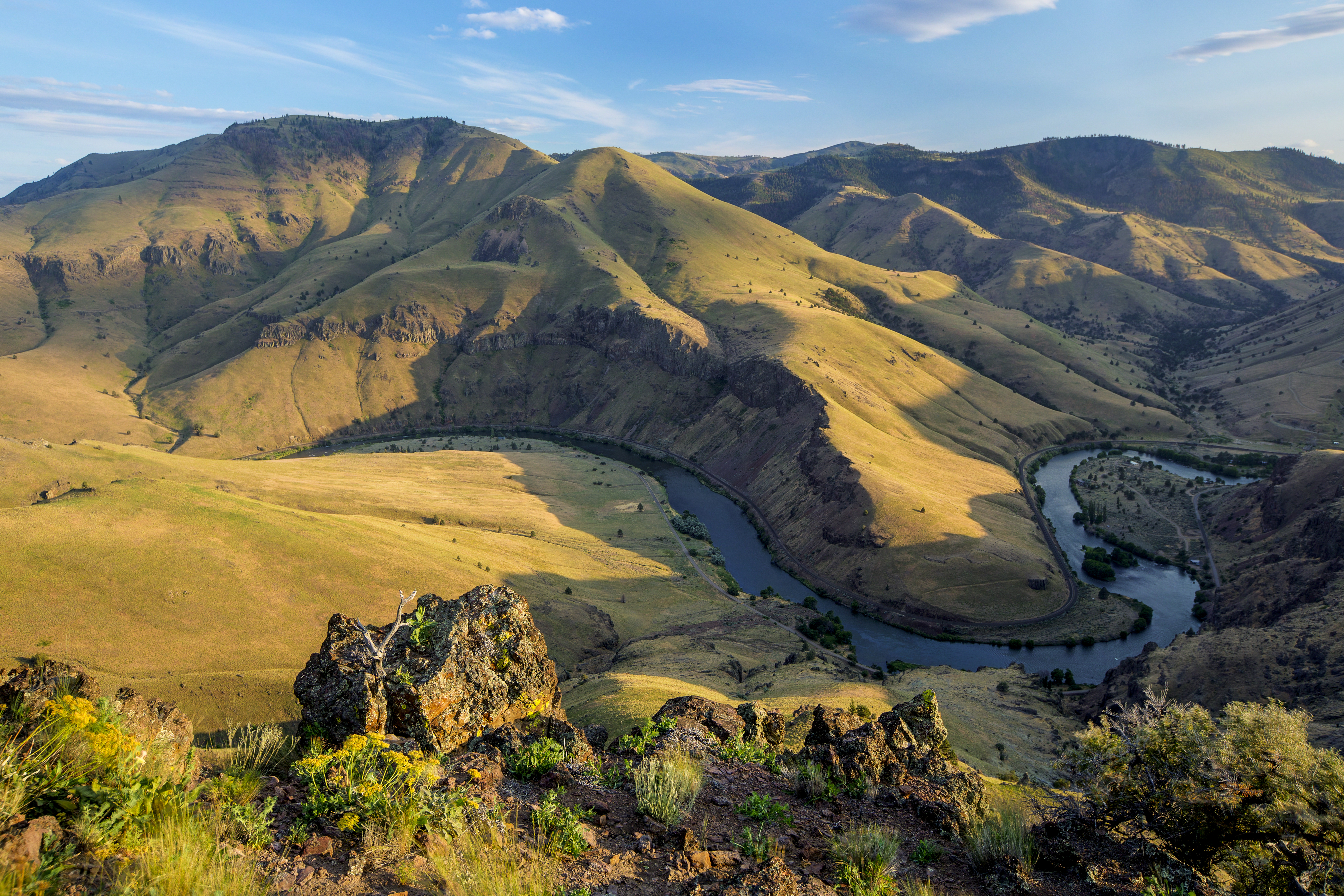
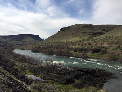
The Deschutes River was designated an Oregon Scenic Waterway in 1970 and a Federal Wild and Scenic River in 1988. The river runs through a deep rimrock-lined canyon that ranges from 900 feet to 2,600 feet in depth. The elevation drops from 1,393 feet at Pelton Reregulation Dam to 160 feet at its confluence with the Columbia River. The average gradient is 13 feet per mile and is relatively constant throughout its length. The most significant drops in gradient are Sherars Falls (River Mile 44), with a vertical drop of 15 feet, and Whitehorse Rapids (River Mile 75), with a vertical drop of approximately 35-40 feet over one mile. Within this canyon you will experience an incredible geologic and cultural history and a diverse community of fish, wildlife and vegetation. The Deschutes River is an increasingly popular river for all kinds of recreationists. Thousands of people visit each year to enjoy its incredible fishing, exciting whitewater, and beautiful scenery. The river offers a variety of opportunities for both day and overnight trips. Recreational activities include boating, fishing, hunting, mountain biking, and hiking.
Know Before You Go:
- A permit is required to boat the Lower Deschutes River. See link below for further permit information.
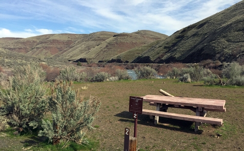
- Sixteen developed first-come, first-served campgrounds and seven day-use areas offer riverside recreating fun.
- Due to high fire danger, the Lower Deschutes River is closed to all campfires and charcoal fires from June 1 through October 15 each year. Propane and white gas stoves and shielded lanterns are permitted. Smoking is permitted only in a closed vehicle, while standing in the water, or while in a boat on the water. Using or possessing fireworks is prohibited at all times. The affected area of this closure is within the Lower Deschutes National Wild and Scenic River corridor, which extends from Pelton Dam to the Columbia River.
- When recreating on public lands, practice Leave-No-Trace principles.
Point of Interest:
Thirty six miles of the Lower Deschutes Access Road near Maupin, Oregon are also designated as the Lower Deschutes River Back Country Byway, a road offering scenic views of the basaltic canyon of the Lower Deschutes.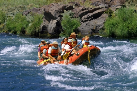
RecAreaDirections
The Deschutes River runs north through Central Oregon and meets the Columbia River east of The Dalles. The river can be accessed via U.S. 97, U.S. 197, and U.S. 26.
Open with Google MapMisc
| Stay Limit | 14 Days |
| Reservable | false |
| Keywords | |
| Map Link | |
| Contact Phone | |
| Contact Email |
Permits info
Facilities
Mecca Flat Campground Campground
List of CampsitesSituated on the banks of the Deschutes Wild and Scenic River, Mecca Flat Campground is located just a mile and a half from Oregon State HIghway 26 near Warm Springs. The site features 13 individual campsites and one group use area. The southern terminus of the 7-mile long Trout Creek Trail can be accessed directly from the campground.
Know Before You Go:
- All campsites, including the group use area are open year-round on a first-come, first-served basis; no potable water is available.
- The 1.6 mile Mecca Flat Road is narrow with few pullouts; use caution particularly when pulling a trailer.
- Access the nearby non-motorized Trout Creek Trail which fronts the Deschutes Wild and Scenic River for 7 miles where it terminates at Trout Creek Campground.
- Cell phone service is not available in the campground.
- Goathead, also known as puncturevine, is present in the area; protect your pets and bicycle tires
Point of Interest:
The Deschutes Railroad ran on portions of the nearby Trout Creek trail and Mecca Flat Road for several decades, competing with the Oregon Trunk Railroad before abandonment in the early 20th century. Look for the historic, now-abandoned tunnel near Highway 26 - but stay clear of this degrading and unstable structure.Rattlesnake Canyon Campground Facility
Located at the mouth of its namesake canyon and along the scenic Lower Deschutes River Back Country Byway, Rattlesnake Canyon Campground is located 20.4 miles north of the city of Maupin, Oregon. Several campsites in the campground offer direct river access along a verdant strip of riparian vegetation.
Know Before You Go:
- Rattlesnake Canyon Campground is open year-round with 8 individual campsites, one group-use campsite, a vault toilet and garbage service. No drinking water or utility hookups are available.
- No reservations are accepted; all campsites are on a first-come, first-served basis only.
- Campfires and smoking are allowed only from October 16 through May 31, annually, unless posted otherwise.
- When recreating on public lands, practice the Leave-No-Trace Principles.
Point of Interest:
Rattlesnakes? Yes, but they are out and about in all low elevation desert river canyons in the region. As predators, rattlesnakes play an important ecological role in keeping small mammal populations in check. Please observe rattlesnakes from a safe distance and do not attempt to engage with them; they want to avoid you as much as you may want to avoid them.
Long Bend Campground Facility
Featuring riverside campsites and a steep, primitive boat launch this cozy campground is a little bit away from the summertime busyness of nearby Maupin. One campsite offers limited shade so you’ll have to bring your own for the other sites.
Know Before You Go:
- Long Bend Campground is open year-round and is with 4 campsites, one vault toilet and garbage service. No drinking water or utility hookups are available.
- No reservations are accepted; all campsites, are available on a first-come, first-served basis only.
- Campfires and smoking are allowed only from October 16 through May 31, annually, unless posted otherwise.
- When recreating on Public Lands, please practice the sevenLeave-No-Trace Principles.
Point of Interest:
Long Bend offers a quieter alternative to the hubbub of nearby Harpham Flat Campground.Lower Deschutes River Boater Pass Permit
Overview:
The Deschutes River begins its journey high in the Cascade Mountains of Oregon at Little Lava Lake and travels through deep rimrock-lined canyons on its 252-mile course north to the Columbia River. The last 100 miles of this path were designated as an Oregon Scenic Waterway in 1970 and a Federal Wild and Scenic River in 1988. The Lower Deschutes River is managed cooperatively by three agencies: Prineville District Bureau of Land Management; the Confederated Tribes of Warm Springs; and Oregon Parks and Recreation Department.Boater Passes are required year-round, for both day and overnight use, for anyone using a watercraft or any other floating device as a means of transport on the Lower Deschutes River. Access is restricted to a limited number of boaters on some segments during peak use periods. Limited Entry passes can be reserved up to 26 weeks in advance. Learn more about these limits, the four unique Lower Deschutes River segments and camping guidelines along the Lower Deschutes River.
The Deschutes has a rich cultural history, providing food and water for thousands of years to the Warm Springs and Wasco people moving seasonally through the area. In the 1800s, due to increasing pressure from settlers, many moved to the lands now known as the Warm Springs Reservation, which borders much of the west side of the Lower Deschutes. Members of the Confederated Tribes of Warm Springs retain their fishing rights and can be seen dip net fishing the traditional way, leaning from platforms over the river just below Sherars Falls.
The Deschutes has a unique flow that is fairly uniform compared to other similar rivers. The annual fluctuation between flows is small due to the many nourishing springs that feed the river in the upper reaches, and the effects of the Pelton Reregulation Dam, which delivers a uniform flow for the last 100 miles.
Visitors on the river pass through steep canyons that reveal their volcanic origin in the towering basalt columns lining the rims. The elevation drops from 1,393 feet at Pelton Dam to 160 feet at its confluence with the Columbia River. The average gradient is 13 feet per mile and is relatively constant throughout its length. The most significant drops in gradient are Sherars Falls (River Mile 44), with a vertical drop of 15 feet, and Whitehorse Rapids (River Mile 75), with a gradient of approximately 35-40 feet over one mile.
Many outstanding opportunities draw people to the Lower Deschutes River. Thousands come every year to enjoy world class fishing, exciting whitewater and beautiful scenery. No matter where you are along the Lower Deschutes, you will experience an incredible geologic and cultural history, a diverse community of fish, wildlife and vegetation, and an abundance of recreational opportunities. Whatever you plan to do, if you want to stay overnight, arrive early to get a campsite, especially during summer weekends. Come enjoy a unique opportunity to discover the historic and present day wonders of the Deschutes River canyon!
Macks Canyon Recreation Site Facility
The Macks Canyon archaeological site is a large, prehistoric village locale overlooking the Deschutes River in north-central Oregon. The site is characterized by shallow, circular, semi-subterranean house depressions, surface artifacts, and riverine shell deposits. Limited excavations conducted in the late 1960's indicate that the site was the location of a winter village occupied by Sahaptin-speaking people of the Columbia Plateau. Although the main period of occupation appears to have occurred within the last 2,000 years, the site may have been occupied as early as 5,000 BC.
A campground and boat ramps are situated at the end of the Access Road along the east bank of the Lower Deschutes River. The area is popular with boaters and fishermen. The route to Macks Canyon is also a National Back Country Byway.
Know Before You Go:
- Macks Canyon Recreation Site is open year-round and is with 18 individual campsites, two group-use campsites two vault toilets and garbage service. No drinking water or utility hookups are available.
- No reservations are accepted; all campsites, are available on a first-come, first-served basis only.
- No cell phone service is available.
- Campfires and smoking are allowed only from October 16 through May 31, annually, unless posted otherwise.
- When recreating on Public Lands, please practice the sevenLeave-No-Trace Principles.
