
Trout Creek Trail
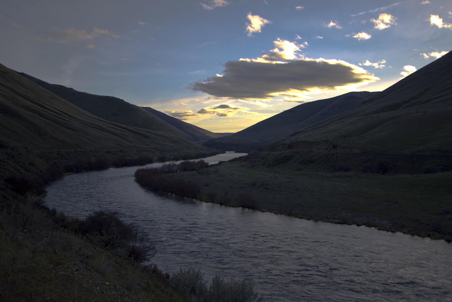
Built largely atop an abandoned railroad grade, the seven-mile Trout Creek trail runs parallel to the Wild and Scenic Deschutes River connecting Trout Creek Campground and Mecca Flat Campgrounds. Not far from Trout Creek Campground is the Trout Creek Climbing Area, a seasonally-popular area for technical rock climbing on spectacular columnar basalt cliffs. Several primitive campsites and vault toilets along the trail offer riverside amenities. Fishing, camping, hiking and outstanding river scenery are some of the opportunities which treat visitors to the area.
Know Before You Go:
-
Portions of the trail cross private property along narrow easements. Please respect landowners’ privacy.
- Goathead, also known as puncturevine, is present in the area; protect your pets and bicycle tires
Point of Interest:
The Deschutes Railroad ran on portions of the Trout Creek trail for several decades, competing with the Oregon Trunk Railroad before abandonment in the early 20th century.
RecAreaDirections
Mecca Flat Trailhead : From Madras, Oregon, drive 12.7 miles north on US highway 26. Immediately before the Deschutes River crossing, turn right on the unsigned Mecca Flat Road, a single-lane dirt road. Watch for the brown BLM directional sign announcing Mecca Flat Campground. Drive another 1.6 miles to the campground and trailhead.
Trout Creek Trailhead: From Madras, Oregon, drive 3 miles north on US highway 97; turn left onto NE Cora Drive and proceed another 0.7 miles. Make a slight left onto NE Clark Drive for another 5.8 mi, then turn left onto NE Buckley Ln/NE Clark Drive; proceed another 0.4 miles. NE Buckley Ln/NE Clark Drive turns left and becomes NE Clemens Drive for another 1.3 miles. At the community of Gateway, turn right to stay on NE Clemens Drive which becomes Coleman Road. The road turns to gravel at Trout Creek and a narrow tunnel precludes tall vehicles. After another 4.4 miles Trout Creek Campground is on the banks of the Deschutes River; the trailhead is at the far southern end of the campground.
Open with Google MapMisc
| Stay Limit | 14 days |
| Reservable | false |
| Keywords | |
| Map Link | |
| Contact Phone | |
| Contact Email |
Permits info
Facilities
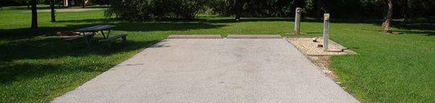
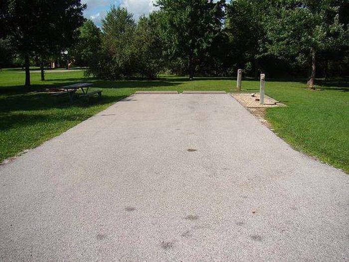
Trout Creek Campground Campground
List of CampsitesFeaturing a boat launch, a seasonal ranger station and trailhead, Trout Creek campground offers 21 campsites and three group-use campsites along the Lower Deschutes Wild and Scenic River. Some pull-through campsites as well as day-use parking are available in the recreation site. Access to the 7-mile Trout Creek Trail and Trout Creek Climbing Area originate at the south end of the campground.
Know Before You Go:
- The campground is open year round but no potable water is available
- Cell phone service is not available in the campground.
- Goathead, also known as puncturevine, is present in the area; protect your pets and bicycle tires
- The Trout Creek Climbing Area is subject to an annual seasonal wildlife closure from January 15 to August 31 to protect sensitive nesting golden eagles.
Point of Interest:
Spectacular and towering volcanic cliffs - fine examples of what geologists call columnar basalt - can be seen on the Trout Creek trail upriver from the campground.Trout Creek Climbing Area Facility
The Trout Creek Climbing Area has an annual closure to protect nesting golden eagles. The closure runs from January 15 -August 31 each year. During the closure, visitors to the area can use the Trout Creek campground and hike along the trail that follows the Lower Deschutes River to the south; however, they cannot leave the trail and head uphill toward the climbing area. This closure restricts access to all uses including hiking, climbing, or mountain biking.
Trout Creek is located in north-central Oregon, about 45 minutes north of Smith Rock State Park.
