Vermilion Cliffs Highway
Embarking from the spectacular Virgin River Gorge, south of St. George, Utah, you can follow 277 miles of paved highways winding through small rural communities to the Navajo Indian Reservation on the east. Scenic overlooks and historic and prehistoric sites along the highways convey various aspects of exploration and survival in this remote region. The Vermilion Cliffs Highways traverse some of the most vast and picturesque landscapes in the West. In many cases, the highways follow historic transportation routes used for centuries by different cultures from American Indian tribes, Spanish explorers and pioneers to modern travelers.
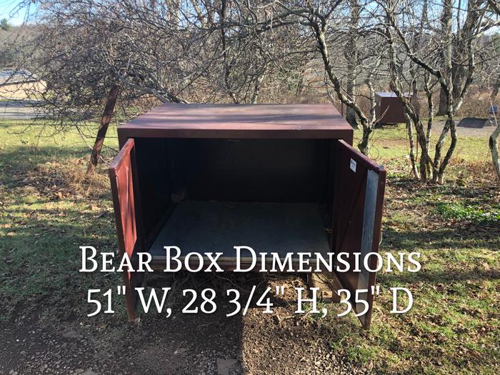
Food Storage
Food Storage Locker Dimensions: 51" W, 28 2/4" H, 35" D
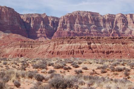
Vermilion cliffs highway
Image of Vermilion cliffs highway with a single engine plane airport in front of red rock mountains.
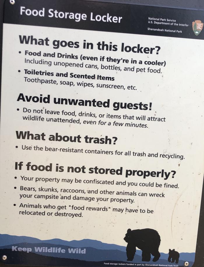
Food Storage Locker; The purpose of the food storage locker is to provide you the convenience of easy storage of your food, coolers, toiletries and other scented items. It is not meant to store your trash. Trash should be taken to bear proof trash bins and recycle areas.
The purpose of the food storage locker is to provide you the convenience of easy storage of your food, coolers, toiletries and other scented items. It is not meant to store your trash. Trash should be taken to bear proof trash bins and recycle areas.
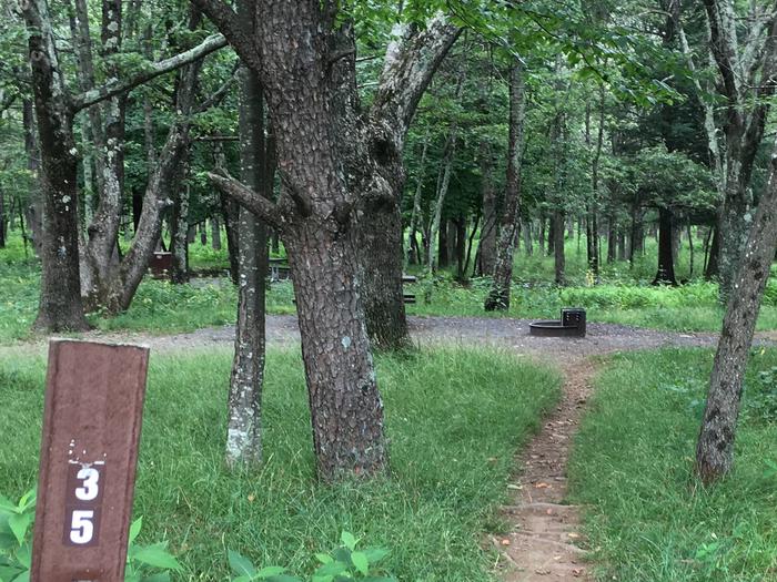
Reserve-able tent only site 35
Tent only site 35
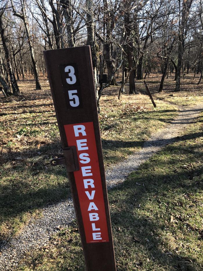
site marker for tent only site 35; If you reserve this site, your camping pass will be attached to this site marker. When you check out, drop your pass off at the registration office.
If you reserve this site, your camping pass will be attached to this site marker. When you check out, drop your pass off at the registration office.
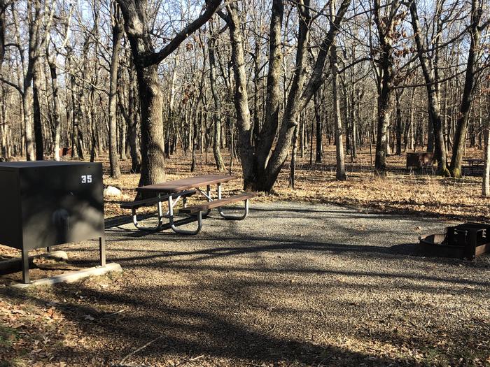
Food storage bin for Tent only site 35 has a food storage bin for your convenience. Food/coolers must be stored in this bin when you are not there to prevent bears and other wildlife from getting into your belongings.
Tent only site 35 has a food storage bin for your convenience. Food/coolers must be stored in this bin when you are not there to prevent bears and other wildlife from getting into your belongings.
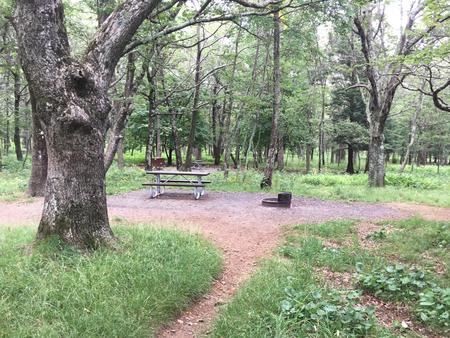
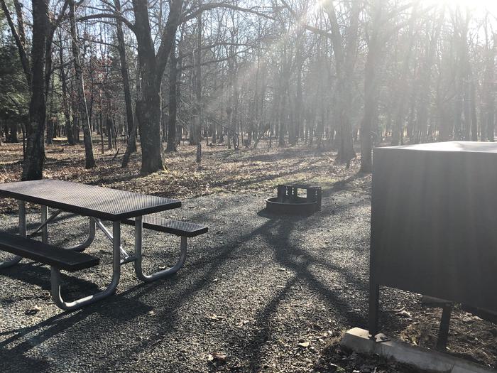
tent only site 35;Large, level site with a short walk from the parking area
Large, level site with a short walk from the parking area
Tent only site 35; image taken on 12/21/20 Vegetation is dormant but the site does have significant shade during camping season.
Vegetation is dormant but the site does have significant shade during camping season.
RecAreaDirections
Interstate 15, and Highway 9 - On the western end of the highways corridor is Interstate 15, and Highway 9. These segments breach what was once a formidable barrier to transportation created by the Beaver Dam and Virgin Mountains. These segments also graphically show the abrupt change from the more somber Basin and Range Physiographic Province in the west to the colorful, layer-cake geology of the Colorado Plateau Province to the east. The power of moving, folding land masses is evident everywhere, especially in the Virgin River Gorge where the Grand Wash Fault line plays a prominent role in the lay of the land.
Open with Google Map
Misc
| Stay Limit | |
| Reservable | false |
| Keywords | |
| Map Link | |
| Contact Phone | |
| Contact Email | |
Permits info
Facilities
More

