South Fork Canyon Special Recreation Management Area
Located northwest of South Fork State Recreation Area, South Fork Canyon offers access to the South Fork River. Float the river in tubes, kayaks or canoes. Along the river you will have the opportunity to see part of the California National Historic Trail (Hastings Cutoff), wildlife, deep limestone canyon walls, and cultural sites. The best time to float the river is during spring runoff. The river is mostly Class I with limited Class II areas (only at peak flows). There are no developed facilities or campgrounds on BLM lands. Roads along the river are primitive and travel is not advised during periods of moisture.
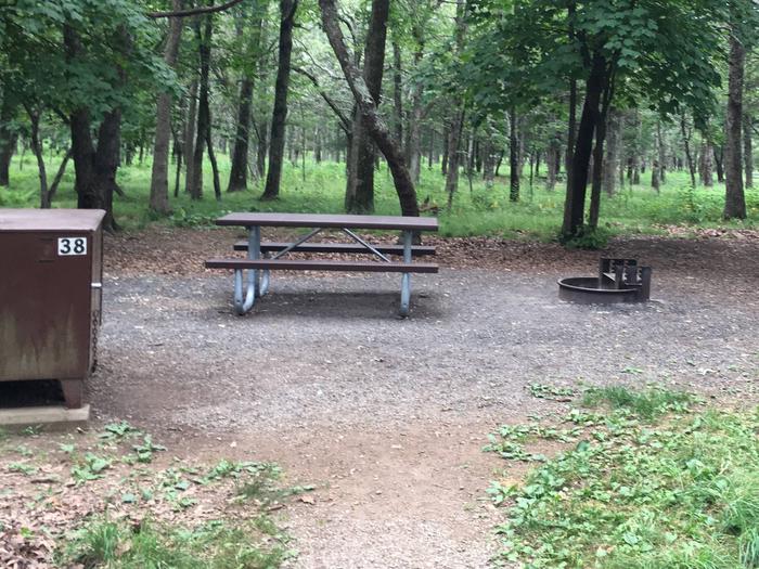
Reserve-able tent only site 38
Tent only site 38
food storage bin for Tent only site 38 has a food storage bin for your convenience. Food/coolers must be stored in this bin when you are not there to prevent bears and other wildlife from getting into your belongings.
Tent only site 38 has a food storage bin for your convenience. Food/coolers must be stored in this bin when you are not there to prevent bears and other wildlife from getting into your belongings.
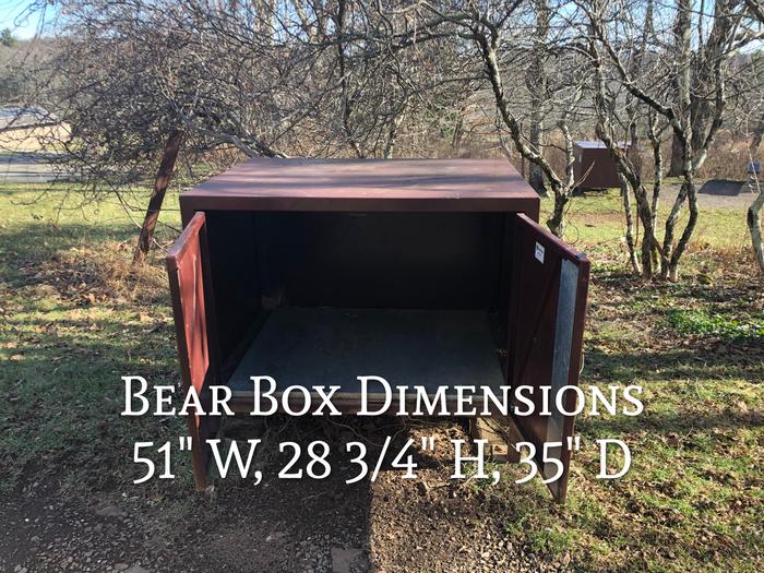
Food Storage
Food Storage Locker Dimensions: 51" W, 28 2/4" H, 35" D
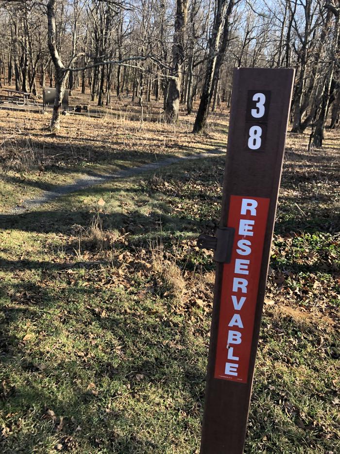
Site marker for tent only site 38;If you reserve this site, your camping pass will be attached to this site marker. When you check out, drop your pass off at the registration office.
If you reserve this site, your camping pass will be attached to this site marker. When you check out, drop your pass off at the registration office.
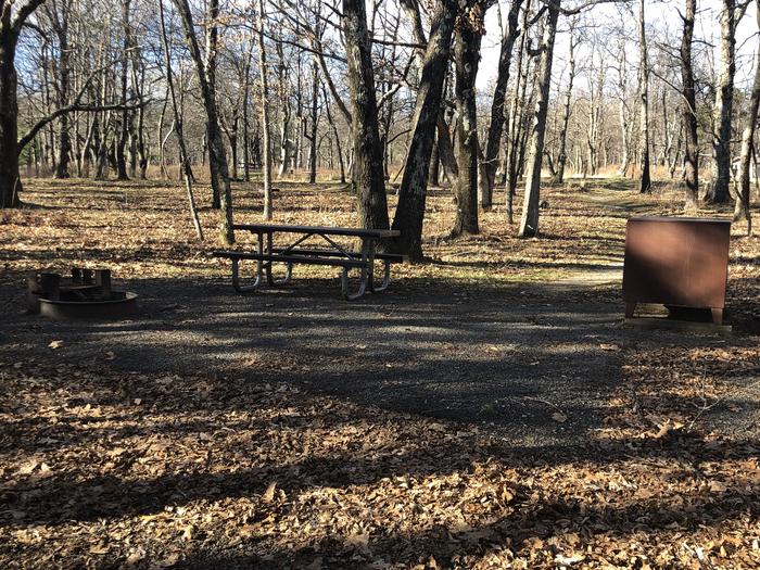
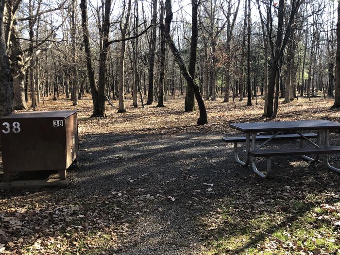
Tent only Site 38; image taken on 12/21/20. Vegetation is dormant but the site does have significant shade during camping season.
Vegetation is dormant but the site does have significant shade during camping season.
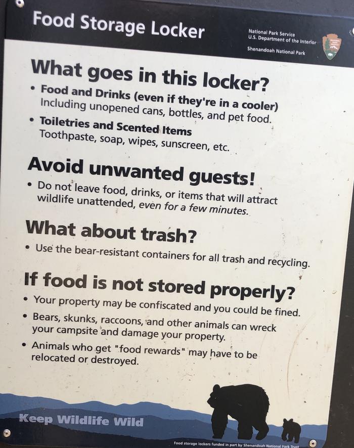
Food Storage Locker; The purpose of the food storage locker is to provide you the convenience of easy storage of your food, coolers, toiletries and other scented items. It is not meant to store your trash. Trash should be taken to bear proof trash bins and recycle areas.
The purpose of the food storage locker is to provide you the convenience of easy storage of your food, coolers, toiletries and other scented items. It is not meant to store your trash. Trash should be taken to bear proof trash bins and recycle areas.
RecAreaDirections
Drive southeast on State Road 227 towards Spring Creek (7 miles). Turn south on State Road 228. Drive approximately 5 miles until the South Fork turnoff to the west. Head northwest of the dam to access South Fork Canyon.
Open with Google Map
Misc
| Stay Limit | 14 day limit |
| Reservable | false |
| Keywords | |
| Map Link | |
| Contact Phone | |
| Contact Email | |
Permits info
Facilities
More

