
Rogue Wild & Scenic River
The United States Congress designated Oregon's Wild Rogue Wilderness in 1978 and it now has a total of 35,806 acres—approximately 27,111 are U.S. Forest Service lands and 8,600 are Bureau of Land Management (BLM) lands. The legislation assigned the U.S. Forest Service to manage the entire Wilderness Area.
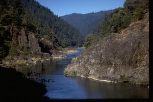
Surrounding the Wild and Scenic Rogue River, the rugged and complex canyon landscape of the Wild Rogue Wilderness provides watershed protection for the Wild portion of the river. The area is characterized by steep terrain of near vertical cliffs, razor-sharp ridges and cascading mountain creeks.
Know Before You Go
Along the river you may see deer and otters, or even black bears looking for a meal of salmon. Bears, grown accustomed to easy pickings from boaters, may prove a nuisance in numerous campsites. Birds abound, such as fish eating osprey and great blue heron and lizards hasten over the dry slopes above the water. Ticks and rattlesnakes are often encountered.
The river corridor is also excellent habitat for poison oak, whose stems and shiny leaves in groups of three can be a problem throughout the year. Mosquitoes are present during a good part of the season and yellow jackets can be a nuisance during the typically hot, rainless summer days.
Visitors can help in protecting this fragile ecosystem by adequately planning and by arriving prepared! Knowledge of the area, weather, terrain, and common sense can help to ensure you have a safe, fun, and memorable trip to the wild. Trail junctions are generally unsigned, so you should carry a map and a compass. And always, be sure to bring your ten essentials!
RecAreaDirections
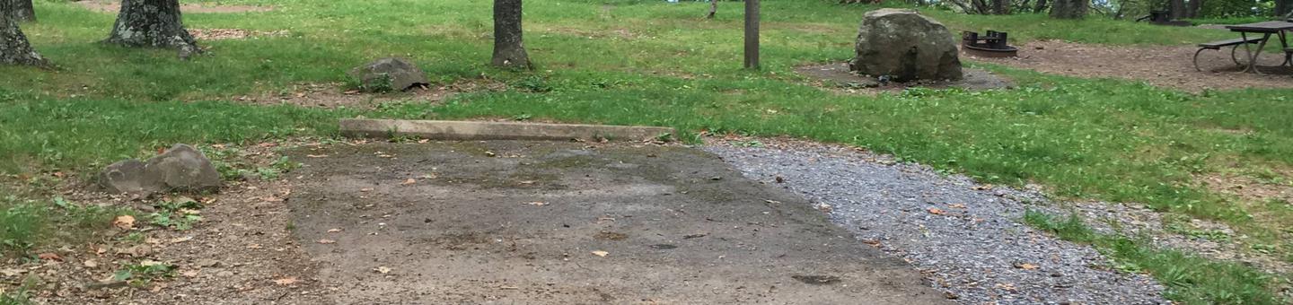
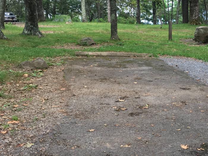
Approximately 15 miles of the 40 mile Rogue River Trail #1160, a National Recreation Trail, provides year-round hiker only access to the river corridor from Graves Creek down to Big Bend near Illahe. The Panther Ridge Trail #1253 follows Panther Ridge from Clay Hill to Buck Point along the upper elevation of the northern wilderness border. A side trail provides access to the unique vista of Hanging Rock, which is a large rock outcrop on a sheer vertical cliff. It provides excellent views into Eden Valley and the Rogue River Canyon. Other outstanding views can be obtained from the Mt. Bolivar Trail #1259 which provides access to the summit of Mt. Bolivar at 4,319 feet. The Mule Creek Trail #1159, located on the Bureau of Land management portion of the wilderness, provides a steep route on an out mining trail between the river and Panther Ridge. In general cross country travel is not advised due to steep slopes and heavy vegetation. The Forest Service administers the entire wilderness, including the Bureau of Land Management portion, so Forest Service regulations apply wilderness-wide.
Open with Google MapMisc
| Stay Limit | 14 Days |
| Reservable | false |
| Keywords | |
| Map Link | |
| Contact Phone | |
| Contact Email |
Permits info
Facilities
Rainie Falls Overlook Facility
Rainie Falls Overlook is located along the Grave Creek to Marial Back Country Byway 1.3 miles above the Grave Creek Boat Ramp. This overlook offers spectacular views of the mighty waterfalls, surrounding forests, and the Wild and Scenic Rogue River. Interpretive signs at the overlook explain the formation of the falls. Rainie Falls Overlook is well above the class V rapid bearing its name. With a 10 foot drop, boaters can use two alternative routes for floating through this cataract.
Know Before You Go:
- Day-use only and open year-round. No facilities are available.
- There is no river access from the overlook. A 2-mile trail to Rainie Falls can be accessed at the Graves Creek bridge.
Point of Interest:
If you take a look across the river and upriver from the overlook, the keen observer will espy a hexagonal structure just above the river. This 13-foot tall abutment is one of the few remnants of a suspension bridge constructed in 1908 but washed out by the flood of 1927.Rogue River Wild Section Permit
Overview:
Surrounded by the lush forests and rugged mountains of Southern Oregon, the Rogue National Wild and Scenic River was one of the original eight rivers designated Wild and Scenic in 1968. The Rogue flows 215 miles from Crater Lake to the Pacific Ocean at Gold Beach. From seven miles west of Grants Pass to 11 miles east of Gold Beach, the 84-mile long National Wild and Scenic portion is cooperatively managed by the Bureau of Land Management (BLM) and the US Forest Service.Each year, approximately 20,000 people float the Wild section of the river, where only a few trails, private lodges and BLM or Forest Service stations are evidence of man's intrusion. To help preserve the Rogue for future float trips, fishing, swimming, wildlife viewing, hiking, and enjoyment of its pristine beauty, a permit system is administered by the BLM. Permits are available year-round on the Wild section. During the peak season, May 15 - October 15, permits must be obtained through the competitive process. A self-issued non-competitive permit is available October 16 - May 14. Wild section float permit regulations are uniform throughout the year, requiring fire pans and toilet systems. While the permit system helps track and regulate use, keeping this remote wilderness untrammelled by man, you, the user, must learn and practice Leave No Trace ethics.
River conditions fluctuate seasonally. The autumn and spring vary in weather and water levels. Winter months are subject to cold temperatures and flood-stage water levels. During the peak summer season, the Rogue has warm temperatures, abundant sunshine and consistent flow rates. Boaters should always check road conditions, particularly during early- and shoulder-season trips, as shuttle routes will vary with road closures.
The Rogue is a well-recognized whitewater/wilderness float trip, known for its scenic beauty and emerald waters offering a remote floating experience with many technical rapids. These class III and IV+ rapids offer boating excitement for both families and experienced adventurers. Hiking on the remote Rogue River Trail, which parallels the entire Wild section of the Rogue River, is accessible from most river campsites. For more information, be sure to contact the Forest Service Gold Beach Ranger District or the BLM Medford District for the latest conditions and access to the spectacular Wild Rogue Wilderness Area!
Float Permit Reservation Information: A float permit is available year-round for the Wild section of the Rogue River. A lottery is used to allocate the control season (May 15 - October 15) launches. Lottery applications for the control season are accepted on Recreation.gov annually Dec. 1 - Jan. 31. Pre- and post-control season launches are obtained by filling out a self-issued permit available at Smullin Visitor Center and Grave Creek Boat Launch access.
