
Buffalo National River
Established in 1972, Buffalo National River flows freely for 135 miles and is one of the few remaining undammed rivers in the lower 48 states. Once you arrive, prepare to journey from running rapids to quiet pools while surrounded by massive bluffs as you cruise through the Ozark Mountains down to the White River.
RecAreaDirections
Buffalo National River is a long, narrow park that is crossed by three main highways.
Highways 7, 43, and 62/65 are the main roads out of Harrison, Arkansas that will take you to the Buffalo River, depending on which part of the park you wish to visit.
GPS systems are not reliable in this area so please call ahead for directions or pick up a map of the area beforehand.
Open with Google MapMisc
| Stay Limit | |
| Reservable | false |
| Keywords | |
| Map Link | |
| Contact Phone | |
| Contact Email |
Permits info
Facilities
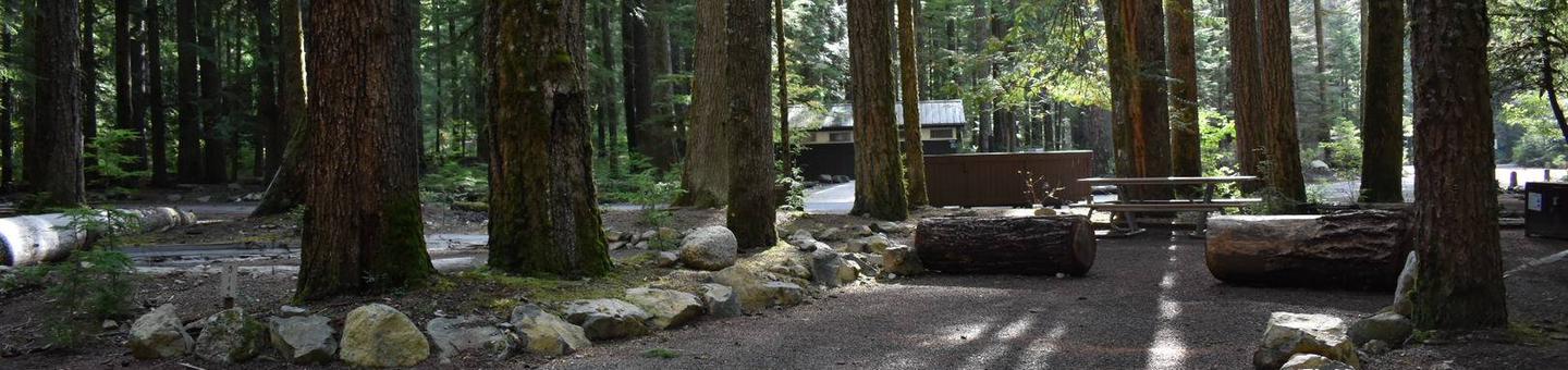
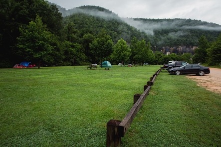
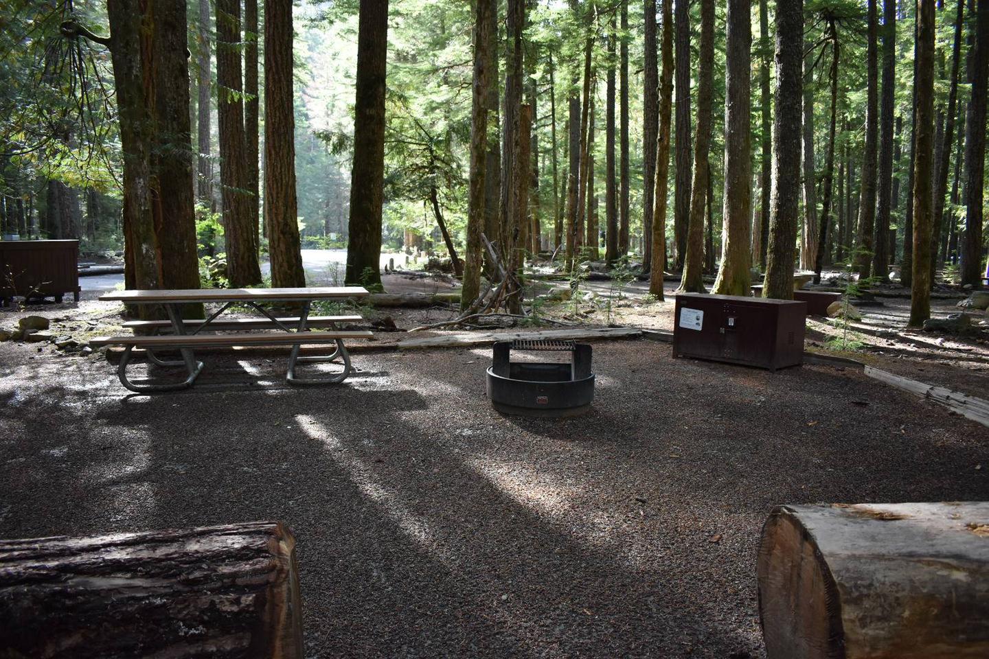
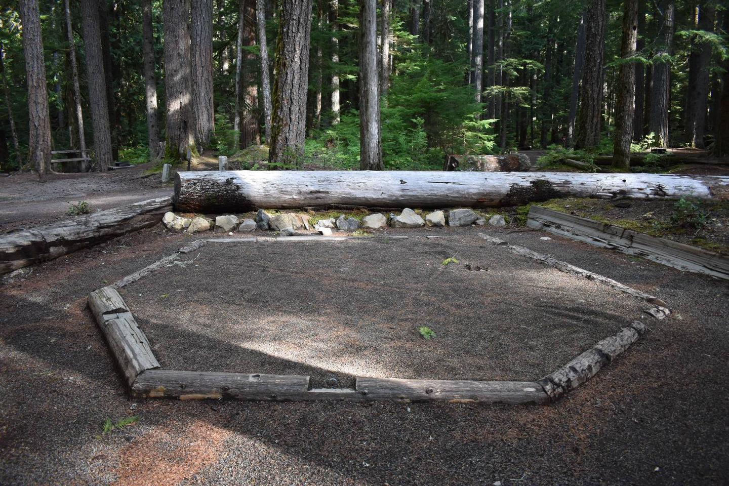
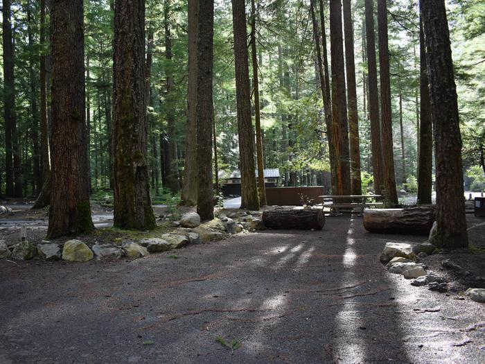
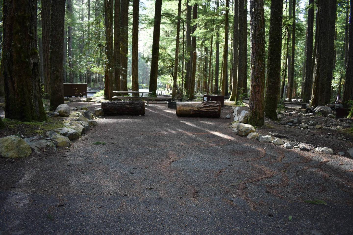
Steel Creek Campground Campground
List of CampsitesOverview
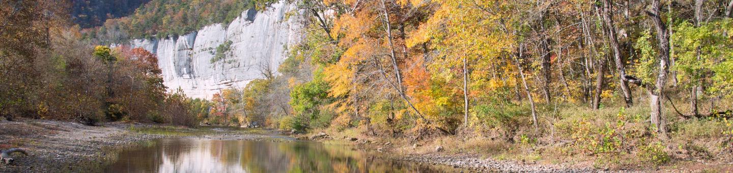
Steel Creek Campground is situated along the Buffalo River under the towering and picturesque Roark Bluff. One section of the campground offers 26 walk-in tent sites and another section of the campground offers 14 sites for those camping with horses. Half of the sites in the campground are available for reservations. Steel Creek is located about 3 miles east of Ponca, just off Highway 74.
Recreation
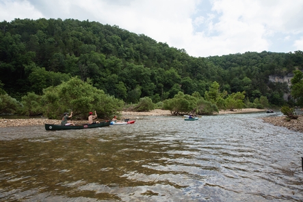
Floating conditions in the upper (westernmost) district of Buffalo National River are extremely dependent upon rainfall. On an average year, the upper river is only navigable by boat in the spring and early summer when consistent rainfall feeds into the watershed. Some sections on the upper end of the river are technical and should not be attempted by novices. For current floating conditions, please check with an outfitter, call the Steel Creek Ranger Station at 870-861-2570, or check river gauges online at ar.water.usgs.gov/buffaloriver.
Facilities
Natural Features
The Buffalo National River flows free over swift running rapids and quiet pools for its 135-mile length. One of the few remaining rivers in the lower 48 states without dams, the Buffalo cuts its way through massive limestone bluffs traveling eastward through the Arkansas Ozarks and into the White River.
Nearby Attractions
The Buffalo River Trail runs through Steel Creek and offers great day hiking or overnight backcountry opportunities.
Boxley Valley is nearby and is home to Lost Valley, an easy to moderate trail that leads hikers past geologic and water formations. Call the Steel Creek Ranger Station at 870-861-2570 or visit www.nps.gov/buff for more details.
Charges & Cancellations
rules and reservation policies
Steel Creek Ranger Station Facility
Steel Creek Ranger Station is open on an intermittent basis as rangers are available. At the contact station visitors can get information on campgrounds, hiking trails, and river accesses. The Steel Creek Ranger Station is located in the Valley Y Ranch Historic Area of Steel Creek Campground. The station is staffed seasonally, and hours may vary depending on park events and interpretive programs. Please call before you visit to ensure that staff will be available to assist you: 870-861-2570.
TYLER BEND CAMPGROUND Campground
List of CampsitesOverview
Campers will delight in the picturesque river views at Tyler Bend. Located 11 miles northwest of Marshall, Arkansas, Tyler Bend is set on a quiet, peaceful section of the great Buffalo National River. Known as the middle river region, the campground offers tranquil views of the river beside pastures.Recreation
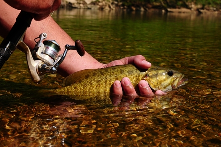
Small-mouth bass, catfish and sunfish are the most popular fish to catch on the Buffalo River, but visitors should be aware that an Arkansas fishing license is required to fish anywhere on the river.The middle river location also allows for extended seasons for kayaking and tubing. If there's enough rain, the sports can go through mid to late summer.
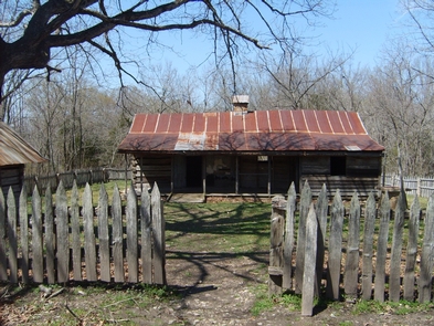
Get a dose of history by hiking to the Collier Homestead, a restored Ozark dwelling from the 1930's. The homestead remembers one of the homes built by settlers in response to the Homestead Act of 1862.
Facilities
The Tyler Bend Visitor Center is open year-round and has interesting exhibits on the history of flora and fauna in the Buffalo National River area. It's the primary visitor center for the region and provides several educational programs in the auditorium. The campground has 10 walk-in and 28 drive-in sites available, plus a day-use pavilion and five group sites.Natural Features
The Buffalo National River flows free over swift running rapids and quiet pools for its 135-mile length. One of the few remaining rivers in the lower 48 states without dams, the Buffalo cuts its way through massive limestone bluffs traveling eastward through the Arkansas Ozarks and into the White River.Nearby Attractions
The Buffalo River Trail is accessible from the Collier trailhead parking area. This trail joins the Ozark Highlands Trail at Woolum, 14 miles upstream from Tyler Bend.Charges & Cancellations
Rules and Reservation Policies
OZARK PAVILION Campground
List of CampsitesOverview
The Ozark Pavilion sits in the middle of the Ozark Campground near the impressive bluffs of the Buffalo River. Bring a picnic lunch or pack up your grill for a day of fresh air and outdoor activities.The big river isn't just a picturesque backdrop for your picnic - it also offers an array of river sports like canoeing, kayaking, tubing, swimming and fishing.
Recreation
The Buffalo River Trailhead is next to the pavilion. The scenic trail spans a massive 36.5 miles of the Buffalo River from Boxely to Pruitt, and is ideal for hiking or backpacking.Peak season for canoeing, kayaking and tubing is spring to early summer.
Facilities
The covered picnic area seats up to 100 people. Electricity is available but it's recommended you bring your own grill. Flush toilets and drinking water are provided.Natural Features
The pavilion is located along the Buffalo National River with views of lush forests and high, riverside limestone bluffs. It is one of the few free-flowing rivers remaining in the contiguous U.S., with 135 miles of undammed waters. It cuts through the Arkansas Ozarks to reach its final destination at the White River.Nearby Attractions
The nearby town of Jasper offers restaurants, gas stations and groceries. The Hilary Jones Wildlife Museum and Elk Center is just north of Jasper. It features displays of elk, white-tailed deer and ducks, as well as freshwater aquariums, wildlife paintings and a gift shop.Charges & Cancellations
Rules and Reservation Policies
BUFFALO POINT Campground
List of CampsitesOverview
Buffalo Point is a convenient, fun-filled destination for families and adventurists of all types. It's perched along the Buffalo National River, providing exciting river sports and hiking opportunities. In peak season, a restaurant is open at the facility, serving up meals for those who want a break from preparing them.Recreation
The wild river is a gathering place for a plethora of water activities. Many campers spend their days fishing, hiking, canoeing, or kayaking. Evenings are ideal for gathering next to the fire to revamp for another great day out on the river.Facilities
Buffalo Point offers campsites with water, electricity and a pay phone. It's the only area in the park with a restaurant, open daily from Memorial Day to Labor Day and on weekends only from mid-April to Memorial Day Weekend and Labor Day Weekend to mid-October.
Natural Features
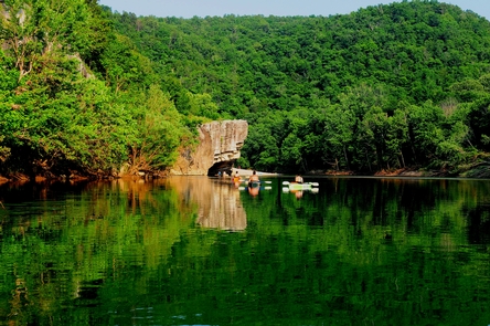
The campground is set along Buffalo National River, one of the few free-flowing rivers remaining in the contiguous United States. The river runs 135 miles without dams and cuts through the Arkansas Ozarks and into the White River. The region is surrounded by droves of lush hardwood trees and grassy open meadows.Nearby Attractions
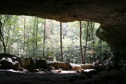
Two popular attractions within the Buffalo Point Area are the Indian Rockhouse Trail and the Rush Historic District. Rush was a zinc mining community until the zinc market collapsed and the settlement was deserted. Tours about the town's history are available. Buffalo Point is the former Buffalo River State Park developed in the 1930's as project of the Civilian Conservation Corps.Blanchard Springs Cavern, an extraordinary living cave, is a one-hour drive from Buffalo Point.
Charges & Cancellations
Rules and Reservation Policies
Kyles Landing Facility
Kyles Landing Campground is a first come, first serve campground located between Jasper, AR and Ponca, AR.. Kyles Landing has 33 tent only sites with no electrical amenities, but flush restrooms and water are available from March 15 through November 14.
Erbie Campground Campground
List of CampsitesErbie Campground is a first come, first serve campground. Erbie has 14 drive in camp sites, 2 walk in tent only sites, and 5 group sites. There are no electrical amenities, flush restrooms, or water available.
Ozark Campground Campground
List of CampsitesOzark Campground is a first come, first serve campground near Jasper, AR. Ozark has 31 drive in and tent sites with no electrical amenities, but flush restrooms and water are available from March 15 through November 14.
Rush Campground Campground
List of CampsitesRush Campground is a first come, first serve campground in the lower district of the park. Rush has 12 tent only sites with no electrical amenities and no flush restrooms. Drinking water is available when fees are collected March 15 - November 14. It is free to camp at Rush in the winter. All sites are limited to 6 people per site and each site is $16 per night. This is a pack in/pack out facility, trash collection is not available.
Spring Creek Campground Campground
List of CampsitesSpring Creek Campground is a first come, first serve campground near Harriet, AR. Spring Creek has 12 tent only sites with no electrical amenities, no flush restrooms, and no water.
Carver Campground Campground
List of CampsitesCarver is a first come, first serve campground in the upper district of the park. It has 8 tent only sites with potable water, but no electrical amenities. A vault restroom is available. This is a pack in/pack out facility with no trash service.
Woolum Facility
Woolum Campground is a large open field at the Woolum access to the Buffalo River near St. Joe AR. There are no amenities at Woolum. There are no designated sites. A vault toilet is available. Fees are not charged at Woolum. Woolum serves as overflow when Tyler Bend campground is full.
Maumee South Facility
Maumee South Campground is a large campground in the lower district of the Buffalo River. There are no amenities at Maumee South. There are no designated sites. A vault restroom is available. Fees are not charged at Maumee South.
Tyler Bend Visitor Center Facility
The Tyler Bend Visitor Center is located about 2 1/2 miles off of Highway 65 between St. Joe and Marshall, Arkansas. Here visitors can get park orientation information, see the park film, and shop at the park bookstore.
Buffalo Point Visitor Contact Station Facility
The Buffalo Point Visitor Contact Station is located about 3 miles off of Highway 14, 14 miles south of Yellville. Signs on Highway 14 indicate the turn for Buffalo Point.
