
Capitol Reef National Park
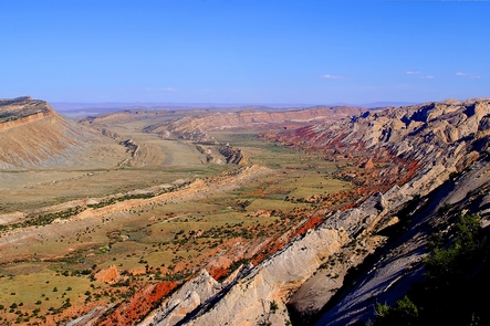
Located in south-central Utah in the heart of red rock country, Capitol Reef National Park is a hidden treasure filled with cliffs, canyons, domes, and bridges in the Waterpocket Fold, a geologic monocline (a wrinkle on the earth) extending almost 100 miles.

RecAreaDirections
From I-70: Take exit 149, then take UT-24 west toward Hanksville; continue for 43.8 miles (70.5 km). Turn right to continue on UT-24 west and continue for 37.3 miles (60 km).
From I-15: take exit 188 then US-50 east toward Scipio. Left on UT-50; continuing 0.7 miles (1.1 km). Turn right onto US-50 east; continue for 24.4 miles (39.3 km). Turn right onto UT-260 south and continue 4.2 miles (6.8 km), then right on UT-24 for 71.3 miles.
UT-12: North on highway 12 to Torrey, UT. Right onto UT-24.
Open with Google MapMisc
| Stay Limit | |
| Reservable | false |
| Keywords | |
| Map Link | |
| Contact Phone | |
| Contact Email |
Permits info
Facilities
Capitol Reef NP Group Campsite Campground
List of CampsitesOverview
Located in south-central Utah in the heart of red rock country, Capitol Reef National Park is a hidden treasure filled with cliffs, canyons, domes and bridges in the Waterpocket Fold, a geologic monocline (a wrinkle on the earth) extending almost 100 miles.The Fruita Campground area is located one mile south of the visitor center and is often described as an oasis within the desert. The Group Campsite is near Loop C of the Fruita Campground. It is a semi-shaded, grassy campsite and is located in the Fruita Historic District of the park.
Recreation
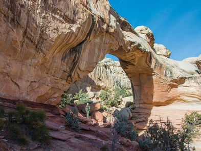
Walk to historic inscriptions on the Capitol Gorge Trail and stroll the Goosenecks Trail. Visitors looking for longer trails can explore Cohab Canyon, Chimney Rock, and Cassidy Arch.Enjoy the geology and view the Fremont petroglyph panels along Hwy 24. In addition, the Scenic Drive will introduce you to the fascinating cultural and geological history of Capitol Reef National Park. The drive includes a portion of the original road through the Waterpocket Fold. The road passes through parts of the Fruita Historic District and follows the western faces of the Waterpocket Fold, and spur roads allow exploration into beautiful Grand Wash and Capitol Gorge.
Check at the visitor center for a current schedule of interpretive programs, which may include geology talks, Fremont culture talks, evening programs, star gazing, moonwalks, and geology hikes. Stop in at Ripple Rock Nature Center to experience interactive exhibits, games, activities, and free educational programs.
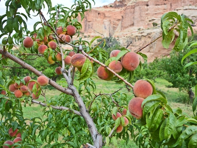
Wander through the historic Fruita orchards and pick fresh fruit when in season. The orchards contain approximately 3,100 trees including cherry, apricot, peach, pear, apple, plum, mulberry, almond, and walnut.
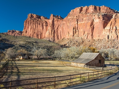
Discover Mormon pioneer history at the historic Gifford House store and museum.
Facilities
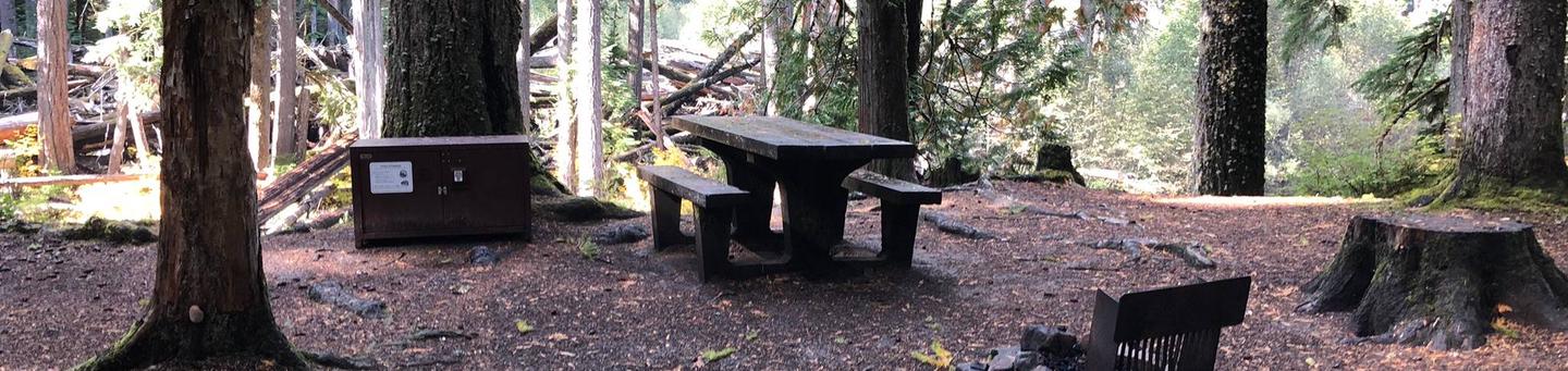
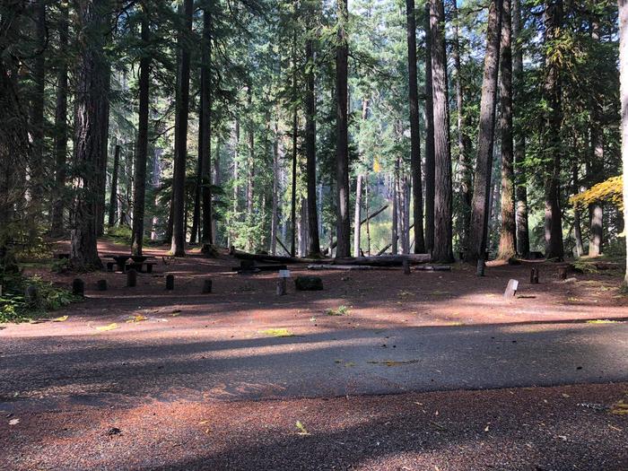
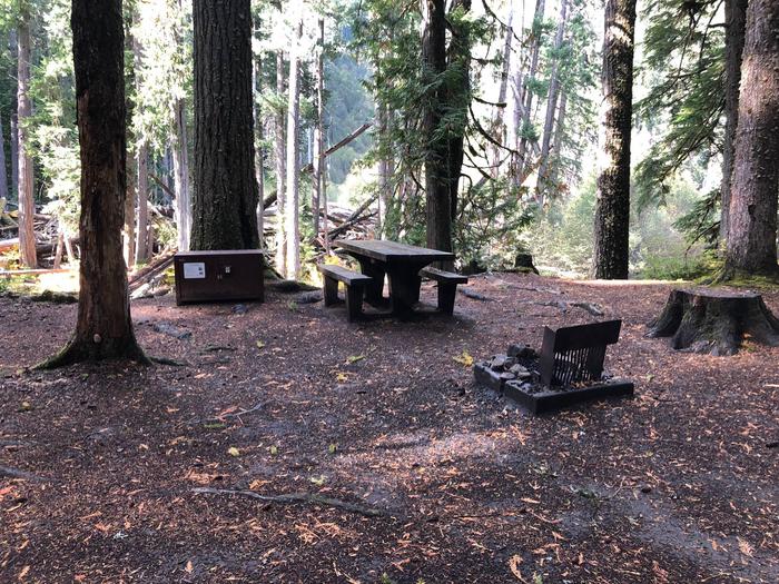
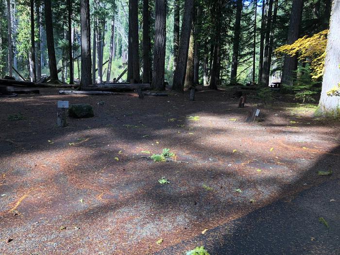
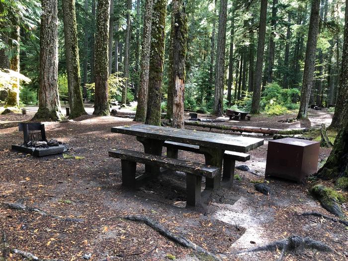
Sheltered picnic areas are provided at the group campsite and there is a large grassy area for tents and activities. Campers will enjoy the fire pit for relaxing evenings around the campfire and the above-ground grill for cooking. Amenities also include restrooms with flush toilets, a utility sink, drinking fountain and potable water faucets centrally located. There is no electricity available.Natural Features
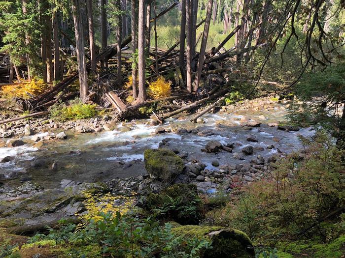
At Fruita Group site, large deciduous trees provide a shaded setting among beautiful and striking red rock cliffs. The group site sits adjacent to the Fremont River at approximately 5,500 feet elevation and is surrounded by unique historic orchards.Nearby, the Waterpocket Fold defines Capitol Reef National Park. The varied topography, geology, elevations, and precipitation patterns along the fold have resulted in a diversity of microhabitats and niches for plant species to inhabit. Seventeen geologic formations are exposed within the Waterpocket Fold, each with unique combinations of minerals, soil types, aspect and slope.
Nearby Attractions
The group site is a short walk from the main campground, amphitheater, picnic areas, hiking trails, the historic Gifford house and orchards.contact_info
For facility specific information, please call (435) 425-3791.Primitive campsites at Cathedral Campground Campground
List of CampsitesIt is located approximately halfway on the Cathedral Valley Loop Road. About 36 miles (57.9 km) from the visitor center, this primitive, no-fee campground has 6 sites, each with a picnic table and fire grate. There is a pit toilet, but no water available. The campground is open year-round; however, visitors should check road conditions with the Capitol Reef Visitor Center prior to planning an overnight stay. The campground is at ~7,000 feet (2,133 m) in elevation, No reservations; first-come, first-served.
Primitive campsites at Cedar Mesa Campground Campground
List of CampsitesIt is located approximately 23 miles (37.0 km) south of Utah State Highway 24 on the Notom-Bullfrog Road and is at 5,500 feet (1,676 m) in elevation. This primitive, no-fee campground has five sites, each with a picnic table and fire grate. There is also a pit toilet, but no water is available. The campground is open year-round, but visitors should check with the Capitol Reef Visitor Center for road conditions prior to planning an overnight stay. No reservations; first-come, first-served.
Backcountry Camping Facility
A free backcountry permit, available at the visitor center, is required for camping outside of campgrounds. Capitol Reef offers many hiking options for serious backpackers and those who enjoy exploring remote areas. For more information on possible backpacking routes, route descriptions and maps are available on our hiking and backpacking page.
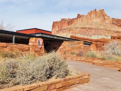
Capitol Reef National Park Visitor Center Facility
Capitol Reef National Park visitor center sits at the intersection of UT-24 and the Scenic Drive.
FRUITA CAMPGROUND Campground
List of CampsitesOverview
Located in south-central Utah in the heart of red rock country, Capitol Reef National Park is a hidden treasure filled with cliffs, canyons, domes and bridges in the Waterpocket Fold, a geologic monocline (a wrinkle on the earth) extending almost 100 miles. The Fruita Campground has 71 sites. 65 sites are reservable from March 1 to October 31. Sites 1, 2, 3, 6, 7 and 8 are used as administrative sites. There are no first come first serve sites during peak season.
Recreation
Walk to historic inscriptions on the Capitol Gorge Trail and stroll the Goosenecks Trail. Visitors looking for longer trails can explore Cohab Canyon, Chimney Rock and Cassidy Arch.Enjoy the geology and view the Fremont petroglyph panels along Hwy 24. In addition, the Scenic Drive will introduce you to the fascinating cultural and geological history of Capitol Reef National Park. The drive includes a portion of the original road through the Waterpocket Fold. The road passes through parts of the Fruita Historic District and follows the western faces of the Waterpocket Fold, and spur roads allow exploration into beautiful Grand Wash and Capitol Gorge.
Check at the visitor center for a current schedule of interpretive programs, which may include geology talks, Fremont culture talks, evening programs, star gazing, moonwalks and geology hikes. Stop in at Ripple Rock Nature Center to experience interactive exhibits, games, activities and free educational programs.
Wander through the historic Fruita orchards and pick fresh fruit when in season. The orchards contain approximately 3,100 trees including cherry, apricot, peach, pear, apple, plum, mulberry, almond and walnut.
Discover Mormon pioneer history at the historic Gifford House store and museum.
Facilities
This developed campground has 71 campsites. Each site has a picnic table and fire ring (except sites 7, 48 and 50, which only have an above ground grill). There is a RV dump and potable water fill station near the entrance to Loops A and B. Campsites have no individual water or sewage hookups. There are no electrical hookups available. Restrooms have running water and flush toilets, but no showers. Accessible campsites are located adjacent to restrooms. A printable campground map and site dimensions can be found at https://www.nps.gov/care/planyourvisit/fruitacampground.htm
