
Mount Rainier National Park
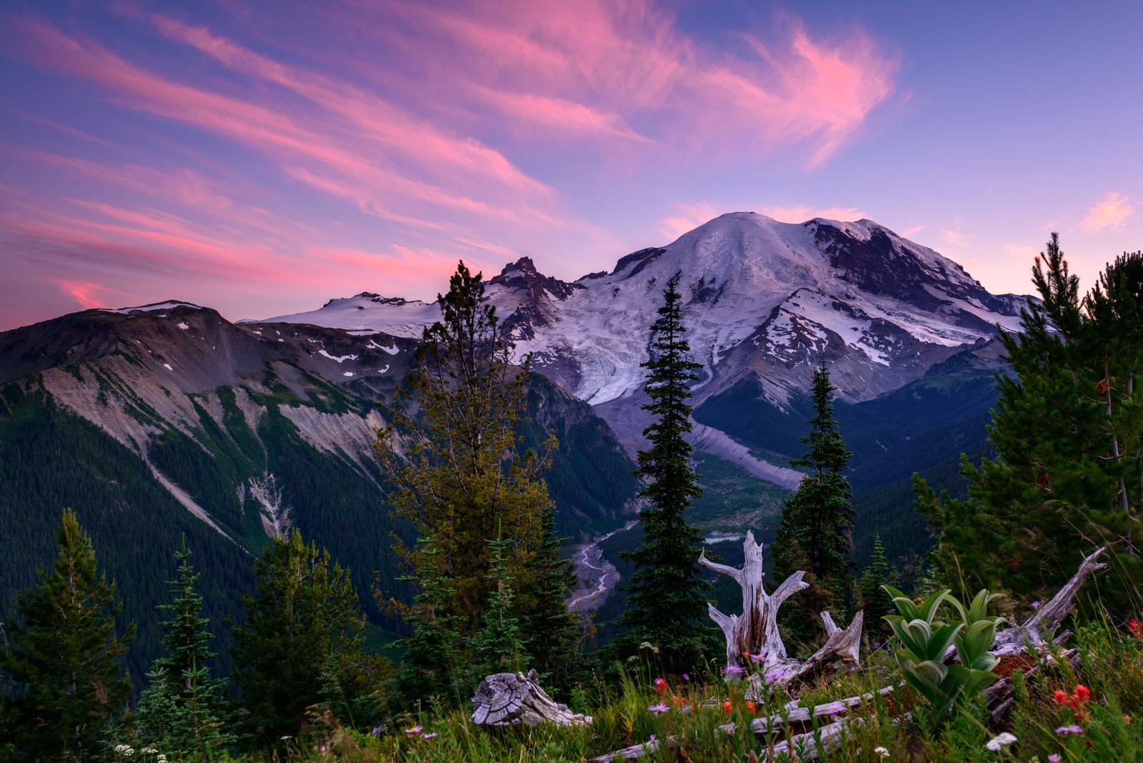
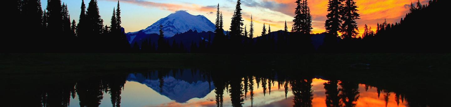
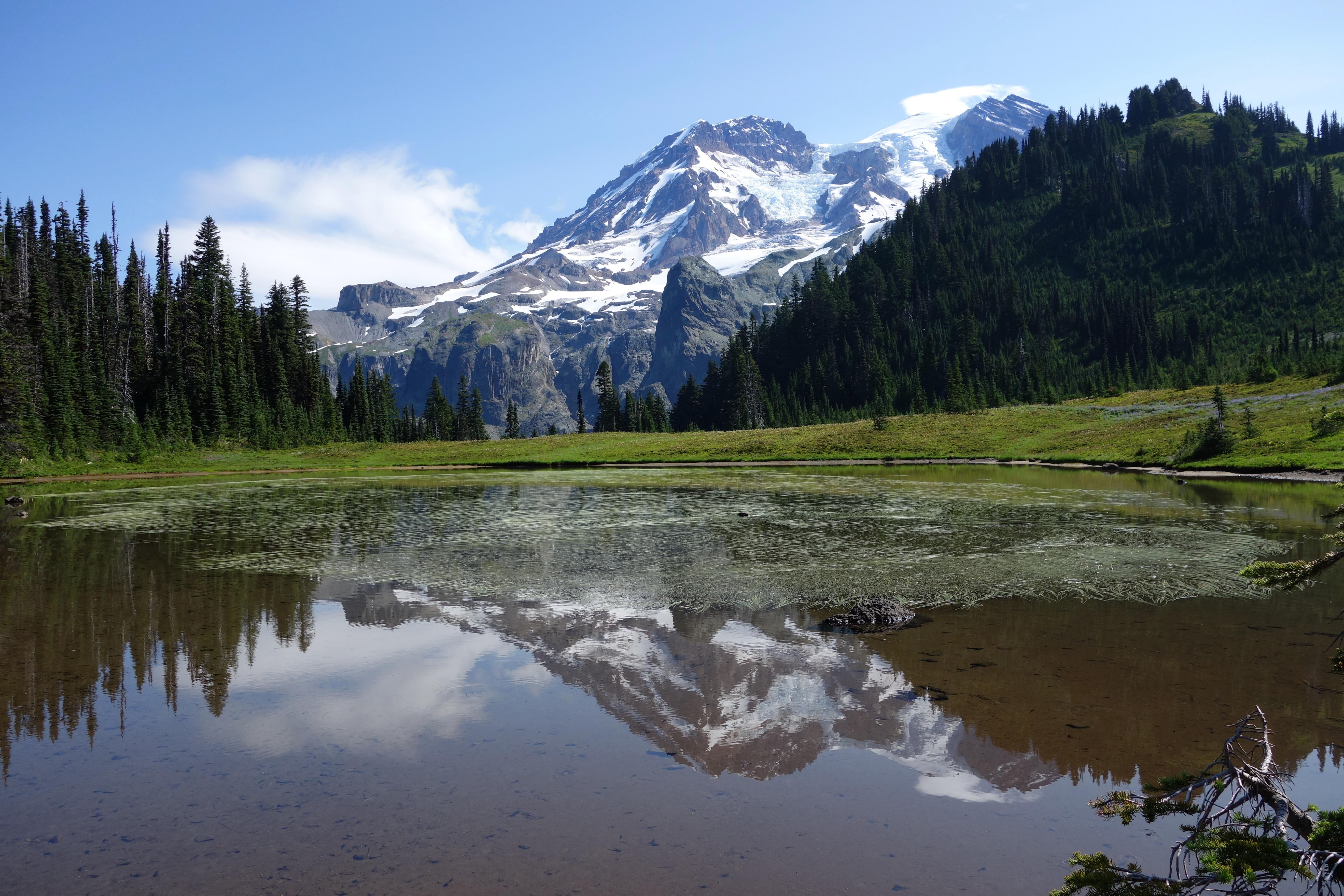
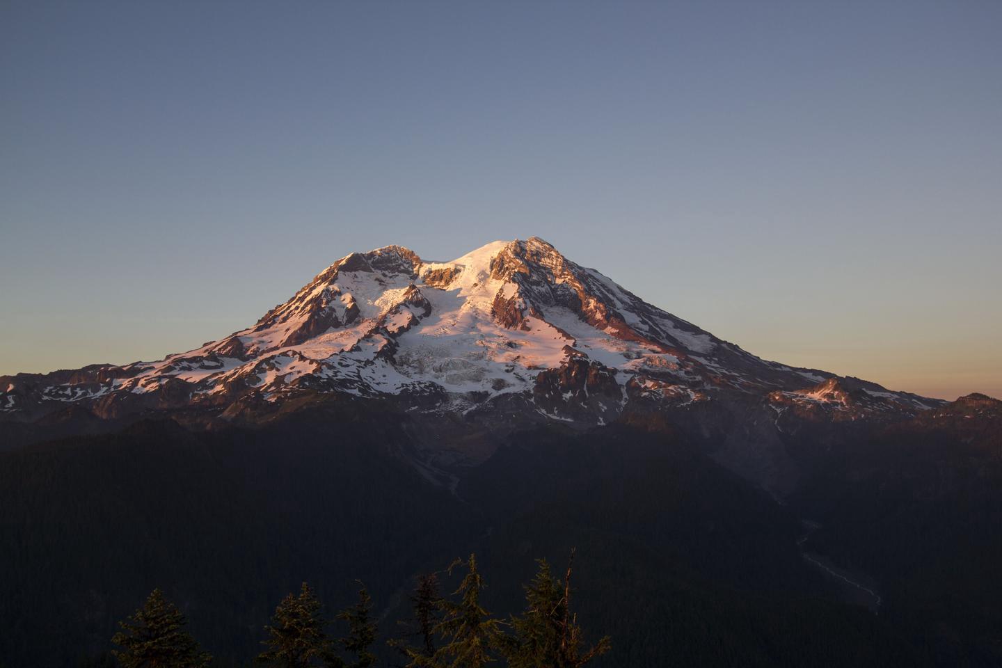
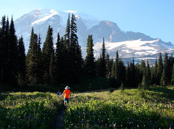
Ascending to 14,410 feet above sea level, Mount Rainier stands as an icon in the Washington landscape. An active volcano, Mount Rainier is the most glaciated peak in the contiguous U.S.A., spawning five major rivers. Subalpine wildflower meadows ring the icy volcano while ancient forest cloaks Mount Rainier’s lower slopes. Wildlife abounds in the park’s ecosystems. A lifetime of discovery awaits.
RecAreaDirections
Mount Rainier National Park is located in west-central Washington state. Several major cities in Washington- Seattle, Tacoma, and Yakima- and Portland, Oregon, are within 200 miles of the park. For GPS to Nisqually Entrance use: 39000 State Route 706 E, Ashford, WA 98304.
Open with Google MapMisc
| Stay Limit | |
| Reservable | false |
| Keywords | |
| Map Link | |
| Contact Phone | |
| Contact Email |
Permits info
Facilities
Longmire Wilderness Information Center Visitor Center
Open during the summer, the Longmire Wilderness Information Center (WIC) is located in the lobby of the historic Longmire Administration Building, a picturesque example of National Park Service rustic architecture in Longmire. The WIC features a 3D model map of Mount Rainier National Park and has an information desk staffed by wilderness rangers. Rangers at the WIC assist with wilderness permits, trip planning, and providing maps and trail condition updates.
White River Wilderness Information Center Visitor Center
Open during the summer, the White River Wilderness Information Center (WIC) located at the Winter River Entrance. The WIC has an information desk staffed by wilderness rangers. Rangers at the WIC assist with wilderness permits, trip planning, and providing maps and trail condition updates.
Paradise Wilderness Information Center Visitor Center
Open during the summer, the Paradise Wilderness Information Center (WIC) is located in the main room of the historic Guide House. The WIC has an information desk staffed by wilderness rangers. Rangers at the WIC assist with wilderness permits, trip planning, and providing maps and trail condition updates.
OHANAPECOSH CAMPGROUND Campground
List of CampsitesOverview
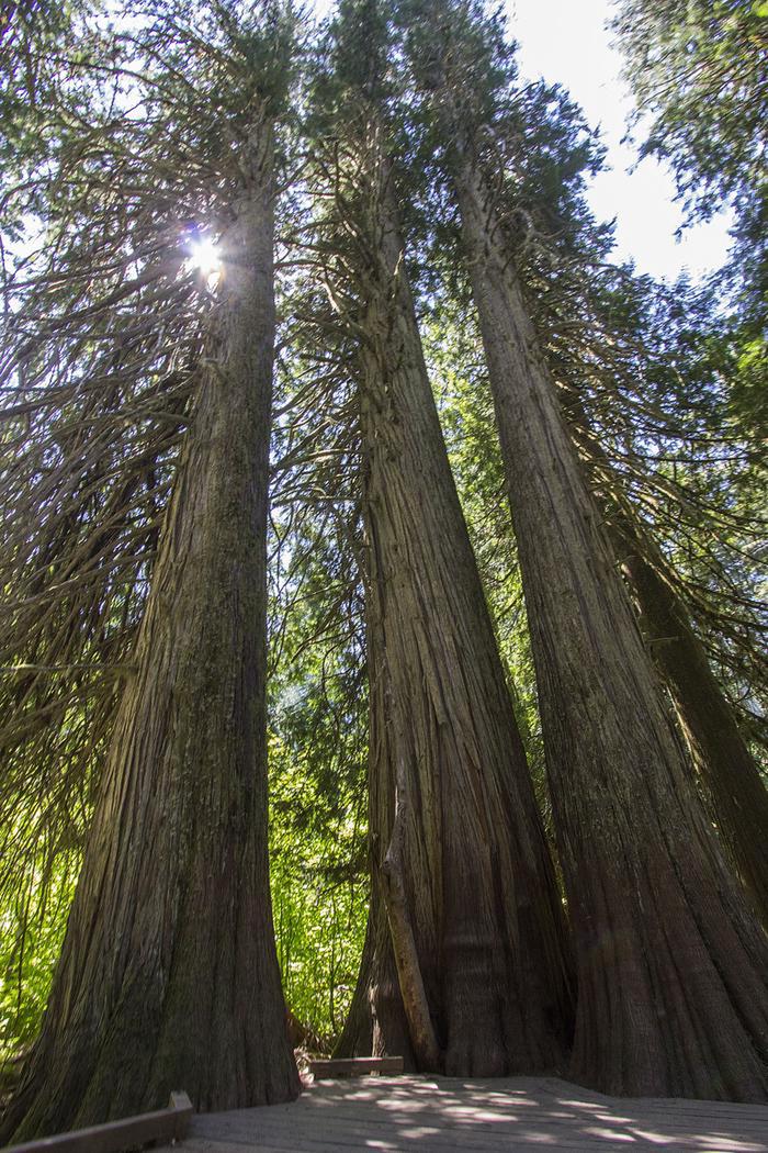
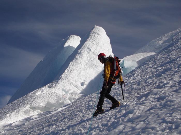
Ohanapecosh Campground, on the southeast side of Mount Rainier National Park, is surrounded by old growth forest and crossed by an exceptionally beautiful snow-fed river. Close to Ohanapecosh are popular hikes to Silver Falls and the Grove of the Patriarchs.The main attraction at Mount Rainier National Park is the mountain itself, a glacier-clad volcano of immense proportions. At 14,411 ft., it dominates the skyline for hundreds of miles. Visitors travel through majestic old-growth forests, past tumbling waterfalls and historic buildings to reach sub-alpine meadows, where world-famous wildflower displays are seen in July and August. Popular activities in the park include sight-seeing, hiking, climbing and camping.
Ohanapecosh campground has an elevation of 1,914 feet. Weather is dry, cool and sunny in the summer with daytime temperatures in the 60 to 80-degree range. Even though the eastern side of the park can be sunnier than other areas, weather can be variable and visitors should come prepared.
Recreation
The most popular campground in the park, Ohanapecosh is convenient to both the Paradise and Sunrise areas. Numerous hiking trails originate both in and nearby the facility, including the Grove of the Patriarchs trail, which leads hikers through stands of old growth forest, and several trails that lead to Silver Falls waterfall.For visitors who would like to learn more about natural and cultural history, the Ohanapecosh Visitor Center is close by as well.
Facilities
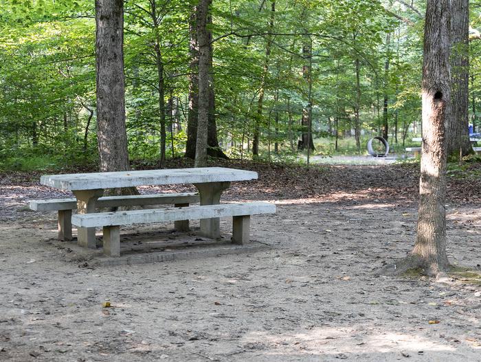
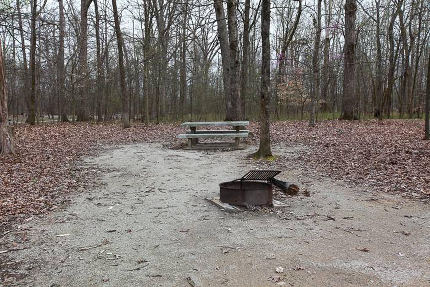
This large campground has 188 individual sites for RV or tent camping situated among the ancient trees. There is drinking water, but no electric hookups. Visitors must use extra caution with food storage, as bear and other animals inhabit the area around the campground.Natural Features
Ohanapecosh is thought to be a Taidnapam Indian word for "standing on the edge" of the Ohanapecosh River. The river itself is lined with mossy boulders and drains cold, clear water down from higher elevations. Its banks are lined with thick, old growth Douglas fir trees and other evergreens. There is no view of Mt. Rainier directly from the campground, though the mountain dominates the landscape in nearby areas of the park.COUGAR ROCK CAMPGROUND Campground
List of CampsitesOverview
Cougar Rock Campground, on the southwest side of Mt. Rainier National Park, is conveniently located near Paradise. Individual campsites are reservable on this page. Group campsite reservations can be made via Cougar Rock Group Campground.
Paradise is the most popular destination in the park, with a lodge and visitor center, many miles of hiking trails and a commanding view of the mountain-the highest in the state and Cascade range. The main attraction at Mount Rainier National Park is the mountain itself, a massive glacier-clad volcano, peaking at 14,411 ft. and dominating the skyline for hundreds of miles. Visitors travel through majestic old-growth forests, past tumbling waterfalls and historic buildings to reach sub-alpine meadows, where world-famous wildflower displays bloom through July and August. Popular activities in the park include sight-seeing, hiking, rock climbing and camping.
Cougar Rock campground is located at an elevation of 3,180 feet. Summers are dry and cool with daytime temperatures ranging from 60 to 80 degrees. Weather throughout the park can be variable, so visitors should come prepared.
Recreation
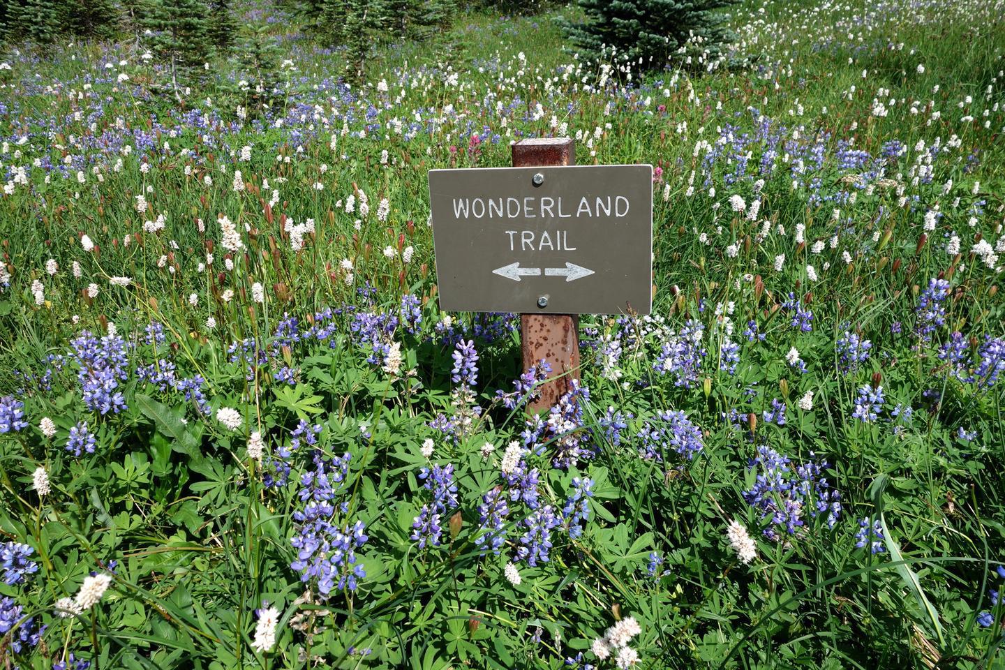
From the facility, experienced hikers and backpackers can access the well-known, strenuous and beautiful Wonderland Trail, which encircles the park for 93 miles. For those who enjoy learning more about the park's natural and cultural history, there is an on-site amphitheater where interpretive programs are held.Facilities
Cougar Rock is relatively rustic, but has drinking water, flush toilets and picnic tables at all 173 campsites. This facility is one of only two campgrounds in the park with campsites that can be reserved. Visitors must use extra caution with food storage, as foxes and other animals have been known to frequent the campground looking for food.Natural Features
Cougar Rock Campground has one lookout point from which campers can view Mt. Rainier. Although it is peaceful now, the still active volcano last erupted in the mid 1800s. The campground is adjacent to the Nisqually River and is surrounded by thick forests. A short drive to Paradise in summer reveals fields of lush wildflowers.Nearby Attractions
Mount Rainier National Park is about 50 miles southeast of the Seattle-Tacoma metropolitan area.OHANAPECOSH GROUP CAMPGROUND Campground
List of CampsitesOverview
This facility is the group site at Ohanapecosh Campground. Ohanapecosh, on the southeast side of Mount Rainier National Park, is surrounded by old growth forest and crossed by an exceptionally beautiful snow-fed river. Close to Ohanapecosh are popular hikes to Silver Falls and the Grove of the Patriarchs.The main attraction at Mount Rainier National Park is the mountain itself, a glacier-clad volcano of immense proportions. At 14,411 ft., it dominates the skyline for hundreds of miles. Visitors travel through majestic old-growth forests, past tumbling waterfalls and historic buildings to reach sub-alpine meadows, where world-famous wildflower displays are seen in July and August. Popular activities in the park include sight-seeing, hiking, climbing and camping.
Ohanapecosh campground has an elevation of 1,914 feet. Weather is dry, cool and sunny in the summer with daytime temperatures in the 60 to 80-degree range. Even though the eastern side of the park can be sunnier than other areas, weather can be variable and visitors should come prepared.
Recreation
The most popular campground in the park, Ohanapecosh is convenient to both the Paradise and Sunrise areas. Numerous hiking trails originate both in and nearby the facility, including the Grove of the Patriarchs trail, which leads hikers through stands of old growth forest, and several trails that lead to Silver Falls waterfall. For visitors who would like to learn more about natural and cultural history, the Ohanapecosh Visitor Center is close by.Facilities
There are two group sites. Both have tent-only camping, and each can fit up to 25 people. Drinking water is provided. Visitors must use extra caution with food storage, as bear and other animals inhabit the area around the campground.Natural Features
Ohanapecosh is thought to be a Taidnapam Indian word for "standing on the edge" of the Ohanapecosh River. The river itself is lined with mossy boulders and drains cold, clear water from higher elevations. Its banks are lined with thick, old growth Douglas fir trees and other evergreens. There is no direct view of Mt. Rainier from the campground, but the mountain dominates the landscape in nearby areas of the park.COUGAR ROCK GROUP CAMPGROUND Campground
List of CampsitesOverview
Cougar Rock Group Campground, on the southwest side of Mt. Rainier National Park, is conveniently located near Paradise. Group campsite reservations can be made on this page. Individual campsites are reservable via Cougar Rock Campground.
Paradise is the most popular destination in the park, with a lodge and visitor center, many miles of hiking trails and a commanding view of the mountain. The main attraction at Mount Rainier National Park is the mountain itself, a glacier-clad volcano of immense proportions. At 14,411 feet, it dominates the skyline for hundreds of miles. Visitors travel through majestic old-growth forest, past tumbling waterfalls and historic buildings to reach sub-alpine meadows, where world-famous wildflower displays are seen through July and August. Popular activities in the park include sight-seeing, hiking, rock climbing and camping.
The Cougar Rock area is located at an elevation of 3,180 feet. Summers are dry and cool with daytime temperatures in the 60 to 80-degree range. Weather throughout the park can be variable, so visitors should come prepared.
Recreation
From the facility, experienced hikers and backpackers can access the well-known, strenuous but beautiful Wonderland Trail, which encircles the park for 93 miles. For those who enjoy learning more about the park's natural and cultural history, there is an on-site amphitheater where interpretive programs are held.Facilities
The group campground has five campsites and is located within the general Cougar Rock Campground. Sites are relatively rustic, but have drinking water, flush toilets and picnic tables. All group campsites must be reserved. Visitors must use extra caution with food storage, as foxes and other animals have been known to frequent the campground looking for food.Natural Features
The campground has one lookout point from which campers can view Mt. Rainier. Although it is peaceful now, the still-active volcano last erupted in the mid 1800s. The campground is adjacent to the Nisqually River and is surrounded by thick forests. A short drive to Paradise in summer reveals fields of lush wildflowers.Nearby Attractions
Mount Rainier National Park is about 50 miles southeast of the Seattle-Tacoma metropolitan area.White River Campground Facility
Located on the eastern side of the park below Sunrise, White River campground takes its name from the river flowing beside it. Tucked into a steep canyon, curves can be tight. When open for the summer, it is always first-come, first-serve. The Wonderland trail runs through the campground on its way up to Sunrise or Summerland.
Longmire Museum Facility
Located on the south side of Mount Rainier at 2,700 feet above sea level, the museum makes up part of the historic Longmire district. Once a ranger office, the building now houses historic exhibits about the park's natural and geological history, and animals. A ranger or volunteer staffs the museum to assist with park information and book and map sales.
Henry M Jackson Memorial Visitor Center Facility
Located at Paradise, on the south side of Mount Rainier, the Jackson Visitor Center is open throughout the summer and with limited days and hours in the winter. Inside the visitor center are accessible restrooms, an information desk staffed by a ranger or volunteer, food services, gift shop, park movie, and exhibits about the plants, animals, and the volcano. NOTE: The exhibits on the second floor are closed for the 2022 season.
Ohanapecosh Visitor Center Facility
This visitor center is located in the southeast corner of the park on State Route 123, 12 miles north of the town of Packwood. It is next to the Ohanapecosh Campground and near the trailhead for the Natural Hot Springs and Silver Falls. There are restrooms, exhibits, and a ranger or volunteer on duty to answer questions when it is open for the summer season.
Sunrise Visitor Center Facility
Located on the northeast flank of Mount Rainier, this visitor center is at the end of the Sunrise Road, 15 miles after the turn off from State Route 410. Only open and accessible in summer, the Sunrise Visitor Center has exhibits, books and maps for sale, and rangers and volunteers on duty to answer questions. Restrooms, gift shop, and food services are located nearby during the summer season.
Carbon River Ranger Station Facility
Located in the northwest corner of the park, the ranger station is staffed by rangers or volunteers. Building hours may vary so call ahead for hours 360-829-9639. When open, rangers and volunteers provide park information, wilderness camping, and climbing permits. Wilderness camping permits available by self-registration when closed.
