
Cachuma Lake
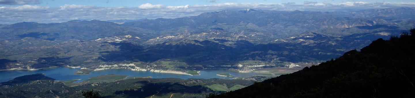
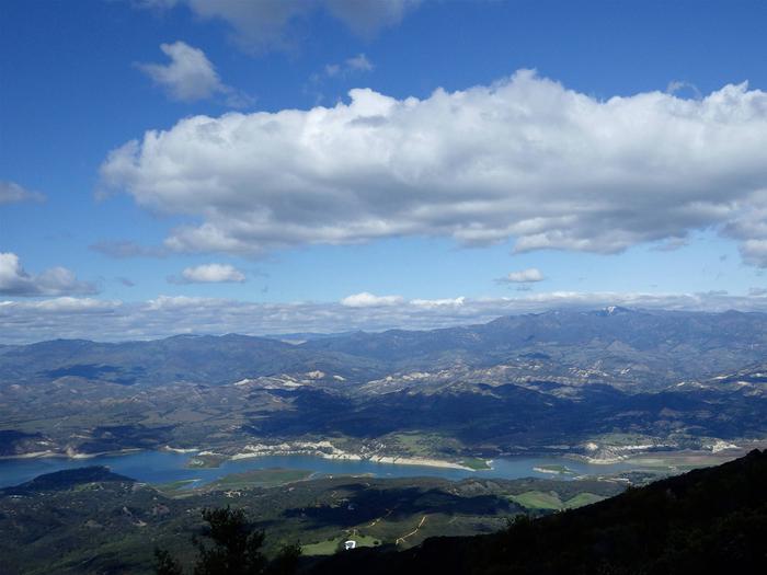
Cachuma Reservoir, formed by Bradbury Dam, offers a prime recreational opportunity for the south central coast area of California. The Cachuma Project is located in the Santa Ynez Valley, the area provides an aesthetic view of the Santa Ynez mountains. The recreation area is adjacent to the Los Padres National Forest. Easily accessible from Santa Barbara, the area provide excellent camping facilities with full hookups for RV's. The lake is stocked during the winter months with trout and provides excellent bass fishing year round. The park is currently developing a recreational fisheries program in cooperation with the California Department of Fish and Game. Day use areas include trails and picnic facilities.
RecAreaDirections
From Santa Barbara take Highway 101 to the San Marcos Pass exit, Highway 154. The park entrance is about 20 miles from this point. From the North take Highway 101 to State Highway 154.. Cachuma Lake is about 20 miles east.
Open with Google MapMisc
| Stay Limit | |
| Reservable | false |
| Keywords | |
| Map Link | |
| Contact Phone | |
| Contact Email |
Permits info
Important Information
It is important to take your time on the Half Dome Cables and use good judgment. A slip or fall from the cables may result in serious injury or death. Rescue personnel may be hours away and/or unable to respond due to weather or other incidents occurring simultaneously.
Tips while using the cables:
- Take your time and be patient with slower hikers.
- Allow faster hikers to pass you (when possible).
- Remain on the inside of the cables.
- Many people find gloves helpful.
Another easy way to make your hike enjoyable is to wear well broken-in boots with good ankle support and traction. Some of the most common injuries Half Dome hikers suffer are blisters and ankle injuries. Proper footwear is the best way to prevent these problems.
Always keep your food within arms reach or on your back. Never leave food unattended. Do not leave packs at the base of the cables even if they do not contain food as marmots and squirrels will chew through straps for the salt content.
The summit of Half Dome is a dangerous place during a lightning storm. Check the weather forecast before your hike and try to reach the summit early in the day to avoid afternoon thunderstorms. If a storm appears nearby, do not continue to the summit and, if in the summit area, descend immediately while still using caution and patience while on the cables and steps.
The summit is typically 15*F (8*C) to 20*F (11*C) cooler than Yosemite Valley and windy conditions are common. Be prepared for cool temperatures and rain showers.
A few visitors each summer have problems with altitude sickness. Know how to recognize the early signs of altitude sickness.
For a short video on Half Dome Click Here
Amenities:
Flush toilets are available at the Vernal Fall Footbridge below Vernal Fall. Composting toilets are available near Emerald Pool above Vernal Fall, near the top of Nevada Fall, and in Little Yosemite Valley. The last potable water is at the Vernal Fall restroom below the waterfall. Springs, streams and the Merced River provide water above this point, but should be properly treated before drinking to remove pathogens.
Long Description
Rising nearly 5,000 feet above Yosemite Valley and 8,800 feet above sea level, Half Dome is a Yosemite icon and a great challenge to many hikers. Despite an 1865 report declaring it was perfectly inaccessible, being probably the only one of the prominent points about the Yosemite which never has been, and never will be, trodden by human foot, George Anderson reached the summit in 1875, in the process creating the predecessor to todays cable route.
The 14 to 16-mile round-trip hike to Half Dome is not for you if youre out of shape or unprepared. You will be gaining elevation (a total of 4,800 feet) most of your way to the top of Half Dome. Most say the reward is worth the effort. Along the way, youll encounter outstanding views of Vernal and Nevada Falls, Liberty Cap, Half Dome, and--from the subdome and summit--panoramic views of Yosemite Valley and the High Sierra.
For further information on Half Dome and Yosemite National Park click http://www.nps.gov/yose/planyourvisit/halfdome.htm
Facilities
no data available
