
Carrizo Plain National Monument
COVID-19
Fire restrictions are in effect as of May 23, 2022 which include no campfires, barbecues, or open fires, in or outside of developed campgrounds. Portable stoves with gas, jelled petroleum, or pressurized liquid fuel are allowed with a valid California campfire permit available free at all BLM, U.S. Forest Service and Cal Fire offices, or at www.readyforwildfire.org/prevent-wildfire/campfire-safety/.
To read the current fire restriction please visitBakersfield Fire Restriction Order 2021
All vehicles including UTVs on the monument must be street-legal (DMV plated) and all vehicles must stay on roads.
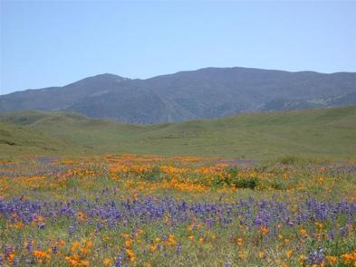
2021 Wild Flowers
Click here for more information on the latest 2021 wildflower conditions
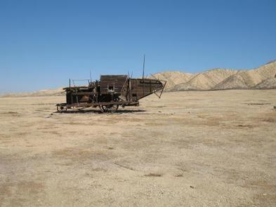
REMINDER:Please follow warning signs and respect private property when visiting your public lands. This is a remote area with limited towing services, no fuel, food or water nearby.
ROADS: Rain showers continue, please be cautious on dirt roads! Don't drive into the flowers, park alongside the road (parallel) as not to obstruct other traffic and watch for pedestrians. Currently Simmler Road and Panorama Road are open. High clearance vehicles are recommended, especially in muddy areas. Soda Lake Road and Elkhorn Road are also open.
Overview
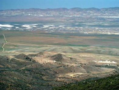
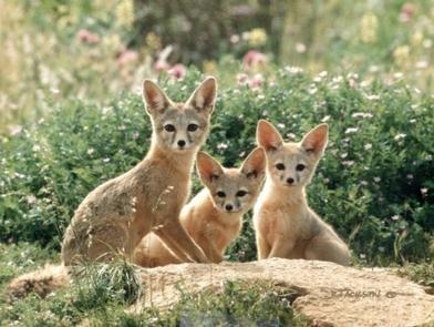
The Carrizo Plain National Monument, located 100 airline miles (160 km) from Los Angeles, is an area by-passed by time. Soda Lake, its centerpiece, is a glistening bed of white salt, set within a vast open grassland, rimmed by steep mountains. The plain is home to diverse communities of wildlife and plant species, is an area culturally important to Native Americans, and is traversed by the San Andreas fault, which has created and moved mountain ranges, carved valleys and is marked by a subtle alignment of ridges, ravines and pools.
Goodwin Education Center
Phone: 805-475-2131
Open: December 1 - May 31.
Hours: 9:00 a.m. - 4:00 p.m., Thursday - Sunday
Maps and brochures are available at the front door when the center is closed. Wheelchair accessible restrooms at the Education Center remain open 24 hours a day, seven days a week, throughout the year.
Contact the Education Center or make it your first stop to receive updated information about your visit to the Carrizo Plain National Monument.
Get permits for Guided and Self-Guided Tours
Download the Carrizo Plain National Monument Recreation Map and Guide
Find the latest 2019 wildflower updates on BLM California social media: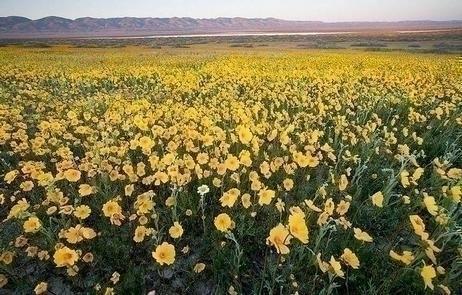
RecAreaDirections
Carrizo Plain National Monument is west of Bakersfield, California.
This area is very remote and undeveloped, therefore it is recommended that you do not rely on GPS or other mapping programs to lead you to the park. All vehicles must remain on roads.
Open with Google MapMisc
| Stay Limit | |
| Reservable | false |
| Keywords | |
| Map Link | |
| Contact Phone | |
| Contact Email |
Permits info
Facilities
Carrizo Plain National Monument Tours Ticket Facility
Overview:
Carrizo Plain National Monument is home to a number of curiously beautiful sights, both natural and man-made. Among those, visitors can expect to see an ancient rock art site, a creek bed disrupted by the San Andreas Fault and a lake filled with a glistening layer of white salt.Adjacent to the southwest edge of the San Joaquin Valley, the Carrizo Plain National Monument is a 250,000-acre oasis as well as a diverse complex of habitats for many endangered, threatened and rare species of plants and animals.
Soda Lake covers an area of about 3,000 acres and is one of the most dominant geographic features of the Carrizo Plain. As a result of evaporating mineral-laden surface water, a crust has formed in the lake, creating a glistening white bed of salt that has become a famous attraction for Carrizo.
The Carrizo Plain is traversed by the San Andreas Fault, providing spectacular topography along the eastern edge. Ridges rise sharply from the plain to form the Panorama and Elkhorn Hills. Temporary pools and salt-encrusted ponds appear along the fault, trapping rainwater to create stunning scenery.
Painted Rock, a large, U-shaped rock outcrop just south of the Goodwin Education Center, features what was once an elaborate, multicolored pictograph site created by the Chumash, a Native American people who historically inhabited the coastal regions of California. Both the interior and exterior sides have paintings, which include geometric images as well as human figures, snakes and aquatic images.
There are numerous seasonal recreational opportunities for visitors, many of them focused on the plain's abundant birds and wildflowers. Aside from the organized tours available, hiking, biking, birding, wildlife viewing and scenic drives are all popular activities for guests.
The San Andreas, Soda Lake, Elkhorn and Seven Mile roads within the monument, all combine to offer a stunning 70-mile scenic loop drive, and the nearby Goodwin Educational Center provides interpretive exhibits and other educational programs.
