
Lake Okeechobee
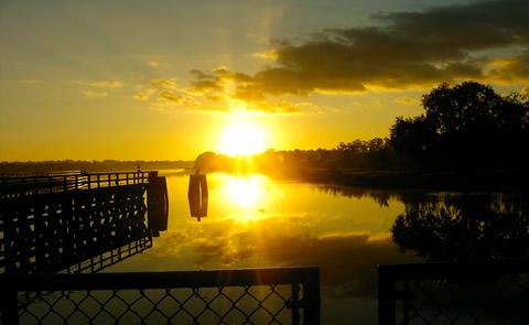
As lake, waterway and surrounding countryside, Okeechobee shows the many faces of Florida. A canopy of moss-draped live oaks hides clusters of sabal palms. A tangle of water plants marks the boundary where wetland meets lakeshore. A lone alligator suns on a riverbank in a deceptively calm moment. Wild birds take flight in a sudden explosion of motion. Between the muted pastels of dawn and the brilliant display of sunset, Okeechobee is for all who love the outdoors.


RecAreaDirections
The project office is located approximately 65 miles west of West Palm Beach, and 65 miles east of Fort Myers, FL.
From W. Palm Beach: Take US-98 heading west, which becomes US-441 North. Take 441N to FL-80 West, which becomes US-27 North. US-27 will take you to Clewiston.
From Ft. Myers: Take FL-80 East to US-27 South. Follow US-27 into Clewiston.
Misc
| Stay Limit | |
| Reservable | false |
| Keywords | |
| Map Link | |
| Contact Phone | |
| Contact Email |
Permits info
Direction
Leave Hwy 395 at Hwy 203 to the town of Mammoth Lakes. Turn right on Minaret Road and go to Mammoth Mountain Adventure Center (Main Lodge) for long term parking and to board the mandatory shuttle to the trailhead. Shuttle stop #6 is Devils Postpile Visitor Center.
Important Information
DOWNLOAD AREA MAP FOR THIS TRAIL:Click Here
Beck Lake Area:
- No campfires at Beck Lakes, Holcomb, Ashley, Anona or Fern Lakes; and no campfires above 10,000 ft., look at USFS Webpage for campfire restriction maps.
- Bear containers are required for storage of food and trash.
- There are several different trails in the area Check the area map for the correct trail name.
- All visitors to Reds Meadow Valley pay a transportation fee which allows use of the mandatory shuttle bus. Call Mammoth Lakes Welcome Center for more shuttle information. (760)924-5500.
- Ansel Adams Wilderness regulations apply.
- Deadline: Reservation will be canceled unless the permit pick up instructions are completed before the deadline. Instructions are in the confirmation letter.
- Only the group leader or alternate leader may pick up the permit; the person picking up the permit must be going on the wilderness trip.
- BE SURE YOUR DATES AND TRAIL ARE CORRECT - The entire group must start on the trail on the entry date listed. Reservations cannot be changed or transferred.
USFS Webpage for: Beck Lake.
Long Description
This trail goes to some little known places like Noname Lake and Beck Lake. From shuttle stop #6 in front of the Devils Postpile Visitor Center it is less that a mile to the junction with the John Muir Trail. A bridge across the river leads to several trail junctions. Above Minaret Falls, the Beck Lake trail separates from the Minaret Lake and John Muir Trails. Passing south of Red Top Mountain, the trail also provides access to Superior and Holcomb Lakes. This is an active bear area so you must use bear resistant food containers to secure your food and refuse. Other area trails have separate quotas, please refer to the area map for trail names.
Facilities
ORTONA SOUTH Campground
List of CampsitesOverview
Ortona South is a perfect campground for a quiet, sunny escape to South Florida. the campground is set along the Caloosahatchie River.
Recreation
Activities here are focused on simple, relaxing pleasures like fishing and strolling the grounds. The long entrance road from the highway provides a great place for walking and bicycling. Catfish, Largemouth Bass, Bluegill, and Crappie are the most commonly caught fish at the large pier at the campground. Snook are commonly caught at the small north end pier which is accessible by walking across the dam from 7AM to 4PM. Several large bird species frequent the area if you are a Bird Watcher.
Facilities
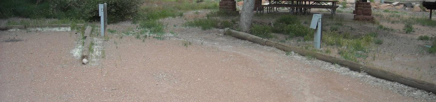
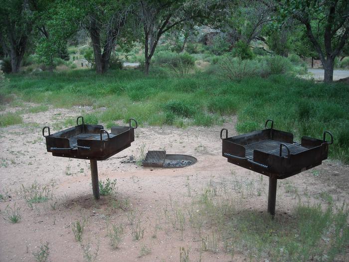
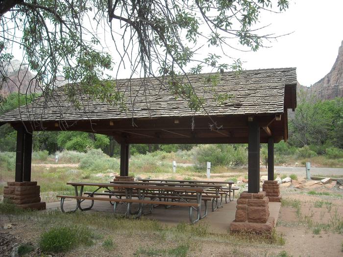
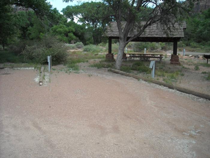
All campsites have concrete pads, electric, 30 amp and 50 amp, water hookups, a fire ring and grill, and a covererd picnic table. Other amenities include a sanitary dump station, restrooms with showers, dumpsters, Wifi (near west end restroom only), and a picnic pavilion for campers only. Day use visitors are allowed on site for fishing. The Ortona North Day Use Area has a boat launch and is a 25 minute drive by way of the Town of LaBelle. LaBelle is the nearest town and has stores, restaurants, etc. Laundry Facilities are not currently available on site.
Natural Features
The campground's terrain is flat and lined with tropical greenery like the Sabal Palm, the state tree of Florida. The Caloosatchie River to your north and picturesque pastures to your south. The South Florida Water Management District is constructing a Water Quality Treatment and Testing Facility, adjacent to the South East end of the campground. Construction at that site may affect the serenity of your experience
Nearby Attractions
Head west to LaBelle, Florida, where an annual Swamp Cabbage Festival is held the last weekend of each February. Or travel east to hike or bike along the Herbert Hoover Dike, part of Lake Okeechobee, and part of the 1,400-mile long Florida National Scenic Trail.
ST LUCIE SOUTH Campground
List of CampsitesOverview
St. Lucie Campground provides a relaxing camping experience on the St. Lucie Canal, part of the 152 mile Okeechobee Waterway that spans South Florida from the Atlantic Ocean to the Gulf of Mexico. Campers can enjoy watching boats and the occasional manatee pass through the St Lucie Lock while sitting under the warm Florida sun.Recreation
Hike the St. Lucie Nature Trail on the north side of the canal, or spend the day fishing and boating on the St Lucie Canal and the south fork of the St. Lucie River.Facilities
The St. Lucie South Campground offers waterfront RV and tent sites, plus cruiser sites for boat campers. All RV and cruiser sites have 50 amp electric and water hookups. A trailer dump station is on site for your convenience A family-friendly visitor center, group picnic shelter, horseshoe pit and a swing set are onsite to entertain the group.
Natural Features
Tropical vegetation surrounds the campground, which is about 25 miles east of Lake Okeechobee, the second largest freshwater lake in the United States. The lake is 451,000 acres and on average only 9 feet deep.Nearby Attractions
The Hobe Sound National Wildlife Refuge is recommended for visitors who are interested in the many species of birds in the area. The city of Stuart is just down the road with restaurants and shopping. Sandy beaches located on nearby Hutchison Island make for a fun days trip to the Atlantic Ocean. Nearby Fort Pierce is home to the National Navy UDT-SEAL Museum.W.P. FRANKLIN N Campground
List of CampsitesOverview
Visitors flock to W.P. Franklin Campground for its well-kept facilities and location on the Caloosahatchee River, where campers can fish, boat and take it easy in sunny southwest Florida. The campground, about 10 miles east of Fort Myers, provides visitors with a taste of tranquil, tropical country life. Nearby Telegraph Creek, offers exciting opportunities to canoe Florida's backcountry swamps and view wildlife.Recreation
Fishing for both salt and fresh water game fish is popular, as is boating. A unique feature of the campground is its cruiser sites, where campers sleep on their boat while enjoying the perks of the campsite facilities.Facilities
The 29 RV sites and 8 boat sites are equipped with 50 amp electric and water hookups. A boat ramp, fishing pier and trailer dump station are conveniently onsite.
Natural Features
The campground is almost completely surrounded by the Caloosahatchee River with just a narrow stretch of land connecting it to the shore. The Caloosahatchee River is part of the 152 mile Okeechobee Waterway that spans South Florida from the Atlantic Ocean to the Gulf of Mexico.Nearby Attractions
Visit the U.S Army Corps of Engineers visitor center across the river in the W.P. Franklin South Recreation Area. Visit downtown Fort Myers for flea markets, grocery stores, shopping and the historic Thomas Edison and Henry Ford Winter Estates, or spend a day exploring the sandy Gulf of Mexico beaches, about 45 minutes from the campground.Moore Haven West Facility
This recreation area is part of Lake Okeechobee
Pahokee City Park Facility
This recreation area is part of Lake Okeechobee
Okeetantie Facility
This recreation area is part of Lake Okeechobee
Indiantown Marina Facility
This recreation area is part of Lake Okeechobee
