
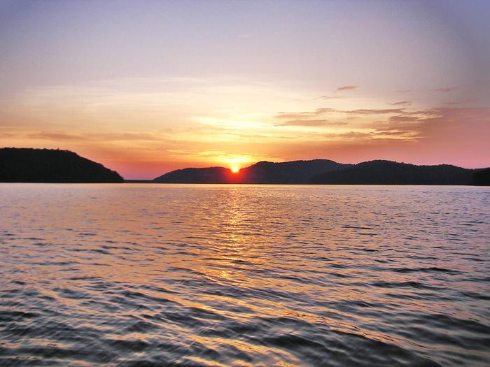
Carters Lake
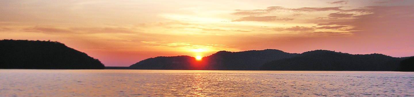
Carters Lake Project is managed by the U.S. Army Corps of Engineers, Mobile District. Carters Lake is one of the most scenic lakes in the Southeast. Located at the southern end of the Blue Ridge Mountains, its sparkling waters and rugged shoreline provide a beautiful surrounding for a variety of recreational opportunities which includes: camping, picnicking, boating, fishing, and hunting.


RecAreaDirections
From North East Atlanta; I-575 North to Carters Lake Exit. Follow signs to desired project locations. From North Atlanta; I-75 North to Exit 293 then Right on Hwy 136. Follow signs to desired project locations. From Chattanooga TN. I-75 South to Exit 336.
Open with Google MapMisc
| Stay Limit | |
| Reservable | false |
| Keywords | |
| Map Link | |
| Contact Phone | |
| Contact Email |
Permits info
Direction
Leave Hwy 395 at Mammoth Lakes, Hwy 203 and follow Lake Mary Road. Follow the signs to Lake George. There is a large parking lot with separate parking for day and overnight hiking
Important Information
DOWNLOAD AREA MAP FOR THIS TRAIL:Click Here.
Deer Lakes Area:
- No campfires above 10,000 ft.
- Food and refuse must be stored so that animals cannot get into the food or trash. Surrounding areas require use of bear containers.
- Camping is not allowed at Crystal Lake.
- There are several different trails in the area Check the area map for the correct trail name.
- John Muir Wilderness regulations apply.
- Deadline: Reservation will be canceled unless the permit pick up instructions are completed before the deadline. Instructions are in the confirmation letter.
- Only the group leader or alternate leader may pick up the permit; the person picking up the permit must be going on the wilderness trip.
- BE SURE YOUR DATES AND TRAIL ARE CORRECT - The entire group must start on the trail on the entry date listed. Reservations cannot be changed or transferred.
USFS Webpage for: Deer Lake.
Long Description
Sometimes called the Crystal Crag trail, this trail begins with a steep climb up the ridge from Lake George to the Mammoth Crest and yields spectacular views of Crystal Crag and Crystal Lake. The trail continues along the rim of the Sierra Crest with views into the back country toward the Middle Fork of the San Joaquin River. Deer Lake is at the end of the trail. The nearest trails that connect to the John Muir Trail are Duck Pass and Red Cones. Camping is not allowed at Crystal Lake. Day hiking this trail does not need a permit.
Facilities
DOLL MOUNTAIN CAMPGROUND Campground
List of CampsitesOverview
Doll Mountain Campground is located in the North Georgia Mountains on beautiful Carters Lake, Which is just a short 70 miles north of Atlanta. Carters Lake provides clean, safe, and quiet campgrounds that help you escape the hustle and bustle of your day to day routine and relax with your family. Doll Mountain offers boating, picnicking at the day use area, and many other summer time activities.
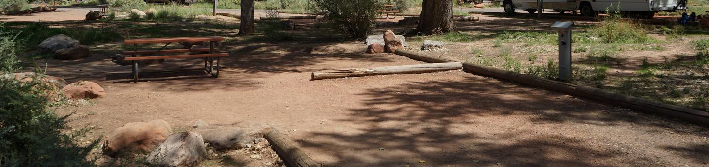
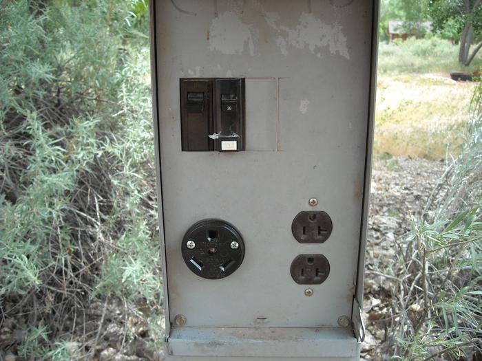
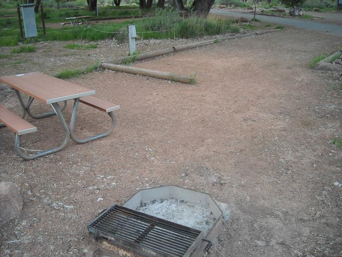
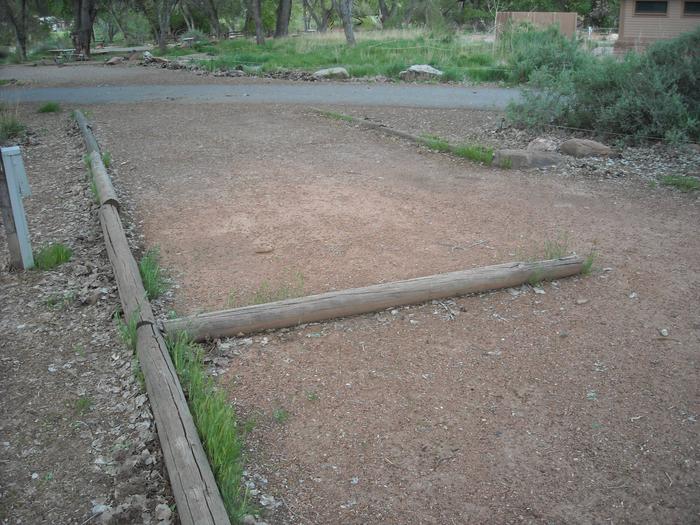
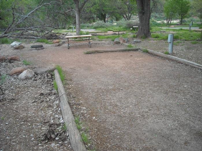
Doll Mountain, one of the larger campgrounds offering 68 campsites to choose from.The majority of them are RV hook ups, so you can enjoy the great outdoors while remaining comfortable with your family.
Doll Mountain also provides easy access to the water with its own boat ramp and boat trailer parking area.
Facilities include, play ground, and two large, restrooms with showers.
Doll Mountain guarantees a pleasant camping experience and several summer activities for the whole family to enjoy.
Recreation
Boaters visit Carters Lake to enjoy its solitude and scenic beauty. Whether in a powerboat or sailboat on the open water or paddling along the shoreline in a canoe, Carters Lake offers enjoyable boating experiences for everyone.Fishing is a popular activity on the lake. Major species include bass (largemouth, smallmouth, hybrid, striped and spotted) crappie, walleye, bream and catfish.
Bank fishing locations are limited due to steep shoreline terrain, but six boat ramps are scattered around the shoreline, offering easy access to the lake.
Facilities
The heavily wooded campground contains RV and tent-only sites, many of which have electric hookups. Flush toilets, showers and drinking water are provided. Additional amenities include a children's playground and a dump station.
Natural Features
Carters Lake embraces a spectacular tract of foothills scenery in the Blue Ridge Mountains of north Georgia. It covers 3,200 surface acres and has 62 miles of undeveloped shoreline.Nearby Attractions
Ridgeway Park and the Woodring Branch Recreation Area are each located within a 45-minute drive from Doll Mountain Campground. Hiking and mountain biking trails in each park offer beautiful scenery and a mix of easy to challenging terrain.contact_info
For local information, please call (706) 276-4413 or call (706) 334-2248 for general information.WOODRING CAMPGROUND Campground
List of CampsitesOverview
Woodring Branch Campground is located in the North Georgia Mountains on the beautiful Carters Lake Project, which is just a short 70 miles north of Atlanta. Carters Lake provides clean, safe, and quiet campgrounds that help you escape the hustle and bustle of your day to day routine and relax with your family. Woodring Branch offers boating, hiking, mountain biking, picnicking at the day use area, and many other summer activities. Woodring Branch has two different loop style trails from from easy to moderate. Amadahy and the Oak Ridge Nature trail will ensure a great family hiking experience as they both include a wide diversity of plants, animals, and scenic views. The campground has 2 boat ramps with limited boat trailer parking spaces for all your boating needs. Woodring branch at Carters Lake has something for everyone, no matter what your hobbies are.Recreation
Boaters visit Carters Lake to enjoy its solitude and scenic beauty. Whether in a powerboat or sailboat on the open water or paddling along the shoreline in a canoe, Carters Lake offers enjoyable boating experiences for everyone.Fishing is a popular activity on the lake. Major species include bass (largemouth, smallmouth, hybrid, striped and spotted), crappie, walleye, bream and catfish. Bank fishing locations are limited due to steep shoreline terrain, but six boat ramps are scattered around the shoreline, offering easy access to the lake.
The Amadahy Trail is located in the Woodring Branch Recreation Area. This 3.5-mile loop is excellent for beginners with flat to rolling terrain. Bikers and hikers are treated to beautiful views of Carters Lake along most of trail's length.
Facilities
This heavily wooded campground offers many sites with scenic lake views. Electric hookups are available at many of the campsites. Flush toilets, showers and drinking water are provided. Additional amenities include a children's playground and a dump station. A boat ramp and swimming area are on-site.
Natural Features
Carters Lake embraces a spectacular tract of foothills scenery in the Blue Ridge Mountains of North Georgia. It covers 3200 surface acres and has 62 miles of undeveloped shoreline.contact_info
For local information, please call (706) 276-6050 or call (706) 334-2248 for general information.Charges & Cancellations
Please review rules and reservation policies at the bottom of the page.Carters Lake Marina Facility
This recreation area is part of Carters Lake
Ridgeway Park Facility
This recreation area is part of Carters Lake
Woodring Day Use Access Facility
This recreation area is part of Carters Lake
