
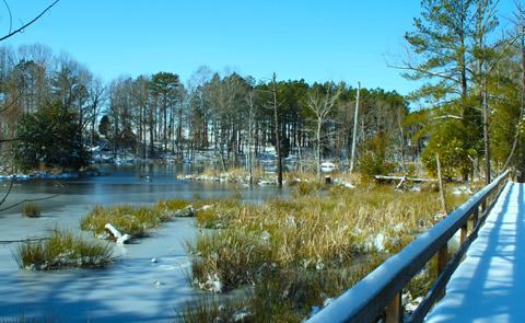
Richard B. Russell Lake
"Ole Dan Tucker was a grand ole man; He washed his face in a fryin' pan; Combed his hair with a wagon wheel; Died with a tooth ache in his heel!" During the 1700's, this famous folk song was sung by slaves in praise of the Reverend Dan Tucker. He was an early settler of the area and is buried on the Richard B. Russell project.
RecAreaDirections
Located on the Georgia / South Carolina border, 20 miles east of Elberton, GA, and 8 miles west of Calhoun, SC off US 72.
Open with Google MapMisc
| Stay Limit | |
| Reservable | false |
| Keywords | |
| Map Link | |
| Contact Phone | |
| Contact Email |
Permits info
Direction
From Bishop go west on Line Street (Hwy 168). Follow Hwy 168 approximately 8 miles to Buttermilk Rd. and turn right. Follow Buttermilk Road (dirt) past Wells Upper Meadow where the road becomes increasingly worse. It is likely you will need 4x4 to drive to the end. Look for small sign to Horton Lake.
Important Information
DOWNLOAD AREA MAP FOR THIS TRAIL:Click Here.
Horton Lakes Area:
- No campfires at Lower Horton Lake; and no campfires above 10,000 ft. look at USFS Webpage for campfire restriction maps.
- Food and refuse must be stored so that animals cannot get into the food or trash.
- John Muir Wilderness Regulations Apply
- Deadline: Reservation will be canceled unless the permit pick up instructions are completed before the deadline. Instructions are in the confirmation letter.
- Only the group leader or alternate leader may pick up the permit; the person picking up the permit must be going on the wilderness trip.
- BE SURE YOUR DATES AND TRAIL ARE CORRECT The entire group must start on the trail on the entry date listed. Reservations cannot be changed or transferred
USFS Webpage for: Horton Lakes.
Long Description
This trail can be found by following a rough dirt road beyond Bishops Buttermilk Country. The Horton Lakes Trail climbs 3.8 miles to Lower Horton Lake at the foot of Mt. Tom.
Facilities
Richard B. Russell State Park Facility
This recreation area is part of Richard B. Russell Lake
Calhoun Falls State Park Facility
This recreation area is part of Richard B. Russell Lake
Mccalla Natural Area Facility
This recreation area is part of Richard B. Russell Lake
Blue Hole Recreation Area Facility
This recreation area is part of Richard B. Russell Lake
