
Cochiti Lake
Cochiti Lake is located within the boundaries of the Pueblo de Cochiti Indian Reservation. Please observe and obey all Pueblo regulations. Do not trespass on lands closed to the public. Cochiti Lake is on the Rio Grande, about half way between Santa Fe and Albuquerque. Cochiti Dam is one of the ten largest earthfill dams in the US. It is one of the four units for flood and sediment control on the Rio Grande, operating in conjunction with Galisteo, Jemez Canyon, and Abiquiu Dams.
RecAreaDirections
From Santa Fe, south on I-25 to exit 264, west on Highway 16 and north on Cochiti Highway (Hwy 22). From Albuquerque, north on I-25 to exit 259, northwest on Highway 22.
Open with Google MapMisc
| Stay Limit | |
| Reservable | false |
| Keywords | |
| Map Link | |
| Contact Phone | |
| Contact Email |
Permits info
Direction
Leave Hwy 395 at Hwy 203 to the town of Mammoth Lakes. Turn right on Minaret Road and go to Mammoth Mountain Adventure Center (Main Lodge) for long term parking and to board the mandatory shuttle to the trailhead. Shuttle stop #1 is Agnew Meadows
Important Information
DOWNLOAD AREA MAP FOR THIS TRAIL:Click Here.
High Trail - PCT Area:
- No campfires at Thousand Island Lake, Garnet, Ruby, Emerald Badger or Clark Lakes; and no campfires above 10,000 ft. look at USFS Webpage for campfire restriction maps.
- Bear containers are required for storage of food and trash.
- No Camping within 300 feet of the outflow of Thousand Island Lake or Garnet Lake.
- All visitors to Reds Meadow Valley pay a transportation fee which allows use of the mandatory shuttle bus. Call Mammoth Lakes Welcome Center for more shuttle information. (760)924-5500.
- Check the area map for the correct trail name. Trips going toward Shadow Creek or the River trail are a different reservation.
- Ansel Adams Wilderness regulations apply.
- Yosemite wilderness regulations apply if entering the National Park.
- Deadline: Reservation will be canceled unless the permit pick up instructions are completed before the deadline. Instructions are in the confirmation letter.
- Only the group leader or alternate leader may pick up the permit; the person picking up the permit must be going on the wilderness trip.
- BE SURE YOUR DATES AND TRAIL ARE CORRECT - The entire group must start on the trail on the entry date listed. Reservations cannot be changed or transferred
USFS Webpage for: High Trail - PCT.
Long Description
The High Trail starts from the Agnew Meadows (shuttle bus stop #1). Instead of crossing Agnew Meadow, the trail climbs partway up the east side of the canyon. There are magnificent views across the valley of the Minarets, Mount Ritter and Banner Peak as the trail contours along the slope to the headwaters of the San Joaquin River. Several trail junctions give options to travel to Summit Lake, Agnew Pass, Clark Lakes, or Badger Lakes. The High Trail is also part of the Pacific Crest Trail. If you continue on the Pacific Crest Trail you will connect with the John Muir Trail near Thousand Island Lake. This is an active bear area so you must use bear resistant food containers to secure your food and refuse. Other area trails have separate quotas, refer to the area map for trail names.
Facilities
Cochiti Day Use Area Tickets Timed Entry
In marked contrast to a city geared to entertainment and gaming, Red Rock Canyon National Conservation Area (RRCNCA) is known as the premier outdoor recreation experience offering enticements of a different nature including a 13-mile scenic drive, miles of hiking trails, rock climbing, horseback riding, mountain biking, road biking, and picnic areas and many other outdoor recreation opportunities just minutes away from the brightly-lit and bustling Las Vegas Strip. RRCNCA is approximately 198,000 acres and located 17 miles west of the Las Vegas Strip on Charleston Boulevard/State Route 159. The area is visited by more than three million visitors each year. The Scenic Drive, a 13 mile-one-way paved road, provides access to explore the many special canyons and sandstone hills in the heart of the Conservation Area. There are 12 different trailheads and parking areas to begin your next outdoor adventure. The world class visitor center at the beginning of the drive provides a great introduction to the unique natural and cultural history of this area along with safety and orientation information. From the parking locations there are 21 different trails to explore the peak tops, rolling sandstone ridges, steep walled canyons which highlight special wildlife, vegetation, and cultural history. RRCNCA will implement a timed entry reservation system in order to meet the CDC, state and local guidance related to COVID-19. Each vehicle entering the Conservation Area will need a reservation.
Cochiti Campground Campground
List of CampsitesOverview
Cochiti Recreation Area is located in Sandoval County, New Mexico, within the boundaries of the Pueblo de Cochiti Indian Reservation. The lake offers two public recreation areas: Cochiti on the west side of the lake and Tetilla Peak on the east side. Both sides offer spectacular scenic views of the water and surrounding mountains. The Cochiti Dam is one of the ten largest earth-fill dams in the United States, and also one of the largest in the world. The lake derives its name from the Indian Pueblo on the Cochiti Reservation.Recreation
Our quiet lake is an ideal location for all paddle, wind surfing, and sailing craft. The lake is also a popular fishing spot for species such as bass, crappie, walleye, pike, catfish, sunfish and trout. Cochiti Recreation Area has a popular, family friendly, swim beach Day Use area for public enjoyment. It is a fee area, $5 per vehicle, but the cost is covered by the campsite fee for visitors staying in the campground. Additionally, the Cochiti picnic area has 21 covered picnic sites with a large group site that can be reserved by calling the main office. Cochiti Day Use Areas are open from April 15th to October 15th.Facilities
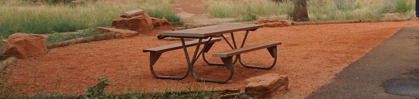
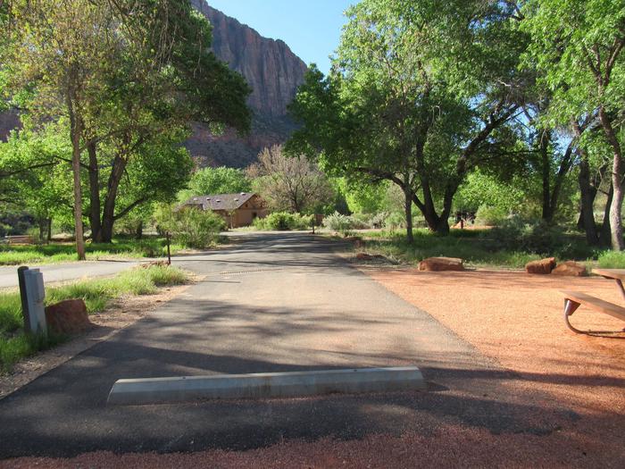
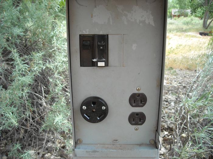
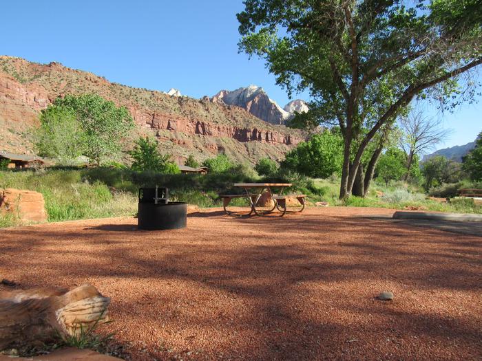
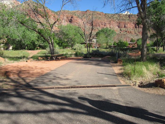
The campground consists of four loops. Juniper Loop campsites have electric hookups and some have water. Elk Run and Ringtail Loops are non-electric and have community water spigots. All sites in Buffalo Grove Loop have water and electric hookups. The Cochiti boat ramp is open year-round and is accessible by a paved road. The ramp has four concrete lanes for loading and unloading.Natural Features
Cochiti Lake sits at 5,343ft in elevation and is nestled in the foothills of the Jemez Mountains. Our high desert environment is dominated by juniper, pinon trees, and mixed grasslands. There are many opportunities for wildlife viewing. Four osprey nesting platforms have been erected around the lake to provide nesting sites, as well as viewing opportunities. On the east side of the lake, deer, coyote, river otters, rabbits, beavers, and the occasional bear are often sighted.Nearby Attractions
Cochiti Lake is five miles from Tent Rocks National Monument, which has fascinating geological formations.TETILLA PEAK Campground
List of CampsitesOverview
Tetilla Peak Recreation Area is located in Sandoval County, New Mexico, within the boundaries of the Pueblo de Cochiti Indian Reservation. The lake offers two public recreation areas: Cochiti on the west side of the lake and Tetilla Peak on the east side. Both sides offer spectacular scenic views of the water and surrounding mountains. The Cochiti Dam is one of the ten largest earth-fill dams in the United States, and also one of the largest in the world. The lake derives its name from the Indian Pueblo on the Cochiti Reservation.Recreation
Our quiet lake is an ideal for all paddle and wind craft. The lake is also a popular fishing spot for species such as bass, crappie, walleye, catfish, sunfish, pike and trout. Santa Cruz Day Use area is open daily and provides visitors with acces to the lake as well as several shade structures, bathrooms, and two fishing docks.Facilities
The campground consists of two loops. Cholla Loop includes 36 individual campsites, each with an electric hookup, table and grill. All electric campsites have shelters, and water spigots are located throughout the campground. This loop also provides a dump station and large restroom and shower building.A partially paved road winds through Coyote Loop, which has 10 sites, each with a table and grill. There are no electric hookups, and water spigots are scattered throughout the loop. The restroom and shower building is centrally located for easy access.
The Tetilla boat ramp area offers a parking area and courtesy dock.
