
Lake O' The Pines
Lake O' the Pines includes about 18,700 acres of water and 9,000 acres of land located in the piney woods of Northeast Texas. The lake is located partially in Marion, Harrison, Upshur, Morris and Camp Counties. Recreation opportunities are numerous with camping, boating, fishing, hunting, watchable wildlife, and bird watching, including wintering bald eagles. Other local attractions include antique shopping, Mardi Gras Upriver, the Annual Historic Pilgrimage, and Christmas Candlelight Tour in Jefferson, TX. Local attractions also include Stagecoach days, a Fire Ant Festival and Christmas lights in Marshall, TX, along with Texas Wildflower Trail routes along some area roads.

RecAreaDirections
Open with Google Map
Misc
| Stay Limit | |
| Reservable | false |
| Keywords | |
| Map Link | |
| Contact Phone | |
| Contact Email |
Permits info
Direction
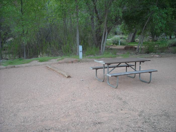
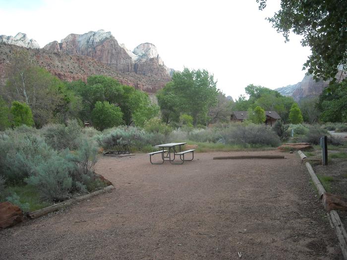
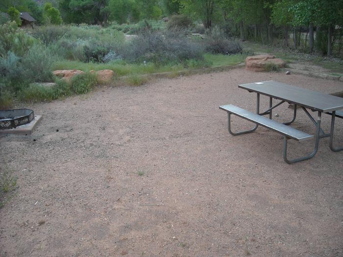
From Bishop go west on Line Street (Hwy 168). Follow Hwy 168 from Bishop in the direction of Aspendell and Sabrina Lake. After Aspendell, turn onto the steep, narrow, mostly dirt North Lake Road. This road is not recommended for trailers. Parking lot for hiking and overnight parking is located near North Lake. Parking in the campground is limited to people registered for campsites. The trail starts from the campground.
Important Information
DOWNLOAD AREA MAP FOR THIS TRAIL:Click Here.
Lamarck Lakes Area:
- The trail to Grass Lake or beyond Lamarck Lake is not recommended for stock.
- No campfires from Grass Lake to Sierra Crest.
- Food and refuse must be stored so that animals cannot get into the food or trash.
- Check the area map for the correct trail name. Trips going toward Piute Pass or Sabrina Lakes Basin are a different reservation.
- John Muir Wilderness regulations apply.
- Sequoia and Kings Canyon wilderness regulations apply if entering the National Park. (including no night box permit pickup, no pets, Cross Country permit type for Lamarck Col, Darwin Canyon)
- Deadline: Reservation will be canceled unless the permit pick up instructions are completed before the deadline. Instructions are in the confirmation letter.
- Only the group leader or alternate leader may pick up the permit; the person picking up the permit must be going on the wilderness trip.
- BE SURE YOUR DATES AND TRAIL ARE CORRECT The entire group must start on the trail on the entry date listed. Reservations cannot be changed or transferred
USFS Webpage for: Lamarck Lakes - North Lake.
Long Description
Starting from North Lake Campground, the Lamarck Lakes Trail immediately splits away from the Piute Pass Trail. The first part of the climb is sheltered by a grove of aspen and pine. The steady climb soon leads to open views of Mount Emerson and the red cliffs of Piute Crags. Lakes are terraced up the canyon in a series of glacier carved granite benches. The trail to Grass Lake or beyond Lamarck Lake is not recommended for stock. The trail ends at Upper Lamarck Lake. Rugged cross country terrain beyond Upper Lamarck Lakes is predominately steep talus and the snow fields of small glaciers that rest at the foot of Mount Lamarck. Separate quotas apply to other area trails. Refer to the areea map for trail names.
Facilities
Overlook Day Use (TX) Campground
List of CampsitesOverview
The Overlook Day Use area feuatures a beautiful lookout point at the north end of the dam at Lake O' the Pines. Here, almost 4 miles stright of lake can be season when the weather conditions are right. A great place to spend time with large groups and lots of nearby areas to recreate.
Day Use Overlook is about 10 miles from Jefferson, TX. At the intersection of 49 and 59, follow 49 West Northwest for 4 miles till you reach FM 729. From there, turn left onto 729 and go 3.5 miles till you reach a left turn at FM 726. Follow 726 2.5 miles till you reach the dam. Overlook Day Use will be on the right about 100 yards past Buckhorn Creek Campground.
Recreation
From Overlook you can see the main body of the lake where most recreation takes place like skiing, wake boarding, and tubing. There is also great access to areas for those looking to kayak, sail or fish.
Facilities
A pavilion with electric and water is available upon rental. A boat ramp with boat and trailer parking near the Fishing and Boat dock. There are also plenty of palces to fish from the shoreline.
Natural Features
An area with a large open field overlooking Lake O' the Pines from the south end, features rolling hills and tall pines all around.
Nearby Attractions
Lakeside Day Use and Buckhorn Creek Campground.
ALLEY CREEK CAMP Campground
List of CampsitesOverview
Alley Creek Campground is situated along the banks of Lake O' the Pines in the Ark-La-Tex portion of the Pineywoods of east Texas near the states of Arkansas, Oklahoma, and Louisiana.
Gate House Hours: 10am-6pm Monday through Saturday, 12pm-6pm Sunday
Recreation
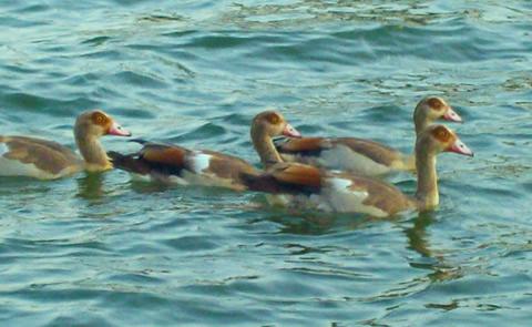
Boating, fishing, water sports, and wildlife viewing are all popular pastimes at the campground. Hunting opportunities for white-tailed deer, waterfowl, and small game are available on nearby public lands. Lake O' the Pines fishing includes largemouth, spotted, and white bass along with crappie, catfish, and sunfish. In addition to boat fishing there are areas for bank fishing along the shore and below the dam along Big Cypress Bayou. Birdwatchers are also encouraged to bring their binoculars as numerous resident and migratory bird species inhabit the area. Bald eagle sightings are a common occurrence in fall and winter and they are occasionally sighted in spring and summer.Facilities
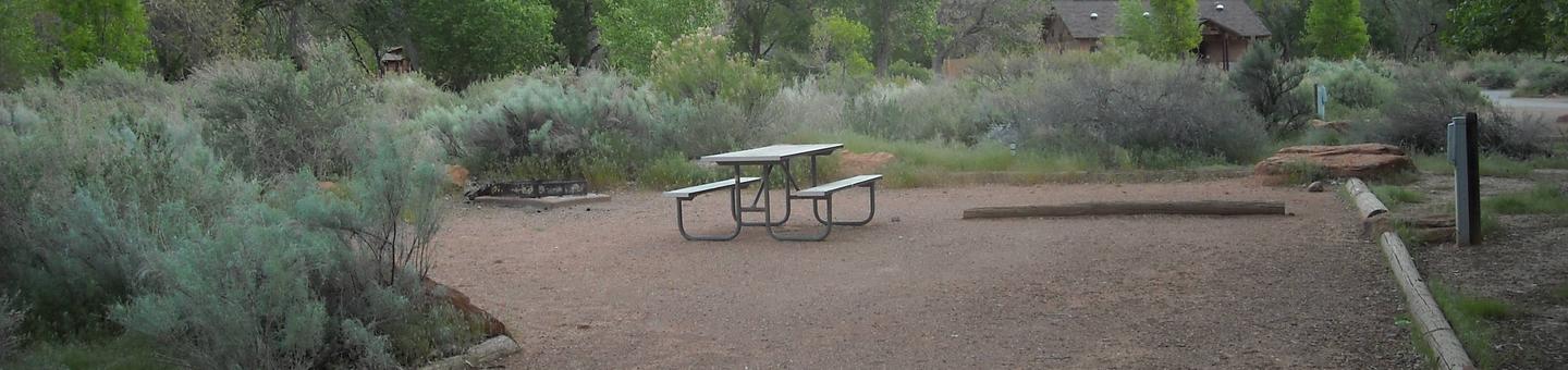
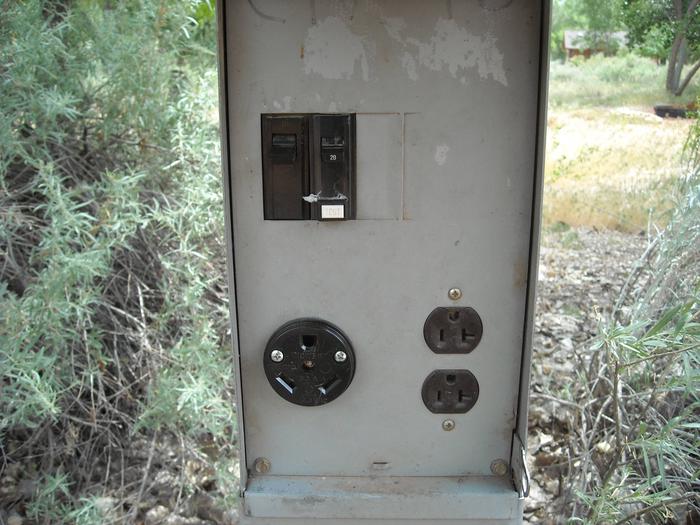
Alley Creek features 49 RV campsites with water and electric hookups. There are also 30 tent campsites that have a picnic table, fire ring, and lantern pole. A group camping area is located in the park which has a group shelter with restrooms and showers and 12 RV sites with water and electric hookups. Restrooms with showers are located in each section of the park. Trash receptacles are located throughout the park. A boat ramp, playground, swimming beach, and sewer dump station are also provided.Natural Features
Lake O' the Pines includes about 18,700 acres of water and 9,000 acres of land, encompassing an area so large it spans five counties. The lake was created by the construction of the Ferrell's Bridge Dam on the Big Cypress Bayou. The reservoir was originally created as part of an overall plan for flood control in the Red River Basin below Denison Dam in Oklahoma, and has now become a recreational oasis for outdoor enthusiasts.Nearby Attractions
The nearby towns of Jefferson and Marshall offer historic and tourist attractions, and Texas Wildflower Trail routes are located along the roads surrounding the lake.BRUSHY CREEK Campground
List of CampsitesOverview
Brushy Creek Campground is situated along the banks of Lake O' the Pines in the Ark-La-Tex portion of the Pineywoods of east Texas near the states of Arkansas, Oklahoma, and Louisiana.
Gate House Hours: 10am-6pm Monday through Saturday, 12pm-6pm Sunday.
Address to get here: 189 Brushy Creek Park Rd. Jefferson, TX 75657
Recreation
Boating, fishing, water sports, and wildlife viewing are all popular pastimes at the campground. Hunting opportunities for white-tailed deer, waterfowl, and small game are available on nearby public lands. Lake O' the Pines fishing includes largemouth, spotted, and white bass along with crappie, catfish, and sunfish. In addition to boat fishing there are areas for bank fishing along the shore and below the dam along Big Cypress Bayou. Birdwatchers are also encouraged to bring their binoculars as numerous resident and migratory bird species inhabit the area. Bald eagle sightings are a common occurrence in fall and winter and they are occasionally sighted in spring and summer.Facilities
Brushy Creek features 62 RV campsites with water and electric hookups. There are also 37 tent campsites, 12 of these sites have electricity available. Restrooms with showers are located in each section of the park. Trash receptacles are located throuhout the park. A boat ramp, courtesy dock, playground, swimming beach, fishing dock, and sewer dump station are also provided.Natural Features
Lake O' the Pines includes about 18,700 acres of water and 9,000 acres of land, encompassing an area so large it spans five counties.The lake was created by the construction of the Ferrell's Bridge Dam on the Big Cypress Bayou. The reservoir was originally created as part of the overall plan for flood control in the Red River Basin below Denison Dam in Oklahoma, and has now become a recreational oasis for outdoor enthusiasts.
Nearby Attractions
The nearby towns of Jefferson and Marshall offer plenty of historic and tourist attractions, and Texas Wildflower Trail routes are located along the roads surrounding the lake.BUCKHORN CREEK Campground
List of CampsitesOverview
Buckhorn Creek Campground is situated along the banks of Lake O' the Pines in the Ark-La-Tex portion of the Pineywoods of east Texas near the states of Arkansas, Oklahoma, and Louisiana.
Gate House Hours: 10am-6pm Monday through Saturday, 12pm-6pm Sunday.
Address to get here: 2669 FM 726, Jefferson, TX 75657
Recreation
Boating, fishing, water sports, and wildlife viewing are all popular pastimes at the campground. Hunting opportunities for white-tailed deer, waterfowl, and small game are available on nearby public lands. Lake O' the Pines fishing includes largemouth, spotted, and white bass along with crappie, catfish, and sunfish. In addition to boat fishing there are areas for bank fishing along the shore and below the dam along Big Cypress Bayou. Birdwatchers are also encouraged to bring their binoculars as numerous resident and migratory bird species inhabit the area. Bald eagle sightings are a common occurrence in fall and winter and they are occasionally sighted in spring and summer.Facilities
Buckhorn Creek features 57 RV campsites with water and electric hookups. There are also 38 non-electric tent campsites which have a tent pad, picnic table, fire ring, and lantern pole. Restrooms with showers are located in each section of the park. Trash receptacles are located throughout the park. A boat ramp, courtesy dock, playground, and sewer dump station are also provided.Natural Features
Lake O' the Pines includes about 18,700 acres of water and 9,000 acres of land, encompassing an area so large it spans five counties.The lake was created by the construction of the Ferrell's Bridge Dam on the Big Cypress Bayou. The reservoir was originally created as part of the overall plan for flood control in the Red River Basin below Denison Dam in Oklahoma, and has now become a recreational oasis for outdoor enthusiasts.
Nearby Attractions
The nearby towns of Jefferson and Marshall offer plenty of historic and tourist attractions, and Texas Wildflower Trail routes are located along the roads surrounding the lake.JOHNSON CREEK CAMP Campground
List of CampsitesOverview
Johnson Creek Campground is situated along the banks of Lake O' the Pines in the in the Ark-La-Tex portion of the Pineywoods of east Texas near Arkansas, Oklahoma, and Louisiana.
Gate House Hours: 10am-6pm Monday through Saturday, 12pm-6pm Sunday.
Address to get here: 580 Crestwood Lp. Avinger, TX 75657
Recreation
Boating, fishing, water sports, and wildlife viewing are all popular pastimes at the campground. Hunting opportunities for white-tailed deer, waterfowl, and small game are available on nearby public lands. Lake O' the Pines fishing includes largemouth, spotted, and white bass along with crappie, catfish, and sunfish. In addition to boat fishing there are areas for bank fishing along the shore and below the dam along Big Cypress Bayou. Birdwatchers are also encouraged to bring their binoculars as numerous resident and migratory bird species inhabit the area. Bald eagle sightings are a common occurrence in fall and winter and they are occasionally sighted in spring and summer.Facilities
Johnson Creek features 63 RV campsites with water and electric hookups. There are also 22 tent campsites, 10 of these sites have electricity available. A group camping area is also available which features a covered picnic shelter with restrooms and showers and 12 RV campsites with water and electric hookups. Restrooms with showers are located in each section of the park. Trash receptacles are located throuhout the park. A boat ramp, playground, swimming beach, and sewer dump station are also provided.Natural Features
Lake O' the Pines includes about 18,700 acres of water and 9,000 acres of land, encompassing an area so large it spans five counties.The lake was created by the construction of the Ferrell's Bridge Dam on the Big Cypress Bayou. The reservoir was originally created as part of the overall plan for flood control in the Red River Basin below Denison Dam in Oklahoma, and has now become a recreational oasis for outdoor enthusiasts.
Nearby Attractions
Other historic and tourist attractions are nearby in the towns of Jefferson and Marshall, and Texas Wildflower Trail routes are located along the roads surrounding the lake.LAKESIDE DAY USE Campground
List of CampsitesOverview
Lakeside Day Use Area is situated along the banks of the Lake O' the Pines in the Ark-La-Tex portion of the Pineywoods of east Texas near the states of Arkansas, Oklahoma, and Louisiana.
Address to get here: 5177 FM 726, Jefferson, TX 75657
Recreation
Boating, fishing, water sports, and wildlife viewing are all popular pastimes at the campground. Hunting opportunities for white-tailed deer, waterfowl, and small game are available on nearby public lands. Lake O' the Pines fishing includes largemouth, spotted, and white bass along with crappie, catfish, and sunfish. In addition to boat fishing there are areas for bank fishing along the shore and below the dam along Big Cypress Bayou. Birdwatchers are also encouraged to bring their binoculars as numerous resident and migratory bird species inhabit the area. Bald eagle sightings are a common occurrence in fall and winter and they are occasionally sighted in spring and summer.Facilities
Lakeside Park offers one large group picnic shelter, complete with electric hookups, that can accommodate up to 100 guests. A boat ramp, dock and swimming beaches, and a volleyball court are also provided, making the area perfect for large parties or family functions.Natural Features
Lakeside Day use is located near the Ferrell's Bridge Dam. Lake O' the Pines includes about 18,700 acres of water and 9,000 acres of land.The lake was created by the construction of the Ferrell's Bridge Dam on the Big Cypress Bayou. The reservoir was originally created as part of the overall plan for flood control in the Red River Basin below Denison Dam in Oklahoma, and has now become a recreational oasis for outdoor enthusiasts.
Nearby Attractions
Other historic and tourist attractions are nearby in the towns of Jefferson and Marshall, and Texas Wildflower Trail routes are located along the roads surrounding the lake.BRUSHY CREEK DAY USE Campground
List of CampsitesOverview
Brushy Creek Day Use Area is situated along the banks of Lake O' the Pines in the Ark-La-Tex portion of the Pineywoods of east Texas near the states of Arkansas, Oklahoma, and Louisiana.
Address to get here: 189 Brushy Creek Park Rd. Jefferson, TX 75657
Recreation
Boating, fishing, water sports, and wildlife viewing are all popular pastimes at the campground. Hunting opportunities for white-tailed deer, waterfowl, and small game are available on nearby public lands. Lake O' the Pines fishing includes largemouth, spotted, and white bass along with crappie, catfish, and sunfish. In addition to boat fishing there are areas for bank fishing along the shore and below the dam along Big Cypress Bayou. Birdwatchers are also encouraged to bring their binoculars as numerous resident and migratory bird species inhabit the area. Bald eagle sightings are a common occurrence in fall and winter and they are occasionally sighted in spring and summer. Boating, fishing, hunting and wildlife viewing are all popular pastimes at Brushy Creek.Facilities
Brushy Creek Day Use area offers one large group picnic shelter, along with 30 smaller, non-reservable picnic sites located in shady areas along the shore. Each site has tables and grills. A boat ramp, courtesy dock, swimming beach and basketball court are also provided, making the area perfect for large parties or family functions.Natural Features
Lake O' the Pines includes about 18,700 acres of water and 9,000 acres of land.The lake was created by the construction of the Ferrell's Bridge Dam on the Big Cypress Bayou. The reservoir was originally created as part of the overall plan for flood control in the Red River Basin below Denison Dam in Oklahoma, and has now become a recreational oasis for outdoor enthusiasts.
Nearby Attractions
Other historic and tourist attractions are nearby in the towns of Jefferson and Marshall, and Texas Wildflower Trail routes are located along the roads surrounding the lake.JOHNSON CREEK DAY USE Campground
List of CampsitesOverview
Johnson Creek Day Use Area is situated along the banks of the Lake O' the Pines in the Ark-La-Tex portion of the Pineywoods of east Texas near the states of Arkansas, Oklahoma, and Louisiana.
Address to get here: 580 Crestwood Lp. Avinger, TX 75657
Recreation
Boating, fishing, water sports, and wildlife viewing are all popular pastimes at the campground. Hunting opportunities for white-tailed deer, waterfowl, and small game are available on nearby public lands. Lake O' the Pines fishing includes largemouth, spotted, and white bass along with crappie, catfish, and sunfish. In addition to boat fishing there are areas for bank fishing along the shore and below the dam along Big Cypress Bayou. Birdwatchers are also encouraged to bring their binoculars as numerous resident and migratory bird species inhabit the area. Bald eagle sightings are a common occurrence in fall and winter and they are occasionally sighted in spring and summer. best waterfowl hunting in East Texas.Facilities
Johnson Creek offers a large group picnic shelter, complete with electric hookups, that can accommodate up to 100 guests. A boat ramp, courtesy dock, fishing dock, volleyball court, and swimming beach are also provided, making the area perfect for large parties or family functions.Natural Features
Lake O' the Pines includes about 18,700 acres of water and 9,000 acres of land. The Johnson Creek Day Use Area is located near the confluence of Johnson Creek and Lake O' the Pines.The lake was created by the construction of the Ferrell's Bridge Dam on the Big Cypress Bayou. The reservoir was originally created as part of the overall plan for flood control in the Red River Basin below Denison Dam in Oklahoma, and has now become a recreational oasis for outdoor enthusiasts.
Nearby Attractions
Other historic and tourist attractions are nearby in the towns of Jefferson and Marshall, and Texas Wildflower Trail routes are located along the roads surrounding the lake.Johnson Creek Marina Facility
This recreation area is part of Lake O' The Pines
Big Cypress Marina Facility
This recreation area is part of Lake O' The Pines
Bullfrog Marina Facility
This recreation area is part of Lake O' The Pines
