
Fortymile National Wild and Scenic River
The Fortymile River is an extensive network of creeks and rivers in east-central Alaska, 392 miles of which are designated a National Wild and Scenic or Recreational River. The river's numerous forks flow into the 'mainstem' Fortymile River, which joins the Yukon River in Canada.
River float trips, camping, and sightseeing from the Taylor Highway are the primary attractions for visitors to the Fortymile. Boaters have many choices for recreational trips through deep, winding canyons lined by forests of birch, spruce and aspen. Remnants of past mining operations dot the river banks as mementos of the area's rich mining history. For an Alaska river, the Fortymile has an unusual number of access points, making it possible to enjoy float trips that range from one day to several weeks in length.
Monitoring River Levels
Various stream gauges throughout the Fortymile provide useful information for monitoring floating conditions. Current observations in the Fortymile River are available on the National Weather Service’s Hydrometeorological Automated Data System (HADS) website: Fortymile HADS website
https://water.weather.gov/ahps2/glance.php? wfo=pafg&gage=fmsa2&riverid=203400
Campgrounds
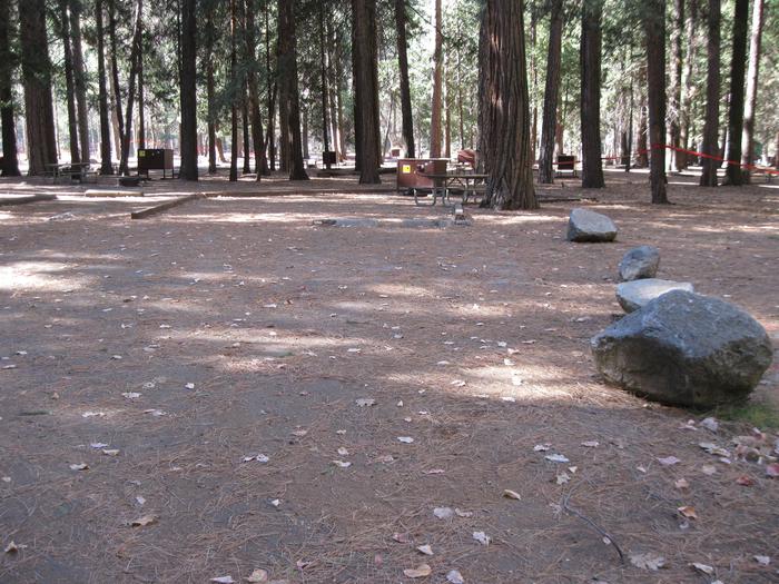
BLM maintains three public campgrounds in the Fortymile region: West Fork Campground (Taylor Highway milepost 48.8), Walker Fork Campground (Taylor Highway milepost 82) and Eagle Campground in the town of Eagle. These campgrounds include campsites with picnic tables, as well as outhouses and potable water. Dump stations are not available; campers are encouraged to dump in Tok or Dawson. Overnight camping is not allowed at BLM waysides along the Taylor Highway.
Are you floating the Fortymile Wild and Scenic River into Canada?
If you will be passing through Canadian waters, contact Canadian Immigration through their remote river crossings email ([email protected]) before your trip. They will respond with the required information needed for a river trip. You will need to provide as much lead time as possible — their service standard on this type of request could be up to 12 weeks. If you have any questions, please contact Canadian Immigration in Whitehorse (867-667-3943).
If your plans involve returning to the United States via the Yukon River, contact U.S. Customs and Border Protection (907-774-2252) before your trip. Upon reaching Eagle, check in with U.S. Customs and Border Protection using the special telephone in the white box on the left side of the Eagle laundromat.
Are you driving a vehicle into Canada?
The Poker Creek (U.S. side) and Little Gold Creek (Canadian side) customs stations on the Top of the World Highway are open daily from 8 a.m. to 8 p.m. Alaska time (9 a.m. to 9 p.m. Pacific time). You may not cross the border when the customs stations are closed, so plan your trip accordingly.
Specific requirements may also apply to you if your trip includes:
- Firearms
- Vehicles and drivers
- Personal defensive pepper spray
- Alcohol and tobacco
Please contact the U.S. and Canadian authorities at the phone numbers listed above for the latest information.

RecAreaDirections
Most visitors to the Fortymile Wild and Scenic River arrive via the 160-mile-long Taylor Highway, which branches off the Alaska Highway at Tetlin Junction near Tok, or via the Top of the Highway from Dawson City. From Tok, proceed east 12 miles on State Highway 2 to the Taylor Highway and then to a selected drop-off point, such as the South Fork Bridge Wayside or Fortymile Bridge. Air taxi shuttles to remote drop-off and take-out points can also be arranged in Tok or Fairbanks.
Approximate driving times: 6 to 8 hours from Fairbanks; 8 to 10 hours from Anchorage; 2 to 3 hours from Dawson City, Yukon Territory.
Open with Google Map
Misc
| Stay Limit | |
| Reservable | false |
| Keywords | |
| Map Link | |
| Contact Phone | |
| Contact Email |
Permits info
Facilities
Walker Fork campground Campground
List of CampsitesThe campground is operated by the BLM and offers 18 camping sites.
In the 1930s and 1940s, this was the site of Lassen airstrip. Year-round air service replaced winter-only sleds delivering equipment and fuel to mining camps on Jack Wade Creek.
West Fork campground Campground
List of CampsitesThe campground has two loops one with seven pull-through spaces and another with 18 back-in spaces. During the summer potable water is hauled to the site and is available at a centralized location for campers. At the overlook on the large loop, look for trumpeter swans and moose on the small oxbow lake.
River Access: One quarter (1/4) mile north of the campground, there is parking and river access to the West Fork of the Dennison Fork of the Fortymile National Wild and Scenic River. Boats must be carried about 20 yards to the water. Except during periods of high water, such as spring runoff, this section of river is typically too shallow for pleasant canoeing or rafting
